Skrka Lakes Trail
How would you rate Skrka Lakes Trail?
Tap a star to share your experience and help other hikers.
Skrka Lakes Trail: Durmitor’s high glacial lakes
HikeList Score
Skrka Lakes Trail scored 78/100 on HikeList's trail-quality metrics.
See score breakdownHide breakdown
- Ideal length 55
- Balanced challenge 100
- Scenery & wildness 78
- Varied terrain 71
- Accommodation 75
- Food & support 81
- Path quality 98
- Season flexibility 76
Computed from length, challenge, scenery & wildness, terrain variety, accommodation, food & support, path quality and season flexibility.
The Skrka Lakes Trail is a 12.5 km moderate day hike in Durmitor National Park, northern Montenegro. This out-and-back route starts at Dobri Do and climbs over Škrčko Ždrijelo before dropping into the high limestone basin of Veliko Škrčko jezero and Malo Škrčko jezero. It suits hikers who want a full mountain day in Durmitor’s high core without committing to a summit scramble or multi-day trek.
Route Overview
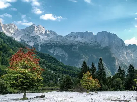
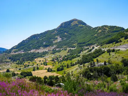
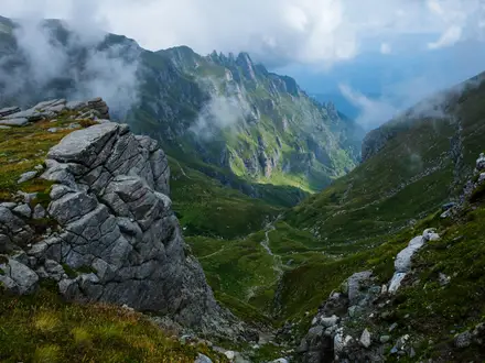
The standard route starts and ends at Dobri Do / Šarban, a small trailhead and parking area at about 1,800 m roughly 20 km from Žabljak along the P14. From the trailhead, the path crosses open grassy and rocky karst terrain to Škrčko Ždrijelo, the high pass at about 2,100–2,113 m. It then descends steeply for around 2.5 km into the lake basin, reaching Veliko Škrčko jezero, Planinarski dom Škrka and, via a short detour, Malo Škrčko jezero. You return the same way. For a harder Durmitor objective, compare it with the Bobotov Kuk Summit Trail; for an easier lake walk near Žabljak, see the Black Lake Loop.
Durmitor’s glacial lake landscape
The Škrčka lakes are part of Durmitor’s group of glacial “mountain eye” lakes, formed in the karst limestone of the Dinaric Alps during the last Ice Age. Durmitor National Park was founded in 1952 and added to the UNESCO World Heritage list in 1980 for its glacial landforms, canyons and forests. Bobotov Kuk, which rises above the basin, was first recorded as climbed in 1883 by Austrian cartographer Oscar Baumann.
Notable highlights
- Veliko Škrčko jezero (Big Škrka Lake, ~1,686 m): An emerald glacial lake and one of Durmitor’s larger lakes, set below limestone walls on three sides. It is the main objective of the walk and sits in the same basin visible from Bobotov Kuk.\n- Malo Škrčko jezero (Small Škrka Lake, ~1,711 m): The smaller twin lake lies slightly higher and northeast of Veliko Škrčko jezero, reached by a short detour of about 550 m. It is shallower and can shrink or dry out in high summer.\n- Škrčko Ždrijelo pass (~2,100–2,113 m): This saddle is the walk’s high point and gives the first major view into the basin. It also marks the start of the steep descent to the lakes.\n- Planinarski dom Škrka (~1,723 m): A basic mountain hut between the two lakes, staffed by a park ranger from June to October. It gives hikers an overnight option in an otherwise remote high valley.\n- Bobotov Kuk, Prutaš and Šareni pasovi: These peaks and cliffs enclose the basin, including Bobotov Kuk, Durmitor’s highest summit, and the striped limestone of Šareni pasovi.\n- Via Dinarica connection: Škrčko jezero lies on the Via Dinarica and links onward routes towards Prutaš, Sušica Canyon and Bobotov Kuk.
Challenges to expect
This is moderate rather than hard, but the effort is real: about 850 m of ascent, a high rocky pass and a steep drop into the lake basin that must be climbed again on the return. Much of the route is above the treeline, so sun, wind and fast weather changes matter. The trail is well marked and needs no scrambling. For another mountain day in Montenegro, compare the Biogradska Gora Lake Loop.
HikeList Score
Skrka Lakes Trail scored 78/100 on HikeList's trail-quality metrics.
See score breakdownHide breakdown
- Ideal length 55
- Balanced challenge 100
- Scenery & wildness 78
- Varied terrain 71
- Accommodation 75
- Food & support 81
- Path quality 98
- Season flexibility 76
Computed from length, challenge, scenery & wildness, terrain variety, accommodation, food & support, path quality and season flexibility.
 Montenegro
Show more data Show less
- Mountainous
- Rocky
- Dirt
- Rock
- Grass
- Huts
- Campsites
- Hotels
- Pet Friendly
- Water Sources
- Campsites
- Shelters
Photos from hikers
Taken on the trail by people who've reviewed Skrka Lakes Trail.
Start at Dobri Do / Šarban, climb across grassy and rocky karst terrain to Škrčko Ždrijelo, then descend steeply into the basin of Veliko Škrčko jezero. Continue to Planinarski dom Škrka and, if conditions allow, make the short detour to Malo Škrčko jezero before returning the same way over the pass.
Reviews
How would you rate Skrka Lakes Trail?
Tap a star to start your review — you could be the first.