Sheep’s Head Way
How would you rate Sheep’s Head Way?
Tap a star to share your experience and help other hikers.
Sheep’s Head Way: Quiet West Cork Coastal Loop
HikeList Score
Sheep’s Head Way scored 89/100 on HikeList's trail-quality metrics.
See score breakdownHide breakdown
- Ideal length 85
- Balanced challenge 100
- Scenery & wildness 88
- Varied terrain 94
- Accommodation 83
- Food & support 88
- Path quality 80
- Season flexibility 89
Computed from length, challenge, scenery & wildness, terrain variety, accommodation, food & support, path quality and season flexibility.
The Sheep’s Head Way is an 88 km waymarked loop around the Sheep’s Head peninsula in West Cork, Ireland, usually walked in 5 days. Starting and finishing in Bantry, it follows the north coast to Sheep’s Head Lighthouse, then returns along the south side through Kilcrohane, Ahakista and Durrus. This is a moderate coastal and moorland walk: no scrambling, but plenty of short climbs, exposed cliff paths and boggy ground after rain. It suits walkers who want a quieter alternative to the Beara Way or Dingle Way.
Route Overview
This is a circular trail, not a point-to-point route. The standard direction leaves Bantry and heads west along the north coast above Bantry Bay, crossing grassy and heathery ground on the peninsula’s higher spine before reaching the western tip and Sheep’s Head Lighthouse. The return follows the south side above Dunmanus Bay, with the main village stops at Kilcrohane, Ahakista and Durrus before closing the loop back to Bantry. Waymarking uses a yellow walking-man arrow on a black background. Because the route begins and ends in Bantry, logistics are simpler than on a linear trail; accommodation still needs booking ahead because the peninsula is sparsely populated. For another West Cork coastal walk, see the Cape Clear Island Loop.
Community-built trail on a quiet peninsula
The Sheep’s Head Way began as a local community initiative on a little-visited West Cork peninsula. It was devised mainly by Tom Whitty, local farmer James O’Mahony and walker Jim Leonard, with a local committee creating the route from a western trail founded in 1993. It was officially opened by Mary Robinson, President of Ireland, with sources differing between 1995 and July 1996. Tom Whitty died in an accident in 1998 and is commemorated on the route.
Notable highlights
- Sheep’s Head Lighthouse: A small, squat lighthouse near the western tip of the peninsula and the scenic turnaround point of the Way. It was first lit in 2004 to aid tankers using Bantry Bay’s oil terminal.
- Seefin ridge and “Finn Mac Cool’s Seat”: The main trail reaches about 300 m on the heathery ridge below Seefin, opening views over Bantry Bay, the Beara peninsula and Dunmanus Bay. The name links the place to the legendary Fionn Mac Cumhaill.
- Napoleonic signal tower: A ruined early-19th-century signal tower stands on the peninsula, part of a coastal chain built to watch for a French invasion during the Napoleonic Wars.
- Stone circles and copper-mine remains: The route passes prehistoric standing stones, stone circles and traces of 19th-century copper mining, adding archaeological interest to the walking days.
- Bantry House and Gardens: An 18th-century stately home overlooking Bantry Bay at the start and finish, known for its terraced gardens and its connection with the 1796 attempted French landing.
- Atlantic cliffs and wildlife: The south-shore cliff paths above Dunmanus Bay are exposed and atmospheric, with chances of seeing dolphins, whales, seals, seabirds and choughs.
Challenges to expect
Expect a moderate trail with repeated short climbs rather than one big mountain. Around 28 km is on minor public roads, mixed with old boreens, field paths, moorland, woodland and coastal cliff paths. Boggy sections are likely after rain, and the south-shore cliffs and final approach to the headland can be windy. Accommodation is limited, so book Bantry, Durrus, Ahakista and Kilcrohane beds ahead. Dogs are not permitted on the route.
HikeList Score
Sheep’s Head Way scored 89/100 on HikeList's trail-quality metrics.
See score breakdownHide breakdown
- Ideal length 85
- Balanced challenge 100
- Scenery & wildness 88
- Varied terrain 94
- Accommodation 83
- Food & support 88
- Path quality 80
- Season flexibility 89
Computed from length, challenge, scenery & wildness, terrain variety, accommodation, food & support, path quality and season flexibility.
 Ireland
Show more data Show less
- Coastal
- Moorland
- Farmland
- Forest
- Dirt
- Grass
- Paved
- B&Bs
- Guesthouses
- Pubs
- Family Friendly
- Pet Friendly
- Restrooms
- Water Sources
- Campsites
- Picnic Areas
Download Our Full Guide to Sheep’s Head Way FREE!
Get our comprehensive guide to this hike for free. Save it for later reading or print out at home.
In these collections
Photos from hikers
Taken on the trail by people who've reviewed Sheep’s Head Way.
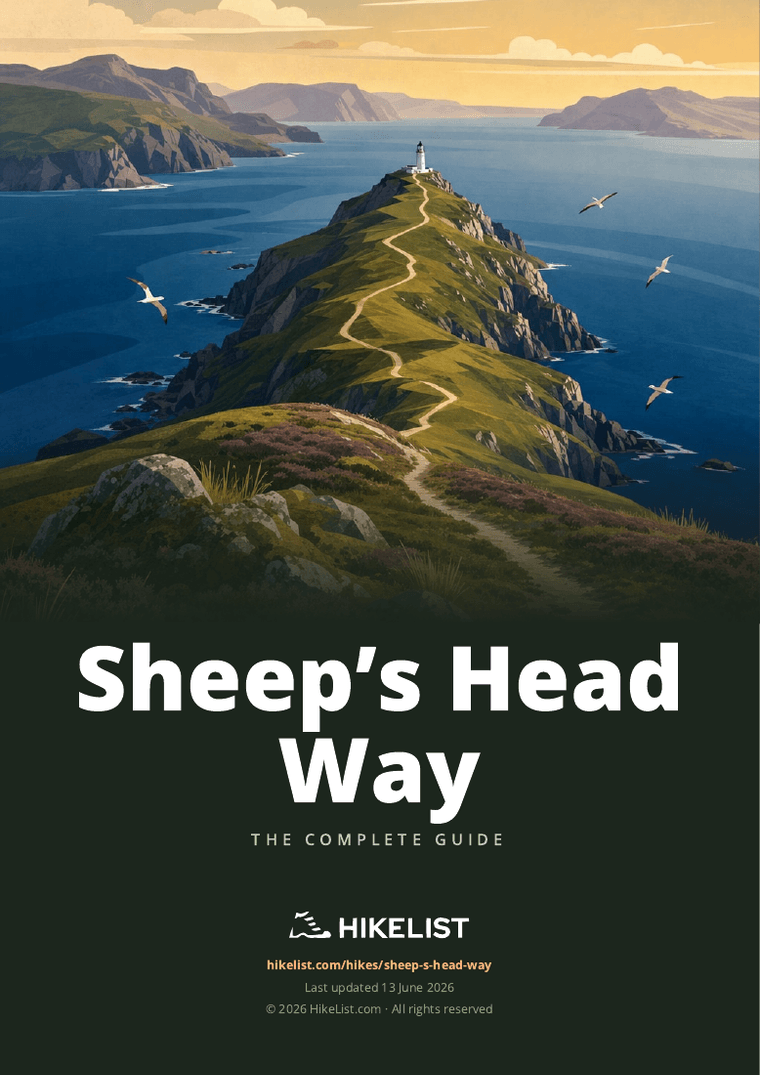
Sheep’s Head Way: The Complete Guide
The Sheep’s Head Way is a quiet West Cork coastal loop for walkers who want Atlantic scenery without the bustle of Ireland’s better-known long-distance trails. Starting and finishing in Bantry (Beanntraí), it circles the slender Sheep’s Head peninsula between Bantry Bay and Dunmanus Bay, reaching the lighthouse at the far western tip before returning through Kilcrohane, Ahakista and Durrus.
This is not a high mountain route, but it feels satisfyingly wild in places. The path links old boreens, heathery ridges, field tracks, cliff paths and small villages, with the high spine below Seefin giving wide views across both bays and towards the Beara peninsula.
The walking suits reasonably fit hikers who are happy with simple village logistics and changeable coastal weather. Accommodation is sparse on the western half of the peninsula, so this is a route to book carefully rather than improvise day by day.
Underfoot, expect a moderate but sometimes tiring trail: around 2,190 m of ascent across the loop, many short steep climbs, boggy ground after rain and exposed cliff and ridge sections where wind can matter. The route is well waymarked, but proper waterproofs, sturdy footwear and sensible weather judgement are still essential.
This guide covers stages, walking days, accommodation, food, transport, terrain and the common planning mistakes to avoid.
Stage-by-Stage Guide
Stage 1: Bantry to Glanlough — approx. 14 km
The first stage leaves Bantry (Beanntraí) and begins the gradual transition from market-town streets to the quieter boreens, fields and open ground of the Sheep’s Head peninsula. It is a useful warm-up day: shorter than the later western stages, but still part of a route with repeated small climbs rather than flat coastal strolling.
Expect a mix of minor roads, country lanes and field or moorland paths. After rain, the off-road sections can be wet underfoot, so waterproof boots or shoes with reliable grip are more useful than lightweight town footwear.
The main planning issue is the finish. Glanlough is not one of the peninsula’s main service villages, so accommodation, evening food and any transfer arrangement must be fixed in advance. Do not assume there will be shops, pubs or taxis available on arrival.
Food and water should be bought in Bantry before setting out. Carry enough for the whole walking day, plus a reserve, because services between Bantry and Glanlough should not be relied on.
Road access is better at the Bantry end than once you are out on the peninsula. Bus Éireann route 236 serves Bantry, but onward public transport along the Sheep’s Head is limited and infrequent, so this stage is not one to start casually without knowing how you will reach the night’s accommodation.
Navigation is generally straightforward on the waymarked line, using the yellow walking-man marker on a black background, supplemented by local posts and markers. Still, the Sheep’s Head Way has wider network variants, so follow the core loop carefully rather than any eastern arms or side routes unless they are part of your plan.
Stage 2: Glanlough to Sheep’s Head Lighthouse and Kilcrohane — approx. 23 km
This is the longest and most committing stage in the five-day schedule, taking the route west towards the end of the peninsula before turning back to Kilcrohane (Cill Chrócháin). It is the day most likely to feel like the heart of the walk: remote ground, sea on both sides of the headland, and the lighthouse reached near the far western tip.
The route passes through the western half of the peninsula, with Cahergal (Cathair Gheal) lying in the day’s sequence before Sheep’s Head / Muntervary and the lighthouse area. The walking is varied, with boreens, open grassy and heathery ground, exposed coastal path and sections that can be boggy after rain.
The Sheep’s Head Lighthouse is reached by a short loop from the road end rather than by a through path continuing beyond the headland. Allow enough time and energy for this extra out-and-back/loop element, especially in poor weather. The small white lighthouse was first lit in 1968 and is the scenic turning point of the Way.
This stage can be windy and exposed, particularly around the cliffs and final headland. In low cloud, heavy rain or strong Atlantic winds, progress can be slower than the distance suggests. The cliff paths require sensible weather judgement; there is no technical scrambling, but the consequences of careless footing are higher than on the inland lanes.
Carry a full day’s food and water from the start unless your accommodation or transfer provider has made a specific arrangement. Services on the western peninsula are sparse, and it is poor planning to rely on finding supplies en route.
Kilcrohane is one of the key accommodation villages on the route, with small-scale lodging rather than large capacity. Beds should be booked well ahead, and evening meals should be checked before arrival, particularly outside the main April–October walking season.
Public transport options around Kilcrohane and the western peninsula are limited and infrequent. If this is a potential bail-out point, timings and availability should be checked before travelling, not after reaching the village.
For navigation, pay attention where the lighthouse loop, local paths and the main Sheep’s Head Way intersect. The broader waymarked network can create choices that are not part of the 88 km core loop, so a current map or GPX from the official trail material is strongly recommended.
Stage 3: Kilcrohane to Ahakista — approx. 12 km
This is the shortest stage in the five-day itinerary and gives a more forgiving day after the long western outing. It follows the peninsula eastwards from Kilcrohane towards Ahakista (Áth an Chiste), with a mixture of quiet lanes, field paths and coastal sections.
The terrain remains typical Sheep’s Head walking rather than a simple road transfer. Expect wet grass, mud or boggy patches after rain, along with sections on minor public roads. Take care on road sections: traffic may be light, but lanes are narrow and sightlines can be limited.
The southern side of the peninsula and Dunmanus Bay provide some of the route’s strongest coastal atmosphere. This coastline is known for cliffs and wildlife, including peregrine falcons and choughs, with the possibility of seeing seals, dolphins, whales and seabirds offshore.
Near Ahakista, the Tom Whitty memorial at Gorteanish, known as Átha Thomáis, is an important trail landmark. It commemorates one of the founders of the Sheep’s Head Way, who died in 1998.
Food and water planning is easier than on the previous day because the stage starts and finishes in recognised route villages, but supplies should still be checked locally. Do not assume daytime services will be open when you pass, especially outside peak season.
Ahakista has limited village-based accommodation, so booking ahead is essential. If staying away from the village itself, make sure any lift, baggage transfer or evening meal arrangement is agreed before setting out from Kilcrohane.
Road access exists around Ahakista, but public transport along the peninsula remains limited. For section walkers, this is a place where pre-arranged pick-up is often more realistic than relying on a bus at short notice; current options should be checked before travelling.
Navigation is usually uncomplicated if you stay alert to the waymarks. The main risk is not technical difficulty but complacency: small lanes, side tracks and local loops can cause unnecessary detours if the core route is not followed carefully.
Stage 4: Ahakista to Durrus — approx. 18 km
The fourth stage continues east from Ahakista to Durrus (Dúras), moving from the quieter south-coast side of the peninsula towards one of the route’s more useful service villages. It is a medium-long day with enough ascent, descent and mixed terrain to feel more substantial than the distance alone suggests.
The walking combines country roads, boreens, field paths, moorland and occasional wooded sections. Across the Sheep’s Head Way as a whole, around 28 km follows minor public roads, and this day can include stretches where firm tarmac alternates with softer, wetter ground.
This part of the route can include archaeological and historical interest, with prehistoric monuments and traces of 19th-century copper mining among the features associated with the walking days on the peninsula. Treat any such sites as fragile heritage: stay on the route, do not climb on remains, and leave gates and field boundaries as found.
The stage may also give broad views back along the peninsula and across the surrounding bays when the weather is clear. In mist or low cloud, the experience is more enclosed, and navigation by waymarks, map and GPS becomes more important.
Carry lunch and enough water from Ahakista unless definite services are planned. Durrus is a better service point than the more remote western stops, but the walk between villages should still be treated as a self-sufficient day.
Durrus has small hotels, guesthouses, B&Bs and pubs within the general accommodation pattern of the route. Capacity is not large, so pre-booking remains important, especially if walking in summer or over holiday periods.
Durrus has road access and is more practical for joining or leaving the trail than the far western stages, but public transport should still be planned carefully. Services on the peninsula are limited compared with Bantry, and current times should be checked before travelling.
Dogs are not permitted on the Sheep’s Head Way, which matters particularly on stages crossing farmland and field paths. Expect livestock and close gates properly; this is a working rural landscape, not just a leisure trail.
Stage 5: Durrus to Bantry — approx. 20 km
The final stage completes the loop from Durrus back to Bantry, closing the circuit at the head of Bantry Bay. It is a full walking day rather than a short finish, with approximately 20 km still to cover and enough undulation to warrant an early, unhurried start.
The day passes through Barnageehy (Bearna Gaoithe) before returning to Bantry. Terrain continues to vary between quiet roads, boreens, field paths and open ground, with the same potential for wet or muddy going after rain.
Views towards Bantry Bay and the Beara peninsula are a major part of this closing section when visibility is good. The high heathery spine of the peninsula, including the ridge below Seefin reached earlier on the loop, gives the route much of its character, even though the trail does not summit Seefin itself.
Food and water should be carried from Durrus for the day. Bantry has the best range of services on the route, but there should be no assumption of reliable supplies between Durrus and the finish.
Accommodation is easiest to arrange in Bantry compared with the smaller peninsula villages, but it is still sensible to book ahead if staying after the walk. Bantry also gives access to onward transport, including Bus Éireann route 236 towards Cork, Glengarriff and Castletownbere.
For road access and onward travel, Bantry is the route’s main gateway. There is no railway on the Sheep’s Head, so anyone connecting to rail or air travel should allow for the bus journey back towards Cork city and onward links from there.
Navigation on the final day is generally reliable on the marked trail, but fatigue can lead to missed turns on lanes and field edges. Keep following the yellow walking-man markers until the loop is fully closed in Bantry rather than cutting down minor roads unless that is an intentional, mapped exit.
Bantry House and Gardens sit above Bantry Bay and make a worthwhile start-or-finish landmark if time allows. The walking day itself should still be planned first: the route is exposed to Atlantic weather, and the final kilometres are easier to enjoy when transport and accommodation are already fixed.
Recommended Itinerary
The most practical schedule for the core Sheep's Head Way loop is five walking days, starting and finishing in Bantry (Beanntraí). This fits the main accommodation hubs while keeping the longer western headland day and the final return to Bantry manageable for reasonably fit walkers.
Distances are approximate. The core loop is usually given as 88 km, while some operators measure a similar circuit at about 93 km; check official mapping before booking accommodation around intermediate stops.
Standard 5-day itinerary
| Day | From | To | Approx. distance | Why this stage makes sense | Services/accommodation notes |
|---|---|---|---|---|---|
| 1 | Bantry (Beanntraí) | Glanlough | 14 km | A controlled first day out of the gateway town, giving time to settle into the waymarking and the peninsula terrain before the more exposed western stages. | Bantry has the best range of services on the route. Glanlough is not a major service centre, so accommodation and any evening meal arrangements must be booked well ahead. |
| 2 | Glanlough | Sheep's Head / lighthouse, then Kilcrohane (Cill Chrócháin) | 23 km | The longest and most committing day on the standard schedule, taking in the western headland and the lighthouse area before returning east to Kilcrohane. Allow extra time for wind, boggy ground after rain and the short lighthouse loop from the road end. | Kilcrohane is one of the key overnight villages on the western peninsula, but beds are limited. Book early and do not assume late food options will be available. |
| 3 | Kilcrohane | Ahakista (Áth an Chiste) | 12 km | A deliberately shorter day after the lighthouse stage, useful if the previous day has been slow in poor weather. It also gives a more relaxed section through the south-side villages rather than pushing straight on to Durrus. | Ahakista has limited village-based accommodation. Arrange dinner and breakfast details when booking. |
| 4 | Ahakista | Durrus (Dúras) | 18 km | A solid but reasonable day continuing east towards the base of the peninsula, with enough distance to avoid leaving an overlong final walk into Bantry. | Durrus is one of the main accommodation points on the loop. It is still worth booking early, especially in the April–October walking season. |
| 5 | Durrus | Bantry (Beanntraí), via Barnageehy (Bearna Gaoithe) | 20 km | A full final day that completes the circuit back to the transport and service hub at Bantry. Start promptly, as this is one of the longer stages in the standard plan. | Bantry has the broadest choice of accommodation, food and onward transport. If using Bus Éireann route 236 after finishing, current times should be checked before travelling. |
Slower 6–8 day variant
A slower schedule suits walkers who want shorter days, more weather flexibility on the exposed headland, or less pressure around boggy ground and repeated short climbs. It is also the better choice if carrying a full pack rather than using baggage transfer.
The main ways to slow the route down are to split the western Glanlough–Kilcrohane section around Cahergal (Cathair Gheal), and/or to split the Durrus–Bantry return around Barnageehy. These are not the main service villages listed for the peninsula, so overnight availability, meals and exact stage distances should be checked before booking.
| Variant | How to structure it | Who it suits | Accommodation caution |
|---|---|---|---|
| 6 days | Split the long western section: Bantry–Glanlough, Glanlough–Cahergal, Cahergal–Kilcrohane via Sheep's Head / lighthouse, Kilcrohane–Ahakista, Ahakista–Durrus, Durrus–Bantry. | Walkers who want to reduce the pressure of the 23 km lighthouse day while keeping the rest of the route compact. | Cahergal is not a major service hub; book accommodation and food arrangements before committing to this plan. |
| 7–8 days | Add an extra split on the return towards Bantry, commonly around Barnageehy, or build in a short day/rest buffer at one of the established villages. | Walkers prioritising shorter days, photography, poor-weather flexibility or a gentler village-based pace. | Beds on the peninsula are sparse, especially away from Bantry, Kilcrohane, Ahakista and Durrus. Every night should be secured in advance. |
Faster 4-day variant
A four-day schedule is possible for strong walkers, but it is less forgiving. The main compromise is combining the Kilcrohane–Ahakista and Ahakista–Durrus stages into one long day, leaving little margin for bad weather, wet ground or slower going on minor roads and cliff paths.
| Day | From | To | Approx. distance | Why this stage makes sense | Services/accommodation notes |
|---|---|---|---|---|---|
| 1 | Bantry | Glanlough | 14 km | Keeps the opening day moderate rather than starting with an overlong push into the western peninsula. | Use Bantry for last-minute supplies. Glanlough accommodation must be arranged in advance. |
| 2 | Glanlough | Kilcrohane via Sheep's Head / lighthouse | 23 km | Retains the standard western headland day rather than trying to combine it with further south-side mileage. | Kilcrohane is the logical overnight after the lighthouse stage; book early. |
| 3 | Kilcrohane | Durrus via Ahakista | 30 km | Combines the two shorter middle stages into one demanding day, suitable only for fit walkers comfortable with a long coastal and village-to-village stage. | Do not rely on finding last-minute beds in Durrus. Carry enough food for a long day between villages. |
| 4 | Durrus | Bantry | 20 km | Completes the loop with a long but straightforward final return to the main gateway town. | Bantry gives the easiest finish for accommodation and onward bus connections. Current bus times should be checked before travelling. |
Planning the Route
The main planning constraint on the Sheep's Head Way is not route-finding; it is fitting the walk around accommodation, food and onward transport on a thinly populated peninsula. The waymarking is generally clear, but beds and evening meals are limited outside Bantry, Durrus, Ahakista and Kilcrohane, especially on the western half of the route.
Most walkers should allow 5–6 walking days for the core circular route from Bantry (Beanntraí) to Sheep's Head / Muntervary and back. Strong walkers can keep to a 5-day schedule, while a 6-day itinerary gives more margin for poor weather, boggy ground and the exposed lighthouse end of the peninsula. Gentler schedules of 7–8 days are possible if accommodation and transfers can be arranged.
Choosing a schedule
The natural overnight stops are dictated by the settlement pattern rather than by perfectly even distances. Bantry, Kilcrohane (Cill Chrócháin), Ahakista (Áth an Chiste) and Durrus (Dúras) are the key places for accommodation and services; Glanlough and the western peninsula require more care when booking.
A practical 5-day plan uses the main accommodation hubs:
| Day | Usual section | Planning notes |
|---|---|---|
| 1 | Bantry to Glanlough | Start with food for the day and have the first night's accommodation fixed before setting out. |
| 2 | Glanlough to Sheep's Head / lighthouse and Kilcrohane | The longest and most committing day on many schedules; allow extra time for the lighthouse spur and exposed weather. |
| 3 | Kilcrohane to Ahakista | A shorter day, useful as recovery after the western headland. |
| 4 | Ahakista to Durrus | A fuller day with a mix of coastal and inland walking. |
| 5 | Durrus to Bantry | Finishes the loop back to the transport hub. |
The official West network is often broken differently, including stages through Cahergal and Barnageehy, and some operators quote slightly different total distances. When booking, check that an itinerary refers to the core Bantry loop, not the larger Sheep's Head Way network with eastern extensions towards Drimoleague, Kealkill and Gougane Barra.
Fast or slow?
A fast 5-day crossing suits fit walkers who are comfortable with repeated short climbs, wet ground and some road walking. It leaves less flexibility if Atlantic weather slows progress on the ridge or around the lighthouse.
A 6-day plan is usually the better balance for independent walkers. It reduces pressure on the longest sections and gives more time to manage starts, meals and transport in places where services are sparse.
Walking it slowly is worthwhile if the aim is to explore the peninsula rather than simply complete the loop. The challenge is practical: extra nights must be available in the right places, and that should be arranged before travel rather than improvised day by day.
Shortening, extending and section hiking
The route is a loop, so it is easy to start and finish in Bantry, but it is not especially easy to shorten once out on the peninsula. Public transport reaches the gateway at Bantry, while bus services onward towards Kilcrohane and Ahakista are limited and infrequent. Bail-out plans should not depend on a same-day bus unless current times have been checked.
Section hiking is practical if based from Bantry or one of the peninsula villages, but it usually needs careful transfer planning. Accommodation providers, baggage-transfer companies and any local transport options should be contacted ahead of time; availability should be checked before travelling.
Extending the walk is possible by using the wider Sheep's Head Way network, but those eastern arms are a different undertaking from the core circuit. Do not mix distance, ascent or stage information from the full network into a booking plan for the 88 km loop.
What to organise first
Book accommodation before fixing anything else. Beds are limited, and the route does not pass through large towns after leaving Bantry until it returns there. On the western half of the peninsula, some hosts may be important not just for a bed but also for evening meals where there is no nearby restaurant.
Food planning matters more than the modest altitude suggests. Do not assume there will be a shop, café or pub at convenient points during the walking day. Carry lunch and snacks from the overnight village unless a specific stop has been checked in advance.
Carry enough water for each full day. The trail crosses rural ground, moorland, lanes and cliff paths, but reliable drinking-water points are not listed for every stage. Refill at accommodation and known services rather than relying on streams or chance sources.
Navigation and route checks
The Sheep's Head Way is waymarked with the yellow walking-man arrow on a black background, with additional posts and stone markers. That is helpful, but it should not be the only navigation plan: carry an offline map or GPX track and know which variant of the route is being followed.
Trail reroutes, access changes and maintenance issues can affect waymarked walks. Check the official trail website and Sport Ireland trail listing before setting out, particularly if walking outside the main April–October season.
Weather, ground and kit planning
The route is low by mountain standards, but it is exposed. The high spine below Seefin reaches about 300 m, and the cliff and lighthouse sections can be windy and slow in poor visibility. Waterproofs, warm layers and secure map access are essential even in summer.
Boggy ground is likely after rain, especially on heathery and open sections. Footwear should cope with wet grass, mud and minor roads; about 28 km of the loop follows minor public roads, so very soft fell shoes are not ideal for everyone.
Out of season, the exposed cliff walks can become treacherous. April to October is the normal planning window, with extra caution needed on windy days at the western headland.
Access rules and practical restrictions
Dogs are not permitted on the Sheep's Head Way, which is an important restriction for anyone planning to walk with a pet. No permit system is specified for the route information available here, but access conditions and any local restrictions should be checked before travelling.
Towns, Villages and Overnight Stops
Accommodation on the Sheep’s Head Way is concentrated in a few small settlements, with long, quiet stretches between them. Bantry (Beanntraí) is the only substantial service town on the loop; Kilcrohane (Cill Chrócháin), Ahakista (Áth an Chiste) and Durrus (Dúras) are the main village stops, while Glanlough, Cahergal and Barnageehy are more practical stage points than service centres.
Book every night before starting, especially on the western half of the peninsula. Beds are limited, and some hosts may be the best source of advice on evening meals, packed lunches and local transfers where there is no nearby restaurant.
| Place | Role on the route | Overnight suitability | Practical notes |
|---|---|---|---|
| Bantry (Beanntraí) | Start and finish | Excellent | Main gateway, best services, Bus Éireann 236 link |
| Glanlough | First-stage stop on common itineraries | Limited | Arrange accommodation and meals in advance |
| Cahergal (Cathair Gheal) | Western-stage point on official-style schedules | Limited | More of a route locality than a service base |
| Sheep’s Head / lighthouse | Far western tip and scenic turnaround | No | Walking objective; do not rely on services |
| Kilcrohane (Cill Chrócháin) | Main western village stop | Good for this route | Key overnight base after the lighthouse day |
| Ahakista (Áth an Chiste) | South-coast village stop | Good for this route | Useful shorter-stage overnight between Kilcrohane and Durrus |
| Durrus (Dúras) | Eastern village stop before returning to Bantry | Good for this route | Important final-night base on 5-day schedules |
| Barnageehy (Bearna Gaoithe) | Route locality before Bantry | Limited | Usually passed through rather than used as a main stop |
Bantry (Beanntraí)
Bantry sits at the head of Bantry Bay and is both the start and finish of the core circular Sheep’s Head Way. It is the most practical place to arrive the day before walking, sort food, check weather, and deal with any last-minute kit or transport issues.
This is the best-served overnight stop on the route, with small hotels, guesthouses, B&Bs and pubs. It is also the obvious place to build in a spare night at either end, particularly if arriving by public transport or if bad weather delays the exposed western stages.
Bantry is the public-transport gateway for the walk. Bus Éireann route 236 links Cork city with Bantry and continues towards Glengarriff and Castletownbere; current times should be checked before travelling, especially for weekend or seasonal journeys.
As the largest town on the loop, Bantry is the sensible main resupply point. Do not assume the smaller peninsula villages can provide the same choice or opening hours.
Glanlough
Glanlough is a common first overnight point on the practical 5-day schedule from Bantry, reached after the initial climb and ridge walking out onto the peninsula. It works well as a stage break, but it should be treated as a small rural locality rather than a fully serviced trail town.
Accommodation here is limited compared with Bantry, Kilcrohane, Ahakista and Durrus. Any stay at or near Glanlough should be booked well ahead, with evening meal, breakfast and packed-lunch arrangements agreed directly with the host.
Do not rely on turning up and finding food or a bed. If accommodation cannot be arranged at Glanlough, a transfer to and from a nearby overnight base may be needed; this should be checked before travelling.
Cahergal (Cathair Gheal)
Cahergal appears on some stage breakdowns of the wider Sheep’s Head Way West network, sitting on the western half of the peninsula before the route reaches the lighthouse and Kilcrohane. For walkers following the HikeList 5-day loop, it is usually part of the longer second walking day rather than a main overnight hub.
Services are very limited. Treat Cahergal as a route point, not a place where food, accommodation or transport can safely be assumed.
If planning a gentler 6- to 8-day itinerary, splitting the western section around Cahergal may be possible only with pre-booked accommodation or arranged transfers. This should be checked before travelling.
Sheep’s Head / Lighthouse
The Sheep’s Head Lighthouse is the far western objective of the walk, reached on the headland at the end of the peninsula. It is a highlight of the route, but it is not a practical overnight stop.
The lighthouse is reached by a short loop from the road end rather than as a serviced village stage. Carry food, water and weatherproof clothing for this section, as the headland and cliff paths are exposed and can be windy.
Most 5-day itineraries continue from the lighthouse section to Kilcrohane for the night. Build in enough time for the lighthouse loop, photography and a cautious pace in poor weather rather than treating it as a quick roadside detour.
Kilcrohane (Cill Chrócháin)
Kilcrohane is the key western village base on the Sheep’s Head Way and one of the most useful overnight stops on the whole loop. On the common 5-day schedule it comes after the long Bantry–Glanlough–lighthouse section, making it an important recovery point after the most committing part of the walk.
Accommodation is available in the village area, including small guesthouse/B&B-style options and pubs, but capacity is limited. Book early and confirm whether evening meals and packed lunches are available, particularly outside the busiest walking season.
Onward public transport along the peninsula is limited and infrequent. Kilcrohane is one of the places where a bail-out may be possible, but bus times and any local transfer arrangements must be checked before relying on them.
Kilcrohane is also a sensible place to reassess weather before continuing along the south side of the peninsula towards Ahakista and Durrus. The walking remains moderate rather than technical, but boggy ground, short steep climbs and exposed coastal sections still make a light day’s planning risky.
Ahakista (Áth an Chiste)
Ahakista sits on the south side of the peninsula between Kilcrohane and Durrus. It is a useful overnight stop for walkers using the 5-day schedule, giving a shorter day from Kilcrohane before the longer onward stage to Durrus.
Accommodation exists here but is sparse, so advance booking is essential. Food options should also be confirmed before arrival; in the smaller villages, the safest plan is to ask the accommodation provider about evening meals and packed lunches when booking.
The Tom Whitty memorial, known as Átha Thomáis, is near Ahakista at Gorteanish and is a meaningful local point on the route, commemorating one of the founders of the trail. It is worth allowing time for, but it does not change the practical need to have accommodation and meals fixed in advance.
Public transport on this part of the peninsula is limited and infrequent. If Ahakista is being used as a start, finish or bail-out point for a section walk, current bus and transfer options should be checked before travelling.
Durrus (Dúras)
Durrus is the main eastern village stop before the final return to Bantry. On the standard 5-day schedule it is the overnight after Ahakista and before the last walking day back to Bantry via Barnageehy.
It is one of the better practical bases on the route, with small accommodation and pub options, but it is still a village rather than a large service centre. Book ahead and confirm food arrangements, especially if arriving late after the Ahakista–Durrus stage.
Durrus is also a useful point for adjusting the itinerary. Walkers who want a gentler finish can break the route here; those on a tighter schedule can continue to Bantry the following day, where transport and wider services are much easier.
Barnageehy (Bearna Gaoithe)
Barnageehy lies on the final part of the loop between Durrus and Bantry. It appears as a stage point in the official-style breakdown of the wider West network, but for most walkers on the 88 km core loop it is a place passed through on the last day rather than a main overnight stop.
Do not assume accommodation, food or transport services at Barnageehy. If planning to stop here or use it as part of a shorter section-walking itinerary, arrangements should be made in advance and checked before travelling.
For most itineraries, the practical approach is to leave Durrus with enough food and water for the day and continue through to Bantry, where the loop finishes and onward transport is simplest.
Getting to the Start
The Sheep’s Head Way starts and finishes in Bantry (Beanntraí), the market town at the head of Bantry Bay. This makes access simpler than for a point-to-point trail: once you reach Bantry, there is no end-to-start transfer to arrange after the walk.
By train
There is no railway on the Sheep’s Head peninsula, and Bantry is not on the rail network. Walkers arriving by train should travel to Cork city, then continue by bus to Bantry.
Rail connections to Cork city from elsewhere in Ireland should be planned separately, allowing enough time to connect with the onward bus. This should be checked before travelling.
By bus
Bus Éireann route 236 links Cork city with Bandon, Bantry, Glengarriff and Castletownbere. For the Sheep’s Head Way, get off in Bantry.
The Cork–Bantry journey is roughly 2–2.5 hours. Timetables, stopping points and Sunday or public-holiday services can change, so exact times should be checked before travelling.
Public transport out along the Sheep’s Head peninsula towards places such as Kilcrohane and Ahakista is limited and infrequent. That matters less for reaching the start, because the main loop begins in Bantry, but it is important if you are trying to shorten the walk, join at a later point or arrange a bail-out.
By car
Driving is straightforward logistically because the route is a loop: leave the car in Bantry, walk the circuit, and return to the same town. This avoids the usual long-distance-trail problem of retrieving a vehicle from the far end.
Long-stay parking arrangements should not be assumed. If staying in Bantry before the walk, ask the accommodation whether a vehicle can be left there for the duration of the hike; otherwise check local parking arrangements before committing to a plan. This should be checked before travelling.
A car is useful for reaching Bantry on your own schedule, but it is not much help once the walking starts unless you are using taxis or accommodation transfers to split stages. The western half of the peninsula has limited services, so do not rely on being able to make easy last-minute transport changes from every village.
From the nearest airport
The nearest airport is Cork Airport. From there, the usual approach is to reach Cork city and take Bus Éireann route 236 to Bantry.
Airport-to-city transfer details, bus departure points and connection times should be checked before travelling. If arriving late in the day, it is safer to stay in Cork or Bantry rather than depend on a tight onward connection.
Taxis can be useful for late arrivals or missed connections, but long transfers in rural West Cork should be pre-booked where possible and priced in advance.
Where to stay before starting
Bantry is the practical place to stay before starting the Sheep’s Head Way. It has the best range of accommodation on the route, including small hotels, guesthouses, B&Bs and pubs.
Staying in Bantry the night before also gives you time to buy any final food or supplies before heading onto the quieter peninsula. Beds become more limited after leaving town, so accommodation for the whole walk should be booked well ahead, not arranged day by day.
If arriving by public transport, plan to start walking the following morning rather than beginning immediately after a long bus journey. The first stage leaves Bantry for Glanlough, and a calm start is preferable to rushing onto the trail late in the day.
Getting Home from the Finish
The Sheep’s Head Way is a circular walk, so the finish is back in Bantry (Beanntraí), the same practical transport hub used at the start. That makes the end logistics simpler than on a point-to-point trail, but onward public transport still needs planning: there is no railway on the peninsula, and rural bus times should not be treated as turn-up-and-go.
By train
There is no railway station in Bantry or anywhere on the Sheep’s Head peninsula. For rail travel elsewhere in Ireland, the usual plan is to take the bus from Bantry to Cork city, then connect with the Irish rail network from there.
Allow a generous margin between the Bantry bus and any onward train, especially at weekends, on public holidays or if finishing the walk late in the day. Current bus and rail times should be checked before travelling.
By bus
Bus Éireann route 236 links Bantry with Cork city via Bandon, and also continues west towards Glengarriff and Castletownbere. The Bantry–Cork journey is roughly 2–2.5 hours, depending on the service and traffic.
This is the key public-transport route for leaving the finish. It is much more useful than trying to rely on transport from the smaller peninsula villages such as Kilcrohane (Cill Chrócháin), Ahakista (Áth an Chiste) or Durrus (Dúras), where services are limited and infrequent.
Check the latest Bus Éireann 236 timetable before booking onward travel. If the final walking day from Durrus to Bantry runs long, staying in Bantry and travelling the next morning is often the safer plan.
By car/taxi
If leaving a car for the duration of the walk, Bantry is the logical place to do it because the route returns to the town. Parking arrangements should be agreed with accommodation or a suitable local provider before the trip; do not assume long-stay parking is available without checking.
Taxis can be useful for short local transfers, late finishes or connecting to accommodation, but availability in rural West Cork can be limited. Pre-book any essential taxi, especially for evening travel, Sunday travel or airport connections. This should be checked before travelling.
From the nearest airport
Cork Airport is the nearest airport for the Sheep’s Head Way. From Bantry, the practical route is normally to travel by bus to Cork city, then continue to the airport by local transport or taxi.
Do not book a tight same-day flight after finishing the walk unless the bus timetable gives a realistic margin. Weather, tired legs and the final 20 km stage from Durrus (Dúras) to Bantry can all make a late finish more likely than planned.
Where to stay at the finish
Bantry has the best range of finish-night accommodation on the route, including small hotels, guesthouses, B&Bs and pubs. Staying in Bantry after the final stage is the most straightforward option if onward bus times do not line up cleanly.
Book ahead in the main walking season. Beds are much more limited along the peninsula than in Bantry, and a relaxed final night in town avoids relying on sparse evening transport after completing the loop.
Which Direction Should You Walk?
Standard direction: Bantry to Glanlough, then Sheep’s Head and back via Kilcrohane
The most natural direction is the standard loop order: Bantry (Beanntraí) – Glanlough – Sheep’s Head / lighthouse – Kilcrohane (Cill Chrócháin) – Ahakista (Áth an Chiste) – Durrus (Dúras) – Barnageehy – Bantry. This matches the practical stage flow used for the 5-day version of the route and keeps the lighthouse as the clear western turning point of the walk.
This direction works well psychologically. The first part of the walk heads out from Bantry towards the high heathery spine and the far end of the peninsula, with the Sheep’s Head Lighthouse acting as the major objective early in the route. After that, the walk feels like a return journey through the peninsula villages towards Bantry.
It also fits the accommodation pattern better than most reverse plans. Beds are sparse on the western half of the peninsula, so a standard itinerary that links Bantry, Glanlough, Kilcrohane, Ahakista and Durrus is usually the simplest starting point for planning. Glanlough and the western end still need careful booking, and evening meals may need to be arranged through accommodation hosts where there is no nearby restaurant.
Walking the route in reverse
The reverse direction is possible in principle because the Sheep’s Head Way is a circular waymarked trail. A reverse itinerary would leave Bantry towards Barnageehy and Durrus first, then continue through Ahakista and Kilcrohane before reaching the lighthouse and returning towards Glanlough and Bantry.
The main reason to choose the reverse direction is accommodation availability. If rooms only line up in Durrus, Ahakista, Kilcrohane and the western peninsula in that order, walking backwards can be perfectly sensible. This should be checked before travelling, especially if relying on baggage transfer or host pick-ups.
Reverse walking also changes the scenic build-up. Instead of reaching the lighthouse early, the route saves the far western headland for later, which some walkers may prefer. The trade-off is that the final section back to Bantry comes after the major headland objective rather than after a gradual return through the larger villages.
Transport and logistics
Direction makes little difference to access because the route starts and finishes in Bantry. Bus Éireann route 236 links Cork city with Bantry, and there is no railway on the Sheep’s Head peninsula.
The bigger issue is not getting to the trailhead, but moving around once on the peninsula. Bus services out towards Kilcrohane and Ahakista are limited and infrequent, so reverse itineraries should not assume easy bail-outs or flexible transfers between villages. Confirm current bus times, baggage-transfer options and any accommodation pick-ups before booking a direction around them.
Climbing, weather and exposed ground
There is no decisive “easier” direction for the climbs. The route’s difficulty comes from cumulative ascent, repeated short steep pulls, boggy ground after rain and exposed ridge and cliff paths rather than a single major pass. Walking in reverse swaps climbs for descents, but it does not materially reduce the effort.
Weather matters more than direction. The cliffs, high ridge and lighthouse section can be windy and exposed, so try to place the Sheep’s Head headland and the higher ground on the best available forecast day. In poor weather, a flexible schedule is more useful than choosing one direction over the other.
Recommendation
For most walkers, the standard direction from Bantry to Glanlough, Sheep’s Head, Kilcrohane, Ahakista, Durrus and back to Bantry is the best choice. It follows the established stage logic, gives a strong early objective at the lighthouse, and generally fits the available village accommodation more cleanly.
Walk the route in reverse only if accommodation, baggage transfer or weather planning clearly makes it the better option. On this trail, direction is less important than securing every overnight stop in advance and giving the exposed western headland a safe weather window.
Accommodation Along the Route
The Sheep’s Head Way works well as an inn-to-inn walk, but only if accommodation is booked before committing to dates. This is a thinly populated peninsula, and the useful overnight bases are concentrated in Bantry, Kilcrohane, Ahakista and Durrus, with much less choice on the western half of the route.
Bantry has the strongest choice and is the natural place to stay before and after the circuit. Once out on the peninsula, expect small hotels, guesthouses, B&Bs and pub accommodation rather than large hotels or hostels. In the quieter stretches, some hosts may also help with evening meals where there is no nearby restaurant, but this should be checked when booking.
Summer and weekends can put pressure on the limited bed stock, particularly in Kilcrohane and Ahakista. Walkers planning a 5-day schedule should secure every night in order before booking travel to Bantry; a gentler 6–8 day schedule may be more comfortable on the legs, but it can be harder to arrange unless accommodation and transfers line up.
| Place | Accommodation level | Best for | Notes |
|---|---|---|---|
| Bantry (Beanntraí) | Good | Start/finish nights; restocking; arrival by public transport | Main gateway town and the best accommodation base on the route. Useful for arriving the evening before the walk and for a final night after completing the loop. |
| Glanlough | Limited | Breaking the first long push west | Not one of the stronger accommodation hubs. If using Glanlough as an overnight stop, book early and check whether meals or transfers are needed. |
| Cahergal (Cathair Gheal) | Limited | Alternative western-stage break | The western half of the peninsula has very limited beds. Do not assume accommodation will be available without advance booking. |
| Sheep’s Head / lighthouse area | None | Daytime turnaround only | The lighthouse is a scenic walking objective, not a practical overnight base. Plan to continue to Kilcrohane or arrange a pre-booked transfer. |
| Kilcrohane (Cill Chrócháin) | Limited | Key western overnight stop | One of the main peninsula bases, but capacity is limited. Book well ahead, especially in the main walking season. |
| Ahakista (Áth an Chiste) | Limited | Shorter middle-stage overnight | A useful stop between Kilcrohane and Durrus. Check food availability when booking, as services are sparse compared with Bantry. |
| Durrus (Dúras) | Limited | Final overnight before returning to Bantry | Practical base for the last walking day back to Bantry. Accommodation exists but should still be reserved early. |
| Barnageehy (Bearna Gaoithe) | Limited / transfer-dependent | Splitting the Durrus–Bantry return | Not a major accommodation hub for most walkers on the core loop. Use only if accommodation or a transfer is arranged in advance. |
Planning overnight stops
For a standard 5-day walk, the most practical overnight pattern is Bantry before starting, then Glanlough or an arranged western stop, Kilcrohane, Ahakista, Durrus, and Bantry again at the end. This matches the practical geography of the loop but depends on availability, especially around Glanlough and the western peninsula.
Many walkers will find it simpler to use Kilcrohane, Ahakista and Durrus as the fixed peninsula nights and adjust daily distances around those bookings. If accommodation at Glanlough or Cahergal is not available, a pre-booked taxi or host transfer may be needed to connect the walking route with a bed for the night. This should be checked before travelling.
Booking, luggage and transfers
Booking ahead is strongly recommended for the whole route. Turning up without reservations is a poor strategy on the Sheep’s Head Way because villages are small, public transport along the peninsula is limited and the next realistic bed may be a long way away.
Baggage transfer can make the route much easier, particularly because the walking includes boggy ground, short steep climbs and exposed cliff or ridge sections. Availability varies, so baggage-transfer arrangements should be checked before booking non-refundable accommodation.
Local taxi or accommodation transfers can also solve awkward gaps, but they should be arranged in advance rather than left until the day. This is especially important on the western half of the peninsula and for any itinerary that uses Glanlough, Cahergal or Barnageehy as stage points.
Camping and Wild Camping
The Sheep’s Head Way is usually planned as a village-based walk rather than a camping route. Bantry, Kilcrohane, Ahakista and Durrus have the main accommodation options, while the western half of the peninsula is thinly populated and has very limited beds and services.
There are no formal campsites that should be assumed as part of the standard 88 km loop. If camping is part of the plan, arrange it in advance with a landowner, accommodation provider or local operator rather than turning up and hoping to pitch.
Wild camping and permission
Treat wild camping on the Sheep’s Head peninsula as permission-based. The route uses boreens, field paths, open moorland, cliff paths and minor roads; being on a waymarked trail does not give permission to camp beside it.
Do not pitch on farmland, near houses, beside livestock, on access tracks, or close to archaeological remains. The south side of the peninsula includes sensitive coastal habitat around Dunmanus Bay, a Special Area of Conservation with birds such as peregrine falcon and chough, so disturbance and visible camping should be avoided.
Where rules or local expectations are unclear, ask locally before relying on a pitch. This should be checked before travelling.
How suitable is the route for camping?
Camping is possible only for walkers who are happy carrying a heavier pack over short steep climbs, boggy ground and exposed coastal paths. The trail has no technical scrambling, but the cumulative ascent, wind exposure and wet ground make a full camping load more tiring than the modest altitude suggests.
The route is not ideal for a first long-distance camping trip. Most walkers will find it more practical to use booked accommodation and carry a day pack, especially because water, food and shelter options are sparse away from the villages.
Practical places to arrange a pitch
If camping, the most realistic approach is to arrange permission near the main overnight settlements rather than on the open ridge or headland.
| Area | Camping practicality |
|---|---|
| Bantry | Best place to start or finish with services nearby; any camping option should be booked or agreed in advance. |
| Glanlough / Cahergal area | Sparse and rural; do not assume there will be facilities or an easy legal pitch. |
| Sheep’s Head / lighthouse | Exposed and windy, with cliff and headland terrain; not a sensible place to plan a camp. |
| Kilcrohane | One of the more practical areas to arrange an overnight stop on the western half, but permission or booked accommodation is still needed. |
| Ahakista | A possible village-based stop if permission or accommodation has been arranged ahead. |
| Durrus | More practical than the open sections for an arranged overnight before returning to Bantry. |
Avoid planning to camp high on the ridge below Seefin or on the exposed cliff sections. These areas are vulnerable to wind, poor visibility and wet ground, and they leave little margin if the weather deteriorates.
Water and food
Carry enough water between villages and refill at overnight stops where possible. Natural water should not be assumed to be safe, especially on a farming peninsula; if it must be used, treat it properly and avoid drawing from water close to livestock, houses or tracks.
Food resupply should also be planned around Bantry, Kilcrohane, Ahakista and Durrus rather than expected on the open sections. The western half of the route has limited services, and some accommodation hosts may arrange evening meals where there is no nearby restaurant.
Leave No Trace rules for this route
Keep any agreed camp small, late and discreet, and leave early. Pack out all litter, food waste and toilet paper, and do not leave anything buried or hidden.
Use a stove only where it is safe to do so, and do not light open fires. Heathery, grassy and boggy ground is easily damaged, and fire risk can rise quickly in dry weather.
Camp well away from the path, watercourses, houses, livestock, monuments and cliff edges. Dogs are not permitted on the Sheep’s Head Way, so the route should not be planned as a camping trip with a dog.
Seasonal concerns
The best walking season is April to October, but Atlantic weather can still bring strong wind, heavy rain and low cloud. Out of season, the exposed cliff walks can be treacherous, and camping adds unnecessary risk.
Even in summer, a tent needs to cope with wind and wet ground. A lightweight shelter, secure pegs, waterproof packing and warm layers are essential if camping has been arranged.
Food, Water and Resupply
Resupply on the Sheep’s Head Way is straightforward at the start and finish in Bantry (Beanntraí), but becomes much thinner once you are out on the peninsula. The walking is village-based, yet the villages are small and the western half is sparsely populated, so each day should be planned as a full-day carry unless a meal stop has been arranged in advance.
Bantry is the best place to buy trail food before starting: breakfast supplies, lunches, snacks and any emergency food should be sorted there. Durrus (Dúras), Ahakista (Áth an Chiste) and Kilcrohane (Cill Chrócháin) have accommodation and pubs, but opening hours, food service and shop availability should not be assumed, especially outside the main April–October walking season.
Food planning
Book evening meals at the same time as accommodation where possible. Some hosts may arrange meals where there is no nearby restaurant, but this should be agreed before arrival rather than left to chance at the end of the day.
For each walking day, carry lunch and snacks from the start of the stage unless a definite pub, café or accommodation-packed lunch has been arranged. This is particularly important for the Glanlough to Sheep’s Head / lighthouse and Kilcrohane day, and for the longer Ahakista–Durrus and Durrus–Bantry stages.
Rural businesses may close early, close on certain weekdays, reduce hours on Sundays, or operate seasonally. This should be checked before travelling, and again locally the day before any stage where food depends on a single village stop.
Water planning
Treat water in the same way as food: leave each overnight stop with enough for the whole stage unless a reliable refill has been arranged. The route crosses open moorland, cliff paths, field paths and quiet lanes, and there are long stretches where there may be no public tap, café or shop.
Accommodation, pubs and cafés are the most practical refill points. Ask to top up bottles before setting off each morning, and do not pass a reliable refill in hot, windy or exposed weather without topping up.
Natural water should not be relied on as a primary source. Boggy ground after rain does not mean safe drinking water, and any water taken from streams, ditches or upland runoff should be filtered or treated.
Stage-by-stage resupply overview
| Section | Food availability | Water availability | Notes |
|---|---|---|---|
| Bantry to Glanlough | Best resupply is before leaving Bantry. Do not assume food later in the day. | Fill bottles in Bantry before departure. | Carry lunch, snacks and enough water for the full stage. Glanlough is not a major service centre, so evening food should be arranged with accommodation if staying nearby. |
| Glanlough to Sheep’s Head / lighthouse and Kilcrohane | Limited until Kilcrohane; carry a full day’s food. | Start full; refill only where specifically arranged. | This is the longest listed stage and includes the exposed western end of the peninsula. Treat it as a self-sufficient day. |
| Kilcrohane to Ahakista | Food may be available through local accommodation or pubs, but opening hours should be checked. | Refill before leaving Kilcrohane; top up in Ahakista if staying there. | Shorter mileage, but still do not depend on casual daytime resupply unless confirmed. |
| Ahakista to Durrus | Limited on-route food; carry lunch and snacks. | Start full and plan to reach Durrus without needing a refill. | A longer stage through a thinly populated part of the peninsula. Check evening meal options in Durrus when booking. |
| Durrus to Bantry | Durrus is the last practical village start before returning to Bantry. Carry food for the day. | Fill in Durrus; Bantry has the best end-of-walk services. | Do not under-pack because Bantry is the finish: the stage is still a full walking day. |
Terrain, Conditions and Difficulty in Practice
The Sheep's Head Way is not a high mountain route, but it is more tiring than its modest high point suggests. The core loop has about 2,190 m of ascent, mostly gained in repeated short climbs and descents rather than one sustained pass, and Sport Ireland grades it as Strenuous even though most walkers experience it as a moderate, non-technical multi-day walk.
The trail reaches about 300 m on the heathery ridge below Seefin; it does not climb Seefin’s summit. There is no scrambling, but the combination of boggy ground, exposed cliff paths, windy headland walking and several long days means it suits walkers with reasonable fitness and proper waterproof hillwalking kit.
Underfoot: lanes, fields, moorland and cliff paths
Expect a varied surface mix. The route uses old boreens, open grassy and heathery moorland, field paths, quiet country roads, short woodland sections and exposed coastal cliff path.
Around 28 km — roughly 31% of the core loop — is on minor public roads. These sections usually make navigation and pace easier, but they can be hard on feet over several consecutive days, so footwear with enough cushioning matters as much as grip.
Away from the roads, the going is often grassy, peaty or heathery rather than engineered trail. After wet weather, the moorland and field sections can become slow, muddy and boggy, particularly where the path crosses open ground rather than stone or lane.
The route is waymarked with the yellow walking-man arrow on a black background, with oak posts and stone markers in places. Waymarking reduces navigation difficulty in normal conditions, but mist, heavy rain or low cloud on the ridge can still make it important to carry a map, GPX and a means of checking position.
Climbs, descents and cumulative effort
The difficulty comes from accumulation. The peninsula’s spine rises and falls repeatedly, with many short steep ascents rather than one obvious mountain day.
On paper, a 300 m high point can look gentle, but the route repeatedly drops towards villages, roads and coastal ground before climbing again. A 20 km day on this terrain can feel significantly harder than the same distance on flat lanes.
The Bantry to Glanlough and Glanlough to Sheep’s Head / Kilcrohane stages put walkers onto higher, more open ground early in the route. The western end around Sheep’s Head and the lighthouse is also exposed, so wind can add effort even when the gradients are modest.
Exposed sections and weather judgement
The most serious terrain is not technical rock; it is exposure. The cliff and ridge paths can be windy, wet and committing, especially on the western headland and along the south side above Dunmanus Bay.
In clear, settled weather these sections are a major part of the appeal of the route. In poor visibility, strong wind or heavy rain, they become more serious because the ground can be slippery and the margin for error is smaller near exposed edges.
The final headland walk to Sheep’s Head Lighthouse should be treated as a weather-dependent section, not just a scenic add-on. If conditions are deteriorating, allow extra time and avoid rushing the out-and-back or loop section at the tip.
Mud, bog and seasonal conditions
The best walking season is April to October. Spring, summer and autumn all work, but conditions can still be wet at any time in West Cork, and a dry forecast does not guarantee dry ground underfoot.
After rain, expect slower progress across open moorland, field paths and grassy sections. Waterproof boots or trail shoes with strong grip are more appropriate than lightweight road-style footwear; gaiters can be useful if conditions have been wet.
Out of season, the exposed cliff walks can be treacherous. Short daylight, stronger winds, wetter ground and fewer services on the peninsula all make winter a much less practical time for the full loop.
Farmland, livestock and access
The Way crosses rural farmland and field paths, so walkers should keep strictly to the marked line, close gates where encountered, avoid disturbing livestock and take care around farm access points. Dogs are not permitted on the Sheep’s Head Way.
Do not assume field sections will be clean or fast underfoot. Even where gradients are easy, wet grass, mud and uneven ground can slow the pace and make trekking poles useful.
What makes the route easier — and harder — in practice
| Factor | Practical effect |
|---|---|
| Good waymarking | Makes the route straightforward in fair weather, but mist and rain still require map or GPX backup. |
| No scrambling | Reduces technical difficulty; the route is suitable for walkers rather than climbers. |
| 31% minor-road walking | Helps with pace and navigation, but increases foot fatigue over several days. |
| Boggy ground after rain | Can slow progress sharply and make short stages feel longer. |
| Repeated short climbs | The 2,190 m of ascent is cumulative; fitness matters more than technical skill. |
| Exposed cliffs and ridge | Wind, rain and poor visibility can turn moderate walking into serious hill-and-coast walking. |
| Sparse settlements | Bad weather decisions matter because easy bail-out options are limited on parts of the peninsula. |
Overall, the Sheep’s Head Way is best understood as a moderate long-distance walk with strenuous moments. Fit walkers comfortable on wet grass, open moorland, minor roads and exposed coastal paths should find it very manageable; those expecting a flat coastal ramble may be surprised by the cumulative climbing and the effect of Atlantic weather.
Weather and Best Time to Walk
The Sheep’s Head Way is best planned for April to October. This is when daylight, underfoot conditions and village services are most favourable for a 5–6 day circuit from Bantry (Beanntraí), particularly on the exposed ridge, cliff and lighthouse sections.
Outside this window, the route is still physically low by mountain standards — the high point is about 300 m below Seefin — but it should not be treated as an easy winter walk. Wind, rain, poor visibility, boggy ground and short daylight can make the open moorland, cliff paths and final headland sections hazardous.
Month-by-month planning
| Period | What to expect | Practical advice |
|---|---|---|
| April–May | Often one of the better times for walking, with improving daylight and less pressure on accommodation than peak summer. Ground can still be wet after rain. | A strong choice for fit walkers who can carry full waterproofs and handle muddy moorland sections. Book accommodation in advance, especially on the western peninsula. |
| June–August | The most straightforward season for daylight and general logistics. The route remains exposed, so rain and wind are still realistic even in summer. | Best for walkers wanting the easiest scheduling. Do not under-pack: waterproofs and warm layers are still necessary on the ridge, cliffs and Sheep’s Head / lighthouse approach. |
| September–October | Good walking can continue into autumn, but days shorten and weather windows become more important. Wind and wet ground are more likely to affect exposed sections. | Start early, keep itineraries realistic, and avoid leaving the cliff or ridge sections late in the day. Confirm accommodation and meal arrangements before travelling. |
| November–March | Not the recommended season. The exposed cliff walks can be treacherous out of season, with short daylight, poor visibility and fewer easy bail-out options on the peninsula. | Suitable only for well-equipped walkers with flexible plans and sound weather judgement. This should be checked before travelling. |
Wind, rain and exposed ground
The main weather issue on the Sheep’s Head Way is exposure rather than altitude. The route crosses open grassy and heathery moorland, follows the high spine of the peninsula below Seefin, and uses exposed coastal cliff paths on the south side above Dunmanus Bay.
After rain, boggy ground is likely, especially away from the minor roads and boreens. Waterproof boots, gaiters or waterproof trousers are sensible, and lightweight trail shoes can become a poor choice if the route has had prolonged wet weather.
The lighthouse and final headland sections are frequently windy. In strong winds or stormy weather, do not press on along exposed cliff edges simply to keep to schedule; adjust the day, wait for a safer weather window, or use local transport support if available. This should be checked before travelling.
Visibility and navigation
The Way is waymarked, but low cloud, mist or heavy rain can still make the moorland and ridge sections slower. Carry offline mapping or a GPX track as well as knowing the day’s road crossings and accommodation points.
Poor visibility matters most on the higher heathery spine near Derrylahard / Glanlough, the open ground below Seefin, and the exposed coastal sections near Sheep’s Head. These are not technical mountain routes, but they do require weather judgement.
Daylight and stage timing
The standard 5-day schedule includes longer days such as Glanlough to Sheep’s Head and Kilcrohane, and Durrus to Bantry. In spring and autumn, begin early enough to avoid finishing on minor roads, moorland or cliff paths in fading light.
A 6–8 day schedule gives more flexibility if the forecast is unsettled. This can be useful on a route where accommodation is sparse and the best response to bad weather may be a later start, a shorter day or an adjusted transfer rather than pushing through exposed ground.
Accommodation season and services
Accommodation is village-based and limited outside Bantry, Durrus (Dúras), Ahakista (Áth an Chiste) and Kilcrohane (Cill Chrócháin), with very limited beds on the western half of the peninsula. Book every night well ahead, even in the main walking season.
Out of peak season, do not assume pubs, evening meals, baggage transfer or local transport options will be available every day. Confirm current opening, food arrangements and any pick-ups before booking a walking itinerary.
Safety Notes
Emergency numbers and communications
In the Republic of Ireland, call 999 or 112 for emergency help. On the open hill, cliff or moorland sections, give the clearest possible location: nearest named place, grid reference or GPS coordinates, direction of travel, and whether the casualty is on the ridge, coast path, road or farmland.
Mobile coverage should not be relied on across the whole peninsula. The Sheep’s Head is thinly populated, especially towards the western end, so download offline mapping, carry a power bank, and let someone know the day’s intended route and expected arrival point.
Weather and exposure
The route is not high by mountain standards, but it is exposed. The ridge below Seefin, the open heathery spine of the peninsula, the cliff paths and the final headland towards Sheep’s Head Lighthouse can all feel serious in strong wind, heavy rain or poor visibility.
Boggy ground is likely after rain, and wet grass, rock and timber can be slippery. Waterproofs, warm layers, hat and gloves are sensible outside high summer, and still worth carrying in summer when Atlantic weather changes quickly.
In warm settled weather, the same exposed sections offer little shelter. Carry enough drinking water for the day, use sun protection, and avoid relying on finding shops or cafés between villages unless already planned.
Cliffs, headlands and water hazards
The main water-related risk on this walk is not river crossing, but exposure near the sea. Keep well back from cliff edges, especially in wind, mist or after rain, and take extra care on the path around the Sheep’s Head / Muntervary headland and south-coast cliff sections above Dunmanus Bay.
Do not shortcut around headlands, fences or eroded edges. If visibility is poor or wind makes balance difficult, slow down and be prepared to turn back or use a lower alternative only where a legitimate waymarked or public route exists.
Road walking and traffic
Around 28 km of the loop follows minor public roads. These are usually quiet country roads rather than engineered walking routes, so expect bends, narrow verges and occasional vehicles.
Walk facing oncoming traffic where safe, step in before blind corners, and use high-visibility or reflective clothing in dull light. Poles can make road sections more comfortable, but keep them under control when vehicles pass.
Livestock, farmland and dogs
The Way uses field paths and rural rights of way, so expect gates, farmland and livestock. Give animals space, avoid getting between cows and calves, and leave gates as found.
Dogs are not permitted on the Sheep’s Head Way. This protects livestock, access agreements and local farming relationships; do not plan to walk the route with a dog.
Solo hiking and remote sections
The route is village-based, but some stages are remote in practical terms. Between Bantry, Glanlough, Kilcrohane, Ahakista and Durrus, services can be sparse, and the western half of the peninsula has limited accommodation and fewer easy bail-out options.
Solo walkers should be conservative with weather decisions, carry offline maps, avoid late starts, and tell accommodation hosts or a trusted contact the intended finish point each day. If using baggage transfer or lifts arranged by hosts, confirm the details before setting off.
Check before setting off each day
Before leaving each morning, check:
- the latest local weather forecast, especially wind, rain and visibility;
- daylight time for the planned stage;
- whether the day includes exposed ridge, cliff or headland walking;
- current route information, waymarking changes or diversions from the official trail channels;
- food and water availability before the next village;
- accommodation check-in arrangements and evening meal options;
- bus or taxi options if the stage needs to be shortened — this should be checked before travelling;
- phone battery, offline maps and emergency contact arrangements.
The Sheep’s Head Way is well waymarked and non-technical, but its safety depends on treating the exposed coastal and ridge sections with respect rather than as casual low-level walking.
Gear Recommendations
The Sheep's Head Way is not a technical mountain route, but it is exposed, wet underfoot in places and surprisingly up-and-down. Pack for a coastal Irish trail with boggy moorland, windy cliff paths, minor-road walking and limited services between the main villages.
Footwear
Waterproof walking shoes or lightweight boots are the best default for most walkers. The route mixes boreens, field paths, heathery moorland, grassy tracks, cliff path and around 28 km of minor public road, so footwear needs grip on wet ground without being excessively stiff on tarmac.
After rain, boggy sections can be slow and wet, especially on the open moorland and ridge ground. Trail runners can work for experienced fast walkers in warmer, settled weather, but they should have an aggressive sole and dry quickly.
Gaiters are useful rather than essential. They help on wet grass, boggy patches and muddy field paths, but full winter gaiters are usually more than most spring-to-autumn walkers need.
Waterproofs and warm layers
Carry proper waterproofs every day: a waterproof jacket with a hood and waterproof overtrousers. The peninsula sits between Bantry Bay and Dunmanus Bay, and the cliff and ridge sections can be windy even when the start of the day feels mild.
A warm mid-layer is important on the high heathery spine below Seefin and around the western headland near Sheep's Head / Muntervary. The route only reaches about 300 m, but there is little shelter on exposed sections and wind chill can build quickly.
Avoid relying on a softshell alone. It may be comfortable for dry, breezy road and lane walking, but it is not enough for sustained rain on open ground.
Navigation
The Way is waymarked with the standard Irish yellow walking-man arrow on a black background, with oak posts and stone markers in places. Even so, carry independent navigation: a paper map or printed route notes, plus an offline GPX or mapping app.
This is especially important in poor visibility on the ridge, around field-path sections and where the trail leaves or joins minor roads. Phone signal and battery life should not be treated as the only navigation plan.
Trail reroutes can happen on waymarked routes crossing farmland and minor roads. Current GPX files and any route updates should be checked before travelling.
Water and food carry
Do not assume frequent shops or cafés between overnight stops. Bantry, Kilcrohane, Ahakista and Durrus are the practical village hubs, but the peninsula is thinly populated and the western half has limited services.
Carry a full day’s food and water when walking the longer stages, especially Bantry to Glanlough, Glanlough to Sheep's Head and Kilcrohane, and Durrus to Bantry. A water capacity of around 1.5–2 litres is a sensible starting point for most walkers, with more in warm weather.
Where accommodation is remote from evening food, some hosts may arrange meals, but this must be agreed in advance. Pack emergency snacks even on shorter days such as Kilcrohane to Ahakista.
Trekking poles
Trekking poles are useful on this route. The climbing is cumulative rather than alpine, but there are many short steep ascents and descents, plus wet grass, boggy ground and uneven field paths.
Poles are also helpful for managing fatigue over consecutive days and for stability in windy conditions on exposed cliff and ridge sections. Rubber tips are worth carrying for the longer minor-road stretches.
Electronics and power
Carry a power bank if using a phone for mapping, accommodation contact, bus times or photography. The loop passes through quiet country and open headland terrain, so battery conservation matters more than on a town-to-town route with frequent charging stops.
Download maps, GPX files, accommodation details and transport information before setting off each morning. Keep the phone in a waterproof pouch or dry bag.
Sun and seasonal protection
From April to October, pack sun cream, sunglasses and a brimmed cap or hat. The route has long exposed sections with little shade, and sun exposure can be underestimated in cool Atlantic wind.
A warm hat and light gloves are still worthwhile in spring and autumn. The best walking season is April–October, but shoulder-season days can feel cold on the ridge and headland.
Out of season, the exposed cliff walks can be treacherous. Winter attempts need stronger weather judgement, warmer layers and the willingness to shorten or abandon a day if conditions deteriorate.
Inn-to-inn hikers
For walkers staying in B&Bs, guesthouses, pubs or small hotels, keep the pack light but not minimal. Waterproofs, warm layer, navigation, headtorch, first-aid basics, water, lunch and spare snacks should still be carried every day.
A small dry bag for spare clothing is useful, particularly if using baggage transfer. Do not send all warm or waterproof kit ahead: the exposed sections can change character quickly in wind and rain.
Even on an inn-to-inn schedule, carry enough food to finish the day without relying on an unplanned stop. Services are sparse away from the main villages.
Campers
Camping logistics are not as straightforward as on busier long-distance trails. The brief for this route does not establish a reliable chain of campsites or camping facilities along the loop, and the peninsula has limited services on the western half. This should be checked before travelling.
Anyone planning to camp should carry a shelter capable of handling wind, rain and exposed ground, plus a warm sleep system and reliable waterproof packing. The route includes cliff and ridge sections where an exposed pitch would be a poor choice in bad weather.
Food planning becomes more important when camping. Carry enough meals between known resupply points and do not assume that every village stop will have late-opening food options.
Fast and section hikers
Fast walkers and section hikers can use lighter footwear and a smaller pack in settled weather, but the safety essentials are the same: waterproofs, insulation, navigation, water, food and a charged phone. The terrain is varied enough that a road-running setup is too limited for most conditions.
For single-day sections, plan transport carefully. Public transport reaches Bantry, but onward service along the peninsula towards Kilcrohane and Ahakista is limited and infrequent, so a light kit should not depend on an easy bail-out.
A compact headtorch is sensible even for fast days. The route is waymarked, but late finishes on minor roads, field paths or open moorland are much easier with independent light.
Budget and Costs
The Sheep’s Head Way is usually a moderate-cost Irish village-to-village walk rather than a cheap camping trek. The main expense is accommodation, especially because beds are sparse outside Bantry (Beanntraí), Durrus (Dúras), Ahakista (Áth an Chiste) and Kilcrohane (Cill Chrócháin), and the western half of the peninsula has limited capacity.
All figures below are broad planning estimates in euros. Prices vary by season, room type, single occupancy, meal arrangements and availability, so current prices should be checked before booking.
Likely daily budget
Indicative per-person costs for a 5–6 day walk, excluding flights and long-distance travel to Cork:
| Style | What it usually means on this route | Indicative cost |
|---|---|---|
| Budget | Simple B&B/pub accommodation where available, shared room where possible, picnic lunches, Bus Éireann to and from Bantry, no baggage transfer | €70–€110 per day |
| Mid-range | B&Bs or small hotels, private room or twin/double share, some pub/restaurant meals, occasional taxi or baggage transfer | €110–€180 per day |
| Comfortable | Better rooms where available, single occupancy or upgraded hotels in Bantry, arranged evening meals, luggage transfer and taxi flexibility | €180–€270+ per day |
A practical total for the core loop is therefore often around €350–€650 for a tight budget, €650–€1,100 for a mid-range trip, and €1,100+ for a more comfortable version, before flights or travel to Cork. Add extra if taking a gentler 7–8 day itinerary, staying in Bantry before or after the walk, or booking as a solo walker.
Accommodation
Accommodation is the key budget item. Bantry has the best range; Durrus, Ahakista and Kilcrohane are smaller, and options become limited on the western peninsula. Book every night well ahead, particularly for summer walking between April and October.
As a rough planning guide, allow:
| Accommodation type | Indicative per-person cost |
|---|---|
| Shared twin/double in a simple B&B or pub | €55–€90 per night |
| Private room or small hotel/B&B | €80–€140 per night |
| Single occupancy | €100–€180+ per night |
In places with few food options, some hosts may arrange evening meals. Check this when booking, as it can be both a useful logistical safeguard and an extra cost.
Food and drink
Do not assume frequent shops or cafés between villages. Carry lunch, snacks and water for each day, especially on the longer western and ridge sections.
A realistic daily food budget is:
| Food style | Indicative cost |
|---|---|
| Supermarket/picnic lunches, simple evening meals | €20–€35 per day |
| Mixed picnic lunches and pub/restaurant dinners | €35–€60 per day |
| More comfortable dining, drinks and coffees | €60+ per day |
Breakfast may be included with B&B accommodation, but this should be checked before booking. Packed lunches are worth asking about in smaller overnight stops.
Transport to and from Bantry
The route is a loop starting and finishing in Bantry, so there is no mandatory end-to-start transfer. This keeps transport costs lower than on many point-to-point Irish trails.
There is no railway on the Sheep’s Head peninsula. Public transport access is via Bus Éireann route 236, linking Cork city with Bantry and onwards towards Glengarriff/Castletownbere. Fares and current timetables should be checked before travelling.
Cork Airport is the nearest airport, with onward travel through Cork city. Rail connections from elsewhere in Ireland go to Cork city rather than Bantry.
Local taxis, bail-outs and transfers
Onward public transport out along the peninsula to Kilcrohane and Ahakista is limited and infrequent. If using taxis for accommodation transfers, missed connections, injury bail-outs or poor-weather changes, arrange them in advance where possible and agree the fare before travel.
Taxi costs can rise quickly on the western peninsula because distances are longer and availability is limited. A contingency fund is sensible, particularly for solo walkers or anyone with fixed onward travel from Bantry.
Luggage transfer
Baggage transfer can be useful on this route because accommodation is sparse and some stages are long, boggy or exposed. Availability should be checked before travelling, especially outside the main April–October walking season.
Some self-guided packages include luggage transfer; independent walkers may need to arrange it separately through accommodation providers or local operators. Check whether the price is per bag, per move or included in the accommodation/package rate.
Camping
This is not best planned as a campsite-to-campsite route. The Sheep’s Head Way is primarily a village-based walk using B&Bs, guesthouses, small hotels and pubs, and no continuous campsite network should be assumed.
Anyone planning to camp should check current campsite availability and local rules before travelling. Do not rely on wild camping as the default budget option.
Guided and self-guided packages
Self-guided walking companies offer Sheep’s Head Way itineraries, usually bundling accommodation, route notes and often luggage transfer. These cost more than arranging the walk independently, but can reduce the risk of accommodation gaps on the quieter western half of the peninsula.
Guided or fully supported options, where available, will normally be the most expensive way to walk the route. Check exactly what is included: nights in Bantry, luggage transfer, meals, taxi transfers, route materials and emergency support can make a large difference to the final cost.
Luggage Transfer, Guided Tours and Support Services
Support services are worth considering on the Sheep's Head Way because the peninsula is quiet, accommodation is limited and public transport away from Bantry is sparse. The walking itself is not technical, but carrying a full pack over boggy moorland, short steep climbs and exposed coastal sections can make the route feel harder than its modest height suggests.
The main decision is whether to organise the walk independently with ad hoc local transfers, or book a self-guided package that bundles accommodation, luggage movement and route information.
Luggage transfer
There is no need to carry camping gear or a multi-day food load if accommodation is booked in advance. Most walkers using B&Bs, guesthouses or small hotels can walk with a daypack and move a main bag between overnight stops.
Because the Sheep's Head peninsula is thinly populated, luggage transfer should be arranged before arrival, not left until the evening before each stage. This is especially important around Glanlough, Kilcrohane (Cill Chrócháin), Ahakista (Áth an Chiste) and Durrus (Dúras), where beds and transport options are more limited than in Bantry (Beanntraí).
Typical arrangements may involve:
- a walking-holiday company moving one main bag per person between booked accommodation;
- accommodation hosts arranging a transfer with a local driver;
- a local taxi carrying luggage or providing a short lift where accommodation is off-route.
Bag size, weight limits, collection times and delivery arrangements vary. Check current details when booking, especially if walking outside the main April–October season or staying somewhere away from the recognised village stops.
Self-guided walking packages
Self-guided packages suit walkers who want the independence of walking without a guide, but do not want to piece together accommodation and luggage transfers in a sparse rural area. Companies such as Hillwalk Tours offer Sheep's Head Way itineraries, typically built around pre-booked accommodation, luggage transfers and route notes.
This option is particularly useful if walking during busy holiday periods, if arriving without a car, or if wanting a gentler schedule that splits the route over more than the standard 5 days. It can also help avoid the common planning problem on this route: an attractive stage plan that looks good on a map but does not match where beds and evening meals are actually available.
Before booking, check exactly which version of the route is included. Some operators measure the core loop at about 93 km rather than the 88 km used for the HikeList listing, and the wider Sheep's Head Way network is longer again. Make sure the itinerary matches the Bantry loop you intend to walk rather than the extended eastern arms of the wider trail network.
Guided options
The Sheep's Head Way is well waymarked and is generally best suited to self-guided walking. A guide is not essential for competent walkers who are comfortable navigating Irish waymarked trails, reading the weather and carrying waterproofs and spare layers.
A guided arrangement can still be useful for groups, first-time long-distance walkers, or anyone wanting local interpretation of the peninsula's history, archaeology and wildlife. Availability of guided walking on specific dates varies, so this should be checked before travelling.
Taxi transfers and short lifts
Taxi transfers can be useful on this route, but they should be treated as a planned support tool rather than a guaranteed fallback. Bantry has the best access to onward transport, while services farther west on the peninsula are much more limited.
Taxis or host-arranged lifts may be helpful for:
- reaching accommodation that is not directly on the line of the Way;
- shortening a stage in bad weather;
- returning to a village after visiting the Sheep's Head lighthouse area;
- dealing with injury, fatigue or a missed accommodation connection;
- linking with Bus Éireann route 236 in Bantry at the start or end of the walk.
Phone coverage and availability should not be assumed in the more exposed western sections. If a lift is likely to be needed, arrange it the previous evening or before setting off in the morning.
When support is unnecessary
Fit, experienced walkers staying close to the route can walk the Sheep's Head Way independently without a package, provided every night is booked ahead and the transport plan is realistic. The loop format also helps: spare luggage can be left in Bantry if returning to the same accommodation before and after the walk.
What should not be left vague is the western half of the route. Accommodation, evening meals, luggage movement and any taxi back-up around Kilcrohane, Ahakista and Durrus should be sorted in advance, as there is little margin for improvisation once on the peninsula.
Shorter Hikes and Best Sections
Shorter trips on the Sheep’s Head Way are very workable, but the logistics are different from a busier linear trail. Bantry (Beanntraí) is the easiest public-transport base; once out on the peninsula, buses are limited and infrequent, so most one-way sections need a pre-arranged lift, transfer or carefully checked local bus connection.
| Best for | Start and end | Approx. distance | Why choose it | Transport notes |
|---|---|---|---|---|
| Best short day walk | Road end near Sheep’s Head / Muntervary to Sheep’s Head Lighthouse and back | 3.4 km | The simplest way to reach the lighthouse at the far western tip without committing to a full stage. Expect exposed Atlantic weather and cliff-edge conditions even on a short walk. | Do not assume public transport will get you to the road end. Access should be arranged in advance from a local base such as Kilcrohane (Cill Chrócháin). This should be checked before travelling. |
| Best full day for scenery | Glanlough to Kilcrohane via Sheep’s Head Lighthouse | 23 km | The strongest single-day sample of the route: high open ground near the spine of the peninsula, the far headland, lighthouse views, and the turn back towards the village at Kilcrohane. | A long day with limited services at the start. Accommodation or a transfer at Glanlough needs arranging well ahead; onward options from Kilcrohane are limited. |
| Best beginner-friendly section | Kilcrohane to Ahakista (Áth an Chiste) | 12 km | The shortest standard stage in the main itinerary, linking two recognised village bases. It gives a manageable taste of the south-side walking without the commitment of the exposed western headland. | Best done while staying locally, or with a pre-arranged pick-up. Peninsula bus times are limited and should be checked before relying on them. |
| Best weekend section | Kilcrohane to Durrus (Dúras) via Ahakista | 30 km over 2 days | A practical two-day village-to-village section using the 12 km Kilcrohane–Ahakista stage and the 18 km Ahakista–Durrus stage. It gives coastal walking, settlement-to-settlement pacing and access to several of the route’s main accommodation hubs. | Book beds in Kilcrohane, Ahakista and Durrus early, especially in the western half of the peninsula. Getting to Kilcrohane and away from Durrus usually needs more planning than reaching Bantry. |
| Best 3–4 day section | Bantry to Durrus via Glanlough, Sheep’s Head Lighthouse, Kilcrohane and Ahakista | 67 km over 4 days | The best longer taste of the Way without completing the return to Bantry. It includes the Bantry start, the western headland, the lighthouse, Kilcrohane, Ahakista and the south-side approach to Durrus. | Bantry is the simplest start, with Bus Éireann route 236 linking Cork, Bantry and Castletownbere/Glengarriff. The finish at Durrus needs a pre-arranged onward plan; this should be checked before travelling. |
| Best section for public transport | Durrus to Bantry | 20 km | This is the most useful section if finishing somewhere with stronger onward transport. It returns to Bantry, the main gateway town for the route. | Finish in Bantry for Bus Éireann route 236. Starting in Durrus is the awkward part and should be arranged in advance; do not rely on a same-day peninsula connection without checking current times. |
| Best for villages and accommodation | Kilcrohane to Ahakista to Durrus | 30 km over 2 days | This is the most accommodation-friendly short section because it uses the named village bases rather than the sparsely serviced western and upland stretches. It is a good choice for walkers who want shorter days and less dependence on remote pick-ups. | Beds are limited across the peninsula, so book before fixing walking dates. Evening meals may also need planning where there is no nearby restaurant. |
| Camping-based short trip | No specific camping-led section is recommended | — | The Sheep’s Head Way is better planned as a village-based B&B/guesthouse walk than as a camping route, unless lawful overnight spots have already been arranged. | Campsites, permissions and any wild-camping assumptions should be checked before travelling. |
Highlights and Points of Interest
The Sheep's Head Way is strongest as a landscape walk: repeated short climbs to open heathery ground, quiet boreens, cliff paths and wide views across both Bantry Bay and Dunmanus Bay. The places below are the main points worth building time around, especially if using a gentler 6–8 day schedule.
Bantry (Beanntraí) and Bantry House
Bantry is the practical start and finish of the loop, but it is also worth time in its own right. Bantry House and Gardens sits above Bantry Bay and is the main cultural stop at the gateway to the walk, with terraced Italianate gardens and an 18th-century house associated with the failed 1796 French landing linked to Wolfe Tone.
If arriving the day before walking, Bantry is the best place on the route to allow spare time for food, supplies and a visit to the house and gardens. Opening arrangements should be checked before travelling.
The high ridge below Seefin
One of the finest walking sections is the high heathery spine of the peninsula near Derrylahard / Glanlough. The route reaches about 300 m on the ridge below Seefin, the highest hill on the peninsula, but it does not go to Seefin’s summit.
This is the classic viewpoint of the Sheep’s Head Way: Bantry Bay and the Beara peninsula to one side, Dunmanus Bay to the other, and the narrow green line of the peninsula running west towards the Atlantic. The area is also associated with “Finn Mac Cool’s Seat”, linked to the legendary giant Fionn Mac Cumhaill.
Plan to enjoy this section in clear weather if the itinerary allows. The ridge is not technically difficult, but it is exposed, and views can disappear quickly in low cloud or Atlantic rain.
Sheep’s Head Lighthouse and the western tip
The small white Sheep’s Head Lighthouse is the scenic turning point of the route and the most recognisable landmark on the peninsula. It stands at the far western tip of Sheep’s Head / Muntervary and is reached on the short Lighthouse Loop from the road end.
The lighthouse was built and first lit in 1968 to guide oil tankers serving the Gulf Oil terminal on Whiddy Island in Bantry Bay. Its setting is the real attraction for walkers: open Atlantic water, cliff-edge paths and the sense of reaching the end of a very narrow headland.
This is a place to avoid rushing. If conditions are windy, wet or visibility is poor, treat the headland with caution and keep strictly to the waymarked path.
Dunmanus Bay cliffs and wildlife
The south side of the peninsula gives some of the route’s most atmospheric coastal walking, with exposed cliff paths above Dunmanus Bay. This coastline is a Special Area of Conservation and is particularly important for peregrine falcons and choughs.
Walkers may also see seals, dolphins, whales and seabirds from the coast, though sightings can never be guaranteed. A slower stage between Kilcrohane (Cill Chrócháin), Ahakista (Áth an Chiste) and Durrus (Dúras) gives the best chance to pause at viewpoints rather than treating the cliffs as a route to be hurried through.
Napoleonic signal tower
The ruined Napoleonic signal tower on the peninsula is one of the key historic landmarks along the Way. It formed part of a chain of early-19th-century coastal signal towers built to watch for a possible French invasion during the Napoleonic Wars.
It is a useful reminder that this quiet peninsula has long been strategically important because of its position between Bantry Bay and Dunmanus Bay. As with all ruined structures, it is best appreciated from safe ground without climbing on unstable masonry.
Prehistoric monuments and copper-mining remains
The walk passes prehistoric stone circles and standing stones, along with traces of 19th-century copper mining. These are not single “must-see” attractions in the way the lighthouse is; they work best as part of the slower rhythm of the route, adding depth to the lanes, fields and moorland crossed between villages.
Keep to waymarked access and avoid entering private land to reach monuments or mine remains unless access is clearly available. Ground around old mine workings can be uneven or unsafe.
Kilcrohane, Ahakista and Durrus
Kilcrohane, Ahakista and Durrus are the main settlement stops on the western and southern half of the loop. They are small, practical walking bases rather than large resort towns, and they help break up the more remote sections of the peninsula.
Kilcrohane is the key village after rounding the western headland, while Ahakista makes a natural pause on the south shore before the route continues towards Durrus. Durrus is the main village before the final return towards Bantry.
Tom Whitty memorial at Gorteanish
Near Ahakista, the roadside memorial known as “Átha Thomáis” commemorates Tom Whitty, one of the founders of the Sheep’s Head Way. Whitty, an American-born resident of the peninsula, helped develop the trail with Jim Leonard and local farmer James O’Mahony before his death in 1998.
It is a modest stop rather than a major attraction, but it is one of the most meaningful local-interest points on the route. It connects the modern waymarked trail with the community effort that created it.
Common Mistakes and Planning Tips
The Sheep's Head Way is straightforward to follow in good conditions, but it is easy to under-plan because the peninsula feels low, compact and village-based. The main traps are not technical mountaineering problems; they are accommodation scarcity, exposed weather, limited services and confusion between the different versions of the Sheep's Head Way.
| Common mistake | Better plan |
|---|---|
| Treating the route as a casual coastal stroll | Allow for a moderate but cumulatively tiring walk: about 88 km on the core loop, with roughly 2,190 m of ascent, many short steep climbs, boggy ground after rain and exposed cliff and ridge sections. |
| Leaving accommodation until late | Book every night well ahead, especially on the western half of the peninsula. Beds are limited in places such as Kilcrohane (Cill Chrócháin), Ahakista (Áth an Chiste) and around the smaller settlement areas. |
| Assuming each village has full walker services | Carry enough food and water for the day, and check evening meal options before setting off. Some hosts may help arrange meals where there is no nearby restaurant, but this should be organised in advance rather than assumed. |
| Confusing the core loop with the wider trail network | The HikeList route is the 88 km circular walk from Bantry (Beanntraí) to Sheep's Head and back. Larger figures of about 102–107 km refer to the western trail network, and about 172–175 km refers to the full Sheep's Head Way with eastern arms. |
| Planning from an old or mismatched GPX file | Use the official Sheep's Head Way route information and current Sport Ireland trail details before walking. Reroutes, access changes and different trail variants can make an old file misleading. |
| Relying only on waymarks | The yellow walking-man markers are helpful, but mist, low cloud and poor visibility on the heathery spine can still make navigation awkward. Carry an offline map/GPX and know which version of the route it follows. |
| Underestimating the Bantry–Kilcrohane side of the walk | The early part of the route includes upland and exposed ground, and the practical 5-day schedule has a long Bantry/Glanlough to Sheep's Head and Kilcrohane day. Start early, especially if also visiting the lighthouse spur. |
| Treating the lighthouse as a quick guaranteed add-on in bad weather | Sheep's Head Lighthouse sits at the exposed western tip, reached by a short loop from the road end. In strong wind, heavy rain or poor visibility, allow extra time and be prepared to adjust the day. |
| Expecting easy bail-outs along the peninsula | Public transport is useful to reach Bantry via Bus Éireann route 236 from Cork, but onward service along the peninsula to places such as Kilcrohane and Ahakista is limited and infrequent. Bail-out plans, taxis and baggage transfer should be arranged or checked before travelling. |
| Forgetting that the route is a loop | The walk starts and finishes in Bantry, so there is no end-to-end transfer to solve if the whole circuit is completed. The planning issue is getting to Bantry and managing any mid-route transport needs, not returning from a distant finish. |
| Packing for village walking rather than Atlantic exposure | Bring waterproofs, warm layers, a hat and gloves outside high summer, and footwear that copes with wet grass, boggy sections and lanes. The high point is only about 300 m, but the ridge and cliff paths can feel severe in wind. |
| Walking out of season without enough margin | April to October is the best walking window. Outside this period, exposed cliff sections can be treacherous and daylight, weather and service availability become bigger constraints. |
| Assuming road sections mean easy progress all day | Around 28 km of the loop follows minor public roads, but the rest includes field paths, moorland, cliff path and wet ground. Road walking does not remove the need for proper footwear, navigation and weather planning. |
| Bringing a dog | Dogs are not permitted on the Sheep's Head Way. Plan this route without one. |
Booking and staging tips
A 5-day itinerary is efficient but not especially leisurely. The day via Sheep's Head and the lighthouse to Kilcrohane is the one most likely to feel long because it combines distance, exposure and the scenic western tip.
A 6-day schedule gives more room for weather and shorter walking days, particularly if accommodation can be lined up in the right places. Gentler 7–8 day schedules are possible, but they depend heavily on bed availability and transport arrangements on the peninsula.
When contacting accommodation, ask three practical questions: whether an evening meal is available or nearby, whether packed lunches can be arranged, and whether baggage transfer is available for the next stage. Current prices and availability should be checked before booking.
Navigation and route-version tips
Be clear which Sheep's Head Way is being walked. The core HikeList circuit returns to Bantry after rounding the peninsula; it does not include the eastern arms towards Drimoleague, Kealkill or Gougane Barra.
If using a guidebook, operator itinerary, GPX track or printed map, compare the named overnight places with the planned route: Bantry, Glanlough, Sheep's Head / lighthouse, Kilcrohane, Ahakista, Durrus, Barnageehy and back to Bantry. A file or itinerary using different stage names may be describing the wider western network rather than the 88 km loop.
Weather and safety tips
Check the forecast before the exposed ridge and cliff sections, not just before leaving Bantry. Wind can be the limiting factor on the final headland and on open high ground below Seefin.
After rain, expect slower progress on boggy and heathery ground. Build time into the day rather than planning every stage at a road-walking pace.
Transport tips
Bantry is the practical public-transport gateway. Bus Éireann route 236 links Cork city with Bantry and onwards towards Glengarriff/Castletownbere, with a journey of roughly 2–2.5 hours from Cork; current timetables should be checked before travelling.
There is no railway on the Sheep's Head peninsula. If a stage must be shortened or abandoned, do not assume there will be a convenient same-day bus from the nearest village; arrange local transport in advance where possible.
Final Advice
The Sheep's Head Way is best for walkers who want a quieter, village-based West Cork trail with sea views, ridge walking and a strong local character, rather than a high-mountain challenge. It suits reasonably fit hikers who are comfortable with repeated short climbs, wet ground, exposed cliff paths and changeable Atlantic weather.
The main planning issue is not navigation; the yellow walking-man waymarks make the route straightforward in normal visibility. The key constraint is logistics: accommodation is sparse beyond Bantry, especially on the western half of the peninsula, and public transport along the peninsula is limited. Book every night well ahead, check current Bus Éireann 236 times before travelling, and avoid relying on improvised bail-outs.
The most rewarding section for many walkers is the western end: the high heathery spine below Seefin, the approach to Sheep's Head / Muntervary, and the short loop to the lighthouse at the tip of the peninsula. This is also where wind, rain and exposed ground matter most, so build in enough time to wait out poor conditions if needed.
As a full walk, the route works well over 5–6 days from Bantry back to Bantry. It can also be section-hiked from bases such as Bantry, Kilcrohane, Ahakista and Durrus, but sparse transport means this usually needs careful taxi planning, lifts or pre-arranged transfers. A baggage-transfer arrangement can make the walk much simpler, particularly if staying in smaller villages with limited services.
Treat the Sheep's Head Way as a modest-height but serious coastal and ridge walk. Carry proper waterproofs, warm layers, food, water and navigation backup; expect boggy stretches after rain; and remember that dogs are not permitted on the Way. Walk it in the April–October season where possible, keep the itinerary flexible, and the route offers one of Ireland's most satisfying quieter long-distance coastal loops.
Reviews
How would you rate Sheep’s Head Way?
Tap a star to start your review — you could be the first.