Sassolungo Circuit
How would you rate Sassolungo Circuit?
Tap a star to share your experience and help other hikers.
Sassolungo Circuit: Dolomites Day Loop Guide
HikeList Score
Sassolungo Circuit scored 81/100 on HikeList's trail-quality metrics.
See score breakdownHide breakdown
- Ideal length 55
- Balanced challenge 100
- Scenery & wildness 98
- Varied terrain 77
- Accommodation 66
- Food & support 81
- Path quality 98
- Season flexibility 76
Computed from length, challenge, scenery & wildness, terrain variety, accommodation, food & support, path quality and season flexibility.
The Sassolungo Circuit is a 17 km, 1-day loop around the Sassolungo/Langkofel group in the Dolomites of South Tyrol and Trentino, Italy. Starting and finishing at Passo Sella, it is a moderate mountain walk: long rather than technical, with rocky, gravelly and steeper sections. It suits fit hikers who want a hut-to-hut-style Dolomites day without committing to a multi-day trek such as Alta Via 1 or Alta Via 2.
Route Overview
The route starts at the Passo Sella car park, reachable from Selva di Val Gardena or Canazei, and is usually walked clockwise on waymarked trails including 557, 527 and 526. From Passo Sella it passes Rifugio Salei, Rifugio Friedrich August, Rifugio Sandro Pertini and Rifugio Sasso Piatto on the Sassopiatto side, then turns around the quieter back of the massif. An optional short detour climbs to Rifugio Vicenza/Langkofelhütte inside the Langkofel cirque. The circuit then continues via Rifugio Comici and Città dei Sassi before descending gently back to Passo Sella. Cable cars can shorten or vary the day, but are not required for the full loop.
History of Sassolungo and the Langkofel Group
Sassolungo means “long peak” or “long rock”; the German name is Langkofel. The group rises between Ladin-speaking Val Gardena to the north and Val di Fassa to the south. Austrian alpinist Paul Grohmann made the first ascent of the Langkofel in 1869, and the massif later became important in Dolomite climbing history, including a hard route opened by Angelo Dibona on the north-west face in 1911. The wider Dolomites area also lay on the Italian-Austrian front during the First World War.
Notable highlights
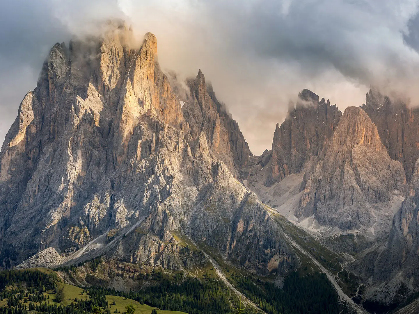
- Sassolungo/Langkofel massif: The 3,181 m Langkofel is the highest peak of the group and the visual centre of the circuit, with the path wrapping around its walls rather than climbing the summit.
- Sassopiatto/Plattkofel side: The Friedrich August Weg crosses alpine meadows beneath this broad neighbouring summit, giving some of the easiest and most open walking on the loop.
- Rifugio Vicenza/Langkofelhütte: This hut sits inside the Langkofel cirque below the north walls. The short uphill detour is worthwhile if you want the closest view of the massif’s major faces.
- Forcella Sassolungo and Toni Demetz hut: This dramatic notch at 2,685 m is off the standard walking circuit, reached by the Forcella Sassolungo “coffin lift” gondola or via ferrata, not by the loop itself.
- Città dei Sassi: The “City of Stones” is a boulder field near Passo Sella, formed by ancient rockfall from the group and passed close to the end of the walk.
- Dolomites UNESCO setting: The Langkofel Group is part of the Dolomites UNESCO World Heritage Site, recognised for its limestone mountain scenery.
Challenges to expect
Expect a long mountain day with around 800 m of ascent, mixed surfaces and limited easy bailout once you are behind the massif. The south side has grassy paths and pasture; the north side is rockier, with gravel, scree and some steeper ascents and descents. Navigation is generally straightforward on waymarked trails, but cloud, early-season snow or late-day fatigue can make the circuit feel harder. July and August are busy around huts and Passo Sella.
HikeList Score
Sassolungo Circuit scored 81/100 on HikeList's trail-quality metrics.
See score breakdownHide breakdown
- Ideal length 55
- Balanced challenge 100
- Scenery & wildness 98
- Varied terrain 77
- Accommodation 66
- Food & support 81
- Path quality 98
- Season flexibility 76
Computed from length, challenge, scenery & wildness, terrain variety, accommodation, food & support, path quality and season flexibility.
 Italy
ItalyShow more data Show less
- Mountainous
- Forest
- Dirt
- Grass
- Gravel
- Rocky
- Scree
- Huts
- Hotels
- Family Friendly
- Pet Friendly
- Restrooms
- Water Sources
- Shelters
In these collections
Photos from hikers
Taken on the trail by people who've reviewed Sassolungo Circuit.
Walk clockwise from Passo Sella on trail 557, passing Rifugio Salei, Rifugio Friedrich August, Rifugio Sandro Pertini and Rifugio Sasso Piatto on the Sassopiatto side. Continue around the back of the massif, with an optional short detour to Rifugio Vicenza/Langkofelhütte, then return via Rifugio Comici and Città dei Sassi to Passo Sella.
Reviews
How would you rate Sassolungo Circuit?
Tap a star to start your review — you could be the first.