River Ayr Way
How would you rate River Ayr Way?
Tap a star to share your experience and help other hikers.
River Ayr Way: Source-to-Sea Hiking Guide
HikeList Score
River Ayr Way scored 84/100 on HikeList's trail-quality metrics.
See score breakdownHide breakdown
- Ideal length 66
- Balanced challenge 100
- Scenery & wildness 72
- Varied terrain 100
- Accommodation 91
- Food & support 81
- Path quality 92
- Season flexibility 89
Computed from length, challenge, scenery & wildness, terrain variety, accommodation, food & support, path quality and season flexibility.
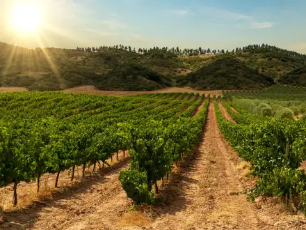
The River Ayr Way is a 66 km (41 mile) source-to-sea trail in Scotland, following the River Ayr from Glenbuck Loch near Muirkirk to Ayr harbour on the Firth of Clyde. Usually walked in 2–3 days, it is moderate rather than mountainous: riverbank paths, woodland tracks, farmland, sandstone gorges and a few short steep climbs. It suits newer long-distance walkers who want a well-waymarked point-to-point route with village stops and an easy continuation onto the Ayrshire Coastal Path.
Route Overview
Walk the River Ayr Way downstream from Glenbuck Loch, near Muirkirk in East Ayrshire, to Ayr harbour and the seafront. The signed route passes Glenbuck Loch, Muirkirk, Sorn, Catrine, Mauchline, Failford, Stair, Annbank and Ayr, moving from open moorland into river gorges, woodland, farmland and town paths. It is a point-to-point trail, so plan a lift, public transport, or use Ayr as a base and connect by bus where practical. At the finish it links with the Ayrshire Coastal Path. If comparing Scottish multi-day walks, also look at the Annandale Way and Arran Coastal Way.
Scotland’s first source-to-sea long-distance path
The River Ayr Way was Scotland’s first source-to-sea long-distance path. It opened in 2006, launched by broadcaster Fred MacAulay as part of the Coalfield Access Project, a scheme to improve countryside access in former Ayrshire mining areas. The route was jointly developed and is maintained by East Ayrshire Leisure Trust from Glenbuck to Failford and South Ayrshire Council from Failford to Ayr. NatureScot designates it as one of Scotland’s Great Trails.
Notable highlights
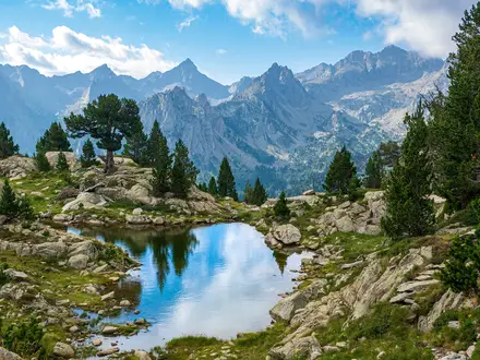
Glenbuck Loch: The trail starts at this quiet reservoir at the source of the River Ayr. The surrounding moorland carries strong former coal-mining and industrial heritage, and Glenbuck is also known as the birthplace of Bill Shankly.
Ballochmyle Viaduct: Near Mauchline, this railway viaduct carries the line over the Ayr gorge. It is noted as Britain’s tallest railway viaduct at about 52 m, with a central masonry arch that was world-leading when completed in 1848.
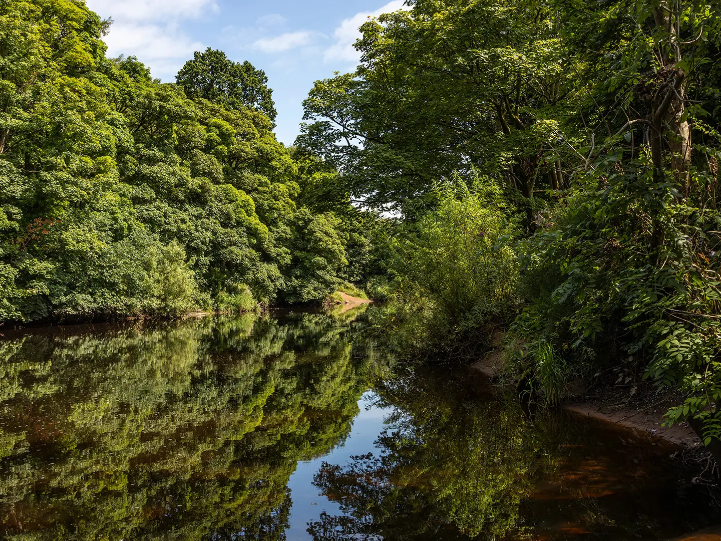
Ayr Gorge Woodlands: This Scottish Wildlife Trust reserve protects ancient oak woodland on steep red-sandstone gorge sides near Failford. It is a good section for birds, spring flowers and a more enclosed, wild feel.
Robert Burns connections: Mauchline and Failford sit in country closely associated with Robert Burns. Failford is linked with the story of Burns parting from his “Highland Mary”, Mary Campbell.
Catrine Voes: These restored mill ponds at Catrine are a wildlife haven and a clear reminder of how the River Ayr powered local mills.
Ayr harbour finish: The walk ends in the historic county town and harbour of Ayr, where the river meets the Firth of Clyde and connects to the Ayrshire Coastal Path.
Challenges to expect
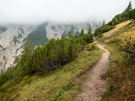
Expect mostly easy walking, but not a pavement stroll. The route mixes field paths, woodland tracks, riverbank sections, minor roads and sandstone gorge paths, with mud likely after rain. There are a few short steep climbs, but no major summit or high mountain ground. The main planning issue is point-to-point logistics: accommodation is in nearby villages and towns, and many walkers use Ayr as a base with buses.
HikeList Score
River Ayr Way scored 84/100 on HikeList's trail-quality metrics.
See score breakdownHide breakdown
- Ideal length 66
- Balanced challenge 100
- Scenery & wildness 72
- Varied terrain 100
- Accommodation 91
- Food & support 81
- Path quality 92
- Season flexibility 89
Computed from length, challenge, scenery & wildness, terrain variety, accommodation, food & support, path quality and season flexibility.
Show more data Show less
- Moorland
- Riverbank
- Woodland
- Gorge
- Farmland
- Urban
- Waymarked Tracks
- Woodland Paths
- Field Paths
- Minor Roads
- Muddy Paths
- B&Bs
- Inns
- Hotels
- Family Friendly
- Dog Friendly On Leash
- Restrooms
- Picnic Areas
- Public Transport Access Points
Photos from hikers
Taken on the trail by people who've reviewed River Ayr Way.
Starting from Glenbuck Loch, the River Ayr Way follows the infant River Ayr westwards across remote moorland and open countryside. The trail leads through areas dotted with remnants of Ayrshire’s coal mining history before passing through the small village of Limmerhaugh. Continuing on, the path enters attractive woodland as it heads towards the historic town of Muirkirk. From Muirkirk, the route closely traces the river’s undulating banks, passing through the tranquil village of Catrine and its nature reserve before arriving at the village of Sorn. Expect well-marked tracks, occasional muddy sections through woods and farmlands, and gentle hills throughout the day.
Leaving Sorn, the trail descends towards Mauchline, a village associated with Robert Burns, offering opportunities to pause and explore local heritage sites. The River Ayr Way here passes attractive rural scenery and traverses a series of gorge woodlands, most notably the atmospheric Failford Gorge with its ancient woodland and river cliffs. After Failford, the route skirts farmland, crosses minor roads, and passes through the village of Stair before arriving at Annbank. The track is varied, primarily comprising woodland paths and field edges, with some moderate undulating sections.
The final stage begins at Annbank and continues downstream towards the coast, following the River Ayr’s wide valley. It passes through the quiet village of Auchincruive, known for its estate and agricultural college, before entering the Dalmilling and Craigie areas on the edge of Ayr. The route then brings hikers through scenic riverside parkland and across footbridges into the town centre. The final section leads directly to the finish in Ayr, close to the river mouth at the Firth of Clyde. Terrain is mostly level, with a mixture of surfaced paths, riverside tracks, and brief urban sections as you approach Ayr.
Reviews
How would you rate River Ayr Way?
Tap a star to start your review — you could be the first.