Pokljuka to Planika Hut
How would you rate Pokljuka to Planika Hut?
Tap a star to share your experience and help other hikers.
Pokljuka to Planika Hut: Triglav’s Gentlest High Approach
HikeList Score
Pokljuka to Planika Hut scored 72/100 on HikeList's trail-quality metrics.
See score breakdownHide breakdown
- Ideal length 55
- Balanced challenge 74
- Scenery & wildness 85
- Varied terrain 89
- Accommodation 49
- Food & support 72
- Path quality 98
- Season flexibility 76
Computed from length, challenge, scenery & wildness, terrain variety, accommodation, food & support, path quality and season flexibility.
Pokljuka to Planika Hut is a 12 km one-way alpine approach in Triglav National Park, Slovenia, from Rudno Polje on the Pokljuka Plateau to Dom Planika pod Triglavom at 2,401 m. It is a hard, demanding day hike with about 1,054 m of ascent, usually walked in 4.5–5 hours before an overnight hut stay. It suits fit hikers wanting the most popular and gentlest walking route to Triglav’s flanks, but not the harder via-ferrata summit section beyond Planika.
Route Overview
The route starts at the Rudno Polje trailhead on the Pokljuka Plateau, reached by road from Bled or Bohinj, with a large car park. From the forested start it climbs steeply to Studorski preval, then crosses toward Vodnikov dom na Velem polju, a mid-route hut with a water spring. The trail continues over Konjsko sedlo before the final rocky, scree-covered climb to Dom Planika pod Triglavom on the Ledine plateau. This listed route is point-to-point and ends at the hut; the Triglav summit is not included. For a longer nearby objective, compare the Bohinj to Triglav Trail or the Julian Alps crossing on the Kranjska Gora to Trenta Trail.
Planika Hut and the Triglav Approach
Mountain shelters have stood on this part of Triglav since the 19th century. The first hut on the site dates to 1871, followed by the Maria Theresa Hut in 1877, later extended in 1911. After the First World War it became the Aleksander Lodge under the Slovenian Alpine Club, then was renamed Planika Lodge at Triglav in 1945. A larger annex was added in 1992. The Pokljuka approach has long been favoured as the easiest walking route onto Triglav, Slovenia’s national symbol.
Notable highlights
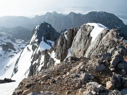
- Dom Planika pod Triglavom (2,401 m): The end point of this route and the main hut used for the final summit push on Triglav. It sits on the Ledine plateau on the mountain’s southern side.
- Pokljuka Plateau: A high karst forest plateau of spruce woods and peat bogs, also known for its biathlon and cross-country ski centre.
- Studorski preval / Studor Pass (1,892 m): The first major saddle, reached after a sustained forest climb from Rudno Polje. It opens the route toward the Velo Polje pasture area.
- Vodnikov dom na Velem polju (1,817 m): A mid-route mountain hut on the Velo Polje pasture, with a drinking-water spring. It is named after Valentin Vodnik, the Slovenian poet linked with early writing about Triglav.
- Triglav National Park: Slovenia’s only national park, covering much of the Julian Alps around Triglav. Triglav’s three-headed outline appears on Slovenia’s national flag and coat of arms.
Challenges to expect
The route is straightforward by Triglav standards but still a hard alpine hike. Expect a sustained climb to Studorski preval, then rockier ground, loose scree and short fixed-cable sections above Vodnikov dom. Weather exposure increases near Planika, and snow can linger into early summer. Navigation is helped by Slovenian red-and-white blazes, but hut space and meals should be booked in the summer season.
HikeList Score
Pokljuka to Planika Hut scored 72/100 on HikeList's trail-quality metrics.
See score breakdownHide breakdown
- Ideal length 55
- Balanced challenge 74
- Scenery & wildness 85
- Varied terrain 89
- Accommodation 49
- Food & support 72
- Path quality 98
- Season flexibility 76
Computed from length, challenge, scenery & wildness, terrain variety, accommodation, food & support, path quality and season flexibility.
Show more data Show less
- Mountainous
- Forest
- Alpine Pasture
- Rocky
- Dirt
- Gravel
- Scree
- Huts
- Family Friendly
- Pet Friendly
- Restrooms
- Water Sources
- Campsites
- Shelters
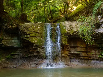
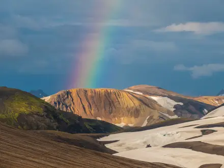
Photos from hikers
Taken on the trail by people who've reviewed Pokljuka to Planika Hut.
Start at Rudno Polje on the Pokljuka Plateau and climb through forest to Studorski preval. Continue across the high pasture country via Vodnikov dom na Velem polju, then cross Konjsko sedlo and tackle the rockier final climb to Dom Planika pod Triglavom at 2,401 m. Most hikers overnight here before any separate Triglav summit attempt.
Reviews
How would you rate Pokljuka to Planika Hut?
Tap a star to start your review — you could be the first.