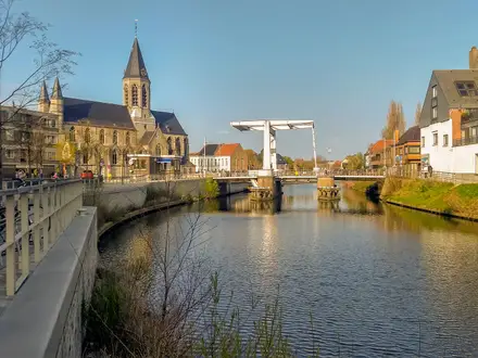
Medway Valley Walk
How would you rate Medway Valley Walk?
Tap a star to share your experience and help other hikers.
Medway Valley Walk: Kent’s Easy Riverside Trail
HikeList Score
Medway Valley Walk scored 78/100 on HikeList's trail-quality metrics.
See score breakdownHide breakdown
- Ideal length 66
- Balanced challenge 60
- Scenery & wildness 78
- Varied terrain 94
- Accommodation 91
- Food & support 88
- Path quality 80
- Season flexibility 89
Computed from length, challenge, scenery & wildness, terrain variety, accommodation, food & support, path quality and season flexibility.
The Medway Valley Walk is a 45 km fully waymarked footpath in Kent, south-east England, following the River Medway from Tonbridge to Rochester. It is an easy, low-lying point-to-point walk, usually completed in 2–3 days, with riverside meadows, farmland, orchards, hop gardens and tidal marshland near the finish. It suits walkers wanting a gentle multi-day route with strong rail access, historic towns and no permit requirements. For other lowland UK routes, compare the Ashby Canal Trail or the Amber Valley Route.
Route Overview
The standard direction is south to north, starting at Tonbridge Castle and ending at Rochester Castle and Cathedral, though the route can be walked either way. Key places in order include Haysden Country Park, East Peckham, Yalding, Nettlestead, Wateringbury, Teston Bridge Country Park, Maidstone, Allington Lock, Aylesford, Burham and Wouldham. The path is linear and waymarked throughout with a kingfisher logo; it is also shown on Ordnance Survey Explorer maps 136 and 148. Rail stations at Tonbridge, Wateringbury, Aylesford, Maidstone and Rochester make section walking straightforward. If you want a more coastal contrast, see the Anglesey Coastal Path.
History along the River Medway
The River Medway has long been a working corridor through Kent, linked with iron, paper, brewing, brick and cement industries and trade towards the sea. Aylesford and the nearby downs have Neolithic remains, including the Medway megaliths such as Kit’s Coty House and the Coldrum Stones. Rochester guarded a Roman river crossing before becoming a Norman stronghold with its castle and cathedral. The walking route itself is modern, created by Kent County Council and partner borough councils to link these places along the river.
Notable highlights
- Tonbridge Castle: A Norman motte-and-bailey castle beside the Medway, with a substantial 13th-century gatehouse. It marks the usual southern start in central Tonbridge.
- Yalding: A village where the Teise and Beult join the Medway, known for its medieval ragstone bridges and marina. The Greensand Way also crosses here.
- Teston Bridge Country Park: A riverside park around a medieval ragstone bridge and lock. It makes a useful rest, picnic and access point around the middle of the walk.
- Allington Lock: The lowest lock on the Medway and the limit of the tide. Below here the character changes from inland river to tidal lower valley.
- Aylesford: A historic village with a 14th-century bridge over the Medway and The Friars, a Carmelite priory founded in 1242. The nearby downs also hold Medway megaliths such as Kit’s Coty House.
- Rochester Castle and Cathedral: The finish is beside a Norman keep and Rochester Cathedral. Together they mark one of the most historic river crossings on the route.
Challenges to expect
The Medway Valley Walk is easy underfoot by long-distance standards, with no hills of note and a highest point of about 21 m. The main challenge is cumulative distance over 45 km. Low-lying riverside, meadow and marsh sections can be muddy or flooded in winter, especially near the lower Medway. Navigation is helped by kingfisher waymarks, but carry the guidebook or OS Explorer maps 136 and 148.
HikeList Score
Medway Valley Walk scored 78/100 on HikeList's trail-quality metrics.
See score breakdownHide breakdown
- Ideal length 66
- Balanced challenge 60
- Scenery & wildness 78
- Varied terrain 94
- Accommodation 91
- Food & support 88
- Path quality 80
- Season flexibility 89
Computed from length, challenge, scenery & wildness, terrain variety, accommodation, food & support, path quality and season flexibility.
 United Kingdom
 England
Show more data Show less
- River Valley
- Meadows
- Marshland
- Farmland
- Dirt
- Gravel
- Paved
- Hotels
- Guesthouses
- Inns
- Family Friendly
- Pet Friendly
- Restrooms
- Water Sources
- Campsites
- Picnic Areas
In these collections
Photos from hikers
Taken on the trail by people who've reviewed Medway Valley Walk.
Start at Tonbridge Castle and follow the River Medway north through low-lying riverside country, passing Haysden Country Park and East Peckham before reaching Yalding, where the Teise and Beult meet the Medway.
Continue from Yalding through the middle Medway valley, passing Nettlestead, Wateringbury and Teston Bridge Country Park before entering Maidstone, Kent’s county town.
Leave Maidstone along the river, passing Allington Lock and Aylesford, where the medieval bridge and The Friars priory are key historic stops, before continuing towards Burham.
The final stage follows the lower Medway through Burham and the Burham/Holborough Marshes, then on via Wouldham to the finish at Rochester Castle and Cathedral.
Reviews
How would you rate Medway Valley Walk?
Tap a star to start your review — you could be the first.