Main Beskid Trail (Główny Szlak Beskidzki)
How would you rate Main Beskid Trail (Główny Szlak Beskidzki)?
Tap a star to share your experience and help other hikers.
Main Beskid Trail (Główny Szlak Beskidzki): Poland’s Beskid Thru-Hike
HikeList Score
Main Beskid Trail (Główny Szlak Beskidzki) scored 80/100 on HikeList's trail-quality metrics.
See score breakdownHide breakdown
- Ideal length 76
- Balanced challenge 56
- Scenery & wildness 98
- Varied terrain 83
- Accommodation 75
- Food & support 88
- Path quality 80
- Season flexibility 89
Computed from length, challenge, scenery & wildness, terrain variety, accommodation, food & support, path quality and season flexibility.
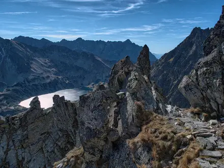
The Main Beskid Trail (Główny Szlak Beskidzki) is a 496 km point-to-point hike across southern Poland, usually walked in 18–21 days from Ustroń to Wołosate. It is strenuous: expect over 21,000 m of ascent, repeated forested climbs, rough earth-and-rock paths and long days between mountain huts or villages. There is no technical climbing, but the length, weather exposure on open meadows and cumulative fatigue make it best for fit hikers with multi-day mountain experience.
Route Overview
The conventional direction is west to east, starting in Ustroń in the Silesian Beskids and finishing at Wołosate in the Bieszczady, close to the Ukrainian border. The red-marked trail crosses the Silesian Beskids, Żywiec Beskids, Gorce, Beskid Sądecki, Low Beskids and Bieszczady, linking key places including Barania Góra, Babia Góra, Rabka-Zdrój, Turbacz, Radziejowa, Krynica-Zdrój, Iwonicz-Zdrój / Rymanów-Zdrój, Cisna and Halicz. It is a linear thru-hike, so plan start/end logistics rather than a loop. For shorter Polish mountain objectives, compare the Five Lakes Valley Trail, Giewont Summit Trail or Karkonosze Ridge Trail.
History of the Główny Szlak Beskidzki
The Main Beskid Trail is one of Poland’s oldest long-distance routes. It is named after Kazimierz Sosnowski, who designed the western Ustroń–Krynica section, completed in 1929. The eastern extension to the Bieszczady was finished by 1935, creating the full traverse used today. The route was briefly named after Józef Piłsudski from 1935 to 1939, and its eastern section partly coincides with the European long-distance path E8.
Notable highlights
- Babia Góra (1,725 m): The highest point on the trail and the loftiest peak in the Polish Beskids. Its exposed summit, inside Babiogórski National Park, gives wide mountain views and is often called the “Queen of the Beskids”.
- Barania Góra (1,220 m): An early high point in the Silesian Beskids. It is notable for holding the source of the Vistula (Wisła), Poland’s longest river.
- Turbacz (1,310 m): The highest summit of the Gorce range, with a large PTTK hut nearby. It is one of the route’s best-known viewpoints, including views towards the Tatras in clear weather.
- Radziejowa (1,262 m): The highest peak of the Beskid Sądecki. This central section is heavily forested and gives the trail a quieter, wilder feel between resort towns.
- Spa towns — Krynica-Zdrój, Iwonicz-Zdrój and Rymanów-Zdrój: Historic Galician spa resorts known for mineral springs and wooden architecture. They are practical places for resupply, accommodation and rest days.
- Bieszczady połoniny and Halicz / Tarnica high country: The south-eastern finale crosses open ridge meadows towards Wołosate, beneath Tarnica (1,346 m), the highest peak of the Polish Bieszczady.
Challenges to expect
The main difficulty is cumulative: 496 km, over 21,000 m of ascent and many steep ascents and descents. Surfaces are mostly natural earth, roots and rock, often through forest, with open meadows exposed to weather in places. Navigation is generally straightforward on continuous red-and-white waymarks. Huts are busiest in July–August, so book ahead; in the Low Beskids and Bieszczady, village guesthouses become more important where huts thin out.
HikeList Score
Main Beskid Trail (Główny Szlak Beskidzki) scored 80/100 on HikeList's trail-quality metrics.
See score breakdownHide breakdown
- Ideal length 76
- Balanced challenge 56
- Scenery & wildness 98
- Varied terrain 83
- Accommodation 75
- Food & support 88
- Path quality 80
- Season flexibility 89
Computed from length, challenge, scenery & wildness, terrain variety, accommodation, food & support, path quality and season flexibility.
Show more data Show less
- Mountainous
- Forest
- Meadow
- Dirt
- Rocky
- Paved
- Huts
- Shelters
- Guesthouses
- Family Friendly
- Dog Friendly On Leash
- Restrooms
- Potable Water Sources
- Established Campsites
- Shelters
- Picnic Areas
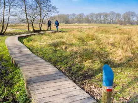
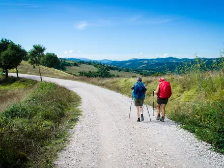
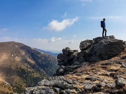
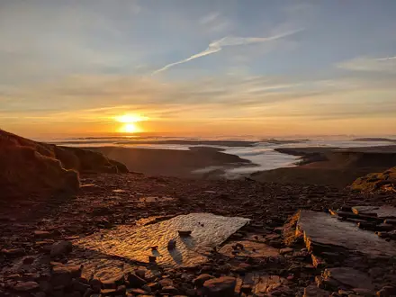
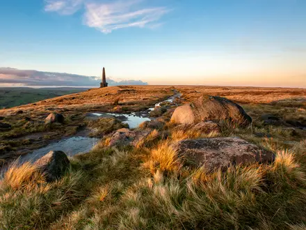
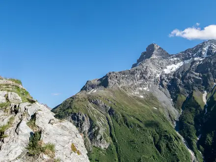
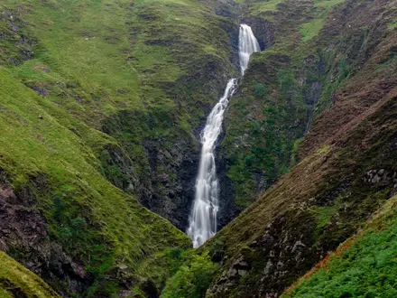
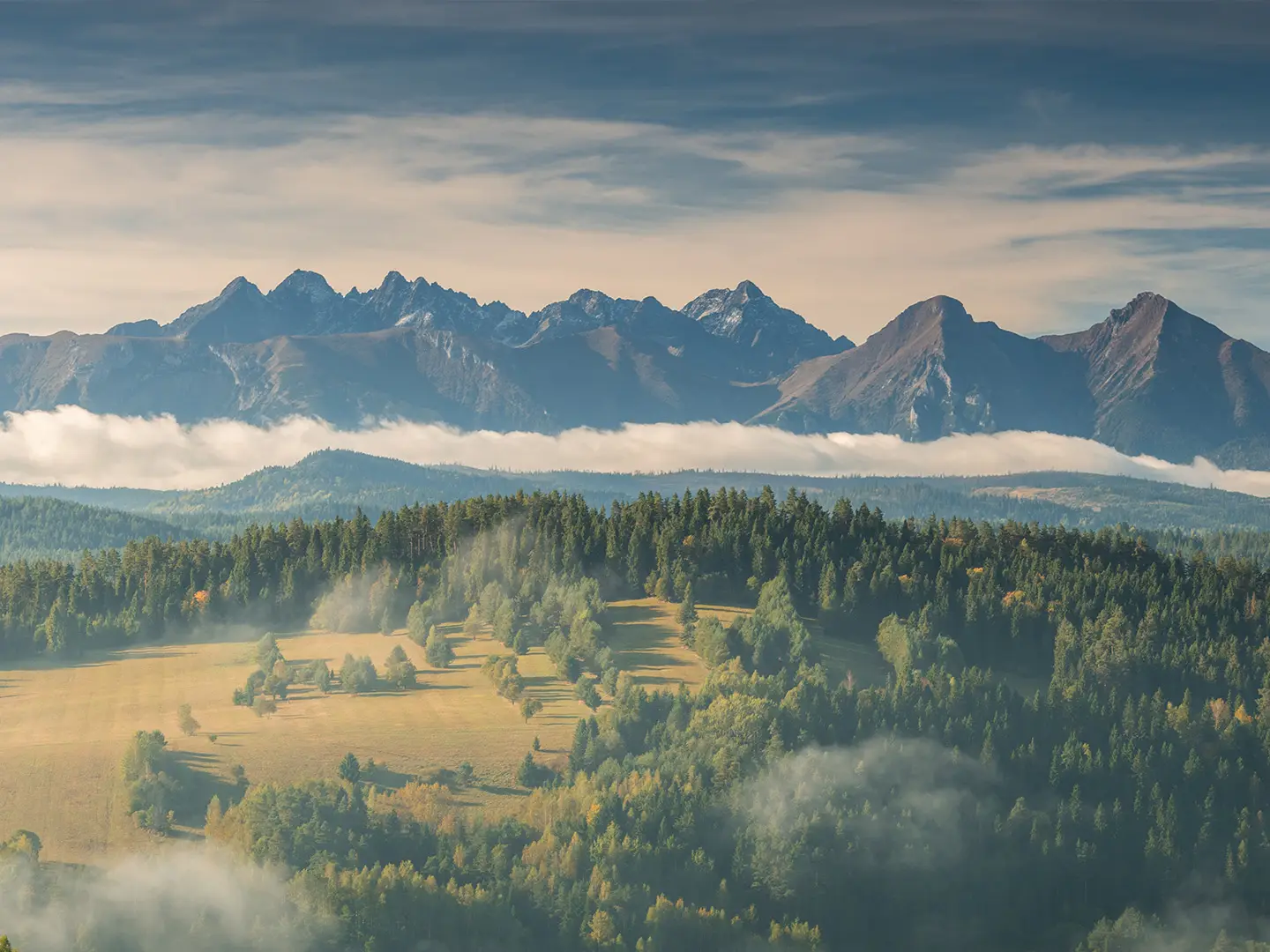
Photos from hikers
Taken on the trail by people who've reviewed Main Beskid Trail (Główny Szlak Beskidzki).
The hike starts from the town of Ustroń, ascending steeply into the Silesian Beskids. After leaving the town, the trail climbs to Mała Czantoria and then continues past Czantoria Wielka’s slopes, offering panoramic views, before traversing along the ridge towards Soszów Wielki. The section ends at the mountain hut on Stożek Wielki, a popular rest spot for trekkers.
From Stożek Wielki, the route follows undulating ridgelines, descending through wooded slopes to Kubalonka Pass, then heading through Stecówka and the picturesque valleys of the Silesian Beskids. It passes the remote Barania Góra peak, the source of the Vistula River, and contours downwards until reaching Węgierska Górka.
This section offers impressive mountain scenery, beginning with a steady ascent into the Żywiec Beskids. Hikers pass through Złatna and enter increasingly remote forests, approaching the open alpine meadows known as the Hala Rysianka, where a mountain hut awaits. Sweeping views over the Beskids and Tatra Mountains can be enjoyed here.
Continuing through the Żywiec Beskids, the trail traverses forested ridgelines, gradually ascending to one of the highest and best-known peaks in the region—Babia Góra. This stage includes significant elevation gain, culminating at Markowe Szczawiny Shelter, the traditional base for climbing the summit itself.
From Markowe Szczawiny, the GSB ascends directly to the peak of Babia Góra (1,725m), the highest point on the route, before descending through open ridges and thick forests to Krowiarki Pass. This section is physically demanding but highly rewarding for its panoramic vistas.
Departing from Krowiarki Pass, the route winds through the wooded foothills and crosses rolling peaks before reaching the small village of Kiczora, marking a transition between the more challenging mountain stretches and the gentler landscapes ahead.
This day leads through mixed forests and highland meadows of the Żywiec and Gorce borderlands. The trail threads above villages and gradually descends toward the spa town of Rabka-Zdrój, known for its mineral waters and access to the Gorce Mountains.
Departing Rabka-Zdrój, the GSB climbs into the Gorce Mountains, winding through thick spruce forests and open glades, eventually reaching Turbacz, the highest point in the Gorce. The popular mountain hut at Turbacz is a welcome resting place with impressive views.
This section traverses the heart of the Gorce, with undulating ridges and forested slopes providing a wild and tranquil experience for most of the route. The descent is gradual, eventually reaching the town of Krościenko nad Dunajcem on the Dunajec River.
Starting from Krościenko, the trail enters the Sącz Beskids, climbing toward Dzwonkówka and Prehyba. The final ascent leads to the ridge and the mountain hut near Radziejowa, the highest peak in the range.
The trek from Radziejowa follows high ridges, then descends through thick primeval forests and mountain streams to the village of Rytro, located at the base of the Sącz Beskids.
Leaving Rytro, the GSB ascends steadily through forests and mountain glades toward Hala Łabowska. The landscape becomes more remote and wild, with fewer settlements and expansive views over the surrounding lowlands.
The route from Hala Łabowska threads through hilly terrain, crossing forested peaks and traversing meadows dotted with wildflowers in summer. The final stretch descends toward the spa town of Krynica-Zdrój, a major resort and resupply point.
After leaving Krynica, the GSB passes through the rolling forested terrain of the Beskid Niski, a region characterized by solitude and historical Lemko villages. The section is slightly less mountainous, ending near the hamlet of Huta Wysowska.
This stage draws hikers deeper into the Low Beskids, an area known for vast woodlands, gentle ridges, and wartime cemeteries. Few facilities exist, and the path occasionally becomes faint before reaching the hamlet of Kąty.
Leaving Kąty, the trail traverses isolated hills and rural landscapes, winding through villages and meadows, ultimately arriving in the spa town of Iwonicz-Zdrój. This stage offers gentle walking with hints of the Carpathians’ cultural heritage.
An easier day with rolling terrain through the protected landscapes of the Low Beskids, connecting two famous spa towns: Iwonicz-Zdrój and Rymanów-Zdrój. The stage is marked by beech forests and tranquil valleys.
Continuing east, the route meanders through rural highlands, forgotten villages, and relics of wooden architecture. The trail gets wilder as it approaches Komańcza, gateway to the Bieszczady region.
Departing the village of Komańcza, the trail now enters the remote wilderness of the Bieszczady Mountains. Vast forests, open ridges, and occasional remote huts mark the route as it travels to the trekking center of Cisna.
This is one of the most iconic stretches, with the hike traversing the main scenic ridges of the Bieszczady, including the famous Połonina Wetlińska and Połonina Caryńska. Open meadows, forested slopes, and panoramic views dominate before descending to Ustrzyki Górne.
On the final day, the GSB climbs to Tarnica (1,346m), the highest summit in the Bieszczady, before descending the last ridges to the remote end point at Wołosate, marking the finish of Poland’s longest marked mountain route.
Reviews
How would you rate Main Beskid Trail (Główny Szlak Beskidzki)?
Tap a star to start your review — you could be the first.