Jubilee Walkway
How would you rate Jubilee Walkway?
Tap a star to share your experience and help other hikers.
Jubilee Walkway: London’s Landmark Walking Loop
HikeList Score
Jubilee Walkway scored 53/100 on HikeList's trail-quality metrics.
See score breakdownHide breakdown
- Ideal length 55
- Balanced challenge 50
- Scenery & wildness 28
- Varied terrain 45
- Accommodation 74
- Food & support 81
- Path quality 37
- Season flexibility 63
Computed from length, challenge, scenery & wildness, terrain variety, accommodation, food & support, path quality and season flexibility.
The Jubilee Walkway is an easy 23 km waymarked urban walk through central London in England. It is a flat, paved, one-day sightseeing route, not a wilderness trail, linking major landmarks on both banks of the River Thames. The full route is usually walked in a long day, with individual loops useful for shorter outings. It suits first-time visitors, city walkers and anyone wanting a largely step-free route with frequent public transport, cafés and exit points.
Route Overview
There is no single fixed start or finish: the Jubilee Walkway is a loop-based network of five interconnected circular sections. Common starting points are Leicester Square for the Western loop, Tate Modern for the Eastern loop, Bank junction for the City loop, Chancery Lane for the Camden loop and Trafalgar Square for the short Jubilee loop. The route follows pavements, riverside walkways and footpaths, crossing the Thames by bridges and linking closely with the Thames Path. Expect Trafalgar Square, Buckingham Palace, Westminster, St Paul’s Cathedral, the Tower of London, Tower Bridge, South Bank, Tate Modern and Covent Garden. For a quieter waterside route outside London, compare the Ashby Canal Trail; for a much longer coastal option, see the Anglesey Coastal Path.
History of the Jubilee Walkway
The route opened on 9 June 1977 as the Silver Jubilee Walkway, marking 25 years of Queen Elizabeth II’s reign and connecting many of London’s major tourist sights on foot. The Jubilee Walkway Trust was created in 1978 to maintain it with local authorities. It was refurbished and reopened on 24 October 2002 during the Golden Jubilee, when “Silver” was dropped from the name. The Camden loop, extending the network towards north-west London, was added in 2003.
Notable highlights
- Tower of London: A medieval royal fortress and UNESCO World Heritage Site beside the Thames. It is one of the route’s strongest historic stops, with associations as a palace, prison and stronghold.
- St Paul’s Cathedral: Sir Christopher Wren’s domed cathedral, completed in 1711 after the Great Fire of London. The walk links it to Tate Modern via the pedestrian Millennium Bridge.
- Westminster Abbey and the Houses of Parliament: Westminster Abbey is the Gothic coronation church of British monarchs, opposite the Palace of Westminster and Elizabeth Tower, better known for Big Ben.
- South Bank and Tate Modern: A busy riverside section of galleries, theatres and street activity. Tate Modern occupies the former Bankside Power Station, near Shakespeare’s Globe.
- Trafalgar Square and the Jubilee loop: Trafalgar Square, with Nelson’s Column and the National Gallery, is the focus of the short Jubilee loop towards royal landmarks including Buckingham Palace and St James’s Park.
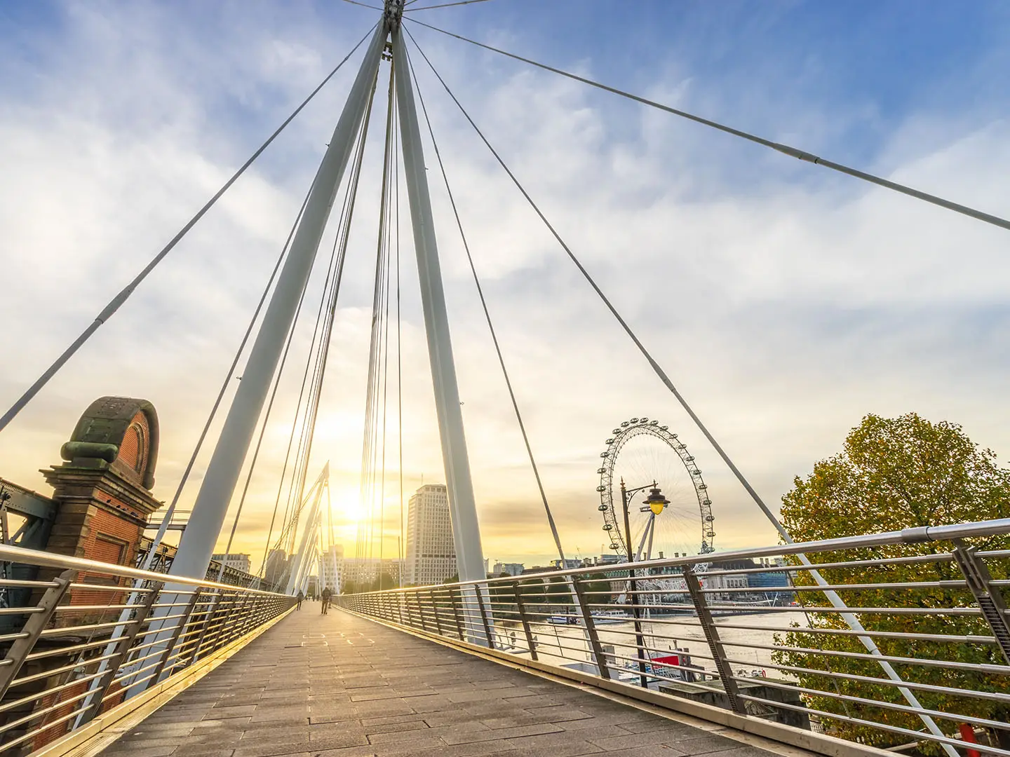
- Tower Bridge and the London Eye: These are two of the Thames’ signature sights: the Victorian bascule bridge in the east and the giant observation wheel on the South Bank.
Challenges to expect
The Jubilee Walkway is physically easy: ascent is negligible and the surface is paved. The main challenges are urban ones — crowds around major landmarks, repeated road crossings, variable London weather and staying alert for pavement discs at junctions. The full 23 km is still a long city walk, especially with sightseeing stops, so many walkers split it into loops. If you want a more rural inland walk, consider the Amber Valley Route.
HikeList Score
Jubilee Walkway scored 53/100 on HikeList's trail-quality metrics.
See score breakdownHide breakdown
- Ideal length 55
- Balanced challenge 50
- Scenery & wildness 28
- Varied terrain 45
- Accommodation 74
- Food & support 81
- Path quality 37
- Season flexibility 63
Computed from length, challenge, scenery & wildness, terrain variety, accommodation, food & support, path quality and season flexibility.
 United Kingdom
 England
Show more data Show less
- Urban
- Paved
- Hotels
- Hostels
- Wheelchair Accessible
- Stroller Accessible
- Family Friendly
- Pet Friendly
- Restrooms
- Water Sources
- Picnic Areas
Photos from hikers
Taken on the trail by people who've reviewed Jubilee Walkway.
Reviews
How would you rate Jubilee Walkway?
Tap a star to start your review — you could be the first.