John Muir Way
How would you rate John Muir Way?
Tap a star to share your experience and help other hikers.
John Muir Way: Scotland Coast-to-Coast Walking Guide
HikeList Score
John Muir Way scored 92/100 on HikeList's trail-quality metrics.
See score breakdownHide breakdown
- Ideal length 95
- Balanced challenge 100
- Scenery & wildness 75
- Varied terrain 100
- Accommodation 100
- Food & support 94
- Path quality 87
- Season flexibility 89
Computed from length, challenge, scenery & wildness, terrain variety, accommodation, food & support, path quality and season flexibility.
The John Muir Way is a 215 km / 134 mile coast-to-coast trail across central Scotland, usually walked west to east from Helensburgh on the Firth of Clyde to Dunbar on the North Sea. Most walkers take 9-10 days. It is a Moderate point-to-point route: mostly low-level paths, towpaths, lanes and coastal tracks, with one more exposed upland crossing in the Kilpatrick Hills. It suits walkers wanting an inn-to-inn Scottish long-distance route with easy logistics and varied history.
Route Overview
The route starts at Helensburgh Esplanade and finishes in Dunbar, John Muir’s birthplace. The usual direction is west to east, linking Balloch and the southern shore of Loch Lomond, Strathblane and the Kilpatrick Hills, Kirkintilloch / Croy and the Antonine Wall, Falkirk, Linlithgow, Bo’ness, South Queensferry, Edinburgh’s outskirts, North Berwick and the East Lothian coast. It is not a loop, so plan separate start and finish transport. The John Muir Way is more inland and heritage-led than the Arran Coastal Way or Ayrshire Coastal Path; for another southern Scotland long-distance option, compare the Annandale Way.
History of the John Muir Way
The John Muir Way was created as a coast-to-coast tribute to John Muir, the Dunbar-born naturalist often called the father of the national parks. Muir emigrated from Scotland via the Clyde as a boy, and the route deliberately links Helensburgh in the west with his birthplace at Dunbar in the east. The full trail opened on 21 April 2014, in the centenary year of his death. It should not be confused with the separate John Muir Trail in California.
Notable highlights
- John Muir’s birthplace, Dunbar: The trail finishes in the town where John Muir was born in 1838. His birthplace is now a free museum, making Dunbar a meaningful end point rather than just a finish line.
- Loch Lomond & The Trossachs National Park: Early stages pass Balloch and the southern shore of Loch Lomond, the gateway to Scotland’s first national park. It is one of the route’s clearest shifts from town walking into open landscape.
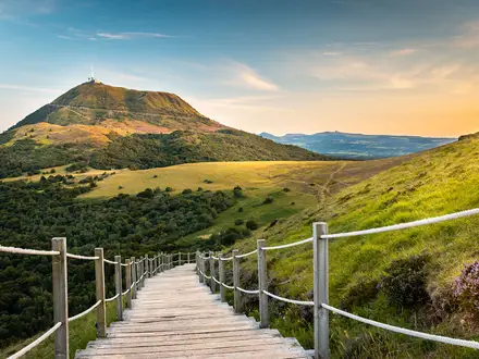
- Kilpatrick Hills: This is the highest and wildest section of the Way, crossing exposed moorland and reaching around 275 m. Expect steeper, rougher going here than on the canals and coast.
- The Falkirk Wheel: The route passes the rotating boat lift linking the Forth & Clyde and Union canals. It is one of the most distinctive engineering landmarks on the trail.
- Antonine Wall: Near Croy, the path reaches the line of this Roman frontier, now a UNESCO World Heritage Site. It adds a strong historical thread to the central section.
- Linlithgow Palace: A short detour reaches the ruined palace, known as the birthplace of Mary, Queen of Scots. It is a worthwhile cultural stop between canal and town walking.
Challenges to expect
Do not underestimate the distance just because the route is low-level. The main challenge is sustaining 9-10 consecutive walking days on mixed surfaces: surfaced towpaths, gravel tracks, lanes, grassy coastal paths and some loose stony ground. The Kilpatrick Hills are the key upland section, with more exposure, steeper terrain and open moorland navigation. Waymarking is in place, but weather can still make the moorland feel remote.
HikeList Score
John Muir Way scored 92/100 on HikeList's trail-quality metrics.
See score breakdownHide breakdown
- Ideal length 95
- Balanced challenge 100
- Scenery & wildness 75
- Varied terrain 100
- Accommodation 100
- Food & support 94
- Path quality 87
- Season flexibility 89
Computed from length, challenge, scenery & wildness, terrain variety, accommodation, food & support, path quality and season flexibility.
 United Kingdom
 Scotland
Show more data Show less
- Low Level
- Undulating
- Coastal
- Moorland
- Woodland
- Canal Towpath
- Rural Lanes
- Paved
- Gravel
- Farm Tracks
- Grass
- Stony
- B&Bs
- Guesthouses
- Inns
- Hotels
- Family Friendly
- Dog Friendly On Leash
- Restrooms
- Potable Water Sources
- Established Campsites
- Picnic Areas
- Public Transport Access Points
Download Our Full Guide to John Muir Way FREE!
Get our comprehensive guide to this hike for free. Save it for later reading or print out at home.
In these collections
Photos from hikers
Taken on the trail by people who've reviewed John Muir Way.
John Muir Way: The Complete Guide
 i
Image by Efraimstochter
i
Image by Efraimstochter The John Muir Way is a coast-to-coast crossing of central Scotland that suits walkers who want a long-distance route with strong logistics, varied scenery and a clear sense of purpose. It runs from Helensburgh on the Firth of Clyde to Dunbar on the North Sea, linking the town from which John Muir left Scotland as a child with his birthplace on the East Lothian coast.
This is not a high mountain trail. Its character comes from contrast: Loch Lomond and the Trossachs, canal towpaths, old railway paths, farmland, city parks, Roman frontier history, the Forth bridges and the beaches and dunes of East Lothian.
The one genuinely wild section is the crossing of the Kilpatrick Hills between Balloch and Strathblane. It is low by Scottish standards, rising to about 275 m, but it is exposed moorland and needs more care than the surfaced towpaths and lanes that make up much of the route.
Most reasonably fit walkers can plan the Way as an inn-to-inn hike, with towns, rail links and baggage transfer making it one of Scotland’s more accessible long trails. The catch is distance: several stages are long, especially the Balloch to Strathblane day, so stamina matters more than technical hill skill.
The finish through North Berwick, John Muir Country Park and Dunbar gives the route a strong final act rather than a simple end point. This guide covers stages, days, accommodation, food, transport, terrain and common planning mistakes.
Stage-by-Stage Guide
Stage 1: Helensburgh to Balloch — 14 km (9 miles)
This is a short first stage on paper, but it is not a flat warm-up. From the John Muir Way marker on Helensburgh Esplanade, the route leaves the Firth of Clyde and climbs inland on pavements, tracks and forest paths, passing close to Hill House before gaining the higher ground around Gouk Hill and Stoneymollan Muir.
Underfoot, expect a mix of pavements, gravel tracks, grassy paths, forest track and quiet roads. The climb is stiff on stony forest tracks, and the descent towards Balloch uses rough stone hill track, so footwear with a solid sole is worthwhile despite the modest distance.
The reward for the early effort is the view north towards Loch Lomond and the Trossachs mountains from the moorland above Stoneymollan Muir. The approach to Balloch brings easier going through Balloch Castle Country Park, with Loch Lomond Shores nearby for cafés and outdoor shops.
Food and water should be sorted in Helensburgh before leaving, as there are no reliable services on the hill section. Balloch has full facilities, including shops, cafés, hotels and B&Bs.
Balloch railway station gives straightforward ScotRail access to Glasgow Queen Street, and buses also connect towards Glasgow. Navigation is generally clear on the purple John Muir Way markers, but the forestry and moorland section is less urban than the start and finish, so keep track of the waymarks carefully.
The main warning is the amount of ascent for such a short day: around 447 m of climbing makes this more demanding than many walkers expect. The higher ground can feel exposed in poor weather, so an early start and waterproof layers make sense even on stage one.
Stage 2: Balloch to Strathblane — 30 km (18.5 miles)
This is the longest and most demanding stage of the John Muir Way. It begins relatively gently south of Loch Lomond, using quiet roads through farmland, before the walking route commits to the Kilpatrick Hills — the highest, wildest and most exposed part of the trail.
The first section is comparatively flat, with views around Balloch Castle Country Park, Gartocharn and the southern side of Loch Lomond. Beyond the farmland, the route passes forestry and reservoirs before reaching rougher upland ground, including loose stone-surfaced paths, farm tracks and steeper sections across the moor.
Key features on this stage include Burncrooks Reservoir, the Whangie area nearby, Mugdock Country Park and Mugdock Reservoir. On the descent, the Campsie Fells come into view before the route drops into Strathblane at their foot.
There are very limited services between Balloch and Strathblane. Edenmill at Auchineden Estate provides hostel accommodation and a café late in the stage, but walkers should not depend on finding food or water across the upland section without checking opening times before setting off.
Strathblane has shops, pubs and accommodation, but it has fewer options than the larger towns on the route. It is not on a railway line; bus services connect to Glasgow, and nearby Milngavie has rail links to Glasgow.
Navigation deserves serious attention on this stage. The walker route over the Kilpatrick Hills is distinct from the cycling alternative, and mist or poor visibility can make the moorland crossing awkward. Carry a map or GPX file, follow the purple walker waymarks, and allow a full 6–7 hours for the day.
Stage 3: Strathblane to Kilsyth — 21 km (13 miles)
After the hard Kilpatrick Hills day, this stage is mostly easier and flatter. It starts on a surfaced shared cycle path with wide views of the Campsie Fells, then picks up canal towpath and later the line of the Antonine Wall around Croy Hill.
The early kilometres are straightforward underfoot on good surfaces through or near Lennoxtown and Milton of Campsie. From Kirkintilloch the route follows the Forth and Clyde Canal eastwards, where the towpath can be muddy after rain.
The final part becomes more historical and slightly rougher as the route reaches the Antonine Wall near Twechar and Croy Hill. Expect rough grass, stone paths and short climbs around the earthworks and Roman fort sites, with good views back to the Campsie Fells.
Food and water are more available than on the previous stage. Lennoxtown has a pub and small shops, Milton of Campsie has small shops, a pub and a hotel, and Kirkintilloch has full town facilities, including a supermarket near where the route enters the town. Twechar is quieter, so do not leave resupply until there.
Kilsyth is around 1.5 km off the main route but has services. Auchinstarry Marina, just off route, is closer and has a hotel and restaurant; accommodation in Kilsyth itself is more limited, so booking ahead is sensible.
Kilsyth has bus services, including links towards Kirkintilloch and Lennoxtown, but no railway station. Croy railway station, just east of the stage end, is useful for section walkers on the Edinburgh–Glasgow Queen Street line via Falkirk.
Navigation is generally simple on the shared path and canal, but the Croy Hill section needs more care. From April to September, free-range cattle may be present on Croy Hill; give them space, keep dogs under close control, and avoid walking directly through a group if they are settled on the path.
Stage 4: Kilsyth to Falkirk — 21 km (13 miles)
This stage continues the central belt historical thread, combining Antonine Wall earthworks, canal towpath and the Falkirk Wheel. It is a varied day rather than a remote one, with several surface changes and some built-up or roadside sections around Bonnybridge.
The stage starts with grass and stone paths around Croy Hill, then settles onto the Forth and Clyde Canal towpath. Around Rough Castle the walking route leaves the cycling line to follow the Antonine Wall earthworks, because cycling is not permitted on the Wall itself.
Croy Hill and Rough Castle are the main historical highlights. Rough Castle Roman fort is one of the best-preserved forts on the Antonine Wall, and the surrounding earthworks give this stage a stronger sense of the Roman frontier than the canal miles alone.
The Falkirk Wheel is the major landmark of the day, linking the Forth and Clyde Canal with the Union Canal by rotating boat lift. If time and legs allow, The Helix and the Kelpies sculpture park lie a short detour east of the main route.
Bonnybridge provides useful mid-stage services, including shops and pubs. Falkirk has full town facilities and a wide choice of accommodation, including hotels, B&Bs and guesthouses.
Falkirk is one of the best transport points on the Way. Falkirk High railway station is on the route at the stage end, and Falkirk Grahamston is also close; both have regular ScotRail services to Glasgow and Edinburgh.
Navigation is mostly straightforward along the canal, but pay attention where the walking route diverges from the cycling route at Rough Castle and rejoins near the Falkirk Wheel. Take care on the road-walking sections through the Bonnybridge area.
Stage 5: Falkirk to Linlithgow — 14 km (9 miles)
This is one of the shortest and easiest official stages, often used as a lighter day after the central canal sections. It leaves Falkirk through Callendar Park, then follows the Union Canal for much of the distance towards Linlithgow.
Underfoot, the canal towpath is mostly flat and well surfaced, with a short woodland and riverside section on the River Avon Heritage Trail that can be muddy. The route drops off the canal near the Avon Aqueduct, follows the wooded river corridor, then climbs back towards minor roads and Linlithgow.
Callendar Park and Callendar House provide the first landmark of the day. The standout feature is the Avon Aqueduct, 250 m long and 26 m high, carrying the Union Canal across the River Avon gorge in wooded countryside.
Linlithgow is an excellent overnight stop. Linlithgow Palace and Linlithgow Loch are close to the route, with the palace ruins visible from outside and admission required to enter.
Services are limited along the canal itself, so carry snacks and water from Falkirk. Linlithgow has full town facilities, including pubs, cafés, restaurants, shops and a supermarket, plus a good choice of B&Bs and hotels.
Linlithgow railway station is on the Edinburgh–Glasgow Queen Street main line, with frequent ScotRail services to both cities. This makes the stage particularly convenient for section walkers.
Navigation is simple on the canal towpath, but the descent from the canal at the aqueduct and the re-climb towards Linlithgow need attention to the waymarks. Because the day is only around 14 km, fit walkers sometimes combine it with Stage 4 or Stage 6, though Linlithgow is a strong place to stop.
Stage 6: Linlithgow to South Queensferry — 22 km (14 miles)
This stage links inland farmland and woodland with the Firth of Forth, then finishes beneath the three great Forth crossings. It has more variety than the distance suggests, with town, estate, coast, parkland and minor-road walking all in one day.
From Linlithgow, the route uses farmland and woodland paths before reaching the Bo'ness area. The coastal section from Bo'ness towards Blackness is partly industrial in character at first, then becomes more scenic as the path follows the Firth of Forth shoreline.
Important landmarks include Kinneil Estate and Kinneil House, the Bo'ness and Kinneil heritage railway, the Roman fortlet at Kinneil and Blackness Castle on the shore. The route then continues through Hopetoun Estate, with Hopetoun House visible from the parkland tracks, before dropping towards South Queensferry.
The finish is dominated by the Forth Bridge, Forth Road Bridge and Queensferry Crossing. The Forth Bridge is the red cantilever railway bridge and a UNESCO World Heritage Site; the route gives close-up views of all three crossings.
Bo'ness has shops, cafés and pubs, and Blackness has limited services, including a pub. South Queensferry has full facilities, with pubs, cafés, restaurants, hotels, inns and B&Bs.
Dalmeny railway station is about a mile from South Queensferry and has ScotRail services on the Fife Circle line, crossing the Forth Bridge towards Edinburgh and into Fife. Buses also connect South Queensferry with Edinburgh, and Edinburgh Airport is reachable by bus from nearby.
Follow the waymarks carefully through Hopetoun parkland, where estate tracks and paths can make the line less obvious. The approach under the bridges involves road walking and minor roads with traffic, so stay alert on the final kilometres.
Stage 7: South Queensferry to Edinburgh — 25 km (15.5 miles)
This is a long urban and suburban stage, but it is far from monotonous. It starts with one of the best bridge viewpoints on the route, then follows the Firth of Forth through Dalmeny Estate before threading through Cramond, Corstorphine and western Edinburgh to The Meadows.
The first section passes beneath the Forth Bridge and continues through woodland and coastal estate paths around Barnbougle Castle and Dalmeny House. The Dalmeny Estate section is private land accessed by courtesy, and the coastal route here is for walkers.
At Cramond, the Way reaches the mouth of the River Almond, with the village and Roman fort site adding interest before the route turns inland. It then uses residential streets, riverside paths and woodland over Corstorphine Hill, where there are views across Edinburgh towards Arthur's Seat.
Later landmarks include Edinburgh Zoo, Murrayfield stadium and the old railway line now used as a cycleway through Murrayfield. The stage finishes at The Meadows, south of the city centre and close to Marchmont Road.
Cramond has a café and pub, and the Edinburgh suburbs provide regular opportunities for shops and supermarkets. The Meadows, Marchmont and nearby Morningside have a wide range of cafés, pubs and restaurants.
Edinburgh has the widest accommodation choice on the whole route, but it is also the place where prices and availability can be most difficult. During the August Festival period, accommodation books out months ahead, so this stage must be planned early for summer trips.
Edinburgh Waverley and Edinburgh Haymarket provide mainline and ScotRail connections, with buses and trams covering the city. The route’s finish at The Meadows is a short distance south of the city centre.
Navigation is more fiddly than the map profile suggests. Waymarking through built-up streets can be missed, and a GPX file or detailed guide map is useful. The main physical challenge is the 25 km distance on hard urban surfaces, which can be tiring even without major ascent.
Stage 8: Edinburgh to Prestonpans — 16 km (10 miles)
This is a shorter stage, leaving Edinburgh on urban paths and cycle routes before reaching the coast again at Musselburgh. It is useful as a gentler day after the long walk into the city, or as a stage that leaves time for Edinburgh in the morning.
The route passes below Arthur's Seat and skirts Holyrood Park, with the option of a steep detour up Arthur's Seat for wider views. That detour adds roughly 2–3 km and should be treated as extra hill time rather than part of the easy coastal walk.
Once east of the city, the walking becomes flatter and more straightforward. Musselburgh provides the main mid-stage stop, with its racecourse, golf links and full town services, before the route follows the Firth of Forth shoreline towards Prestonpans.
Prestonpans adds a strong local-history finish, with its mining and salt-panning background, the 1745 Battle of Prestonpans site and outdoor murals. The walking into town is not difficult, but the hard surfaces can still be noticeable after the Edinburgh stage.
Musselburgh has shops, cafés and other services either on or close to the route. Prestonpans has shops, pubs and cafés, though accommodation is more limited than in Edinburgh or larger coastal towns.
Prestonpans railway station is on the ScotRail Edinburgh–North Berwick/Dunbar line, with frequent trains to Edinburgh. This makes the stage simple to walk as a day section, and it also gives flexibility if staying back in Edinburgh.
Navigation is relatively straightforward on urban cycle paths, waymarked links and coastal promenade. There are no major terrain hazards on this stage, but allow for exposed coastal weather and check current transport times before travelling.
Stage 9: Prestonpans to North Berwick — 26 km (16.5 miles)
This is a long East Lothian coastal stage, mostly low-level but demanding because of the distance. It links former industrial coast, sandy beaches, nature reserve paths, golf-course country and the final approach to North Berwick.
The route passes through or near Cockenzie and Port Seton, then continues by Seton Sands and Gosford Sands. The walking is generally flat, with a mix of coastal path, tracks and village sections rather than sustained climbing.
Seton Collegiate Church is a worthwhile historic landmark early in the day. Aberlady Bay is one of the major natural highlights: the UK's first Local Nature Reserve, known for wildfowl and wading birds, including oystercatchers, terns, geese and ducks.
Beyond Aberlady, the route continues through the Gullane area, with links golf courses, village facilities and coastal scenery. Yellowcraig beach gives views towards Fidra island before the final approach to North Berwick.
Food and water are available at Cockenzie and Port Seton, Aberlady and Gullane, but the day is long enough that walkers should carry enough between stops. North Berwick has full facilities, including cafés, pubs, restaurants, shops, hotels, B&Bs and guesthouses.
North Berwick railway station is on the ScotRail branch line to Edinburgh, with regular services. This makes the stage straightforward to section-walk, though accommodation in North Berwick is busy in summer and should be booked ahead.
Navigation is generally clear, but take care through Aberlady Bay’s dunes and grassland, where wandering off the defined path can become confusing. Start early: 26 km is a long day, and coastal wind can make the final miles feel slower than expected.
Stage 10: North Berwick to Dunbar — 24 km (15 miles)
The final stage is a varied coastal-and-country walk to John Muir’s birthplace in Dunbar. It uses country tracks, gravel paths, quiet roads, river path and coastal sections, with more inclines and steps than the previous East Lothian stage.
North Berwick Law, a 187 m volcanic plug, is the obvious optional detour at the start. The summit adds roughly 1 km and gives wide views towards Edinburgh, Arthur's Seat, Tantallon Castle and the Bass Rock in clear weather.
Tantallon Castle is the major landmark on the early part of the day, standing on clifftops facing the Bass Rock. The route then continues through inland and riverside sections around East Linton, where Preston Mill and Phantassie Doocot are nearby.
East Linton is the main practical mid-stage stop, with shops, cafés and a pub. After this, the route follows the River Tyne area and continues towards John Muir Country Park, Belhaven Bay and the approach to Dunbar.
The section through John Muir Country Park includes dunes, cliff paths and the tidal inlet at Biel Water, where the Bridge to Nowhere causeway is impassable at high tide. Tide times must be checked before setting off, and timing should not be left to chance on the final day.
Dunbar has full town services, including cafés, pubs, restaurants, supermarkets, hotels, guesthouses and B&Bs. The finish at John Muir's Birthplace Museum on the High Street gives the route a clear endpoint in the town where John Muir was born.
Dunbar railway station is on the ScotRail and LNER East Coast Main Line, with trains to Edinburgh and onward long-distance services. It is a practical finish for returning home the same day if the final stage is started early.
Navigation is mostly clear, but sea haar can make the John Muir Country Park section disorienting, so a GPX file is useful. Take care on the cliff-top path above Dunbar, especially in wind or wet conditions, and allow enough daylight for the full 24 km rather than treating the finish as a short coastal stroll.
Recommended Itinerary
Standard 10-day itinerary
The 10-day schedule is the most practical default for the John Muir Way. It follows the official stage pattern, keeps most overnight stops in towns or well-served villages, and avoids creating awkward transfers except where accommodation is limited.
| Day | From | To | Approx. distance | Why this stage makes sense | Services/accommodation notes |
|---|---|---|---|---|---|
| 1 | Helensburgh | Balloch | 14 km (9 miles) | A short first day, useful if arriving in Helensburgh the same morning. It eases you into the route before the longer and rougher Kilpatrick Hills stage. | Helensburgh and Balloch both have full town services. Balloch has shops, pubs, hotels and B&Bs, plus ScotRail links to Glasgow Queen Street. |
| 2 | Balloch | Strathblane | 30 km (18.5 miles) | This is the longest and hardest day, crossing from the Loch Lomond side into the Kilpatrick Hills. The upland section is exposed, rougher underfoot and includes the route’s wildest walking. | There are no regular services for a long stretch across the hills, so carry food and water. Strathblane has B&Bs, a pub and a village shop; book early, as options are fewer here than in the larger towns. |
| 3 | Strathblane | Kilsyth | 21 km (13 miles) | A steadier day through Lennoxtown and Milton of Campsie before the route reaches Kirkintilloch and picks up the Forth & Clyde Canal corridor. | Lennoxtown and Milton of Campsie have shops and places to eat. Kilsyth is the sensible overnight stop; accommodation around Croy is more limited. |
| 4 | Kilsyth | Falkirk | 21 km (13 miles) | Mostly canal-side walking, with the historical high point of the Antonine Wall near Croy Hill before returning towards the Forth & Clyde Canal and the Falkirk Wheel. | The Falkirk Wheel visitor centre is a useful break point with a café and toilets. Falkirk has full town services and Falkirk High station on the ScotRail network. |
| 5 | Falkirk | Linlithgow | 14 km (8.5 miles) | The shortest and easiest day, mainly along the Union Canal with woodland sections and the Avon Aqueduct. It works well as a recovery day after the previous canal and hill stages. | Linlithgow has good accommodation choice, shops and a busy ScotRail station with links towards Edinburgh and Glasgow. Linlithgow Palace is a straightforward detour if time allows. |
| 6 | Linlithgow | South Queensferry | 22 km (14 miles) | A varied stage linking canal, Bo’ness, Blackness, Hopetoun and the approach to the Firth of Forth. The arrival at South Queensferry gives one of the route’s strongest finishes. | South Queensferry has pubs, restaurants and B&Bs. Dalmeny station is nearby for ScotRail services to Edinburgh. |
| 7 | South Queensferry | Edinburgh | 25 km (15.5 miles) | A long but rewarding stage through the Dalmeny Estate, Cramond and the coastal edge of Edinburgh. The route uses Cramond Brig to cross the River Almond before continuing into the city. | There are limited services through the estate section, then more options from Cramond onwards. Edinburgh has the widest accommodation choice on the route and is the easiest place to add a rest night. |
| 8 | Edinburgh | Prestonpans | 16 km (10 miles) | A moderate day out of the city, following the Firth of Forth shore and passing Musselburgh before reaching Prestonpans. | Musselburgh has shops, cafés and pubs. Prestonpans has a ScotRail station, but accommodation choice is limited, so book ahead. |
| 9 | Prestonpans | North Berwick | 26 km (16.5 miles) | A long East Lothian coastal stage through Cockenzie, Port Seton, Longniddry, Aberlady and Gullane, with beach, bay and Bass Rock views before North Berwick. | Aberlady and Gullane are useful service points. North Berwick has hotels, B&Bs, restaurants and a ScotRail station. A bus service links Edinburgh, Musselburgh, Prestonpans, Longniddry, Aberlady, Gullane and North Berwick; times should be checked before travelling. |
| 10 | North Berwick | Dunbar | 24 km (15 miles) | The final stage crosses farmland and coast before John Muir Country Park, Belhaven Bay and the clifftop approach into Dunbar. It finishes at John Muir’s Birthplace. | Dunbar has hotels, B&Bs, shops and ScotRail/LNER services towards Edinburgh and London. John Muir’s Birthplace Museum is free to enter and is a John Muir Trust passport stamping point; current stamping locations should be checked before travelling. |
Slower 12-day variant
A 12-day schedule suits walkers who prefer to keep most days below the low-20 km range, want more time on the coast, or are cautious about the Kilpatrick Hills. It is also a good option if the 30 km Balloch to Strathblane stage feels too demanding.
| Change | How to do it | Who it suits | Planning notes |
|---|---|---|---|
| Split Day 2 | Walk Balloch to Edenmill Farm / Auchineden, then Edenmill Farm / Auchineden to Strathblane | Walkers who want to reduce the longest and most exposed day | Edenmill Farm is the practical mid-stage split, with hostel accommodation and a café. Availability should be checked before booking the rest of the itinerary. |
| Split Day 9 | Break Prestonpans to North Berwick at Aberlady or Gullane | Walkers who want a shorter East Lothian coastal day, or time for Aberlady Bay, Gullane and North Berwick | Exact daily distances depend on the chosen stop, so check official mapping before booking. Accommodation and bus options should be checked before travelling. |
| Add time in Edinburgh | Take an extra night in Edinburgh between South Queensferry and Prestonpans | Walkers wanting a rest day or a buffer for weather, transport or tired legs | Edinburgh is the easiest place on the route to pause, with full accommodation, rail and bus connections. |
Faster 8–9 day variant
A faster schedule is realistic only for fit, experienced long-distance walkers who are comfortable with long days on mixed surfaces. The route is not mountainous overall, but repeated 25 km-plus days, hard towpaths and the exposed Kilpatrick Hills still take a toll.
| Option | How it works | Typical long day created | Best for | Cautions |
|---|---|---|---|---|
| 9 days | Combine Kilsyth to Falkirk and Falkirk to Linlithgow | Kilsyth to Linlithgow: about 35 km (21.5 miles) | Strong walkers who want to save one day without disrupting the eastern coast stages | This creates a long canal-heavy day. Linlithgow accommodation should be booked in advance. |
| 8 days | Use the 9-day structure, then combine Edinburgh to Prestonpans and Prestonpans to North Berwick | Edinburgh to North Berwick: about 42 km (26 miles) | Very fit walkers with light packs and long-day experience | This is a serious day and removes the natural overnight stop at Prestonpans. It is not recommended for most first-time long-distance walkers. |
| Alternative compression | Combine Falkirk to Linlithgow with the following stage to South Queensferry | Falkirk to South Queensferry: about 36 km (22.5 miles) | Walkers who prefer one long central-stage day rather than compressing the coast | This skips the easy Linlithgow overnight. Allow time if visiting Linlithgow Palace or using Linlithgow as a rail access point. |
For most walkers, the standard 10-day itinerary remains the best balance of distance, accommodation and transport. The main booking pressure points are Strathblane, the Kilsyth/Croy area and Prestonpans; these should be arranged before committing to fixed travel at either end.
Planning the Route
How many days to allow
Most walkers should plan the John Muir Way as a 10-day walk, following the official stage pattern between established overnight stops. That pace suits reasonably fit hikers and keeps the route as an inn-to-inn journey rather than a fast endurance crossing.
An 11–12 day itinerary is more comfortable if you want shorter days, more time in Edinburgh, or a gentler approach to the East Lothian coast. The most obvious stage to split is Balloch to Strathblane, which is both the longest day at about 30 km (19 miles) and the only section with sustained upland exposure over the Kilpatrick Hills.
Fit walkers can complete the route in 8–9 days, but that usually means combining already long stages or moving quickly through the sections that are most worth lingering over. Edinburgh, North Berwick and the coastal approach to Dunbar are better enjoyed without a tight schedule.
| Itinerary | Best for | Main trade-off |
|---|---|---|
| 10 days | Most end-to-end walkers | Standard pace, but Balloch–Strathblane is a demanding day |
| 11–12 days | First long-distance walkers, slower hikers, walkers wanting more town time | Requires more overnight bookings |
| 8–9 days | Strong walkers used to long days | Less flexibility for weather, sightseeing and recovery |
How the stages are shaped
The route is largely dictated by where accommodation and services sit. The natural overnight stops are Helensburgh, Balloch, Strathblane, Kilsyth, Falkirk, Linlithgow, South Queensferry, Edinburgh, Prestonpans, North Berwick and Dunbar.
This makes planning straightforward, but not completely flexible. Smaller places such as Gartocharn, Bonnybridge, Blackness, Aberlady and Dirleton have limited or no accommodation, so they are better treated as passing-through points rather than reliable stage ends.
The main staging decision is the Balloch to Strathblane day. It crosses the Kilpatrick Hills, includes the roughest and most exposed ground on the route, and takes more time than its distance alone suggests. Edenmill near Auchineden, with hostel accommodation and a cafe, can work as a mid-stage break option, but availability and opening arrangements should be checked before travelling.
At the other end of the scale, Falkirk to Linlithgow is a shorter canal-stage day at about 14 km (9 miles). Some walkers combine it with the following stage towards South Queensferry, but doing so creates a much longer day and removes useful recovery time before the approach to Edinburgh.
Where to add time
Edinburgh is the obvious place for a rest day or half-day. It sits neatly between the central canal stages and the East Lothian coast, has excellent resupply options, and gives the legs a break before the final coastal section.
The East Lothian stages also reward a slightly slower pace. Prestonpans to North Berwick and North Berwick to Dunbar are both substantial walking days, and the coast around Aberlady, Gullane, North Berwick, Tantallon, Belhaven and John Muir Country Park is not a section to rush if time allows.
If walking early or late in the season, build in more flexibility around the Kilpatrick Hills day. Scotland’s weather can make this exposed section slower, wetter and colder than the low height suggests.
Accommodation planning
Accommodation is the most important planning task on the John Muir Way. The route passes through many towns, but the useful beds are unevenly distributed and the best-located options fill quickly.
Book the full route several months ahead for July and August. Edinburgh is the major pressure point: during the Edinburgh Festival Fringe in August, beds can be booked months in advance and prices rise sharply, with hostel dorm beds sometimes £60 or more. For an August walk, book Edinburgh nights by January or February if possible.
Spring and autumn are also popular. For April, May, September and October, book at least 6–8 weeks ahead for the key stops, and earlier if travelling at weekends or using a tight itinerary.
The Strathblane and Kilpatrick Hills area needs particular care. This is the thinnest accommodation stretch on the route, with options spread between Strathblane, Lennoxtown and Milton of Campsie. Ardoch House near Strathblane accepts campers in its grounds, but this should be checked before travelling.
Near Croy, accommodation is limited, so Kilsyth is the main practical end point for the Strathblane to Kilsyth stage. The official John Muir Way website has a per-section accommodation search which is useful when matching beds to stage lengths.
Food and water
Food and water logistics are generally easy compared with more remote Scottish trails. The John Muir Way is a town-to-town route through the Central Belt, and potable water is usually available from cafes, restaurants and shops.
The main exception is the Kilpatrick Hills crossing between Balloch and Strathblane. Carry enough water and food from Balloch for the full exposed section, and do not rely on finding services on the hill.
Small village shops, cafes and rural pubs may have reduced hours on Sundays and outside the main season. The canal-stage villages around Bonnybridge and the Polmont area are less service-rich than the larger towns, so plan lunches and snacks before leaving the bigger stops.
Section hiking and shortening the route
Section hiking is very practical. The route stays close to rail and bus links for much of its length, and several stage starts or finishes are usable for day walks or weekend sections.
A sensible way to divide the route is into three broad sections:
| Section | Practical break points | Planning notes |
|---|---|---|
| Western section | Helensburgh to Kirkintilloch | Helensburgh has ScotRail services from Glasgow; fewer intermediate stations, with buses filling some gaps |
| Central section | Kirkintilloch / Kilsyth to Edinburgh | Falkirk High, Polmont, Linlithgow and Dalmeny serve the canal and Forth-side stages |
| Eastern section | Edinburgh to Dunbar | The best-served section, with stations including Musselburgh, Prestonpans, Longniddry, North Berwick, East Linton and Dunbar |
Helensburgh Central is the natural rail access for the western start, while Dunbar has ScotRail and LNER East Coast Main Line services for the finish. South Queensferry is served via Dalmeny station.
The eastern section is especially easy to walk in day stages from Edinburgh. This makes it a good option if accommodation on the coast is full or if weather makes a flexible schedule preferable.
Navigation and route changes
The John Muir Way is waymarked and is one of Scotland’s easier long-distance trails to follow, but it should still be treated as a navigated walk. Carry offline mapping, especially for the Kilpatrick Hills and any urban-edge sections where paths, cycleways and lanes meet.
Official PDF maps are available from johnmuirway.org, and GPX files are available from LDWA and Walking Englishman. Ordnance Survey Landranger sheets 63–67 cover the full route.
Check the official John Muir Way website before starting for current diversions. This matters particularly around the Kilpatrick Hills, where forestry works can cause temporary closures.
Baggage transfer and organised packages
Baggage transfer is available for the full Helensburgh to Dunbar route and can make the John Muir Way much easier as a first long-distance walk. Highland Transfers runs the John Muir Way Baggage Service, with door-to-door luggage movement, a 20 kg maximum per bag, bags ready by 9am and delivery by 4pm.
The full 10-day baggage service is priced from around £1,050 per bag, but current prices should be confirmed before booking. Summer capacity can be limited, so book early if relying on luggage transfer.
Self-guided holiday companies such as Contours Walking Holidays, Celtic Trails Walking Holidays, Absolute Escapes and Macs Adventure offer John Muir Way packages. These typically combine accommodation booking, luggage transfer and a route information pack, which is useful if you want to avoid piecing together the logistics independently.
Passport, completion and final checks
There is an optional John Muir Way Passport, managed by the John Muir Trust. It costs £5 and can be bought from the official John Muir Way Store and at venues along the route.
Stamps are collected at participating pubs, cafes, castles and other venues. Ten stamps are needed for a completion certificate, available free from John Muir’s Birthplace Museum in Dunbar and Destination Helensburgh, with e-certificates available online.
Before finalising the itinerary, check three things: accommodation availability in Strathblane and Edinburgh, any live route diversions, and current opening hours for services on the more thinly supplied stages. Those details matter more on the John Muir Way than permits or technical mountain planning.
Towns, Villages and Overnight Stops
Accommodation on the John Muir Way is generally straightforward because the route links towns and transport corridors rather than remote mountain country. The main exceptions are the Balloch–Strathblane crossing, where the Kilpatrick Hills make the day long and more exposed, and parts of East Lothian where smaller coastal villages have fewer beds.
There are no hostels or bunkhouses outside Edinburgh on the route. Most walkers use a mix of B&Bs, guesthouses, inns and hotels, with some campsite options in selected areas. Book ahead for Strathblane, Edinburgh in August, and North Berwick or Dunbar on summer weekends.
Helensburgh
Helensburgh is the western start of the John Muir Way, with the marker on the esplanade beside the Firth of Clyde. It is a practical place to arrive the day before starting, especially if using public transport from Glasgow.
The town has a good choice of hotels and B&Bs, plus shops, cafes, restaurants and pubs. Stock up here before leaving: there are no services on the Helensburgh to Balloch stage, so carry food and water from town.
Helensburgh Central has regular ScotRail services to Glasgow Queen Street, taking about 45 minutes. Helensburgh Upper is on a less frequent line. Bus links also run between Helensburgh, Dumbarton and Balloch, but the direct Glasgow bus has changed in recent years and a change at Dumbarton may now be needed, so current routes and times should be checked before travelling.
Balloch
Balloch is the natural first overnight stop after the short opening stage from Helensburgh. It sits at the southern tip of Loch Lomond and marks the route’s entry into Loch Lomond & The Trossachs National Park.
There is a good choice of hotels and B&Bs, with cafes, pubs and lochside restaurants. Because Balloch is a popular visitor base, accommodation should be booked ahead in summer and on busy weekends.
Balloch has a ScotRail station on the Glasgow line and is also served by local buses towards Dumbarton and Helensburgh. It is one of the easiest places on the western half of the route to start, stop or section-walk.
Gartocharn / Loch Lomond Southern Shore
The route passes the southern Loch Lomond area between Balloch and the Kilpatrick Hills. This is useful for scenery and the transition into more open country, but it is not as strong an overnight base as Balloch or Strathblane.
Facilities are more limited than in the main towns, so do not rely on finding a full resupply here. For most walkers, this section is part of the long Balloch to Strathblane day rather than a planned stop.
Strathblane
Strathblane is the key overnight stop after the long Balloch to Strathblane stage, which is around 30 km and includes the highest, wildest section of the Way through the Kilpatrick Hills. It sits at the foot of the Campsie Fells and is the place where accommodation planning matters most on the western stages.
The Kirkhouse Inn is directly on the John Muir Way and is the main walker-friendly option in the village, with rooms and food available through its bar and restaurants. Alternatives in Strathblane itself are limited, so book early rather than assuming spare capacity.
There are shops for basic supplies in the village. Strathblane has bus links to Glasgow but no railway station, so it is less flexible than Balloch, Falkirk, Linlithgow or the East Lothian towns.
Lennoxtown
Lennoxtown lies on the Strathblane to Kilsyth stage and is useful as a mid-stage service stop. It has shops and places to eat, making it a practical lunch or resupply point after the previous day’s more exposed walking.
It can also work as a bail-out point because bus services run back towards Glasgow. Most end-to-end walkers continue through rather than stay overnight, unless splitting the Strathblane to Kilsyth section.
Milton of Campsie
Milton of Campsie is another useful village on the route between Strathblane and Kilsyth. It has shops and places to eat or stay, so it can help break up the day if weather, pace or fatigue make a shorter stage preferable.
Bus services provide a link back towards Glasgow. Accommodation choices are not as extensive as in the larger towns, so any overnight plan here should be arranged in advance.
Kirkintilloch
Kirkintilloch is a substantial town on the Forth & Clyde Canal section. It is one of the better resupply points between Strathblane and Kilsyth, with shops, pubs and cafes.
The canal towpath through Kirkintilloch is well-used and easy walking, making the town a straightforward lunch stop. It is not usually used as an official-stage overnight stop, but it is a practical place to leave or rejoin the route by bus.
Bus links run to Glasgow. If using Kirkintilloch to shorten the western stages, check current bus times before travelling.
Kilsyth
Kilsyth is the usual Stage 3 overnight stop, but it requires a detour of about 1.5 km from the John Muir Way. The town has all basic services and is a sensible base before continuing towards Croy, the Antonine Wall and Falkirk.
Auchinstarry Marina, near Kilsyth and slightly closer to the route, provides a hotel and restaurant alternative. This can be more convenient than heading fully into Kilsyth, depending on the day’s finish and accommodation availability.
Kilsyth has bus connections to Glasgow and Falkirk. Croy railway station is nearby on the following stage, giving another useful transport option.
Croy
Croy is a small village on the Stage 4 corridor, where the route runs near the line of the Antonine Wall. Its main value to walkers is transport rather than accommodation.
Croy railway station is on the ScotRail Edinburgh–Glasgow Queen Street line via Falkirk. It is a useful escape point if the Kilsyth to Falkirk stage needs to be shortened or if section-walking this central part of the Way.
Bonnybridge / Falkirk Wheel
The Bonnybridge and Falkirk Wheel area sits on the approach to Falkirk. The Falkirk Wheel is a major landmark on or very near the route, linking the Forth & Clyde and Union canals.
There are canalside food options around the visitor area, and this is a good place to pause before continuing into Falkirk. For overnight logistics, Falkirk itself has a much wider range of beds and transport.
Falkirk
Falkirk is one of the strongest overnight stops on the whole route. It ends the Kilsyth to Falkirk stage and starts the shorter onward stage to Linlithgow, with excellent facilities and rail links.
Accommodation includes a Travelodge, B&Bs and hotels. The town centre has a pedestrianised High Street with shops, while the canal and Falkirk Wheel areas add pubs, restaurants and visitor facilities.
Falkirk High and Falkirk Grahamston stations have regular ScotRail services to Edinburgh and Glasgow. The Helix park and The Kelpies sit adjacent to the route area, making Falkirk a good place to build in an easier afternoon if the schedule allows.
Polmont
Polmont lies on the Falkirk to Linlithgow section. It is not normally a primary overnight stop for John Muir Way walkers, but it can be useful for access, services or shortening the day.
Facilities are more local in scale than Falkirk or Linlithgow. If planning to stop here rather than in one of the main stage towns, accommodation and transport should be checked before travelling.
Linlithgow
Linlithgow is an excellent overnight stop and one of the easiest towns on the route to use for an inn-to-inn schedule. The Union Canal towpath brings the route into and out of town, so navigation and logistics are simple.
There is a good selection of independent shops, cafes, pubs and restaurants along the High Street. The Star and Garter and Platform Three are close to the station, while Linlithgow Palace and Linlithgow Loch are on or very close to the walking line.
Linlithgow station has regular ScotRail services to Edinburgh, taking around 25 minutes, and also links to Glasgow. Accommodation is strong for walkers, but weekends should be booked ahead.
Bo'ness
Bo'ness, or Borrowstounness, lies on or near the Stage 6 corridor between Linlithgow and South Queensferry. It has all basic facilities and can be useful if breaking the day or using public transport to adjust the schedule.
Buses link Bo'ness with Falkirk and Linlithgow. The Bo'ness & Kinneil Railway is a local attraction, but for most walkers the town is mainly a services and transport option rather than the default overnight stop.
Blackness
Blackness is a small village on the Firth of Forth shoreline and makes a good lunch stop on the Linlithgow to South Queensferry stage. It has a pub and a community shop, which are useful because facilities are more spread out on this section.
Blackness Castle is on the route. Accommodation choices are limited compared with Linlithgow and South Queensferry, so do not assume it will work as a last-minute overnight halt.
Hopetoun
The route passes through the Hopetoun House estate area before South Queensferry. This is a highlight of the stage but not a service stop.
There are no commercial facilities on the route here. Carry what is needed from Linlithgow, Bo'ness or Blackness, especially if walking outside normal shop or pub hours.
South Queensferry
South Queensferry is a strong overnight stop at the foot of the Forth bridges. It is the end of the Linlithgow to South Queensferry stage and the start of the walk towards Edinburgh.
The town has hotels, pubs, cafes, restaurants and fish and chip shops on and around the High Street. Accommodation options include the Hawes Inn, Dakota Hotel and Premier Inn, with the Hawes Inn particularly close to the bridge views and the route area.
Dalmeny railway station is about 1 mile away, with regular ScotRail services between Edinburgh Waverley and Fife/Dunfermline. This makes South Queensferry a very convenient place to stop, start or retreat to Edinburgh if accommodation is tight.
Dalmeny Estate / Cramond
The South Queensferry to Edinburgh stage passes through the Dalmeny Estate and the Cramond area. This is an attractive but relatively service-light stretch compared with the towns at either end.
Plan it as a walking section rather than a resupply section. South Queensferry and Edinburgh are the practical accommodation bases, with Dalmeny station providing the most useful rail access near the western end.
Edinburgh
Edinburgh is the biggest service point on the John Muir Way and the best place for a full reset before the East Lothian coast. The route avoids the city centre, but a short detour from the Meadows gives access to the full range of city facilities.
Accommodation ranges from hostels and budget hotels to B&Bs and higher-end hotels. The city also has supermarkets, pharmacies, restaurants and outdoor retailers, including Cotswold and Tiso, making it the main gear-resupply stop on the route.
Edinburgh Waverley and Haymarket provide excellent rail connections, and the bus network is extensive. In August, the Edinburgh Festival fills the city; accommodation should be booked many months ahead if walking then.
Musselburgh
Musselburgh is the first town east of Edinburgh on the coastal section. It is a practical resupply point before continuing towards Prestonpans.
The town has pubs, cafes and supermarkets, including Aldi and Lidl. It is served by buses from Edinburgh and has a ScotRail station, so it works well for section-walkers or anyone shortening the Edinburgh to Prestonpans stage.
Prestonpans
Prestonpans is the usual Stage 8 overnight stop after the walk from Edinburgh. It is a small town with enough supplies for walkers, including Greggs and Lidl.
Accommodation is more limited than in Edinburgh or North Berwick, with some B&B options. Seton Sands holiday park nearby provides a campsite option, but availability and access should be checked before travelling.
Prestonpans has a ScotRail station on the Edinburgh–North Berwick/Dunbar line. This makes it a useful point for section-walking, even though the town has fewer overnight choices than the larger stops.
Longniddry
Longniddry lies on the East Lothian coastal corridor between Prestonpans and Aberlady/Gullane. It has a ScotRail station, which is its main practical value for walkers.
Village facilities are limited, so treat it mainly as a passing point or transport link rather than a guaranteed resupply stop. If planning to end a day here, accommodation and food should be checked before travelling.
Aberlady
Aberlady is an attractive village on Aberlady Bay and can work well as a quieter overnight alternative to North Berwick. It sits on the Stage 9 corridor between Prestonpans and North Berwick.
The village has a hotel, inn/pub, well-stocked local shop and restaurant. That makes it useful both for lunch and for splitting the long Prestonpans to North Berwick day.
Bus services run from Edinburgh via Musselburgh, Prestonpans and Longniddry. This is a useful option if accommodation in North Berwick is full or if a shorter walking day is needed.
Gullane
Gullane is a well-serviced East Lothian golf and seaside village on the approach to North Berwick. It has cafes, shops and accommodation options, making it a good lunch stop or possible overnight halt.
The village is served by buses from Edinburgh along the East Lothian coastal corridor. Muirfield golf course is nearby, and accommodation can be busy during golf and summer periods, so book ahead.
Dirleton
Dirleton is a practical late-stage stop between Gullane and North Berwick. It has a pub and shop, and Dirleton Castle is a notable landmark in the village.
For walkers, its value is mainly as a food, drink or rest stop before continuing to North Berwick. Bus services on the East Lothian coastal corridor provide additional flexibility.
North Berwick
North Berwick is the best-serviced town on the East Lothian coast and the usual Stage 9 overnight stop. It is also the logical place to resupply before the final stage to Dunbar.
The town has a wide choice of B&Bs and hotels, plus Nisa, Co-op, independent shops, cafes, restaurants, fish restaurants and pubs. It is popular with visitors, so summer accommodation should be booked ahead.
North Berwick station has direct ScotRail services to Edinburgh Waverley, taking about 33 minutes. The harbour, beach and views towards the Bass Rock make it a rewarding final overnight stop before the last coastal day.
Tantallon / Whitekirk
The final stage from North Berwick towards Dunbar passes the Tantallon and Whitekirk area. This section is more about the coastal walking and landmarks than full-service villages.
Facilities are limited compared with North Berwick and Dunbar. Carry food and water from North Berwick unless specific stops have been checked before travelling.
Belhaven
Belhaven and John Muir Country Park form the penultimate approach to Dunbar. Belhaven Bay is an important marker that the route is nearing its eastern finish.
There are no commercial facilities within John Muir Country Park itself. A dog-friendly campsite near the beach at Belhaven provides a camping option in the area, but availability should be checked before travelling.
Dunbar
Dunbar is the eastern finish of the John Muir Way and a practical place to stay after completing the route. The trail arrives in the town, so no onward walking is needed to reach services.
There is a good choice of hotels, guesthouses and B&Bs, with pubs, cafes, restaurants and shops on the High Street. John Muir's Birthplace at 128 High Street is free to visit and is the natural end-of-walk stop.
Dunbar station is on the East Coast Main Line, with trains to Edinburgh in about 25–30 minutes, Newcastle in about 1 hour 10 minutes and London King's Cross in about 4 hours 30 minutes. ScotRail also serves the Edinburgh–Dunbar corridor, and LNER direct services are available.
Getting to the Start
The John Muir Way starts at the marker on Helensburgh Esplanade, on the Firth of Clyde. Helensburgh Central is the most convenient rail station for the start, with the esplanade reached by a short, flat walk from the station.
Helensburgh Upper is a different station, higher up the hill. It can be useful for walkers arriving on the West Highland Line or the Caledonian Sleeper, but it is less convenient for the official start marker than Helensburgh Central.
By train
Train is the best option for most walkers starting the John Muir Way. Helensburgh is well connected to Glasgow, and using public transport avoids the awkward car-retrieval problem at the end of a point-to-point walk.
| Arrival station | Best for | Notes |
|---|---|---|
| Helensburgh Central | Most walkers | Closest station to the esplanade start; served by ScotRail on the North Clyde Line. |
| Helensburgh Upper | West Highland Line / Caledonian Sleeper arrivals | Around 15–20 minutes on foot from the esplanade, with the station sitting higher above the town. |
From Glasgow Queen Street Low Level, ScotRail runs direct trains to Helensburgh Central, usually around half-hourly, with a typical journey time of about 45 minutes. From Glasgow Central, journeys usually involve a change via Glasgow Queen Street Low Level and take roughly 54 minutes.
From Edinburgh Waverley, direct services to Helensburgh Central are available, with an average journey time of about 2 hours. Timetables, evening services and engineering work should always be checked on ScotRail before travelling.
Walkers coming from London or the north of England can use the Caledonian Sleeper Highlander service to Helensburgh Upper. It runs from London Euston towards Fort William, stopping at Helensburgh Upper on Sunday–Friday departures, with seated and room options available. The onward walk down to the esplanade start is straightforward, but Helensburgh Central remains the better station if connecting through Glasgow.
Book and check live train times through ScotRail, National Rail, Trainline or Caledonian Sleeper. This should be checked before travelling.
By bus
Local buses link Helensburgh with Dumbarton and Balloch, which can be useful for connecting the start with Balloch or if rail services are disrupted. Bus routes and operators in this area have changed in recent years, and a change at Dumbarton may now be needed for Glasgow, so this should be checked before travelling.
For most walkers, the bus is slower and less convenient than the train. Current routes and times should be checked through Traveline Scotland before travelling.
By car
Helensburgh is about 25 miles (40 km) north-west of Glasgow city centre. By road, access is usually via the A82 towards Balloch or the A814 along the Clyde shore into Helensburgh.
Typical driving times are around 30–40 minutes from Glasgow, depending on traffic, and around 1.5 hours from Edinburgh via the Glasgow area. These timings are only useful for drop-offs or short visits unless a vehicle-retrieval plan is in place.
The main issue with driving is that the John Muir Way finishes in Dunbar, not Helensburgh. Anyone leaving a car at the start will need to return across central Scotland to collect it, arrange a shuttle, or use rail to link back.
Useful Helensburgh parking options include:
| Car park | Notes |
|---|---|
| Helensburgh Pier Car Park, West Clyde Street, G84 8SQ | Pay & Display; very close to the esplanade start. Motorhome parking is available, but overnight motorhome stays are not permitted. |
| Maitland Court, G84 7PD | Pay & Display; 32 spaces. |
| Kidston Park, Rhu Road Lower, G84 8QB | Free parking; 62 spaces. |
| Victoria Halls, Sinclair Street, G84 8TU | Free parking; 28 spaces; 3 m height restriction. |
| Colquhoun Square, G84 8AQ | Pay & Display; motorhome parking available. |
| Helensburgh Station car parks, East Princes Street | Private car parks; daily parking available, with prices subject to change. |
Argyll & Bute Council’s PayByPhone parking can allow multi-day extensions in some council car parks. Long-stay rules, charges and maximum permitted stays should be checked before leaving a vehicle for the duration of the walk.
From the nearest airport
Glasgow Airport is the closest major airport, about 20 miles by road from Helensburgh. A taxi or car transfer typically takes around 30 minutes, with fares subject to change.
There is no direct rail link from Glasgow Airport to Helensburgh. A practical public-transport route is to take the 500 airport bus into Glasgow city centre, then continue from Glasgow Queen Street Low Level by ScotRail train to Helensburgh Central. Allow roughly 1 hour 25 minutes overall, depending on connections.
Edinburgh Airport is a workable alternative but less convenient for the start. Take the tram into Edinburgh city centre, then travel by train towards Glasgow and onward by ScotRail to Helensburgh Central. A total journey of about 2.5–3 hours is realistic, but this should be checked before travelling.
Where to stay before starting
Helensburgh has B&Bs, guesthouses and hotels suitable for the night before the walk. Staying in town makes the first morning simple, especially if using baggage transfer or starting early for the walk to Balloch.
Options in or near Helensburgh include Balmillig B&B, No.20 Boutique B&B, Moorlands B&B and several town-centre hotels. Availability and walker services such as parking, early breakfast and luggage collection should be checked when booking.
Glasgow is also a practical overnight base, with a much wider choice of accommodation and direct morning trains to Helensburgh Central. This works well for late arrivals, but it adds a rail journey before the first walking day.
Getting Home from the Finish
The John Muir Way finishes in Dunbar, East Lothian, at John Muir’s birthplace on the North Sea coast. Dunbar is about 45 km (28 miles) east of Edinburgh and is one of the easier long-distance trail finishes in Scotland, with rail, bus, taxi, food and accommodation all close to the end point.
Dunbar railway station is roughly 500 m from the town centre and finish area, so most walkers can reach onward transport on foot. If finishing late, check train and bus times before committing to same-day travel, as evening services vary and engineering works can affect the East Coast Main Line.
By train
Dunbar station is on the East Coast Main Line and is the best way to leave the finish. It is a staffed station with a ticket office, toilets, waiting room, vending machines and seating on both platforms. The station is fully accessible, with a footbridge and lifts.
Typical rail options from Dunbar include:
| Destination / connection | Typical service pattern | Notes |
|---|---|---|
| Edinburgh Waverley | Around 21–30 minutes | ScotRail, LNER, CrossCountry and TransPennine Express all serve the route; around 30 trains per day in total. |
| London King’s Cross | Around 4 hours direct | LNER runs direct East Coast Main Line services; advance tickets are usually much cheaper than walk-up fares. |
| Newcastle, York and other ECML destinations | Direct or easy connections | LNER, CrossCountry and TransPennine Express provide useful southbound options. |
| Dundee / Aberdeen and northern Scotland | Direct or via Edinburgh | CrossCountry and LNER are useful for some northbound journeys; Edinburgh is the main interchange. |
| Helensburgh Central, for a car left at the start | Change at Edinburgh Waverley | From Edinburgh Waverley, ScotRail services continue to Helensburgh Central; allow for the cross-Scotland connection when planning. |
ScotRail runs roughly every two hours between Dunbar and Edinburgh Waverley, with a journey time of about 27–30 minutes. LNER also serves Dunbar, with faster Edinburgh journeys of around 21–30 minutes and direct long-distance trains to London King’s Cross.
CrossCountry and TransPennine Express add further services, including trains towards Edinburgh, Newcastle and longer-distance UK destinations. Exact stopping patterns vary, so long-distance tickets should be booked against the specific train you intend to catch.
Advance LNER tickets are normally released around 12 weeks before travel, and booking several weeks ahead can make a large difference on longer journeys. Current timetables, fares and any engineering-work bus substitutions should be checked before travelling.
By bus
Buses stop on or near Dunbar High Street, close to the finish and town services. They are useful for East Lothian connections, for reaching Edinburgh without using the train, or for linking back to intermediate points on the eastern end of the trail.
Key services include:
| Service | Route | Use for walkers |
|---|---|---|
| East Coast Buses X7 | Dunbar to Edinburgh via Haddington and Musselburgh | A direct bus option to Edinburgh city centre, taking under 1 hour in normal conditions. |
| Eve Coaches 120 | Dunbar to North Berwick via East Linton | Useful for returning to North Berwick or local East Lothian accommodation. |
| Borders Buses 253 | Edinburgh to Berwick-upon-Tweed via Dunbar | Useful for Edinburgh or Berwick-upon-Tweed connections. |
Bus times are more timetable-dependent than the train and may be less convenient in the evening or on Sundays. Use Traveline Scotland for current times before relying on a bus connection from the finish.
By car/taxi
Dunbar has no taxi rank at the railway station, so taxis should be pre-booked. This matters if arriving tired, finishing after dark, carrying extra luggage, or connecting to accommodation outside the town centre.
Local taxi operators include:
| Operator | Phone |
|---|---|
| Torrance Taxis & Travel | 01368 862612 |
| WB Taxis | 07585 330139 |
| TAB Taxis | 01368 650600 |
| Redline Cabs | 01368 864640 |
Pre-booking is particularly sensible at weekends, during summer, or if a minibus or airport transfer is needed. For walkers returning to a vehicle left in Helensburgh, the train via Edinburgh is usually the practical option rather than a long taxi transfer across central Scotland.
From the nearest airport
Edinburgh Airport is the nearest relevant airport, approximately 63 km (39 miles) from Dunbar by road. There is no direct bus from Edinburgh Airport to Dunbar.
The usual public-transport route is:
- Walk from the finish to Dunbar railway station.
- Take a train from Dunbar to Edinburgh Waverley.
- Continue by tram from Edinburgh city centre to Edinburgh Airport.
Allow about 1 hour 40 minutes in total for the Dunbar–Edinburgh–airport journey, depending on the connection. This should be checked before travelling, especially for early flights or late finishes.
A taxi or private transfer from Edinburgh Airport to Dunbar takes roughly 42 minutes by road in normal conditions and may cost around £100–£120. Pre-booked operators such as Torrance Taxis offer airport transfers, but current prices should be confirmed before booking.
Where to stay at the finish
Staying overnight in Dunbar is often the most relaxed option, especially after the North Berwick to Dunbar stage, which is around 24 km (15 miles). It also removes pressure to reach a particular evening train and gives time to visit John Muir’s Birthplace before leaving.
Dunbar has a reasonable range of accommodation, including hotels, B&Bs, guesthouses and some self-catering or Airbnb options. Booking ahead is strongly advised on summer weekends and during busy East Lothian holiday periods.
Options in town include the Bayswell Park Hotel, a clifftop hotel near the harbour and on the John Muir Way, and the Dunmuir Hotel on the High Street. The official John Muir Way accommodation listings are a useful place to check current options before booking.
For food and supplies after finishing, Dunbar High Street has Co-op supermarkets, cafés, takeaways and restaurants. Useful end-of-walk options include Dunbar Community Bakery on the High Street, The Creel at Dunbar Harbour, and The Bear & Bull Bar on the High Street.
Which Direction Should You Walk?
Walk the John Muir Way west to east, from Helensburgh to Dunbar, unless there is a strong personal or transport reason to do otherwise. This is the standard direction, the one used by the official guidebook and stage breakdown, and the direction followed by the vast majority of end-to-end walkers.
The route can be walked east to west, but it is not the natural way to plan it. Reverse walkers need to pay closer attention to stage planning, accommodation sequencing and weather exposure, especially over the Kilpatrick Hills.
West to east: Helensburgh to Dunbar
West to east is the intended direction for practical and symbolic reasons. The official John Muir Way FAQ recommends starting in Helensburgh if you want the prevailing wind behind you, and the guidebook and waymarking are oriented Helensburgh → Dunbar.
It also gives the route its strongest narrative. John Muir left Scotland as a child from the Clyde area for America; walking from the Firth of Clyde to Dunbar reverses that journey and finishes at his birthplace, giving the final day a clear sense of arrival rather than simply reaching the end of a path.
The scenery also builds well in this direction. The Kilpatrick Hills arrive early, the middle stages move through canal, Roman and industrial heritage around Croy, Falkirk and Linlithgow, and the final days open out along the East Lothian coast through Aberlady, Gullane, North Berwick, Tantallon, Belhaven and Dunbar.
Wind and weather
The prevailing winds in Scotland are south-westerly. On a west-to-east crossing, that usually puts the wind broadly behind you rather than in your face.
This matters most on the Balloch to Strathblane stage over the Kilpatrick Hills, the highest and most exposed part of the route. A westerly tailwind is noticeably helpful across open moorland; walking the same section east to west can mean pushing into the weather on the wildest day of the Way.
Climbing and gradients
The Kilpatrick Hills are reached early when walking west to east. The main climb from the Balloch side, rising from the Burncrooks Reservoir area, is the steeper side of the crossing, while the descent towards Strathblane is gentler.
That makes west to east slightly preferable: the harder climbing comes first, and the more gradual side is used for the descent. The high point is the same in either direction, at around 275 m, so this is not a decisive mountain-route issue — but it does make the standard direction feel more logical underfoot.
Transport at each end
West to east also works better for most public-transport plans. Helensburgh is straightforward to reach at the start, while Dunbar is the stronger place to leave from after finishing.
| Direction | Start logistics | Finish logistics | Practical verdict |
|---|---|---|---|
| West to east | Trains run from Glasgow Queen Street to Helensburgh Central in around 45 minutes. Many walkers can travel from Glasgow on the morning of Day 1. | Dunbar is on the East Coast Main Line, with trains to Edinburgh Waverley in around 30 minutes and direct LNER services towards Newcastle and London King’s Cross. | Best option for most walkers, especially those returning south or via Edinburgh. |
| East to west | Dunbar is easy to reach from Edinburgh and the East Coast Main Line. | Helensburgh has rail access to Glasgow, but onward connections are usually less convenient than leaving from Dunbar. | Feasible, but less tidy at the finish. |
One common planning error is mixing up Glasgow’s main stations. Glasgow Queen Street is the key station for Helensburgh Central services; Glasgow Central handles many other main-line services. Current timetables should be checked before travelling.
Accommodation and baggage flow
Accommodation planning is also cleaner west to east. The official 10-stage structure runs Helensburgh, Balloch, Strathblane, Kilsyth, Falkirk, Linlithgow, South Queensferry, Edinburgh, Prestonpans, North Berwick and Dunbar, and most self-guided holiday and baggage-transfer arrangements are built around that flow.
Companies offering John Muir Way walking holidays or baggage support commonly structure itineraries from Helensburgh to Dunbar. Reverse walkers can still arrange the route, but may need to adapt stage lengths and check that baggage transfer, accommodation dates and pickup points work in the opposite direction before booking.
The final nights also work well in the standard direction. North Berwick and Dunbar provide a strong coastal finish with good end-of-walk accommodation and food options, rather than ending with a shorter urban approach into Helensburgh.
When east to west makes sense
Walking from Dunbar to Helensburgh is perfectly possible. The route is not one-way, and the waymarking can be followed in either direction with normal map or GPS backup.
Reverse direction may suit walkers based in Edinburgh who want to start locally, or anyone who deliberately wants the East Lothian coast first and the Loch Lomond / Clyde side as the finale. It can also make sense for a section-walker fitting stages around train and bus links rather than completing the Way as a continuous end-to-end journey.
The trade-offs are clear: more likelihood of headwinds, a less symbolic finish, less convenient onward travel from Helensburgh, and more self-management of accommodation and baggage logistics.
Recommendation
For almost all end-to-end walkers, the best direction is west to east: Helensburgh to Dunbar. It follows the official structure, uses the prevailing wind to better effect, handles the Kilpatrick Hills in the more natural direction, gives the strongest scenery progression, and ends with the meaningful arrival at John Muir’s birthplace on the North Sea coast.
Accommodation Along the Route
The John Muir Way works well as an inn-to-inn walk. It crosses Scotland’s central belt from town to town, so most nights can be planned around B&Bs, guesthouses, inns and small hotels rather than camping.
Accommodation is well distributed compared with wilder Scottish long-distance routes, but it is not unlimited. Strathblane is the main pinch-point, the Kilsyth / Kirkintilloch area needs care, and Edinburgh becomes very difficult during the August festival season.
Accommodation summary by overnight stop
| Place | Accommodation level | Best for | Notes |
|---|---|---|---|
| Helensburgh | Good | Inn-to-inn start | Multiple B&Bs and hotels near the start; Balmillig B&B is a popular walker-friendly option. |
| Balloch | Good | End of Day 1 | Hotels, B&Bs and Lomond Woods Holiday Park for camping, touring and chalets. |
| Strathblane | Limited | End of Day 2 | The key pressure point. Kirkhouse Inn is the main on-route option; book early. |
| Kirkintilloch / Kilsyth | Limited | End of Day 3 | Some B&Bs, but choice is not abundant; taxi transfers to nearby towns may be needed. |
| Falkirk | Moderate–good | End of Day 4 | Larger town with more choice; options include Premier Inn, Spoke’n’Boot pods and The Wheel campsite. |
| Linlithgow | Moderate | End of Day 5 | Guesthouses and B&Bs in town; Bo’mains Farm is nearby, just off the route. |
| South Queensferry | Moderate | End of Day 6 | Inns, B&Bs, places to eat and shops; Dalmeny station is useful if using Edinburgh for overflow. |
| Edinburgh | Excellent outside August / extremely pressured in August | End of Day 7 | Wide choice of hotels, hostels and B&Bs; Newington is practical for route access. Book many months ahead for August. |
| Prestonpans / Musselburgh | Moderate | End of Day 8 | Prestonpans has some accommodation; Musselburgh has more choice. |
| North Berwick | Good | End of Day 9 | Strong choice of B&Bs and hotels in a coastal resort town; recommended for the penultimate night. |
| Dunbar | Good | Finish / Day 10 | Hotels, guesthouses and Dolphin Dunbar Hostel; Bayswell Park Hotel is another established option. |
Best overnight strategy
The standard 10-day itinerary gives sensible overnight stops at Helensburgh, Balloch, Strathblane, Kilsyth, Falkirk, Linlithgow, South Queensferry, Edinburgh, Prestonpans, North Berwick and Dunbar. This keeps most days within the official stage pattern and makes good use of the towns where services exist.
Most walkers should book the full route in advance rather than trying to find rooms day by day. The trail passes through towns, but several are small, and a single fully booked inn or B&B can create an awkward transport problem at the end of a long stage.
The western half needs the most attention. Balloch has a decent spread of accommodation, but the following night at Strathblane is the hardest booking on the whole route.
Strathblane: the main accommodation pinch-point
Strathblane should be booked first. Kirkhouse Inn sits directly on the John Muir Way in Strathblane and is the main inn-to-inn option for the end of the long Balloch to Strathblane stage.
It has rooms, food and drink, and secure bike storage, which also makes it important for cyclists on the route. Summer weekends can fill well ahead, so this is a months-ahead booking, not a last-minute one.
If Strathblane is full, the practical alternatives are to use accommodation in a nearby town and arrange a taxi or pre-agreed pickup and drop-off. Milngavie and Cumbernauld are commonly considered for wider choice from this part of the route, but any transfer arrangement should be fixed directly with the accommodation or taxi provider before committing to the itinerary. This should be checked before travelling.
Kilsyth and Kirkintilloch
The next awkward area is the Kilsyth / Kirkintilloch section. Both are small towns with some B&B provision, but they do not have the depth of accommodation found later in Falkirk, Edinburgh or North Berwick.
If no suitable bed is available, a taxi transfer to a nearby town can keep the walking itinerary intact. This is best treated as part of the booking plan rather than an emergency fallback after arrival.
Easier towns for accommodation
Falkirk is one of the more straightforward central stops, with a wider spread of town accommodation and practical options near the canal attractions. Spoke’n’Boot camping pods and The Wheel campsite are useful for walkers open to simpler overnight arrangements, while Premier Inn Falkirk gives a familiar budget-to-mid-range hotel option.
Linlithgow is smaller but manageable, with guesthouses and B&Bs in and around the historic town. Bo’mains Farm near Bo’ness and Linlithgow adds another nearby option just off the John Muir Way.
South Queensferry is a good overnight before the Edinburgh stage, with accommodation, food and shops. If rooms are tight, Dalmeny station gives access to Edinburgh, which can be useful for overflow provided onward transport is planned.
Edinburgh accommodation
Edinburgh has by far the greatest accommodation choice on the route, including the main hostel provision. The John Muir Way passes through the city but not through the main hotel district, so many walkers choose accommodation slightly off-route rather than trying to stay exactly on the line.
Newington, especially around Minto Street and Mayfield Gardens, is a practical area for walkers. It is close to the route, usually better value than the most central areas, and sits on a main bus corridor into the city centre.
August is the exception to every normal booking rule. During the Edinburgh Festival Fringe, accommodation across Edinburgh and a wide surrounding area can be fully booked, with prices far above normal. For an August itinerary, book 9–12 months ahead; if dates are flexible, avoiding August makes the whole route easier to organise.
Outside festival season, Edinburgh is much easier. Even so, booking ahead remains sensible because the city is busy year-round with business travel, events and tourism.
East Lothian coast and final nights
After Edinburgh, the route has a useful run of coastal towns and villages, but the strongest overnight bases are not always the smallest places. Prestonpans has some accommodation, while Musselburgh generally gives more choice if the Day 8 stop needs adjusting.
Aberlady, Gullane and Dirleton are attractive intermediate places, but smaller villages can have limited overnight capacity. Aberlady has inn and hotel options, Gullane adds further choice including higher-end accommodation, and Dirleton is better treated as a services stop unless a room has been secured.
North Berwick is the strongest penultimate-night base. It has a good range of B&Bs and hotels, a full set of services, and works well before the final stage to Dunbar.
Dunbar is a good place to finish rather than rushing away immediately. It has hotels and guesthouses, plus Dolphin Dunbar Hostel, a self-catering option with a mix of private rooms and dorm-style accommodation close to the town, beach, harbours and railway station.
Camping and hostels
Camping is optional, not necessary. Useful formal options include Lomond Woods Holiday Park near Balloch, The Wheel campsite near the Falkirk Wheel, Spoke’n’Boot pods near Falkirk, and campsite options on the East Lothian coast around Seton Sands, Aberlady, Dirleton, North Berwick and Dunbar.
Wild camping rights apply in Scotland, but this route crosses the most densely populated part of the country. In practice, wild camping is very limited west of Longniddry and becomes more plausible only on the coastal section east of Aberlady, where responsible, low-impact camping still needs careful judgement.
Hostel-style accommodation is limited. Edinburgh is the main place on the route with genuine hostel choice, while Dolphin Dunbar Hostel is useful at the finish.
Booking ahead: how early is enough?
For Strathblane, book as far ahead as possible, especially for summer weekends. It is the single accommodation booking most likely to shape the rest of the itinerary.
For Edinburgh in August, book 9–12 months ahead or avoid the month altogether. For bank holidays and summer weekends from June to August, allow 8–12 weeks across the route where possible.
In shoulder season, April to May and September to October, 4–6 weeks is usually workable for most towns, but Strathblane remains the exception. Current availability, opening dates and prices should always be checked before booking transport around fixed overnight stops.
Luggage transfer and packaged trips
Baggage transfer is available on the full John Muir Way and makes the route easier for inn-to-inn walkers staying in B&Bs and hotels. Highland Transfers is one operator covering the Helensburgh to Dunbar route.
Self-guided walking holiday companies such as Absolute Escapes, Contours, Macs Adventure, Celtic Trails and Northern Adventures offer packages that combine accommodation booking, luggage transfer and itinerary planning. These can be useful if Strathblane, Edinburgh or the East Lothian coast are proving difficult to piece together independently.
Camping and Wild Camping
The John Muir Way can be camped, but it is not primarily a campsite-to-campsite trail. It is a town-to-town route through central Scotland, with long stretches on towpaths, lanes, farmland edges and coastal paths where B&Bs, guesthouses and hotels are often more practical than carrying a full camping load.
Camping works best if the itinerary is planned around the established sites that sit on or near the route. The western half is more awkward, especially around the Loch Lomond byelaw area and the Central Belt sections, while the eastern coastal stages have a better spread of campsites.
Campsites on or near the John Muir Way
Book ahead wherever possible, especially in summer, at weekends and around Edinburgh, North Berwick and Dunbar. Several sites are touring parks or holiday parks rather than simple backpacker fields, so check whether tent pitches are available before relying on them.
| Route section | Campsite | Practical notes |
|---|---|---|
| Helensburgh to Balloch | Lomond Woods Holiday Park, Balloch | Around 100 yards from the John Muir Way. A full touring park with static caravans, glamping pods and touring pitches. More suited to walkers who are happy using a larger holiday-park setup rather than a basic backpacker site. |
| Balloch to Strathblane | West Highland Way Campsite / West Highland Way Hotel & Campsite, Blanefield | On both the West Highland Way and John Muir Way. Welcomes backpackers and walkers, with hot showers, café and parking. Strathblane village is roughly a mile away. One of the most useful early-route camping options. |
| Strathblane to Kilsyth to Falkirk | No straightforward dedicated trail-camping line | This section is mainly villages, farmland, the Campsie Fells edge and canal corridor. Plan carefully if camping, as established sites are sparse and wild-camping opportunities are limited by enclosed land and settlement. |
| Falkirk to Linlithgow | Beecraigs Country Park Caravan & Camping Site, near Linlithgow | West Lothian Council-run site in the Bathgate Hills, roughly 2–3 km off the John Muir Way. Grass tent pitches are open April–October; hardstanding pitches are open all year. Has toilet and shower facilities. |
| South Queensferry / Edinburgh area | Mortonhall Caravan and Camping Park, Edinburgh | Open all year and useful for walkers who want to camp while stopping in Edinburgh. It is on the south side of the city, about 6 km from the city centre, so it requires urban transport or extra walking. |
| Edinburgh to Prestonpans / Musselburgh | Drummohr Camping and Glamping Site, Musselburgh | Useful for Stage 8 or 9 planning. Musselburgh is on the route, making this one of the more convenient eastern-half camping stops. |
| North Berwick area | Station Park Caravan Site, East Fortune | Touring site on a working farm with a shop. Useful for the North Berwick section, but check access and pitch availability before building an itinerary around it. |
| North Berwick | Tantallon Caravan Park | Family-owned park near North Berwick, with views towards the Fife coast and the Bass Rock area. Convenient for the Stage 9 finish or Stage 10 start. |
| Dunbar area | Thurston Manor Leisure Park, Dunbar | Holiday park near the finish, with restaurant and bar. Check whether its pitch options suit backpacking tents before booking. |
| Dunbar / Belhaven | Belhaven Bay Caravan & Camping Park | A strong final-night option for walkers. It sits inside John Muir Country Park by the coast, near Belhaven Bay, with electric and non-electric touring/camping pitches, glamping pods, sanitary facilities, laundry and a small shop at reception. |
Wild camping: the legal position in Scotland
Wild camping is permitted across most of Scotland under the Land Reform (Scotland) Act 2003 and the Scottish Outdoor Access Code, provided it is done responsibly. For walkers, that means small-scale camping on unenclosed land, away from houses, gardens, buildings, enclosed fields and roads.
Do not assume that every grassy verge, canal bank or coastal car park is a suitable pitch. Much of the John Muir Way passes through farmland, settlements, estates, country parks, nature reserves and busy public spaces, where camping may be inappropriate even if the general Scottish access framework is generous.
The basic rules are:
- Camp in small numbers and stay no more than 2–3 nights in one place.
- Pitch late, leave early and keep well away from buildings, roads and enclosed fields.
- Take all litter out, including food waste.
- Avoid damaging vegetation, dunes, crops, walls, fences or access tracks.
- Bury human waste at least 30 m from water sources and carry a trowel.
- Use a stove rather than a fire.
Loch Lomond camping byelaws
The early stages pass through or near Loch Lomond & The Trossachs National Park, including the Balloch and southern Loch Lomond area. The National Park operates Camping Management Byelaws in lochshore areas from 1 March to 30 September each year.
Inside these Camping Management Zones, wild camping requires a permit. The permit cost is approximately £4.30 per tent per night, but current prices and zone boundaries should be checked before travelling.
This matters most on Days 1–2 between Helensburgh, Balloch and Strathblane. If planning to camp anywhere near the Loch Lomond zone in spring or summer, check the National Park camping map and book a permit where required. Outside the permit zones, normal Scottish access rights apply.
East Lothian coast restrictions and sensitive areas
The final coastal stages are attractive for camping, but they also pass sensitive habitats. Aberlady Bay is a Local Nature Reserve and wild camping is not appropriate there.
East Lothian Council’s land management rules restrict camping at ecologically sensitive sites. Around the Yellowcraig, Gullane and North Berwick coast, discreet beach-edge wild camping may be tolerated in some places, but overnight stays in car parks are not permitted. Check signage locally and move on if camping is discouraged.
Spring and early summer also bring nesting birds on parts of the East Lothian coast. Keep away from dunes, fenced-off areas and obvious nesting habitat, and avoid dogs or disturbance near wildlife.
Where wild camping is most realistic
The best wild-camping possibilities are on the more open, less settled ground rather than in the Central Belt towns. The Kilpatrick Hills and Campsie Fells edge offer the most plausible upland-style camping, but pitches still need to be chosen carefully on unenclosed ground and away from livestock, watercourses and paths.
The route’s one genuinely upland and exposed stretch is between Balloch/Loch Lomond and Strathblane, over the Kilpatrick Hills area near the Whangie / Auchineden. This is also where weather, wind and water planning matter more than on the canal and town sections.
By contrast, the Forth & Clyde canal corridor, the Falkirk and Linlithgow approaches, urban Edinburgh and much of the farmland between towns are poor places to improvise a camp. These sections are better planned around formal accommodation or established sites.
Best sections for a camping itinerary
A practical camping plan usually uses a mix of campsites, occasional wild camping and some indoor accommodation where the route is too built-up. The easiest camping rhythm is on the eastern half, where sites cluster around Musselburgh, North Berwick and Dunbar.
Good camping-focused sections include:
- Balloch / Blanefield / Strathblane area: useful because of the West Highland Way Campsite at Blanefield, but check Loch Lomond byelaw zones if camping further west.
- Kilpatrick Hills / Campsie Fells edge: the most realistic area for responsible wild camping, provided land is unenclosed and the pitch is discreet.
- Linlithgow area: Beecraigs Country Park is a useful off-route campsite, though the diversion needs to be planned into the day.
- Edinburgh to Dunbar: the strongest run of established campsites, with options around Musselburgh, North Berwick and Dunbar.
The weakest section for camping is the central stretch from Strathblane through Kilsyth, Falkirk and towards Linlithgow, where the trail is often close to villages, canals, farmland and roads.
Water for campers
Water is usually easy to manage on the John Muir Way because the route regularly passes towns, villages, cafés, pubs, shops and visitor facilities. Campers should still leave the last settlement with enough water for the evening, overnight camp and next morning.
Do not rely on natural water through farmland or along the East Lothian coast. Use campsite taps where available, or fill up in towns before leaving the route for a pitch.
On the Kilpatrick Hills crossing there are streams, but water should be filtered or treated before drinking. Grazing land nearby increases the risk of contamination.
Fires and stove use
A stove is the right choice for this route. Fires are rarely appropriate on a mixed lowland trail with woodland, farmland, dunes, peat and busy public-access areas.
If a fire is ever used under the Scottish Outdoor Access Code, it must be small, supervised and well away from trees, peat bogs, woodland and dry vegetation. Do not collect growing or standing wood, and use a fire pan on sensitive ground. During dry or windy weather, do not light a fire at all.
Practical verdict
Camping the John Muir Way is viable, but it takes more planning than on a remote hill route with obvious wild pitches. The extra weight of tent, sleeping kit, stove and food is noticeable on stages of 21–30 km (13–19 miles), especially on hard towpaths and surfaced cycleways.
For most walkers, the most efficient approach is mixed accommodation: campsites where they fit naturally, indoor beds on the awkward central sections, and careful wild camping only where the land, rules and weather make it appropriate.
Food, Water and Resupply
The John Muir Way is generally straightforward for food because it links towns and villages across central Scotland. Most days start and finish somewhere with shops, pubs, cafes or restaurants, and the larger stops — Balloch, Falkirk, Linlithgow, South Queensferry, Edinburgh, North Berwick and Dunbar — are reliable places to buy a proper resupply.
The planning issue is the uneven spacing. Several stages have long rural, moorland, canal or coastal sections where there is little or nothing directly on the route, so do not assume a cafe will appear at lunchtime.
How much to carry
For most stages, carry lunch, snacks and 1–1.5 litres of water as a normal starting point. Increase this to around 2 litres for the longer or more exposed gaps, especially Balloch to Strathblane and North Berwick to Dunbar.
Stage 2 is the one stage where food and water planning matters most. Leave Balloch with enough food for the full day unless Edenmill Farm cafe is definitely open, and do not rely on untreated moorland water in the Kilpatrick Hills.
Stage-by-stage food and water
| Section | Food availability | Water availability | Notes |
|---|---|---|---|
| Helensburgh to Balloch | Easy at both ends. Helensburgh has cafes, restaurants, pubs, shops and supermarket options; Balloch is a strong resupply point with town-centre restaurants, Loch Lomond Shores cafes and delicatessens, and a large retail/supermarket presence. Limited options en route along the Gare Loch and River Leven shoreline. | Fill before leaving Helensburgh and again in Balloch. | A short first stage, so there is no need to over-carry if starting after breakfast. |
| Balloch to Strathblane | The main food gap of the route. Drymen is a short detour from near Croftamie, with The Clachan Inn and a village shop. Killearn has cafes and restaurants. Edenmill Farm cafe, on or very near the route near Stockiemuir Road, is the key mid-stage stop, but opening days should be checked before travelling. Strathblane has small shops, The Fells cafe, pubs and accommodation. | Start with at least 1.5–2 litres. Moorland streams in the Kilpatrick Hills should be filtered or purified if used. | This is the longest stage at about 30 km and crosses the route’s most exposed country. Carry lunch even if planning to stop at Edenmill Farm. |
| Strathblane to Kilsyth | Lennoxtown and Milton of Campsie have shops and cafes. Kirkintilloch has full town services, including pubs, cafes and supermarkets. Kilsyth has local shops, and The Boathouse at Auchinstarry Marina offers food and rooms. | Use villages, cafes and pubs for refills. Canal water on the Forth and Clyde Canal is not potable. | A well-served day once on the Strathkelvin Railway Path and canal corridor. |
| Kilsyth to Falkirk | Limited around Croy and the Antonine Wall. Bonnybridge has local shops. The Falkirk Wheel has a Scottish Canals visitor centre cafe, and Callendar House in Callendar Park has a cafe. Falkirk has full services. Bridge 49 cafe and bistro near Causewayend Marina is also a useful canal-side stop; check opening hours. | Refill in Kilsyth, Bonnybridge, at visitor centres/cafes, or in Falkirk. Canal water is not potable. | Do not count on much food in the Roman frontier section near Croy. |
| Falkirk to Linlithgow | Shorter stage with limited food directly on the Union Canal towpath. Bridge 49 / Muiravonside area may be useful if open. Linlithgow has a good choice of shops, cafes, pubs and restaurants, including supermarket resupply. | Fill in Falkirk and Linlithgow; use cafes if stopping en route. Canal water is not potable. | At about 14 km, this is the easiest day to manage with breakfast and a late lunch in Linlithgow. |
| Linlithgow to South Queensferry | Limited between Linlithgow, Blackness, Hopetoun and South Queensferry. Do not rely on significant food stops through the Blackness and Hopetoun section. South Queensferry has High Street cafes and shops, pubs, and Tesco Superstore at Ferrymuir. | Start full from Linlithgow. Refill at the end in South Queensferry. | Carry lunch and water for the rural/coastal stretch. |
| South Queensferry to Edinburgh | Sparse until the Edinburgh edge. The Dalmeny estate section has no food. Cramond Brig pub is a useful stop before the city. Edinburgh has the best resupply on the route, with supermarkets, cafes, restaurants and pubs across the city. | Fill in South Queensferry; refill at Cramond Brig if stopping, then in Edinburgh. | A 25 km stage where carrying lunch is sensible unless timing a meal at Cramond Brig. |
| Edinburgh to Prestonpans | Well served by urban and suburban services. Musselburgh has cafes, shops and supermarkets. Prestonpans has local shops and pubs, with Greggs and Lidl useful for budget food. | Easy refills through Edinburgh, Musselburgh and Prestonpans. | One of the simplest stages for food and water logistics. |
| Prestonpans to North Berwick | Longniddry has cafes. Aberlady has hotel/inn food options. Gullane has cafes and shops and is a stronger stop than Aberlady. Dirleton is a small village. North Berwick has full services, including cafes, restaurants, pubs, Tesco Express and the Scottish Seabird Centre harbourside cafe. | Refill in settlements, especially Aberlady, Gullane and North Berwick. Carry enough between villages in warm weather. | This is a long 26 km day through open coastal and agricultural country. Carry snacks and do not leave Prestonpans without water. |
| North Berwick to Dunbar | Limited. Tantallon Castle has no food at the castle itself, Whitekirk has no services, and Belhaven is small. East Linton is slightly off-route and has a Co-op, pub and cafe. Dunbar has shops, accommodation and places to eat. | Start full from North Berwick. Refill only if detouring to a settlement with services, or at the finish in Dunbar. | Carry food for the full stage unless deliberately detouring to East Linton. The final coastal section through John Muir Country Park has no food stops. |
Best resupply towns
The most useful places for proper shopping are Helensburgh, Balloch, Kirkintilloch, Falkirk, Linlithgow, South Queensferry, Edinburgh, North Berwick and Dunbar. These are the places to buy breakfast supplies, trail snacks and packed-lunch food rather than relying only on pubs and cafes.
Edinburgh is the strongest resupply point on the whole route. It is the best place to replace worn kit, buy extra food for the East Lothian coast, or reorganise if weather or accommodation plans have changed.
Water and filtration
Scotland’s tap water is safe to drink, and the practical approach on this route is to refill from accommodation, cafes, pubs, visitor centres and shops. Asking for a tap-water refill is normal, particularly when buying food or drink.
There are no specific trail water-refill taps to rely on across the route. Plan each day around towns, villages and staffed facilities rather than expecting dedicated outdoor water points.
Do not drink untreated water from the Forth and Clyde Canal, the Union Canal, rivers or lowland drainage ditches. These are not safe drinking sources without filtration or purification.
The Kilpatrick Hills are the only genuinely upland section with moorland streams. Even there, water should be filtered or purified if used, as livestock, peat and hill runoff can affect quality.
Sunday and seasonal opening hours
Larger towns such as Edinburgh, Falkirk, Linlithgow, South Queensferry, North Berwick and Dunbar have shops open on Sundays. Smaller villages and rural cafes can have reduced hours, no Sunday opening, or seasonal closures.
Take particular care with Strathblane, Gartocharn, Lennoxtown, Aberlady and rural farm cafes such as Edenmill Farm. If a cafe or pub is essential to the day’s food plan, check current opening hours before travelling.
The official John Muir Way Plan Your Trip directory is useful for current businesses along the route, but packed lunch and water should still be carried on the longer stages.
Terrain, Conditions and Difficulty in Practice
In practice, the John Muir Way is made easier by its low altitude and frequent use of firm surfaces, but harder by long daily distances, repeated surface changes and one notably exposed upland crossing. Most of the route is not technical: expect towpaths, compacted gravel, tarmac lanes, cycleways, woodland tracks, estate roads, farmland paths and coastal grass rather than mountain terrain.
The main exception is the Kilpatrick Hills between Balloch and Strathblane. This is the section that changes the character of the walk from accessible lowland route to genuine open moorland walking, with rougher ground, exposure to wind and wetter conditions underfoot.
Overall difficulty in real terms
More than 80% of the route is easy to moderate underfoot. The total ascent is modest for a 215 km (134 mile) coast-to-coast walk, and the high point is only around 275 m in the Kilpatrick Hills.
The challenge is cumulative rather than technical. Several stages are over 24 km, and hard surfaces such as tarmac, towpath and cycleway can tire feet and joints even when the walking itself is straightforward.
There is very little rocky scrambling or steep mountain walking. Loose stone, mud, soft sand, tree roots and boggy moorland are the main underfoot issues.
Terrain by section
| Section | Main surfaces | Practical difficulty |
|---|---|---|
| Helensburgh to Balloch | Quiet tarmac roads, shared-use paths, short grassy sections, Firth of Clyde and Loch Lomondside paths | Mostly flat and straightforward |
| Balloch to Strathblane | Estate paths, quiet roads, stone tracks, then Kilpatrick Hills moorland | Longest and hardest day; rough, exposed and boggy in places |
| Strathblane to Kilsyth | Quiet lanes, gravel tracks, grassy farmland paths, Croy Hill | Moderate; some mud and livestock areas |
| Kilsyth to Falkirk | Forth & Clyde Canal towpath, tarmac paths, road crossings | Flat, fast and easy, but potentially monotonous |
| Falkirk to Linlithgow | Urban paths, Falkirk Wheel area, Union Canal towpath | Flat and well-surfaced |
| Linlithgow to South Queensferry | Canal towpath, estate tracks, quiet lanes, grassy coastal path | Mostly easy with gentle undulations near the Forth shore |
| South Queensferry to Edinburgh | Dalmeny Estate tracks, woodland paths, foreshore grass/gravel, urban paths | Easy to moderate; roots and mud in woodland after rain |
| Edinburgh to Prestonpans | Paved paths, shared-use cycleways, tarmac and gravel coastal paths | Straightforward and mostly flat |
| Prestonpans to North Berwick | Gravel tracks, firm grass, dune edges, sandy coastal paths | Moderate mainly because soft sand and longer distance tire the legs |
| North Berwick to Dunbar | Farm tracks, gravel paths, cliff-top grass, beach/foreshore, dune grassland, lanes | Varied coastal walking with soft sand and exposed sections |
The Kilpatrick Hills: the key terrain challenge
The Balloch to Strathblane stage is the day that most affects how difficult the John Muir Way feels. At around 30 km it is already the longest stage, and the walking route crosses roughly 13 km of upland ground in the Kilpatrick Hills.
After easier paths through Balloch Castle Country Park and several kilometres of quiet road and stone-surfaced path, the walking and cycling routes diverge. The walking route then climbs onto heather moorland, grassy hillside and rougher upland path.
Underfoot, expect steep loose stone on the ascent, firm gravel in places, soft heather and grass, and boggy patches after rain. The descent towards the A809 Drymen Road can be particularly wet, and the later approach towards Strathblane uses forest track and gravel.
This is the most exposed and remote-feeling section of the Way. There is little shelter from wind or rain, and mist or low cloud makes careful navigation more important even though the route is waymarked. Carry extra water on this stage, as it is less service-rich than the town and canal sections.
Canal towpaths and hard-surface walking
The central part of the route is dominated by the Forth & Clyde Canal and the Union Canal. From Auchinstarry near Kilsyth towards Falkirk, and then from the Falkirk Wheel towards Linlithgow, the walking is largely flat, compacted gravel towpath.
These sections are easy to follow and usually quick underfoot. The difficulty is not gradient but repetition: long, flat towpaths can feel tiring on feet, knees and hips, especially after the rougher western stages.
Edges can become muddy after rain, and summer vegetation may narrow the usable line in places. The towpaths are shared-use routes, so walkers should expect cyclists and other path users, particularly near towns.
Coastal paths, dunes and soft ground
The East Lothian stages are varied rather than technically difficult. From Musselburgh eastwards the route increasingly uses foreshore paths, gravel tracks, firm grass, dune edges and coastal grassland.
Aberlady Bay, Gullane and the approach to North Berwick bring sandy and grassy sections that are usually straightforward but can be soft underfoot. On tired legs, sand is slower and more tiring than the map distance suggests.
Between North Berwick and Dunbar the route includes farm tracks, cliff-top grass path near Tantallon, dune grassland and gravel tracks through John Muir Country Park. The final approach to Dunbar returns to tarmac lanes and town paths.
Road walking, crossings and urban sections
Road walking is generally limited and well managed, but it is part of the route. Expect quiet lanes on the western and central stages, plus more urban and semi-urban paths and crossings around the Cumbernauld fringe, Falkirk, Edinburgh and the towns along the coast.
The Edinburgh approach is fully urban in character, using tarmac pavements, cycle paths and riverside paths along the Water of Leith. These sections are easy to navigate and firm underfoot, but they bring the usual need to pay attention at junctions, crossings and shared-use paths.
Mud, bog and wet-weather conditions
The muddiest walking is usually on the Kilpatrick Hills, especially in winter, spring and after prolonged rain. Boggy patches are part of the moorland crossing, and waterproof footwear is strongly recommended for that stage.
Croy Hill can also be muddy, particularly on the grassy paths near the Antonine Wall. Woodland sections in the Dalmeny Estate may have wet patches, tree roots and slick mud after rain.
The canal towpaths and urban paths remain the most reliable surfaces in poor weather. Coastal dune and beach sections are generally passable, but soft sand and wind-driven rain can make the eastern stages feel more demanding than their gradients suggest.
Livestock, gates and access barriers
Livestock is most relevant around Croy Hill and Barrhill. Free-range cattle may be present on Croy Hill from April to September; they can be young and inquisitive and may stand on or near the path. Pass calmly, give animals space and avoid getting between cows and calves.
Farm gates occur on the livestock sections. The route is not a stile-heavy walk, with most access managed by gates, kissing gates or lifting bars.
Around the Antonine Wall scheduled monument sections, gates and barriers are present. Cyclists may be asked to dismount and push, while walkers are generally unaffected beyond normal gate use.
Seasonal conditions
Spring and autumn are often good walking seasons, but the Kilpatrick Hills can hold wet, boggy ground after rain. Early-season walkers should be prepared for colder wind on the exposed moorland section than in the surrounding towns.
Summer gives the most settled conditions and the easiest long-day logistics, but it also brings shared-use path traffic, growth on towpath edges and livestock on hill and farmland sections. Carrying enough water matters most on the long Balloch to Strathblane stage.
Winter walking is possible on many of the lower, surfaced sections, especially the canals and urban paths, but the Kilpatrick Hills require more caution. Snow or ice is possible in January and February, and short daylight makes the 30 km Balloch to Strathblane stage a much bigger undertaking.
Footwear and terrain-specific kit
Trail running shoes or light hiking boots are suitable for much of the John Muir Way. Heavy mountain boots are not necessary for the flat canal, cycleway and urban sections, and lighter footwear can be more comfortable over repeated hard surfaces.
Waterproof footwear is strongly recommended for the Kilpatrick Hills and for any wet-weather itinerary. Good grip and some ankle support are useful on the loose stone, uneven moorland and boggy ground between Balloch and Strathblane.
A lightweight waterproof shell is important even in settled weather, because the exposed moorland and East Lothian coast can feel very different from sheltered towpaths. On the Kilpatrick Hills, carry enough food and water to be self-sufficient until the next settlement.
Weather and Best Time to Walk
Best months
The best overall window for the John Muir Way is May and June. These months give the strongest combination of long daylight, relatively lower rainfall, mild temperatures and midge levels that are not yet at their summer peak.
Late April, September and early October are also good choices. They are cooler, usually quieter and still practical for a 9–10 day crossing, but autumn walkers need to take daylight seriously on the longer stages, especially Balloch to Strathblane and Prestonpans to North Berwick.
July and August are perfectly walkable, but they bring the highest midge pressure in the west and stronger demand for accommodation, particularly in popular towns such as North Berwick. Book well ahead for summer trips.
| Period | Practical verdict |
|---|---|
| Late April | Often viable, but some seasonal accommodation may not yet be open. This should be checked before travelling. |
| May–June | Best overall window: long days, mild temperatures, relatively drier, midges not at full peak. |
| July–August | Warmest period, but peak midge season and busier accommodation. |
| September | Excellent if planned with earlier starts; midges fading and temperatures still reasonable. |
| Early October | Possible, but daylight and rain become more limiting. |
| Late October–March | Challenging for a full end-to-end walk; short days, poorer weather, ice risk and reduced rural accommodation. |
Daylight and daily stage planning
Daylight varies dramatically at this latitude. Around the June solstice, Dunbar has about 17 hours 42 minutes of daylight, with sunrise around 4:25am and sunset around 9:54pm. In practice, this gives huge flexibility for the longer days and makes it easier to take breaks, detours and weather delays in stride.
By September, expect roughly 12–14 hours of daylight. In October this drops to around 10–11 hours, which is still workable but much less forgiving on stages of 24 km+.
December has only about 7 hours of daylight. A full winter end-to-end walk is therefore difficult to plan safely, particularly where the itinerary includes long days such as Balloch to Strathblane and North Berwick to Dunbar.
Temperature, rain and wind
The route has a temperate maritime climate, so there is no completely dry season. May, June and July are generally the least wet months, while October is typically the wettest, with central-belt monthly rainfall rising from around 55 mm in May to roughly 90–100 mm in October.
Typical summer daytime highs are around 17–19°C, with evenings around 11–14°C. Spring can range from cool single figures to warm days, while autumn is usually cooler, with days around 13°C and evenings around 7°C. Winter temperatures average around 4–7°C, with frost and occasional snow.
The west is wetter than the east. The early stages around Helensburgh, Balloch, Loch Lomond and the Kilpatrick Hills are more likely to feel damp, while the East Lothian coast sits in a drier rain shadow.
Scotland’s prevailing wind is from the south-west. Walking the standard direction, Helensburgh to Dunbar, usually puts this wind more behind you, which is one reason the route is commonly recommended west to east. The exposed East Lothian coast can still feel cold in easterly winds, especially in spring and autumn.
Trail surfaces in wet weather
Most of the John Muir Way remains manageable in poor weather because much of it uses towpaths, old railway paths, lanes, cycleways and gravel tracks. The canal sections around Falkirk, Linlithgow and the central belt are among the most weather-resistant parts of the route.
The main exception is the Kilpatrick Hills section on the Balloch to Strathblane stage. This is the highest and wildest part of the Way, and the moorland can become boggy after prolonged rain; in autumn or after heavy rain, peat and standing water can make progress much slower.
The Dalmeny Estate and coastal approach towards Edinburgh can also be muddy after rain. On the final East Lothian stages, wind is usually a bigger factor than mud, although exposed coastal paths can feel much harder in poor weather.
Haar and coastal visibility
The East Lothian coast can experience haar, a cold sea fog that rolls in from the North Sea. It is most common from April to September, often in the morning, and may burn off by midday, though it can sometimes last all day.
Haar does not normally make the well-waymarked coastal sections difficult to follow, but it can reduce visibility and make the final stages feel cold and grey. If conditions allow, a later start on the North Berwick to Dunbar stage can sometimes give the fog time to lift.
Midges and ticks
Midges are a genuine issue on the John Muir Way, mainly on the western stages. They are present from May to October, with the worst conditions usually in July and August.
The highest midge pressure is likely around Helensburgh, Balloch, the Loch Lomond southern shore, wooded areas and boggy ground on the early stages. Still, humid mornings and evenings are the worst times. The central canal and urban sections have fewer midges, and the breezier East Lothian coast has very low midge pressure by Scottish standards.
Carry repellent such as Smidge or a DEET-based product in summer, and consider a head net for still evenings in the west. The Smidge midge forecast is useful when planning the western days.
Ticks are also present, especially from March to October, with a peak in spring and early summer. Higher-risk areas include the Loch Lomond edges, the Kilpatrick Hills moorland, heather and bracken, woodland near the Campsie/Kilsyth area and Dalmeny Estate. Wear long trousers where vegetation is high, carry a tick-removal tool and check carefully each evening.
Accommodation and seasonal availability
Accommodation is much easier to arrange from late spring through early autumn. Summer needs advance booking, especially in North Berwick and other busy coastal towns.
From November to March, many rural B&Bs and guesthouses reduce availability or close, particularly around Strathblane, the Kilsyth/Kirkintilloch area and the western stages. Larger towns such as Falkirk, Linlithgow, South Queensferry, Edinburgh, North Berwick and Dunbar remain more viable year-round, but a continuous end-to-end itinerary becomes harder to stitch together. This should be checked before travelling.
Is the John Muir Way realistic in winter?
A full winter crossing is possible in theory but not recommended for most walkers. The route is low-level, but the combination of short daylight, wet ground, icy towpaths, reduced accommodation and the exposed Kilpatrick Hills makes it a poor season for a first end-to-end attempt.
The Kilpatrick Hills can have ice or snow, turning the Day 2 moorland crossing into a serious undertaking without winter skills and suitable equipment. Cold easterly winds on the East Lothian coast can also be severe in late winter and early spring.
Winter is better suited to individual day sections near the towns and transport links, especially the urban, canal and Forth-side stages. For a full 215 km (134 mile) walk, late March is the earliest sensible starting point for most independent hikers, with May and June the strongest choice overall.
Safety Notes
The John Muir Way is a moderate, low-level long-distance route, but it should not be treated as risk-free. The main safety issues are the long Day 2 crossing of the Kilpatrick Hills, changeable Scottish weather, road sections, livestock, and occasional closures or diversions.
Emergency help and mobile signal
In an emergency in Scotland, call 999 or 112. If someone is injured or in difficulty on the hill, ask for Police, then Mountain Rescue; Mountain Rescue is deployed through Police Scotland.
If a voice call will not connect but a weak signal is available, Text 999 can be used, but registration must be completed in advance. Text “register” to 999 and follow the instructions before starting the route.
Most of the John Muir Way passes through or near towns and is reasonably well covered by mobile networks. The exception is the Kilpatrick Hills section between Balloch and Strathblane, where signal can be variable and shelter is limited.
Do not rely on a single phone, app or online map. Carry an OS paper map or a fully downloaded offline mapping app, plus enough battery capacity for a full day.
Kilpatrick Hills: the key exposed section
The Balloch to Strathblane stage is the longest day of the standard itinerary at about 30 km, and includes the highest and wildest ground on the route, reaching around 275 m in the Kilpatrick Hills. This is the section most likely to feel remote, especially in poor weather.
Expect open moorland, little shelter, steep sections and muddy ground after rain. In autumn and winter conditions the ground can be particularly wet and tiring.
Carry full waterproofs, a warm layer, food, water and backup navigation even if the forecast looks benign. Strong wind, driving rain and low cloud can make wayfinding and progress harder on the moorland.
If conditions deteriorate early, there are possible retreat options back towards Balloch via forest tracks, but the middle of the crossing has few easy escape routes. Start early enough to avoid being committed to the exposed section late in the day.
Weather, heat and cold
Scotland’s weather can change quickly in any season. Sudden rain, wind and a drop in temperature are possible even on otherwise settled days.
Check the daily forecast before setting off, using the Met Office for general conditions and MWIS for hill weather when crossing the Kilpatrick Hills. Adjust the day’s plan if high winds, persistent rain or poor visibility are forecast for the exposed section.
In warm weather, the long surfaced and coastal stages can still be tiring. Carry enough water between towns, use sun protection, and avoid assuming that every rural section will have immediate services.
Road walking and junctions
The Way uses a mixture of towpaths, cycleways, forest tracks, lanes and some busier roads. Take particular care at road crossings, junctions and any section walked in poor visibility or near dusk.
Walk facing oncoming traffic where there is no pavement and it is safe to do so. A bright or high-visibility item is sensible on lane and road sections, especially in rain or low light.
Livestock and dogs
The route crosses working farms and estates, and livestock may be unfenced or close to the path. Keep dogs under close control around livestock and follow local signs.
Two places need particular attention:
| Area | What to expect | Practical advice |
|---|---|---|
| Croy Hill, near the Antonine Wall | Free-range cattle can be present from April to September and may sit on or near the path | Walk calmly around cattle; do not run. Walkers with dogs or concerns can use the alternative canal towpath bypass. |
| Hopetoun Estate, between Blue Gate and Nethergate | Cattle and deer may be present in the Deer Park area | Keep dogs close and give animals plenty of space. |
If cattle block the route, move slowly and quietly around them, keeping a safe distance. Never place yourself between cows and calves.
Livestock locations can change, so check current John Muir Way updates before travelling.
Coastal paths, canals and path closures
Several stages use canal towpaths and coastal paths. Take care beside water, especially in wet, windy or low-light conditions, and keep children and dogs away from exposed edges.
At Dunbar, a section of the Doo Rock Coastal Path / Clifftop Trail at The Glebe has been closed due to coastal erosion and path collapse. The closed path is unstable; follow the signed diversion and do not attempt to use the closed section.
Check the John Muir Trust and official John Muir Way updates for the current status of diversions before reaching Dunbar.
Ticks and midges
Ticks are present on moorland, woodland and grassland sections, especially from May to October. Wear long trousers, consider tucking trousers into socks in long grass, use repellent, and check for ticks at the end of each day.
Remove ticks with a tick tool rather than fingers. Seek medical advice if a red ring develops around a bite or flu-like symptoms appear in the days or weeks afterwards.
Midges can be active from May to October, particularly at dawn and dusk in still, humid conditions. They are mainly an annoyance rather than a serious hazard, but repellent is useful on the Kilpatrick Hills and woodland sections.
Solo walking
The John Muir Way is generally suitable for solo walkers because most stages pass through or near towns, transport links and well-used paths. The Kilpatrick Hills crossing is the main exception.
Solo walkers should leave a route plan and expected check-in times with someone before the Balloch to Strathblane stage. Carry offline navigation, extra battery power and enough clothing to stop safely if progress is delayed.
What to check each morning
Before setting off, check:
- the weather forecast for the day, especially wind, rain and visibility;
- official John Muir Way or John Muir Trust updates for closures and diversions;
- whether the day includes long gaps between services, particularly on the Kilpatrick Hills stage;
- battery level and offline maps;
- water, food, waterproofs, warm layer and basic first aid kit;
- daylight available for the planned distance.
Useful official safety checks include the John Muir Trust route updates, the Met Office forecast, Mountaineering Scotland guidance on calling for help, and Scottish Mountain Rescue information on emergency procedures.
Gear Recommendations
The John Muir Way is not a mountain route, so gear should be chosen for long days on mixed low-level surfaces rather than technical terrain. The main exceptions are the Kilpatrick Hills between Balloch and Strathblane, where the walking is rougher, wetter and more exposed, and the long paved or hard-packed sections where foot comfort matters as much as grip.
Most walkers do best with a light, weatherproof kit: reliable waterproofs, cushioned footwear, offline navigation and enough insulation for Scottish wind and rain. Overpacking is a common mistake, especially if using baggage transfer or staying in accommodation.
Footwear
Lightweight waterproof boots or sturdy walking shoes are the best default choice. The route includes canal towpaths, cycleways, pavements, gravel tracks, lanes, woodland paths, coastal grass and some loose stony ground, so heavy leather mountain boots are usually unnecessary.
Waterproofing matters more than ankle height for most walkers. Spring and autumn conditions can leave towpaths, woodland tracks and the Kilpatrick Hills wet or muddy, and the moorland section between Balloch and Strathblane is the place where waterproof footwear earns its keep.
Trail runners can work in dry summer conditions, particularly for fast or section walkers carrying a small pack. They are less ideal after prolonged rain, on boggy ground, or for anyone carrying camping gear.
Prioritise cushioning. Several stages include long stretches on tarmac, urban pavements and firm canal paths, especially around Edinburgh and the central canal sections, which can make feet ache even when the gradients are gentle. Well-cushioned shoes, quality socks and possibly supportive insoles are more useful here than stiff mountain soles.
Pack gaiters if walking in wet weather or outside high summer. They are most useful on the Kilpatrick Hills, muddy woodland sections and wet grass, but many inn-to-inn walkers leave them behind in settled summer conditions.
Waterproofs and Clothing Layers
A proper waterproof and windproof jacket with a hood is essential. A water-resistant softshell is not enough for a 9–10 day crossing of central Scotland, where rain is likely at some point in any season.
Waterproof overtrousers are strongly recommended. They may stay in the pack on easier canal or town stages, but they are important for the Kilpatrick Hills, exposed coastal sections and any long wet day when there is no quick way to dry out before the finish.
Use a simple layering system:
| Layer | Recommended choice | Why it matters on this route |
|---|---|---|
| Base layer | Merino or synthetic | Wicks moisture and dries faster than cotton; merino helps reduce odour on multi-day inn-to-inn trips |
| Mid-layer | Fleece or light insulated jacket | Needed during stops, windy coast sections and cooler spring/autumn days |
| Shell | Waterproof/windproof jacket | Essential for Scottish rain and exposed moorland/coastal walking |
| Legs | Walking trousers plus waterproof overtrousers | More versatile than heavy winter trousers for spring–autumn conditions |
A warm hat and gloves are worth carrying even in summer. The route’s high point is modest, but wind chill on the Kilpatrick Hills and on the eastern coastal stages can still feel cold when wet.
Avoid cotton walking clothes. Once wet, cotton dries slowly and becomes uncomfortable on long stages such as Balloch to Strathblane, South Queensferry to Edinburgh, Prestonpans to North Berwick and North Berwick to Dunbar.
Pack Size and Waterproofing
For inn-to-inn walkers using baggage transfer, a 20–28 litre day pack is usually enough. It should hold waterproofs, warm layer, food, water, first aid, navigation, power bank and personal essentials.
A pack cover is useful, but a waterproof liner or dry bag inside the pack is more reliable in persistent rain. At minimum, keep spare clothing, electronics and paperwork inside a dry bag or heavy-duty liner.
Campers should expect to carry a 55–65 litre pack. The John Muir Way has frequent towns and villages, so camping kit can still be relatively light, but the heavier load changes footwear choices and makes poles more useful.
Navigation
The John Muir Way is waymarked in both directions with the purple John Muir Way signage and walker direction markers for eastbound and westbound travel. Waymarking is generally good, but missing or damaged signs are possible, so do not rely on waymarks alone.
A phone with the full GPX downloaded and offline mapping is the minimum sensible navigation setup. Mobile signal is generally better than on remote Highland routes, especially in towns and along canal sections, but it can be patchier on the Kilpatrick Hills, so offline maps should be downloaded before setting out.
Useful map options include:
| Option | Best for |
|---|---|
| OS Explorer maps OL38, 348, 349, 350 and 351 | Most detailed paper mapping at 1:25,000 |
| OS Landranger maps 63, 64, 65, 66 and 67 | Lighter paper coverage at 1:50,000 |
| OS Maps app with offline maps | Practical phone navigation for the full route |
| GPX files from the official John Muir Way website, LDWA or Walking Englishman | Following the line accurately, especially where paths and cycle routes split |
Paper mapping is most valuable for the Kilpatrick Hills section, where visibility and wayfinding can be poorer in bad weather. For the more urban and canal-based stages, offline phone mapping is usually sufficient if battery life is managed carefully.
Water and Food Carry
Most stages pass through towns or villages where water and food can be obtained, so a huge water carry is rarely needed. A 1 litre capacity is usually enough for many of the lower-level stages if starting hydrated and refilling where possible.
Carry more for the Balloch to Strathblane stage over the Kilpatrick Hills. For this section, 1.5–2 litres is sensible, along with lunch and spare snacks, because services are more limited and the stage is long.
Natural water may be present on the hill section, but quality is variable where livestock and moorland drainage are involved. If relying on streams, carry a filter or purification tablets.
Food planning is straightforward for inn-to-inn walkers, but do not assume every intermediate village will have convenient opening hours. Buy lunch supplies the evening before or at the start of the day when tackling longer stages such as Balloch to Strathblane, Prestonpans to North Berwick and North Berwick to Dunbar.
Campers should carry enough food between towns and not depend on campsite shops or late arrivals. Resupply is easier than on remote Scottish routes, but a tired walker reaching a small place after closing time can still be caught out.
Trekking Poles
Trekking poles are optional rather than essential. On towpaths, cycleways and urban pavements they can be more awkward than useful, especially when paths are busy.
They are worth considering for:
- the boggier, rougher Kilpatrick Hills section;
- muddy woodland paths after rain;
- East Lothian dune and grassy coastal sections;
- long late-day stretches when knees and feet are tired;
- anyone carrying a camping pack.
Fast summer section walkers may prefer to leave poles behind. Spring and autumn walkers are more likely to benefit from them, particularly if conditions are wet.
Insect, Tick and Sun Protection
Midges can be a nuisance from May to September, with the worst conditions typically in still, humid, overcast weather around dawn and dusk. The western stages around Helensburgh, Balloch, Loch Lomond-side woodland and Strathblane are the most likely places to need repellent.
Pack a small bottle of Smidge or another effective midge repellent. A lightweight head net weighs very little and is worth carrying in midge season, especially for campers or anyone sitting outside accommodation in the evening.
Ticks are a genuine consideration in woodland, bracken, long grass and coastal vegetation. Carry a tick remover and check skin and hair each evening, particularly after the Strathblane area, wooded Antonine Wall sections and East Lothian paths.
Sun protection still matters in Scotland. Sunglasses, a cap or buff, sunscreen and SPF lip balm are useful on open canal banks, coastal paths, dunes and long exposed days in East Lothian.
First Aid and Foot Care
The biggest first-aid issue on the John Muir Way is likely to be foot damage rather than injury from technical terrain. Long stages on hard surfaces increase the risk of blisters, hot spots and bruised soles.
Carry a compact kit with:
- blister dressings such as Compeed;
- zinc oxide tape or Leukotape for hot spots;
- antiseptic wipes;
- small bandage or dressing;
- pain relief such as ibuprofen or paracetamol;
- tick remover;
- any personal medication.
Merino or wool walking socks are a good choice, and liner socks can help walkers prone to friction. Footwear should be properly broken in before the route, including at least some long training walks on hard surfaces.
Power and Electronics
A phone is likely to be used for navigation, photographs, accommodation contact and emergency communication, so battery management matters. A 10,000 mAh power bank is a sensible backup, especially for the longer stages and for anyone using GPS continuously.
Inn-to-inn walkers can normally recharge each night, so there is no need for a remote-expedition power setup. Campers should be more cautious, particularly if spending multiple nights away from reliable charging.
Keep cables and the power bank in a dry bag. Scottish rain and damp packs are a common cause of avoidable electronics problems.
Gear by Walking Style
| Walking style | Recommended setup |
|---|---|
| Inn-to-inn with baggage transfer | 20–28 litre day pack, waterproof jacket and overtrousers, light warm layer, waterproof walking shoes or lightweight boots, offline GPX/maps, 1–2 litre water capacity, blister kit, insect protection and power bank |
| Inn-to-inn carrying all kit | Slightly larger pack, careful clothing discipline, cushioned waterproof footwear, dry bags, more attention to laundry and foot care |
| Camper | 55–65 litre pack, 3-season tent, 3-season sleeping bag for spring–autumn, sleeping mat, stove, fuel, cooking kit, water treatment, heavier-duty footwear and poles strongly worth considering |
| Fast or section walker | Lightweight trail shoes or trail runners in dry conditions, small pack, waterproof shell, one warm layer, offline GPX/maps, compact first aid, water and snacks for the specific section |
Highland Transfers offers baggage transfer for the full Helensburgh to Dunbar route; current schedules and prices should be checked before booking. Using baggage transfer makes the route much easier on feet and allows a lighter day-pack setup.
Camping Gear Notes
A 3-season tent is suitable for normal spring–autumn use. A 3-season sleeping bag with an appropriate comfort rating and a reliable mat are more relevant than heavy winter expedition gear, unless walking outside the normal season.
There are campsites in areas including Balloch, Kirkintilloch, Falkirk, Edinburgh and near North Berwick. Availability, opening dates and booking requirements should be checked before travelling.
Scottish wild camping rights apply, but the practical kit should be lightweight and low impact. Campers also need a water filter or purification tablets if using natural water, and should carry enough food where evening resupply is uncertain.
Seasonal Adjustments
Spring and autumn require warmer layers, waterproof footwear and a lower tolerance for marginal weather forecasts. Wet ground on the Kilpatrick Hills and wind on the coast can make these seasons feel much colder than the low altitude suggests.
Summer walkers can go lighter, but should still carry full waterproofs. Add midge repellent, a head net, sunscreen and a sun hat or buff.
Winter is outside the usual walking season for most John Muir Way itineraries. Short daylight, colder rain and biting wind chill make the exposed sections more serious, and any winter attempt should be planned with extra insulation, lighting and weather margin.
Budget and Costs
The John Muir Way is one of Scotland’s easier long-distance trails to keep affordable because it links towns, rail stations and regular resupply points. The main cost variables are accommodation style, whether luggage transfer is used, and whether the Edinburgh / North Berwick section is walked in peak summer.
All costs below are in GBP (£). Prices change seasonally and operators revise rates, so check current prices before booking.
Typical accommodation costs
Accommodation is available in most route towns, but prices vary sharply between workaday stops such as Falkirk or Linlithgow and popular places such as Edinburgh and North Berwick. Strathblane and the Kilpatrick Hills section have fewer options, so booking early matters there even if travelling on a budget.
| Accommodation type | Typical cost | Notes |
|---|---|---|
| Hostel dorm | From about £20 per night | Limited availability along the whole trail; Dunbar has hostel bunk rooms from about £20. |
| Campsite pitch | About £10–£20 per tent per night | Useful for cutting costs, but campsites are not evenly spaced for every stage. |
| Budget B&B / guesthouse | About £55–£90 per person per night | Breakfast is usually included. |
| Mid-range private room | About £60–£90 per person sharing; £80–£110 single | A realistic inn-to-inn budget for most walkers. |
| Hotels | About £90–£150+ per room | More common in Edinburgh, Falkirk, Linlithgow and South Queensferry. |
| Edinburgh B&B / hotel rooms | About £70–£150+ per room | August can be much higher because of the Edinburgh Festival and Fringe. |
North Berwick is also a popular seaside and golf town, so summer accommodation can be noticeably dearer than in inland towns. Budget walkers should avoid August if possible, or book Edinburgh and North Berwick well ahead.
Camping and lowest-cost options
Camping can make the John Muir Way much cheaper, but it needs more planning than a simple inn-to-inn schedule. Known options include The Wheel Campsite near the Falkirk Wheel, Ardoch House near Strathblane, Beecraigs Country Park near Linlithgow in the summer season, and Loch House Farm Caravan Park, which welcomes backpackers.
Near Balloch / Loch Lomond, Lomond Woods Holiday Park has tourers and chalets but no tent camping. This is important if planning a lightweight tent itinerary from Helensburgh through Balloch and Strathblane.
A basic camping budget is usually around £10–£20 per tent per night where suitable sites are available. Because the route is town-to-town, it is also possible to mix occasional camping with B&Bs in places where camping is awkward.
Food and drink costs
Most B&B rates include breakfast, often a full Scottish breakfast. If charged separately, breakfast is typically worth about £10–£15 per person.
Packed lunches from B&Bs usually cost around £8–£12 and often need arranging in advance, commonly 48 hours ahead. Supermarket lunches are cheaper and practical because the route passes through frequent resupply towns including Helensburgh, Balloch, Kirkintilloch, Kilsyth, Falkirk, Linlithgow, Edinburgh, the Prestonpans area, North Berwick and Dunbar.
| Food style | Likely daily spend | What that usually covers |
|---|---|---|
| Budget | £25–£35 per day | Supermarket lunch, simple snacks, one pub meal or self-catered dinner. |
| Mid-range | £40–£60 per day | Café lunch, pub dinner and drinks. |
| Comfortable | £65–£85 per day | More restaurant meals, especially in Edinburgh or North Berwick. |
Typical pub mains are around £10–£15, with Edinburgh pubs and restaurants more often around £14–£20+ for a main course. Takeaway food, café snacks, soup, coffee and cake are usually around £5–£10. A supermarket dinner can be kept to about £5–£10.
Transport to the start and from the finish
Public transport keeps access costs low. The standard approach from Glasgow is by ScotRail to Helensburgh Central, with the journey taking about 45 minutes and single fares often around £4–£5; a return is roughly £8.90.
If travelling via Edinburgh, the Edinburgh–Glasgow rail leg is usually around £12–£15 single and takes under an hour, so Edinburgh to Helensburgh via Glasgow can often be done for about £16–£20 in total.
At the eastern end, Dunbar has regular rail services to Edinburgh Waverley on the East Coast Main Line. Dunbar–Edinburgh singles are typically about £8–£15 depending on booking time and train, with the journey taking around 30 minutes. Advance LNER fares can be cheaper, while walk-up fares are higher.
A private hire taxi from Dunbar to Edinburgh is roughly £40–£60 and is mainly useful for late finishes or small groups when train times do not suit. Long-distance rail fares from Edinburgh, including LNER services to London, vary substantially; check current prices before booking.
Luggage transfer costs
Luggage transfer is available for the full Helensburgh–Dunbar route, but it can be a major part of the budget if booked independently. Highland Transfers covers the full route and lists a 10-day complete-route quote from about £1,050 per bag, with a maximum bag weight of 20 kg; per-day rates are available separately.
For that service, bags need to be ready by 9am and are delivered by 4pm. The stated season is 22 March–19 October 2026. Check current prices, dates and weight limits before booking.
For many walkers, luggage transfer is best value when included in a self-guided package. If booking independently, compare the transfer cost against simply carrying a lighter pack or using rail-accessible section walking.
Self-guided package costs
Self-guided packages usually include B&B accommodation with breakfast, daily luggage transfer, route notes or GPX, and support. Lunches, evening meals, drinks and travel to or from the route are normally extra.
| Operator | Typical published price | Notes |
|---|---|---|
| Contours Walking Holidays | About £1,507 pp for 10 days / 11 nights; £1,644 pp for 11 days / 12 nights; £1,775 pp for 12 days / 13 nights | Section hikes from about £571 pp. Season listed as 23 March–19 October. |
| Celtic Trails | From about £1,740 pp | Usually 11–12 nights, with B&Bs, breakfast, luggage transfers and route planning. |
| Northern Adventures | About £1,245–£1,375 pp for 10 days / 11 nights | Based on 2–5+ people sharing; single room supplement about £40 per night; solo walker supplement 50%. |
| Gemini Walks | About £1,420 pp based on two sharing | Includes accommodation and baggage transfers. |
| Macs Adventure | Current price should be checked before booking | August prices are higher because of the Edinburgh Fringe. |
| Mickledore Travel | Current price should be checked before booking | Offers John Muir Way packages. |
Package prices change each season and may alter with room availability, single occupancy, rest days and transfers. Always check what is included before comparing prices, especially evening meals, personal travel, solo supplements and any off-route accommodation transfers.
Route passport and small extras
The official John Muir Way passport costs £5 and has stamp spaces for the 10 route sections. On completion, walkers can claim a free personalised certificate of completion from the John Muir Trust.
The passport can also unlock offers and discounts at participating businesses along the route, such as free coffees or preferential admission prices. For most thru-hikers it is a low-cost extra that may pay for itself.
Example full-route budgets
These estimates assume a typical 10-day completion and around 10 paid nights. Add extra nights before Helensburgh, after Dunbar, or in Edinburgh if extending the trip.
| Style | Likely total per person | Assumptions |
|---|---|---|
| Budget camping / self-catered | About £480–£500 | Around £150 camping, £300 food and drink, £25–£35 rail access, £5 passport. Assumes carrying own kit and finding suitable campsites. |
| Independent budget B&B | About £1,080–£1,100 without luggage transfer | Around £600 accommodation, £450 food and drink, £25–£35 transport, £5 passport. |
| Independent budget B&B with luggage transfer | About £2,100+ | As above, plus about £1,050 per bag for full-route luggage transfer. |
| Mid-range self-booked | About £1,330–£1,350 without luggage transfer | Around £750 accommodation and £550 food and drink, plus transport and passport. |
| Mid-range self-booked with luggage transfer | About £2,350+ | As above, plus full-route baggage transfer. |
| Operator self-guided package | About £1,600–£2,250 pp | Package at about £1,245–£1,775 pp, plus £350–£450 for meals beyond breakfast and about £25–£40 transport. |
| Comfortable / solo | About £1,800–£2,400+ independent; £2,500+ packaged solo | Higher-grade rooms, restaurant meals, single rooms or solo supplements. |
The easiest ways to reduce costs are to avoid Edinburgh in August, book North Berwick early, buy lunches from supermarkets, carry luggage rather than transfer it, and use the rail network for section walking instead of taxis.
Luggage Transfer, Guided Tours and Support Services
The John Muir Way is well suited to supported walking. It links towns and villages across central Scotland, so most walkers can either arrange their own accommodation and add baggage transfer, or book a self-guided package that handles beds, bags and route notes together.
Support is most useful on the longer stages, especially Balloch to Strathblane, Prestonpans to North Berwick and North Berwick to Dunbar. It is less essential for day-section walkers using the train and bus network around Balloch, Falkirk, Linlithgow, South Queensferry/Dalmeny, Edinburgh, Prestonpans, North Berwick and Dunbar.
Luggage transfer on the John Muir Way
Baggage-transfer companies move your main bag between overnight stops, leaving you to walk with a day pack. This is the simplest upgrade for DIY walkers who want to book their own B&Bs, guesthouses or hotels but avoid carrying a full pack for 215 km (134 miles).
| Operator | Coverage | Useful details |
|---|---|---|
| Highland Transfers | Full Helensburgh–Dunbar route, with partial-route options | Specialist Scottish trail-transfer operator. Published season runs 22 March–19 October for 2026. Full 10-day package from £1,050 per bag; maximum 20 kg per bag. Bags should be ready by 9am and are delivered by 4pm. Phone/WhatsApp: +44 (0)141 611 0085; email: [email protected]. |
| John Muir Way Baggage Service | Dedicated John Muir Way service | Covers the Helensburgh–Dunbar route. Check current operating status, prices and booking terms directly before relying on it. |
Bags normally need to be packed and left at the agreed collection point either the previous evening or by 9am on the walking day. Keep waterproofs, food, water, medication, valuables and any essential navigation kit in your day pack, not in the transferred bag.
Baggage transfer should be booked after accommodation is fixed, because the courier needs exact overnight addresses. If using smaller guesthouses or out-of-centre accommodation, check that bag collection and delivery are acceptable before finalising the booking.
Self-guided walking-holiday packages
Self-guided packages suit walkers who want to walk independently but do not want to coordinate every overnight stay, transfer and route pack. These holidays normally include accommodation, luggage transfer and walking notes; some also arrange personal transfers between accommodation and the trail where needed.
| Company | Format | Typical inclusions and notes |
|---|---|---|
| Contours Walking Holidays | Self-guided | Offers 10, 11 and 12 walking-day versions. Published prices start from £1,507 per person for 10 walking days / 11 nights, £1,644 for 11 walking days / 12 nights and £1,775 for 12 walking days / 13 nights. Includes accommodation, luggage transfer and a custom holiday pack with maps, route notes and transport information. Season listed as 23 March–19 October. Also offers West and East section packages. |
| Celtic Trails | Self-guided | Offers 11-night and 12-night versions, with published prices from £1,740 to £1,860 per person. Includes B&B accommodation, luggage transfers, personal transfers between accommodation and trailheads, route planning materials, maps and dining recommendations. Season runs March–October. Mileages and nights can be adjusted on request. Phone: +44 (0)1291 689 774. |
| Absolute Escapes | Self-guided | Edinburgh-based Scotland specialist offering John Muir Way packages with hand-picked accommodation, baggage transfers, 24/7 emergency support and a personalised information pack. Check current prices directly when booking. |
| Mickledore Travel | Self-guided | Offers John Muir Way walking holidays, typically built around accommodation and baggage transfer. Check current itineraries, prices and inclusions directly before booking. |
These packages are a good fit if accommodation availability is tight, if the group wants predictable logistics, or if the daily distances need adjusting. They are also useful around the Strathblane and Kilpatrick Hills section, where overnight options are fewer than in the larger towns.
They are less necessary for confident independent walkers who are happy booking beds directly and using standalone baggage transfer. The route’s strong public-transport access also makes unsupported section walking straightforward.
Guided options
Fully guided end-to-end John Muir Way holidays, with a guide accompanying the whole route over 10 days, are not as common as self-guided packages. Most commercial support on this trail is built around independent walking with accommodation, bags and route materials arranged for you.
Argyll Walks offers a different guided format: monthly guided group stages led by local guide Gerena, running as 14 stages from March 2026 to April 2027. The stages are graded B/C, generally moderate/easy and around 4–6 hours per stage, and are suitable for average fitness.
Argyll Walks’ format is best for walkers who want a guide on the day but are not trying to complete the route as a continuous holiday. It includes the guide, a free John Muir Way Passport and a free completion certificate, but does not appear to include accommodation or luggage transfer. Dogs are not accepted and children must be 16 or over. Pre-booking is required; phone +44 (0)7796 364 306 or email [email protected].
If a fully guided private or continuous end-to-end walk is essential, contact walking-holiday operators directly. Some may be able to arrange bespoke guiding or recommend local guides, but this should be checked before travelling.
Taxi transfers and local lifts
Most walkers will not need many taxis because the route is well served by public transport at key points, including Helensburgh, Balloch, Falkirk, Linlithgow, South Queensferry/Dalmeny, Edinburgh, Prestonpans, North Berwick and Dunbar. Taxis become useful when accommodation is away from the line of the route, when shortening a long day, or when a group wants a fixed transfer rather than waiting for a bus or train.
For the eastern stages, Torrance Taxis and Travel in the Dunbar / East Lothian area can provide taxis and minibuses: +44 (0)1368 862612. This is particularly useful around the final stages and for getting away from Dunbar at the finish if public-transport timings do not suit.
On the Helensburgh and Glasgow side, ScotRail connections usually reduce the need for taxis at the start. Where a self-guided package includes off-route accommodation, companies such as Contours and Celtic Trails may include personal transfers between accommodation and trailheads where needed.
Passport, stamps and completion certificate
The official John Muir Way Passport is a small but useful support tool for walkers completing the route in sections or end to end. It costs about £5 and is managed by the John Muir Trust, with stamping stations spread along the route in places such as pubs, cafés, visitor centres, hotels and attractions.
Stamping locations include Helensburgh, Balloch, Strathblane, Kilsyth, Falkirk and Dunbar among others. Current locations are listed on the official John Muir Way passport map, and passport stock should be checked before ordering.
Walkers who complete all 10 sections and collect the required stamps can claim a free completer certificate, either in Dunbar or online. This is separate from baggage transfer or holiday packages, although some guided or supported trips may include the passport as part of the booking.
When to book support services
Book self-guided packages around 3–6 months ahead for July and August, especially for groups or anyone wanting shorter daily distances. Easter and late September can also be busy.
Baggage-only transfer can often be arranged with less lead time, but school holidays and bank-holiday weekends should not be left until the last minute. The main operating season for support services broadly matches the walking season, running from late March to mid-October.
Before paying, check exactly what is included: accommodation standard, single-room supplements, bag-weight limits, transfer cut-off times, emergency contact arrangements, and whether any off-route lifts are covered. Prices, dates and availability change, so current details should always be checked when booking.
Shorter Hikes and Best Sections
The John Muir Way is one of the easier Scottish long-distance routes to split into short trips. ScotRail stations serve many stage starts and finishes, especially from Falkirk eastwards, so day walks and weekend sections work well without a car.
The main exception is the Balloch to Strathblane stage: Strathblane has bus links but no railway station, and this is also the longest and most exposed day on the route. Bus times for Strathblane should be checked before travelling.
| Best for | Section | Approx distance | Transport notes |
|---|---|---|---|
| Best day walk | Falkirk to Linlithgow | 14 km (9 miles) | Train to Falkirk High; train back from Linlithgow |
| Best beginner section | Edinburgh to Prestonpans | 16 km (10 miles) | Rail at both ends on the Edinburgh–North Berwick line |
| Best weekend | Edinburgh to North Berwick via Prestonpans | 42 km (26 miles), 2 days | Rail at Edinburgh, Prestonpans and North Berwick |
| Best 3–5 day section | Linlithgow to Dunbar | about 113 km (70 miles), usually 5 days | Rail access at Linlithgow, South Queensferry/Dalmeny, Edinburgh, Prestonpans, North Berwick and Dunbar |
| Best scenery | Prestonpans to Dunbar | about 50 km (31 miles), 2 days | Rail at Prestonpans, North Berwick and Dunbar |
| Best for villages and accommodation | East Lothian coast | 50 km (31 miles) over 2 days, or shorter | Frequent settlements including Aberlady, Gullane, Dirleton, North Berwick and Dunbar |
| Best for a wilder feel | Helensburgh to Strathblane | 44 km (27 miles), 2 days | Rail at Helensburgh and Balloch; Strathblane by bus |
Best day walk: Falkirk to Linlithgow
Start: Falkirk
Finish: Linlithgow
Distance: about 14 km (9 miles)
Typical time: 3.5–4 hours
This is the most straightforward one-day sample of the central John Muir Way. It combines parkland at Callendar Park, easy Union Canal towpath walking, the Avon Aqueduct, the wooded River Avon Heritage Trail and a strong finish in Linlithgow.
It is almost entirely flat, well waymarked and logistically simple. The route passes close to Linlithgow Palace and Linlithgow Loch near the finish, so it works well as a relaxed day out rather than just a point-to-point march.
Use the train to reach Falkirk High from Glasgow or Edinburgh, then return from Linlithgow by rail. There are cafés and pubs in Falkirk and Linlithgow, but facilities are limited once on the canal section, so carry food and water.
Best beginner section: Edinburgh to Prestonpans
Start: Edinburgh
Finish: Prestonpans
Distance: about 16 km (10 miles)
This is the easiest introduction to the route. It is very flat, has frequent facilities and escape points, and stays close to public transport for much of the day.
The stage starts in Edinburgh, passes Arthur’s Seat and then follows the coastal side of the city out through Musselburgh, Fisherrow Harbour and the promenade towards Prestonpans. Underfoot it is generally easier than the upland western section, making it a sensible first long-distance day.
Both ends have rail access, with Prestonpans on the Edinburgh–North Berwick line. It is also a useful bad-weather choice because it avoids the exposed Kilpatrick Hills.
Best weekend section: Edinburgh to North Berwick
Start: Edinburgh
Finish: North Berwick
Distance: about 42 km (26 miles) over 2 days
This is the best compact weekend on the John Muir Way. It gives an easy first day to Prestonpans, then a longer and more scenic second day along the East Lothian coast to North Berwick.
Day 1 is the Edinburgh to Prestonpans stage, about 16 km (10 miles), mostly flat and simple to navigate. Day 2 continues for about 26 km (16 miles) through the coastal villages and landscapes of East Lothian, including Port Seton, Aberlady, Gullane, Yellowcraig Beach, Dirleton and North Berwick.
The transport is excellent: Edinburgh, Prestonpans and North Berwick all have rail links. Walkers can either stay near Prestonpans or use the train to return to Edinburgh between walking days, depending on accommodation availability.
Best 3–5 day section: Linlithgow to Dunbar
Start: Linlithgow
Finish: Dunbar
Distance: about 113 km (70 miles) using the standard stage split
For a substantial short trip, Linlithgow to Dunbar gives the strongest mix of heritage, city walking and coast. It links Linlithgow Palace and Linlithgow Loch, the Forth bridges at South Queensferry, Edinburgh, the East Lothian coast, North Berwick and the finish at John Muir’s birthplace in Dunbar.
Most walkers will find this a better 5-day walk than a 3-day walk, because several stage distances are still full long-distance days. A shorter 3-day version is Edinburgh to Dunbar, about 66 km (41 miles), following the final three stages through Prestonpans and North Berwick.
Rail access is strong throughout this eastern half. Linlithgow, Dalmeny for South Queensferry, Edinburgh, Prestonpans, North Berwick and Dunbar are all practical transport points, making it easy to shorten, extend or bail out if needed.
Self-guided walking companies offer packages on the eastern John Muir Way, commonly including accommodation and luggage transfer. Current itineraries, inclusions and prices should be checked before booking.
Best section for scenery: Prestonpans to Dunbar
Start: Prestonpans
Finish: Dunbar
Distance: about 50 km (31 miles) over 2 days
The final two stages are the scenic highlight for many walkers. The route moves through East Lothian’s coastal villages, beaches, dunes and farmland, with Aberlady Bay, Gullane, Yellowcraig Beach, North Berwick, the Bass Rock offshore, Tantallon Castle, John Muir Country Park and Dunbar all on or near the line.
This is still low-level walking rather than a mountain route, but the days are not short. Prestonpans to North Berwick is about 26 km (16 miles), followed by North Berwick to Dunbar at about 24 km (15 miles), so an early start is sensible if using trains at the end of each day.
Prestonpans, North Berwick and Dunbar all have rail access. East Linton also has rail access, but any bus or train timing for intermediate stops should be checked before travelling.
Best section for public transport
The easiest day-section choices are the rail-linked stages east of Falkirk. Falkirk to Linlithgow, Linlithgow to South Queensferry via Dalmeny, South Queensferry to Edinburgh, Edinburgh to Prestonpans, Prestonpans to North Berwick and North Berwick to Dunbar are all practical by public transport.
Falkirk to Linlithgow is the simplest single day because both towns have regular rail services and the walking is relatively short. Edinburgh to North Berwick is the best two-day choice because every day can start and finish at a station.
The awkward section is Balloch to Strathblane. Balloch has rail access, but Strathblane has no station, so walkers relying on public transport need to plan buses carefully. This should be checked before travelling.
Best section for villages, pubs and accommodation
The East Lothian coast is the best choice if frequent settlements matter. From Prestonpans eastwards the route links or passes close to places such as Port Seton, Longniddry, Aberlady, Gullane, Dirleton, North Berwick, Belhaven and Dunbar.
This makes food stops, accommodation and shorter day options easier than on the western hill section. North Berwick is the most obvious overnight base between Prestonpans and Dunbar, with rail access for walkers splitting the coast into day walks.
Best section for camping and a wilder feel: Helensburgh to Strathblane
Start: Helensburgh
Finish: Strathblane
Distance: about 44 km (27 miles) over 2 days
The western opening gives the strongest sense of open country. Helensburgh to Balloch is the shorter first day, then Balloch to Strathblane crosses the Kilpatrick Hills, the highest and wildest part of the John Muir Way.
This is not the best beginner choice. The Balloch to Strathblane stage is about 30 km (19 miles), crosses exposed moorland near the Whangie and has fewer services than the eastern stages.
Wild camping in Scotland is possible under the Land Reform (Scotland) Act 2003 when done responsibly and in line with the Scottish Outdoor Access Code. Any camping plan should be conservative on this section: carry enough water and food, avoid late starts, and do not rely on Strathblane having the same level of services as the larger towns on the route.
Highlights and Points of Interest
The John Muir Way is strongest when treated as more than a town-to-town crossing. Several places are worth allowing extra time for, especially if you are not walking to a tight 9–10 day schedule: the Kilpatrick Hills, the Falkirk Wheel, Linlithgow, South Queensferry, Edinburgh, North Berwick and Dunbar all reward a slower pace.
| Area | Why pause here | Practical note |
|---|---|---|
| Balloch and Loch Lomond | First clear shift from urban edge to open landscape, with views across the southern shore of Loch Lomond | Useful place to break before the long Kilpatrick Hills stage |
| Kilpatrick Hills and the Whangie | The highest, wildest and most exposed part of the route | Best tackled in settled weather; paths can be boggy after rain |
| Falkirk | Falkirk Wheel, canal engineering and The Helix with The Kelpies | One of the best places on the route for a half-day sightseeing stop |
| Linlithgow | Linlithgow Palace and Linlithgow Loch | Easy short detour from the route into town |
| South Queensferry | The Forth Bridge, Forth Road Bridge and Queensferry Crossing | Particularly good at dawn or dusk if staying overnight |
| Edinburgh | Capital-city section with Corstorphine Hill, Water of Leith, Union Canal and the Meadows | Arthur’s Seat is a worthwhile optional 1–2 hour addition |
| North Berwick | Harbour town, Bass Rock views, Scottish Seabird Centre and North Berwick Law | Strong candidate for an overnight stop before the final coastal stage |
| Dunbar | John Muir’s Birthplace Museum and the North Sea finish | The eastern terminus is a meaningful end point, not just a finishing marker |
Western highlights: Helensburgh to Strathblane
Helensburgh Esplanade and the Firth of Clyde
The route starts on Helensburgh Esplanade at the John Muir Way marker, with views across the Firth of Clyde towards the Argyll hills. It is a straightforward but satisfying beginning: coastal, well connected and clearly marked.
Helensburgh is also one of the easiest start points for a Scottish long-distance trail, with Helensburgh Central station linked to Glasgow by ScotRail. If arriving the evening before, the esplanade is worth visiting before the first day’s walking rather than rushing straight out of town in the morning.
Balloch, Loch Lomond and the national park edge
Balloch marks the route’s first major change of character. The Way passes Balloch Castle Country Park and reaches the southern shore of Loch Lomond, within Loch Lomond & The Trossachs National Park.
This is the best early-stage place to slow down, especially if walking the official stages and facing the long Balloch to Strathblane day next. The wide water views give a strong contrast with the canals, lanes and lowland paths that dominate much of the central route.
The Kilpatrick Hills and the Whangie
The Kilpatrick Hills are the most important natural highlight of the western half of the Way. This is the route’s highest and wildest section, crossing exposed moorland to around 275 m, with roughly 8 miles of remote upland path on the Balloch to Strathblane stage.
Expect the walking here to feel very different from the rest of the trail. The ground can include steep, loose stone path, farm and forest tracks, and boggy sections after rain, so this is not the place to underestimate weather or footwear.
The Whangie, a distinctive basalt outcrop with dramatic splits and fissures, lies nearby and is a popular short walk in its own right. In clear weather the area gives broad views across Loch Lomond and towards Glasgow, making it one of the best viewpoint areas on the whole route.
Central highlights: Strathblane to South Queensferry
Forth & Clyde Canal and Union Canal towpaths
The central stages make extensive use of the Forth & Clyde Canal and the Union Canal. These sections are generally flat, traffic-free and well surfaced, making them efficient walking after the rougher Kilpatrick Hills crossing.
The canals also provide one of the route’s main heritage threads. The Forth & Clyde Canal opened in 1790, linking Glasgow with the Firth of Forth, while the Union Canal opened in 1822 and connects Edinburgh with Falkirk.
Kirkintilloch is a useful canalside stop and is known as the canal capital of Scotland. For walkers planning shorter days, the canal corridor through the Kirkintilloch, Kilsyth, Croy, Bonnybridge and Falkirk area gives plenty of practical stopping points without losing the continuity of the route.
Antonine Wall near Croy, Bar Hill and Twechar
The Antonine Wall is one of the strongest historical features on the John Muir Way. Built around AD 142, this turf-built Roman frontier ran about 60 km across central Scotland and is part of the UNESCO-listed Frontiers of the Roman Empire.
The route passes directly through the scheduled monument area near Croy, with important remains around Bar Hill and Croy Hill. Bar Hill Fort, signposted from Twechar, was the highest of the Antonine Wall forts and includes sections of rampart, ditch, Military Way and surviving Roman baths.
Croy Hill is another worthwhile pause, with a visible earthwork ditch and views north to the Campsies. This is one of the best places on the route to connect the walking line with Scotland’s older frontier history.
Falkirk Wheel and The Helix
The Falkirk Wheel is the standout engineering sight on the central stages. It is the world’s only rotating boat lift, linking the Forth & Clyde Canal with the Union Canal, and opened in 2002 as part of the Millennium Link project to restore the canal connection.
The site is easy to build into a walking day because the Way passes the canal network here. Entry to the site is free, while boat trips cost extra and should be booked ahead in summer; current prices should be checked before travelling.
Nearby The Helix adds another major landmark: The Kelpies, two 30 m steel horse-head sculptures by Andy Scott. They are free to view from outside, with a separate charged interior experience.
Linlithgow Palace and Linlithgow Loch
Linlithgow is one of the best towns on the route for a short sightseeing detour. The ruined royal palace stands beside Linlithgow Loch and was the birthplace of Mary, Queen of Scots in 1542.
The palace is managed by Historic Environment Scotland and is close enough to the route to visit without turning the day into a major diversion. Opening hours and admission prices should be checked before travelling, especially outside the main season.
Linlithgow is also a John Muir Way passport stamping location. If collecting stamps or completer evidence, allow time for this rather than arriving late in the day.
Blackness Castle and Hopetoun Estate
Between Linlithgow and South Queensferry, the route reaches the Firth of Forth and passes Blackness Castle. This 15th-century fortress sits on a promontory and is nicknamed “the ship that never sailed” because of its long, ship-like shape.
The castle later became a major artillery fortification and has also been used as a filming location for Outlander. Even without going inside, its position on the coastal path makes it one of the most dramatic built landmarks before South Queensferry.
The Way then crosses Hopetoun Estate, including the North Deer Park, where red deer may be visible. The estate paths also give fine views across the Firth of Forth, adding a quieter and more rural approach to the bridge views ahead.
South Queensferry and the Forth bridges
South Queensferry is one of the most memorable overnight stops on the John Muir Way. The three Forth crossings dominate the waterfront: the Forth Bridge, the Forth Road Bridge and the Queensferry Crossing.
The Forth Bridge, opened in 1890, is the Victorian rail bridge and a UNESCO World Heritage Site. It is 2,467 m long and was an extraordinary engineering achievement for its time, with two main cantilever spans of 521 m.
If the itinerary allows, stay long enough to see the bridges in changing light. Dawn and dusk are the best times for photographs and for appreciating the scale of the rail bridge over the Firth of Forth.
Edinburgh and the approach from South Queensferry
Dalmeny Estate and Cramond
The South Queensferry to Edinburgh stage is not just an urban approach. The route follows woodland and coastal paths along the Firth of Forth through Dalmeny Estate, passing Dalmeny House and views towards Cramond Island.
This is one of the quietest and most scenic stretches close to the capital. It works well as a slower day if you want to enter Edinburgh without rushing straight from the bridges into the city.
Edinburgh city section
The John Muir Way is unusual among coast-to-coast trails in passing through a capital city. The Edinburgh section includes Corstorphine Hill, the Water of Leith, the Slateford Aqueduct, the Union Canal’s Lochrin Basin and the Meadows, with views towards Edinburgh Castle.
Arthur’s Seat is the obvious optional addition for walkers with spare energy. This ancient volcano in Holyrood Park rises to 251 m and gives one of Scotland’s best all-round city viewpoints; allow around 1–2 hours for the detour.
Eastern highlights: Edinburgh to Dunbar
Musselburgh and Prestonpans coast
After Edinburgh, the route returns to the coast at Musselburgh, including its sandy beach. This marks the beginning of a more maritime final third, with beaches, saltmarsh, dunes, harbour towns and seabird viewpoints becoming increasingly important.
Prestonpans adds local history, with its mining and salt-panning background and the nearby Battle of Prestonpans site from the 1745 Jacobite rising. The shoreline between Musselburgh and Prestonpans is also good for wading birds.
Aberlady Bay Local Nature Reserve
Aberlady Bay is one of the finest wildlife stops on the John Muir Way. Designated in 1952, it was the UK’s first Local Nature Reserve and protects saltmarsh, sand dunes, mudflats and scrub habitat.
More than 170 bird species have been recorded here. Autumn can bring large roosts of pink-footed geese from Iceland, while waders, eiders and divers may be seen through the year.
Dogs are not permitted in the reserve. Walkers with dogs should plan the day carefully and follow local signage at the reserve boundary.
Gullane Beach and the East Lothian links coast
Gullane Beach is a wide, east-facing sandy bay backed by dunes. It is one of the most attractive coastal pauses on the Prestonpans to North Berwick stage and a good place to break up a long day.
The surrounding links landscape is characteristic of East Lothian. From the beach, eider duck and red-throated divers may be visible offshore.
North Berwick, North Berwick Law and the Bass Rock
North Berwick is a strong candidate for a longer stop or overnight break. It has good walker facilities, including cafés, pubs, shops and accommodation, and sits well for the final stage to Dunbar.
North Berwick Law is a worthwhile optional climb. Although only 187 m high, this volcanic plug gives outstanding views over East Lothian, Arthur’s Seat in Edinburgh, Tantallon Castle and the Bass Rock; allow around 30 minutes for the detour if conditions are good.
The Bass Rock sits roughly 2 km offshore and is visible from the shore. It holds one of the world’s largest northern gannet colonies, with tens of thousands of birds in the breeding season, and appears white in summer from guano and nesting birds. Colony numbers fell sharply after avian flu reached the rock in 2022, so current figures should be checked before travelling.
The Scottish Seabird Centre on the harbourfront has live cameras on the Bass Rock and runs boat trips when weather allows. If a boat trip is part of the plan, build in flexibility because sailings depend on conditions.
Tantallon Castle
Tantallon Castle is one of the most photogenic historic sites on the entire route. The ruined red sandstone stronghold stands on a clifftop promontory east of North Berwick, facing the Bass Rock.
The castle was a stronghold of the Douglas family from the 14th century and is now managed by Historic Environment Scotland. Visitors can climb parts of the structure for close views of the Bass Rock and, in season, gannets offshore.
Opening hours and admission details should be checked before travelling. Even if not visiting inside, the approach and coastal setting make this a natural pause on the final day.
John Muir Country Park and Belhaven Bay
Before Dunbar, the Way passes through John Muir Country Park at the estuary of the River Tyne. This is a fitting final landscape for the route: dunes, saltmarsh, tidal mudflats, pine woods and open fields, all immediately west of John Muir’s birthplace town.
Belhaven Bay is the main scenic feature, a sheltered sandy bay backed by dunes and saltmarsh. The area supports skylark, lapwing and ringed plover in the breeding season, with eider, shelduck, terns and gannets also possible; dolphins may be seen offshore.
Dunbar and John Muir’s Birthplace
Dunbar gives the route a proper ending. John Muir was born here in 1838 before emigrating to America and becoming a central figure in the development of national parks and modern conservation thought.
John Muir’s Birthplace Museum stands on Dunbar High Street and is free to enter, with three floors of displays about his life, philosophy and legacy. Opening days and seasonal hours should be checked before arrival, particularly outside summer.
The finish on the North Sea coast is therefore more than a geographical endpoint. It ties the walk’s coast-to-coast line back to the person whose name the trail carries.
Common Mistakes and Planning Tips
The John Muir Way is one of Scotland’s more straightforward long-distance routes to organise, but a few recurring mistakes can still spoil the trip. The main risks are not technical mountaineering problems; they are accommodation pressure, underestimated stage length, patchy village services and relying on old route information.
Leaving accommodation too late
The biggest booking trap is Edinburgh. The route passes through South Queensferry and Edinburgh, and accommodation is in high demand year-round; during the Edinburgh Festival and Tattoo in August, beds across a wide area can be booked months ahead and prices can rise sharply.
Fix: book 9–12 months ahead for an August walk, especially for South Queensferry, Edinburgh and nearby alternatives. If walking outside August, still book the Edinburgh night early rather than treating it as an easy city stop.
Strathblane also needs early attention. It sits after the long Kilpatrick Hills stage and has limited local accommodation, with fewer easy fall-back options than the larger towns.
Fix: secure the Balloch–Strathblane section before committing to the rest of the itinerary. If Strathblane is full, consider whether the stage can be split or whether a transport-supported overnight is needed; this should be checked before travelling.
Underestimating Balloch to Strathblane
Stage 2 is the stage that catches walkers out. Balloch to Strathblane is about 30 km (18.5 miles), with the Kilpatrick Hills giving the route its longest, roughest and most exposed day, including roughly 13 km (8 miles) of remote upland walking and a steep loose-stone descent.
There are no cafés or shops once you leave the Balloch/Lomond Shores area for the hills. The ground and weather feel very different from the easier lowland sections elsewhere on the Way.
Fix: treat Stage 2 as a full hill day, not as a normal town-to-town ramble. Start early, carry lunch, water and waterproofs, and avoid booking evening commitments in Strathblane.
Not carrying enough water and food
Most of the John Muir Way passes through the Central Belt, so resupply is usually straightforward. That can create a false sense of security before the Kilpatrick Hills and some rural middle sections.
Stage 2 has no reliable services through the hills. Rural parts of Strathblane to Kilsyth and Kilsyth to Falkirk can also have long stretches where villages are off-route or facilities are closed.
Fix: leave Balloch with at least 1.5 litres of water and enough food for the full day. Natural water near the upland sections, including around Burncrooks Reservoir, should be treated with care; a filter is sensible if relying on streams or open water.
Assuming every village has a shop or pub
Settlements along the Way vary a lot. Strathblane, Lennoxtown, Milton of Campsie and Kirkintilloch have useful services, but smaller places are not always practical resupply points.
Croy, near the Antonine Wall, has very limited services. Polmont and Bo’ness can require short detours off-route, and opening hours may not suit walkers arriving early, late or on a Sunday.
Fix: check food stops for each stage before setting off. Load up at the last reliable open shop before rural sections, and be particularly cautious with Sunday mornings, Monday closures and low-season pub hours.
Following the wrong signs
The John Muir Way is waymarked for both walkers and cyclists, and the two routes sometimes diverge. Eastbound walking signs use the walker symbol and an “E”; cycle signs use a bicycle symbol and may lead you onto a different line.
Signs can also be missing, damaged or easy to miss in towns, estates and junction-heavy sections.
Fix: use the waymarks, but do not rely on them alone. Download the latest official GPX files offline before each stage and carry either paper mapping or OS mapping covering the route.
Using outdated GPX files or ignoring live diversions
Route changes matter on this trail. The John Muir Trust manages current route information, including diversions and route issues, while local access authorities maintain sections on the ground.
Stage 10 has had significant diversions around the Dunbar end and near the Preston Mill / River Tyne crossing, including a diversion via East Linton and Phantassie Farm. In 2026, forestry felling near Auchineden and Strathblane can also affect the Stage 2 forest section, with barriers, banksmen and signed diversions during operations.
Fix: check the John Muir Trust diversions page before each section, especially Stages 2 and 10. Use current official route files from the John Muir Way or John Muir Trust rather than older third-party GPX tracks.
Planning too many long days back-to-back
The official 10-day schedule is achievable for fit walkers, but it is not effortless. Several days are over 20 km (12.5 miles), with Stage 2 at about 30 km (18.5 miles), Stage 7 about 25 km (15.5 miles), Stage 9 about 26 km (16 miles) and Stage 10 about 24 km (15 miles).
Fatigue often builds in the middle and eastern stages, especially if hard surfaces and lanes start to wear on feet.
Fix: consider an 11-day plan if long road, towpath and cycleway walking tends to cause foot or knee problems. Common pressure points to shorten are Stage 2, by breaking around Gartocharn or using Edenmill Farm hostel, and Stage 9, by breaking around Longniddry or Aberlady.
Treating the Kilpatrick Hills like a lowland path
The Way is mostly low-level, but the Kilpatrick Hills are exposed moorland at around 275 m. Cold wind and rain can make this section feel much more serious than the altitude suggests, even in summer.
Fix: check the weather forecast before leaving Balloch and carry waterproofs plus an extra warm layer regardless of the morning conditions. If the forecast is poor, allow more time and make sure navigation is available offline.
Misjudging the Dunbar finish
Dunbar is well connected by rail, with ScotRail and LNER services on the East Coast Main Line and journeys to Edinburgh taking around 30 minutes. The problem is timing: Stage 10 from North Berwick is still about 24 km (15 miles), and late finishes can put pressure on onward travel.
Sunday services in East Lothian can be reduced or less frequent, and the last useful connection may matter if travelling beyond Edinburgh.
Fix: check train times with Traveline Scotland before finalising the last day. If the final stage is likely to finish late, book a night in Dunbar rather than rushing the walk to catch a train.
Walking east-to-west without allowing for navigation
The usual direction is west-to-east, from Helensburgh to Dunbar. This also works well with the route’s signing convention and can give a small advantage from Scotland’s prevailing south-westerly winds.
East-to-west is possible, but navigation can feel less intuitive because the standard waymarking is primarily set up for the west-to-east journey.
Fix: if walking from Dunbar to Helensburgh, carry reliable offline mapping and pay extra attention at junctions where walker and cyclist lines separate.
Confusing it with the John Muir Trail
The John Muir Way in Scotland is not the John Muir Trail in California. The Scottish route is a 215 km (134 mile) coast-to-coast walk through central Scotland; the California route is a separate high Sierra trail with very different altitude, permits and resupply logistics.
Fix: when downloading maps, reading packing advice or booking services, check that all information relates to the John Muir Way in Scotland, not the JMT in the United States.
Final Advice
The John Muir Way is best treated as a practical, varied coast-to-coast rather than a wilderness challenge. It suits reasonably fit walkers who want a first long-distance trail with good public transport, regular towns and mostly low-level terrain, but it still demands respect: several stages are long, the surfaces are mixed, and the Kilpatrick Hills can feel far more serious than the route profile suggests.
Who the John Muir Way suits best
This is a strong choice for walkers building confidence on multi-day trails. Towpaths, old railway paths, lanes, farmland, canal paths and coastal tracks make the navigation and terrain more approachable than rougher upland routes, while the 215 km (134 miles) length still gives a proper long-distance experience.
It also suits walkers who enjoy history and built landscape as much as open country. The route links canal engineering, the Antonine Wall, Linlithgow, the Forth bridges, Edinburgh and the East Lothian coast, so the interest is spread across the whole journey rather than concentrated in one mountain section.
It is less suitable for anyone wanting continuous remoteness. Much of the middle of the route uses urban fringe, canal corridor and settled lowland Scotland; the Kilpatrick Hills are the only genuinely wild and exposed section.
The main thing to plan carefully
Accommodation is the biggest pressure point. The route is most popular in April/May and July/August, and the western stages around Balloch, Strathblane and the Kilpatrick Hills have fewer options than the eastern half, so book these beds before fixing the rest of the itinerary.
August needs particular care if the itinerary passes through Edinburgh. The Fringe Festival pushes prices up and reduces availability, so accommodation should be booked months ahead or the dates adjusted.
The Balloch to Strathblane stage is the key planning day. At about 30 km (19 miles), it is the longest stage in the standard 10-day schedule and includes the most exposed moorland on the route; poor visibility, strong wind or winter conditions can make it a very different proposition from the easier first day out of Helensburgh.
Thru-hike or section hike?
Both approaches work well. A 10-day thru-hike gives the most satisfying shape: Firth of Clyde to Loch Lomond, over the Kilpatrick Hills, through the Central Belt, across the Forth, through Edinburgh and along the East Lothian coast to Dunbar.
Section hiking is unusually practical because both ends have rail access and many stage towns have train or bus links, including Helensburgh, Balloch, Falkirk, Linlithgow, South Queensferry/Dalmeny, Edinburgh, Prestonpans, North Berwick and Dunbar. This makes the route a good option for walkers based around Glasgow or Edinburgh, or for anyone spreading the cost and time commitment across several trips.
Strong walkers may compress the route into 8–9 days, but that leaves less margin for weather, sightseeing and accommodation constraints. For most independent walkers, 10 days is the more comfortable plan.
The most rewarding finish
The East Lothian coast is the route’s strongest finale. From Prestonpans onwards, the walking builds through Aberlady, Gullane, Dirleton and North Berwick, with harbour views, the Bass Rock offshore, Tantallon, Whitekirk, Belhaven and the final approach to Dunbar.
Finishing at John Muir’s birthplace gives the route a clear sense of purpose. The free John Muir’s Birthplace Museum in Dunbar makes the eastern terminus feel earned rather than arbitrary, especially after walking coast-to-coast across central Scotland.
Passport and completer certificate
Walkers who want a formal record of the journey can use the official John Muir Way passport. It costs £5 and can be stamped at participating pubs, cafés, castles and visitor centres along the route.
Collecting all 10 stamps allows walkers to claim a free completer certificate from John Muir’s Birthplace Museum in Dunbar, or to request an e-certificate via johnmuirway.org. Free completer certificates are also available from Destination Helensburgh at the western end.
The John Muir Trust leads on route management and is updating the passport scheme, so the current passport arrangements and stamping points should be checked at johnmuirtrust.org before setting out.
Final recommendation
Do not underestimate the Kilpatrick Hills. Walkers who find the Helensburgh to Balloch stage gentle can be caught out by the longer, steeper and more exposed moorland crossing that follows; carry waterproofs, warm layers, food, water and navigation tools, and tell someone the day’s plan.
Do not assume every village has a shop, pub or reliable resupply. Services are sparser on parts of the western half, particularly around the Strathblane, Lennoxtown and Kilsyth area, so each stage should be started with enough food and water for the day.
The John Muir Way is well waymarked with its round purple John Muir face markers, but a GPX track is still worth carrying, especially for the Kilpatrick Hills and the Dalmeny Estate section near Edinburgh. The smoothest walks come from booking accommodation and transport first, then choosing the start date around what is actually available.
The John Muir Way begins on the waterfront in Helensburgh, following residential streets and woodland paths as it quickly climbs for sweeping views over the Firth of Clyde. The route descends through tranquil woods, crosses the Highland Boundary Fault, and passes through quiet farmland before reaching the village of Balloch, the gateway to Loch Lomond. This stage combines gentle ascents with easy stretches, and offers a mix of urban edges and scenic greenery.
From Balloch, the trail heads east alongside Loch Lomond’s lower reaches before entering Milton. The section continues through agricultural landscapes, forestry tracks, and the Kilpatrick Hills, with intermittent views toward Glasgow and the Clyde. Descending through Mugdock Country Park, the route meanders beside reservoirs and pleasant woodland before reaching the village of Strathblane, nestled at the foot of the Campsie Fells.
Leaving Strathblane, the route follows the old railway path along the base of the Campsie Fells, offering open views and passing small villages like Lennoxtown and Milton of Campsie. The path then skirts through woodland and open countryside, following the peaceful Strathkelvin Railway Path before linking with canal towpaths and arriving in Kilsyth. The day’s walk is mostly level and on well-made paths.
From Kilsyth, the John Muir Way follows the Forth & Clyde Canal towpath, a flat and easygoing stretch that passes the impressive Kelvin Aqueduct and the unique Falkirk Wheel. The route offers a blend of tranquil canalside walking and glimpses of historic engineering, concluding in the bustling town of Falkirk with opportunities to explore its Roman Antonine Wall and the famous Kelpies sculptures nearby.
Departing Falkirk, the trail stays close to the Union Canal, winding through woodland and past Polmont before reaching the historic town of Linlithgow. Highlights include the Avon Aqueduct and expansive views of the surrounding farmland. The route provides easy walking and frequent points of interest, culminating at the picturesque Linlithgow Loch and its prominent palace.
The route leaves Linlithgow on countryside paths, winding through fields and small villages like Philpstoun and Niddry. It passes by woodland estates and offers sightings of impressive structures such as Hopetoun House. The route continues along the southern shore of the Firth of Forth before entering the historic town of South Queensferry, with its iconic rail and road bridges dominating the skyline.
From South Queensferry, the trail follows the coast of the Firth of Forth and gradually approaches the outskirts of Edinburgh. The path meanders through Dalmeny Estate’s expansive parkland, past sandy beaches and quiet coves, before cutting into Edinburgh’s urban fringe. The day’s walk includes some road and pavement walking but is enriched by scenic views and a gentle introduction to Scotland’s capital.
Departing from central Edinburgh, the John Muir Way traces the city’s green corridors, passing through Holyrood Park and beneath Arthur’s Seat before reaching the Portobello seafront. The route continues east along sandy beaches and promenades, then follows the coastal path through Musselburgh and scenic urban stretches to Prestonpans, an area steeped in Jacobite history.
From Prestonpans, the route follows the East Lothian coastline through coastal villages such as Longniddry, Aberlady, and Gullane. Walkers enjoy open beaches, salt marshes, and golf courses en route. The section ends in North Berwick, with its bustling harbor, sandy bay, and the iconic Bass Rock looming offshore. This is one of the most scenic stretches of the entire Way.
The final stage takes walkers along coastal paths and grassy tracks past Tantallon Castle and rugged cliffs, through the fishing village of Belhaven, and across sandy beaches. The route then skirts through John Muir Country Park before finally arriving at Dunbar, where the trail concludes at John Muir’s birthplace. This stretch is celebrated for its wild coastline, diverse birdlife, and dramatic sea views.
Useful Links
Hand-picked external resources for planning and researching the John Muir Way — official trail sites, maps and GPX downloads, baggage transfer and local information. Each link opens in a new tab.
Official & reference
-
 John Muir Trust – John Muir Way johnmuirtrust.org
The John Muir Trust now leads on managing the John Muir Way, so this is the closest thing to an official trail page. It links to the passport stamping stations, completer certificates, current route diversions and an overview of the coast-to-coast route from Helensburgh to Dunbar.
-
 John Muir Way – Wikipedia en.wikipedia.org
A solid factual overview of the 215 km / 134 mile coast-to-coast route, its history (opened 2014), designation as one of Scotland's Great Trails, and the towns and landscapes it links between Helensburgh and Dunbar.
-
 John Muir Way – Scotland's Great Trails scotlandsgreattrails.com
The official Scotland's Great Trails (NatureScot) listing for the John Muir Way, giving an authoritative summary of distance, terrain, suggested days and the trail's place among Scotland's network of quality-assured long-distance routes.
Maps & GPX
-
 John Muir Way GPS files & maps – Walking Englishman walkingenglishman.com
Free downloadable GPX route file and Google Earth (KMZ) track for the whole route, plus an interactive map, full route statistics and the list of OS Explorer 1:25,000 maps that cover Helensburgh to Dunbar.
-
 John Muir Way – LDWA Long Distance Paths ldwa.org.uk
The Long Distance Walkers Association database entry with start/finish grid references, waymarking notes, a downloadable GPX route file and links to free section map PDFs and current guidebooks for the trail.
Planning & logistics
-
 John Muir Way baggage transfer – Highland Transfers highlandtransfers.com
Door-to-door baggage transfer covering the full Helensburgh-to-Dunbar route (now running the former John Muir Way Baggage Service), so you can walk with just a daypack. Bags up to 20 kg are moved between overnight stops each day.
Local area & national parks
-
 John Muir Way – Loch Lomond & The Trossachs National Park lochlomond-trossachs.org
The national park authority's page on the John Muir Way, useful for the early western stages around Balloch and Loch Lomond – Scotland's first national park, which the trail deliberately passes through.
-
 John Muir Way – Visit East Lothian visiteastlothian.org
Official East Lothian tourism information covering the trail's three eastern coastal sections (Edinburgh to Prestonpans, on to North Berwick, and finishing in Dunbar), with downloadable section leaflets and details of attractions like Tantallon Castle and John Muir's birthplace.
External links are provided for convenience and are not affiliated with HikeList. Always check official sources for the latest trail conditions before you set out.
Where does the John Muir Way start and end?
The John Muir Way starts in Helensburgh on Scotland’s west coast and ends in Dunbar on the east coast, covering a coast-to-coast route across central Scotland.
How long is the John Muir Way?
The John Muir Way is approximately 134 miles (215 kilometers) long.
How long does it take to walk the John Muir Way?
Most hikers take 7 to 10 days to walk the full length of the John Muir Way, depending on their pace and daily distance covered.
What is the best month to hike the John Muir Trail?
The best months to hike the John Muir Way are typically April to September, when the weather in central Scotland is milder and the days are longer, offering more daylight for walking.
How difficult is the John Muir Trail?
The John Muir Way is considered a moderate long-distance walk. It features mostly well-marked and maintained paths with some gentle climbs, making it accessible to most reasonably fit walkers, though daily distances and mixed terrain may be challenging for some.
How well marked is the John Muir Trail?
The John Muir Way is well marked throughout its length, with frequent signposts and waymarkers displaying the trail’s logo to help guide walkers along the route.
What is the John Muir Way passport?
The John Muir Way passport is a souvenir booklet that hikers can use to collect stamps at various locations along the trail. It serves as a memento of the journey and a way to track progress across the route.
Can you hike parts of the John Muir Trail?
Yes, you can hike individual sections of the John Muir Way. The trail passes through many towns and is accessible by public transport, making it easy to enjoy shorter day walks or specific segments instead of walking the entire route.
What is the fastest known time on the John Muir Trail?
As of now, the fastest known time (FKT) for the John Muir Way in Scotland is just under 22 hours, set by ultra runners. Times may vary as new records are set; always refer to official FKT websites for the most up-to-date information.
Did John Muir ever go back to Scotland?
Yes, John Muir returned to Scotland in 1893 to visit his birthplace, Dunbar, after having emigrated to the United States as a child.
What was John Muir's famous quote?
One of John Muir’s most famous quotes is: “The mountains are calling and I must go.”
What is John Muir's most famous movement?
John Muir is most famous for his role in the conservation movement, particularly for advocating the preservation of wilderness areas and helping to establish national parks in the United States.
How crowded is the John Muir Trail?
The John Muir Way is generally less crowded than many popular hiking routes, though some stretches near cities or tourist sights can be busier, especially during peak summer months and weekends. Most of the trail remains peaceful and uncrowded.
What is the hardest part of the JMT?
On the John Muir Way, the most challenging sections are often in the western portion, particularly the stretches involving gentle climbs through the Kilpatrick Hills and the longer daily distances between some towns. However, no part of the trail is considered technically difficult.
What is the rarest passport to have?
The “rarest passport” refers to travel documents issued only in very limited numbers, such as the diplomatic or official passports of small nations or unique entities like a Sovereign Military Order of Malta passport. This is not directly related to the John Muir Way, but some trails, including the John Muir Way, offer novelty passports for hikers as souvenirs.
What is the Offas Dyke passport?
The Offa’s Dyke passport is a souvenir booklet available to walkers of the Offa’s Dyke Path in Wales and England. Hikers use it to collect stamps at various points along the trail. While not specific to the John Muir Way, the concept is similar to the John Muir Way passport for marking your journey.
What is the Wild Atlantic Way passport?
The Wild Atlantic Way passport is a souvenir booklet for travelers exploring the Wild Atlantic Way route in Ireland. It allows visitors to collect stamps at various locations along that scenic drive. While not related to the John Muir Way, it is a similar way to commemorate your journey.
What was John Muir's accident?
John Muir’s accident refers to a workplace injury in 1867 when he was temporarily blinded after a tool slipped and struck his eye. The incident led him to reevaluate his life and inspired his commitment to nature and conservation.
Where was John Muir's 1000 mile walk?
John Muir's 1,000-mile walk took place in the southeastern United States, from Indiana to Florida, in 1867. This journey is detailed in his book “A Thousand-Mile Walk to the Gulf.”
How many miles is the Muir Woods walk?
The main walking trails in Muir Woods National Monument, California, range from short loops of about 0.5 miles (0.8 km) to longer walks up to 6 miles (9.7 km). However, these are separate from the John Muir Way in Scotland.
Reviews
How would you rate John Muir Way?
Tap a star to start your review — you could be the first.