Ireland’s National Famine Way
How would you rate Ireland’s National Famine Way?
Tap a star to share your experience and help other hikers.
Ireland's National Famine Way: A 165km Canal Walk Through Famine History
HikeList Score
Ireland’s National Famine Way scored 77/100 on HikeList's trail-quality metrics.
See score breakdownHide breakdown
- Ideal length 93
- Balanced challenge 50
- Scenery & wildness 58
- Varied terrain 94
- Accommodation 91
- Food & support 88
- Path quality 80
- Season flexibility 89
Computed from length, challenge, scenery & wildness, terrain variety, accommodation, food & support, path quality and season flexibility.
Ireland's National Famine Way is a 165km, 6-day point-to-point walk across the Irish midlands from Strokestown, Co. Roscommon, to Dublin Docklands. It is an easy long-distance trail: mostly flat, well waymarked and on hard canal towpath or greenway, with the main challenge being long daily distances. It suits hikers who want a self-guided cultural route rather than a mountain trek. For another flat, off-road option in Ireland, compare it with the Great Western Greenway; for tougher coastal waymarked trails, see the Dingle Way or the Beara Way.
Route Overview
The route starts at the National Famine Museum, Strokestown Park, then crosses quiet country roads and small farmland sections to Clondra / Richmond Harbour in Co. Longford. From there it follows the Royal Canal towpath and Royal Canal Greenway almost all the way to Dublin, passing Abbeyshrule, Mullingar, Longwood Harbour and Maynooth Harbour before finishing at the Famine sculptures and World Poverty Stone on Custom House Quay. It is a point-to-point trail through Roscommon, Longford, Westmeath, Meath, Kildare and Dublin, so plan access to Strokestown and onward travel from Dublin separately. Accommodation is in B&Bs, guesthouses and hotels in towns and villages; there are no on-trail huts.
The Missing 1490 and the 1847 Famine March
In 1847, during the Great Irish Famine, 1,490 evicted tenants from the Mahon estate at Strokestown were escorted on foot along the Royal Canal to Dublin. They continued by steamer to Liverpool and then to Canada on coffin ships including the Virginius and Naomi; up to half died during the crossing or in the fever sheds of Grosse Ile. Landlord Major Denis Mahon was assassinated near Strokestown on 2 November 1847. The trail retraces that forced journey and is linked to the National Famine Museum and Waterways Ireland.
Notable highlights
- National Famine Museum, Strokestown Park: The trailhead is a Georgian estate associated with landlord Major Denis Mahon. Its glass memorial wall lists the 1,490 emigrants and gives the walk its historical frame.
- Bronze children's shoes: More than 30 pairs of life-size bronze 19th-century children's shoes mark significant points along the route. Each pair tells part of an emigrant's story and makes the history hard to miss while walking.
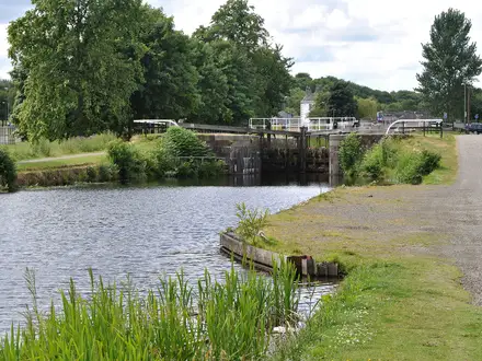
- Royal Canal and Greenway: Most of the trail follows the early-19th-century Royal Canal, using flat towpath and off-road greenway. Expect locks, stone hump-backed bridges and long straight canal-side kilometres.
- Clondra / Richmond Harbour: This restored canal harbour in Co. Longford is where the route meets the Royal Canal. From here the walk settles into its long towpath section towards Dublin.
- Mullingar and Robinstown famine graveyard: Mullingar is a key canal town on the route through Co. Westmeath. The nearby famine-era burial ground is one of the historic places passed en route.
- Custom House Quay famine sculptures, Dublin: The finish is at Rowan Gillespie's bronze Famine statues beside the Jeanie Johnston famine ship and EPIC The Irish Emigration Museum, with the final pair of shoes and the World Poverty Stone.
Challenges to expect
Navigation is straightforward thanks to yellow walking-man waymarkers and the canal alignment, but the days are long: the official itinerary includes stages of up to about 32km. The route is flat, yet hard tarmac and compacted-gravel surfaces can tire feet. The towpath is exposed, so dry, mild weather is preferable. There are no huts, so book town and village accommodation ahead.
HikeList Score
Ireland’s National Famine Way scored 77/100 on HikeList's trail-quality metrics.
See score breakdownHide breakdown
- Ideal length 93
- Balanced challenge 50
- Scenery & wildness 58
- Varied terrain 94
- Accommodation 91
- Food & support 88
- Path quality 80
- Season flexibility 89
Computed from length, challenge, scenery & wildness, terrain variety, accommodation, food & support, path quality and season flexibility.
 Ireland
Show more data Show less
- Canal Towpath
- Greenway
- Quiet Country Roads
- Farmland
- Paved
- Gravel
- Compacted Gravel
- B&Bs
- Guesthouses
- Hotels
- Family Friendly
- Pet Friendly
- Restrooms
- Water Sources
- Campsites
- Picnic Areas
In these collections
Photos from hikers
Taken on the trail by people who've reviewed Ireland’s National Famine Way.
Start at the National Famine Museum, Strokestown Park, and walk east towards Clondra / Richmond Harbour. This opening section uses quiet country roads with small stretches of farmland before meeting the Royal Canal.
Follow the Royal Canal towpath from Clondra towards Abbeyshrule. This is the longest official stage, so the flat profile is offset by a full day on hard canal-side surfaces.
Continue along the canal and greenway into Co. Westmeath, finishing in Mullingar. The route remains easy to follow, with the canal providing the line for the day.
Leave Mullingar on the Royal Canal route and continue towards Longwood Harbour. Expect another long, flat stage on towpath and greenway terrain.
Walk from Longwood Harbour towards Maynooth Harbour, staying with the Royal Canal as it crosses into Co. Kildare. Accommodation is in the towns and villages rather than trail huts.
The final stage follows the canal corridor into Dublin and finishes at the Famine sculptures and World Poverty Stone on Custom House Quay, beside the Jeanie Johnston and EPIC museum.
Reviews
How would you rate Ireland’s National Famine Way?
Tap a star to start your review — you could be the first.