Inishbofin Loop Trails
How would you rate Inishbofin Loop Trails?
Tap a star to share your experience and help other hikers.
Inishbofin Loop Trails: Island Walks off Connemara
HikeList Score
Inishbofin Loop Trails scored 79/100 on HikeList's trail-quality metrics.
See score breakdownHide breakdown
- Ideal length 55
- Balanced challenge 90
- Scenery & wildness 68
- Varied terrain 100
- Accommodation 100
- Food & support 68
- Path quality 87
- Season flexibility 89
Computed from length, challenge, scenery & wildness, terrain variety, accommodation, food & support, path quality and season flexibility.
The Inishbofin Loop Trails are three official, waymarked walks on Inishbofin, a small island off the Connemara coast of County Galway in Ireland. Walk one loop in 1.5 to 2.5 hours, or combine the Westquarter, Cloonamore and Middlequarter loops into an 18 km full-island circuit taking roughly 5 to 7 hours. All three are graded moderate. These coastal loops suit hikers who want a ferry-accessed day walk with beaches, cliffs, wildlife and island history, without carrying overnight backpacking kit.
Route Overview
All three loops start and finish at the ferry pier in the harbour village on Inishbofin, reached by passenger ferry from Cleggan on the mainland in roughly 30 minutes. The Westquarter Loop heads into the wilder west for Lough Bofin, Dún Mór, Trá Gheal, blowholes, cliffs and seal-watching. The Cloonamore Loop explores the eastern end, circling Lough Gowlansgowar and passing St Colman’s monastery ruins. The Middlequarter Loop crosses the centre of the island via Lough Fawna and a cairned ridge. For other Irish island walking, compare the Aran Islands Loop Trails, Cape Clear Island Loop and Achill Island Trails.
Island History on the Inishbofin Loops
Inis Bó Finne means “Island of the White Cow”, linked to a local legend of an old woman driving a white cow that turned to stone. St Colmán founded a monastery here around 665 AD after leaving Lindisfarne over the dating of Easter; the settlement later suffered Viking raids around 795. At the harbour mouth, the star-shaped Cromwell’s Barracks was built in 1656–57 on an earlier stronghold linked to the Spanish corsair Bosco and the O’Malleys, and was later used as a prison for Catholic clergy.
Notable highlights
- Cromwell’s Barracks (harbour mouth): A star-shaped fort built in 1656–57 on an earlier stronghold. It guarded the harbour and once held Catholic priests during the Cromwellian period.
- St Colman’s monastery/church (Cloonamore Loop): Ruins marking the early Christian monastery founded by St Colmán around 665 AD. It gives the eastern loop a clear historical focus.
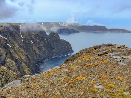
- Dún Mór promontory fort and cliffs: An Iron Age coastal fort on the Westquarter Loop, set above the Atlantic with views towards Inishark. Take care near the cliff edges.
- Sea blowholes and arch: Natural rock features on the exposed western coast where Atlantic swell surges through. They are most dramatic in rough weather, but also demand extra caution.
- Seal colony and corncrakes: Grey seals haul out on rocks off the Westquarter, and Inishbofin is a Special Area of Conservation partly for seals and corncrakes. Corncrakes are rare, secretive birds more often heard than seen in summer.
- Trá Gheal and sandy beaches: White-sand beaches include Trá Gheal on the Westquarter Loop and the East End strand on the Cloonamore Loop.
Challenges to expect
The walking is moderate rather than mountainous, but Inishbofin is exposed, windy and treeless. Expect minor roads, laneways, bog roads, grassy tracks, rocky coastal paths, beaches and clifftop sections. Ground can be boggy or waterlogged after rain, phone signal is patchy, and waymarking needs checking at junctions. Carry waterproofs and layers; keep well back from cliffs.
HikeList Score
Inishbofin Loop Trails scored 79/100 on HikeList's trail-quality metrics.
See score breakdownHide breakdown
- Ideal length 55
- Balanced challenge 90
- Scenery & wildness 68
- Varied terrain 100
- Accommodation 100
- Food & support 68
- Path quality 87
- Season flexibility 89
Computed from length, challenge, scenery & wildness, terrain variety, accommodation, food & support, path quality and season flexibility.
 Ireland
Show more data Show less
- Coastal
- Island
- Clifftop
- Boggy
- Paved
- Rocky
- Sand
- Grass
- Dirt
- Hotels
- Guesthouses
- B&Bs
- Hostels
- Family Friendly
- Pet Friendly
- Restrooms
- Picnic Areas
Photos from hikers
Taken on the trail by people who've reviewed Inishbofin Loop Trails.
A moderate 2 to 2.5 hour loop waymarked with a purple arrow on white. It covers the island’s western, wildest section, passing Lough Bofin, stony beaches, sea blowholes, a sea arch, Dún Mór cliffs and promontory fort, Trá Gheal, a famine road and the seal colony.
A moderate 2 to 2.5 hour loop waymarked with a red arrow on white. It explores the eastern end of Inishbofin, circling Lough Gowlansgowar, following a sandy beach and passing the ruins of St Colman’s church and monastery.
A moderate 1.5 hour loop waymarked with a blue arrow on white. It circles the centre of the island via Lough Fawna and a ridge marked with stone cairns and a communications mast, with wide views across Inishbofin.
Reviews
How would you rate Inishbofin Loop Trails?
Tap a star to start your review — you could be the first.