Grindelwald to Wengen Circuit
How would you rate Grindelwald to Wengen Circuit?
Tap a star to share your experience and help other hikers.
Grindelwald to Wengen Circuit: Jungfrau Day Walk Guide
HikeList Score
Grindelwald to Wengen Circuit scored 81/100 on HikeList's trail-quality metrics.
See score breakdownHide breakdown
- Ideal length 55
- Balanced challenge 100
- Scenery & wildness 78
- Varied terrain 94
- Accommodation 83
- Food & support 81
- Path quality 98
- Season flexibility 76
Computed from length, challenge, scenery & wildness, terrain variety, accommodation, food & support, path quality and season flexibility.
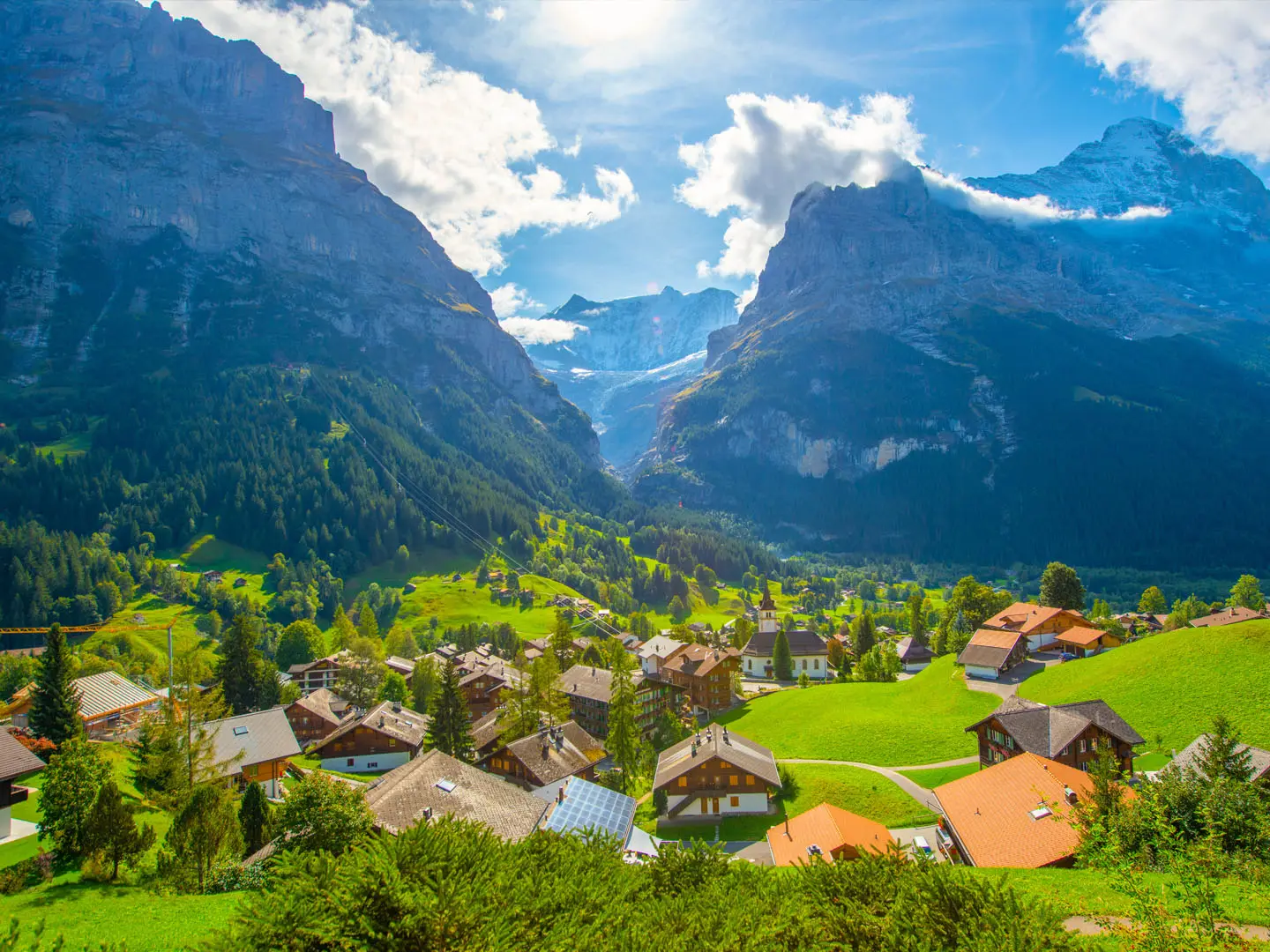
The Grindelwald to Wengen Circuit is best understood as a point-to-point day walk in the Jungfrau region of the Bernese Oberland, Switzerland, not a true loop. The classic route links Grindelwald with car-free Wengen via Männlichen and Kleine Scheidegg, with a representative distance of 15 km and moderate difficulty. It suits hikers wanting a lift-assisted alpine day beneath the Eiger, Mönch and Jungfrau, with rail and cable-car options at both ends.
Route Overview
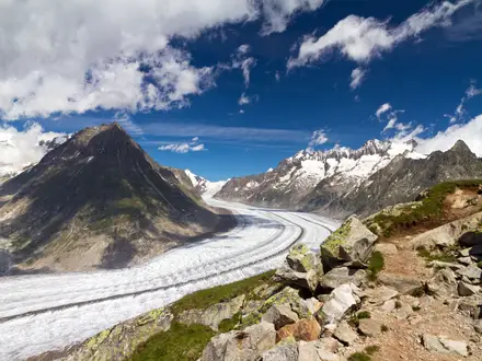
Start in Grindelwald and finish in Wengen, usually using mountain transport to gain height towards Männlichen or Kleine Scheidegg. The main line of the walk follows well-waymarked Swiss mountain paths: the Männlichen–Kleine Scheidegg Panoramaweg, sections towards Wengernalp, and the descent to Wengen. Some variants begin from Alpiglen and include the Eiger Trail at the foot of the Eiger north face. This route does not go via Grosse Scheidegg, which lies on a different eastbound line towards First and Meiringen. For a longer Swiss crossing, compare the Alpine Pass Route; for glacier scenery, see the Aletsch Glacier Panorama Trail.
Alpine Tourism and the Jungfrau Railways
Grindelwald and Wengen became important centres of Alpine tourism in the 19th century, attracting British climbers, artists and walkers to the Jungfrau region. The Wengernalp Railway opened in 1893 between Lauterbrunnen, Wengen, Kleine Scheidegg and Grindelwald, making this high walking corridor much easier to reach. The Jungfrau Railway, completed in 1912, later pushed access through the Eiger towards the Jungfraujoch. The walking routes themselves follow old pasture and pilgrimage ways used by local communities.
Notable highlights
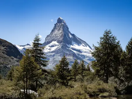
- Eiger, Mönch and Jungfrau: The walk stays in frequent view of this iconic Bernese Oberland trio, including the Eiger north face. The Männlichen–Kleine Scheidegg Panoramaweg is the clearest viewpoint section.
- Männlichen–Kleine Scheidegg Panoramaweg: This gentle, popular family walk is about 4.7 km with a descent of around 230 m. From Männlichen station, the optional Royal Walk climbs to the 2,343 m summit.
- Kleine Scheidegg (2,061 m): The route-defining high pass sits directly beneath the Eiger and is a major rail junction. It is also the departure point for the Jungfrau Railway towards the Jungfraujoch.
- Eiger Trail variant: This alternative traverses the base of the Eiger’s 1,800 m north wall between Eigergletscher and Alpiglen. Expect rockier, steeper mountain path than on the Panoramaweg.
- Wengen: The finish is a car-free village on a sunny terrace above the Lauterbrunnen Valley, reached by the Wengernalp rack railway or cable car.
- Lauberhorn slopes: Wengen has hosted the Lauberhorn ski races since 1930, and the walking route crosses the same mountain landscape used in winter.
Challenges to expect
The standard lift-assisted route is moderate, but it is still an alpine walk: weather can change quickly, snow can linger outside the summer season, and descents towards Wengen are sustained. The Eiger Trail and Alpiglen variants are rockier and steeper than the Panoramaweg. Navigation is generally straightforward on white-red-white Swiss waymarks, but check lift and Wengernalp Railway times before setting out.
HikeList Score
Grindelwald to Wengen Circuit scored 81/100 on HikeList's trail-quality metrics.
See score breakdownHide breakdown
- Ideal length 55
- Balanced challenge 100
- Scenery & wildness 78
- Varied terrain 94
- Accommodation 83
- Food & support 81
- Path quality 98
- Season flexibility 76
Computed from length, challenge, scenery & wildness, terrain variety, accommodation, food & support, path quality and season flexibility.
Show more data Show less
- Mountainous
- Alpine Meadows
- Pasture
- Forest
- Gravel
- Dirt
- Rocky
- Hotels
- Guesthouses
- Mountain Inns
- Family Friendly
- Pet Friendly
- Restrooms
- Water Sources
- Shelters
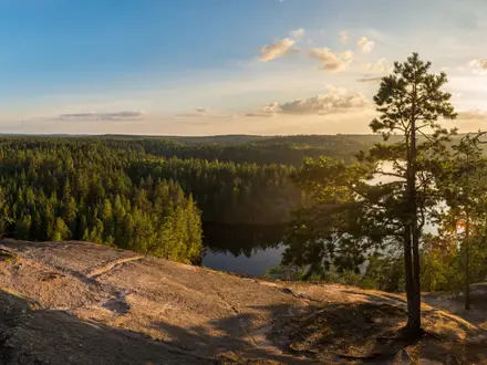
Photos from hikers
Taken on the trail by people who've reviewed Grindelwald to Wengen Circuit.
A representative full-day version links Grindelwald with Wengen via Männlichen or Alpiglen, Kleine Scheidegg and Wengernalp. The Männlichen–Kleine Scheidegg Panoramaweg gives the easiest, most scenic high-level section, while the Eiger Trail variant adds steeper, rockier walking below the Eiger north face. Finish by descending through meadow and forest to car-free Wengen.
Reviews
How would you rate Grindelwald to Wengen Circuit?
Tap a star to start your review — you could be the first.