Galtymore Ascent
How would you rate Galtymore Ascent?
Tap a star to share your experience and help other hikers.
Galtymore Ascent: Black Road Route Guide
HikeList Score
Galtymore Ascent scored 79/100 on HikeList's trail-quality metrics.
See score breakdownHide breakdown
- Ideal length 55
- Balanced challenge 100
- Scenery & wildness 98
- Varied terrain 59
- Accommodation 83
- Food & support 54
- Path quality 98
- Season flexibility 89
Computed from length, challenge, scenery & wildness, terrain variety, accommodation, food & support, path quality and season flexibility.
The Galtymore Ascent is a 9 km mountain day-walk in the Galtee Mountains of Munster, Ireland. The standard Black Road route is an out-and-back climb to Galtymore, the highest point of both County Tipperary and County Limerick. Allow 3-4 hours for roughly 700 m of ascent. It suits hillwalkers who are comfortable leaving a track for open, boggy mountainside; the walking is non-technical, but navigation, wind and mist can quickly make it a serious mountain outing.
Route Overview
Start at the small Black Road car park, also known as the Galtymore North or Black Road trailhead, off the R639 about 3 km north of Kilbeheny near Skeheenarinky. Follow the old Black Road mountain track for about 2.5 km, then continue over open grass, heather, peat and rockier ground towards the col between Galtybeg and Galtymore. The route then climbs to Galtymore’s summit cairn, trig-pillar remains and white Celtic cross before returning by the same line. Parking is very limited and there are no facilities. For longer Irish walks, compare the Blackwater Way, Beara Way or Dingle Way.
Galtymore history and folklore
Galtymore’s Irish name, Cnoc Mor na nGaibhlte, means “big hill of the Galtees”. The summit ridge has long marked county and estate boundaries, and the Galtee Wall runs west from below Galtymore as a drystone boundary and navigation feature. It was begun in the late 1870s and built by local men as both estate work and famine-relief employment during agricultural depression. The white Celtic cross on the summit was erected in 1975 by members of Tipperary Adventure Sports club. Local folklore links Lough Diheen with St Patrick and a banished serpent.
Notable highlights
Galtymore summit (918 m): The high point of the Galtee Mountains and the county top of both Tipperary and Limerick. In clear weather it gives wide views over the Glen of Aherlow, Knockmealdowns, Slievenamon and the Munster lowlands.
Summit Celtic cross: A white Celtic cross stands just beyond the true summit, near the cairn and old trig-pillar remains. It is the main landmark most walkers photograph at the top.
Galtybeg (799 m): This neighbouring top can be added via the saddle for a longer outing. It gives a close view of Galtymore’s steep eastern face, but adds distance and effort.
Lough Diheen: A small glacial corrie lake below the cliffs between Galtymore and Galtybeg. It is a striking feature from the upper slopes and is tied to local St Patrick folklore.
The Galtee Wall: A drystone wall running west along the ridge from below Galtymore. In poor visibility it can act as a useful handrail on longer ridge variants.
Challenges to expect
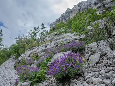
Expect a real mountain walk, not a marked trail. The lower Black Road is straightforward, but higher up the route crosses wet grass, heather, peat and rockier ground with little waymarking. Mist is common, mobile coverage and GPS can be unreliable, and cliff edges near Lough Diheen carry serious drops. There are no toilets, water points or mountain facilities; carry food, water, waterproofs, map and compass.
HikeList Score
Galtymore Ascent scored 79/100 on HikeList's trail-quality metrics.
See score breakdownHide breakdown
- Ideal length 55
- Balanced challenge 100
- Scenery & wildness 98
- Varied terrain 59
- Accommodation 83
- Food & support 54
- Path quality 98
- Season flexibility 89
Computed from length, challenge, scenery & wildness, terrain variety, accommodation, food & support, path quality and season flexibility.
 Ireland
Show more data Show less
- Mountainous
- Gravel
- Dirt
- Rocky
- Hotels
- Guesthouses
- Campsites
- None
Photos from hikers
Taken on the trail by people who've reviewed Galtymore Ascent.
Follow the Black Road mountain track for the first section, then leave the track for open mountainside towards the col between Galtybeg and Galtymore. Climb the steeper final ground to Galtymore’s summit cairn, trig-pillar remains and white Celtic cross, then descend by the same route. Allow 3-4 hours in normal conditions.
Reviews
How would you rate Galtymore Ascent?
Tap a star to start your review — you could be the first.