Clwydian Way
How would you rate Clwydian Way?
Tap a star to share your experience and help other hikers.
Clwydian Way: A Complete Hiking Guide
HikeList Score
Clwydian Way scored 90/100 on HikeList's trail-quality metrics.
See score breakdownHide breakdown
- Ideal length 96
- Balanced challenge 84
- Scenery & wildness 82
- Varied terrain 100
- Accommodation 100
- Food & support 88
- Path quality 84
- Season flexibility 89
Computed from length, challenge, scenery & wildness, terrain variety, accommodation, food & support, path quality and season flexibility.
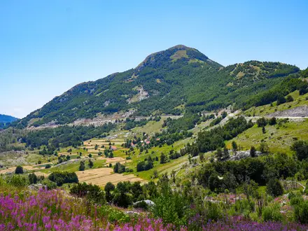
The Clwydian Way, or Ffordd Clwyd, is a 196 km circular long-distance footpath in north-east Wales, mainly in Denbighshire with sections in Flintshire and Conwy. It is usually walked in 7-11 days and is a hard route, with steep ascents, exposed moorland and a total ascent of roughly 5,200 m. It suits fit, experienced walkers who want a varied Welsh thru-hike linking the Clwydian Range, Dee Valley, Llangollen, Mynydd Hiraethog and the Vale of Clwyd.
Route Overview
The route is a loop, commonly described from Prestatyn on the North Wales coast, where it meets the end of Offa's Dyke Path, though it can be joined anywhere. Loggerheads and Llangollen are attractive alternative start points. From Prestatyn it heads through Trelawnyd and Bodfari into the Clwydian Range, taking in Moel Arthur, Moel Famau and Loggerheads Country Park before reaching Ruthin and Llangollen. The return crosses the Llantysilio Range, Corwen, Clocaenog Forest, Llyn Brenig, Mynydd Hiraethog, Denbigh, St Asaph and Rhuddlan. Public transport links some towns. For coastal alternatives, compare the Anglesey Coastal Path; for a tougher south Wales mountain route, see the Beacons Way; and for a short North Wales day walk, try the Aber Falls Walk.
History of the Clwydian Way
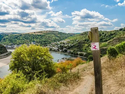
The Clwydian Way was created by the North Wales Area of the Ramblers Association to mark the Millennium and opened in 2000. It links existing public rights of way into a single circular route through the Clwydian Range, Dee Valley and Vale of Clwyd. The trail is waymarked with a distinctive white disc bearing a buzzard. The printed guidebook is now out of print and Denbighshire County Council has withdrawn the published OS map, but downloadable route descriptions remain available on the official website.
Notable highlights
- Moel Famau and the Jubilee Tower (554 m): The high point of the Clwydian Range is topped by the ruined Jubilee Tower, begun in 1810 for King George III's golden jubilee. It is one of the route's key exposed ridge sections, with wide views in clear weather.
- Castell Dinas Bran, Llangollen: This dramatic ruined medieval castle stands on a steep hill above Llangollen. It was built in the 1260s by the princes of Powys Fadog on the site of an Iron Age hillfort.
- Horseshoe Falls: Thomas Telford's curved weir on the River Dee was completed in 1808 to feed the Llangollen Canal. It now forms part of the Pontcysyllte Aqueduct and Canal World Heritage Site.
- Iron Age hillforts of the Clwydian Range: The ridge includes prehistoric hillforts such as Moel Arthur and Penycloddiau, with ramparts still visible from the walking route.
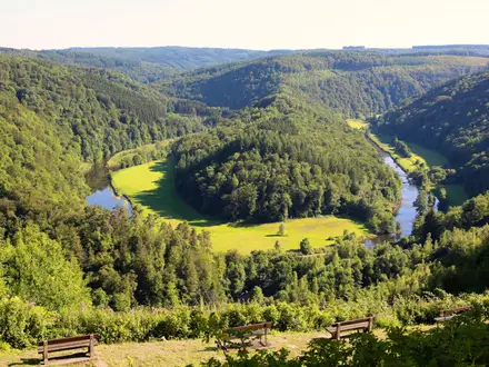
- Llyn Brenig and Mynydd Hiraethog: The remote return leg crosses heather moorland, reservoir-side paths and Clocaenog Forest, giving a wilder upland feel than the lowland Vale of Clwyd sections.
- St Asaph Cathedral: The route passes through St Asaph, a small cathedral city on the lowland section through the Vale of Clwyd.
Challenges to expect
Expect repeated steep climbs and descents, especially across the Clwydian and Llantysilio ranges. Moorland sections can be exposed, wet, boggy and misty, so navigation skills are useful away from clearer ridge paths. The route mixes hill paths with forest tracks, lanes and field paths. Accommodation exists in towns and villages, but there is no dedicated trail lodging, so book B&Bs, inns or campsites carefully.
HikeList Score
Clwydian Way scored 90/100 on HikeList's trail-quality metrics.
See score breakdownHide breakdown
- Ideal length 96
- Balanced challenge 84
- Scenery & wildness 82
- Varied terrain 100
- Accommodation 100
- Food & support 88
- Path quality 84
- Season flexibility 89
Computed from length, challenge, scenery & wildness, terrain variety, accommodation, food & support, path quality and season flexibility.
Show more data Show less
- Moorland
- Hill Ridges
- Forest
- Farmland
- Riverside
- Dirt
- Grass
- Gravel
- Paved
- B&Bs
- Inns
- Hotels
- Campsites
- Family Friendly
- Pet Friendly
- Restrooms
- Water Sources
- Campsites
- Picnic Areas
Download Our Full Guide to Clwydian Way FREE!
Get our comprehensive guide to this hike for free. Save it for later reading or print out at home.
In these collections
Photos from hikers
Taken on the trail by people who've reviewed Clwydian Way.
Clwydian Way: The Complete Guide
 i
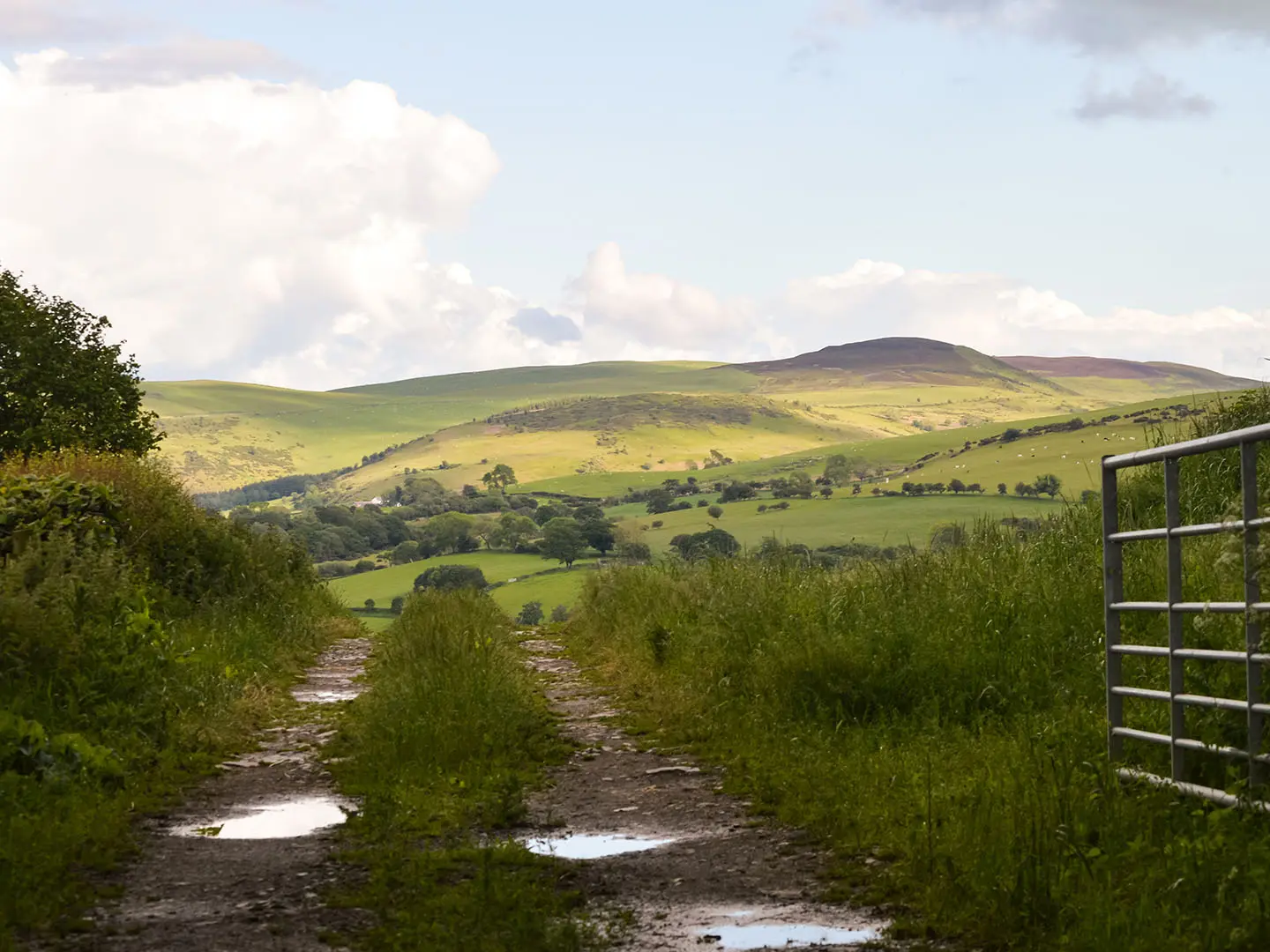
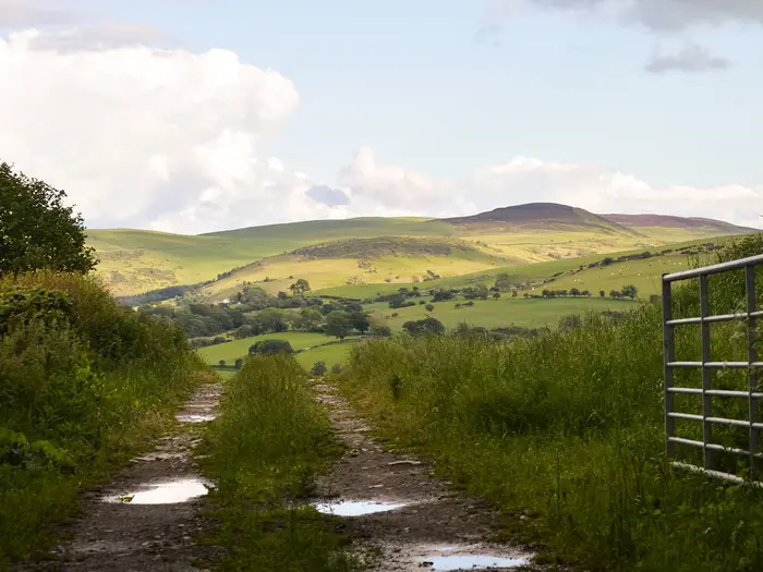
Image by Alison
i
Image by Alison The Clwydian Way is a serious, varied circular walk through north-east Wales, linking coast, ridge, valley, river and moor in one long-distance route. Starting conventionally at Prestatyn, it heads into the Clwydian Range (Bryniau Clwyd) before sweeping south towards Llangollen and the Dee Valley.
The route has some of the best hill walking in this part of Wales: Penycloddiau, Moel Arthur, Moel Famau and the Llantysilio Range give long ridge sections, steep climbs and wide views in clear weather. Lower down, Loggerheads, Ruthin (Rhuthun), Denbigh (Dinbych), St Asaph (Llanelwy) and the Vale of Clwyd (Dyffryn Clwyd) add services, history and easier walking between the harder upland days.
Its quietest section is the return across Llyn Brenig, Mynydd Hiraethog and Clocaenog Forest, where accommodation and public transport become much thinner. This is where the walk feels most committing, and where good route planning matters as much as fitness.
The Clwydian Way suits experienced walkers who want a demanding Welsh loop without the crowds of the better-known national trails. Expect repeated ascent, exposed high ground, wet or boggy paths in places, and navigation that cannot be left entirely to waymarks or a phone screen.
This guide covers stages, days, accommodation, food, transport, terrain and common mistakes.
Stage-by-Stage Guide
The stages below follow the common clockwise eight-day breakdown from Prestatyn. They are useful for planning, but the Clwydian Way is a flexible circular route: accommodation, transport and the choice of high or lower return option may mean adjusting the day lengths.
Stage 1: Prestatyn to Bodfari — approx. 24 km
The opening stage leaves the North Wales coast at Prestatyn and heads inland through the lower ground before reaching Bodfari, the first major foothill gateway on the route. It is a steady introduction rather than an easy warm-up, with a mix of field paths, lanes and rising country as the walk moves away from the coast.
The main places on this stage are Prestatyn, Trelawnyd, Rhuallt and Bodfari. Views gradually open back towards the coastal plain and ahead to the Clwydian Range (Bryniau Clwyd), giving a clear sense of the hillier walking to come.
Prestatyn is the best place to buy food before setting off and has the most straightforward transport access, with its railway station on the North Wales Coast line. Once away from the town, services are much more limited, so carry food and water for the day unless specific village stops have been checked before travelling.
Bodfari has some accommodation options, but capacity is limited compared with larger towns. Book ahead, especially if walking in a fixed itinerary, and be prepared to use a taxi or bus link if no suitable bed is available on the route.
Navigation is generally simpler than on the later moorland sections, but do not treat the first day as purely lowland walking. Watch for the buzzard waymarks at junctions, and use OS mapping where field paths, lanes and village exits make the route less obvious.
Stage 2: Bodfari to Loggerheads — approx. 23 km
This is one of the signature Clwydian Range stages, with sustained hill walking over or near the chain of ridges and hillforts above the Vale of Clwyd (Dyffryn Clwyd). Expect repeated climbs and descents, grassy ridge paths, open hill ground and exposed sections where wind and mist can make navigation more demanding.
The key landmarks are Penycloddiau hillfort, Moel Arthur, Moel Famau and the Jubilee Tower area, before the route drops towards Cilcain and Loggerheads Country Park. Penycloddiau is one of the largest Iron Age hillforts in Wales, while Moel Arthur gives another prominent defended summit on the ridge.
Moel Famau needs a little care in planning. It is the highest summit of the Clwydian Range at 554 m, but the current waymarked Clwydian Way can contour below the actual summit, while the classic OS-mapped or higher Offa’s Dyke line reaches the Jubilee Tower. Walkers wanting to stand on the summit should check the map carefully and decide which line to follow before leaving Bodfari.
Food and water should be carried from Bodfari unless any intended stop has been checked in advance. Loggerheads Country Park has a visitor centre and cafe, but opening times should be checked before relying on it at the end of the day.
Accommodation directly at Loggerheads is limited, so this is a stage where advance booking and possible off-route transport matter. Local buses in the area should be checked with Traveline Cymru before travelling, rather than assumed.
The main warnings are exposure, steep grassy descents and loss of visibility on the ridge. In poor weather, keep a close line on the map rather than following faint hill tracks, as the broader ridge country can be confusing when cloud drops.
Stage 3: Loggerheads to Llangollen — approx. 31 km
This is the longest stage in the eight-day schedule and should be treated as a hard day. It links the limestone and woodland around Loggerheads with Maeshafn, Eryrys, Llandegla and the Llantysilio Range before descending to Llangollen.
Terrain is varied but consistently demanding: lanes and field paths are mixed with higher, more exposed hill ground. The Llantysilio Range gives some of the finest upland walking on the southern half of the route, but it is also a place where wind, rain and low cloud can slow progress significantly.
The stage ends in Llangollen, one of the best service stops on the whole Clwydian Way. Castell Dinas Brân stands on the steep hill above the town and is a major landmark on arrival in the Dee Valley.
Carry enough food and water for a full long day. Loggerheads may provide food at the start if the cafe is open, and Llangollen has accommodation and services at the end, but the reliability of options through the smaller settlements should be checked before travelling.
Llangollen is a sensible place for an overnight stop because it has more accommodation choice than the surrounding rural sections. It also has better bus access than the remote upland stages, though current services and evening times should be checked with Traveline Cymru.
Navigation is important on this stage because of its length and the number of transitions between villages, farmland and open hill. Start early, especially outside high summer, and avoid committing to the Llantysilio Range in poor visibility without full map-and-compass confidence.
Stage 4: Llangollen to Corwen — approx. 20 km
This stage follows the Dee Valley section of the Clwydian Way, giving a change of character after the bigger ridge days. It is still a proper walking day, but the landscape feels more settled, with the River Dee, valley-side paths, lanes and historic features around Llantysilio.
The main highlight is Horseshoe Falls near Llantysilio, Thomas Telford’s curved weir on the River Dee, completed in 1808 to feed the Llangollen Canal. The route then continues towards Carrog and Corwen, with the Dee Valley providing a more enclosed contrast to the open Clwydian and Llantysilio hills.
Llangollen is the best place to stock up before leaving. Corwen has accommodation options at the end of the stage, but any intermediate food stops should be checked before relying on them.
Public transport is more realistic here than on the moorland stages because both Llangollen and Corwen are established settlements. Even so, bus times vary and should be checked with Traveline Cymru, particularly if planning to shorten or split the day.
Navigation is less exposed than on the previous stage, but do not switch off. Valley walking often involves frequent changes between lanes, tracks and field paths, and waymarks can be easier to miss in and around settlements.
Stage 5: Corwen to Llanfihangel Glyn Myfyr — approx. 14 km
This is the shortest stage in the standard eight-day schedule, but it is not a rest day in practical terms. It moves away from Corwen into quieter rural country via Betws Gwerful Goch towards Llanfihangel Glyn Myfyr, setting up the more remote Mynydd Hiraethog and Llyn Brenig section that follows.
Underfoot, expect a mix of lanes, field paths and rougher rural tracks rather than continuous high ridge walking. The stage is useful as a shorter day because accommodation and transport become much harder to arrange beyond this point.
Corwen is the key place for food before setting out. Services at or near Llanfihangel Glyn Myfyr are limited, so the next day’s food planning should be sorted before leaving Corwen or by using pre-arranged transport to a larger service centre.
Accommodation at the stage end must be planned carefully. If no suitable lodging is available close to Llanfihangel Glyn Myfyr, arrange a taxi or other link transport in advance rather than expecting to solve it on arrival.
Public transport is limited in this part of the route. This should be checked before travelling, especially if using this stage as part of a section hike.
Navigation becomes more consequential here because the route is heading into quieter country with fewer obvious escape options. Keep the route description, OS map and GPX aligned, and avoid relying only on waymarks at minor lane and field-path junctions.
Stage 6: Llanfihangel Glyn Myfyr to Llyn Brenig / Rhewl — approx. 25 km
This is the remotest and most logistically awkward stage of the Clwydian Way. It crosses the Mynydd Hiraethog uplands, takes in Llyn Brenig and uses forest and moorland terrain around Clocaenog before heading towards Cyffylliog and Rhewl in the Vale of Clwyd.
The walking is a major contrast with the settled valley stages. Expect heather moorland, reservoir-side paths, forest tracks, wet ground and long sections where visibility and wayfinding matter more than speed.
Llyn Brenig is the main landmark, but the wider experience is one of open upland and forestry rather than villages and frequent facilities. This is the loneliest part of the route and should be planned as a self-sufficient day.
Carry a full day’s food and enough water. There is very little en-route accommodation or service provision on the Mynydd Hiraethog / Llyn Brenig leg, and natural water should not be relied on without treatment.
Do not assume accommodation at Llyn Brenig or Rhewl without a booking. Many walkers will need to arrange a lift, taxi or bus connection to a bed in a larger settlement such as Ruthin (Rhuthun), Denbigh (Dinbych) or another suitable base; this should be fixed before starting the stage.
Public transport is sparse or absent on parts of this section. This should be checked before travelling, and it is unwise to depend on same-day improvisation if the weather turns or progress is slower than expected.
This is the stage where map-and-compass skills matter most. Mist, wet ground and forest tracks can all make the way less obvious, and distance figures can vary depending on the exact high or lower return option being followed. Make sure the route description, OS map and GPX file all match the variant being walked.
Stage 7: Rhewl to Denbigh — approx. 13 km
After the moorland, this stage gives a shorter and gentler return through the Vale of Clwyd. It passes through or near Ruthin (Rhuthun) before continuing to Denbigh (Dinbych), with a stronger lowland farming character than the ridge and reservoir sections.
Terrain is mainly field paths, lanes and valley walking, with mud likely after wet weather. The Vale of Clwyd is less exposed than Mynydd Hiraethog, but navigation still needs care where rights of way cross farmland and village edges.
Ruthin and Denbigh are both historic market towns and useful service points on the return leg. Denbigh’s hilltop medieval castle is the main landmark at the end of the day.
Food and water planning is easier here than on the previous stage because Ruthin and Denbigh offer better opportunities for accommodation and resupply. Opening times should still be checked before relying on a specific stop, particularly on quieter days or out of season.
Accommodation is more straightforward in Denbigh than on the remote upland legs, but it should still be booked ahead on a fixed itinerary. This is also a practical place to pause, shorten the schedule or rejoin the trail as a section walker.
Bus access is generally more practical in the Vale of Clwyd than on the moors, but current timetables should be checked with Traveline Cymru. On lanes, walk attentively and take care where there is no pavement.
Stage 8: Denbigh to Prestatyn via St Asaph and Dyserth — approx. 22 km
The final stage completes the circuit through the northern Vale of Clwyd and back to the coast at Prestatyn. It passes St Asaph (Llanelwy), Dyserth and Meliden (Gallt Melyd), linking cathedral city, villages and lowland paths before returning to the conventional start point.
The terrain is a mix of lanes, field paths and easier valley walking, with a gradual transition back towards the coastal edge. It is less wild than the hill stages, but 22 km remains a full final day, especially if the ground is wet.
St Asaph is the main cultural highlight, with its cathedral — the smallest ancient Anglican cathedral in Britain. The return to Prestatyn also brings the Clwydian Way back to the North Wales coast, where Offa’s Dyke Path also reaches the sea.
Denbigh and St Asaph are the best service points before the final approach. Dyserth and Meliden should not be treated as guaranteed resupply stops unless current opening times and facilities have been checked before travelling.
Prestatyn has the best end-of-route transport, with regular rail services on the North Wales Coast line towards Chester, Llandudno Junction and onward connections. It also has accommodation if an overnight stay is needed after finishing.
Navigation on the final stage is mainly about staying attentive through settlement edges, lanes and field-path junctions. Waymarking helps, but urban and lowland sections can be just as easy to miss as hill paths when the route changes direction frequently.
Recommended Itinerary
Standard 8-day itinerary
The 8-day schedule is the most natural fit for the Clwydian Way: it keeps the route within the usual 7–11 day window, gives a sensible rhythm of harder hill days and shorter recovery days, and avoids making the remote Mynydd Hiraethog / Llyn Brenig section even longer than it needs to be.
Distances on the Clwydian Way vary slightly by route variant, especially around Moel Famau and the high or lower return options. Use these distances for planning, then check official mapping before booking accommodation or transport.
| Day | From | To | Approx. distance | Why this stage makes sense | Services/accommodation notes |
|---|---|---|---|---|---|
| 1 | Prestatyn | Bodfari | 24 km | A solid opening day from the North Wales coast into the first inland hills, passing through places such as Trelawnyd and Rhuallt before reaching Bodfari. It gets the walk properly started without committing to the higher Clwydian ridge too late in the day. | Prestatyn is the easiest place to reach by rail and has the widest start-point services. Bodfari has some accommodation, but it should be booked ahead rather than treated as a guaranteed turn-up stop. |
| 2 | Bodfari | Loggerheads | 23 km | One of the classic Clwydian Range days, taking in the Penycloddiau and Moel Arthur area and the high ridge country around Moel Famau. Walkers wanting the actual Moel Famau summit and Jubilee Tower may need to choose the higher Offa’s Dyke / OS-mapped line rather than the current waymarked contouring line. | Loggerheads Country Park has a visitor centre and café, but overnight options in or near Loggerheads are limited. Expect to book carefully or use a taxi/bus link to accommodation off-route. |
| 3 | Loggerheads | Llangollen | 31 km | The longest standard day, linking the Clwydian foothills with the Dee Valley via Maeshafn, Eryrys, Llandegla and the Llantysilio Range. It is a serious stage with repeated climbing and should not be underestimated. | Llangollen is one of the best overnight stops on the route, with a stronger choice of accommodation and food than the smaller villages. If the full 31 km is too much, split this day using pre-booked accommodation or link transport around Eryrys or Llandegla. |
| 4 | Llangollen | Corwen | 20 km | A shorter but still substantial day through the Dee Valley, with Horseshoe Falls near Llantysilio and Carrog on the way to Corwen. It works well after the long approach into Llangollen. | Llangollen and Corwen are both practical service stops. Corwen is a sensible place to restock before the quieter country to the west and north. |
| 5 | Corwen | Llanfihangel Glyn Myfyr | 14 km | A deliberately shorter stage after several hard days. It positions the walk for the remote Mynydd Hiraethog / Llyn Brenig leg without overloading the schedule. | Accommodation is much more limited than in Llangollen or Corwen. Book ahead and be prepared to arrange transport to a bed away from the line of the route. |
| 6 | Llanfihangel Glyn Myfyr | Llyn Brenig / Rhewl | 25 km | This is the key remote upland stage, crossing towards Llyn Brenig, Mynydd Hiraethog and Clocaenog Forest before dropping towards the Vale of Clwyd. Navigation, weather and daylight need close attention here. | This is the section where accommodation and public transport are thinnest. Do not rely on finding lodging en route; arrange the end point, pick-up or onward transfer before setting out. |
| 7 | Rhewl | Denbigh (Dinbych) | 13 km | A shorter Vale of Clwyd stage through gentler lowland country, giving useful recovery after the moorland crossing. Ruthin (Rhuthun) and Denbigh (Dinbych) make this one of the more serviceable parts of the route. | Ruthin and Denbigh are among the better places for accommodation, food and resupply. This is also a good place to correct the schedule if bad weather or slow going has cost time earlier. |
| 8 | Denbigh (Dinbych) | Prestatyn, via St Asaph (Llanelwy) and Dyserth | 22 km | A final moderate day across the lower Vale of Clwyd, passing St Asaph and Dyserth before returning to Prestatyn. It gives a clean finish back at the railway and avoids ending the walk in a transport-poor location. | St Asaph and Dyserth offer useful intermediate service points, but Prestatyn is the best finish for onward travel, especially by train on the North Wales Coast line. |
Slower 10–11 day variant
A slower schedule suits walkers carrying heavier packs, those who want more time on the Clwydian Range summits, or anyone who prefers not to make the Loggerheads–Llangollen and Mynydd Hiraethog days too demanding. It also gives more flexibility if hill weather is poor.
The main places to add time are:
| Adjustment | How to do it | Why it helps | Planning note |
|---|---|---|---|
| Split Prestatyn to Bodfari | Break the opening stage around Trelawnyd or Rhuallt, using pre-booked accommodation or a transport link. | Makes the first day easier and avoids starting the walk with a full 24 km stage. | Check official mapping before booking, as exact stopping distances depend on the chosen line and accommodation location. |
| Split Loggerheads to Llangollen | Break the 31 km stage around Eryrys or Llandegla, or use a taxi/bus link to nearby accommodation. | This is the most obvious stage to shorten: it is long, hilly and exposed in places. | Do not assume accommodation sits directly on the route. Arrange the overnight stop before committing to this split. |
| Add time before or after Llyn Brenig | Keep the Llanfihangel Glyn Myfyr to Llyn Brenig / Rhewl section conservative, with pre-arranged pick-up or off-route lodging if needed. | The Mynydd Hiraethog leg is remote, can be wet and misty, and has limited services. | This should be planned around real transport and accommodation availability, not just distance on the map. |
| Split Denbigh to Prestatyn | Add an overnight around St Asaph or Dyserth. | Makes the final stage shorter and leaves more time for the Vale of Clwyd and the return to the coast. | St Asaph is a practical intermediate stop, but current accommodation and transport should be checked before travelling. |
Faster 7-day variant
A 7-day crossing is realistic only for fit, efficient walkers who are comfortable with long days, repeated ascent and navigation in poor hill conditions. The cleanest way to shorten the schedule is to combine the final two lower-level stages, rather than over-extending the remote moorland section.
| Day | From | To | Approx. distance | Why this stage makes sense | Services/accommodation notes |
|---|---|---|---|---|---|
| 1 | Prestatyn | Bodfari | 24 km | Standard opening stage from the coast to the edge of the Clwydian Range. | Start in Prestatyn for rail access and full pre-walk services. |
| 2 | Bodfari | Loggerheads | 23 km | Keeps the main Clwydian ridge day intact. | Book the Loggerheads-area overnight plan carefully. |
| 3 | Loggerheads | Llangollen | 31 km | Long, hard hill stage, but it avoids awkward splitting if accommodation is limited. | Llangollen is a strong overnight stop after a demanding day. |
| 4 | Llangollen | Corwen | 20 km | A manageable Dee Valley day after the long stage into Llangollen. | Corwen is useful for food and accommodation before the quieter middle section. |
| 5 | Corwen | Llanfihangel Glyn Myfyr | 14 km | Shorter day used to position for the remote upland crossing. | Essential to have accommodation or transport arranged in advance. |
| 6 | Llanfihangel Glyn Myfyr | Llyn Brenig / Rhewl | 25 km | Keeps the Mynydd Hiraethog / Llyn Brenig stage at a sensible length. | Sparse services and transport; do not extend this day casually. |
| 7 | Rhewl | Prestatyn, via Denbigh, St Asaph and Dyserth | 35 km | Combines the two gentler Vale of Clwyd stages into one long final push back to the coast. | Only sensible with early start, good daylight and a clear exit plan from Prestatyn. If this feels marginal, use the standard 8-day finish instead. |
Planning the Route
The Clwydian Way is best planned around overnight stops and transport links, not just daily mileage. The walking is waymarked, but the combination of repeated climbs, exposed hill ground and a remote moorland return means a good itinerary needs clear accommodation bookings, reliable maps and a fallback plan for poor weather.
How many days to allow
Most walkers should allow 8 to 10 days. An 8-day itinerary matches the common breakdown of the route, but it still includes long, hilly days and limited flexibility if accommodation is awkward.
A 7-day schedule is possible for strong, efficient walkers, but it leaves little margin for bad weather on the Clwydian Range (Bryniau Clwyd), the Llantysilio Range or Mynydd Hiraethog. A 10- or 11-day schedule is more comfortable, especially if using B&Bs, pubs with rooms or buses/taxis to reach beds away from the line.
Daily stages are not evenly convenient. Towns and larger villages such as Prestatyn, Bodfari, Llangollen, Corwen, Ruthin (Rhuthun), Denbigh (Dinbych) and St Asaph (Llanelwy) are the practical anchors, but the route also passes through quieter areas where there may be little or no accommodation directly on the trail.
The main planning pinch points
The hardest part to organise is usually not the first ridge section, but the middle and return legs where settlements are smaller and transport is thinner.
| Part of the route | Planning issue |
|---|---|
| Prestatyn to Bodfari | Straightforward start logistics thanks to Prestatyn railway station, but this is not a gentle warm-up: start with a full day’s food and hill kit. |
| Bodfari to Loggerheads / Cilcain area | High Clwydian ridge walking with steep climbs around Penycloddiau, Moel Arthur and the Moel Famau area. Accommodation should be booked before fixing this stage. |
| Loggerheads to Llangollen | One of the longer, harder links if walked as a single day, with hill country continuing towards Llandegla and the Llantysilio Range. Consider splitting only where transport and accommodation make it practical. |
| Llangollen to Corwen | A more natural service-to-service stage, with Llangollen and Corwen both useful overnight points. |
| Corwen to Llanfihangel Glyn Myfyr | Often a shorter walking day, but important because it positions you for the remote Mynydd Hiraethog / Llyn Brenig section. |
| Llanfihangel Glyn Myfyr to Llyn Brenig / Rhewl | The key remote leg: moorland, forest and reservoir-side walking with very limited lodging and sparse public transport. Plan food, water, navigation and pick-up/drop-off options carefully. |
| Rhewl, Ruthin, Denbigh, St Asaph and Dyserth to Prestatyn | Generally more settled than the moorland section, but still worth booking ahead rather than assuming walk-up beds. |
Choosing a route line
Use 196 km / 122 miles as the planning distance for the standard route, but expect small variations depending on the exact line followed. The Clwydian Way has had route variants, especially on the return across Mynydd Hiraethog and the Vale of Clwyd (Dyffryn Clwyd), and different mapping sources give different totals.
Decide your route line before booking accommodation. The high Mynydd Hiraethog option and lower Vale of Clwyd options affect both distance and ascent, and they can also change which villages are useful for overnight stops.
There is also an important detail around Moel Famau. The route’s named high point is the 554 m summit of the Clwydian Range, crowned by the Jubilee Tower, but the current waymarked line can contour below the summit while the classic/OS-mapped line crosses it. Walkers who specifically want the summit and tower should plan that line deliberately rather than assuming the buzzard waymarks will take them over the top.
Direction and start points
The route is usually walked clockwise from Prestatyn, which keeps the conventional descriptions in order and makes travel simple at the start and finish. Prestatyn is on the North Wales Coast railway line, with Transport for Wales services linking towards Chester, Llandudno Junction and onward connections.
Because the Clwydian Way is a loop, it can also be joined at places such as Bodfari, Loggerheads, Llangollen, Ruthin or Denbigh. This works well for section hiking, but inland public transport is much less convenient than the coastal railway, so each join and finish point needs checking in advance.
Accommodation strategy
Book accommodation before committing to daily stages. There is no dedicated chain of trail accommodation, and not every logical walking endpoint has an obvious bed on the route.
Prestatyn, Llangollen, Corwen, Ruthin (Rhuthun), Denbigh (Dinbych) and St Asaph (Llanelwy) are the more useful service centres. Bodfari can also be useful, while quieter places and the Mynydd Hiraethog / Llyn Brenig area may require taxis, bus links or off-route accommodation.
If using taxis to connect with accommodation, arrange them before the trip where possible. This is particularly important around Llyn Brenig, Clocaenog Forest and the moorland return, where waiting until the day can leave few options.
Food and water planning
Do not plan this as a village-to-village café walk. Services are concentrated in the towns and larger villages, with long hill and moorland stretches where you should carry the day’s food.
Loggerheads Country Park has a visitor centre and café, but elsewhere the safest approach is to buy food before leaving the main settlements. Carry enough snacks and lunch for exposed sections, especially across the Clwydian tops, the Llantysilio Range and Mynydd Hiraethog.
Water planning should be conservative. Fill up before leaving settlements and treat the remote upland legs as carry-what-you-need days unless reliable refilling points have been identified in advance. This should be checked before travelling.
Navigation and route information
The Clwydian Way is waymarked with a buzzard on a white disc, but waymarks are not enough on their own. Mist, forestry, moorland trods and route variants make map-and-compass navigation important, particularly on Mynydd Hiraethog and around the higher ranges.
The official printed guidebook is out of print and the dedicated OS-published map has been withdrawn. Use the free stage-by-stage route descriptions and GPS files from the official Clwydian Way website, and carry proper mapping rather than relying only on a phone.
The recommended OS Explorer sheets are 256, 264 and 265. Downloaded GPX files are useful, but batteries, weather and route changes mean they should support — not replace — map reading. Check current route notices, waymarking updates and diversions before travelling.
Transport and section hiking
Prestatyn is the easiest transport point because it sits on the North Wales Coast railway line. This makes the full loop simple: arrive by train, walk the circuit, and finish back at the same station.
Away from the coast, planning depends on local and regional buses, with Traveline Cymru the key place to check current times. Several middle sections have sparse or no practical public transport, so section hikers should avoid assuming that every village can be used as a simple start or finish.
Section hiking is still practical if organised around the larger settlements: Prestatyn, Bodfari, Llangollen, Corwen, Ruthin, Denbigh and St Asaph are the most useful anchors. For remote legs, pre-booked taxis or lifts may be the difference between a workable section and a stranded finish.
Weather, season and contingency time
Spring, summer and autumn are the normal seasons for the Clwydian Way. Even then, the high ground can be wet, boggy, windy and misty, and the moorland sections need proper hill clothing rather than lightweight lowland kit alone.
Build slack into the itinerary if walking the route in the shorter days of spring or autumn. The long Loggerheads–Llangollen and Llanfihangel Glyn Myfyr–Llyn Brenig / Rhewl type stages are poor places to be forced into late finishes by slow going, navigation delays or bad weather.
Permit planning is not the main issue on this route. The priorities are accommodation, transport, route choice, food, water and navigation, with current access notices and diversions checked before setting out.
Towns, Villages and Overnight Stops
Accommodation planning is one of the main challenges on the Clwydian Way. The route passes several useful towns, but many of the best walking sections cross ridges, moorland, forest and small villages where beds, evening meals and public transport cannot be assumed.
Most walkers should book accommodation before starting, especially between Llangollen, Corwen, Llanfihangel Glyn Myfyr, Llyn Brenig and the Vale of Clwyd. Taxis or local buses may be needed to link the end of a walking day with a bed off-route; bus times should be checked with Traveline Cymru before travelling.
Prestatyn
Prestatyn is the conventional start and finish, on the North Wales coast. It is the easiest place on the whole route for arrival and departure because it is on the North Wales Coast railway line, with Transport for Wales services towards Chester, Llandudno Junction and onward connections.
It is a sensible place to stay before the first day and after completing the loop. Accommodation and food options are better here than in the small inland villages, and it is the best place to make any last-minute gear, food or transport adjustments before leaving the coast.
The first stage leaves Prestatyn for Bodfari via places including Trelawnyd and Rhuallt. Do not treat these smaller settlements as guaranteed resupply points without checking current opening times.
Trelawnyd and Rhuallt
Trelawnyd and Rhuallt sit on the early inland section between Prestatyn and Bodfari. They are useful route markers on the first day rather than primary overnight bases for most end-to-end walkers.
Accommodation and food should not be assumed here unless pre-booked. If breaking the first day short, check both lodging and onward transport before committing to a schedule.
Bodfari
Bodfari is a common first overnight stop when walking clockwise from Prestatyn. It sits at the foot of the Clwydian Range (Bryniau Clwyd), before the route climbs into the ridge-and-hillfort country around Penycloddiau, Moel Arthur and Moel Famau.
The brief identifies Bodfari as one of the places on or near the route with B&Bs, inns or other limited accommodation, so it is a practical staging point. Book ahead, because the village is much smaller than Prestatyn, Llangollen, Ruthin or Denbigh and walkers using the standard stage pattern will often be aiming for the same limited beds.
Food and evening meal arrangements should be checked when booking. If no suitable bed is available in Bodfari, a taxi or bus link to accommodation off-route may be needed.
Cilcain
Cilcain lies beyond the high Clwydian ridge section, after the route has passed the Penycloddiau and Moel Arthur area and the Moel Famau/Jubilee Tower zone. It can be useful for walkers wanting to split the Bodfari-to-Loggerheads stage, but it is not one of the main accommodation hubs listed for the trail.
Treat Cilcain as a possible short-stage or refreshment stop only if services have been checked in advance. The surrounding walking is hillier and more exposed than the Vale of Clwyd sections, so it is a poor place to rely on improvised arrangements late in the day.
Loggerheads Country Park
Loggerheads is a natural staging point on the eastern side of the Clwydian Range and is used in the common eight-stage itinerary as the end of day two. It is on the Afon Alyn and has a visitor centre and cafe, making it one of the more useful daytime service points on the route.
Overnight accommodation is limited compared with the larger towns. Walkers planning to stop here should book well ahead or arrange transport to accommodation nearby.
Loggerheads is also a sensible place to reassess weather and energy before the long stage to Llangollen. That next section is one of the bigger days in the standard schedule, so an early start and firm evening accommodation are important.
Maeshafn and Eryrys
Maeshafn and Eryrys sit between Loggerheads and Llandegla on the route south. They are small settlements, useful for orientation and stage planning, but not dependable overnight stops unless accommodation has been arranged in advance.
Do not assume shop, cafe or evening meal availability here. Carry enough food and water for the day’s walking from Loggerheads towards Llangollen, particularly if using the longer standard stage.
Llandegla
Llandegla is another useful intermediate village before the route pushes on towards the Llantysilio Range and Llangollen. It can help break up the long Loggerheads-to-Llangollen section, but it should not be treated like a full-service trail town.
If planning to overnight in or around Llandegla, book accommodation before setting out and check food options at the same time. Public transport links in this part of the route should also be checked before travelling.
Llangollen
Llangollen is one of the best overnight stops on the Clwydian Way. It comes after the demanding traverse from Loggerheads and before the next stage along the Dee Valley towards Corwen.
Accommodation, pubs, cafes and general visitor services are more realistic here than in the smaller hill villages, making it a good place for laundry, resupply and a more comfortable night. It is also a strong option for joining or leaving the loop if section-hiking, though onward public transport still needs checking in advance.
Many walkers will want time here for Castell Dinas Brân above the town and the nearby Horseshoe Falls near Llantysilio. If adding either as a diversion or lingering in town, allow for the fact that the following day to Corwen still involves a full walking stage.
Llantysilio and Horseshoe Falls
The route passes the Dee Valley area around Llantysilio and Horseshoe Falls after Llangollen. This is a worthwhile section, but it is better treated as part of the Llangollen-to-Corwen walking day rather than as a primary overnight base.
Any accommodation or food stop around Llantysilio should be checked and booked before travelling. The main practical overnight choices on this part of the route are usually Llangollen and Corwen.
Carrog
Carrog lies between Llangollen and Corwen on the Dee Valley section. It can be useful for walkers wanting to shorten or split the day, but it is not listed as one of the main accommodation centres for the route.
If using Carrog as a staging point, check accommodation, meals and onward transport before finalising the itinerary. Do not rely on being able to adjust plans on arrival, particularly outside the main walking season.
Corwen
Corwen is a key overnight stop before the route turns towards the quieter country around Betws Gwerful Goch and Llanfihangel Glyn Myfyr. It is included among the route’s towns and larger villages with accommodation options, though these are still limited compared with large urban centres.
It works well as the end of the Llangollen-to-Corwen stage and as a place to prepare for the more remote middle part of the walk. Stock up before leaving, because the following stages become less forgiving for resupply and public transport.
Accommodation and evening meals should be booked in advance. If the next planned overnight is Llanfihangel Glyn Myfyr or an off-route bed, arrange any taxi or bus link before leaving Corwen.
Betws Gwerful Goch
Betws Gwerful Goch is a small place on the Corwen-to-Llanfihangel Glyn Myfyr leg. It is mainly useful as a waypoint and possible pause rather than a dependable overnight base.
Carry food for this day and do not assume services. If poor weather, injury or delays make the stage difficult, pre-planned escape transport is safer than relying on finding accommodation en route.
Llanfihangel Glyn Myfyr
Llanfihangel Glyn Myfyr is used in the standard stage plan as an overnight between Corwen and the Llyn Brenig/Rhewl leg. This is one of the more important logistical points on the route because the walking around Mynydd Hiraethog, Llyn Brenig and Clocaenog Forest is remote.
Accommodation is limited and must be planned carefully. If no suitable lodging is available in the village or nearby, arrange transport to and from accommodation off-route before starting the stage.
Food, breakfast and packed-lunch arrangements should be agreed when booking. The next day towards Llyn Brenig and the Vale of Clwyd has little margin for casual resupply.
Llyn Brenig
Llyn Brenig marks the remote moorland and reservoir section of the Clwydian Way. This is one of the least convenient areas for accommodation and public transport, and it is not a place to reach late without a clear onward plan.
Walkers should decide in advance whether the day will finish near Llyn Brenig, continue towards Rhewl, or use arranged transport to accommodation elsewhere. Carry sufficient food, waterproofs and navigation equipment; the surrounding Mynydd Hiraethog moorland and Clocaenog Forest can be wet, exposed and misty.
Any cafe, visitor facility or transport assumption around Llyn Brenig should be checked before travelling. Opening times and seasonal services can affect whether it is a useful stop or simply a landmark on a long day.
Clocaenog Forest and Cyffylliog
Clocaenog Forest and Cyffylliog sit on the return from the Mynydd Hiraethog/Llyn Brenig area towards the Vale of Clwyd. This is not a section where walkers should expect frequent services.
Cyffylliog may help with route planning, but overnighting here should only be attempted with a firm booking. The practical goal for many itineraries is to reach Rhewl, Ruthin (Rhuthun) or arranged transport to a bed in the Vale.
Rhewl
Rhewl is used in the standard itinerary as the end of the long stage from Llanfihangel Glyn Myfyr via Llyn Brenig, and as the start of the short next stage to Denbigh. Its main value is logistical: it brings the route back from the wilder moorland into the Vale of Clwyd (Dyffryn Clwyd).
Accommodation may require using nearby options rather than assuming a bed in the village itself. Plan this night particularly carefully, because it follows one of the harder-to-service days on the route.
Rhewl also gives the option of linking with Ruthin (Rhuthun), which has better town facilities and is one of the listed accommodation centres on or near the route.
Ruthin (Rhuthun)
Ruthin (Rhuthun) is one of the most useful Vale of Clwyd towns for accommodation, food and recovery time. It is a historic market town and a practical base for walkers who need more services than the smaller villages can provide.
Depending on the chosen stage pattern, Ruthin may be used as an overnight stop, a resupply stop, or an off-route accommodation base linked by taxi or bus. Transport should be checked before travelling, especially if using it to connect with Rhewl or another point on the route.
Ruthin is a good place to reset after the remote Mynydd Hiraethog section. If the weather has caused delays on the moorland leg, building flexibility into a Ruthin or Vale-based night can make the later stages easier to manage.
Denbigh (Dinbych)
Denbigh (Dinbych) is a major practical stop on the return leg through the Vale of Clwyd. It is included among the route’s main accommodation centres and works well as the penultimate overnight on an eight-day schedule.
Accommodation, food and town services make Denbigh a better bet than the smaller villages before and after it. Book ahead, especially if walking during weekends or holiday periods.
The final stage from Denbigh returns to Prestatyn via St Asaph (Llanelwy), Dyserth and Meliden (Gallt Melyd). Check the forecast before leaving Denbigh, but the walking is generally more serviceable than the remote moorland stages.
St Asaph (Llanelwy)
St Asaph (Llanelwy) lies on the final return towards the coast and is one of the listed places with accommodation options. It is a useful stop for walkers splitting the last section rather than walking all the way from Denbigh to Prestatyn in one day.
As a small cathedral city, it has more practical value than many of the villages on the route, but accommodation and food should still be checked before travelling. It can also serve as a joining or leaving point for a shorter section of the Clwydian Way, using local transport planned in advance.
Dyserth
Dyserth is on the final approach back to Prestatyn. It can be useful for a short break or as a way to split the Denbigh-to-Prestatyn finish, but most walkers on the standard schedule continue to the coast.
Do not rely on Dyserth as a late, unplanned overnight unless accommodation has been booked. Once past here, the route continues via Meliden (Gallt Melyd) towards Prestatyn, where onward rail travel and a wider choice of services are available.
Meliden (Gallt Melyd)
Meliden (Gallt Melyd) is one of the last settlements before returning to Prestatyn. It is mainly a final route marker rather than a major overnight stop.
If finishing the loop on the same day, Prestatyn is the more practical target for accommodation, food and transport. If breaking the day short, check lodging and any local transport before committing to Meliden as the end point.
Getting to the Start
By train
Prestatyn is the conventional start and finish of the Clwydian Way and has the most straightforward public transport access on the route. Prestatyn station is on the North Wales Coast railway line, with regular Transport for Wales services to Chester and Llandudno Junction, plus onward connections towards Manchester, Birmingham, Cardiff and London.
For most walkers, arriving by train and starting from Prestatyn is simpler than trying to begin at an inland point. The route is a loop, so there is no end-to-end transfer to arrange if you finish back in Prestatyn.
Allow enough time on arrival to find the route, buy food and deal with any last-minute navigation or weather checks before committing to the first stage towards Bodfari. Current train times and engineering work should be checked before travelling.
By bus
Prestatyn can also be approached by bus, but the most useful public transport for this route is generally the rail line to the coast and local or regional buses for inland links. Traveline Cymru is the key journey-planning service for buses around Denbighshire, Flintshire and Conwy.
If joining the loop away from Prestatyn, the practical alternative start points include Bodfari, Loggerheads, Llangollen, Ruthin (Rhuthun) and Denbigh (Dinbych). These are useful for section-hiking or for tailoring accommodation, but bus coverage varies and several middle sections have sparse or no public transport, especially around Mynydd Hiraethog, Llyn Brenig and Clocaenog Forest.
Do not assume there will be a convenient bus at the end of every walking day. Check current services carefully and be ready to use a taxi for short transfers to accommodation or to return to the trail. This should be checked before travelling.
By car
Driving to Prestatyn is a practical option because the route returns to the same town. That makes it easier than a linear trail, as no final transfer back to the start is needed.
The main planning issue is parking for 7–11 days. Long-stay parking availability, restrictions, security and charges in Prestatyn can change, so this should be checked before travelling. If staying in Prestatyn the night before the walk, ask the accommodation whether leaving a car for the duration is possible; do not assume it will be allowed.
Starting the loop from an inland town may suit walkers with accommodation booked there, but it can make parking and end-of-section transport more complicated. Prestatyn remains the simplest start for a full continuous circuit.
From the nearest airport
There is no airport at the trailhead. For walkers flying in, the practical approach is to use an airport with rail connections into the wider North Wales Coast railway network, then travel on to Prestatyn by train via the appropriate interchange.
Prestatyn has onward rail connections through Chester and Llandudno Junction, with wider links towards major cities including Manchester, Birmingham, Cardiff and London. Flight-to-rail connections, total journey times and late-arrival options should be checked before travelling.
Where to stay before starting
Prestatyn is the best place to stay before starting the Clwydian Way. It has the advantage of the railway station, coastal services and a straightforward first walking day out towards Trelawnyd, Rhuallt and Bodfari.
Accommodation on the wider route is mixed and limited rather than trail-specific, with B&Bs, inns, pubs with rooms, a few hotels and campsites in the towns and larger villages. Booking the Prestatyn night in advance is sensible, especially if arriving late by train or leaving a car.
If starting elsewhere on the loop, choose a place with both accommodation and realistic transport access. Bodfari, Loggerheads, Llangollen, Ruthin (Rhuthun) and Denbigh (Dinbych) are common alternatives, but onward buses and taxi availability should be checked before travelling.
Getting Home from the Finish
The Clwydian Way is a circular route, so the usual finish is back in Prestatyn, the same place most walkers start. This makes the end logistics much easier than on a point-to-point trail: once you reach Prestatyn, the railway gives straightforward onward travel along the North Wales coast and towards the wider UK rail network.
By train
Prestatyn is on the North Wales Coast railway line. Transport for Wales services run from Prestatyn towards Chester and Llandudno Junction, with onward connections towards Manchester, Birmingham, Cardiff and London.
This is the simplest way to leave the route if you are not travelling by car. Check current train times before committing to a final-day finish, especially if walking the Denbigh (Dinbych) to Prestatyn stage in one day via St Asaph (Llanelwy) and Dyserth.
If finishing late, do not assume there will be a convenient last train for a long onward journey. Either plan a conservative final day, book accommodation in Prestatyn, or have a taxi option ready.
By bus
Local and regional buses serve parts of the Vale of Clwyd and the inland towns on the route, but the best public transport option from the official finish is normally the train from Prestatyn.
For bus travel from Prestatyn, or if leaving the route before completing the loop at places such as Denbigh (Dinbych), Ruthin (Rhuthun), Corwen or Llangollen, use Traveline Cymru to check current routes and times. Services on some inland sections are limited, and the Mynydd Hiraethog / Llyn Brenig area is especially poor for public transport.
By car/taxi
If you parked in Prestatyn before starting, finishing the loop is straightforward: no end-to-start transfer is needed. This is one of the main logistical advantages of the Clwydian Way compared with a linear long-distance path.
If you joined the route elsewhere, such as Bodfari, Loggerheads, Llangollen, Ruthin (Rhuthun) or Denbigh (Dinbych), you will need to arrange a return transfer from Prestatyn. Local taxis can be useful for linking back to accommodation, parked cars or bus stops, but availability should be checked before travelling, particularly for evening finishes or Sundays.
A taxi is also the safest fallback if the final stage takes longer than expected. The last miles into Prestatyn come after a full day from Denbigh (Dinbych), so avoid building a tight onward connection around an optimistic walking time.
From the nearest airport
Airport travel from the finish is best planned via the rail network from Prestatyn, using connections along the North Wales Coast line via Chester or Llandudno Junction as appropriate. Exact airport routings and late-day connections are timetable-dependent and should be checked before travelling.
If an onward flight is fixed, staying overnight in Prestatyn after finishing is usually more reliable than trying to complete the walk, reach the station and make a long airport transfer on the same day.
Where to stay at the finish
Prestatyn has accommodation options and is the most convenient place to stay after completing the route. This is particularly useful if arriving late, travelling on a reduced timetable day, or wanting to avoid a rushed final connection.
Booking ahead is sensible in the main walking season. If the final day starts in Denbigh (Dinbych), allow for a long stage through St Asaph (Llanelwy), Dyserth and Meliden (Gallt Melyd) before reaching Prestatyn, and do not rely on having time to sort onward travel only after arrival.
Which Direction Should You Walk?
The Clwydian Way is a circular route, so there is no compulsory direction. In practice, the standard and most straightforward option is to start at Prestatyn and walk clockwise, following the usual order towards Bodfari, Loggerheads, Llangollen, Corwen, Llyn Brenig, Ruthin (Rhuthun), Denbigh (Dinbych), St Asaph (Llanelwy), Dyserth and back to Prestatyn.
Clockwise from Prestatyn
Clockwise is the traditional direction and the one most route planning material is built around. It also fits naturally with arriving by train at Prestatyn, walking away from the North Wales coast, then returning to the same railhead at the end.
The main advantage is logistical clarity. The route’s commonly used stages flow from larger service points such as Bodfari, Loggerheads, Llangollen, Corwen, Ruthin (Rhuthun), Denbigh (Dinbych) and St Asaph (Llanelwy), with the more awkward Mynydd Hiraethog, Llyn Brenig and Clocaenog Forest section positioned after several days on trail rather than immediately at the start.
Scenically, clockwise gives a strong opening: the route leaves the coast and climbs into the Clwydian Range (Bryniau Clwyd), with Penycloddiau, Moel Arthur and the Moel Famau area arriving early. It then moves through the Dee Valley around Llangollen before crossing the quieter moorland and forest country, and finally returns through the Vale of Clwyd (Dyffryn Clwyd) towards the sea.
The drawback is that there is no gentle warm-up. The first half includes demanding ridge and hill country, and the Loggerheads to Llangollen stage is commonly one of the tougher days if walked as a single section.
Anti-clockwise from Prestatyn
Walking anti-clockwise is perfectly possible, but it is less conventional. It starts with the lower Vale of Clwyd side of the route through Dyserth, St Asaph (Llanelwy) and Denbigh (Dinbych), before turning towards Ruthin (Rhuthun), the remote Mynydd Hiraethog and Llyn Brenig area, then Corwen, Llangollen and the Clwydian Range.
This can appeal if you want a gentler-feeling start before the bigger upland sections. It also gives a more dramatic final few days, with the Llantysilio and Clwydian hill country saved for later before returning to Prestatyn.
The trade-off is planning complexity. Route descriptions and stage breakdowns are usually easier to follow clockwise, and walking them backwards requires more attention at junctions, especially where the waymarking, field paths and moorland navigation are less obvious. Accommodation and link transport still need careful booking, particularly around the remote Llyn Brenig and Mynydd Hiraethog section.
Climbs, weather and accommodation flow
Neither direction avoids the hard work. The Clwydian Range, Llantysilio Range and Mynydd Hiraethog sections all involve exposed ground, repeated climbing and potentially wet or misty conditions, whichever way you walk.
There is no reliable directional advantage for weather. On high sections, the important choice is not clockwise versus anti-clockwise, but whether the forecast is suitable for exposed moorland and ridge walking, especially if visibility is poor.
Accommodation tends to be simpler to organise using the standard clockwise stage order, because the usual stopping points are arranged around that direction. If beds are scarce, however, the best direction may simply be the one that makes available accommodation and taxi or bus links line up cleanly.
Recommendation
Most walkers should walk the Clwydian Way clockwise from Prestatyn. It is the traditional direction, the easiest to match with route descriptions and stage planning, and it gives a well-balanced journey from the coast into the Clwydian hills, through the Dee Valley and remote moors, then back via the Vale of Clwyd.
Choose anti-clockwise only if accommodation availability, transport links or personal pacing make it work better. It is a viable option for experienced navigators, but it demands a little more care because the route is less commonly planned that way.
Accommodation Along the Route
The Clwydian Way is workable as an inn-to-inn walk, but it is not a trail with evenly spaced accommodation at every stage end. Beds are concentrated in the main towns and a handful of larger villages, with much thinner provision on the upland and moorland sections.
The strongest bases are Prestatyn, Llangollen, Corwen, Ruthin (Rhuthun), Denbigh (Dinbych) and St Asaph (Llanelwy). Bodfari also has useful accommodation for the early stages, while the Loggerheads and Mynydd Hiraethog / Llyn Brenig sections need the most care.
Booking ahead is strongly advised, especially if walking the route in one continuous 7–11 day schedule. Availability can be tight on weekends and in the main walking season, and small villages may have only one or two realistic options. Current opening, prices and availability should be checked before travelling.
Best overnight stops
| Place | Accommodation level | Best for | Notes |
|---|---|---|---|
| Prestatyn | Good | Start/finish night, rail access, recovery night at the end | The most convenient conventional base because the route starts and finishes here and the town is on the North Wales Coast railway line. Useful if arriving the evening before walking. |
| Bodfari | Limited | End of the first stage from Prestatyn | A practical first-night stop on the standard clockwise itinerary, but choice is not broad. Book before committing to stage distances. |
| Loggerheads | Limited | Breaking the Clwydian Range section | The country park is a key trail point, but do not assume accommodation at the park itself. Many walkers may need to stay nearby or arrange a short transfer. This should be checked before travelling. |
| Llangollen | Good | Strong mid-route overnight stop, rest day, resupply | One of the best places on the route for accommodation choice. Also useful before or after the Llantysilio Range and Dee Valley sections. |
| Corwen | Good | Overnight after Llangollen, staging point before quieter country | A useful service stop on the western side of the route. Good place to reset before the route turns towards the more remote inland sections. |
| Llanfihangel Glyn Myfyr | Limited | Shorter stage option after Corwen | A logical stage end in the standard itinerary, but accommodation is limited. Book early or plan transport to a nearby bed. |
| Llyn Brenig / Mynydd Hiraethog | None / very limited | Remote moorland planning point | This is the awkward accommodation gap on the route. Expect very little en-route lodging and plan taxis, buses where available, or a longer day to reach accommodation elsewhere. |
| Rhewl | Limited | Link between moorland and Vale of Clwyd sections | Useful for splitting the route before Ruthin (Rhuthun) or Denbigh (Dinbych), but not a place to rely on without advance booking. |
| Ruthin (Rhuthun) | Good | Comfortable Vale of Clwyd stop, resupply | One of the better overnight towns on the return half of the loop. Useful if adjusting the itinerary after the Mynydd Hiraethog section. |
| Denbigh (Dinbych) | Good | Penultimate or late-route overnight stop | A strong base before the final section via St Asaph (Llanelwy), Dyserth and Meliden (Gallt Melyd) back to Prestatyn. |
| St Asaph (Llanelwy) | Good | Alternative late-route stop | Useful if shortening the final day to Prestatyn or splitting the Denbigh–Prestatyn leg. |
| Dyserth / Meliden (Gallt Melyd) | Limited | Final approach to Prestatyn | Possible late-route stopping points, but most end-to-end itineraries continue to Prestatyn. Accommodation should be checked before relying on them. |
Where accommodation planning is most difficult
The main difficulty is not the overall lack of beds, but their uneven spacing. The route passes through several good accommodation towns, then crosses areas where there may be little or nothing at the exact place where a day’s walking naturally ends.
The Mynydd Hiraethog, Llyn Brenig and Clocaenog Forest section is the key problem area. This part of the route is remote, public transport is sparse, and accommodation on or very close to the line is limited. Do not plan this section assuming it will be possible to improvise a bed at the end of the day.
Loggerheads can also be awkward. It is a major trail and visitor point, but accommodation may require staying away from the route or using a transfer. The same applies to smaller places such as Llanfihangel Glyn Myfyr and Rhewl, where availability can dictate the final stage plan.
Using taxis, buses and off-route stays
Short taxi transfers are often the simplest way to make the Clwydian Way work as a continuous walk without forcing very long or poorly balanced days. They are particularly useful around Loggerheads, Llanfihangel Glyn Myfyr, Llyn Brenig, Rhewl and the Vale of Clwyd.
Where buses are used, times should be checked with Traveline Cymru before booking accommodation. Several inland and moorland sections have sparse or no practical public transport, so do not rely on turning up and finding an evening bus.
If using taxis, book them before the walking day begins, especially for remote pick-ups. Mobile reception and late-day availability should not be assumed on the moorland and forest sections.
Is the Clwydian Way suitable for inn-to-inn walking?
Yes, but only with careful planning. A comfortable inn-to-inn itinerary is most straightforward if overnight stops are built around Prestatyn, Bodfari, Llangollen, Corwen, Ruthin (Rhuthun), Denbigh (Dinbych), St Asaph (Llanelwy) and selected village stays or transfers between them.
A strict “sleep exactly on the route every night” plan is harder. The route’s 7–11 day duration gives some flexibility, but the remote middle and return sections mean many walkers will need at least one taxi or bus link to make the accommodation pattern fit.
Luggage transfer may also help, but there is no dedicated trail accommodation network on the Clwydian Way. Any baggage movement should be arranged directly with accommodation providers, taxi companies or a suitable local service, and this should be checked before travelling.
Camping and Wild Camping
Camping is possible on the Clwydian Way, but it needs more organisation than on routes with a regular chain of trail campsites. There is no dedicated Clwydian Way campsite network, and the route passes through long stretches of farmland, ridge, moorland and forest where overnight options are limited.
Most walkers who camp will still need to plan around towns and larger villages, or use taxis and buses to reach sites off-route. Prestatyn, Bodfari, Ruthin (Rhuthun), Llangollen, Corwen, Denbigh (Dinbych) and St Asaph (Llanelwy) are the most practical service centres to check first, but current campsite availability, opening dates and whether tents are accepted should be checked before travelling.
How well does the route suit camping?
The Clwydian Way can suit a fit backpacker carrying camping kit, but it is not the easiest Welsh long-distance route for camping logistics. The repeated climbs over the Clwydian Range (Bryniau Clwyd), the Llantysilio Range and the Mynydd Hiraethog / Llyn Brenig section make pack weight noticeable, especially in wet weather.
The main difficulty is spacing. Some stage ends have services nearby, while the remote moorland and forest sections around Llyn Brenig and Clocaenog Forest have very little en-route accommodation or public transport. Do not assume there will be a campsite at the end of each walking day.
| Part of the route | Camping practicality | Planning notes |
|---|---|---|
| Prestatyn to Bodfari | Moderate | Best planned from established accommodation or campsites in/near settlements. The first day is long enough without searching late for a pitch. |
| Bodfari to Loggerheads and the Clwydian hills | Limited | High ground is exposed and much is private land or protected landscape. Use established sites where available, or arrange permission in advance. |
| Loggerheads to Llangollen | Moderate to limited | A long and strenuous section if walked in one day. Llangollen is a key place to look for camping or other beds. |
| Llangollen to Corwen | Moderate | More practical than the higher moorland sections, but still requires advance checking. |
| Corwen to Llanfihangel Glyn Myfyr, Llyn Brenig and Clocaenog Forest | Poor to limited | This is the section where camping logistics matter most. It is remote, exposed and has little en-route lodging or public transport. Carrying extra food and water may be necessary. |
| Rhewl, Ruthin, Denbigh, St Asaph, Dyserth and back to Prestatyn | Moderate | The Vale of Clwyd (Dyffryn Clwyd) has more settlements, making campsite or accommodation planning easier than on the moorland leg. |
Wild camping rules and practical reality
Wild camping in Wales is generally not a right and normally requires the landowner’s permission. The Clwydian Way crosses private farmland, forestry, moorland, reservoir-side paths and sections inside the Clwydian Range and Dee Valley National Landscape, so assume that pitching without permission is not allowed.
Do not treat open-looking hill ground as public camping land. The ridges around Penycloddiau, Moel Arthur, Moel Famau and the Llantysilio Range are prominent, exposed and sensitive places, and camping there without permission risks damaging the route’s relationship with landowners.
The same applies around Llyn Brenig, Clocaenog Forest and Mynydd Hiraethog. These areas may feel remote, but access, forestry operations, reservoir management and conservation restrictions can all affect where camping is permitted. Local rules should be checked before travelling.
Water and cooking
Reliable water planning is important if camping. The route passes rivers and water features including the Afon Alyn, River Dee, River Clwyd and Llyn Brenig, but natural water should not be assumed to be safe to drink untreated.
Carry enough water for high, exposed sections where there may be no convenient tap or safe source. Any water taken from streams or other natural sources should be filtered or treated, and reservoir water should only be used where local rules allow.
Open fires are not appropriate on this route. Moorland, heather, grassland, woodland and farmland are all vulnerable to fire damage, especially in dry spells. If cooking outdoors, use a small stove only where permitted, keep it stable, and leave no scorch marks or waste.
Leave No Trace essentials
Camping choices on the Clwydian Way have a direct effect on access and landowner goodwill. Keep impact low and use established campsites wherever possible.
- Get landowner permission before any wild camp.
- Pitch late and leave early only where permission has been granted.
- Keep groups small and avoid visible summits, ridgelines, fields with livestock, gateways and farm tracks.
- Take all litter, food waste and packaging out.
- Do not light fires.
- Keep well away from buildings, livestock and working forestry areas.
- Avoid damaging wet ground, heather, pasture and woodland edges.
- Use toilets in settlements where possible; otherwise follow accepted backcountry sanitation practice and never pollute streams, rivers or reservoirs.
Seasonal considerations
Spring, summer and autumn are the normal walking seasons, but camping conditions can still be rough. The high ground can be wet, boggy, misty and windy, and the Mynydd Hiraethog section is especially exposed.
In summer, book established campsites ahead where possible. In autumn, allow for shorter daylight and colder nights, particularly if carrying a heavy pack over the longer stages.
Food, Water and Resupply
The Clwydian Way passes through enough towns and villages to make resupply straightforward on some days, but it is not a route where food can be improvised stage by stage. The high ground of the Clwydian Range (Bryniau Clwyd), the Llantysilio Range and the Mynydd Hiraethog / Llyn Brenig section can leave long gaps between reliable facilities.
Plan to buy main supplies in the larger settlements: Prestatyn, Llangollen, Corwen, Ruthin (Rhuthun), Denbigh (Dinbych) and St Asaph (Llanelwy). Smaller places such as Bodfari, Cilcain, Llandegla, Llanfihangel Glyn Myfyr, Cyffylliog, Rhewl, Dyserth and Meliden (Gallt Melyd) may have pubs, cafes or limited village facilities, but opening hours and current availability should be checked before travelling.
Food planning
Carry lunch and emergency snacks every day, even when a pub or cafe appears likely on the map. Rural businesses may keep short hours, close early, or not open every day, and Sunday or Monday closures can affect plans.
The most important stages to preload food for are the ridge, moorland and forest sections. The Loggerheads to Llangollen day is long, the Llangollen to Corwen section crosses hill country above the Dee Valley, and the Llanfihangel Glyn Myfyr to Llyn Brenig / Rhewl leg is the most remote part of the walk.
Loggerheads Country Park is a useful known stop, with a visitor centre and cafe, but it should not be treated as a guaranteed late-day resupply point without checking current opening times. Petrol stations should also not be relied on unless their location and hours have been checked in advance.
Water planning
The safest water strategy is to refill from accommodation, cafes, pubs and public-facing facilities whenever available. Start each stage with enough water for the full day if the route ahead is on high ground, through forest, or across moorland.
Natural water is present in the landscape — including rivers such as the Afon Alyn, River Dee and River Clwyd, plus upland water around Llyn Brenig — but it should not be assumed drinkable untreated. If using natural sources, filter, purify or boil water, and avoid taking water immediately downstream of farmland, settlements, livestock or stagnant margins.
In cool conditions, many walkers will be comfortable starting with around 1.5–2 litres, topping up where possible. In warm weather, on exposed climbs, or on the longer remote stages, carry more and do not rely on finding a drinkable source en route.
| Section | Food availability | Water availability | Notes |
|---|---|---|---|
| Prestatyn to Bodfari | Good at Prestatyn before leaving the coast; limited once on the hill approach to Bodfari. | Fill fully in Prestatyn; further refills depend on open village facilities or accommodation. | Start with lunch and snacks. Do not assume a mid-stage shop. |
| Bodfari to Loggerheads | Limited between settlements, with upland walking over the Clwydian Range. Loggerheads Country Park has a visitor centre and cafe. | Carry enough from Bodfari; top up at Loggerheads if facilities are open. | A key ridge day. If taking the higher Moel Famau / Jubilee Tower option, allow for extra effort and water. |
| Loggerheads to Llangollen | Limited and spread out through smaller villages and hill country; Llangollen is the main reliable resupply point. | Fill at Loggerheads before setting off; natural sources should be treated if used. | This is one of the longest typical stages, so carry a full day’s food. |
| Llangollen to Corwen | Good at Llangollen before departure; Corwen is the next main service point. Facilities between them should not be relied upon without checking. | Fill in Llangollen; the Dee Valley has water in the landscape, but untreated water is not recommended. | Carry lunch from Llangollen. Check any planned pub or cafe stop before committing to a light food carry. |
| Corwen to Llanfihangel Glyn Myfyr | Resupply is best done in Corwen; options after leaving town are limited. | Fill in Corwen and again at accommodation if staying in Llanfihangel Glyn Myfyr. | A shorter stage on the standard itinerary, but still rural. Do not arrive expecting late food without prior arrangements. |
| Llanfihangel Glyn Myfyr to Llyn Brenig / Rhewl | Very limited. This is the main remote resupply gap, crossing the Mynydd Hiraethog / Llyn Brenig and Clocaenog Forest area. | Start full. Treat any natural water. Do not rely on reservoir or moorland water without filtration or purification. | Carry a full day’s food plus spare calories. Check end-point accommodation, evening meal and breakfast arrangements before booking the stage. |
| Rhewl to Denbigh | Limited at the start; Denbigh (Dinbych) is the next strong resupply point. | Fill before leaving Rhewl or accommodation; Denbigh provides the next dependable refill. | A shorter Vale of Clwyd section, but still worth carrying lunch if starting early or walking on a Sunday. |
| Denbigh to Prestatyn via St Asaph and Dyserth | Best stocked at Denbigh and Prestatyn, with St Asaph (Llanelwy), Dyserth and Meliden (Gallt Melyd) useful intermediate settlements if facilities are open. | Fill in Denbigh; top up in towns and villages where open. | The final day has more settlements than the moorland stages, but opening hours still need checking. |
Terrain, Conditions and Difficulty in Practice
The Clwydian Way is hard because of cumulative effort rather than technical mountaineering. There is no scrambling, but the route repeatedly asks for steep climbs, long descents, wet high ground and careful navigation over a 196 km circuit with about 5,200 m of ascent.
Underfoot, expect a changing mix of grass and dirt paths, open moorland trods, gravel forest tracks, field paths and surfaced lanes. The easiest walking is usually in the Vale of Clwyd (Dyffryn Clwyd) and on firmer tracks; the hardest comes on the Clwydian Range (Bryniau Clwyd), the Llantysilio Range and the remote Mynydd Hiraethog / Llyn Brenig leg.
Surfaces underfoot
| Terrain type | Where it matters | Practical effect |
|---|---|---|
| Grassy ridge and hill paths | Clwydian Range, including the Penycloddiau, Moel Arthur and Moel Famau area | Fast in dry weather, but exposed and slippery when wet. Climbs and descents are more tiring than the map distance suggests. |
| Heather moorland and wet upland ground | Mynydd Hiraethog, Llyn Brenig and the higher, lonelier return sections | Can be boggy, slow and hard to navigate in mist. Waterproof footwear and reliable navigation are important. |
| Gravel forest tracks | Clocaenog Forest and other wooded sections | Generally straightforward underfoot, but can feel monotonous and still require close attention to route finding at junctions. |
| Field paths and farmland | Vale of Clwyd and lower linking sections | Expect uneven grass, mud after rain, gates and possible stiles or fenced field edges. Treat these as working farmland sections. |
| Surfaced lanes | Scattered throughout the route, especially on lower linking sections | Useful for faster progress, but hard on feet over a long day. Take care where lanes are narrow or visibility is limited. |
Climbs, descents and exposure
The route’s headline height is modest by Welsh mountain standards, but the ascent builds relentlessly. The Clwydian Range gives repeated up-and-down ridge walking around Bodfari, Penycloddiau, Moel Arthur, Moel Famau and Loggerheads, while the Llantysilio Range above the Dee brings another serious hill section before the route drops towards Llangollen.
Moel Famau is the highest summit of the Clwydian Range at 554 m, crowned by the ruined Jubilee Tower. Walkers specifically wanting the summit should check the line they intend to follow: the current waymarked route can contour below the top, while the classic/OS-mapped line and the higher Offa’s Dyke Path line take in the summit area.
The main physical difficulty is not one single climb, but the pattern of climbing, descending, then climbing again. A 20–25 km day here can feel harder than the same distance on a flatter national trail, especially with a full pack or in wet grass.
Mud, bog and wet ground
High ground on this route can be wet, boggy and exposed, particularly on Mynydd Hiraethog and around Llyn Brenig. After rain, progress can slow sharply on moorland and grassy paths, and waterproof boots or trail shoes with dependable grip are more useful than lightweight footwear chosen only for dry conditions.
The Vale of Clwyd sections are gentler but not automatically dry. Field paths, riverside ground and lowland grass can become muddy, especially in spring and autumn or after prolonged rain.
Navigation and waymarking
The Clwydian Way is waymarked with a buzzard and the route name on a white disc, but it should not be treated as a route that can be followed by signs alone. Moorland, forest junctions, mist and variant lines all make map-and-compass or GPS navigation important.
This matters most on the remote Mynydd Hiraethog / Llyn Brenig leg, where there are fewer settlements and less easy bail-out transport. Carry the relevant OS mapping and the latest route description or GPX, and check for route notices or diversions before setting off.
Road walking and hard surfaces
There is some surfaced lane walking, mostly as linking ground between ridges, villages, farmland and valley sections. This makes parts of the route easier to follow and faster in poor weather, but it also adds foot fatigue over a multi-day walk.
Hard surfaces can be especially noticeable at the end of long days such as Prestatyn to Bodfari, Loggerheads to Llangollen, or the Denbigh to Prestatyn finish via St Asaph (Llanelwy) and Dyserth. Footwear should be comfortable on both rough upland paths and tarmac.
Seasonal conditions
Spring, summer and autumn are the practical walking seasons. Spring can bring wet grass, mud and soft moorland; summer usually gives the longest daylight and the best chance of firm ground, but exposed ridges and moors still need windproof and waterproof layers.
Autumn can be excellent for cooler walking, but mist, shorter days and wetter ground increase the seriousness of the upland sections. In poor visibility, the Clwydian and Mynydd Hiraethog sections become much slower and navigation-dependent.
What makes the route easier or harder
The route is easier when broken into shorter stages, with accommodation and transport arranged around the sparse-service sections. It is also made easier by the variety of terrain: long climbs are often followed by lower valley walking, forest tracks or lanes.
It becomes significantly harder if daily stages are pushed towards the upper end of the usual range, if the moorland section is crossed in mist or wet weather, or if accommodation forces long off-route transfers. Fitness matters, but so does pacing: the Clwydian Way rewards steady walkers who leave time for route finding, climbs, mud and the occasional slow farm or forest section.
Weather and Best Time to Walk
The Clwydian Way is best treated as a spring, summer or autumn walk. The route is not high by mountain standards, but it crosses exposed ridges, heather moorland and remote upland ground where wet weather, wind and mist can make navigation and underfoot conditions much harder than the map profile suggests.
For most walkers, the easiest planning window is late spring to early autumn, when daylight is longer and there is more time to complete the longer stages. The exposed sections over the Clwydian Range (Bryniau Clwyd), the Llantysilio Range and Mynydd Hiraethog should still be planned as upland days, with waterproofs, warm layers and map-and-compass navigation carried even in settled weather.
| Season | Practical implications for walkers |
|---|---|
| Spring | A good time to walk if conditions are settled, with improving daylight and generally quieter accommodation demand than peak summer. Expect wet ground on moorland and field paths after rain, especially around Mynydd Hiraethog, Llyn Brenig and Clocaenog Forest. |
| Summer | Usually the easiest season for daylight and stage length, useful on longer days such as Loggerheads to Llangollen and the moorland leg towards Llyn Brenig / Rhewl. Book accommodation ahead, as the route has limited dedicated trail lodging and relies on B&Bs, inns, hotels and campsites in towns and larger villages. |
| Autumn | Often a good walking season, but daylight becomes a bigger constraint and wet, misty conditions are more likely to affect the high and remote sections. Build in realistic start times and avoid leaving the Mynydd Hiraethog leg late in the day. |
| Winter | Not the normal season for the full route. Short daylight, cold rain, wind, boggy ground and possible poor visibility make the harder stages less forgiving, and any snow or ice forecast on the higher ground should be taken seriously. A winter crossing is realistic only for experienced, well-equipped walkers with flexible plans. |
Weather hazards that matter on this route
Mist is one of the main practical issues. The waymarking helps, but the Clwydian Way crosses open, exposed ground where losing the line in low cloud can waste time quickly, especially on the remote Mynydd Hiraethog and Llyn Brenig section.
Rain affects both comfort and pace. High ground can be wet and boggy, while field paths and grassy descents can become slow and slippery after prolonged rain. Forest tracks through Clocaenog Forest and surfaced lanes give some firmer going, but they do not remove the need for waterproof footwear and proper wet-weather clothing.
Wind is most significant on the ridges and open moorland. Moel Famau, the Llantysilio Range above the Dee, and the more exposed upland return can feel very different from the sheltered Vale of Clwyd (Dyffryn Clwyd), so do not judge the day solely from conditions in Prestatyn, Ruthin (Rhuthun), Denbigh (Dinbych) or Llangollen.
Daylight and stage planning
The route is commonly walked in 7–11 days, but several stages are long enough that daylight matters. The 31 km Loggerheads to Llangollen day and the 25 km Llanfihangel Glyn Myfyr to Llyn Brenig / Rhewl stage are the ones to treat most carefully in poor weather or outside summer.
In spring and autumn, start early and avoid relying on reaching accommodation after dark, particularly where public transport is sparse. The moorland and reservoir-side sections are not good places to be making navigation decisions by headtorch unless that has been deliberately planned.
Accommodation and seasonal availability
There is no dedicated trail accommodation network on the Clwydian Way, so seasonal planning is mostly about booking beds rather than avoiding closures. Prestatyn, Ruthin (Rhuthun), Denbigh (Dinbych), St Asaph (Llanelwy), Llangollen and Corwen give the best range of options, while the Mynydd Hiraethog / Llyn Brenig area has very little en-route lodging.
Summer weekends and holiday periods need advance booking, especially if walking fixed stages. Outside the main season, some campsites, pubs or food options may operate reduced hours; this should be checked before travelling.
Insects and ticks
There is no special insect issue that should dictate the walking season, but the route includes long grass, fields, heather moorland and woodland. Standard tick precautions are sensible: wear long trousers where vegetation is high, check skin after each day, and remove ticks promptly if found.
Safety Notes
The Clwydian Way is not technically mountaineering, but it is a hard, committing long-distance walk with repeated climbs, exposed ridge and moorland sections, and some remote ground where a simple delay can become a problem. Treat it as a hill route rather than a lowland ramble, especially between Bodfari and Loggerheads, over the Llantysilio Range, and on the Mynydd Hiraethog / Llyn Brenig and Clocaenog Forest leg.
Emergency help
In the UK, call 999 or 112 in an emergency. For an incident on the hills, ask for Police, then Mountain Rescue.
Mobile signal can be unreliable on the more remote upland and forest sections, particularly around Mynydd Hiraethog, Llyn Brenig and Clocaenog Forest. Do not rely on being able to call from every point on the route; carry a map, know your escape options, and leave your intended stage and expected finish time with someone if walking alone.
Navigation and remoteness
The route is waymarked with a buzzard and the route name on a white disc, but waymarks should not be treated as the only navigation tool. Mist, forestry tracks, field exits and route variants can all make the line less obvious.
Carry suitable mapping and a compass, plus an offline GPS track or route description if using a phone. The official route descriptions and GPS files are useful, but phone batteries and signal should not be depended on as the sole means of navigation.
The most committing section is the upland return through Mynydd Hiraethog, Llyn Brenig and Clocaenog Forest, where accommodation and public transport are sparse. Start early, carry enough food and water for the full day, and have a realistic plan for reaching the booked bed or arranged lift at the end.
Weather exposure
The Clwydian Range (Bryniau Clwyd), Llantysilio Range and Mynydd Hiraethog are exposed to wind, rain and hill fog. Conditions can feel much colder on the ridges and moors than in Prestatyn, Llangollen, Ruthin (Rhuthun), Denbigh (Dinbych) or the Vale of Clwyd (Dyffryn Clwyd).
Waterproofs, warm layers, hat and gloves are sensible outside high summer, and still worth carrying in summer on the higher sections. In mist, slow down and navigate carefully rather than following faint trods or assuming the next marker will appear.
Hot weather is also a safety issue on long open stages. The route has lengthy upland and lane sections with limited shade, so carry more water than usual, use sun protection, and avoid underestimating the cumulative ascent.
Road walking and lanes
The Clwydian Way includes some surfaced lanes as well as paths, tracks and open hill ground. Expect occasional narrow rural roads where traffic may be infrequent but fast.
Walk facing oncoming traffic where there is no pavement, take extra care on bends and crests, and make yourself visible in dull weather. A small rear light or reflective detail is useful if a long stage overruns into poor light.
Livestock, fields and dogs
Lowland sections through the Vale of Clwyd and other farming areas use field paths, so livestock may be present. Give cattle and sheep plenty of space, leave gates as found, and avoid walking between cows and calves.
Dogs should be kept under close control, especially around livestock and ground-nesting bird habitat on open moorland. If cattle become threatening, let the dog go rather than trying to hold on to it.
Water hazards
The route passes rivers, reservoirs and wet moorland, including the Afon Alyn near Loggerheads, the River Dee around Llangollen and Horseshoe Falls, the River Clwyd in the Vale of Clwyd, and Llyn Brenig. These are not swimming stops on a long-distance hiking day.
Keep back from slippery banks, weirs and reservoir edges, particularly in wet weather or when tired at the end of a stage. Boggy ground on the moors can also slow progress and soak footwear, increasing the risk of blisters and cold feet.
Solo hiking
Solo walkers should be particularly conservative with timings on the longer and remoter days. The Loggerheads to Llangollen stage, the Llangollen to Corwen hill section, and the Llanfihangel Glyn Myfyr to Llyn Brenig / Rhewl leg all deserve an early start and a clear fallback plan.
Tell someone where you are staying, which stage you are walking, and when you expect to arrive. If accommodation or transport is off-route, make sure the link is arranged before setting off rather than relying on finding a last-minute option from a remote finish point.
Check before setting off each day
Before leaving each morning, check:
- the day’s distance, ascent and expected finish time;
- the weather forecast for the high ground, not just the nearest town;
- whether the stage crosses remote moorland, forest or exposed ridge;
- current route notes, diversions and any local closures;
- water and food availability before the next settlement;
- battery levels for phone, GPS device and power bank;
- accommodation check-in arrangements and any taxi or bus connection;
- an escape or shortening option if the weather deteriorates.
The safest approach is to keep each stage realistic. On the Clwydian Way, the difficulty comes less from a single dangerous obstacle and more from long days, repeated climbs, wet ground, mist, and limited services between the main towns and villages.
Gear Recommendations
The Clwydian Way needs proper hillwalking kit rather than lightweight lowland-walk gear. The route mixes lanes, field paths, forest tracks, grassy ridges and wet moorland, with repeated climbs and exposed sections where mist and poor weather can make navigation harder.
Footwear
Waterproof walking boots or robust trail shoes with excellent grip are the most suitable choice. The route includes surfaced lanes and gravel tracks, but the decisive sections are the wet, grassy and boggy uplands around the Clwydian Range (Bryniau Clwyd), the Llantysilio Range, Llyn Brenig and Mynydd Hiraethog.
Ankle support is useful if carrying a multi-day pack, especially on repeated steep descents from the ridges and hillforts. Gaiters are worth considering in wet periods, particularly for the moorland and forest sections around Llyn Brenig and Clocaenog Forest.
Waterproofs and insulation
Pack a reliable waterproof jacket and waterproof trousers, even in summer. The high ground is exposed and can be wet, windy and misty, while the remote Mynydd Hiraethog leg leaves little room for retreat if the weather deteriorates.
Carry a warm mid-layer and a spare dry layer. The route’s highest named summit is Moel Famau at 554 m, and the Llantysilio and Mynydd Hiraethog sections can feel much colder than the Vale of Clwyd (Dyffryn Clwyd), particularly in wind or low cloud.
A hat and gloves are sensible outside high summer. In spring and autumn they should be treated as standard kit, not optional extras.
Navigation
Do not rely only on the buzzard waymarks. The Clwydian Way is waymarked, but long upland stretches, forestry, field boundaries and mist can make route-finding more demanding than the signage suggests.
Carry paper mapping and know how to use it with a compass. The official site recommends OS Explorer 256, 264 and 265 for the route; check the latest route descriptions and GPX files before setting off, as the printed guidebook is out of print and the dedicated OS-published route map has been withdrawn.
A GPS app or handheld GPS is useful as a backup, especially on Mynydd Hiraethog and around Llyn Brenig, but it should not be the only navigation tool. Carry a power bank and keep your phone protected from rain.
Walkers aiming to visit the actual summit of Moel Famau and the Jubilee Tower should pay close attention to mapping. The modern waymarked line can contour below the summit, while the classic/OS-mapped or higher line crosses it.
Water and food
Carry enough water for a full day between reliable services. The route passes towns and larger villages such as Prestatyn, Bodfari, Loggerheads, Llangollen, Corwen, Ruthin (Rhuthun), Denbigh (Dinbych) and St Asaph (Llanelwy), but the spacing of services is uneven.
Food planning matters most on the longer and more remote days, especially Loggerheads to Llangollen and the Mynydd Hiraethog / Llyn Brenig section. Carry lunch, snacks and an emergency food reserve rather than assuming cafés or shops will appear at the right time.
Water treatment is not a substitute for planning on this route. Streams, reservoirs and rivers are part of the landscape, but potable water availability should be checked in advance where accommodation or cafés are being relied on.
Trekking poles
Trekking poles are highly useful on the Clwydian Way. They help on the repeated climbs and descents over Penycloddiau, Moel Arthur, the Moel Famau area and the Llantysilio Range, and they reduce strain during longer road and track sections.
Poles also help with balance on wet grass, muddy field paths and boggier upland ground. They are less essential for short lowland sections in the Vale of Clwyd, but most multi-day walkers will find them worth carrying.
For inn-to-inn hikers
Keep the pack compact, but do not strip it down to town-walking kit. Even if sleeping indoors each night, carry full waterproofs, insulation, map, compass, headtorch, power bank, first-aid basics, food and water for the day.
Because accommodation is limited in places and some beds may be off-route, leave enough spare capacity for extra food on stages with fewer services. A dry bag or pack liner is strongly recommended to keep spare clothing and electronics protected.
For campers
Camping is possible only with careful planning, as there is no dedicated trail accommodation network and campsites are limited. Identify legal overnight options before committing to a camping itinerary; this should be checked before travelling.
Campers need to balance weight against the route’s cumulative ascent of about 5,200 m. Use a weather-capable shelter, a warm sleep system for exposed upland conditions, and a stove or food plan that does not depend on evening services in remote sections.
The Mynydd Hiraethog / Llyn Brenig and Clocaenog Forest part of the route is the section where camping logistics need the most attention. Do not assume easy resupply, public transport or last-minute accommodation there.
For fast or section hikers
Fast walkers and section hikers can go lighter, but the exposed sections still require hill safety kit. A minimal pack should still include waterproofs, a warm layer, navigation, food, water, phone, power bank and a headtorch if there is any chance of a late finish.
For single-day sections, match kit to the terrain rather than the distance alone. A short Vale of Clwyd day may be straightforward in fair weather, while a longer moorland or ridge day can require full mountain-walking preparation.
Seasonal extras
In summer, carry sun protection, a brimmed cap or sunglasses, and enough water for warm exposed ridges where shade is limited. Insects can be a nuisance around damp woodland, moorland and reservoir-side ground, so insect repellent is worth packing in warmer months.
In spring and autumn, add warmer gloves, a hat, and an extra insulating layer. Shorter daylight makes a headtorch essential for any long stage, especially if using the common 7–8 day itinerary with several substantial days.
Budget and Costs
The Clwydian Way is not an expensive permit-based trail, but it can become costly because accommodation is unevenly spaced and several middle sections have sparse public transport. The main budget variables are where you sleep, how often you need taxis to reach off-route beds, and whether you eat in pubs or carry more food from towns.
Prices in rural north-east Wales change by season, day of week and room availability, so use the figures below as planning allowances and check current prices before booking.
Typical daily budget
| Style | Likely approach | Planning allowance |
|---|---|---|
| Budget | Campsites where available, basic rooms when necessary, supermarket/picnic food, buses where possible | £55–£90 per person per day |
| Mid-range | B&Bs, pubs with rooms or modest hotels, paid breakfast/dinner, occasional taxis | £110–£170 per person per day |
| Comfortable | Private rooms in better-located accommodation, regular pub meals, more taxi links or luggage help | £180–£280+ per person per day |
A fast 7-day itinerary may reduce accommodation nights but can increase taxi costs if stage ends do not match available beds. An 8–11 day itinerary is often easier to book, but every extra walking day adds another night’s accommodation and food.
Accommodation costs
Accommodation is the largest cost on the Clwydian Way. There is no dedicated trail accommodation network, and beds are concentrated in places such as Prestatyn, Llangollen, Corwen, Ruthin (Rhuthun), Denbigh (Dinbych), St Asaph (Llanelwy) and some larger villages. Around Mynydd Hiraethog, Llyn Brenig and the Clocaenog Forest area, options are much thinner, so off-route transfers may be needed.
| Accommodation type | Planning allowance | Notes |
|---|---|---|
| Campsite pitch | £10–£25 per person/night | Cheapest paid option, but campsites are not evenly spaced along the route. Check opening dates and whether walkers are accepted before relying on one. |
| B&B / pub room | £70–£130 per room/night | Single walkers often pay more per person than two walkers sharing. Breakfast may or may not be included. |
| Twin/double share | £45–£90 per person/night | Usually better value if walking as a pair. Availability can be limited in smaller places. |
| Hotel / more comfortable room | £120–£200+ per room/night | More likely in larger towns, but prices can rise at weekends and in peak holiday periods. |
Camping can reduce costs, but it does not remove the need for careful stage planning. Because the route is a loop through hills, villages and moorland rather than a campsite-to-campsite trail, a mixed approach is often more realistic than expecting to camp every night.
Food and drink
Food costs depend heavily on how much you buy in towns before remote sections. Prestatyn, Llangollen, Corwen, Ruthin (Rhuthun), Denbigh (Dinbych) and St Asaph (Llanelwy) are the most useful places to restock or eat properly; smaller villages may have limited opening hours.
| Food style | Planning allowance | Notes |
|---|---|---|
| Mostly self-catered | £15–£25 per day | Breakfast items, packed lunches, snacks and simple evening food bought in advance. Carry extra for the Mynydd Hiraethog / Llyn Brenig leg. |
| Mixed self-catering and pub/cafe meals | £30–£55 per day | A realistic allowance for many walkers using pubs, cafes and shop food where available. |
| Eating out most evenings | £55–£80+ per day | Possible in larger towns, less dependable in smaller villages or remote stage ends. Book evening meals where accommodation is isolated. |
Do not assume food is available at every stage end. On remote or moorland days, carry a full day’s food plus reserve snacks, especially where a taxi transfer or accommodation check-in time could delay dinner.
Transport costs
Prestatyn is the simplest and usually cheapest access point because it is on the North Wales Coast railway line, with Transport for Wales services and onward connections. Rail fares vary widely by booking time, origin and ticket type, so check current prices before committing to a start date.
Local buses can help with section-walking and off-route accommodation links, but services inland are more limited than on the coast. Check Traveline Cymru before relying on buses, particularly around the middle of the route and the Mynydd Hiraethog / Llyn Brenig area.
Taxis are the cost to watch. A short taxi link to a nearby village may be manageable, but repeated transfers to and from remote stage ends can quickly outweigh the saving from cheaper accommodation. Pre-book taxis for places with sparse public transport, and agree the fare or meter basis in advance.
Luggage transfer and organised options
Do not assume a continuous baggage-transfer service exists for the whole Clwydian Way. If luggage support is needed, it is more realistic to arrange local taxi transfers between specific accommodation stops, particularly on the remote middle sections. This should be checked before travelling.
The route is also less commonly packaged than major UK National Trails. Any self-guided or guided arrangement should be checked carefully for what is included: accommodation location, daily transfers, luggage movement, route notes, GPX files and what happens on the Mynydd Hiraethog / Llyn Brenig stage.
Practical ways to keep costs down
- Start and finish at Prestatyn to avoid one-way transfer costs.
- Book accommodation early in smaller places such as Bodfari, Llanfihangel Glyn Myfyr and the remote return-leg area.
- Share twin or double rooms where possible; solo walkers should budget for higher per-person accommodation costs.
- Carry lunches and snacks from larger towns rather than relying on village shops or cafes being open.
- Use buses for section links where they fit, but check current timetables before building an itinerary around them.
- Group taxi transfers with other walkers if walking as a party, especially around the sparse-transport sections.
Luggage Transfer, Guided Tours and Support Services
The Clwydian Way is best treated as an independent long-distance walk unless a bespoke support package has been arranged in advance. It is a waymarked route, but it does not have dedicated trail accommodation, and the remoter stages around Mynydd Hiraethog, Llyn Brenig and Clocaenog Forest make day-to-day logistics more awkward than on busier UK trails.
Luggage transfer
Do not assume there will be an end-to-end baggage-transfer service covering every overnight stop. If walking with luggage support, arrange it directly before booking the full itinerary: either through a walking-holiday organiser, through accommodation providers willing to move bags locally, or by pre-booked taxi transfers between overnight bases.
This is most useful for walkers tackling the full 7–11 day circuit, especially on the longer hill days between Bodfari, Loggerheads, Llangollen and the remote return leg via Llanfihangel Glyn Myfyr, Llyn Brenig and Rhewl. It is less necessary for strong walkers using a lightweight backpack, or for section-hikers returning to a fixed base by bus or taxi.
When arranging bag moves, check all of the following before committing:
| Check | Why it matters on the Clwydian Way |
|---|---|
| Exact pick-up and drop-off points | Some accommodation may be off-route, particularly around the Mynydd Hiraethog / Llyn Brenig leg. |
| Whether the provider covers every stage | The route passes through quieter rural areas with sparse public transport and limited services. |
| Bag weight and number limits | Small B&Bs, pubs and taxi firms may not handle large or multiple heavy bags. |
| Timing | Bags may need to be ready early, and remote drops may not be possible late in the day. |
| Current cost | Prices vary with distance, waiting time and whether a driver is making a special journey; confirm current prices before booking. |
A practical fallback is to carry overnight kit for the most remote section and use luggage support only where it is straightforward between larger places such as Prestatyn, Llangollen, Corwen, Ruthin (Rhuthun), Denbigh (Dinbych) and St Asaph (Llanelwy).
Self-guided walking holidays
Self-guided packages, where available, are the simplest way to reduce the planning burden. These normally bundle accommodation booking, route notes or GPX information, luggage movement and sometimes transfers to or from off-route accommodation.
For the Clwydian Way, this type of package suits walkers who want the full circuit but do not want to build the accommodation and taxi plan stage by stage. It is particularly valuable if following an 8-day-style itinerary with long days and limited lodging choices between Corwen, Llanfihangel Glyn Myfyr, Llyn Brenig and Rhewl.
Availability, start dates, inclusions and prices should be checked before travelling. Make sure any package is based on the current route line and that it clearly states how the remote middle stages are handled.
Guided options
A guide is not essential for the whole Clwydian Way: the route is waymarked with the buzzard disc, and fit walkers with map-and-compass skills can plan it independently. However, guided walking can be useful for less confident navigators, groups, or walkers who want support on the exposed upland sections.
The most relevant guided support is for the Clwydian Range (Bryniau Clwyd), the Llantysilio Range and the Mynydd Hiraethog / Llyn Brenig area, where mist, wet ground and limited escape options can make navigation more consequential. If booking a guide, check exactly which stages are covered, whether transport is included, and what happens in poor weather.
Taxi transfers and public-transport links
Taxis are likely to be the most flexible support option on this route, particularly for reaching accommodation away from the line of the trail. They are also useful for shortening a day, skipping an awkward road link, or returning to a fixed base when section-walking.
Pre-book taxis for the quieter inland stages rather than relying on same-day availability. The sections around Llanfihangel Glyn Myfyr, Llyn Brenig, Clocaenog Forest and Rhewl need particular care because accommodation and public transport are limited.
Buses can help on some lower-level and town-to-town sections, but inland services are local and may be infrequent. Use Traveline Cymru to check current bus times before building a stage plan around public transport.
Shorter Hikes and Best Sections
The Clwydian Way works well as a section walk because it is circular and passes several useful towns, but many sections are still point-to-point days. Prestatyn is the easiest rail access point; elsewhere, expect local buses, taxis or pre-arranged lifts, especially away from the Vale of Clwyd (Dyffryn Clwyd). Bus times should be checked with Traveline Cymru before travelling.
| Best for | Section | Approx. distance | Why choose it | Transport notes |
|---|---|---|---|---|
| Best day walk | Bodfari to Loggerheads | 23 km | The strongest single-day sample of the Clwydian Range (Bryniau Clwyd), with Penycloddiau, Moel Arthur and the Moel Famau area before dropping towards Loggerheads Country Park. It is a hard day rather than an easy stroll. | Both ends need local bus or taxi planning. Loggerheads is a useful finish because it is a recognised country park gateway, but onward transport should still be checked before travelling. |
| Best weekend section | Llangollen to Llanfihangel Glyn Myfyr via Corwen | 34 km over 2 days | A manageable two-day section using the Llangollen to Corwen stage, then the shorter Corwen to Llanfihangel Glyn Myfyr stage. It gives a strong mix of Dee Valley walking, Horseshoe Falls, Carrog, Corwen and quieter inland country. | Llangollen and Corwen are the practical service points. Llanfihangel Glyn Myfyr is a small finish point, so accommodation and onward taxis or buses need arranging in advance. |
| Best 3–5 day section | Prestatyn to Llangollen via Bodfari and Loggerheads | 78 km over 3 demanding days, or split more gently if accommodation allows | The best compact version of the route’s northern half: coast at Prestatyn, the Clwydian ridge, hillforts, Loggerheads and the approach to Llangollen. It gives the most recognisable scenery without committing to the remote Mynydd Hiraethog return. | Prestatyn has the clearest rail access. Llangollen relies on local or regional bus and taxi links; check current connections before booking. Splitting the long Loggerheads to Llangollen leg may require off-route accommodation or transfers. |
| Best section for scenery | Bodfari to Loggerheads | 23 km | This is the classic ridge-and-hillfort day, with wide views from the Clwydian Range in clear weather. Walkers wanting the actual Moel Famau summit and Jubilee Tower should check the current route line, as the modern waymarked Clwydian Way can contour below the summit while the higher line crosses it. | Treat it as a full hill day with map-and-compass navigation, not just a waymark-following walk. Arrange transport at both ends before setting off. |
| Best for beginners | Rhewl to Denbigh (Dinbych) | 13 km | One of the shorter and gentler stages, with Vale of Clwyd walking rather than exposed ridge or remote moorland. It is the best taster for less experienced walkers, though normal navigation and weather judgement still matter. | Ruthin (Rhuthun), Rhewl and Denbigh are more practical than the moorland sections for services and local transport, but times and stopping points should be checked before travelling. |
| Best for public transport | Denbigh to Prestatyn via St Asaph (Llanelwy) and Dyserth | 22 km | A useful final-stage section through settled country, finishing at Prestatyn station on the North Wales Coast railway line. It also includes St Asaph and the approach back to the coast. | This is one of the least awkward sections to leave by public transport because of the rail finish at Prestatyn. Denbigh, St Asaph and Dyserth depend on local buses or taxis; check Traveline Cymru. |
| Best for villages and accommodation | Rhewl to Prestatyn via Ruthin, Denbigh, St Asaph and Dyserth | 35 km over 2 days | A practical lowland section with more settlements than the high moorland parts. Ruthin, Denbigh, St Asaph and Prestatyn give better chances of rooms, food and transport links than the Mynydd Hiraethog / Llyn Brenig leg. | Book beds in advance, especially if walking in a fixed two-day schedule. Prestatyn is the easiest end point for rail travel. |
| Best remote section | Llanfihangel Glyn Myfyr to Rhewl via Llyn Brenig and Clocaenog Forest | 25 km | The loneliest-feeling part of the route, crossing the Mynydd Hiraethog / Llyn Brenig area and Clocaenog Forest before returning towards the Vale of Clwyd. Choose it for moorland character, not convenience. | This is one of the worst sections for casual public transport or last-minute accommodation. Carry suitable navigation, check the weather, and arrange onward transport before committing. |
Camping on shorter sections
Camping is possible only with careful planning. There is no dedicated trail accommodation network, and campsites are limited to some towns and larger villages such as Prestatyn, Bodfari, Ruthin, Llangollen, Corwen, Denbigh and St Asaph.
The most practical camping-oriented short section is the settled Vale of Clwyd side, especially Rhewl to Prestatyn over two days, because it keeps you closer to towns and services. The Mynydd Hiraethog / Llyn Brenig section should not be planned as a simple wild or informal camping leg; overnight options, permissions and transport should be arranged before travelling.
Highlights and Points of Interest
The Clwydian Way’s interest comes from its changes in character: exposed ridge walking, Iron Age hillforts, the Dee Valley around Llangollen, a remote moorland return via Llyn Brenig and Clocaenog Forest, then gentler Vale of Clwyd towns and cathedral-country before the coast at Prestatyn. These are the places most worth building time around if you are shortening days, booking an extra night or choosing where to linger.
Prestatyn and the North Wales coast
Prestatyn is the conventional start and finish of the loop, and a practical place to begin because it has rail access on the North Wales Coast line. It is also where Offa’s Dyke Path reaches the sea, so the first or final day has a natural long-distance-trail landmark feel rather than being just a transport stop.
If travelling by train, Prestatyn is the easiest place on the route to add a buffer night before starting or after finishing. It is also the most straightforward exit point if the weather or timing forces a change of plan.
Penycloddiau and Moel Arthur hillforts
The Clwydian Range (Bryniau Clwyd) section north of Moel Famau is one of the strongest historical stretches of the walk. Penycloddiau is one of the largest Iron Age hillforts in Wales, with grassy ramparts crossing the ridge near Bodfari.
Further along the range, Moel Arthur gives a smaller but very clear hillfort experience, with steep sides, concentric ramparts and wide views from the ridge. These sites are worth taking slowly rather than treating as simple waypoints, especially in good visibility.
Moel Famau and the Jubilee Tower
Moel Famau is the highest summit of the Clwydian Range at 554 m, and its ruined Jubilee Tower is one of the defining landmarks of the route. The tower’s foundation stone was laid in 1810 for the golden jubilee of King George III; the upper structure was later demolished after an 1862 storm, leaving the broad base on the summit.
In clear weather, this is one of the major viewpoints of the walk, with views over the Vale of Clwyd (Dyffryn Clwyd) and towards Snowdonia. The summit also makes a natural place to pause if the day’s timing and weather allow.
There is an important route-planning detail here: the modern waymarked Clwydian Way can contour below the actual summit, while the classic or OS-mapped line crosses it. Walkers who specifically want Moel Famau summit and the Jubilee Tower should check their map line carefully and be prepared to take the higher option where appropriate.
Loggerheads Country Park and the Afon Alyn
Loggerheads Country Park is a useful contrast to the open ridges: woodland, limestone scenery and the Afon Alyn rather than high, exposed ground. It is also one of the more practical stopping points on the route, with a visitor centre and cafe.
For walkers not trying to keep a tight schedule, this is a good place to allow extra time for food, rest and route checking before the longer onward section towards Llandegla and Llangollen.
Llangollen, Castell Dinas Brân and the Dee Valley
Llangollen is one of the most rewarding overnight stops on the Clwydian Way, both for services and for the surrounding landmarks. Castell Dinas Brân stands on a steep hill above the town and is a dramatic ruined medieval castle built in the 1260s by Gruffydd ap Madog, a prince of Powys Fadog, on the site of a much older Iron Age hillfort.
The surrounding Dee Valley gives this part of the route a different feel from the Clwydian ridge: steeper hill ground over the Llantysilio Range, then the river corridor around Llangollen and Llantysilio. If adding a rest or half-day, Llangollen is one of the strongest candidates.
Horseshoe Falls near Llantysilio
Horseshoe Falls is a distinctive engineering landmark on the River Dee near Llantysilio. Thomas Telford’s curved weir was completed in 1808 to feed the Llangollen Canal, and it now forms part of the Pontcysyllte Aqueduct and Canal World Heritage Site.
It is a worthwhile short pause on the Llangollen–Corwen side of the route, especially because it adds industrial and canal history to a walk otherwise dominated by ridges, valleys and moorland.
Llyn Brenig, Mynydd Hiraethog and Clocaenog Forest
The Llyn Brenig and Mynydd Hiraethog section is the loneliest part of the Clwydian Way. Expect heather moorland, reservoir-side walking and forest tracks through or near Clocaenog Forest rather than regular villages or easy bailout points.
This is a highlight for walkers who enjoy remoter upland country, but it is also one of the sections where navigation, weather awareness and accommodation planning matter most. It is not the place to rely on finding last-minute services along the line of the walk.
Ruthin (Rhuthun) and Denbigh (Dinbych)
Ruthin and Denbigh bring the route into the historic market-town landscape of the Vale of Clwyd. They are useful places to slow the pace, resupply, and break up the lower-level return leg after the moorland section.
Denbigh is particularly notable for its hilltop medieval castle, adding another strong historic stop before the route continues towards St Asaph and the coast. These towns also give the lowland sections more character than a simple road-and-field approach back to Prestatyn.
St Asaph (Llanelwy) and the cathedral
St Asaph is a small cathedral city in the Vale of Clwyd, and St Asaph Cathedral is the smallest ancient Anglican cathedral in Britain. It makes a worthwhile cultural stop on the final approach back towards Dyserth, Meliden (Gallt Melyd) and Prestatyn.
For many walkers, this final Vale of Clwyd stretch is gentler underfoot than the ridge and moorland days, so it can be a good place to allow time for a longer lunch stop rather than rushing the closing stage.
The Vale of Clwyd landscape
The Vale of Clwyd is not a single viewpoint so much as a broad change in mood: lowland farming country, the River Clwyd and a chain of historic towns after the higher ground of the Clwydian and Llantysilio ranges. It gives the circular route its balance, turning the return to Prestatyn into more than a simple descent from the hills.
In clear conditions, the best appreciation of the vale often comes from the surrounding high ground, especially from the Clwydian Range above it. On the valley sections themselves, the interest is more in settlement, field paths, lanes and the historic stops at Ruthin, Denbigh and St Asaph.
Common Mistakes and Planning Tips
The Clwydian Way is well waymarked in places, but it is not a simple village-to-village ramble. The main planning errors come from treating it like a fully serviced national trail, underestimating the cumulative climbing, or assuming the line shown in one guide or GPX file is the only current option.
| Common mistake | Better plan |
|---|---|
| Booking the first few nights and leaving the rest flexible | Book the awkward middle and return-leg accommodation first, especially around Corwen, Llanfihangel Glyn Myfyr, Llyn Brenig, Clocaenog Forest and the Vale of Clwyd. Beds are limited away from the larger towns, and taxis or buses may be needed to reach off-route accommodation. |
| Assuming every named village has useful resupply | Carry food for the day and do not rely on small places for shops, meals or late opening. Prestatyn, Llangollen, Ruthin (Rhuthun), Denbigh (Dinbych), St Asaph (Llanelwy) and other larger settlements are the safer resupply points; smaller villages should be treated as uncertain unless checked in advance. |
| Planning stages only by distance | Allow for repeated steep climbs and descents over the Clwydian Range (Bryniau Clwyd) and Llantysilio Range, plus wet moorland and forest going around Mynydd Hiraethog, Llyn Brenig and Clocaenog Forest. A 20 km day here can feel much harder than a lowland 20 km day. |
| Relying only on the buzzard waymarks | Carry proper mapping and know how to navigate in mist. The route crosses exposed ridge, moorland and forest sections where missed waymarks, poor visibility or forestry tracks can quickly cause confusion. OS Explorer 256, 264 and 265 are the key maps recommended for the route. |
| Using an old guidebook, old map or unreviewed GPX without checking the current line | The printed guidebook is out of print and the dedicated OS-published map has been withdrawn. Use the free official route descriptions and GPS files from the Clwydian Way website, then check for current route notices, diversions and any differences against OS mapping before setting off. |
| Assuming the waymarked route automatically visits Moel Famau summit and the Jubilee Tower | The modern waymarked line can contour below the summit, while the classic/OS-mapped line crosses Moel Famau. Walkers who specifically want the 554 m summit and Jubilee Tower should plan the higher line deliberately and rejoin the route afterwards, rather than expecting the waymarks to take them there. |
| Treating the route distance as an exact single figure | Use 196 km / 122 miles for planning, but expect small differences between sources and GPS tracks. Variations are linked to route options, especially the higher Mynydd Hiraethog return and lower Vale of Clwyd alternatives, plus different mapped lines around the hills. |
| Leaving inland transport decisions until the day | Prestatyn is straightforward by rail, but the inland sections rely on local and regional buses, and some middle sections have sparse or no public transport. Check Traveline Cymru and arrange taxis or accommodation transfers before committing to a stage, especially around the remote moorland leg. |
| Underestimating the Loggerheads to Llangollen day | This is commonly planned as one of the longest days, around 31 km, and includes demanding hill ground before reaching Llangollen. Fit walkers may manage it, but it is a poor place to discover that the itinerary is too ambitious. Consider shorter staging if accommodation and transport allow. |
| Arriving on the exposed sections without a weather margin | The Clwydian, Llantysilio and Mynydd Hiraethog sections can be wet, windy and misty even in the main walking seasons. Check the forecast, carry waterproofs and warm layers, and be prepared to shorten or reroute a day if navigation or exposure becomes unsafe. |
| Expecting easy bail-out options across the moors | The Llyn Brenig, Mynydd Hiraethog and Clocaenog Forest area is the loneliest part of the route, with limited services and transport. Start those days with enough food, water, battery and daylight, and know where the next definite road access or arranged pick-up will be. |
| Assuming pubs, cafés and visitor facilities will be open when needed | Rural opening hours vary, and Sunday or seasonal hours can be limited. This applies even to otherwise useful stops such as country parks, inns and village services. This should be checked before travelling. |
| Starting somewhere other than Prestatyn without reworking the logistics | The route is a loop, so Bodfari, Loggerheads, Llangollen, Ruthin (Rhuthun) or Denbigh (Dinbych) can work as alternative joining points. However, stage lengths, public transport and accommodation availability change immediately, so the itinerary should be rebuilt rather than simply rotated from the standard Prestatyn clockwise plan. |
A sensible Clwydian Way plan builds in flexibility: book the scarce beds early, carry navigation independent of waymarks, and treat the high moorland and ridge days as serious hillwalking rather than countryside strolling.
Final Advice
The Clwydian Way is best suited to experienced, reasonably fit walkers who want a quiet Welsh long-distance route with real variety: ridge walking, hillforts, wooded valleys, market towns, moorland and a coastal finish. It is not a gentle first multi-day trail. The daily distances are manageable for fit walkers, but the repeated climbing, rougher upland ground and navigation demands make it a serious undertaking.
The main planning risk is not the terrain itself but the logistics between the better-served towns. Accommodation and transport are straightforwardest around Prestatyn, Ruthin (Rhuthun), Denbigh (Dinbych), St Asaph (Llanelwy), Llangollen and Corwen, but the Mynydd Hiraethog, Llyn Brenig and Clocaenog Forest section needs particular care. Book beds early, check bus times with Traveline Cymru, and arrange taxis or off-route transfers before committing to daily stages.
The most rewarding walking is on the higher ground: the Clwydian Range (Bryniau Clwyd) around Penycloddiau, Moel Arthur and Moel Famau, followed by the Llantysilio Range above the Dee Valley. Walkers who want the actual Moel Famau summit and Jubilee Tower should check the line being followed, as the current waymarked route can contour below the summit while the classic OS-mapped line crosses it.
As a full thru-hike, the route works well for walkers who enjoy self-sufficient planning and can handle occasional awkward transport links. As a section hike, it is often easier: Prestatyn, Bodfari, Loggerheads, Llangollen, Ruthin, Denbigh and St Asaph all make practical access points, allowing the exposed and remote legs to be saved for good weather.
Carry proper OS mapping, download the official route descriptions and GPS files before setting out, and do not rely on waymarks alone in mist on the moors. The guidebook is out of print and route variants affect distance and ascent figures, so current route notes, diversions and transport should be checked before travelling. In good conditions, with accommodation and link transport planned properly, this is one of north-east Wales’s most satisfying circular long-distance walks.
The loop begins at the Offa's Dyke Path sculpture on Prestatyn's seafront, sharing the national trail's first steps before climbing steeply out of town past the hilltop masts. Field paths and a wooded stretch pass the site of St Elmo's Summer House before dropping to the village of Trelawnyd. Prestatyn has a railway station and full services, making it the natural place to start and finish.
A short farmland section over stiles and footbridges, briefly sharing the line of the North Wales Pilgrim's Way. Quiet bridleways and field paths cross low hills to the village of Rhuallt. The route is marked with the Clwydian Way's white buzzard disc and is waymarked in both directions.
From Rhuallt the way passes under the A55 and briefly rejoins the Offa's Dyke Path before slanting away along wood edges and hillside pasture. Stiles, bridleways and lanes bring the route into Bodfari at the foot of the Clwydian ridge. Bodfari is one of the official alternative starting points, handy for walkers who want to begin in the hills rather than on the coast.
The longest northern section climbs from Bodfari onto the flanks of the main Clwydian ridge, following the Offa's Dyke Path as far as Grove Hall before taking bridleways along the hillside into open country. The hillfort-crowned tops of Penycloddiau and Moel Arthur rise close above this stretch, with the Jubilee Tower on Moel Famau (554 m) the great landmark of the range hereabouts. The current official line differs from the older guidebook and OS mapping, so follow the downloadable route description and waymarks on the ground.
A short link from Cilcain's church and White Horse pub through community woodland and down to the Leete, the old watercourse path along the wooded Alyn valley. The path runs along the valley side to the visitor centre at Loggerheads Country Park. Loggerheads has visitor facilities and is another popular place to join the circuit.
From the Loggerheads visitor centre the route crosses the A494 at the Boundary Stone and threads through the grounds of the Colomendy outdoor activity centre. Wood-edge paths and bridleways lead to the village green at Maeshafn, then on through farmland to the hamlet of Graianrhyd. This quiet limestone-and-woodland country makes a gentle interlude between the big ridge sections.
A short section of lanes, green tracks and field paths over the rise from Graianrhyd to Llandegla. Stiles and a green track past a farmhouse lead over the hill and down into the village. At Llandegla the way prepares to rejoin the Offa's Dyke Path for the run south towards the Dee.
The way shares the Offa's Dyke Path out of Llandegla to the lane at Hafod Bilston, then follows the revised waymarked route through woods and across streams — the older guidebook line over the Horseshoe Pass by the Ponderosa is no longer the mapped route. It descends to finish in Llangollen on the River Dee, beneath the ruined hilltop castle of Castell Dinas Brân. Llangollen, an official alternative start point, has a full range of accommodation and services.
One of the route's finest sections: the canal towpath runs from the Llangollen wharf past Thomas Telford's Horseshoe Falls, the curved weir of 1808 that feeds the Llangollen Canal within the Pontcysyllte World Heritage Site. Beyond Llantysilio church a byway climbs through the Llantysilio range, crossing the pass before descending to the Dee valley at Corwen. This is a long hill stage by the loop's standards, with exposed ground on the tops in poor weather.
Corwen, with its Owain Glyndŵr sculpture, is left along the A5 and over the Dee bridge before riverside fields lead to the Rhug Estate, whose farm café makes an early break. Lanes and footpaths continue through the village of Betws Gwerfil Goch to Llanfihangel Glyn Myfyr on the Afon Alwen. From here to Denbigh the route crosses its remotest country, with little public transport, so plan overnights ahead.
Sharing the line of the Hiraethog Trail, the way climbs from Llanfihangel Glyn Myfyr to Pentre Llyn Cymer and on to the dam at Llyn Brenig, crossing it to reach the visitor centre on the reservoir shore. The surrounding country mixes Clocaenog Forest plantations with open moorland on the edge of Mynydd Hiraethog. The section ends at Pont y Brenig; the country ahead is the loneliest on the loop, so carry supplies.
The longest section of the Clwydian Way runs from Pont y Brenig along the shore of Llyn Brenig, then by upgraded tracks and hillside paths — shared with the Brenig Way — down through forest to the Vale of Clwyd at Rhewl, near Ruthin. An official alternative, the 30-mile Conwy section, strikes north-west instead over the Mynydd Hiraethog moorland past the Llyn Aled reservoirs and Llansannan, rejoining the main route at Denbigh. With no services along the way, this is the day to plan most carefully.
From Rhewl the route joins the River Clwyd and follows the riverside path downstream through the vale, crossing at a series of road bridges including Pont Clwyd. Field paths and lanes then bring the way into Denbigh beneath its hilltop castle. A separate waymarked link path runs from Denbigh up to the ridge at Llangwyfan for anyone splitting the loop into two shorter circuits.
A gentle vale section leaving Denbigh beside the A541 before turning off along field paths and the woods at Perthewig, crossing the river at Pont Llannerch. The way arrives beside the cathedral in St Asaph, a small cathedral city and the last town before the coast. Take care on the initial stretch beside the busy road out of Denbigh.
From the crossroads by St Asaph Cathedral the route takes Chester Road out of the city, crosses the A55 and returns to farm tracks and well-defined field paths over the low hills at the northern end of the vale. Lanes and paths lead into Dyserth beneath the limestone hills behind the coast. The end of the loop is now one short section away.
The final leg follows the Dyserth to Prestatyn Walkway along a former railway line before climbing away at the Graig car park and rejoining the Offa's Dyke Path for the descent back into Prestatyn. The loop closes at the seafront sculpture where it began. Trains from Prestatyn connect along the North Wales coast line for the journey home.
Useful Links
Hand-picked external resources for planning and researching the Clwydian Way — official trail sites, maps and GPX downloads, baggage transfer and local information. Each link opens in a new tab.
Official & reference
-
 Clwydian Way – Official Website (North Wales Ramblers) clwydianway.co.uk
The official site set up by the North Wales Area of the Ramblers, who created the route. It has downloadable stage-by-stage route descriptions, a maps/GPS page, recommended OS Explorer sheets (256, 264, 265) and a problem-reporting form.
-
 Clwydian Way – Wikipedia en.wikipedia.org
Encyclopaedic overview of the 122-mile (196 km) circular Millennium route: its history, the towns it links (Prestatyn, Ruthin, Llangollen, Corwen, St Asaph, Denbigh) and key landmarks like Moel Famau and Castell Dinas Brân.
Maps & GPX
-
 Clwydian Way – LDWA Long Distance Paths ldwa.org.uk
The Long Distance Walkers Association record for the trail: route statistics, elevation profile, interactive map, connecting paths and recommended OS sheets, plus downloadable GPX/MemoryMap/Tracklogs files for LDWA members.
-
 Clwydian Way – Walking Englishman (maps & GPX) walkingenglishman.com
Detailed walker's guide with an interactive map and free downloadable GPX and Google Earth (KMZ) files for the whole route, plus statistics and recommended 1:25,000 OS Explorer maps.
-
 Clwydian Way Walk with OS Map – GPS Routes gps-routes.co.uk
Free OS/OpenStreetMap route viewer with a downloadable GPX track, elevation profile and notes on the buzzard waymarking, towns and waterside sections along Llyn Brenig and the rivers.
Local area & national parks
-
 Clwydian Range and Dee Valley National Landscape (AONB) clwydianrangeanddeevalleyaonb.org.uk
Official site for the protected landscape the route crosses, run by Denbighshire County Council. Useful for the heather-clad Clwydian Range, the Dee Valley, ranger contacts in Llangollen and country-park facilities.
External links are provided for convenience and are not affiliated with HikeList. Always check official sources for the latest trail conditions before you set out.
How long is the Clwydian Way and how many days does it take?
The main route of the Clwydian Way is about 196 km (122 miles), a circular walk around Denbighshire with stretches in Flintshire and Conwy; GPS measurements of the mapped line come out slightly shorter, at around 185 km. A continuous walk usually takes 7–11 days. The official description splits the loop into numbered sections of roughly 5–25 km, and since the route opened in 2000 many walkers have tackled it as day walks and short breaks rather than one push.
Where does the Clwydian Way start and finish?
It is a circular route, described clockwise from the Offa's Dyke Path sculpture on the seafront at Prestatyn, though it is waymarked in both directions and can be joined anywhere. Official alternative starting points include Bodfari, Loggerheads, Llangollen, Ruthin and Denbigh. Prestatyn has a railway station on the North Wales coast line, which makes the traditional start the easiest to reach.
How hard is the Clwydian Way?
It is a hard route by UK trail standards, with roughly 5,200 m of total ascent — the climbing comes in repeated steep pulls over the Clwydian and Llantysilio ranges rather than any single big mountain. The moorland around Mynydd Hiraethog and Llyn Brenig is exposed, often wet and boggy, and can be misty, so confident navigation helps away from the clearer ridge paths. Underfoot the way mixes hill paths, forest tracks, field paths and quiet lanes.
How is the Clwydian Way waymarked?
The Clwydian Way is waymarked in both directions with a distinctive white disc carrying a buzzard emblem. The original guidebook is out of print and the route as now waymarked differs in places from the line printed in the book and on older OS maps, so the downloadable section descriptions on the official website are the definitive guide. Carrying the relevant OS Explorer maps alongside them is recommended.
Is there an alternative route section on the Clwydian Way?
Yes. Between Llyn Brenig and Denbigh the main route drops east into the Vale of Clwyd via Rhewl, while an official alternative — a roughly 30-mile Conwy section — crosses the Mynydd Hiraethog moorland past the Llyn Aled reservoirs and the village of Llansannan before rejoining at Denbigh. A separate waymarked link path between Denbigh and the ridge at Llangwyfan lets walkers split the full circuit into two shorter loops.
Where do you stay on the Clwydian Way?
Accommodation is in B&Bs, inns, hotels and campsites in the towns and villages around the loop — Prestatyn, Llangollen, Corwen, Denbigh and St Asaph all have services, with Ruthin close to the route in the Vale of Clwyd. There is no dedicated trail lodging, so book ahead, especially for the remote stretch between Llanfihangel Glyn Myfyr and Denbigh where villages are small and far apart. The trail itself is free to walk, following public rights of way throughout.
Can you walk the Clwydian Way as day walks using public transport?
Yes — most people have walked the route in day trips and short breaks since it opened as a Millennium project in 2000. The official guidance notes that the sections are by and large accessible by public transport, the exception being the remote inland stretch around Llyn Brenig and the moors. Prestatyn's railway station and bus links to towns such as Denbigh, Ruthin, Llangollen and Corwen do most of the work.
When is the best time of year to walk the Clwydian Way?
Spring to autumn is the usual season for the Clwydian Way, giving longer daylight for the bigger hill sections. This is a high-rainfall corner of Wales, so waterproofs and gaiters earn their keep at any time, and the exposed moorland tops are best kept for settled days. Heather turns the Clwydian ridge purple in late summer, a favourite time for the range.
Reviews
How would you rate Clwydian Way?
Tap a star to start your review — you could be the first.