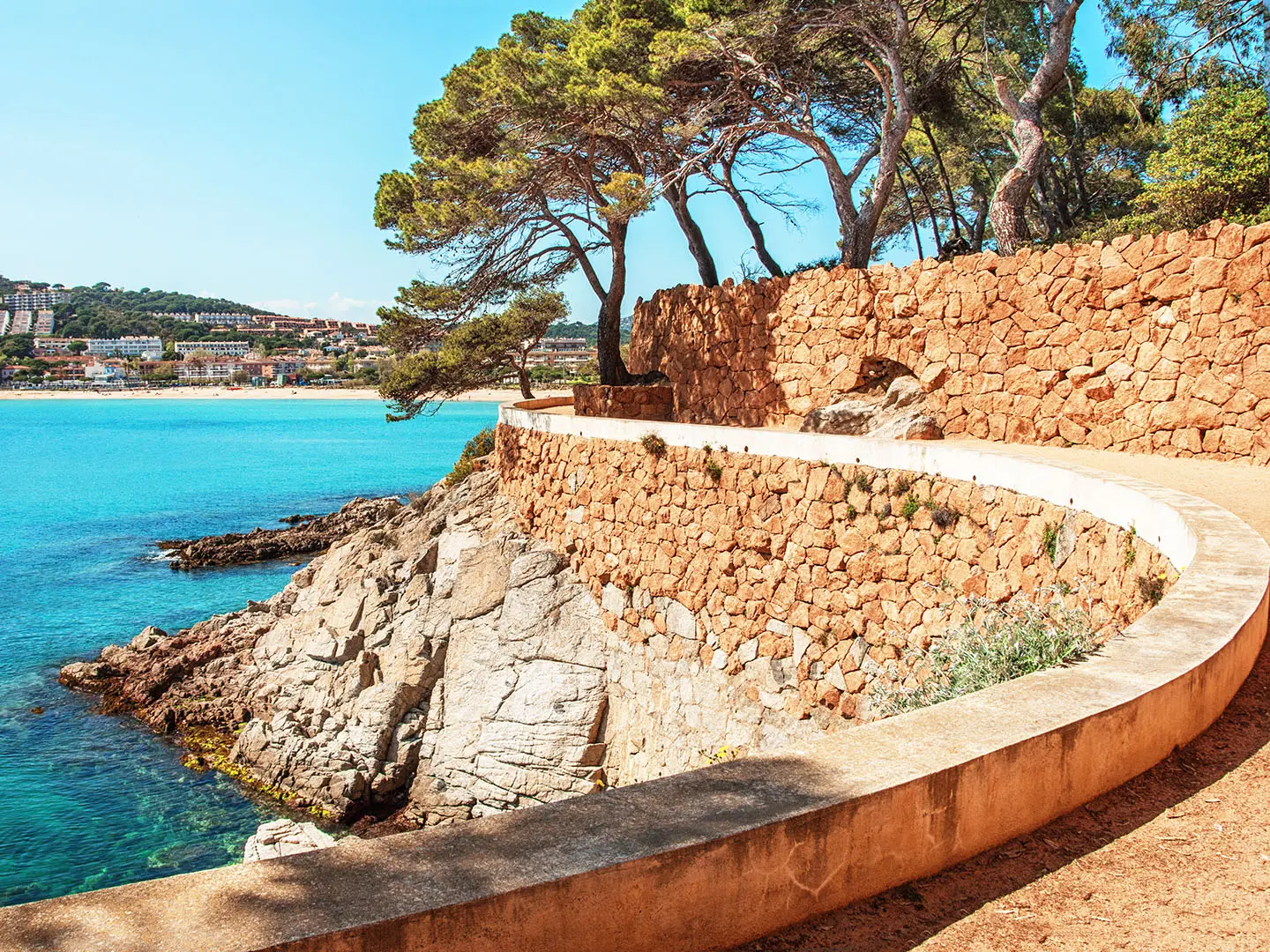
Camí de Ronda (Costa Brava Trail)
How would you rate Camí de Ronda (Costa Brava Trail)?
Tap a star to share your experience and help other hikers.
Camí de Ronda (Costa Brava Trail): Complete Hiking Guide
HikeList Score
Camí de Ronda (Costa Brava Trail) scored 88/100 on HikeList's trail-quality metrics.
See score breakdownHide breakdown
- Ideal length 94
- Balanced challenge 100
- Scenery & wildness 98
- Varied terrain 59
- Accommodation 83
- Food & support 88
- Path quality 80
- Season flexibility 76
Computed from length, challenge, scenery & wildness, terrain variety, accommodation, food & support, path quality and season flexibility.
The Camí de Ronda is a 190 km point-to-point coastal walk on the Costa Brava in Catalonia, north-east Spain. It follows the Mediterranean coast between Blanes / Lloret de Mar and Portbou on the French border, mostly using the red-and-white waymarked GR-92. Allow about 10 days. Difficulty is moderate: the walking is generally straightforward, but repeated climbs out of coves, rocky clifftop paths, exposed sun and some 20 km-plus stages make it more than a beach stroll.
Route Overview
Most walkers hike the Camí de Ronda either north-to-south from Portbou to Lloret de Mar, or south-to-north from Blanes / Lloret towards Portbou. The standard 10-stage GR-92 coastal traverse links Llançà, Cadaqués, Roses, L'Escala, Torroella de Montgrí, l'Estartit, Begur, Palamós, Sant Feliu de Guíxols and Tossa de Mar. It is a town-to-town route rather than a wilderness trek: food, water, accommodation and public transport are available in many coastal towns, with Girona as an inland transport hub. For other Spanish long walks, compare the Camino del Norte, GR1 Historic Trail or Carros de Foc (Aigüestortes Circuit).
History of the Camí de Ronda
The camins de ronda began as seaside paths used by fishermen, villagers and sailors moving between coves along the Costa Brava. From the 19th century, they took on a patrol role: first the Carabineros and later the Guardia Civil used them to watch the coast and combat smuggling. In the post-Civil-War years they were linked to border control and the black-market trade in goods such as tobacco, alcohol, sugar and penicillin. Tourism later replaced policing, and the paths were restored for walkers.
Notable highlights
- Cap de Creus Natural Park: A wild, wind-scoured headland at the northern end of the route and the most easterly point of Spain and the Iberian Peninsula. Expect rocky coves, exposed scrub and a more remote feel than the resort sections.
- Cadaqués: A whitewashed fishing village reached after the Cap de Creus section. It is closely associated with Salvador Dalí, who kept a home in nearby Portlligat.
- Greco-Roman ruins of Empúries, near L'Escala: An archaeological site beside the route, founded as the Greek trading colony of Emporion and later developed as a Roman town. It is one of the key cultural stops on the walk.
- Montgrí, Medes Islands and Baix Ter Natural Park: Around l'Estartit, the route passes a protected coastline facing the Medes Islands. The islands are a well-known marine reserve for snorkelling and diving.
- Palafrugell coves: Calella, Llafranc and Tamariu: A classic Costa Brava run of cove villages linked by attractive clifftop camí de ronda sections. Sant Sebastià lighthouse and Cap Roig botanical garden sit close to this part of the coast.
- Tossa de Mar: Near the southern end, Tossa is crowned by the Vila Vella, a 12th- to 14th-century walled medieval old town on a headland above the beach.
Challenges to expect
The main challenge is cumulative effort, not altitude: about 4,000 m of ascent comes from repeated short climbs and descents between coves and headlands. Surfaces vary from rocky footpath and dirt track to sand, promenades, stairs and short road sections. Navigation is usually easy on the GR-92, but markings can be unclear through towns. Spring and autumn are best; midsummer brings heat, strong sun and busy beaches.
HikeList Score
Camí de Ronda (Costa Brava Trail) scored 88/100 on HikeList's trail-quality metrics.
See score breakdownHide breakdown
- Ideal length 94
- Balanced challenge 100
- Scenery & wildness 98
- Varied terrain 59
- Accommodation 83
- Food & support 88
- Path quality 80
- Season flexibility 76
Computed from length, challenge, scenery & wildness, terrain variety, accommodation, food & support, path quality and season flexibility.
 Spain
SpainShow more data Show less
- Coastal
- Dirt
- Rocky
- Paved
- Hotels
- Hostels
- Campsites
- Family Friendly
- Pet Friendly
- Restrooms
- Water Sources
- Campsites
- Picnic Areas
Download Our Full Guide to Camí de Ronda (Costa Brava Trail) FREE!
Get our comprehensive guide to this hike for free. Save it for later reading or print out at home.
In these collections
Photos from hikers
Taken on the trail by people who've reviewed Camí de Ronda (Costa Brava Trail).
Camí de Ronda (Costa Brava Trail): The Complete Guide
 i
Image by steftach
i
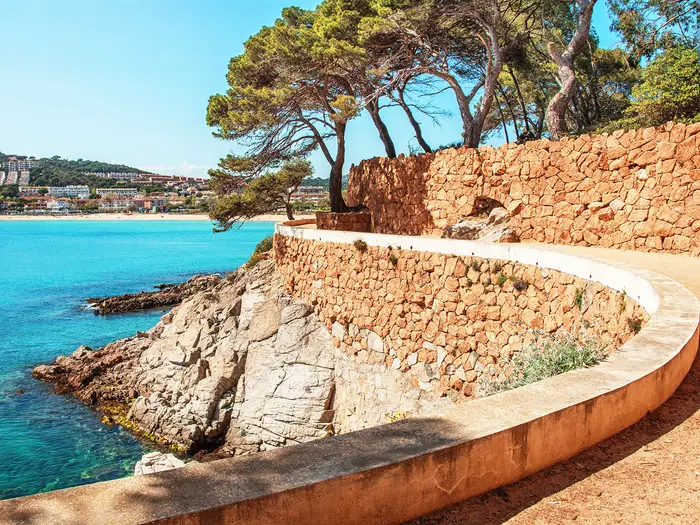
Image by steftach The Camí de Ronda is the Costa Brava’s classic coastal walk: a waymarked GR-92 traverse from Portbou on the French border towards Lloret de Mar, with Blanes often treated as the southern gateway. Over about 190 km, it links fishing towns, resort seafronts, pine-backed coves and rougher headlands into a practical 10-day hike.
Its appeal is the constant change underfoot. One hour the path is a stone balcony above turquoise water; the next it is crossing a beach, climbing steps through pines, or following a promenade into a town with beds, shops and evening food.
The northern stages through Cap de Creus feel wilder and more exposed, while the middle and southern coast brings places such as Cadaqués, Empúries, l’Estartit, the Palafrugell coves, S’Agaró and Tossa de Mar. It suits reasonably fit walkers who want a scenic first long-distance coastal route, but still has enough rough path and variety for experienced hikers.
Do not treat it as a beach holiday with a rucksack. The route has repeated short climbs and descents, rocky clifftop sections, stairs, strong sun and several days above 20 km, with the Sant Feliu de Guíxols to Tossa de Mar stage crossing the Serra de l’Ardenya as the hardest day.
This guide covers the stages, daily planning, accommodation, food, transport, terrain and common mistakes to avoid.
Stage-by-Stage Guide
The stage distances below are approximate, as day splits on the Costa Brava GR-92 vary slightly between guidebooks, operators and accommodation plans. The red-and-white GR waymarks are generally reliable, but a map or GPX is still useful through resort streets, promenades, short road sections and any temporary diversions. Seasonal cliff-path closures can apply on parts of the coast, including protected-bird nesting diversions near Sant Feliu de Guíxols; this should be checked before travelling.
Stage 1: Portbou to Llançà — approx. 10 km
This is a short opening stage from the French-border railway town of Portbou to Llançà, with Colera as the main intermediate settlement. It gives an immediate taste of the northern Costa Brava: rocky coastal terrain, short climbs and descents, and sections where the path feels more like a clifftop walking route than a seaside promenade.
Expect a mix of footpath, tracks, coastal edges and built-up approaches to the towns. The stage is not long, but the sun and wind exposure can be felt quickly in this far-northern section, particularly outside the shelter of the villages.
Food and water are most sensibly taken from Portbou before setting off, with further options in Colera and Llançà. Do not rely on every small seasonal business being open outside the main holiday period.
Llançà has the accommodation base expected of a coastal town on the route, including hotels, hostals and other town-based options. Portbou has a railway station, making the start straightforward, and regional buses link the coastal towns; current times should be checked before travelling.
Navigation is mainly a matter of following the GR-92 markings south, but pay attention where the route enters and leaves towns. The main planning risk on this first day is underestimating the exposure: even a short stage needs proper water, sun protection and footwear for rougher coastal path.
Stage 2: Llançà to Cadaqués — approx. 19.5 km
This is one of the defining northern stages, moving from Llançà through El Port de la Selva and into the wild Cap de Creus landscape before reaching Cadaqués. The section beyond El Port de la Selva is tougher than the distance alone suggests, with a notable climb behind the town and exposed, rocky ground through wind-scoured scrub.
The terrain is more rugged than on the resort sections further south. Expect uneven stone and dirt path, open hillside, short steep pulls and limited shade, rather than continuous village-to-village seafront walking.
El Port de la Selva is the key service point between Llançà and Cadaqués. Carry enough food and water for the Cap de Creus crossing after leaving it, especially in warm weather or if walking outside the most serviced months.
Cadaqués is a major overnight stop on the trail, with hotels, guesthouses and other accommodation in and around the town. It is a popular destination, so booking ahead matters in busy periods.
The GR-92 waymarks guide the crossing, but Cap de Creus deserves careful navigation in poor visibility or strong wind because the landscape is open and rocky. This is not a technical mountain stage, but it is one of the places where the route stops feeling like an easy beach walk.
Stage 3: Cadaqués to Roses — approx. 21.5 km
The third stage continues south from Cadaqués, with Portlligat close by and the route gradually moving towards the larger resort town of Roses. The day combines coastal walking, coves, headlands and more developed approaches as the route leaves the wilder northern headlands behind.
Path conditions are varied: sections of rocky coastal footpath and dirt track are mixed with village streets, beachside areas and resort approaches. Expect repeated small climbs and descents rather than a flat shoreline traverse.
Cadaqués is the obvious place to stock up before leaving. Portlligat is close to Cadaqués and is known for the Salvador Dalí house-museum, but opening times, tickets and any detour logistics should be checked separately if planning a visit.
Roses has a broad accommodation and service base, making it a practical overnight stop after a longer day. It is also a useful access point for section hikers because regional buses serve the Costa Brava towns, though timetables vary by season.
Navigation can become more fiddly where the GR moves between natural coast, lanes and built-up resort edges. Keep an eye on red-and-white waymarks at junctions and do not assume that the most obvious promenade or beach route is always the signed GR-92 line.
Stage 4: Roses to L'Escala via Empuriabrava — approx. 20.5 km
This stage links Roses with L'Escala, passing through or near the lower, more developed coastal belt around Empuriabrava and Sant Pere Pescador. It is a different day from Cap de Creus: less rugged, more open and more influenced by beaches, roads, promenades and resort infrastructure.
The walking is still part of the GR-92 coastal traverse, but the terrain is generally less dramatic than the rocky headlands to the north and the cove paths further south. Expect a practical linking stage with stretches where navigation through developed areas matters as much as footpath walking.
Food and water are available at the larger settlements, especially Roses, Empuriabrava and L'Escala. Smaller seasonal businesses should not be relied on outside the main tourist season, so start with enough supplies for the day.
L'Escala is a good overnight base with the usual coastal accommodation mix. The route also passes the seafront area of Sant Martí d'Empúries and the Greco-Roman ruins of Empúries near L'Escala, one of the most important cultural stops on the whole walk.
Public transport access is relatively flexible along this more developed part of the coast, with regional buses linking the main towns. Check current bus times before using this stage as a short section or bail-out day.
The main warning is navigation rather than exposure to difficult terrain. Road edges, resort streets and beachside alternatives can blur the line of the GR-92, so use the waymarks carefully and keep a map or GPX to hand.
Stage 5: L'Escala to Torroella de Montgrí / l'Estartit — approx. 21 km
This stage heads from L'Escala towards the Montgrí coast, with the day commonly ending at Torroella de Montgrí or l'Estartit depending on the itinerary. The split matters for accommodation and the following morning, because the next listed stage starts from Torroella de Montgrí; check the exact overnight plan before booking.
The character changes again around l'Estartit and the Montgrí coastline, where the route looks out towards the Medes Islands offshore. The islands themselves are not visited by the walking route, but they are a major visual landmark and marine reserve just off the coast.
Expect a mixture of coastal walking, tracks and town approaches, with some rougher or more uneven sections where the path follows the Montgrí shore. As on much of the Costa Brava, the difficulty comes from cumulative ups and downs, sun exposure and surface changes rather than technical ground.
L'Escala, l'Estartit and Torroella de Montgrí are the key service points for food, water and accommodation. If ending in l'Estartit rather than Torroella, check how that affects the next day’s start and any local transport or walking connection required.
Regional buses serve the main coastal towns, but not every connection is equally convenient for a walking itinerary. This should be checked before travelling, particularly outside summer.
Navigation is generally helped by the GR-92 markings, but the Torroella/l'Estartit split is a practical planning issue. Make sure accommodation is booked for the same end point as the route notes being followed.
Stage 6: Torroella de Montgrí to Begur — approx. 21.5 km
This is a longer middle stage from Torroella de Montgrí to Begur, moving inland and coastal sections together as the GR-92 continues south through the Baix Empordà part of the Costa Brava. It is less defined by a single famous landmark than the stages either side, but it is a substantial walking day and should be treated as such.
Terrain is mixed: tracks, footpaths, lanes, developed edges and uneven sections all feature on this part of the route. The repeated changes of surface can make the stage feel longer than a simple distance figure suggests.
Torroella de Montgrí is the sensible place to start with food and water. Begur has accommodation and services at the end, but intermediate availability depends on the exact GR-92 line followed and the season, so carry enough for the full day.
Begur is a well-established overnight stop with hotels and guesthouse-style options in and around the town. As with the rest of the coast, summer demand can be high and some smaller places reduce or close out of season.
Public transport is possible via the regional bus network serving the Costa Brava towns, but this is not a stage to improvise around an unverified timetable. Check current bus times before planning to shorten the day.
Navigation needs more attention than on the obvious seafront camí sections. In places, the route may feel like a linking stage between better-known coastal highlights, so keep following the GR-92 marks rather than drifting onto local paths or roads that appear more direct.
Stage 7: Begur to Palamós — approx. 22.5 km
This is one of the classic Costa Brava walking days, linking Begur with Palamós via the Palafrugell coves: Tamariu, Llafranc and Calella de Palafrugell. It includes some of the best-preserved camí de ronda path on the route, with small fishing-cove villages, clifftop sections and repeated descents to the shore.
The walking is scenic but not flat. Expect stone steps, rocky and uneven clifftop path, pine-shaded sections, short climbs above coves and promenades through the villages.
The Far de Sant Sebastià near Llafranc is a major viewpoint on this stage, set around 170 m above the sea. The Cap Roig headland and botanical garden lie just to the south, close to the line of travel.
Food and water options are better than on wilder stages because the route passes several coastal villages. Even so, summer heat and the stage length make it unwise to depend on the next café or beach bar without carrying water from Begur and topping up where available.
Palamós is a substantial overnight stop with a wide range of coastal accommodation and services. The stage also has better road access and bus possibilities than the more remote northern headlands, but current times should still be checked before relying on them.
Navigation is usually straightforward where the camí de ronda is obvious along the coves, but take care where the GR-92 leaves promenades or climbs away from the water. Busy beaches and local paths can distract from the waymarked line in high season.
Stage 8: Palamós to Sant Feliu de Guíxols via S'Agaró — approx. 14.5 km
This is a shorter stage by Costa Brava standards, linking Palamós with Sant Feliu de Guíxols via Sant Antoni de Calonge, Platja d'Aro and S'Agaró. It is a useful easier day before the much tougher Sant Feliu to Tossa crossing.
The terrain is mixed but generally less committing than the mountain stage that follows. Expect promenades, resort edges, beachside paths, steps, coves and short road or street sections.
The S'Agaró and Sa Conca camí de ronda is the highlight of the day. This well-known seafront path between Sant Pol beach and Sa Conca cove is one of the most walked and most polished sections of the Costa Brava coastal path, with villas and carefully built coastal walkway sections.
Services are frequent by the standards of the route, with Palamós, Sant Antoni de Calonge, Platja d'Aro, S'Agaró and Sant Feliu de Guíxols all providing opportunities for food and drink. Outside the main season, check opening patterns rather than assuming every beachfront business will be operating.
Sant Feliu de Guíxols is a major overnight stop and the place to prepare for the hardest day of the traverse. Accommodation is plentiful in season, but booking ahead is sensible.
Navigation through built-up areas needs attention, particularly where promenades, beach access paths and streets offer several plausible lines. Also check for any current cliff-path diversions in the Sant Feliu area before setting out.
Stage 9: Sant Feliu de Guíxols to Tossa de Mar — approx. 23.5 km
This is the longest and hardest stage of the standard 10-day traverse. Unlike most of the Camí de Ronda, it leaves the immediate coast and climbs inland over the granite Serra de l'Ardenya / Cadiretes massif before descending to Tossa de Mar.
The high point of the route is reached on this crossing, at about 482 m, with Puig de ses Cadiretes rising nearby. The stage passes through cork-oak woods and rougher inland terrain, making it feel more like a low mountain day than a coastal walk.
Start early in warm weather and carry enough food and water from Sant Feliu de Guíxols. Do not plan this stage around frequent beachside stops; it is the one day where the route’s inland line makes self-sufficiency more important.
Tossa de Mar is the overnight goal and has a strong accommodation base. It is also one of the route’s major historic stops, with the Vila Vella walled medieval old town on the headland above the main beach.
Public transport and road access exist at the towns at either end, but the middle of the stage is less convenient for easy bail-outs than the more developed resort sections. Check buses before treating it as a flexible section walk.
Navigation should be taken seriously here. The GR-92 waymarks remain the main guide, but the inland crossing has more junctions, tracks and wooded sections than the obvious seafront paths; a map or GPX is strongly recommended. Seasonal diversions or access restrictions near Sant Feliu de Guíxols should be checked before travelling.
Stage 10: Tossa de Mar to Lloret de Mar — approx. 13 km
The final standard stage is a shorter walk from Tossa de Mar to Lloret de Mar. It returns the route to the southern Costa Brava coast after the inland Ardenya crossing, with a mix of coastal path, coves, steps, resort approaches and short urban sections.
Tossa de Mar’s Vila Vella is the key landmark at the start of the day and is worth allowing time for before leaving if it was not visited the previous evening. The walking then works south towards the larger resort town of Lloret de Mar.
Although the distance is modest, the stage should not be dismissed as a flat finish. Expect the usual Costa Brava pattern of short climbs and descents, uneven clifftop ground and exposed sunny sections.
Food and water are available in Tossa de Mar and Lloret de Mar, with seasonal options likely in the developed areas between, depending on the exact line and time of year. Carry water from Tossa rather than relying on beach services being open.
Lloret de Mar is the standard finish for the 10-stage coastal traverse and has extensive accommodation and onward transport options. Some itineraries continue a little further to Blanes, the conventional southern limit of the Costa Brava and a useful railway access point on the Rodalies network.
Navigation is usually straightforward with the GR-92 marks, but the approach to Lloret involves more resort infrastructure where it is easy to follow a promenade or road out of habit. If continuing to Blanes, treat that as an extra section and check the exact route and transport plan before travelling.
Recommended Itinerary
Standard 10-day itinerary
The standard schedule follows the usual Portbou to Lloret de Mar direction and keeps the route to manageable walking days of roughly 10–23.5 km. Distances are approximate: check official mapping before booking accommodation, especially where overnight stops vary between Torroella de Montgrí and l'Estartit, or where seasonal diversions affect the coast path.
| Day | From | To | Approx. distance | Why this stage makes sense | Services/accommodation notes |
|---|---|---|---|---|---|
| 1 | Portbou | Llançà | 10 km | A short opening day from the rail-served border town, useful if arriving the same morning or wanting an easy first stage before the longer Cap de Creus walking begins. | Llançà is a practical first overnight stop with town-based accommodation. Book ahead in summer and check out-of-season opening dates. |
| 2 | Llançà | Cadaqués | 19.5 km | This is one of the most memorable northern stages, passing through the wilder Cap de Creus landscape via the El Port de la Selva side of the coast. It is a proper walking day, with exposed ground and enough ascent to feel more serious than the distance suggests. | Cadaqués has a wide choice of accommodation in season, but it is a very popular overnight stop. Reserve early in busy periods. |
| 3 | Cadaqués | Roses | 21.5 km | A solid day continuing south from Cadaqués, with the option to factor in nearby Portlligat before leaving the area if time allows. Keeping Roses as the overnight stop avoids over-extending the already long northern stages. | Roses is a large coastal town with good accommodation choice and transport options compared with smaller coves. |
| 4 | Roses, via Empuriabrava | L'Escala | 20.5 km | This stage links the larger resort coast around Roses and Empuriabrava with L'Escala, setting up the cultural stop at Sant Martí d'Empúries and the Empúries ruins. It is a long but logical through-day between established overnight towns. | L'Escala is a sensible base with hotels, guesthouses and campsites in season. Check campsite and smaller hostal opening dates outside the main holiday period. |
| 5 | L'Escala | Torroella de Montgrí / l'Estartit | 21 km | A full day moving from the Empúries area towards the Montgrí and Medes Islands coast. The Torroella de Montgrí versus l'Estartit overnight choice affects the next morning, so plan the exact finish before booking. | Both Torroella de Montgrí and l'Estartit work as overnight bases depending on the chosen line of the stage. Confirm the current route, accommodation and onward walking distance before committing. |
| 6 | Torroella de Montgrí | Begur | 21.5 km | This keeps the central Costa Brava traverse moving at a steady pace and positions the next day for the classic Palafrugell cove section. It is another day where cumulative ascent and heat matter more than the map distance alone. | Begur is an established overnight stop, but accommodation can be busy and pricier in midsummer. Book ahead. |
| 7 | Begur | Palamós | 22.5 km | A highlight stage through the Palafrugell coves: Tamariu, Llafranc and Calella de Palafrugell, with the Sant Sebastià lighthouse area near Llafranc. The distance is long enough that early starts are worthwhile in warm weather. | Palamós has a broad accommodation base and is a practical place to finish a long day. The cove villages also make natural slower-itinerary stops. |
| 8 | Palamós | Sant Feliu de Guíxols, via S'Agaró | 14.5 km | A shorter stage by design, passing the developed resort coast and the well-known S'Agaró / Sa Conca camí de ronda. It gives useful recovery time before the hardest day of the route. | Sant Feliu de Guíxols is the key overnight stop before the Serra de l'Ardenya crossing. Check any current cliff-path diversions in this part of the coast before relying on a coastal line. |
| 9 | Sant Feliu de Guíxols | Tossa de Mar | 23.5 km | The longest and toughest day, leaving the shore to cross the granite Serra de l'Ardenya / Cadiretes massif, with the route high point around 482 m before descending to Tossa. Start early, especially in heat. | There are no listed coastal-resort staging points between the two towns on the standard route, so this day is harder to shorten on foot. Tossa de Mar is a major overnight stop. |
| 10 | Tossa de Mar | Lloret de Mar | 13 km | A shorter final stage from Tossa, allowing time for the Vila Vella before or after the walk and avoiding a rushed finish. Some walkers continue separately to Blanes, the conventional southern limit of the Costa Brava. | Lloret de Mar is a large resort town with extensive accommodation. For onward travel, many walkers use Lloret or continue towards Blanes for rail connections; current bus and train times should be checked before travelling. |
Slower variant: 11–14 days
A slower schedule suits first-time multi-day walkers, hot-weather trips, anyone carrying a heavier pack, and hikers who want time for Cadaqués/Portlligat, Empúries, the Palafrugell coves, S'Agaró and Tossa de Mar rather than treating them as brief stops.
Good places to add nights or shorten stages include:
- El Port de la Selva, to reduce the demanding Llançà–Cadaqués / Cap de Creus section.
- Empuriabrava or Sant Pere Pescador, to break the long Roses–L'Escala day.
- l'Estartit, if choosing it over Torroella de Montgrí helps with the Montgrí / Medes Islands section.
- Tamariu, Llafranc or Calella de Palafrugell, to slow down the Begur–Palamós stage and spend more time on the best-preserved cove-to-cove camí de ronda.
- Sant Antoni de Calonge, Platja d'Aro or S'Agaró, to make the Palamós–Sant Feliu de Guíxols section very relaxed.
The Sant Feliu de Guíxols to Tossa de Mar stage is the least easy day to split naturally on foot because it crosses the Serra de l'Ardenya rather than following a chain of coastal towns. If that stage looks too long, plan a transport-assisted variant and check current bus or taxi options before travelling.
Faster variant: 8–9 days
A faster itinerary suits strong, experienced walkers travelling light, outside the hottest part of the year, and with accommodation already fixed. The most straightforward 9-day full-route option is to combine the first two stages into a long Portbou to Cadaqués day of about 29.5 km, then continue with the standard stages from Cadaqués to Lloret de Mar.
Compressing the walk to 8 days is possible only by accepting another very long day, such as combining Begur–Palamós–Sant Feliu de Guíxols at about 37 km, or Sant Feliu de Guíxols–Tossa de Mar–Lloret de Mar at about 36.5 km. The latter includes the hardest mountain stage over the Serra de l'Ardenya and is not a sensible plan for most walkers.
For most independent hikers, the 10-day itinerary is the best balance: long enough to complete the full coastal traverse without racing, but still efficient and easy to book around the main overnight towns.
Planning the Route
How many days to allow
The standard plan is 10 walking days from Portbou to Lloret de Mar, using the coastal towns as overnight stops. That suits most fit walkers because it keeps the route within natural town-to-town stages while still leaving some days over 20 km.
A faster itinerary is possible, but it is rarely the best way to enjoy this route. The Camí de Ronda is not technically difficult, yet the repeated climbs out of coves, stone steps, uneven cliff paths and exposed sun make long days feel harder than the map suggests.
A slower plan works especially well if you want time for Cadaqués and Portlligat, Empúries, the Palafrugell coves, S’Agaró or Tossa de Mar. Adding rest or half-days also gives flexibility around heat, wind, accommodation availability and any temporary coastal-path diversions.
How the stages are shaped
Daily stages are mostly dictated by where the coastal settlements are. The practical overnight chain is based around places such as Llançà, Cadaqués, Roses, L’Escala, Torroella de Montgrí or l’Estartit, Begur, Palamós, Sant Feliu de Guíxols, Tossa de Mar and Lloret de Mar.
This is a town-based walk rather than a hut-to-hut trail. That makes logistics straightforward, but it also means the best stopping points are not always evenly spaced: several stages sit around the 20 km mark, while the shorter days tend to fall where major resort towns are close together.
The main day to treat with extra respect is Sant Feliu de Guíxols to Tossa de Mar. It is the longest and hardest stage, leaving the shore to cross the Serra de l’Ardenya / Cadiretes massif and reaching about 482 m before descending to Tossa de Mar.
Planning pressure points
| Planning issue | What matters on this route |
|---|---|
| Accommodation | Book ahead in midsummer, especially in smaller coastal towns and popular resorts. Out of season, check opening dates for hostals, small hotels and campsites before relying on them. |
| Food | Most stages start and finish in towns, so resupply is usually simple. Do not assume beach bars, campsite shops or smaller seasonal businesses will be open outside the main season. |
| Water | Carry enough for exposed cliff sections and longer inland stretches. Heat and sun are a bigger issue than remoteness, particularly in summer. |
| Navigation | Follow the red-and-white GR-92 waymarks, but carry a map or GPX for town exits, road links, promenades and temporary diversions. Waymarking is generally good, but urban and resort sections can be less intuitive than wild coast paths. |
| Weather | Spring and autumn are the most comfortable seasons. In midsummer, plan early starts, longer breaks and more water; in winter, allow for shorter daylight and reduced services. |
| Transport | Portbou has a railway station, Blanes is on the Rodalies rail network, and coastal buses including Sarfa/Moventis services make it practical to join, leave or shorten the walk at many points. Timetables should be checked before travelling. |
| Access and diversions | Seasonal cliff-path closures or diversions can apply on parts of the coast, including protected-bird nesting areas near Sant Feliu de Guíxols. Check current route information before committing to a day’s plan. |
Shortening, extending and section hiking
The Camí de Ronda is very easy to break into sections. Coastal buses link many of the towns, and rail access at Portbou and Blanes makes the northern start and southern end practical without a car.
Good short-route options include walking only the northern Cap de Creus section, taking the Palafrugell cove section around Tamariu, Llafranc and Calella de Palafrugell, or sampling the well-known S’Agaró to Sa Conca stretch. These sections give the character of the trail without needing the full 10-day commitment.
For a full traverse, the usual finish is Lloret de Mar, but some walkers continue to Blanes, the conventional southern limit of the Costa Brava and the southern terminus of the GR-92’s Girona stretch. If finishing at Blanes, check the exact onward route and transport plan before travelling.
Direction of travel
Most itineraries run north-to-south from Portbou to Lloret de Mar. This is convenient because Portbou is a clear railway-accessible starting point on the French frontier, and the GR-92 waymarks lead south along the coast.
Walking south-to-north from Blanes or Lloret de Mar also works. This can be useful if transport, flights or accommodation line up better in that direction, but stage planning should still be built around the same coastal towns and the same long sections.
What to prioritise before booking
Accommodation is the main fixed element. Once overnight stops are secured, transport and daily distances usually fall into place.
Next, check current bus and train times, especially for any planned skipped stages, late arrivals or bail-out options. Do not rely on turning up for the last service of the day without checking the timetable.
Finally, review the forecast and any current path diversions shortly before departure. On this route, heat, sun exposure, wind on open headlands and temporary coastal closures can affect the day more than the overall distance on paper.
Towns, Villages and Overnight Stops
The Camí de Ronda is a town-to-town route rather than a hut trek. Most walkers use hotels, hostals, B&Bs, hostels and campsites in coastal resorts and fishing towns, with the standard overnight rhythm built around Llançà, Cadaqués, Roses, L'Escala, Torroella de Montgrí or l'Estartit, Begur, Palamós, Sant Feliu de Guíxols, Tossa de Mar and Lloret de Mar.
Accommodation is plentiful in season in the larger resort towns, but midsummer is busy and more expensive. Smaller places, campsites and some hostals may close outside the main season, so opening dates should be checked before travelling and summer beds should be booked ahead.
Portbou
Portbou is the northern trailhead, on the French frontier, and is the most practical place to start if walking north-to-south. It is a small border town with a railway station, making it one of the easiest access points on the whole route.
It works well as a pre-walk overnight stop, especially if arriving by train from Girona, Barcelona or France. Expect basic town services rather than a large resort choice; book ahead if arriving late or outside the main season.
Food and café options should be sorted before setting out, as the first stage to Llançà is short but still follows coastal terrain rather than a continuous urban strip. The red-and-white GR-92 waymarks lead south from here.
Colera
Colera sits between Portbou and Llançà on the first stage. It is useful as a short break or bad-weather fallback rather than a standard overnight stop, because the usual first night is in Llançà.
Do not rely on Colera for full resupply or late-day accommodation without checking in advance. It can, however, make the opening day feel less abrupt if starting the trail after a same-day arrival into Portbou.
Llançà
Llançà is the standard end of Day 1 and the first major overnight stop south of Portbou. It is one of the coastal towns where accommodation is concentrated, with a more reliable choice of hotels, hostals and other visitor beds than the smaller settlements either side.
It is a sensible place to stock up before the longer Llançà to Cadaqués stage, which passes via El Port de la Selva and the Cap de Creus area. Bars, cafés and shops are easier to plan around here than on the wilder headland sections.
Llançà is also a useful section-hike access point on the northern Costa Brava. Regional bus links serve the coast, but current timetables should be checked before travelling.
El Port de la Selva
El Port de la Selva lies between Llançà and Cadaqués and is the key settlement before the route enters the tougher Cap de Creus section. It can be used to split the Llançà to Cadaqués day if the full stage feels too long or if accommodation availability dictates a shorter itinerary.
This is a good place to eat, refill and reassess conditions before continuing into more exposed terrain. The climb away from El Port de la Selva towards Cap de Creus is one of the harder northern sections, so do not leave town short of water in hot weather.
Accommodation may be possible here, but it is not one of the standard 10-day overnight stops. Availability and seasonal opening should be checked before building an itinerary around it.
Cadaqués
Cadaqués is the standard overnight after crossing the Cap de Creus area and one of the most important stops on the northern half of the walk. It has a stronger accommodation and food base than the smaller coves nearby, but it is also popular, so advance booking is wise in spring weekends, holidays and summer.
For hikers, Cadaqués is valuable because it follows one of the more committing early stages. It is also the practical base for Portlligat, just along the coast, where Salvador Dalí's former home is now a house-museum.
Resupply before leaving Cadaqués is important, as the next stage to Roses is another long coastal day. Regional buses serve the main Costa Brava towns, but current services should be checked before relying on them for a bail-out or rest-day transfer.
Portlligat
Portlligat is near Cadaqués and is best treated as a local side-stop rather than a main overnight base. Most walkers will stay in Cadaqués and visit Portlligat before or after the walking day.
Its main relevance is the Dalí house-museum, which sits directly beside the route corridor. If planning to visit, check opening times before travelling, as this can affect the start time for the Cadaqués to Roses stage.
Roses
Roses is the standard overnight at the end of the Cadaqués to Roses stage. It is a large resort town with a broad choice of accommodation and food, making it one of the easier places on the route for laundry, resupply and a more comfortable night.
It is also a practical transport point for section hikers, with regional buses linking the Costa Brava towns. This makes Roses a good place to start or stop a shorter northern itinerary covering Cap de Creus and the Empordà coast.
The following stage towards L'Escala is long and more developed in character, passing via Empuriabrava. Stock up before leaving if walking outside peak season, when some intermediate services may be reduced.
Empuriabrava
Empuriabrava lies on the Roses to L'Escala stage and can be used as an intermediate service stop or alternative overnight if adjusting the standard itinerary. Its position is useful because this stage is over 20 km and can otherwise feel long after the previous Cap de Creus days.
As a developed resort area, it is more likely to offer food and accommodation than the smaller settlements, especially in season. Outside the main holiday period, opening dates should still be checked before committing to it as a stop.
Sant Pere Pescador
Sant Pere Pescador sits on or near the long middle stretch between Roses, Empuriabrava and L'Escala. It is not a standard overnight on the 10-day schedule, but it can help walkers shorten the Roses to L'Escala stage.
Use it as a planning option only after checking accommodation and the exact route connection for the chosen variant. This part of the walk is easier to customise than the wilder Cap de Creus and Ardenya sections, but transport and lodging details still need confirming before travel.
L'Escala
L'Escala is the standard overnight after the Roses / Empuriabrava stage and a strong logistical stop. Accommodation is concentrated here, and it is a useful place for food, supplies and transport planning before heading towards the Montgrí and l'Estartit area.
The route passes close to Sant Martí d'Empúries and the seafront Greco-Roman ruins of Empúries, making L'Escala one of the best cultural overnight stops on the trail. Allow time if visiting the archaeological site, as it can easily turn a walking day into a longer day out.
L'Escala is also a sensible place to pause if section-walking the central Costa Brava. Regional bus options should be checked before travelling.
Sant Martí d'Empúries
Sant Martí d'Empúries is a small historic stop near L'Escala, beside the Empúries archaeological site. The path walks past the Greek and Roman remains, so it is a natural pause on the route rather than a place most hikers will use as a main overnight.
For practical purposes, L'Escala is the safer base for accommodation and evening services. If planning to stay in or around Sant Martí d'Empúries, book ahead and check what is open at the time of year.
Torroella de Montgrí
Torroella de Montgrí is one of the standard Day 5 finish options, paired in many itineraries with nearby l'Estartit. It is a useful inland town stop before the route continues towards Begur.
It can suit walkers who prefer a more town-based overnight rather than staying on the seafront at l'Estartit. Accommodation and food should be booked or checked in advance, especially outside the main season.
For section hikers, Torroella de Montgrí also works as a practical break in the central part of the route. Current regional bus times should be checked before relying on it for arrival or departure.
l'Estartit
l'Estartit is the coastal alternative to Torroella de Montgrí and one of the main accommodation centres on this section. It sits by the Montgrí coastline, looking out towards the Medes Islands, which are offshore and reached only by boat.
It is a strong overnight choice for walkers who want to stay closer to the sea after the L'Escala stage. Food and accommodation are generally easier here than in smaller coves, but summer demand is high and off-season openings can vary.
l'Estartit is also a good place to pause if adding a rest day or water-based activity, though that should not be allowed to compromise the next day's walking plan towards Begur.
Begur
Begur is the standard overnight after the Torroella de Montgrí / l'Estartit section and an important staging point before the Palafrugell coves. It is one of the named towns where accommodation is concentrated, so it is a practical place to book a proper overnight rather than gambling on smaller coastal villages.
The following stage to Palamós is one of the longer days and passes through the classic cove villages of Tamariu, Llafranc and Calella de Palafrugell. Stock up before leaving Begur, particularly in hot weather or outside the busiest visitor months.
Regional bus links make Begur useful for section itineraries, but current services should be checked before travelling.
Tamariu
Tamariu is one of the Palafrugell cove villages on the Begur to Palamós stage. It is a good place for a scenic pause or for splitting the day if accommodation is available.
Because this is a smaller cove settlement, do not assume year-round services. If using Tamariu as an overnight stop, book ahead and check food options before committing to the plan.
Llafranc
Llafranc is another key cove on the Palafrugell section and sits near the climb to Far de Sant Sebastià, the Sant Sebastià lighthouse viewpoint above the coast. It is a useful food or coffee stop in season and can work as an overnight if the Begur to Palamós stage is being shortened.
Accommodation and restaurants are likely to be busy in midsummer and more variable outside the main season. Check opening dates before relying on Llafranc for an evening meal or bed.
Calella de Palafrugell
Calella de Palafrugell is one of the most useful intermediate stops on the Begur to Palamós stage. It sits on a well-known run of preserved camí de ronda path between the Palafrugell coves and gives walkers a natural place to pause before continuing south.
It can be used as an overnight alternative where availability allows, especially for a slower itinerary through the best cove scenery. For a standard 10-day schedule, most walkers continue to Palamós.
Palamós
Palamós is the standard overnight at the end of the Begur to Palamós stage and a strong logistics town. It has a good concentration of accommodation and the sort of services walkers need: food, cafés, shops and onward transport options.
It is also a sensible place to reorganise before the shorter Palamós to Sant Feliu de Guíxols stage. This next day passes through Sant Antoni de Calonge, Platja d'Aro and S'Agaró, so there are more intermediate service options than on the wilder northern headlands.
For section walkers, Palamós is one of the better places to start or finish a central Costa Brava section. Check current regional bus times before travelling.
Sant Antoni de Calonge
Sant Antoni de Calonge lies south of Palamós on the route towards Platja d'Aro and S'Agaró. It is more useful as an on-stage service stop than a necessary overnight, as the Palamós to Sant Feliu de Guíxols stage is one of the shorter days.
If accommodation in Palamós or Sant Feliu de Guíxols is limited, Sant Antoni de Calonge may help with an adjusted itinerary. Availability should be checked before relying on it.
Platja d'Aro
Platja d'Aro is a large resort stop between Sant Antoni de Calonge and S'Agaró. It can be useful for food, shops and accommodation, particularly if shortening the Palamós to Sant Feliu de Guíxols stage or travelling as a section hiker.
Because this is a popular resort area, midsummer accommodation can be busy and prices can rise sharply. In winter or shoulder periods, check what remains open before planning a night here.
S'Agaró
S'Agaró sits on one of the most famous short sections of the Camí de Ronda, including the seafront path towards Sa Conca. For end-to-end walkers it is usually a highlight and a pause on the way to Sant Feliu de Guíxols rather than a standard overnight.
It can be a useful place to slow the day down, particularly if walking the route in shorter coastal sections. Accommodation planning should still focus on the larger nearby towns unless a specific booking has been made.
Sant Feliu de Guíxols
Sant Feliu de Guíxols is the standard overnight before the hardest day of the route. The next stage leaves the coast and crosses the Serra de l'Ardenya / Cadiretes massif to Tossa de Mar, reaching the route's highest ground at about 482 m.
This is one of the most important places to arrive organised. Buy food, carry enough water and check weather before leaving, because the Sant Feliu de Guíxols to Tossa de Mar stage is the longest and toughest day on the standard itinerary.
Accommodation is concentrated here, and it is a practical place for restaurants, cafés and section-hike transport. Seasonal cliff-path diversions can apply on parts of the coast near Sant Feliu de Guíxols, including for protected bird nesting; current diversions should be checked before travelling.
Tossa de Mar
Tossa de Mar is the standard overnight after the Serra de l'Ardenya crossing and a very useful recovery stop. It has a strong accommodation base and plenty of food options in season, though it is also a popular resort and should be booked ahead in summer.
The town is crowned by the Vila Vella, the walled medieval old town above the main beach. For walkers, its main value is practical: it breaks the route cleanly before the final shorter day to Lloret de Mar.
Regional bus links make Tossa de Mar a useful point for ending or starting a shorter southern section. Timetables should be checked before travelling.
Lloret de Mar
Lloret de Mar is the standard southern finish for the 10-stage coastal traverse. It is a large resort town, so accommodation and food are generally easier to find here than in smaller places, but summer demand is high.
It is a practical end point because onward transport is straightforward by bus, with rail access commonly made via Blanes. Current bus and train times should be checked before booking onward travel.
Some walkers continue a little further to Blanes, the conventional southern limit of the Costa Brava and the southern terminus of the GR-92's Girona stretch. If finishing at Lloret de Mar, allow time to sort transport rather than assuming immediate onward connections.
Blanes
Blanes is an optional continuation beyond Lloret de Mar and is often treated as the broader southern end of the Costa Brava. It has a railway station on the Rodalies network, making it one of the most useful exit points for travel towards Barcelona.
It is also a good fallback finish if accommodation or transport from Lloret de Mar does not fit the schedule. Walkers ending here should check the exact route continuation, accommodation availability and current train times before travelling.
Getting to the Start
The usual starting point for the Camí de Ronda Costa Brava traverse is Portbou, a small border town on the French frontier with its own railway station. The GR-92’s red-and-white waymarks lead south from the town towards Colera and Llançà.
By train
Train is the simplest way to reach Portbou. Portbou railway station sits on the line connecting the town with Girona, Barcelona and the rail network across the border into France.
For most walkers arriving from elsewhere in Spain, the practical approach is to travel first to Barcelona or Girona, then continue by train to Portbou. Current train times, connections and any cross-border timetable changes should be checked before travelling.
If starting the walk later in the day, remember that the first stage to Llançà is short but still involves coastal walking rather than a flat seafront stroll. Arriving the evening before is usually the easier option, especially in hot weather.
By bus
Regional buses are useful along much of the Costa Brava, particularly for shortening stages, reaching coastal towns and bailing out mid-route. The Sarfa/Moventis network links many towns along the coast.
For Portbou itself, the train is normally the more straightforward access option. If planning to reach Portbou or a nearby starting point by bus, current routes and timetables should be checked before travelling, as coastal services vary by place and season.
By car
Driving to Portbou is possible, but it is usually less convenient than arriving by train because this is a point-to-point walk ending around Lloret de Mar or Blanes, not back at Portbou. A car left at the start creates a return-transport problem at the end of the hike.
Do not rely on informal long-stay parking without checking it locally. Ask accommodation in Portbou about parking options, restrictions and whether a vehicle can be left for the duration of the walk. This should be checked before travelling.
For walkers using a car, a common alternative is to park near the finish and use train or bus connections to reach Portbou before starting. The exact logistics depend on whether the walk is finished at Lloret de Mar or continued to Blanes.
From the nearest airport
Girona–Costa Brava Airport is the main inland air hub for the route area. From Girona, continue towards Portbou using onward public transport, with train connections forming the most practical part of the journey.
Barcelona is also a major access city for the route because Portbou is on the rail line to Barcelona. Airport-to-rail transfers, onward train times and late-arrival options should be checked before travelling.
If arriving by air in the evening, plan an overnight stop rather than assuming it will be practical to reach Portbou and start walking the same day. This is particularly important outside the main season, when some accommodation and services in smaller places reduce.
Where to stay before starting
The cleanest start is to stay in Portbou the night before walking. This avoids a morning transfer and lets you begin directly on the GR-92 heading south.
If Portbou accommodation is limited or full, Llançà is the next major overnight option on the first stage and also has rail access. In that case, take the train back to Portbou in the morning before starting the trail. This should be checked before travelling.
Accommodation on the Costa Brava is generally town- and village-based: hotels, hostals, guesthouses, B&Bs, hostels and campsites rather than mountain huts. In midsummer, beds can be busy and more expensive; out of season, some smaller places and campsites close, so opening dates should be checked before booking.
Getting Home from the Finish
The standard 10-stage walk finishes in Lloret de Mar. Some walkers continue a little further to Blanes, which is the conventional southern limit of the Costa Brava and has the most useful rail connection for leaving the trail.
By train
Lloret de Mar is best treated as a bus or taxi finish rather than a rail finish. For trains, use Blanes station, which is reached by Barcelona’s R1/RG1 Rodalies services.
If finishing in Lloret de Mar, allow time to connect onward to Blanes before relying on a train. Bus and taxi options between Lloret de Mar and Blanes are timetable- and availability-dependent, so this should be checked before travelling, especially if finishing late in the day.
From Blanes, Rodalies trains give onward access towards Barcelona. For Girona, use the relevant rail or bus connection via the regional network; exact routings and times should be checked before booking accommodation or onward travel.
By bus
Regional buses are one of the easiest ways to leave Lloret de Mar. The Costa Brava towns are served by the Sarfa/Moventis network, with connections along the coast and towards inland transport hubs.
Buses are generally a practical option for hikers because they serve the resort towns directly, avoiding the need to reach a railway station first. Timetables can vary by season, day of week and time of day, so check current schedules before fixing an onward train, flight or hotel booking.
If the final walking day from Tossa de Mar to Lloret de Mar runs late, do not assume there will be a convenient evening connection. Staying in Lloret de Mar and travelling the next morning is often the safer plan.
By car/taxi
For short onward transfers, taxis are the simplest fallback from Lloret de Mar, particularly to reach Blanes station or a nearby hotel after a late finish. Availability may be tighter at busy holiday periods or late in the evening, so arranging one in advance is sensible if onward travel is time-critical.
Driving logistics are less straightforward for an end-to-end walk because the route starts far away in Portbou. If using a car, it is usually more practical to park at one end and use the train/bus network to reposition, rather than trying to return to the start by taxi.
From the nearest airport
Girona–Costa Brava airport is the main nearby air hub for the Costa Brava. Girona is also the principal inland transport hub for the route, with onward rail and bus links.
For international departures, allow generous time between leaving Lloret de Mar or Blanes and reaching the airport. Bus connections, train connections and airport transfer times are timetable-dependent and should be checked before travelling.
Where to stay at the finish
Lloret de Mar is a large resort town, so accommodation is usually easier to find here than in smaller coves and villages on the route. Hotels, hostals, apartments and other tourist accommodation are concentrated in the town, with more options nearby in Blanes.
In midsummer, book ahead: the southern Costa Brava is busy and prices can rise sharply. Outside the main season, some accommodation and campsite services may reduce or close, so check opening dates before relying on a walk-up room.
Staying overnight at the finish is the best option if the final stage has taken longer than expected, if onward buses or trains are limited, or if a flight connection would otherwise be tight.
Which Direction Should You Walk?
The Camí de Ronda is usually described and staged north-to-south, from Portbou to Lloret de Mar. That is the cleanest direction to follow if you want to match the common 10-stage itinerary, starting at the French border and working down the Costa Brava coast through Llançà, Cadaqués, Roses, L'Escala, Begur, Palamós, Sant Feliu de Guíxols and Tossa de Mar.
Walking south-to-north from Lloret de Mar or Blanes to Portbou is also perfectly workable. It mainly changes the feel of the journey rather than the logistics: the same towns, accommodation bases and transport links are available, but the wildest northern scenery arrives at the end rather than near the start.
| Direction | Best for | Main advantages | Main drawbacks |
|---|---|---|---|
| Portbou → Lloret de Mar / Blanes | Most end-to-end walkers; anyone following standard stage notes | Matches the usual stage order; easy rail access to Portbou; Cap de Creus comes early; finish has straightforward onward transport by bus or via Blanes railway station | The final approach is into the more developed southern resort coast rather than the wilder north |
| Lloret de Mar / Blanes → Portbou | Walkers who want a wilder finale; those starting from the Barcelona/Blanes side | Builds towards Tossa de Mar, the Palafrugell coves, Cadaqués and Cap de Creus; Portbou has a railway station for leaving the route | Stage descriptions are often written the other way; the hardest and wilder northern sections come later when fatigue may be higher |
Transport and start/finish logistics
There is no major transport penalty in either direction. Portbou has a railway station with links towards Girona, Barcelona and France, which makes it a practical northern start or finish.
At the southern end, Lloret de Mar is well served by bus, and Blanes has a railway station on the Rodalies network. If finishing at Lloret de Mar, many walkers treat Blanes as the practical onward rail point. Current train and bus times should be checked before travelling.
Scenery and route progression
North-to-south gives a strong opening. After the short first stage to Llançà, the route quickly reaches the wilder northern Costa Brava, including the Cap de Creus section towards Cadaqués and the exposed headlands around the far north.
The middle and southern stages then move through a more varied pattern of coves, fishing towns, promenades, beaches and short road links, with standout sections around l'Estartit and the Medes Islands, Tamariu, Llafranc and Calella de Palafrugell, S'Agaró, and Tossa de Mar.
South-to-north has the better scenic build-up for some walkers. It starts on the busier southern resort coast, then gradually works towards the classic Palafrugell coves, the Montgrí coast, Cadaqués and finally the rougher, wind-scoured landscapes near Portbou and Cap de Creus.
Climbs and effort
The total effort is broadly the same whichever way you walk. This is not a route where one direction avoids the climbing: the Camí de Ronda repeatedly drops into coves and climbs back over headlands, so ascent accumulates throughout the walk.
The key physical day remains the Sant Feliu de Guíxols to Tossa de Mar section over the Serra de l'Ardenya / Cadiretes massif, whether taken north-to-south or in reverse. It is the longest and toughest stage of the standard itinerary and reaches the route high point of about 482 m.
North-to-south places this hard mountain-crossing stage near the end, after several days of walking. South-to-north puts it near the beginning, which may suit walkers who prefer to tackle the biggest effort while fresh.
Weather and exposure
There is no reliable direction choice that removes the main weather issue: sun and exposure. In warm weather, the important decisions are start time, water carrying, sun protection and pacing, not whether the route is walked northbound or southbound.
Wind can be a factor on the open headlands, especially in the north around Cap de Creus, but it is too variable to choose a whole itinerary around. Check the local forecast before committing to exposed stages.
Accommodation flow
Accommodation works in both directions because the route is town- and village-based. The standard stage towns — including Llançà, Cadaqués, Roses, L'Escala, l'Estartit, Begur, Palamós, Sant Feliu de Guíxols, Tossa de Mar and Lloret de Mar — make either direction manageable.
Direction matters less than season. In midsummer, the coastal resorts are busy and prices rise; outside the main season, some smaller hostals, hotels and campsites reduce opening. Book ahead and check opening dates before relying on a particular overnight stop.
Recommendation
For most walkers, walk north-to-south from Portbou to Lloret de Mar, optionally continuing or transferring to Blanes for rail connections. It follows the most common stage order, starts cleanly from a railway town, reaches the wild Cap de Creus early, and finishes with flexible onward transport from the southern Costa Brava.
Choose south-to-north if the transport works better from Blanes/Lloret de Mar, or if the idea of finishing with Cadaqués, Cap de Creus and the border town of Portbou is more appealing. It is not easier overall, but it can feel more dramatic as a scenic crescendo.
Accommodation Along the Route
The Camí de Ronda works well as an inn-to-inn walk. The standard stage ends are towns or resorts rather than mountain huts, so accommodation is based around hotels, hostals, B&Bs, hostels and campsites.
There is no chain of walking refuges on the route. Planning is therefore straightforward in the larger coastal towns, but less forgiving if a preferred small village is full, closed out of season or awkwardly placed for the next day’s distance.
Best overnight stops
The most practical ten-day itinerary uses the main stage towns: Portbou, Llançà, Cadaqués, Roses, L'Escala, Torroella de Montgrí or l'Estartit, Begur, Palamós, Sant Feliu de Guíxols, Tossa de Mar and Lloret de Mar. Blanes is also a useful southern end point if continuing beyond Lloret de Mar.
The strongest accommodation choice is in the larger resorts and established coastal towns: Roses, L'Escala, l'Estartit, Palamós, Sant Feliu de Guíxols, Tossa de Mar, Lloret de Mar and Blanes. Cadaqués, Llançà and Begur are also normal overnight stops, but should not be treated as last-minute options in busy periods.
Smaller places such as Colera, El Port de la Selva, Sant Martí d'Empúries, Tamariu, Llafranc, Calella de Palafrugell, S'Agaró and some intermediate beach settlements can be useful for shorter stages, rest days or a more relaxed itinerary. Availability in these places is more seasonal and should be checked before travelling.
Booking strategy
Book ahead in midsummer. The Costa Brava is a major holiday coast, and July and August bring high demand, higher prices and busy beaches, especially in the resort towns and the famous cove sections.
Spring and autumn are usually the best balance for walkers: more comfortable temperatures and quieter towns, while still keeping the route practical for a hotel-based traverse. Even then, advance booking is sensible for Cadaqués, Begur, the Palafrugell coves and Tossa de Mar.
Out of season, the issue is not crowding but closures. Some smaller hostals, campsites and resort accommodation reduce opening periods outside the main season, so check opening dates before building a fixed stage plan.
Accommodation table
| Place | Accommodation level (good/limited/none) | Best for | Notes |
|---|---|---|---|
| Portbou | Limited | Start night before Day 1 | Small border town with a railway station. Practical for starting early, but do not rely on broad choice. |
| Colera | Limited | Shortening the first stage | Useful as an intermediate coastal stop between Portbou and Llançà. Availability should be checked before travelling. |
| Llançà | Good | Standard Day 1 overnight | One of the regular accommodation bases on the northern section. A practical first stop before the longer walk towards Cadaqués. |
| El Port de la Selva | Limited | Breaking up the Cap de Creus approach | Useful if shortening the Llançà to Cadaqués stage. Smaller-town availability is seasonal. |
| Cadaqués | Good | Standard Day 2 overnight; rest day | Important overnight stop after Cap de Creus, with Portlligat nearby. Book well ahead in busy periods. |
| Roses | Good | Standard Day 3 overnight | Large resort town and one of the easier places for accommodation choice and services. |
| Empuriabrava / Sant Pere Pescador area | Limited | Splitting the Roses to L'Escala stage | Useful for a shorter itinerary, but exact accommodation choice and transport links should be checked before travelling. |
| L'Escala | Good | Standard Day 4 overnight | Practical base near Sant Martí d'Empúries and the Empúries ruins. Good choice in season. |
| Sant Martí d'Empúries | Limited | Quieter alternative near L'Escala | Attractive stop by the route, but less flexible than L'Escala. Check opening dates. |
| Torroella de Montgrí | Limited | Stage logistics around the Montgrí section | Used in some stage plans before continuing towards Begur. Accommodation should be booked rather than assumed. |
| l'Estartit | Good | Coastal alternative around the Montgrí / Medes Islands section | Good resort-based option, especially if you want to stay by the coast looking out to the Medes Islands. |
| Begur | Good | Standard Day 6 overnight | Key base before the Palafrugell-cove section. Book ahead in peak season. |
| Tamariu | Limited | Shorter cove-based itinerary | Small coastal stop on the Palafrugell section. Good for breaking up the Begur to Palamós day if accommodation is available. |
| Llafranc | Limited | Cove stay; Sant Sebastià lighthouse area | Useful alternative to staying in Begur or Palamós, but seasonal demand can be high. |
| Calella de Palafrugell | Limited | Cove stay; relaxed itinerary | One of the classic Palafrugell coves. Treat as a book-ahead stop, not a fallback. |
| Palamós | Good | Standard Day 7 overnight | Larger coastal town with a stronger range of services than the smaller coves. |
| Sant Antoni de Calonge / Platja d'Aro | Good | Shortening or reshaping Day 8 | Developed resort coast between Palamós and Sant Feliu de Guíxols, useful for flexible stage planning. |
| S'Agaró | Limited | Short stay on the Sa Conca camí de ronda | Best treated as an intermediate or alternative stop rather than a core stage town. Availability should be checked before travelling. |
| Sant Feliu de Guíxols | Good | Standard Day 8 overnight; staging point before the hardest day | Important place to stay before the long inland crossing to Tossa de Mar over the Serra de l'Ardenya. |
| Serra de l'Ardenya / Cadiretes crossing | None | Not an overnight section | No hut chain on the mountain stage. Start with accommodation secured in Sant Feliu de Guíxols and Tossa de Mar. |
| Tossa de Mar | Good | Standard Day 9 overnight | Major stop near the southern end, with plenty of accommodation in season. Book ahead in midsummer. |
| Lloret de Mar | Good | Standard finish | Large resort town and common end point for the ten-stage traverse. Broad choice, but still busy in peak season. |
| Blanes | Good | Alternative southern finish / onward transport | Conventional southern limit of the Costa Brava and useful if continuing beyond Lloret de Mar. |
Using transfers, buses and taxis
The route is easier to adapt than many long-distance trails because the coast has regular regional buses and the start and finish are linked into the rail network via Portbou and Blanes. This makes it realistic to shorten stages, skip a fully booked town, or stay two nights in one base and use public transport to return to the trail.
Do not assume that luggage transfer is automatically available between every overnight stop. If walking with a small daypack is essential, arrange this through a walking-holiday operator, your accommodation or a local taxi before booking the itinerary; availability and prices should be checked before travelling.
Taxi transfers can solve awkward accommodation gaps, especially where a preferred small cove is full or closed. They are also useful around the longer Sant Feliu de Guíxols to Tossa de Mar stage, but should be arranged in advance rather than left until arrival.
Camping and Wild Camping
Formal campsites
The Camí de Ronda is better planned as a town-based walk than a remote camping trek, but camping can work if you are happy to use established commercial campsites. Campsites are found in the Costa Brava’s coastal resort and fishing-town belt, with likely planning bases around places such as Llançà, Roses, L'Escala, l'Estartit, Begur, Palamós, Sant Feliu de Guíxols, Tossa de Mar, Lloret de Mar and Blanes.
Do not assume every stage-end has a campsite within easy walking distance of the GR-92. Some sites are set back from the coast or outside town, and many smaller campsites reduce opening or close outside the main season. Opening dates, pitch availability and current prices should be checked before booking.
Midsummer is the hardest time to improvise. The route passes through busy beach resorts, so campsites can fill, prices rise and arriving late with no reservation is a poor strategy. Spring and autumn are usually more comfortable for walking, but out-of-season campsite closures make advance planning more important.
Does the route suit camping?
Camping is possible, but it is not the easiest way to walk this trail. The route has repeated short climbs, stone steps, rocky cliff path, promenades, road sections and several days over 20 km, so carrying a full camping load makes the walking noticeably harder.
A camping plan works best if stages are built around confirmed campsite locations rather than the standard 10-day itinerary. Be prepared to shorten or lengthen days, use local buses to reach accommodation, or mix campsites with hostals and hotels where campsite spacing does not line up well.
The most awkward sections for a camping-only itinerary are the wilder and less service-dense parts of the route. The Cap de Creus stretch between El Port de la Selva, Cadaqués and Roses is exposed and protected, while the Sant Feliu de Guíxols to Tossa de Mar stage leaves the shore and crosses the Serra de l'Ardenya / Cadiretes massif. On both, carry enough water and do not rely on finding somewhere informal to sleep.
Wild camping and bivouacking
Wild camping should not be treated as a normal option on the Costa Brava coast. The route crosses developed resort areas, private land, beaches, coves, clifftops, pine woods and protected landscapes such as Cap de Creus and the Montgrí–Illes Medes area, where local rules and seasonal restrictions matter.
Do not pitch a tent on beaches, dunes, coves, clifftops, woodland or private ground unless it is explicitly permitted by the relevant landowner or local authority. Rules can vary by municipality and protected area, and this should be checked locally before relying on any bivouac plan.
A discreet emergency bivouac is different from planning to camp illegally. If an emergency stop is unavoidable, leave at first light, leave no trace, avoid paths and viewpoints, and never light a fire. This should not be used as a substitute for booking accommodation.
Water and food when camping
The trail passes many towns and villages, so food resupply is usually straightforward on the developed coastal stages. Water is still a serious planning point because the walking is hot, exposed and often on reflective rock, seafront paving or dry clifftop path.
Carry more water than usual on long stages, especially Cadaqués to Roses, the longer central stages around L'Escala, Torroella de Montgrí, l'Estartit and Begur, and the Sant Feliu de Guíxols to Tossa de Mar crossing. Do not assume natural water sources will be available or suitable to drink.
If using campsites, check whether the next day has reliable shops, cafés or fountains before leaving town. In midsummer, start early and avoid arriving at a campsite with no water left after a hot afternoon on the coast.
Fire, stoves and low-impact practice
This is a dry Mediterranean coastline with pine woods, scrub and periods of strong sun and wind. Open fires are inappropriate on this route and may be prohibited, especially in protected areas or during high fire-risk periods.
Stove use should be checked against campsite rules and any local fire restrictions. In dry or windy conditions, use campsite cooking areas where available rather than cooking in exposed scrub, woodland or clifftop locations.
Leave No Trace standards are essential: use established campsites, take all rubbish with you, keep soap and food waste away from water, stay off dunes and fragile vegetation, and avoid disturbing wildlife or other walkers. The Costa Brava is busy and heavily visited in places, so poor camping behaviour is both visible and damaging.
Food, Water and Resupply
The Camí de Ronda is generally an easy trail to resupply because it links coastal towns and resorts rather than remote mountain huts. Most overnight stops have places to eat and buy basic provisions in season, particularly larger towns such as Llançà, Cadaqués, Roses, L'Escala, l'Estartit, Begur, Palamós, Sant Feliu de Guíxols, Tossa de Mar and Lloret de Mar.
The main planning issue is not total remoteness, but timing. Several stages cross exposed headlands, quiet coves or the inland Serra de l'Ardenya, where food and water cannot be assumed between towns. Start each day with lunch or substantial snacks unless the route clearly passes through serviced villages.
Food resupply
Cafés, bars, restaurants, bakeries and food shops are concentrated in the settlements. The more developed central and southern sections, especially around the Palafrugell coves, Palamós, Platja d'Aro, S'Agaró and Sant Feliu de Guíxols, are usually the easiest for meals and short-notice snacks.
The least convenient stages for on-trail food are the wilder Cap de Creus sections in the north and the Sant Feliu de Guíxols to Tossa de Mar stage over the Serra de l'Ardenya. Treat these as self-contained walking days: leave with breakfast sorted, carry lunch, and keep enough high-energy food to finish the stage if cafés or shops are closed.
Out of season, do not rely on every beach café, campsite shop or small restaurant being open. Smaller hostals, campsites and seasonal businesses may close outside the main holiday period, while Sunday and public-holiday shop hours can be reduced. Buy food the previous evening when the next day is long, remote or starts early. This should be checked before travelling.
Water strategy
Plan around treated tap water from accommodation, cafés and towns, plus bottled water bought in shops where needed. Do not rely on natural water sources: the route is coastal, rocky and often dry, and streams or springs should not be assumed to be available or safe.
For short, town-to-town stages, most walkers can refill at the start and again at the next settlement. For longer stages over exposed coast or inland hills, carry enough water to complete the full stage if no refill appears. In midsummer heat, water demand is much higher; the trail has repeated climbs, stone steps and very little shade in places, so conservative carrying capacity matters.
Filtering water should be treated only as a backup, not as the normal resupply plan. The practical approach is to leave every overnight town with full bottles and top up whenever a reliable tap, café or shop is available.
Stage-by-stage resupply outlook
| Section | Food availability | Water availability | Notes |
|---|---|---|---|
| Portbou to Llançà | Food at Portbou and Llançà; Colera provides a useful intermediate settlement. | Refill before leaving Portbou; top up in settlements rather than expecting natural sources. | Shortest stage of the standard itinerary, but still start with water if walking in heat. |
| Llançà to Cadaqués | Food at Llançà, El Port de la Selva and Cadaqués; limited once committed to the Cap de Creus headland. | Fill up in Llançà and again at El Port de la Selva if passing through; carry enough for the exposed Cap de Creus section. | One of the more exposed northern days. Carry lunch or buy it before leaving the last town. |
| Cadaqués to Roses | Food at Cadaqués, Portlligat and Roses, with quieter stretches between. | Start full from Cadaqués; do not count on natural water along the rocky coastal sections. | A long day by standard stage splits, so snacks and a proper lunch are sensible. |
| Roses to L'Escala | Good settlement-based options at Roses, Empuriabrava, Sant Pere Pescador and L'Escala. | Water is most reliable in towns and staffed businesses. | More developed than Cap de Creus, but opening hours still matter outside peak season. |
| L'Escala to Torroella de Montgrí / l'Estartit | Food at L'Escala, Sant Martí d'Empúries, l'Estartit and Torroella de Montgrí. | Refill in the towns; carry enough between settlement stops. | The route passes a mix of coast and Montgrí-area walking, so avoid assuming constant services. |
| Torroella de Montgrí to Begur | Food at Torroella de Montgrí and Begur; carry lunch unless a current map and opening hours show a reliable stop. | Start with full bottles and plan for limited refills between the main towns. | A longer stage where the safe plan is to be self-sufficient for the day. |
| Begur to Palamós | Good food availability through Begur, Tamariu, Llafranc, Calella de Palafrugell and Palamós. | Several settlement refill opportunities, but still start with enough water for exposed clifftop sections. | One of the easiest sections for cafés and meals in season. Very busy in midsummer. |
| Palamós to Sant Feliu de Guíxols | Strong resort-based resupply at Palamós, Sant Antoni de Calonge, Platja d'Aro, S'Agaró and Sant Feliu de Guíxols. | Water is generally easiest to manage through towns and seafront areas. | Shorter standard stage with frequent developed areas, but seasonal closures can still affect small businesses. |
| Sant Feliu de Guíxols to Tossa de Mar | Food at Sant Feliu de Guíxols and Tossa de Mar; treat the Serra de l'Ardenya crossing as having no dependable on-trail resupply. | Carry enough water for the full stage unless a current, reliable refill point has been identified. | Longest and toughest stage. Leave early, full, and with lunch already packed. |
| Tossa de Mar to Lloret de Mar | Food at Tossa de Mar and Lloret de Mar, with extensive resort services at the finish. | Refill before leaving Tossa; do not depend on natural sources between coves. | Shorter final stage, but exposed sun can still make water planning important. If continuing to Blanes, check services and transport before extending the day. |
Terrain, Conditions and Difficulty in Practice
What the walking is actually like
The Camí de Ronda is best treated as a repeated sequence of headland, cove, beach, promenade and town, rather than as a flat seaside stroll. Much of the walking is low-level, but the effort builds through constant short climbs and descents, especially where the path drops into coves and climbs out again on stone steps or rocky ground.
Underfoot, expect a mixture of rocky clifftop path, dirt track, pine-wood trail, stone steps, sandy beach, seafront promenade and occasional short road sections. The red-and-white GR-92 waymarks make the route straightforward in normal visibility, but junctions around towns, resort edges and beach promenades still need attention.
There is no technical climbing on the standard route. The difficulty comes from distance, heat, rough footing, stairs, exposed cliff sections and the cumulative ascent of roughly 4,000 m across the full traverse.
Main terrain types
| Terrain | Where it matters | Practical impact |
|---|---|---|
| Rocky clifftop path | Frequent along the historic camí de ronda sections | Uneven footing; care needed near drops and on rough stone, especially when tired |
| Stone steps and short steep climbs | In and out of coves throughout the coast | Slows progress and adds more effort than the map profile may suggest |
| Dirt tracks and pine-wood paths | Common between headlands and on less developed sections | Generally straightforward, but can be dusty in dry weather and slippery after rain |
| Sandy beaches | Some coastal links and resort approaches | Short sections may feel slow with a pack; sand in shoes is a minor but regular irritation |
| Promenades and urban edges | Through developed towns and resorts such as Roses, Palamós, Platja d'Aro, Sant Feliu de Guíxols, Tossa de Mar and Lloret de Mar | Fast, easy walking, but less wild and sometimes harder to follow where waymarks pass through busy built-up areas |
| Short road sections | Intermittent links where the coast path cannot stay on the shore | Usually not the defining feature of the route, but walkers should be alert at junctions and resort approaches |
The harder sections
The northern Cap de Creus area is one of the rougher and more exposed parts of the route. Between El Port de la Selva and Cadaqués the coast is wilder, rockier and more wind-scoured than the resort sections further south, and the climb behind El Port de la Selva is one of the tougher efforts on the trail.
The Sant Feliu de Guíxols to Tossa de Mar stage is the standout hard day. It is the longest stage at roughly 23.5 km and leaves the shore to cross the granite Serra de l'Ardenya / Cadiretes massif, reaching about 482 m near Puig de ses Cadiretes before descending to Tossa de Mar.
This inland crossing changes the character of the walk. Instead of cove-hopping along the water, you are committing to a longer mountain-style day through higher, wooded terrain, with more ascent, fewer seaside escape points and a more serious feel than most of the coastal stages.
Exposure, cliffs and footing
The route includes cliff paths and narrow coastal sections where a slip would matter. These are not technical mountaineering terrain, but they do require concentration, particularly on rough rock, steps, eroded corners and path edges above coves.
Wind can be noticeable on open headlands, especially in the more exposed northern coast around Cap de Creus. Strong sun is a more consistent challenge across the route: many stages have limited shade on headlands, beaches and promenades, and the reflected heat from rock and paving can make moderate distances feel harder.
Footwear should be chosen for grip rather than just comfort on pavements. Lightweight trail shoes are suitable for many walkers in dry conditions, but soles need enough traction for rock, dust, steps and occasional wet stone.
Mud, wet ground and slippery surfaces
This is not a boggy route. The main wet-weather issue is not deep mud, but slippery rock, polished stone steps, dirt tracks and urban paving after rain.
Short muddy patches can occur on dirt tracks or in wooded sections after wet weather, but prolonged bog or saturated upland ground is not a normal feature of the Camí de Ronda. In contrast, dry-season dust, loose grit and hard sun-baked paths are more typical underfoot problems.
Stiles, livestock and barriers
This is not a British-style field-walking route dominated by stiles, livestock fields, gates or fence crossings. The practical obstacles are coastal steps, rocky path, town navigation, occasional road links and seasonal access restrictions rather than farm infrastructure.
Some sections pass through protected coastal landscapes, including Cap de Creus and the Montgrí–Illes Medes area. Path discipline matters in these places: stay on the marked route, avoid informal cliff-edge shortcuts and respect any temporary diversions.
Seasonal difficulty
Spring and autumn usually offer the most balanced walking conditions, with more comfortable temperatures and less pressure on accommodation and beaches than midsummer. Even then, exposed headlands and long paved sections can be hot, so water, sun hat and sun protection are essential rather than optional.
Midsummer makes the route significantly harder. The trail itself does not become more technical, but strong heat, intense sun, busy resort sections and expensive or fully booked accommodation can turn a moderate day into a tiring one.
Winter walking is possible, especially on southern sections, but shorter daylight and reduced services change the planning. Some smaller accommodation and campsites close out of season, and current opening dates should be checked before travelling.
After storms or periods of heavy rain, expect slower going on rocky and stepped sections. Seasonal cliff-path closures or diversions can also apply on parts of the coast, including areas near Sant Feliu de Guíxols for protected bird nesting; current diversions should be checked before relying on a stage plan.
What makes it feel easier or harder
The route feels easier because it is well waymarked, frequently passes towns and villages, and has many chances to shorten or break the walk using coastal transport. There are also regular promenades and resort sections where progress is quick and navigation is simple.
It feels harder because the coast is constantly corrugated. A stage with modest maximum altitude can still include repeated drops to sea level, climbs back to headlands, staircases, hot road or promenade walking, and rough rock underfoot.
The most common underestimation is treating the Camí de Ronda as a beach walk. It is a moderate long-distance trail with no technical climbing, but the full Portbou to Lloret de Mar traverse still demands steady fitness, good footwear, heat management and realistic daily distances.
Weather and Best Time to Walk
Best time: spring and autumn
Spring and autumn are the best seasons for the Camí de Ronda. Temperatures are generally more comfortable for long walking days, the coast is quieter than in midsummer, and accommodation is still more practical than in the depths of winter.
These seasons suit the route’s real demands: repeated short climbs and descents, rocky clifftop path, stone steps, exposed headlands and several stages over 20 km. The northern Cap de Creus section and the inland Serra de l'Ardenya crossing are much more enjoyable when heat and sun are not the main limiting factors.
Summer: possible, but hot and busy
Midsummer is the hardest time to walk the full route comfortably. The trail is low-level, but it is often exposed, with strong sun on beaches, promenades, cliffs, scrubby headlands and road sections. A hat, high-factor sun protection and enough water are essential, not optional.
Early starts matter in summer, especially on the longer days such as Cadaqués to Roses, Roses to L'Escala, Begur to Palamós and Sant Feliu de Guíxols to Tossa de Mar. The Sant Feliu–Tossa stage is the toughest day of the route and climbs inland over the Serra de l'Ardenya, so it should not be treated as a relaxed coastal stroll in hot weather.
Accommodation is plentiful in season, but coastal towns and resort areas are busy and more expensive in midsummer. Book well ahead, particularly in popular places such as Cadaqués, Begur, Palamós, Tossa de Mar and Lloret de Mar.
Winter: possible in parts, but services and daylight are limiting
Winter walking is realistic on some southern and more accessible sections, but it is not the easiest season for an end-to-end traverse. Daylight is short, which makes the 20 km-plus stages less forgiving and leaves less margin for slow going on rocky or uneven sections.
The route is mostly a low coastal path and has no technical climbing, so snow is not a normal planning concern. The bigger winter issues are reduced accommodation and campsite availability, fewer open seasonal services in smaller places, and the need to plan transport and overnight stops carefully. Opening dates should be checked before booking.
Rain, wind and exposed coast
Rain can make the rocky path, stone steps and clifftop sections slippery. After wet weather, take extra care on uneven coastal paths and do not assume that a short-looking section will be quick.
Wind is a serious comfort factor on this coast, especially around the wild northern headlands of Cap de Creus. Strong wind can make exposed clifftop walking tiring and can affect balance on narrow or uneven sections, even though the route is not technically difficult.
Stormy weather is a good reason to slow down, use road or town-based alternatives where appropriate, or wait in a coastal town rather than pushing on along exposed cliffs. Current local conditions should be checked before committing to a long stage.
Seasonal access and diversions
Seasonal cliff-path diversions can apply on parts of the coast, including protected-bird nesting areas near Sant Feliu de Guíxols. These diversions should be checked before travelling, especially if walking in spring or relying on a specific GPX line.
The red-and-white GR-92 waymarks make the route straightforward in normal conditions, but diversions, construction, erosion repairs or protected-area restrictions can change the exact line temporarily. Check current information from local tourism offices, natural park notices and accommodation hosts before setting out each day.
Safety Notes
The Camí de Ronda is a moderate, well-waymarked coastal trail rather than a technical mountain route, but it still needs proper day-by-day judgement. The main risks are heat, exposure, uneven cliff paths, long stages, occasional road sections and the more remote northern and inland stretches.
Emergency help and communications
Spain uses 112 for emergency services. Save it before starting and know the name of the next town or village on your stage, as many incidents are easier to locate by the nearest beach, cove, headland or road access point.
Mobile signal is generally better near towns and resorts, but do not rely on constant coverage on wilder sections such as Cap de Creus or the Serra de l'Ardenya between Sant Feliu de Guíxols and Tossa de Mar. Carry an offline map or downloaded GPX, plus enough battery for navigation and calls.
Heat, sun and exposure
Strong sun is one of the most important safety factors on this route, especially in midsummer. Much of the walking is open coastal path, beach, promenade or exposed scrub, with limited shade on some headlands.
Start early in hot weather, wear a hat and sunglasses, and carry more water than feels necessary at breakfast. Several stages are over 20 km, and the repeated climbs out of coves can become much harder in heat.
Spring and autumn are usually more comfortable, but exposed sections can still be windy. In winter, daylight is shorter and some services reduce, so timing and resupply need more care.
Cliff paths, steps and rocky ground
The route has no technical climbing, but many camí de ronda sections are rocky, stepped, narrow or uneven. Take particular care on clifftop paths, stone steps, loose dirt and wet rock, especially when tired near the end of a long stage.
Footwear matters. Lightweight trainers may be fine for promenade sections, but the full traverse is better suited to walking shoes or trail shoes with reliable grip.
Do not cut corners on cliff paths or leave the marked route for exposed viewpoints. Seasonal diversions can apply on parts of the coast, including around protected nesting areas near Sant Feliu de Guíxols; current closures should be checked before setting off.
Remoter and tougher sections
The wildest walking is in the north around Cap de Creus, particularly between El Port de la Selva and Cadaqués, where the route crosses exposed, rocky coastal terrain. The climb behind El Port de la Selva is one of the tougher parts of the trail.
The hardest stage is Sant Feliu de Guíxols to Tossa de Mar, which leaves the shore and crosses the granite Serra de l'Ardenya / Cadiretes massif. It is the longest day on the standard itinerary and reaches about 482 m, so allow enough time, water and daylight.
Solo walkers should be especially conservative on these stages: tell someone the intended destination, keep a charged phone, and avoid starting late in hot weather.
Road walking and resort sections
The Camí de Ronda includes short road sections as well as seafront promenades and resort streets. Stay alert where the GR-92 leaves the coast, crosses roads or threads through busier towns such as Roses, Palamós, Platja d'Aro, Tossa de Mar and Lloret de Mar.
Do not assume that waymarks will be equally obvious in built-up areas. Check the next junction before wandering too far from the red-and-white GR marks.
Water, food and swimming
This is a town-based walk, but not every cove or beach has open services, especially outside the main season. Carry enough water and food to complete the stage, not just to reach the next settlement on the map.
Swimming can be a welcome break, but it should not replace proper heat management. Enter the sea only where conditions are safe, pay attention to local beach warnings, and avoid swimming if tired, dehydrated or walking alone with no one aware of your location.
Livestock and animals
Livestock is not a major hazard on this coastal route. The more likely nuisances are urban dogs, insects and general wildlife on scrubby or wooded sections; keep food packed away and give any animals space.
Daily checks before setting off
Before each stage, check:
- the weather forecast, especially heat, wind and storms;
- current cliff-path closures or GR-92 diversions;
- the amount of daylight needed for the stage;
- water availability and whether cafés or shops are open;
- onward transport options if cutting the day short;
- accommodation check-in arrangements at the next town;
- phone battery, offline maps and emergency contact details.
The route is straightforward for a well-prepared walker, but the safest days are planned as real hikes rather than beach strolls.
Gear Recommendations
Pack for a coastal hike that is easy to resupply but harder underfoot than its beach-resort setting suggests. The Camí de Ronda mixes rocky cliff path, stone steps, dirt track, pine woods, promenades, beaches and short road sections, with repeated climbs out of coves and one tougher inland mountain stage between Sant Feliu de Guíxols and Tossa de Mar.
Footwear
Wear proper walking shoes rather than sandals or casual trainers. Lightweight hiking shoes or trail shoes with a grippy sole suit most walkers; light boots are a good choice if you prefer ankle support on rocky sections and long stair descents.
Soles matter more than height. The clifftop path can be uneven, dusty and stony, while paved promenades and road sections reward footwear that is cushioned enough for hard surfaces.
Beach sandals are useful for evenings, campsites and swimming stops, but they are not suitable as primary footwear for the full route.
Clothing and Weather Protection
The route is low-level and Mediterranean, but it is still exposed. A lightweight waterproof jacket should be carried outside midsummer too, especially in spring, autumn and winter when weather can change and services may be reduced.
A windproof layer is particularly useful on the Cap de Creus headland and other open clifftop sections. Add a light fleece or insulated layer for early starts, breezy evenings and the higher Serra de l'Ardenya crossing.
In summer, prioritise breathable clothing, a wide-brimmed hat or cap, sunglasses and high-factor sun cream. Much of the walking is exposed to strong sun, and shade is not guaranteed between coves and headlands.
Navigation
The route follows the red-and-white GR-92 waymarks, but a phone with offline mapping or GPX is still strongly recommended. Waymarks can be easier to miss through towns, resort promenades, road sections and path junctions around coves.
Carry a power bank if using a phone for navigation, photography and transport checks. Some stages are over 20 km, and battery life drops quickly in heat, wind and bright-screen conditions.
Check current diversions before walking, particularly on cliff-path sections where seasonal closures can apply for protected bird nesting, including around parts of the coast near Sant Feliu de Guíxols. This should be checked before travelling.
Water and Food Carry
Do not treat this as a continuous beach promenade with constant facilities. The route links towns and resorts, but several walking days include long, exposed stretches between reliable services.
Carry water capacity for a full hot stage rather than only for the next village. In midsummer, or on the longer 20 km-plus days, many walkers will need space for multiple litres; refill whenever reliable taps, shops or cafés are available rather than waiting until bottles are empty.
Food carry is usually simple because the route is town- and village-based. A full multi-day food load is unnecessary for most inn-to-inn walkers, but carry lunch and snacks on the longer stages, especially Cadaqués to Roses, Begur to Palamós and Sant Feliu de Guíxols to Tossa de Mar.
Trekking Poles
Trekking poles are optional but useful. They help on repeated stairways, loose rocky descents, the climb-and-drop pattern between coves, and the longer inland stage over the Serra de l'Ardenya.
Fast walkers and those with light packs may prefer to leave them behind for the promenade and town sections. If using poles throughout, rubber tips are considerate on paved seafronts and urban stretches.
For Inn-to-Inn Walkers
Keep the pack light. Accommodation is in towns, villages and resorts rather than mountain huts, so there is usually no need to carry camping equipment, cooking gear or several days of food.
Prioritise comfortable footwear, sun protection, waterproof/windproof layers, blister care, a small first-aid kit, offline navigation and enough water capacity for exposed stages. A compact evening layer is still worth carrying, particularly outside summer.
For Campers
Camping is possible in parts of the Costa Brava because campsites are found around coastal towns and resorts, but this is not a wilderness camping route with a hut chain or remote camping infrastructure. Some campsites and smaller services close outside the main season, so opening dates should be checked before booking stages around them.
Use lightweight camping kit: a compact tent, sleeping mat, seasonal sleeping bag and simple cooking setup if needed. Do not assume that camping will be available at every stage end, and do not build a plan around informal camping without checking local rules and access before travelling.
A heavier camping pack makes the rocky stairways, hot climbs and long Sant Feliu de Guíxols to Tossa de Mar stage more tiring, so reduce non-essential weight wherever possible.
For Fast or Section Hikers
For a single day or short section, a small running-style vest or daypack is enough if it carries water, sun protection, a wind shell, phone, power bank, snacks and basic first aid. The famous Palafrugell coves and S'Agaró sections are popular short outings, but they still include steps and uneven coastal path.
Fast hikers should not rely entirely on pace to manage heat. Start early in warm weather, refill whenever possible and carry enough water for delays, wrong turns through towns or a closed café.
Seasonal Extras
Spring and autumn are the easiest seasons to pack for: light layers, waterproofs, sun protection and enough warmth for windy headlands are usually the key items.
Midsummer requires the strictest heat kit: high-capacity water carry, sun hat, sunglasses, sun cream, breathable clothing and electrolyte or salty snacks if prone to heat fatigue. The busiest beach areas also make early starts useful.
Winter walking is possible on some sections, especially further south, but daylight is short and some services reduce. Carry a headtorch, warmer layer and a more conservative navigation and transport plan.
Budget and Costs
Spain uses the euro (€). For the Camí de Ronda, the main budget variable is not trail fees or specialist equipment, but the cost of sleeping and eating in Costa Brava coastal towns for around 10 walking days.
There is no permit cost for walking the GR-92 coastal route, and the trail is town-based rather than hut-based. Costs rise sharply in midsummer, when beach resorts are busiest, while spring and autumn usually give better value as well as better walking conditions. Current prices should be checked before booking.
Main cost categories
| Cost | What to plan for |
|---|---|
| Accommodation | Hotels, hostals, B&Bs, hostels and campsites in towns such as Llançà, Cadaqués, Roses, L'Escala, l'Estartit, Begur, Palamós, Sant Feliu de Guíxols, Tossa de Mar and Lloret de Mar. Book well ahead in summer. Some smaller places and campsites reduce or close out of season. |
| Food and drink | Most walkers will buy meals and supplies in the coastal towns. Restaurant meals in resort areas can become a major daily cost, while carrying picnic lunches keeps spending lower. |
| Transport to and from the trail | Portbou has a railway station, and Blanes is on the Rodalies rail network. Lloret de Mar and the intermediate coast are served by regional buses, notably Sarfa/Moventis. Girona is the main inland rail and airport hub. Check current train and bus fares before travelling. |
| Local transfers and taxis | Useful for shortening a stage, reaching accommodation away from the GR-92, or bailing out in poor weather or heat. Do not rely on taxis for every stage without arranging them in advance; prices and availability vary by town and season. |
| Campsites | A lower-cost option where open, especially in season. Campsite opening dates are important on this route, as some reduce services or close outside the main holiday period. |
| Luggage transfer | Not something to assume will be available independently in every stage town. If required, arrange it through accommodation, a walking-holiday package, or local transport providers before committing to the itinerary. This should be checked before travelling. |
| Guided or self-guided packages | These can bundle accommodation, route notes and sometimes luggage transfer, reducing admin but usually costing more than booking independently. Compare inclusions carefully, especially meals, baggage movement and transfers to Portbou or from Lloret de Mar / Blanes. |
Budget approach
A lower-cost walk means avoiding peak midsummer where possible, using simple hostals, hostels or campsites, carrying your own bag and relying on trains and regional buses rather than taxis. Food costs can be kept down by buying breakfast items and lunch supplies before leaving each town.
This approach needs more planning than a hotel-to-hotel package. Campsites and smaller lodgings may not be open outside the main season, so every night should be checked before fixing the stage plan.
Mid-range approach
Most independent walkers will fall into a mid-range pattern: guesthouses, B&Bs or modest hotels, a mix of shop-bought lunches and evening meals out, and public transport at the start and finish. Occasional taxis may be useful if accommodation is not directly on the route or if a long stage needs shortening.
For the standard 10-stage traverse, accommodation should be booked around the stage towns rather than left to chance, especially in Cadaqués, Begur, the Palafrugell coves, Tossa de Mar and the larger resort towns during holiday periods.
Comfortable approach
A comfortable version uses hotels throughout, more restaurant meals, luggage transfer where arranged, and taxis or private transfers for awkward connections. This suits walkers who want to reduce pack weight or add rest time in places such as Cadaqués, L'Escala, l'Estartit, Palamós or Tossa de Mar.
The trade-off is cost and reduced flexibility. Coastal hotels can price dynamically in busy periods, so current rates and cancellation terms matter as much as the walking itinerary.
Practical money-saving points
- Walk in spring or autumn rather than midsummer if lower costs and quieter towns are priorities.
- Book accommodation early for the busier coastal towns and cove villages.
- Use Portbou and Blanes rail links, plus regional buses along the coast, before defaulting to taxis.
- Carry lunch and sufficient water on longer or more exposed stages, especially where the route leaves the coast between Sant Feliu de Guíxols and Tossa de Mar.
- Add a contingency for weather, heat, missed buses, route diversions or an extra night in a stage town.
Treat all € amounts from accommodation sites, transport operators, taxi firms and package companies as live prices. Confirm current prices, opening dates and what is included before booking.
Luggage Transfer, Guided Tours and Support Services
The Camí de Ronda is a town-to-town coastal walk rather than a hut-to-hut mountain route, so support is arranged through hotels, taxis, buses and walking-holiday operators rather than a single official trail service. Most walkers either carry their own pack, book a self-guided package with baggage transfer included, or arrange ad hoc taxi transfers between overnight stops.
Luggage transfer
There is no single route-wide luggage-transfer system that every independent walker can rely on without checking. Because the trail passes through busy coastal towns such as Llançà, Cadaqués, Roses, L'Escala, l'Estartit, Begur, Palamós, Sant Feliu de Guíxols, Tossa de Mar and Lloret de Mar, hotel-to-hotel baggage moves are usually best arranged through a walking-holiday company or directly with accommodation and local taxi firms.
For independent walkers, the practical approach is to ask each hotel or guesthouse whether it can help arrange a same-day bag transfer to the next stop. This is most realistic where the next overnight town is accessible by road; it may be less straightforward on awkward stages, in small places out of season, or where reception hours are limited.
Book baggage support before committing to a light-pack itinerary. Do not assume that a taxi will be available at short notice in smaller coastal towns, especially outside the main season or during busy summer periods.
If using luggage transfer, keep the walking essentials with you: water, sun protection, waterproof layer, first-aid basics, phone, power bank, documents, medication and swim/extra layer if needed. The Cap de Creus sections and the Sant Feliu de Guíxols to Tossa de Mar stage should still be treated as proper hiking days even if the main bag is being moved by road.
Self-guided walking packages
Self-guided packages are the easiest way to walk the full route without carrying a large rucksack. These typically bundle accommodation, luggage transfer, route notes or GPX files, and an emergency or local contact number. Some itineraries use the standard 10-stage Portbou to Lloret de Mar line, while others shorten or soften the route by focusing on the best-known coastal sections.
This option suits walkers who want the logistics handled but do not need a guide on the trail. It is particularly useful in high season, when accommodation in places such as Cadaqués, Begur, Palamós, Tossa de Mar and Lloret de Mar can be busy, and in shoulder seasons when smaller hostals or campsites may have variable opening dates.
Before booking, check exactly what is included:
| Item to check | Why it matters on this route |
|---|---|
| Exact start and finish | Some itineraries finish at Lloret de Mar, while others continue or connect to Blanes. |
| Daily distances | The standard stages include several days over 20 km and the harder inland crossing from Sant Feliu de Guíxols to Tossa de Mar. |
| Luggage rules | Check weight limits, labelling requirements, pick-up times and delivery cut-offs. |
| Accommodation location | A hotel away from the waterfront or old town may add extra walking at the end of a long day. |
| Route material | GPX files are useful alongside the red-and-white GR-92 waymarks, especially where promenades, roads and local paths intersect. |
| Seasonal diversions | Cliff-path diversions can apply on parts of the coast, including protected-bird nesting closures near Sant Feliu de Guíxols. This should be checked before travelling. |
Prices vary by season, accommodation grade, luggage policy and itinerary length. Confirm current prices and inclusions before booking.
Guided walking options
A fully guided end-to-end Camí de Ronda is less essential than on remote mountain routes, because the GR-92 is waymarked and the coast has frequent towns and transport links. Guided walking is most useful for walkers who want interpretation, a more social trip, or a short curated itinerary rather than the full 190 km traverse.
Guided day walks are particularly logical on the more scenic or complex sections: Cap de Creus between El Port de la Selva and Cadaqués, the Palafrugell coves around Tamariu, Llafranc and Calella de Palafrugell, the S'Agaró to Sa Conca path, and the Tossa de Mar area. For a full through-walk, check whether the guide or operator covers the entire Portbou to Lloret de Mar route or only selected Costa Brava sections.
Ask whether luggage transfer, accommodation, transport back to the start point and route changes for closures are included. Dates, group sizes and languages vary, so current details should be checked before booking.
Taxi transfers and public-transport back-up
Taxis are useful for moving luggage, shortening a day, reaching accommodation away from the path, or avoiding a section in severe heat. They are also a sensible contingency on the longer stages, especially the 23.5 km Sant Feliu de Guíxols to Tossa de Mar stage, where the route leaves the coast and crosses the Serra de l'Ardenya.
Public transport gives the route unusually good flexibility for a long-distance walk. Portbou has a railway station with connections towards Girona, Barcelona and France, while Blanes is reached by Rodalies trains and Lloret de Mar is linked by bus. Along the coast, regional buses, notably the Sarfa/Moventis network, connect many of the main towns, making it possible to skip, rejoin or section-walk parts of the route.
Timetables are seasonal and can change, especially in smaller towns and outside summer. Bus and train times should be checked before travelling, and again the day before any planned transfer.
When support is unnecessary
Fit walkers used to multi-day hiking can complete the Camí de Ronda independently with a moderate pack. The route has regular accommodation, shops, cafés and transport compared with more remote long-distance trails, so full support is a convenience rather than a requirement.
Support becomes more valuable if walking in hot weather, travelling with limited time, booking higher-comfort accommodation, walking only selected sections, or trying to avoid carrying luggage over repeated climbs, stairs and rocky coastal path. For the full route in midsummer, booking accommodation and any baggage transfers ahead is strongly recommended.
Shorter Hikes and Best Sections
The Camí de Ronda is easy to sample because the GR-92 passes through regular coastal towns rather than remote huts. Distances below use the standard stage splits and are approximate; bus times, accommodation opening dates and any seasonal cliff-path diversions should be checked before travelling.
Best shorter options at a glance
| Best for | Start → end | Approx. distance | Why choose it | Transport notes |
|---|---|---|---|---|
| Best day walk | Palamós → Sant Feliu de Guíxols, via S'Agaró | 14.5 km | A compact coastal stage with resort services, coves and the famous Camí de Ronda de Sa Conca near S'Agaró. | Coastal buses serve the main towns; check current Sarfa/Moventis times. |
| Best weekend section | Begur → Palamós → Sant Feliu de Guíxols | 37 km over 2 days | Links two of the route’s most popular stretches: the Palafrugell coves and the S'Agaró/Sa Conca coast. | Stay in Palamós between stages. Buses link the coastal towns, but timetables vary by season. |
| Best 3-day section | Portbou → Llançà → Cadaqués → Roses | 51 km over 3 days | The strongest short version of the northern Costa Brava: border start, Cap de Creus, Cadaqués, Portlligat and the approach to Roses. | Portbou has a railway station. Roses is a bus-linked coastal town; onward connections should be checked before booking. |
| Best 4-day extension | Portbou → L'Escala | 71.5 km over 4 days | Adds the Roses–Empuriabrava–L'Escala stage and brings the walk to the Empúries area near Sant Martí d'Empúries. | Train to Portbou; buses from L'Escala and other coastal towns. |
| Best scenery | Llançà → Cadaqués | 19.5 km | A full-value day into the wilder northern coast, with the Cap de Creus landscape and the tougher climb behind El Port de la Selva. | Llançà and Cadaqués have accommodation and bus links; check current schedules. |
| Best for beginners | Palamós → Sant Feliu de Guíxols | 14.5 km | Short enough for a first GR-92 day, with frequent services nearby and no inland mountain crossing. Still expect steps, sun exposure and uneven coastal path. | Straightforward to plan around coastal buses and resort accommodation. |
| Best for public transport | Tossa de Mar → Lloret de Mar | 13 km | A short southern stage finishing in Lloret de Mar, where onward travel via Blanes and the Rodalies rail network is practical. | Use buses to/from Tossa de Mar and Lloret de Mar; Blanes has a railway station. |
| Best for villages and accommodation | Begur → Palamós | 22.5 km | Passes the Palafrugell cove villages of Tamariu, Llafranc and Calella de Palafrugell, with good options for food and overnight stops in season. | Useful as a single long day or as part of a slower village-based itinerary; book ahead in summer. |
| Best if camping | L'Escala → l'Estartit/Torroella de Montgrí → Begur → Palamós | About 65 km over 3 days | Campsites are concentrated around coastal resorts and fishing towns, making this a more practical camping-based section than the wilder headlands. | Do not rely on campsites being open year-round. Opening dates and availability should be checked before travelling. |
How to choose the right section
For a single scenic day, Palamós to Sant Feliu de Guíxols is the most convenient choice: it is short by GR-92 standards, has plenty of nearby services and includes the well-known S'Agaró path between Sant Pol beach and Sa Conca. It suits walkers who want a representative Costa Brava coastal day without committing to a remote or very long stage.
For the most rewarding weekend, Begur to Sant Feliu de Guíxols gives a strong two-day sample of the central Costa Brava. The first day covers the Palafrugell coves around Tamariu, Llafranc and Calella de Palafrugell before reaching Palamós; the second continues through the more developed but easy-to-logistically-manage coast towards S'Agaró and Sant Feliu de Guíxols.
For a short multi-day hike with a wilder feel, start at Portbou and walk south to Roses over three days. This gives a clean railway start, a manageable first day to Llançà, the Cap de Creus crossing to Cadaqués, and a third day past Portlligat towards Roses. It is the best short itinerary for walkers who want the exposed northern headlands rather than the resort-focused central coast.
Beginners should avoid making the Sant Feliu de Guíxols to Tossa de Mar stage their first taste of the trail. That day is the longest and hardest of the standard route because it leaves the coast and crosses the Serra de l'Ardenya / Cadiretes massif. A shorter serviced section such as Palamós to Sant Feliu de Guíxols or Tossa de Mar to Lloret de Mar is a better introduction.
Camping can work only where established campsites are open in the coastal towns and resorts. This is not a route to plan around informal wild pitches, and smaller campsites may close outside the main season. If camping, choose stages with frequent towns and make bookings or opening-date checks before fixing the itinerary.
Highlights and Points of Interest
The Camí de Ronda is strongest when treated as a chain of distinct coastal landscapes rather than one continuous beach route. The northern stages are wilder and more exposed; the middle of the route has archaeological and natural-park interest; the southern half links some of the best-known coves, resort towns and historic seafront paths on the Costa Brava.
Cap de Creus Natural Park
Between El Port de la Selva and Cadaqués, the route crosses the Cap de Creus headland, one of the most memorable wild sections of the trail. This is the most easterly point of mainland Spain and the Iberian Peninsula, with wind-scoured rock, scrub, rocky coves and a much more remote feel than the resort sections farther south.
The climb out from behind El Port de la Selva is one of the tougher parts of the route, so this is not a stage to rush if the weather is hot or windy. It is worth allowing time for pauses on the higher ground and for a slower descent towards Cadaqués.
Cadaqués and Portlligat
Cadaqués is one of the key overnight stops on the northern Costa Brava, reached after the Cap de Creus section. Its whitewashed fishing-village setting makes it one of the most attractive places on the route to build in extra time.
Nearby Portlligat, just along the coast, is closely associated with Salvador Dalí, whose former home is now a house-museum. Opening times and ticket arrangements can change, so this should be checked before travelling if visiting the museum is part of the plan.
Empúries and Sant Martí d’Empúries
Near L’Escala, the path passes the Greco-Roman ruins of Empúries by the seafront. The site began as the Greek colony of Emporion and later became a Roman town, making it one of the most important cultural stops on the whole walk.
This is one of the few places where Greek and Roman remains sit together, and it is directly useful for walkers because it lies beside the route rather than requiring a major detour. Sant Martí d’Empúries also makes a natural place to slow the day down if the schedule allows.
Montgrí Coast, l’Estartit and the Medes Islands
Around l’Estartit and the Montgrí coastline, the route looks out towards the Medes Islands just offshore. The islands are a well-known marine reserve for snorkelling and diving, but they are offshore islets reached only by boat, not part of the walking line.
This section is best appreciated as a coastal viewpoint and natural-park landscape rather than as a village-to-village promenade. If adding a rest or half-day, l’Estartit is the logical base for boat-based activities to the Medes Islands.
The Palafrugell Coves: Tamariu, Llafranc and Calella de Palafrugell
The run through Tamariu, Llafranc and Calella de Palafrugell is one of the classic Costa Brava sections, linking small fishing-cove settlements by well-preserved camí de ronda path. It is among the best places on the route for walkers who want the traditional cove-and-clifftop character without committing to the whole 190 km trail.
This is also one of the most popular areas for short walks, so expect more people here than on the wild northern headlands. It is a strong candidate for an extra night if the aim is to enjoy coves, short side strolls and an easier-paced day.
Far de Sant Sebastià and Cap Roig
Near Llafranc, the Far de Sant Sebastià stands on a clifftop around 170 m above the sea and gives one of the broadest panoramas on the Costa Brava route. It is a useful landmark as well as a viewpoint, sitting above the Palafrugell coves section.
Just to the south lies the Cap Roig headland and botanical garden. If planning to visit the garden rather than simply pass the area, opening dates and times should be checked before travelling.
S’Agaró and the Camí de Ronda de Sa Conca
The S’Agaró to Sa Conca stretch is one of the most famous and most walked parts of the camí de ronda. It follows an elegant early-20th-century seafront path between Sant Pol beach and Sa Conca cove, with Noucentista and Modernista villas along the way.
For end-to-end walkers, this section usually comes on the Palamós to Sant Feliu de Guíxols day. For section walkers, it is one of the easiest highlights to sample as a shorter outing because it is compact, scenic and well known.
Serra de l’Ardenya / Cadiretes Crossing
The stage from Sant Feliu de Guíxols to Tossa de Mar is the physical outlier of the route. Instead of hugging the coast, the GR-92 turns inland and climbs through the granite Serra de l’Ardenya / Cadiretes massif, reaching about 482 m near Puig de ses Cadiretes.
This is the longest and toughest day of the standard traverse, with a very different feel from the cove-hopping sections. The cork-oak woods and higher ground give variety, but the stage needs an early start in hot weather and should not be treated as a simple seaside walk.
Tossa de Mar and the Vila Vella
Tossa de Mar is the standout historic town near the southern end of the route. Its Vila Vella is a walled medieval old town on a headland above the main beach, dating from the 12th to 14th centuries.
It is the only fortified medieval town still standing on the Catalan coast, and it makes a strong final overnight stop before the shorter last stage to Lloret de Mar. If the schedule is tight, this is one of the places where arriving early is worth planning for.
Quick Planning Guide to the Main Highlights
| Highlight | Best reason to pause | Practical note |
|---|---|---|
| Cap de Creus Natural Park | Wildest northern scenery, exposed headland walking and rocky coves | Tougher climb behind El Port de la Selva; carry enough water in hot weather |
| Cadaqués and Portlligat | Whitewashed coastal village and Dalí association | Good place to add time after the Cap de Creus stage |
| Empúries | Major Greek and Roman seafront ruins | The path passes the site near Sant Martí d’Empúries and L’Escala |
| l’Estartit and Medes Islands views | Natural-park coastline and offshore marine reserve | The islands are reached by boat, not on foot |
| Tamariu, Llafranc and Calella de Palafrugell | Classic preserved cove-to-cove camí de ronda | Popular with day walkers; excellent for a shorter sample section |
| Far de Sant Sebastià | High clifftop panorama above Llafranc | Around 170 m above the sea; allow time for the viewpoint |
| S’Agaró to Sa Conca | Famous historic seafront path and villas | One of the easiest short highlight sections to walk separately |
| Serra de l’Ardenya / Cadiretes | Tough inland mountain contrast and route high point | Longest/hardest standard stage; reaches about 482 m |
| Tossa de Mar Vila Vella | Walled medieval old town above the beach | Worth arriving early enough to explore before the final stage |
Common Mistakes and Planning Tips
The Camí de Ronda is straightforward to follow in principle, but many problems come from treating it as a resort stroll rather than a 190 km point-to-point trail with heat, repeated climbs and seasonal logistics.
| Common mistake | Why it matters here | Practical fix |
|---|---|---|
| Assuming it is just a beach walk | The route repeatedly climbs and drops between coves, uses rocky clifftop path, stone steps, dirt track and short road sections, and totals roughly 4,000 m of ascent. Several stages are over 20 km. | Train for repeated short climbs, not just flat distance. Wear proper walking shoes or boots with grip rather than sandals or casual trainers. |
| Underestimating the Sant Feliu de Guíxols to Tossa de Mar stage | This is the longest and hardest day of the standard itinerary: about 23.5 km, leaving the coast to cross the Serra de l'Ardenya / Cadiretes massif, with the route high point around 482 m. | Start early, carry more water than on the promenade-heavy days, and avoid placing this stage after a late night or short recovery. Strong walkers may still find it noticeably tougher than the coastal sections. |
| Booking accommodation too late in midsummer | The route relies on town and village accommodation rather than a mountain-hut chain. Hotels, hostals, B&Bs, hostels and campsites are plentiful in season, but Costa Brava resort towns become busy and more expensive in midsummer. | Book key overnight stops well ahead, especially Cadaqués, Begur, Palamós, Sant Feliu de Guíxols, Tossa de Mar and Lloret de Mar. In spring, autumn and winter, check that smaller hostals and campsites are open before committing to a stage plan. |
| Planning stages only from the distance figures | A 21 km day on the Camí de Ronda can feel very different depending on heat, steps, cliff path, road sections and ascent. The Cap de Creus section and the Ardenya crossing are more demanding than their headline distances suggest. | Check both distance and elevation for each day. Keep the first two or three days conservative if starting with a full pack from Portbou. |
| Not carrying enough water in hot weather | The path is exposed in places, especially across Cap de Creus and on open coastal sections. Midsummer brings strong sun and intense heat, and shade is not continuous. | Leave each overnight town with enough water for the full stage, not just to the next beach or cove. A hat, sunscreen and an early start are essential in hot conditions. |
| Assuming every cove has reliable food and services | The trail passes many resorts and fishing towns, but the route also includes wilder stretches, natural park sections and smaller coves where services may be seasonal or closed. | Buy food before leaving larger towns such as Llançà, Cadaqués, Roses, L'Escala, l'Estartit, Begur, Palamós, Sant Feliu de Guíxols and Tossa de Mar. Opening hours should be checked before travelling, especially outside summer. |
| Relying only on GR-92 waymarks | The red-and-white GR marks are a major advantage, but coastal development, road crossings, promenade sections and local path variants can still cause hesitation. | Carry an offline map or GPX track as well as following the waymarks. Check the route each evening against the next day’s accommodation, especially where the path passes through larger towns. |
| Using an old GPX without checking diversions | Seasonal cliff-path closures and diversions can apply on parts of the coast, including protected-bird nesting areas near Sant Feliu de Guíxols. | Check current route notices before walking and be ready to follow signed local diversions. This is particularly important if using a downloaded GPX from a previous season. |
| Confusing the Costa Brava trail with the full GR-92 | This hike is the Costa Brava coastal section of the GR-92, normally walked from Portbou to Lloret de Mar, about 190 km. The full GR-92 continues far beyond this route. | When downloading maps or booking luggage transfers, use the Costa Brava / Girona coastal section details, not the full Mediterranean Path. Make sure the itinerary matches Portbou, Llançà, Cadaqués, Roses, L'Escala, Begur, Palamós, Sant Feliu de Guíxols, Tossa de Mar and Lloret de Mar. |
| Leaving the finish logistics vague | The standard 10-stage walk finishes at Lloret de Mar, while some itineraries continue to Blanes. Blanes has a railway station; Lloret de Mar is linked by bus. | Decide whether the final booked night and onward travel are from Lloret de Mar or Blanes. Current bus and train times should be checked before travelling. |
| Assuming buses will always solve a poor stage plan | Regional buses make the route flexible, and Portbou and Blanes have rail access, but timetables vary and may not suit an exact late-afternoon bail-out. | Treat buses as useful backup, not a substitute for realistic daily distances. Check Sarfa/Moventis and Rodalies timings before relying on a connection, especially outside high season. |
| Walking the exposed sections too late in the day | Cap de Creus and the Sant Feliu de Guíxols to Tossa de Mar stage have less resort infrastructure and more exposure than the developed cove sections. Heat and wind can make progress slower. | Start early on the Cadaqués-side Cap de Creus days and on the Ardenya crossing. Keep spare time for navigation, rests and any signed diversions. |
| Packing for a city break rather than a walking holiday | The trail passes resort towns, but the surface is often uneven: rocky path, steps, pine woods, sandy beaches and short road sections. A heavy suitcase-style load is awkward if not using baggage transfer. | Pack light and use a comfortable walking rucksack. If using luggage transfer, keep a daypack with water, sun protection, waterproof layer, snacks, phone, charger and navigation. |
| Ignoring season when choosing dates | Spring and autumn usually give the best balance of temperature, daylight and quieter towns. Midsummer brings heat and crowds; winter can be walkable on southern sections but has shorter daylight and reduced services. | For an end-to-end walk, spring or autumn is the easiest planning window. If walking in midsummer, shorten stages or start very early. If walking in winter, check accommodation, campsite and transport availability before booking. |
| Treating Torroella de Montgrí and l'Estartit as a minor detail | Itineraries around the Montgrí section vary, with overnight stops using Torroella de Montgrí and/or l'Estartit. Booking the wrong place can add awkward extra logistics. | Match the accommodation to the exact stage plan before booking. If staying away from the line of walk, check how to get back to the trail the next morning. |
| Not allowing time for route-side sights | Empúries, Portlligat, the Palafrugell coves, Far de Sant Sebastià, S'Agaró and Tossa de Mar’s Vila Vella are directly on or beside the route, but long stages leave little spare time. | Build sightseeing into the itinerary rather than trying to fit it into 20 km-plus days. Cadaqués, L'Escala, Calella de Palafrugell, Sant Feliu de Guíxols and Tossa de Mar are good places to consider a slower evening or extra night if time allows. |
Final Advice
The Camí de Ronda is best suited to walkers who want a coastal long-distance route with regular towns, straightforward logistics and enough rough path to feel like a real hike. It is not technically difficult, but it should not be treated as a flat promenade: the repeated climbs out of coves, stone steps, uneven cliff path, exposed sun and several 20 km-plus days make fitness, footwear and water planning important.
The main thing to plan carefully is timing. Spring and autumn give the best balance of walking temperatures, daylight and open services, while midsummer brings heat, strong sun and very busy resort towns. In winter, southern sections can still work well, but smaller accommodation and campsites may reduce opening, so every overnight stop should be checked before booking travel.
For a full traverse, book accommodation ahead in the busier coastal towns and keep stage lengths realistic. The Sant Feliu de Guíxols to Tossa de Mar stage deserves particular respect: it is the longest and hardest day, leaving the coast to cross the Serra de l'Ardenya / Cadiretes massif before dropping to Tossa de Mar.
The route also works exceptionally well as a section hike. Good rail access at Portbou and Blanes, plus coastal buses through many of the intermediate towns, make it easy to walk a few stages at a time or choose the strongest day-walk sections. The Palafrugell coves around Tamariu, Llafranc and Calella de Palafrugell, the S'Agaró to Sa Conca camí de ronda, Cap de Creus and the Tossa de Mar finish are among the most rewarding choices for shorter trips.
Before setting off, check current bus and train times, accommodation opening dates and any seasonal cliff-path diversions, especially where protected coastal wildlife can affect access. Carry a reliable route map or GPX as well as following the red-and-white GR-92 waymarks, and start early on hot or longer stages.
Walked end-to-end, the Camí de Ronda is one of the most practical and varied coastal traverses in Spain: wild headlands, fishing coves, resort promenades, cultural stops such as Empúries and Cadaqués, and one tougher inland mountain crossing. Planned with respect for heat, accommodation pressure and the longer stages, it is a rewarding first multi-day coastal hike as well as a flexible route for experienced walkers who prefer to travel light between towns.
A short opening stage from the French-border town of Portbou to Llançà, following the coastal GR-92.
A longer coastal stage towards Cadaqués, with the northern Costa Brava becoming more rugged around the Cap de Creus area.
Continue south from Cadaqués to Roses on a full-day GR-92 stage with repeated coastal ups and downs.
A stage from Roses to L'Escala via Empuriabrava, staying with the coastal traverse.
Walk from L'Escala towards the Torroella de Montgrí and l'Estartit area, near the Montgrí, Medes Islands and Baix Ter Natural Park.
A long town-to-town stage from Torroella de Montgrí to Begur, continuing along the GR-92 corridor.
One of the longer stages, linking Begur with Palamós and passing the Palafrugell coastal area of Calella, Llafranc and Tamariu.
A shorter stage from Palamós to S'Agaró or Sant Feliu de Guíxols, useful after the longer preceding days.
The longest listed stage, continuing south from Sant Feliu de Guíxols to Tossa de Mar.
A shorter final stage from Tossa de Mar to Lloret de Mar, completing the standard 10-stage coastal traverse.
Useful Links
Hand-picked external resources for planning and researching the Camí de Ronda (Costa Brava Trail) — official trail sites, maps and GPX downloads, baggage transfer and local information. Each link opens in a new tab.
Official & reference
- Camí de Ronda® — official route organisation camideronda.com
The official Camí de Ronda organisation, backed by the Girona and Catalan tourism boards, with route descriptions and self-guided packages including booked accommodation — its signature options are a 43 km Sant Feliu de Guíxols–Begur linear route and a 140 km circular from Girona. Site in English, Catalan, Spanish and German.
- GR-92 Sender de la Mediterrània — FEEC (Catalan hiking federation) senders.feec.cat
The trail body that waymarks and homologates the GR-92, which the Camí de Ronda follows for most of the Costa Brava. Stage listings plus live maintenance alerts and temporary closure notices — worth checking before you set out.
- Camins de Ronda one-day hikes — Costa Brava Girona tourism board costabrava.org
The official Costa Brava destination board's guide to the best one-day camí de ronda sections, useful for sampling the finest cove-to-cove stretches without committing to the full ten-day traverse.
Maps & GPX
-
 The Catalan coast on foot: Mediterranean Path (GR 92) — Komoot komoot.com
A curated Komoot collection breaking the GR-92 into day stages with interactive maps, elevation profiles and GPX export; the northern stages cover the Costa Brava traverse between Portbou and Blanes.
- GR92 stage-by-stage overview — Costa Brava Wandern costabrava-wandern.de
A dedicated English-language planning resource for the ten-stage GR-92 walk along the Costa Brava, with per-stage directions, public-transport connections and advice on splitting the route into shorter sections.
Local area & national parks
-
 GR 92 — Wikipedia en.wikipedia.org
Encyclopaedic overview of the GR-92 through Catalonia — 583 km from Portbou to Ulldecona in 31 stages — explaining how the Costa Brava stages were adapted from the historic camins de ronda patrol paths.
- GR 92 Sender Mediterrani — Catalunya.com (Catalan Tourist Board) catalunya.com
The Catalan Tourist Board's English-language introduction to the Mediterranean Path, setting the Costa Brava walk in the context of the full Catalan coastal route and its landscapes.
External links are provided for convenience and are not affiliated with HikeList. Always check official sources for the latest trail conditions before you set out.
How long is the Camí de Ronda?
The full Camí de Ronda along the Costa Brava is about 190 km, running between Blanes / Lloret de Mar and Portbou on the French border and mostly following the waymarked GR-92. Most walkers allow around 10 days for the complete traverse. The name is also used for much shorter marketed routes, including a 43 km Sant Feliu de Guíxols to Begur walk spread over two or three days.
Where does the Camí de Ronda start and finish?
The coastal traverse runs between Portbou, on the French border, and Blanes or Lloret de Mar at the southern end of the Costa Brava, and it can be walked in either direction. The standard ten stages link Llançà, Cadaqués, Roses, L'Escala, l'Estartit, Begur, Palamós, Sant Feliu de Guíxols and Tossa de Mar. Girona is the most convenient inland transport hub for reaching either end.
How hard is the Camí de Ronda?
It is a moderate walk: the path never climbs much above 220 m, but around 4,000 m of cumulative ascent builds up through repeated climbs out of coves and over headlands. Surfaces vary from rocky clifftop footpath and dirt track to sand, stairs and promenades, and several stages exceed 20 km. Strong sun on exposed sections is as much of a challenge as the terrain itself.
Is the Camí de Ronda the same as the GR-92?
They overlap for most of the way but are not identical. Camins de ronda are the historic coastal patrol paths of the Costa Brava, once used by fishermen and later by the Guardia Civil watching for smugglers, while the GR-92 Sender de la Mediterrània is a modern long-distance route covering 583 km of the whole Catalan coast. A full Costa Brava walk follows the GR-92 corridor and drops onto original camí de ronda sections around the coves.
When is the best time to walk the Camí de Ronda?
Spring and autumn are best, with mild temperatures, quieter paths and, later in the year, a sea still warm enough for swimming. Midsummer brings intense heat, strong sun and crowded resort beaches, so early starts and plenty of water are essential then. Winters are mild on this coast, although many seasonal businesses in the resort towns close.
Where do you stay on the Camí de Ronda?
This is a town-to-town walk, so each stage ends somewhere with hotels, hostels or campsites, from larger resorts such as Roses and Palamós to smaller places like Cadaqués and Tossa de Mar. Self-guided packages with accommodation booked ahead are offered by the official Camí de Ronda organisation. Book early for summer and for the smaller villages, where beds are more limited.
Is the Camí de Ronda waymarked?
Yes. The route mainly follows the GR-92, marked with the standard red-and-white GR stripes and maintained by the Catalan hiking federation, the FEEC. Local camí de ronda and natural-park signs supplement the GR waymarks on many stretches, but marking can be unclear through the larger towns, so a GPX track or mapping app helps when rejoining the coast path beyond a promenade.
Do you need a permit to walk the Camí de Ronda?
No permit or fee is required, and the coast path is open year-round. Sections cross protected areas, including the Cap de Creus and Montgrí, Illes Medes i Baix Ter natural parks, where the usual rules apply: stay on the path and camp only at official campsites. Dogs are welcome on the trail, though many resort beaches restrict dogs in the summer season.
Reviews
How would you rate Camí de Ronda (Costa Brava Trail)?
Tap a star to start your review — you could be the first.