Beverley 20
How would you rate Beverley 20?
Tap a star to share your experience and help other hikers.
Beverley 20: Humber Bridge to Beverley Minster
HikeList Score
Beverley 20 scored 72/100 on HikeList's trail-quality metrics.
See score breakdownHide breakdown
- Ideal length 55
- Balanced challenge 42
- Scenery & wildness 85
- Varied terrain 89
- Accommodation 74
- Food & support 88
- Path quality 84
- Season flexibility 89
Computed from length, challenge, scenery & wildness, terrain variety, accommodation, food & support, path quality and season flexibility.
The Beverley 20 is a waymarked point-to-point challenge walk in East Yorkshire, England, linking the Humber Bridge at Hessle with Beverley Minster across the southern Yorkshire Wolds. It is listed at 32 km, reflecting its nominal 20-mile name, though GPS measurements put the walk closer to 18 miles on the ground. Plan it as a strenuous one-day hike: gradients are gentle, but roughly a full day on foot over the tidal foreshore and field paths makes it best for fit walkers.
Route Overview
Walk the Beverley 20 south to north, starting beside the Humber Bridge at Humber Bridge Country Park / car park in Hessle and finishing at Beverley Minster. The route follows the Humber foreshore east to North Ferriby, then turns inland through Long Plantation, Terrace Plantation and the wooded chalk valley of Welton Dale. It continues past Risby Park, the edge of Walkington, Skidby and its windmill, then crosses Beverley Westwood into Beverley. This is a linear route, not a loop, so arrange transport back from Beverley to Hessle. For longer British trips, compare the Beacons Way or the Anglesey Coastal Path.
History of the Beverley 20
The Beverley 20 is a modern recreational route devised by Glen Hood of the Ramblers' Association to connect two major East Yorkshire landmarks: Beverley Minster and the Humber Bridge. It is registered as an LDWA Long Distance Path and forms the first stage of the East Riding Heritage Way from the Humber Bridge to Filey. The route also crosses older landscapes, including the medieval site at Risby and the North Ferriby foreshore, known for the Bronze Age Ferriby Boats.
Notable highlights
Humber Bridge: The walk starts beside this landmark suspension bridge over the Humber estuary, opened in 1981 and visible from miles around.
North Ferriby: This riverside village marks the turn inland from the Humber foreshore. Its foreshore is known for the Ferriby Boats, Bronze Age sewn-plank boats among the oldest found in Europe.
Welton Dale: A steep-sided wooded dry chalk valley in the Wolds near Welton, and one of the more secluded rural sections of the walk.
Risby Park: Former parkland with the site of a deserted medieval village, remains of Risby Hall, fishing ponds and the Folly Cafe, making it a useful mid-route stop.
Skidby Windmill: A working 19th-century tower windmill near Skidby, listed by English Heritage and visible across the surrounding Wolds.
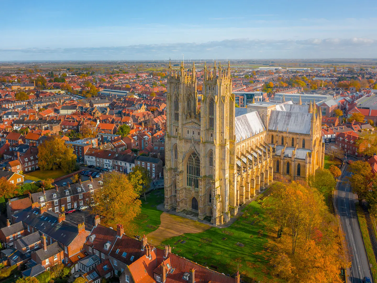
Beverley Minster: The northern finish is a large 13th-century Gothic church and one of England’s notable parish churches, despite never becoming a cathedral.
Challenges to expect
The main challenge is endurance: this is a long single-day walk rather than a hilly route, with low Wolds gradients but around a full day on foot. The opening Humber foreshore is tidal, so check tide tables before setting out. Field paths, grassy banks and woodland tracks can be muddy after rain, especially in winter. Waymarking exists, including shared Yorkshire Wolds Way signs early on, but carry a map or GPS.
HikeList Score
Beverley 20 scored 72/100 on HikeList's trail-quality metrics.
See score breakdownHide breakdown
- Ideal length 55
- Balanced challenge 42
- Scenery & wildness 85
- Varied terrain 89
- Accommodation 74
- Food & support 88
- Path quality 84
- Season flexibility 89
Computed from length, challenge, scenery & wildness, terrain variety, accommodation, food & support, path quality and season flexibility.
 United Kingdom
 England
Show more data Show less
- Coastal
- Forest
- Rural
- Dirt
- Grass
- Gravel
- Paved
- Hotels
- Guesthouses
- Family Friendly
- Pet Friendly
- Restrooms
- Water Sources
- Campsites
- Picnic Areas
Photos from hikers
Taken on the trail by people who've reviewed Beverley 20.
Reviews
How would you rate Beverley 20?
Tap a star to start your review — you could be the first.