Battle of the Bulge Trail
How would you rate Battle of the Bulge Trail?
Tap a star to share your experience and help other hikers.
Battle of the Bulge Trail: Bastogne Memorial Walk Guide
HikeList Score
Battle of the Bulge Trail scored 77/100 on HikeList's trail-quality metrics.
See score breakdownHide breakdown
- Ideal length 55
- Balanced challenge 100
- Scenery & wildness 78
- Varied terrain 71
- Accommodation 66
- Food & support 88
- Path quality 80
- Season flexibility 89
Computed from length, challenge, scenery & wildness, terrain variety, accommodation, food & support, path quality and season flexibility.
The Battle of the Bulge Trail is a waymarked WWII memorial walk near Bastogne in the Belgian Ardennes, Wallonia. Treat it as a family of routes, not one fixed trail: this guide uses the best-documented ~17 km loop from the Mardasson Memorial via Bois de la Paix and Bois Jacques. It is a 1-day, moderate walk: no serious climbs, but rolling forest, farmland, gravel and mud make it more than a stroll. It suits hikers who want a half-to-full-day route with strong Battle of the Bulge context rather than a wilderness trek.
Route Overview
Start and finish at the Mardasson Memorial and adjoining Bastogne War Museum, a few kilometres north-east of Bastogne town centre. The ~17 km memorial loop threads the Mardasson grounds, Bois de la Paix, the Bois Jacques foxholes near Foy, and quiet lanes between Ardennes farms and woods before returning to the museum area. Because “Battle of the Bulge Trail” is used for several official memorial walks, check local waymarks and the chosen map at the start: shorter options include the ~4.7 km Promenade des Fox Holes and ~3 km Mardasson loops, while the Freedom Trail / Path of Freedom is ~66–68 km over ~3 days. For other Belgian history routes, compare the Flanders Fields Trail; for longer Wallonia walking, see GR 126 (Semois & Meuse Rivers).
Battle of the Bulge history
The Battle of the Bulge ran from 16 December 1944 to 25 January 1945. It was Germany’s last major Western offensive of WWII: a surprise push through the Ardennes aimed at splitting the Allies and seizing Antwerp. Bastogne, a key road junction, was encircled and defended by the 101st Airborne, whose “Nuts!” reply to a German surrender demand became famous. The battle was the largest and bloodiest single battle fought by US forces in the war.
Notable highlights
- Mardasson Memorial (star-shaped American monument): A 12 m high memorial with 31 m sides, dedicated in 1950 to the 76,890 US soldiers killed, wounded or missing in the battle. Its parapet names the 48 then-US states, and visitors can climb it for views over the Ardennes.
- Bastogne War Museum (main interpretation point): Opened in 2014 beside the Mardasson, the museum explains the Battle of the Bulge through four characters, immersive shows and original artefacts. It makes the strongest start or finish to the walk.
- Bois Jacques foxholes (near Foy): Pine woodland where Easy Company of the 506th PIR, 101st Airborne, held the line from late December 1944 in sub-freezing cold. Their dug foxholes are still visible in the forest floor.
- Bois de la Paix / Peace Wood (commemorative planting): Planted for the battle’s 50th anniversary in 1994, with around 4,000 trees laid out in the shape of the UNICEF symbol. Some trees bear the names of US veterans, and Bastogne’s walnut tree recalls General McAuliffe’s “Nuts!” reply.
- Bastogne town centre and McAuliffe Square (siege setting): Bastogne was the encircled town defended by the 101st Airborne. McAuliffe Square keeps a Sherman tank and a memorial recalling the refusal to surrender.
Challenges to expect
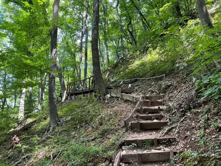
Expect rolling Ardennes terrain rather than big climbs: the challenge is length, repeated undulation and mixed surfaces. Forest paths and gravel tracks can turn muddy after rain, with some asphalt lanes through villages. Winter adds cold and possible snow on the plateau. Check waymarks carefully at the start, as several different memorial loops share the area.
HikeList Score
Battle of the Bulge Trail scored 77/100 on HikeList's trail-quality metrics.
See score breakdownHide breakdown
- Ideal length 55
- Balanced challenge 100
- Scenery & wildness 78
- Varied terrain 71
- Accommodation 66
- Food & support 88
- Path quality 80
- Season flexibility 89
Computed from length, challenge, scenery & wildness, terrain variety, accommodation, food & support, path quality and season flexibility.
 Belgium
Show more data Show less
- Forest
- Farmland
- Dirt
- Gravel
- Paved
- Hotels
- Campsites
- Family Friendly
- Pet Friendly
- Restrooms
- Water Sources
- Campsites
- Picnic Areas
Photos from hikers
Taken on the trail by people who've reviewed Battle of the Bulge Trail.
Reviews
How would you rate Battle of the Bulge Trail?
Tap a star to start your review — you could be the first.