Ashby Canal Trail
How would you rate Ashby Canal Trail?
Tap a star to share your experience and help other hikers.
Ashby Canal Trail: Flat Towpath Walking in the Midlands
HikeList Score
Ashby Canal Trail scored 71/100 on HikeList's trail-quality metrics.
See score breakdownHide breakdown
- Ideal length 59
- Balanced challenge 50
- Scenery & wildness 59
- Varied terrain 83
- Accommodation 83
- Food & support 88
- Path quality 98
- Season flexibility 100
Computed from length, challenge, scenery & wildness, terrain variety, accommodation, food & support, path quality and season flexibility.
The Ashby Canal Trail is a flat, lock-free towpath walk on the navigable Ashby-de-la-Zouch Canal in the English Midlands. It runs 35 km between Marston Junction near Bedworth and Snarestone, usually taking 1–2 days. This is an easy point-to-point walk: level canal-side walking, simple navigation and no meaningful climbing. It suits first-time long-distance walkers, wildlife-focused hikers and anyone wanting a lowland route in England without hills.
Route Overview
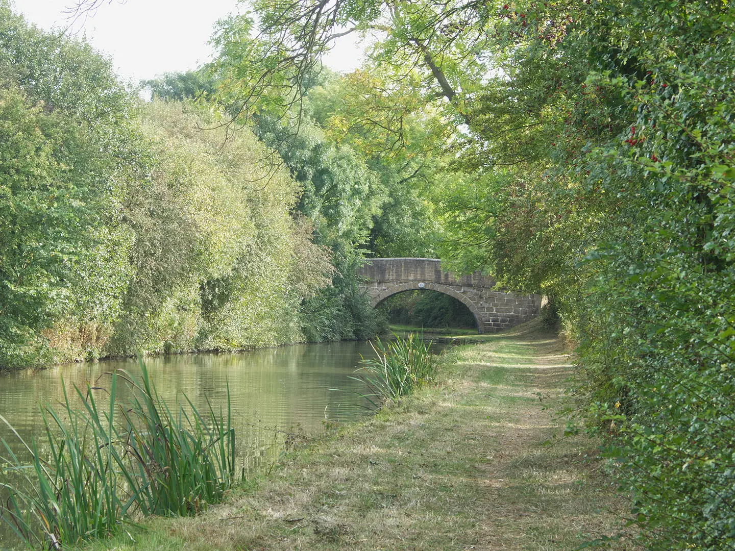
The route follows the public towpath between Marston Junction, where the Ashby Canal meets the Coventry Canal, and Snarestone Wharf, the current head of navigation beyond the short Snarestone Tunnel. Either direction works: just follow the canal. From the Bedworth end, the towpath passes Burton Hastings, skirts Hinckley, continues via Stoke Golding, Ambion Hill and Sutton Cheney near Bosworth Battlefield, then reaches Market Bosworth, Bosworth Water Park and Shackerstone before the wooded final stretch to Snarestone. This is a linear walk, but it can be broken into shorter sections using villages, buses and the Battlefield Line heritage railway. For other planning comparisons, see the Amber Valley Route or the Anglesey Coastal Path.
Ashby-de-la-Zouch Canal History
The Ashby-de-la-Zouch Canal was authorised in 1794 and opened from Marston Junction to Moira in 1804. It was built to carry coal from the Moira and Measham collieries and lime from quarries near Ashby, following a lock-free contour at about 300 ft above sea level. Mining subsidence later damaged the northern section, and the Moira–Snarestone length was progressively abandoned from 1944 to 1966. Today, the open navigable canal runs from Marston Junction to Snarestone, with restoration work continuing north of Snarestone.
Notable highlights
- Lock-free level pound (about 300 ft): The Ashby Canal has no locks, so the walking stays flat from end to end. That single-level canal profile is the main reason this is such an easy long-distance towpath route.
- Bosworth Battlefield (Ambion Hill / Sutton Cheney): The canal passes close to the site of the 1485 Battle of Bosworth, where Richard III was killed. Sutton Cheney Wharf and the battlefield heritage centre make a worthwhile detour.
- Battlefield Line Railway, Shackerstone: This preserved steam and diesel heritage railway runs between Shackerstone, Market Bosworth and Shenton. Its canal-side station is useful for shortening or returning from a linear walk.
- Market Bosworth and Bosworth Water Park: Market Bosworth is a historic Leicestershire market town close to the canal, with Bosworth Water Park nearby. It is one of the most practical mid-route stops for food, rest or accommodation.
- Snarestone Tunnel and Wharf: The short Snarestone Tunnel leads to the current head of navigation at Snarestone Wharf. This is the northern end of the 35 km navigable towpath walk.
- Canal wildlife and the SSSI: The reedy, hedge-lined waterway supports herons, kingfishers, moorhens and dragonflies. The Snarestone-to-Carlton Bridge stretch is designated as a Site of Special Scientific Interest.
Challenges to expect
The walking is easy, but the towpath is often grass, dirt or gravel and can be muddy after rain, especially in winter. There is little navigational difficulty because the route follows the canal, though road crossings and village access points need normal care. Accommodation and food are available in nearby towns and villages, but plan ahead if splitting the walk over two days. Wild camping is not appropriate on this lowland English towpath. For a very different trip, compare the Beacons Way.
HikeList Score
Ashby Canal Trail scored 71/100 on HikeList's trail-quality metrics.
See score breakdownHide breakdown
- Ideal length 59
- Balanced challenge 50
- Scenery & wildness 59
- Varied terrain 83
- Accommodation 83
- Food & support 88
- Path quality 98
- Season flexibility 100
Computed from length, challenge, scenery & wildness, terrain variety, accommodation, food & support, path quality and season flexibility.
 United Kingdom
 England
Show more data Show less
- Wetlands
- Rural
- Urban
- Dirt
- Gravel
- Grass
- Hotels
- Guesthouses
- Campsites
- Family Friendly
- Pet Friendly
- Restrooms
- Water Sources
- Campsites
- Picnic Areas
In these collections
Photos from hikers
Taken on the trail by people who've reviewed Ashby Canal Trail.
Reviews
How would you rate Ashby Canal Trail?
Tap a star to start your review — you could be the first.