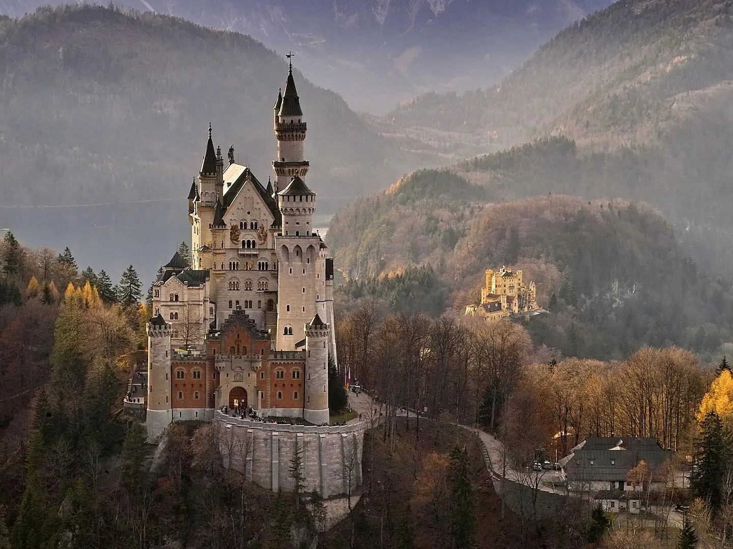
Via Claudia Augusta (Bavarian Segment)
How would you rate Via Claudia Augusta (Bavarian Segment)?
Tap a star to share your experience and help other hikers.
Via Claudia Augusta (Bavarian Segment): Roman Road Walking to the Alps
HikeList Score
Via Claudia Augusta (Bavarian Segment) scored 87/100 on HikeList's trail-quality metrics.
See score breakdownHide breakdown
- Ideal length 100
- Balanced challenge 90
- Scenery & wildness 74
- Varied terrain 100
- Accommodation 83
- Food & support 88
- Path quality 76
- Season flexibility 89
Computed from length, challenge, scenery & wildness, terrain variety, accommodation, food & support, path quality and season flexibility.
The Via Claudia Augusta Bavarian Segment is a 165 km point-to-point hike in Germany, running from Donauwörth on the Danube south along the River Lech to Füssen at the foot of the Alps. Most hikers take about 7 days. It is easy to moderate: largely flat river-valley walking to Landsberg am Lech, then gentler hills towards Forggensee and Füssen. It suits hikers who want history, frequent towns, straightforward accommodation and no high Alpine passes.
Route Overview
The route starts in Donauwörth, where the Wörnitz meets the Danube, and heads south via Harburg, Augsburg, Landsberg am Lech, Epfach, Schongau, Lechbruck am See, Roßhaupten and Forggensee to Füssen near the Austrian border. It is a linear, point-to-point trail following the line of the Roman road and often shadowing the Via Claudia Augusta cycle route. Lodging is available in towns and villages at stage ends, with hotels, Gasthöfe and pensions common. For other German long-distance routes with strong landscape variety, compare the Altmühltal Panorama Trail, Albsteig (Swabian Jura Trail) and Goldsteig.
Roman Road Across Raetia
The Via Claudia Augusta was the first Roman road across the central Alps. It was begun in 15 BC by Nero Claudius Drusus, stepson of Augustus, to improve military movement and control Raetia. Under Emperor Claudius it was completed and given paved, wheeled-vehicle status around AD 46–47. The historic road linked the Po Valley and the Adriatic, crossing the Reschen Pass to Augusta Vindelicorum — today Augsburg — and on to the Danube frontier near Mertingen and Donauwörth.
Notable highlights
- Donauwörth: A medieval former Free Imperial city in Swabia where the Wörnitz meets the Danube. It is the northern start of this Bavarian section, close to the Roman fort site at Burghöfe/Mertingen.
- Harburg Castle: A large, well-preserved medieval castle above the Wörnitz, close to the route between Donauwörth and Augsburg. It is one of the strongest historical landmarks on the early section.
- Augsburg: Roman Augusta Vindelicorum, founded around 15 BC and historically central to Raetia. Today it offers Roman museums and a UNESCO-listed historic water-management system.
- Landsberg am Lech: A well-preserved medieval town on the Lech with town gates and a stepped Renaissance/Baroque townscape. It makes a practical and attractive mid-route stop.
- Schongau: A walled medieval town in the Pfaffenwinkel region, set above the Lech. Its intact ramparts mark the transition into the hillier southern part of the walk.
- Forggensee and Füssen: Forggensee is the final lakeside approach before the Alps, with mountain views. Füssen, Bavaria’s highest town at 808 m, is the southern finish and gateway to Neuschwanstein and Hohenschwangau.
Challenges to expect
This is not a high-mountain route, but do not treat it as a casual stroll: 165 km still means repeated long walking days. Navigation can be uneven because Via Claudia Augusta markers are not present on every section, so carry a guidebook or GPS. Expect mixed surfaces — paved farm and cycle tracks, field paths, forest trails and quiet roads — plus gentle hills south of Landsberg and the main climb after Lechbruck towards Forggensee and Füssen.
HikeList Score
Via Claudia Augusta (Bavarian Segment) scored 87/100 on HikeList's trail-quality metrics.
See score breakdownHide breakdown
- Ideal length 100
- Balanced challenge 90
- Scenery & wildness 74
- Varied terrain 100
- Accommodation 83
- Food & support 88
- Path quality 76
- Season flexibility 89
Computed from length, challenge, scenery & wildness, terrain variety, accommodation, food & support, path quality and season flexibility.
 Germany
Show more data Show less
- River Valley
- Floodplain
- Forest
- Pasture
- Hilly
- Paved
- Dirt
- Field Path
- Forest Trail
- Road
- Hotels
- Guesthouses
- Pensions
- Family Friendly
- Pet Friendly
- Restrooms
- Water Sources
- Campsites
- Picnic Areas
Download Our Full Guide to Via Claudia Augusta (Bavarian Segment) FREE!
Get our comprehensive guide to this hike for free. Save it for later reading or print out at home.
Photos from hikers
Taken on the trail by people who've reviewed Via Claudia Augusta (Bavarian Segment).
Via Claudia Augusta (Bavarian Segment): The Complete Guide
 i
Image by Helmut_Kroiss
i
Image by Helmut_Kroiss The Via Claudia Augusta’s Bavarian segment is a low-altitude, history-rich walk from Donauwörth on the Danube to Füssen at the foot of the Alps. Over about 165 km, it follows the old Roman road corridor south through Bavarian Swabia, the Lech valley, the Pfaffenwinkel and the Ostallgäu.
This is not a high-mountain trek. Its appeal is steadier and more practical: frequent towns, river-valley walking, medieval centres such as Landsberg am Lech and Schongau, and a strong Roman thread running through Augsburg, the former Augusta Vindelicorum.
The route suits walkers who want a week-long journey with real cultural depth but no technical ground or Alpine passes. The final approach past Forggensee towards Füssen brings the mountains gradually into view, with Neuschwanstein and Hohenschwangau close to the finish.
What it asks for is consistency rather than specialist skill. Daily stages of roughly 22–25 km, mixed paved and gravel surfaces, and patchy hiking-specific waymarking mean good footwear, sensible pacing and independent navigation matter.
This guide covers stages, days, accommodation, food, transport, terrain and the common mistakes to avoid.
Stage-by-Stage Guide
The stages below follow the 7-day structure for the Bavarian segment from Donauwörth to Füssen. Distances are approximate, and variants around towns, cycle-route alignments and local diversions can change the day total, so carry a GPS track or the official Via Claudia Augusta mapping rather than relying on waymarks alone.
Stage 1: Donauwörth to Harburg — approx. 19 km
This is the shortest stage of the week and a useful settling-in day before the longer Lech valley sections. Donauwörth makes a practical starting point, with rail access and full town services before leaving the Danube-side start of the Bavarian segment.
The walking is low-level and non-technical, with a mix of paved tracks, quiet roads, field paths and gravel. The early route sits in gentle Bavarian Swabian countryside rather than mountain terrain, so the main considerations are hard surfaces underfoot and steady navigation through lanes and settlement edges.
The main historic focus is Donauwörth itself, a former Free Imperial city where the Wörnitz meets the Danube. The wider Roman frontier context is close by around Mertingen and Burghöfe, the site associated with Submuntorium, although walkers should treat this as a nearby historical reference point rather than expect continuous Roman-road remains underfoot.
Harburg Castle is the clear landmark of the day, standing above the Wörnitz near the end of the stage. It is one of the strongest visual highlights of the northern section and makes Harburg a more distinctive overnight halt than its size alone might suggest.
Food and water are easiest to organise in Donauwörth before setting off. Do not rely on frequent mid-stage facilities unless they have been checked in advance; carry lunch and enough water for the full walking day.
Accommodation in Harburg should be booked ahead, as the choice is more limited than in the larger route towns. Donauwörth is the safer fall-back for wider hotel, Gasthof and Pension options if the first night’s plan needs adjusting.
Donauwörth has a railway station and is the main transport anchor for the start. Public transport options at Harburg should be checked before travelling, especially if planning to shorten, skip or rejoin this first stage.
Navigation is most likely to be awkward on town exits, minor-road links and where the walking line shadows the better-signed Via Claudia Augusta cycle route. Expect patchy hiking-specific waymarking and keep the day’s route loaded offline.
Stage 2: Harburg to Rain am Lech — approx. 24 km
This stage moves the walk towards the Lech corridor, with a longer but still moderate day over low ground. It is less about steep climbing and more about maintaining a steady pace over mixed rural surfaces.
Expect a practical combination of farm tracks, gravel, paved cycleway sections, field paths and quiet roads. In wet weather, unsurfaced field and woodland stretches may be muddy, while in dry summer weather the open valley sections can feel exposed to sun despite the modest altitude.
Rain am Lech is the day’s objective and marks a clear move into the Lech valley character that defines much of the middle route. The landscape becomes broader and more river-linked, with the Lech providing the main geographical thread southwards.
Services between Harburg and Rain am Lech should not be assumed. Start with enough water and food for the day, and check current opening hours for any planned intermediate stops.
Accommodation at Rain am Lech should be arranged before arrival. It is not one of the major rail-and-accommodation hubs of the route, so availability may be tighter than in Augsburg, Landsberg am Lech or Füssen.
For public transport, check current local options before committing to this as a flexible start or finish point. Donauwörth and Augsburg are the more reliable rail hubs for wider journey planning.
Navigation needs attention where the route follows or crosses cycle-route infrastructure. The Via Claudia Augusta Radweg is often a useful orientation aid, but walkers should not assume every cycle sign marks the best walking line.
Stage 3: Rain am Lech to Augsburg — approx. 25 km
This is one of the longer days in the 7-day schedule and continues down the Lech valley towards Augsburg. The terrain remains straightforward, but the distance, hard surfaces and urban approach make it a full walking day.
The route uses broad valley terrain with paved farm and cycle tracks, gravel sections, field paths and quiet roads. Gersthofen lies on the approach to Augsburg, where the walk becomes more urban and navigation becomes more detailed.
Augsburg is one of the major historical anchors of the entire Via Claudia Augusta. Roman Augusta Vindelicorum was founded around 15 BC and later became a provincial capital of Raetia; surviving Via Claudia Augusta milestones name it as the terminus.
The city is also a major modern logistics point, with accommodation, food, rail connections and cultural sights. Its Roman collections and UNESCO-listed historic water-management system are the key reasons to allow time here rather than treating it only as a bed stop.
Food and water planning is easier on this stage than on the smaller-town days because the finish is a large city. Even so, carry enough water for the open valley walking before the urban approach, as services are not guaranteed exactly when needed.
Augsburg has extensive hotel, Gasthof and Pension options, but beds can still be busy in peak summer because the corridor is also popular with cyclists. Booking ahead is recommended, especially at weekends and during busy holiday periods.
Augsburg is one of the best public-transport access points on the route. It is a main rail hub for joining, leaving, splitting or rest-daying the Bavarian segment.
Navigation is usually most demanding on the final approach and through the city. Expect junctions, cycle paths, canals, urban streets and possible route choices; use a map or GPS track rather than relying on intermittent hiking waymarks.
Stage 4: Augsburg to Landsberg am Lech — approx. 22 km
This stage leaves Augsburg and continues south through the Lech valley towards Landsberg am Lech. It remains low-altitude and non-technical, but the day can feel harder than the elevation profile suggests because of paved surfaces and the need for careful navigation out of the city.
Königsbrunn and Untermeitingen lie on the wider route corridor south of Augsburg. The walking is generally through settled valley country, using a mixture of cycle tracks, farm tracks, quiet roads and gravel or field paths.
The Lech remains the organising feature of the day, even where the route does not sit directly on the riverbank. This is still the flatter half of the Bavarian segment before the route begins to roll more noticeably beyond Landsberg and Schongau.
Landsberg am Lech is one of the most attractive overnight stops on the route. Its walled medieval townscape, town gates and stepped Renaissance and Baroque architecture make it a strong place to finish rather than press on.
Food and water can be organised in Augsburg before departure and in Landsberg at the end. Between the two, do not plan around unverified opening hours in smaller places; carry lunch and sufficient water.
Landsberg am Lech has town-based accommodation, including hotels, Gasthöfe and Pensionen. It is a natural mid-route halt, so booking ahead is sensible during the main walking and cycling season.
Both Augsburg and Landsberg am Lech have railway stations, making this one of the easier stages to use for section hiking or rest-day planning. Current train times should still be checked before travelling.
The main navigation issue is the transition from Augsburg’s urban edge into the quieter Lech valley corridor. Watch for places where the cycle route, local paths and road links diverge, and keep the walking route available offline.
Stage 5: Landsberg am Lech to Schongau — approx. 23 km
This stage continues south from the walled town of Landsberg into the Lechrain and Pfaffenwinkel, with the route beginning to feel more gently rural and pre-Alpine. It is still not mountainous, but the landscape becomes less flat than the northern Lech valley.
The day’s walking uses mixed surfaces: paved minor roads and farm tracks, gravel, field paths and occasional forest trail. Low hills, pasture and woodland become more common as the route approaches Schongau.
Epfach and Hohenfurch lie on the route corridor between Landsberg and Schongau. They are useful orientation points, but walkers should still plan the day as a full stage rather than depend on frequent services between the main towns.
Schongau is the key highlight and overnight stop. It is a walled medieval town above the Lech, with intact ramparts, and marks the transition from the flatter valley walking into the hillier southern section.
Carry food and water from Landsberg unless specific stops have been checked in advance. Smaller villages can have limited or irregular services, particularly outside the main daytime hours.
Schongau has town-based accommodation and is one of the named stage-end hubs for the route. Booking ahead remains advisable because the Via Claudia Augusta corridor is used by both walkers and cyclists.
Schongau has a railway station, so this is a practical point for joining, leaving or dividing the route. Train times should be checked before travelling, particularly if linking with onward regional travel.
Navigation becomes a little more varied than on the broad valley stages. Expect more changes between lanes, tracks, field paths and wooded sections, with patchy hiking-specific marking and regular need to check the map.
Stage 6: Schongau to Lechbruck am See — approx. 22 km
This stage takes the route deeper into the Pfaffenwinkel and towards the Ostallgäu, with a more clearly pre-Alpine feel. The walking remains easy to moderate, but there is more rolling ground than on the northern stages.
Altenstadt and Burggen sit on the line between Schongau and Lechbruck am See. The route uses a practical mix of quiet roads, farm tracks, gravel, field paths and forest sections, with pasture and low hills becoming more characteristic.
The Lech continues to guide the route south, although the walking is now less like a flat floodplain march and more like a sequence of low hills and rural links. Views begin to open towards the Alpine edge as the route approaches Lechbruck am See.
Food and water planning should be conservative. Schongau is the reliable place to start supplied, and any intermediate stops should be checked before relying on them.
Lechbruck am See is a useful overnight halt before the final Forggensee stage. Accommodation is available in the wider town-and-village style of the route, with hotels, Gasthöfe, Pensionen and camping possibilities in the Lech and lake areas, but booking ahead is strongly advised in summer.
Public transport in this southern Ostallgäu section is more dependent on regional buses than the railway-linked central towns. Current bus times towards Lechbruck am See and nearby route points should be checked before travelling.
Navigation is important on this stage because hiking-specific waymarking is not continuous and the route can shadow cycle infrastructure. A GPS track or official map is strongly recommended, particularly through forest and farm-track junctions.
Stage 7: Lechbruck am See to Füssen — approx. 25 km
The final stage is one of the most scenic sections of the Bavarian segment, moving from Lechbruck am See towards Roßhaupten, the Forggensee shore and Füssen. It is still a low-level walk, but at roughly 25 km it is a substantial final day.
The terrain is rolling Ostallgäu countryside with paved and gravel tracks, quiet roads, field paths and lakeside sections. The route approaches its highest sustained ground at Füssen, Bavaria’s highest town at 808 m, but there is no high Alpine pass or technical mountain walking.
Roßhaupten, Dietringen and the Forggensee shore are the main waypoints. The stretch near Forggensee is one of the places where the route sits close to the line of the original Roman road, and a replica Roman milestone near Dietringen reinforces the Via Claudia Augusta theme.
Forggensee is the major scenic feature of the final day. The shoreline gives broad views towards the Alps, making the approach to Füssen feel very different from the flatter Lech valley stages further north.
Food and water should be planned carefully despite the popularity of the lake area. Use Lechbruck am See for supplies before starting, and check any intended stops around Roßhaupten, Dietringen or Forggensee before relying on them.
Füssen has a wide range of town accommodation and is the strongest overnight base at the southern end of the Bavarian segment. It is also the gateway town for Neuschwanstein and Hohenschwangau, so beds can be busy in peak holiday periods and should be booked ahead.
Füssen has a railway station with direct regional train links to Augsburg and München (Munich). Regional buses also serve parts of the Ostallgäu, including areas towards Roßhaupten and Schwangau, but current times should be checked before travelling.
The key seasonal issue is Forggensee. It is a reservoir and is partly drawn down outside summer, so water-level and shore-path conditions should be checked before relying on a specific lakeside line; the boat-shuttle season, if being used to adapt the day, should also be checked before travelling.
Navigation around the lake can involve choices between lakeside paths, roads, cycle-route sections and local links into Füssen. Keep the route available offline and allow enough time for the final urban approach, especially if connecting with an onward train the same day.
Recommended Itinerary
Standard 7-day itinerary
This is the most balanced way to walk the Bavarian segment: seven steady days, generally around 22–25 km, with overnight stops in practical towns rather than isolated rural points. Distances are approximate and should be checked against official mapping before booking, especially where the walking line differs from the better-signed cycle route.
| Day | From | To | Approx. distance | Why this stage makes sense | Services/accommodation notes |
|---|---|---|---|---|---|
| 1 | Donauwörth | Harburg | 19 km | A manageable first day from the Danube/Wörnitz confluence, keeping the opening stage shorter while walkers settle into the route and navigation. Harburg also gives access to Schloss Harburg, one of the major early landmarks. | Donauwörth is a strong start point with rail access. Harburg is a smaller overnight stop; book ahead rather than assuming late availability. |
| 2 | Harburg | Rain am Lech | 24 km | This stage moves the route towards the Lech corridor and keeps the itinerary aligned with the north–south Roman-road line. It is a full but realistic day on mostly gentle terrain. | Rain am Lech is a practical town stop, but accommodation should still be reserved in advance, particularly in summer when cycle-route traffic increases demand. |
| 3 | Rain am Lech | Augsburg | 25 km | A longer day, but the reward is finishing in Augsburg, the most important city on the Bavarian section and a major historical anchor of the Via Claudia Augusta. | Augsburg has the best range of services on the route: hotels, Gasthöfe, Pensionen, restaurants, shops and rail connections. It is the best place for a rest night if needed. |
| 4 | Augsburg | Landsberg am Lech | 22 km | This stage continues up the Lech valley to another strong town stop, avoiding a vague rural overnight and keeping logistics simple. Landsberg am Lech is a natural mid-route base. | Landsberg am Lech has good town-based accommodation and rail access. Book ahead in peak season. |
| 5 | Landsberg am Lech | Schongau | 23 km | The route leaves the flatter Lech-valley character and approaches the Pfaffenwinkel, with Schongau marking the transition into hillier pre-Alpine country. | Schongau is one of the key overnight towns on the southern half, with accommodation and rail access. It is a sensible resupply point before the quieter Ostallgäu stages. |
| 6 | Schongau | Lechbruck am See | 22 km | A well-proportioned day through the gentler southern countryside, keeping the next day into Füssen possible without overloading it. | Lechbruck am See is a useful overnight hub before the Forggensee approach. Accommodation can be busy in summer; reserve ahead. |
| 7 | Lechbruck am See | Füssen | 25 km | The final stage follows the pre-Alpine line towards Roßhaupten, Forggensee and Füssen, with the Alpine backdrop building towards the finish. This is the longest-feeling day for some walkers because it comes at the end of the route. | Füssen has extensive town services, accommodation and rail departures towards Augsburg and München (Munich). If using the Forggensee shore or boat options, check current water-level, shore-path and boat-season information before travelling. |
Slower variant: 8–9 walking days
A slower itinerary suits walkers who prefer shorter days, want more time in Augsburg, Landsberg am Lech or Füssen, or are carrying heavier packs. It is also the better choice for families, mixed-ability groups and anyone relying on shorter daylight windows in spring or autumn.
The simplest slower plan is to add one rest or short day at Augsburg or Landsberg am Lech. Both are strong service towns and rail-connected, so they are easy places to pause without complicating transport.
For a walking-day split, use the intermediate towns and villages already on the corridor — for example Gersthofen, Königsbrunn, Untermeitingen, Epfach, Hohenfurch, Altenstadt, Burggen, Roßhaupten or the Forggensee shore around Dietringen — but do not book from names alone. Check official mapping before booking, because hiking-specific waymarking is patchy and the walking line may not match the cycle-route distance exactly.
Faster variant: 6 walking days
A 6-day crossing is possible only for fit walkers who are comfortable with repeated long days, efficient navigation and limited time for sightseeing. It is less attractive if the aim is to enjoy Augsburg, Landsberg am Lech, Schongau and the Forggensee approach properly.
The practical way to compress the route is to use the rail-served towns as anchors — Donauwörth, Augsburg, Landsberg am Lech, Schongau and Füssen — and accept that some days will be longer than the standard 22–25 km pattern. Exact stage lengths should be checked on official mapping before booking accommodation.
For most independent walkers, the 7-day version is the better balance: long enough to feel like a through-hike, but still built around reliable towns, frequent services and manageable daily distances.
Planning the Route
How many days to allow
Most walkers should plan on 7 walking days for the Bavarian segment, with daily distances generally in the 22–25 km range. This is realistic for a fit, steady walker, but it leaves limited time for museums, Roman sites, long lunches or weather delays.
An 8–9 day itinerary is often more comfortable if the aim is to enjoy Augsburg, Landsberg am Lech, Schongau, Forggensee and Füssen rather than simply move from bed to bed. The route is not technically hard, but repeated long days on mixed paved, gravel and cycle-path surfaces can be tiring.
Walking it quickly is possible because the terrain is low and non-technical. Walking it slowly suits the character of the route better: the main interest is the Roman road corridor, medieval towns, the Lech valley and the gradual change from Bavarian Swabia into the pre-Alpine Ostallgäu.
Stage planning and overnight stops
The route is best planned around towns and larger villages, not wild or remote overnight points. Accommodation is typically in hotels, Gasthöfe and Pensionen, with campsites also available along the Lech and around Forggensee.
The main practical overnight hubs are:
| Route section | Useful planning hubs |
|---|---|
| Northern section | Donauwörth, Harburg, Rain am Lech |
| Lech valley / city section | Augsburg, Königsbrunn, Untermeitingen, Landsberg am Lech |
| Pfaffenwinkel / Lechrain | Epfach, Hohenfurch, Schongau, Altenstadt, Burggen |
| Ostallgäu / Forggensee | Lechbruck am See, Roßhaupten, Dietringen, Füssen |
Beds can be busy in peak summer because the Via Claudia Augusta is also a popular cycle route. Book accommodation ahead, especially in smaller places where there may be fewer options than in Augsburg, Landsberg am Lech or Füssen.
When building an itinerary, calculate each day from the exact map or GPS track being used. The walking route shadows the Via Claudia Augusta cycle route, and small variations between walking line, cycle line and accommodation location can change the practical day length.
Shortening, extending and rest days
The easiest places to shorten the route are the towns with railway stations: Donauwörth, Augsburg, Landsberg am Lech, Schongau and Füssen. These make the route practical for a long weekend section, a half-route, or a staged completion over several trips.
Augsburg is the most obvious place for a rest day because of its Roman history and historic water-management system. Landsberg am Lech and Schongau also work well for shorter days or overnight pauses before the route becomes hillier towards the Ostallgäu.
The natural extension is to continue beyond Füssen towards the Tyrolean section of the Via Claudia Augusta, in the direction of the Fern and Reschen passes. That should be planned as a separate onward journey, as the Bavarian segment ends before the high Alpine crossings begin.
Füssen also lends itself to an extra day for nearby Neuschwanstein and Hohenschwangau. Treat that as an add-on rather than part of the walking mileage.
Section hiking
Section hiking is very practical on this route. The rail network supports access at several points, and regional buses fill some of the gaps in the southern Ostallgäu, including around Lechbruck am See, Roßhaupten and Schwangau.
Good section breaks include:
- Donauwörth to Augsburg — the northern Bavarian Swabia and Lech-valley approach.
- Augsburg to Landsberg am Lech — a strong middle section with frequent settlement.
- Landsberg am Lech to Füssen — the hillier Pfaffenwinkel and Ostallgäu finish, including Forggensee.
Current train and bus times should be checked before travelling, especially for the Ostallgäu stages where buses are more important than on the rail-served sections.
What matters most in planning
Accommodation is the main booking issue. This is a town-based walk, but the smaller overnight stops do not have the depth of accommodation found in larger cities, and cyclist demand can tighten availability in summer.
Navigation needs more attention than the terrain suggests. Hiking-specific waymarking is not continuous, so carry a reliable map, guidebook or GPS track. The official Via Claudia Augusta mapping is a useful planning resource, but do not rely on waymarks alone.
Food and water are generally manageable because the route passes frequent towns and villages. Still, carry enough for the full day between planned stops, particularly on longer stages and on Sundays or public holidays when services may be more limited. This should be checked before travelling.
Transport is strong by long-distance walking standards. Donauwörth, Augsburg, Landsberg am Lech, Schongau and Füssen have railway stations; Füssen has direct regional trains to Augsburg and München (Munich). Use the rail-served towns to build flexibility into the itinerary.
Weather is usually a planning detail rather than a major hazard on this low-altitude route. The best season is roughly April/May to October, with summer often pleasant for walking, but hot paved sections and wet days can still affect pace and comfort.
Forggensee needs one extra check outside the main summer season. It is a reservoir and can be partly drawn down outside summer, so any shore-path notes, water-level information and the seasonal boat shuttle should be checked before relying on them. Boats run roughly from early June to mid-October, but current operating dates should be checked before travelling.
Permit planning is not a defining feature of this route. Time is better spent securing beds, checking onward transport, downloading navigation and making sure the chosen itinerary matches the actual walking line.
Towns, Villages and Overnight Stops
Accommodation on this segment is mostly town-based: hotels, Gasthöfe and Pensionen in the main stage towns, with campsites also available along the Lech and around Forggensee. Because the route shadows the popular Via Claudia Augusta cycle route, book ahead in peak summer rather than assuming same-day beds will be available.
The most straightforward 7-day overnight chain is Donauwörth, Harburg, Rain am Lech, Augsburg, Landsberg am Lech, Schongau, Lechbruck am See and Füssen. Roßhaupten is also a useful southern stop if splitting the final approach to Füssen or adjusting around Forggensee conditions.
Donauwörth
Donauwörth is the northern start of the Bavarian segment, where the Wörnitz meets the Danube. It is the best place to arrive the day before starting if you want a low-stress first morning and time to sort food, cash and navigation.
Accommodation is part of the normal town-based pattern on this route, with hotels, Gasthöfe and Pensionen. As a sizeable town and rail point, it is also one of the easier places to handle last-minute route admin.
Transport is strong: Donauwörth has a railway station on the Augsburg–Nürnberg/Treuchtlingen line. It is also close to the Roman frontier context of Submuntorium at Burghöfe near Mertingen, although that is a history stop rather than essential walking logistics.
Mertingen / Burghöfe
Mertingen and Burghöfe sit near the northern part of the route corridor, close to the Roman fort site of Submuntorium. This is mainly relevant for walkers interested in the Roman-road story at the Danube frontier.
Do not treat this as a guaranteed overnight unless accommodation has been booked in advance. Services and local transport should be checked before travelling, especially if planning a detour from the main walking line.
Harburg
Harburg is the first typical overnight stop in the 7-day schedule, after the stage from Donauwörth. It is useful because it breaks the opening section before the route continues towards the Lech valley.
The main reason to pause here is practical as well as historic: Harburg Castle stands above the Wörnitz close to the route. Accommodation should be arranged ahead, as Harburg is a smaller stop than Donauwörth or Augsburg.
Transport options are not a core strength of this itinerary compared with the main rail towns. If using Harburg as a join, leave or rest point, current local transport should be checked before travelling.
Rain am Lech
Rain am Lech is the standard second-night stop between Harburg and Augsburg. It places the route firmly into the Lech corridor and keeps the next day into Augsburg to a manageable full walking day.
As a town stop, Rain am Lech is a sensible place to plan an evening meal and basic resupply rather than relying on smaller places along the way. Accommodation should still be booked ahead in summer, especially because cycle-route traffic can increase demand.
No specific rail link is needed for the main 7-day itinerary here. If using Rain am Lech for section-hiking or a mid-route exit, check current regional transport before committing to a plan.
Gersthofen
Gersthofen lies on the northern approach to Augsburg. For most walkers it is more useful as a practical suburban break before the city than as a planned overnight on the standard schedule.
It can help if the Rain am Lech to Augsburg day needs shortening, but accommodation and onward transport should be checked before travelling. Augsburg remains the stronger overnight and transport choice immediately to the south.
Augsburg
Augsburg is one of the key overnight stops on the Bavarian Via Claudia Augusta. It is the strongest service centre on the route and a natural place for a rest evening, replacement gear, laundry, pharmacy stops and reliable food options.
Accommodation is plentiful by route standards, with hotels, Gasthöfe and Pensionen in the wider town-based pattern. It is still worth booking ahead, particularly in summer and at weekends.
Transport is excellent: Augsburg is one of the main rail hubs for this route. It also anchors the Roman history of the trail as Augusta Vindelicorum, with Roman collections and the UNESCO-listed historic water-management system adding good reasons to allow extra time.
Königsbrunn
Königsbrunn sits south of Augsburg on the long onward stage towards Landsberg am Lech. It is mainly a useful intermediate service point rather than a headline overnight for the full 7-day itinerary.
Walkers splitting the Augsburg to Landsberg am Lech section may look at Königsbrunn, but accommodation and public-transport connections should be checked before travelling. If walking the standard schedule, Augsburg and Landsberg are the more robust overnight anchors.
Untermeitingen
Untermeitingen is another intermediate place on the Augsburg to Landsberg am Lech stretch. It can be useful for staging flexibility if the day needs shortening or if accommodation elsewhere is full.
Do not rely on it without a booking and a transport plan. This part of the route is still relatively low and straightforward underfoot, but the distance between major overnight centres makes advance planning important.
Landsberg am Lech
Landsberg am Lech is one of the best overnight stops on the route and a natural mid-route reset. It sits on the Lech and marks the transition from the broad Lech-valley walking into the more varied Lechrain, Pfaffenwinkel and Ostallgäu stages to the south.
Accommodation is part of the main town-based network, with hotels, Gasthöfe and Pensionen. It is a good place to restock, eat properly and deal with any kit issues before the hillier southern half.
Landsberg am Lech has a railway station, making it one of the better places to start, finish or break a section hike. The walled medieval townscape and river setting also make it one of the most rewarding non-rushed stops.
Epfach
Epfach is an intermediate place between Landsberg am Lech and Schongau. For most walkers it is a daytime waypoint rather than a primary overnight.
It can be useful if splitting the Landsberg to Schongau stage, but smaller-place logistics apply: accommodation, evening food and local transport should be checked before travelling. Carry enough food and water not to depend on every village having open services when you arrive.
Hohenfurch
Hohenfurch lies on the approach to Schongau. It is relevant mainly as a staging point if the Landsberg am Lech to Schongau day is being shortened.
Schongau is the stronger planned overnight because it has the clearest role in the itinerary and sits at the edge of the hillier pre-Alpine section. Use Hohenfurch only with confirmed accommodation or a clear onward transport plan.
Schongau
Schongau is a key overnight stop above the Lech and marks a real change in feel on the route. From here the walk leaves the flatter Lech-valley character behind and heads into the gentler hills, forest and pasture of the Pfaffenwinkel and Ostallgäu.
Accommodation is part of the main town-based pattern, with hotels, Gasthöfe and Pensionen. It is a sensible place to resupply before the smaller villages and lake-country stages to the south.
Schongau has a railway station, so it works well for section-hikers and for anyone needing a mid-route exit. The intact ramparts and medieval town centre are worth allowing time for, but the main planning value is its position before the more rural southern days.
Altenstadt
Altenstadt sits just south of Schongau on the route towards Lechbruck am See. It is best treated as an early-stage village stop rather than a planned overnight for most walkers.
If using Altenstadt to split the Schongau to Lechbruck am See day, check accommodation and food options before booking the surrounding stages. Schongau and Lechbruck am See are the more dependable itinerary anchors.
Burggen
Burggen is an intermediate village between Schongau and Lechbruck am See. It may be useful for pacing the day, but it is not one of the main overnight hubs in the standard schedule.
As with other smaller southern villages, do not assume late-opening food or easy onward transport. This should be checked before travelling if Burggen is part of a shorter-stage plan.
Lechbruck am See
Lechbruck am See is the standard overnight before the final stage to Füssen. It sits in the pre-Alpine southern section and is a useful base before the route continues towards Roßhaupten, Forggensee and Füssen.
Accommodation is specifically part of the route’s town-and-village pattern, with hotels, Gasthöfe and Pensionen. Campsites are also available along the Lech and around Forggensee, making this part of the route more flexible for walkers carrying camping gear.
Regional buses fill some of the southern Ostallgäu gaps, including towards Lechbruck am See, but timetables should be checked before travelling. Book ahead in summer, when cycle-route users and lake visitors increase pressure on beds.
Roßhaupten
Roßhaupten is a useful southern overnight or stage-adjustment point near the Forggensee section. It is especially helpful if the Lechbruck am See to Füssen day feels too long, or if weather, lake-shore conditions or accommodation availability make a shorter final day preferable.
Accommodation is part of the recognised town-and-village network on this route. It also has regional bus relevance in the Ostallgäu, but current services should be checked before travelling.
Roßhaupten works well for walkers who want more time on the Forggensee approach rather than treating the final day as a straight push to Füssen. It is one of the better places to build flexibility into the southern itinerary.
Dietringen
Dietringen sits by the Forggensee shore on the final approach. It is notable for the replica Roman milestone near the lake, making it a worthwhile historical pause on the southern stage.
Treat Dietringen primarily as a route feature rather than a guaranteed overnight or resupply point. If planning to stop here, accommodation, food and transport should be checked before travelling.
Forggensee
Forggensee is not a town, but it is one of the most important logistical features of the final stage. The route follows the lake shore with views opening towards the Alps, and campsites are available around the lake.
Forggensee is a reservoir, and its water level is partly drawn down outside summer. Shore-path conditions and any relevant route notes should be checked before relying on the lakeside line outside the main season.
A boat shuttle can be combined with the shore stage in season, roughly from early June to mid-October. Timetables and operating dates should be checked before travelling, and the boat should be treated as an optional aid rather than a substitute for a walkable plan.
Füssen
Füssen is the southern finish of the Bavarian segment and the strongest endpoint for accommodation, food and onward travel. It is Bavaria’s highest town at 808 m and sits at the foot of the Alps near the Austrian border.
Accommodation is widely available by route standards, with hotels, Gasthöfe and Pensionen, but demand can be high because Füssen is also the gateway to Neuschwanstein and Hohenschwangau. Book ahead if finishing in peak summer or at weekends.
Transport is straightforward: Füssen has a railway station with direct regional trains to Augsburg and München (Munich). It is the natural place to end the walk, add a rest night, or continue into the Tyrolean section towards the Fern and Reschen passes.
Getting to the Start
By train
Donauwörth is the practical starting point for the Bavarian segment. It has a railway station and sits on the Augsburg–Nürnberg/Treuchtlingen line, making rail the simplest way to reach the trailhead.
Augsburg and München (Munich) are the main rail hubs for most walkers. From either, route to Donauwörth by regional or long-distance rail as available on the day; current connections and ticket conditions should be checked before travelling.
The trail is point-to-point, so arriving by train is usually easier than leaving a car at the start. The finish at Füssen also has a station, with direct regional trains to Augsburg and München (Munich), which makes a rail-based itinerary practical at both ends.
By bus
Bus is not the main access method for Donauwörth. Use the train where possible, then walk or take a local taxi from the station to accommodation or the chosen start point in town.
Regional buses are more useful later in the route, especially in parts of the southern Ostallgäu around places such as Lechbruck am See, Roßhaupten and Schwangau. They are less relevant for reaching the northern start, and any local bus option into Donauwörth or nearby villages should be checked against current timetables before travelling.
By car
Driving to Donauwörth is possible, but it creates a return-logistics problem because the route finishes 165 km south in Füssen. If using a car, the simplest plan is usually to park in Donauwörth, complete the walk, then return from Füssen by train via Augsburg or München (Munich) and continue back to Donauwörth by rail.
Long-stay parking rules, charges and maximum stay limits in Donauwörth should be checked before leaving a vehicle for a week. Hotel parking may be possible if staying in Donauwörth the night before, but this must be agreed directly with the accommodation.
A taxi can be useful for short local transfers at the start, for example between Donauwörth station, accommodation and the exact starting point. It is not a realistic substitute for the long end-to-start transfer from Füssen unless arranged privately at significant cost.
From the nearest airport
For international arrivals, the most practical approach is to travel first to a major rail hub such as München (Munich) or Augsburg, then continue by train to Donauwörth. Airport-to-rail connections, journey times and late-evening arrivals should be checked before booking onward accommodation.
If arriving late in the day, plan to sleep in Donauwörth rather than trying to start walking immediately. The first stage is a full walking day, and beginning tired or after a delayed flight is a poor trade-off on a week-long point-to-point route.
Where to stay before starting
Donauwörth is the best place to stay before starting. It has the services expected of a historic Bavarian town and avoids the need for a morning transfer before the first walking stage.
Look for hotels, Gasthöfe or Pensionen close to the station or central Donauwörth, depending on whether rail convenience or an easy start from the old town matters more. Beds can be busy in peak summer because the Via Claudia Augusta corridor is also popular with cyclists, so book ahead rather than relying on same-day availability.
The Roman fort site area at Burghöfe near Mertingen is historically relevant to the Danube frontier, but Donauwörth remains the normal and most convenient start for this Bavarian walking segment.
Getting Home from the Finish
By train
Füssen has a railway station and is the easiest place to leave the Bavarian segment by public transport. Direct regional trains run from Füssen to Augsburg and München (Munich), making both cities practical onward rail hubs after the walk.
For a return to the start, take the train from Füssen towards Augsburg, then continue to Donauwörth on the Augsburg–Nürnberg/Treuchtlingen line. Exact connections, last trains and any engineering changes should be checked before travelling, especially if finishing late in the day.
If the final stage into Füssen runs long, do not assume there will be a convenient late onward connection. Füssen is a sensible overnight stop rather than a place to rush away from after a 25 km final day.
By bus
Regional buses cover parts of the southern Ostallgäu, including connections around Lechbruck am See, Roßhaupten and Schwangau. They are useful if shortening the final stage, diverting towards the castle area, or linking back from villages around Forggensee.
Bus usefulness depends heavily on the day of the week and season. Timetables should be checked before travelling, and a Sunday or public-holiday finish needs particular care.
By car/taxi
Because this is a point-to-point route from Donauwörth to Füssen, leaving a car at the finish usually means arranging a rail return to the start or using a taxi for local transfers only. Füssen is well placed for taxis to nearby accommodation, Schwangau or the Forggensee area, but a long taxi transfer back up the route would be expensive and should be pre-arranged if needed.
If driving logistics matter, the cleanest plan is usually to park at or near a rail-served town and use trains at one end of the trip. Donauwörth, Augsburg, Landsberg am Lech, Schongau and Füssen all have stations, which gives useful options for section-hiking as well as the full route.
From the nearest airport
For international departures, München (Munich) is the practical airport gateway because Füssen has direct regional rail links to München. Allow a generous margin between the train journey from Füssen and any flight, as regional services and airport connections are timetable-dependent.
Augsburg is also an important rail hub on the route, but for flights most walkers will route via München. Current train times and airport transfer details should be checked before booking fixed onward travel.
Where to stay at the finish
Füssen is one of the best places on the route to spend a final night. It has town-based accommodation, including hotels, Gasthöfe and Pensionen, and it avoids the risk of missing onward trains after the last walking day.
Booking ahead is wise in peak summer, partly because Füssen is also the gateway to Neuschwanstein and Hohenschwangau. If planning to visit the castles or recover after the full 165 km, staying overnight in Füssen is usually more practical than travelling on immediately.
Which Direction Should You Walk?
Standard direction: Donauwörth to Füssen
The natural direction for the Bavarian segment is southbound, from Donauwörth to Füssen. This follows the way the route is usually presented on this page: starting at the Danube frontier area and walking up the Lech corridor towards the foot of the Alps.
Southbound also gives the best scenic build-up. The opening days are comparatively flat through the Wörnitz and Lech lowlands, then the route passes Augsburg and Landsberg am Lech before becoming hillier through the Pfaffenwinkel and Ostallgäu. The final approach along Forggensee, with the Alps ahead and Füssen as the finish, is the strongest ending.
Transport also works well this way. Donauwörth is straightforward to reach by train, while Füssen has regional rail connections back towards Augsburg and München (Munich). This makes it practical to travel to the start, walk the route, then leave from the more southerly finish without needing to return to Donauwörth.
Reverse direction: Füssen to Donauwörth
Walking northbound is perfectly feasible. The route has no technical ground and no high Alpine pass, so there is no major safety reason to prefer one direction over the other.
The main advantage of the reverse direction is that it is very slightly easier in elevation terms. Füssen is the highest sustained point of the Bavarian segment at around 808 m, so walking north generally trends downhill towards the Lech valley and the Danube side. In practice, the difference is modest: total ascent is only about 1,100 m across the whole route, and the climbs are generally gentle rather than decisive.
The trade-off is the sense of progression. Northbound walkers begin with the most Alpine-feeling scenery around Füssen, Forggensee and the Ostallgäu, then finish in the lower, flatter country around Donauwörth. That may suit section-hikers or anyone connecting from the Tyrolean section, but it is a less satisfying direction if the aim is a clear journey towards the mountains.
Accommodation and logistics in either direction
Accommodation works in both directions because the route is town-based, with regular overnight options in places such as Donauwörth, Augsburg, Landsberg am Lech, Schongau, Lechbruck am See and Füssen. The main issue is not direction but availability: this corridor also shadows a popular cycle route, so hotels, Gasthöfe and Pensionen can fill in peak summer.
Book the key stage towns in sequence before committing to travel, especially at weekends and during holiday periods. If walking in reverse, secure Füssen accommodation first, as it is also a busy visitor base for Neuschwanstein and Hohenschwangau.
Navigation demands are similar both ways. Hiking-specific waymarking is not continuous, so carry a reliable map, guidebook or GPS track whether walking southbound or northbound.
Weather and walking comfort
There is no route-specific wind or weather advantage strong enough to determine direction. The Bavarian segment is low-altitude and generally suitable from spring to autumn, with summer often pleasant, but daily conditions matter more than the compass direction.
Check the forecast before each stage and take particular care with heat and sun exposure on open valley, farm-track and lakeside sections. Outside summer, also check any current Forggensee shore-path or water-level notes before relying on the lakeside approach.
Recommendation
For most walkers, the best direction is Donauwörth to Füssen. It gives the clearest historical and landscape progression, starts with easier lowland walking, builds gradually into the pre-Alpine hills, and finishes strongly at Füssen beneath the Alps.
Walk Füssen to Donauwörth only if accommodation, onward travel or a northbound connection from Tyrol makes it more convenient, or if a slight overall downhill trend is more important than the scenic build-up.
Accommodation Along the Route
The Via Claudia Augusta Bavarian segment works well as an inn-to-inn walk. It is a lowland, town-based route rather than a remote trail, with hotels, Gasthöfe and Pensionen in the main stage towns and larger villages.
The strongest accommodation bases are Donauwörth, Augsburg, Landsberg am Lech, Schongau, Lechbruck am See, Roßhaupten and Füssen. These are the most sensible places to build an itinerary around, especially if walking the route in roughly seven days.
Booking ahead is strongly recommended in peak summer. The route shadows the popular Via Claudia Augusta cycle route, so beds in smaller towns and villages can be taken by cyclists as well as walkers, particularly at weekends and during holiday periods.
Best overnight stops
| Place | Accommodation level | Best for | Notes |
|---|---|---|---|
| Donauwörth | Good | Start-night accommodation | Practical northern base with rail access and enough town services for arriving, eating and preparing before the first walking day. |
| Harburg | Limited | Breaking the first section | Used as a natural first-stage stop in the 7-day itinerary. Availability should be checked before committing to this stop. |
| Rain am Lech | Limited | Overnight between Harburg/Donauwörth and Augsburg | A useful Lech-valley stop before the longer approach towards Augsburg. Book ahead rather than assuming late availability. |
| Augsburg | Good | Major rest stop, resupply and flexible overnight | One of the strongest accommodation points on the route, with the best urban choice and excellent transport options. A sensible place for a rest night if walking at a more relaxed pace. |
| Landsberg am Lech | Good | Mid-route overnight and possible rest stop | A strong and attractive overnight base on the Lech, well placed between Augsburg and the Pfaffenwinkel section. Rail access also makes it useful for section walkers. |
| Schongau | Good | Transition into the hillier southern section | A practical overnight before the route moves into the pre-Alpine Ostallgäu. Accommodation should still be booked ahead in busy periods. |
| Lechbruck am See | Good | Final southern approach and lake-country stop | A key overnight on the route towards Forggensee and Füssen, with campsites also available in the broader Lech/Forggensee area. |
| Roßhaupten | Good | Alternative or additional stop before Füssen | Useful if splitting the final approach around Forggensee into shorter days. Particularly relevant for walkers wanting more time on the lakeside section. |
| Füssen | Good | Finish-night accommodation | Strongest southern base, with rail connections and plenty of demand from walkers, cyclists and castle visitors. Book early in peak season. |
Where choice is strongest
Augsburg, Landsberg am Lech and Füssen are the most forgiving places for accommodation planning. They are larger, better connected and more suitable for a rest day, late arrival or itinerary change.
Donauwörth is also a sensible place to stay the night before starting. Schongau and Lechbruck am See are important because they anchor the southern half, where stages are less easily rearranged without changing daily distances.
Where accommodation needs more care
Harburg and Rain am Lech are useful stage stops, but should not be treated as flexible turn-up-and-find-a-bed places. Check availability before fixing daily distances around them.
The same applies if inserting extra nights in smaller villages between Landsberg am Lech, Schongau, Lechbruck am See and Roßhaupten. The route passes frequent settlements, but not every village should be assumed to have suitable walker accommodation.
Camping and budget options
Campsites are available along the Lech and around Forggensee, so camping can work for some itineraries. It should be planned carefully, as campsites will not necessarily fall exactly at the end of each standard walking stage.
Do not assume a continuous campsite-to-campsite version of the route without checking current pitch availability, opening dates and exact locations. This is especially important around Forggensee outside the main summer season.
Luggage transfer, taxis and awkward gaps
The route is well suited to walkers using luggage transfer if booked through a walking-holiday arrangement or agreed directly with accommodation providers. A route-wide baggage service should not be assumed unless arranged in advance.
Taxi transfers can help if a preferred overnight stop is full or if a walker needs to shorten a stage, but local availability and prices should be checked before relying on this. In practice, rail access at Donauwörth, Augsburg, Landsberg am Lech, Schongau and Füssen gives the route good fallback options for section walkers.
In the southern Ostallgäu, regional buses help fill some of the gaps around places such as Lechbruck, Roßhaupten and Schwangau. Current bus times should be checked before travelling, especially at weekends and outside the main holiday season.
Booking strategy
For a straightforward 7-day inn-to-inn itinerary, book every night before starting. Prioritise the smaller stops first, then fill in the larger towns.
A sensible order is to secure Harburg, Rain am Lech, Lechbruck am See and any Roßhaupten/Forggensee-area night before finalising the easier urban stops. Füssen should also be booked early in summer because it is a major visitor base for Neuschwanstein and Hohenschwangau as well as the end of the route.
Camping and Wild Camping
Camping is possible on this route, but it is not the default way most walkers complete the Bavarian Via Claudia Augusta. The route is strongly town-based, with hotels, Gasthöfe and Pensionen in the main stage towns, while campsites are available along the Lech and around Forggensee.
Because the route shadows a popular cycle corridor, camping pitches can be busy in peak summer. Do not assume that a campsite will have space for a late-arriving walker without checking ahead, especially around the Lech valley holiday areas and the Forggensee/Füssen end of the route.
Where camping works best
The most practical camping sections are the river and lake stretches, rather than the urban sections. The Lech valley offers the best chance of finding campsites on or near the route corridor, and the southern section around Lechbruck am See, Roßhaupten, Forggensee and Füssen is the strongest area for a camping-based finish.
| Route section | Camping practicality |
|---|---|
| Donauwörth to Rain am Lech | Possible only with advance planning; do not rely on informal camping between villages. |
| Rain am Lech to Augsburg | Less attractive for camping because the route approaches a major urban area. Accommodation planning is usually simpler here. |
| Augsburg to Landsberg am Lech | Possible to plan around the Lech corridor, but check campsite locations and opening dates before committing to a long walking day. |
| Landsberg am Lech to Schongau | More rural and better suited to a camping itinerary if a suitable campsite fits the day’s distance. |
| Schongau to Lechbruck am See | One of the more practical camping stretches, with the route moving into the Pfaffenwinkel/Ostallgäu countryside. |
| Lechbruck am See to Füssen via Roßhaupten and Forggensee | The best camping area on the route, with campsites around Forggensee and strong end-of-route services at Füssen. |
Camping adds weight to a route where the main difficulty is cumulative distance rather than terrain. With typical walking days around 22–25 km, a lighter town-to-town set-up will suit many hikers better than carrying a full tent, sleep system and cooking kit.
Wild camping
Do not plan this route around wild camping. The Bavarian segment crosses a settled, lowland and pre-Alpine landscape of towns, villages, farmland, forest, lakeshore and private land, not remote open country where discreet overnight camping can be assumed.
Rules for sleeping outside vary by land status, municipality and landowner permission. This should be checked locally before travelling, and explicit permission should be obtained where required. If there is any doubt, use an official campsite or booked accommodation.
Forggensee and the Lech corridor are especially poor places to improvise a camp. They are visible, well-used recreational areas with paths, shore access, private land and managed visitor infrastructure. Around Forggensee, also check current water-level and shore-path conditions outside summer, as the lake is a reservoir and is partly drawn down outside the main season.
Water and cooking
The route follows the Lech for much of its length and finishes along Forggensee, but river and lake water should not be treated as a reliable drinking source. Use taps, shops, cafés, accommodation and official campsite facilities to refill.
Carry enough water between settlements, particularly on warm summer days and on longer stages where services may not sit exactly where a walker needs them. The route is not remote, but a 22–25 km day can still leave long gaps if cafés or shops are closed.
Use camping stoves only where they are permitted by the campsite or land manager. Open fires should not be part of a camping plan on this route, particularly in forest, farmland, lakeshore areas or dry summer conditions.
Seasonal and practical points
Most camping plans are realistic from spring to autumn, roughly the same April/May to October window that suits the walk overall. Campsite opening dates vary, so check each site before booking travel; this is particularly important at the start and end of the season.
In summer, the combination of walkers, cyclists and holiday traffic around the Lech and Forggensee can make advance booking worthwhile. Around Füssen and Forggensee, demand can be high because the area also serves visitors to Neuschwanstein and Hohenschwangau.
A camping itinerary should be built around confirmed overnight stops, not simply around the standard walking stages. If a campsite sits off the main line, allow for the extra distance at the end of the day and again the next morning.
Leave No Trace expectations
Whether using a campsite or any permitted private arrangement, keep the impact low. Camp only where allowed, arrive and leave quietly, pack out all rubbish, avoid trampling crops or lakeshore vegetation, and use toilets rather than burying waste near the Lech, Forggensee or village edges.
The Via Claudia Augusta passes through lived-in Bavarian countryside as much as recreational landscape. Good camping etiquette matters here: respect private land, stay out of fields, close gates where used, and avoid blocking farm or cycle tracks with tents or gear.
Food, Water and Resupply
The Bavarian Via Claudia Augusta is a town-and-village route, not a wilderness walk. Food planning is usually straightforward, with the easiest resupply in Donauwörth, Augsburg, Landsberg am Lech, Schongau, Lechbruck am See and Füssen, plus smaller options in intermediate settlements.
Do not assume that every village on the line has an open shop, café or evening meal. The route often follows cycle tracks, farm roads and quiet roads that may pass the edge of settlements rather than their commercial centre, so food stops should be planned deliberately rather than left to chance.
Food availability
For most walkers, the safest routine is to buy breakfast supplies, lunch and snacks before leaving each stage town. Larger towns are the best places for supermarkets, bakeries, cafés, restaurants and Gasthöfe; smaller villages may have limited hours or no useful resupply at all.
Evening meals are easiest where accommodation is town-based, especially in Augsburg, Landsberg am Lech, Schongau and Füssen. In smaller overnight stops, check whether the Gasthof or Pension serves dinner, and whether nearby restaurants are open on the night needed.
Sunday and public-holiday closures matter in Bavaria. Supermarkets and many small shops are commonly closed on Sundays, and rural restaurants may have weekly rest days. If a stage falls on a Sunday, carry food from the previous town and do not rely on finding a shop during the day.
Petrol stations, kiosks and bakery cafés can be useful in German towns, but they should not be treated as guaranteed resupply points on this route. This should be checked before travelling if a specific mid-stage stop is needed.
Water
Start each day with filled bottles from accommodation. Cafés, restaurants and Gasthöfe are the most reliable refill opportunities, especially in the larger towns and stage ends.
The route follows the Wörnitz, the Lech and later the Forggensee area, but these are not automatic drinking-water sources. If natural water is used, it should be filtered or treated, particularly along agricultural lowland sections, near settlements and around reservoir or lake shores.
In mild spring or autumn conditions, most walkers should still carry enough water for several hours between confirmed services. In summer, start with at least 1.5–2 litres and more if walking in heat, as long paved and gravel sections can feel exposed and there may be no convenient refill exactly when needed.
Stage-by-stage resupply notes
| Section | Food availability | Water availability | Notes |
|---|---|---|---|
| Donauwörth → Harburg | Good at Donauwörth and Harburg; do not rely on frequent mid-stage food unless planned in advance. | Fill before leaving Donauwörth; refill most likely in settlements or at hospitality stops. | Carry lunch or at least substantial snacks from Donauwörth. |
| Harburg → Rain am Lech | Best at Harburg and Rain am Lech; intermediate options should be treated as uncertain. | Start full; use cafés, accommodation or restaurants where available. | A full day’s walking, so leave with food rather than depending on a casual stop. |
| Rain am Lech → Augsburg | Strongest resupply at Augsburg; Rain am Lech is the practical morning stock-up point. | Fill at the start; refill opportunities improve approaching larger settlements such as Gersthofen and Augsburg. | Augsburg is the easiest place on the route for a full supermarket and restaurant reset. |
| Augsburg → Landsberg am Lech | Excellent in Augsburg and Landsberg am Lech; possible services through the more built-up corridor including Königsbrunn and Untermeitingen, but opening times vary. | Reliable at the start and finish; cafés and restaurants are the practical refill points en route. | Leave Augsburg with lunch if walking outside normal shop hours or on a Sunday. |
| Landsberg am Lech → Schongau | Good at Landsberg am Lech and Schongau; smaller places such as Epfach and Hohenfurch may not provide dependable resupply for every walker. | Fill in Landsberg; expect refills mainly from hospitality or accommodation in settlements. | This is a stage where carrying a complete day’s lunch is sensible. |
| Schongau → Lechbruck am See | Good at Schongau; resupply is more village-based through Altenstadt, Burggen and Lechbruck am See. | Fill before leaving Schongau; use village hospitality where open. | Opening days matter in smaller places, so check dinner options at Lechbruck am See when booking accommodation. |
| Lechbruck am See → Füssen | Food available at Lechbruck am See and Füssen, with possible stops around Roßhaupten and the Forggensee shore area depending on route choice and season. | Start full; do not treat Forggensee as drinking water unless filtered or treated. | Seasonal businesses around the lake may not keep year-round hours. Carry enough food and water to reach Füssen comfortably. |
Practical resupply strategy
No section requires carrying food for more than a day, but each morning should begin with that day’s lunch and emergency snacks already packed. This is especially important on Sundays, public holidays, and on stages between smaller overnight stops.
A simple system works well: breakfast at accommodation or from a bakery, packed lunch from a supermarket or bakery, and dinner in the stage town. Where staying in a small Gasthof or Pension, confirm evening meals and breakfast when booking, rather than assuming they are available.
Cash is useful for small rural cafés, bakeries and Gasthöfe, even though card payment is common in larger towns. Carrying a lightweight reserve meal is also sensible if arriving late, walking out of season, or using campsites rather than town-centre accommodation.
Terrain, Conditions and Difficulty in Practice
Overall terrain character
The Bavarian Via Claudia Augusta is physically straightforward by long-distance hiking standards. It is a low-altitude, town-to-town route with no high Alpine passes, no scrambling, no exposed ridges and no technical mountain ground.
The practical challenge is the combination of distance, hard surfaces and navigation. Most walking days are around 22–25 km, and the route uses a mix of paved farm lanes, cycle tracks, gravel, field paths, forest trails and quiet roads. Feet and joints can feel the repeated hard-surface walking more than the elevation gain.
Total ascent over the Bavarian segment is modest at about 1,100 m across roughly 165 km. The high ground comes gradually in the south, with Füssen at around 808 m marking the highest sustained point rather than a mountain summit.
Donauwörth to Landsberg am Lech: flat valley and firm tracks
From Donauwörth southwards towards Rain am Lech, Augsburg and Landsberg am Lech, the route is dominated by the broad Lech valley and its river floodplain. This is the easiest terrain on the route: generally flat, open and non-technical, with long sections where progress is steady rather than strenuous.
Expect a high proportion of firm surfaces here, including paved cycle or farm tracks, gravel lanes and quiet local roads. This makes navigation and walking underfoot simple in dry weather, but it can also mean long, repetitive kilometres on hard ground.
After rain, unsurfaced field paths, riverside margins and forest tracks can become soft or muddy in places. The route is not defined by boggy upland terrain, but waterproof footwear is still useful in spring and after prolonged wet spells.
Landsberg am Lech to Schongau and Lechbruck am See: rolling pre-Alpine countryside
South of Landsberg am Lech, the route gradually leaves the flattest Lech-valley walking and enters the Pfaffenwinkel and Ostallgäu landscape. The terrain becomes more rolling, with low hills, woodland, pasture and quieter rural sections around places such as Schongau, Altenstadt, Burggen and Lechbruck am See.
The climbs are generally short and moderate rather than steep or sustained. This section feels more varied than the northern valley stages, but it remains a low-level walking route rather than a mountain approach.
Underfoot, expect the same mixture of gravel, field paths, forest trails, paved lanes and local roads. Forest sections may hold moisture longer after rain, while open agricultural tracks can be hot and exposed in settled summer weather.
Lechbruck am See to Füssen: lake shore, gentle hills and Alpine backdrop
The final approach via Roßhaupten, Dietringen, Forggensee and Füssen brings the most scenic pre-Alpine character, but not a major increase in technical difficulty. The route runs through gentle Ostallgäu countryside and along or near the Forggensee shore, with the Alps becoming more prominent ahead.
This is still walking terrain, not Alpine terrain. The Forggensee shore stage tops out only a little above the level of Füssen, so the difficulty comes from the length of the day, the mixed surfaces and any weather exposure beside the lake rather than from altitude or steep climbing.
Forggensee is a reservoir and is partly drawn down outside summer. Shore-path status and any water-level-related notes should be checked before travelling if relying on the lakeside line outside the main summer season.
Roads, cycle tracks and waymarking
The route largely shadows the Via Claudia Augusta cycle route, so walkers should expect shared-use sections and occasional stretches where the most obvious line is built around cycling rather than hiking. This usually means good surfaces and simple gradients, but also some harder paved kilometres and the need to stay aware of faster-moving cyclists.
Quiet road walking is part of the route character. These sections are not the technical difficulty, but they do affect comfort: use visible clothing in poor light, walk defensively on narrow lanes and avoid assuming that every road section has a separate footway.
Hiking-specific waymarking is not continuous on every section. Carry the official map, a guidebook or a GPS track, especially where the walking line diverges from or loosely follows the better-signed cycle route.
Seasonal conditions
The best practical season is roughly April/May to October. In spring, the route is generally accessible because it stays low, but unsurfaced paths can be wetter and the southern sections near the foot of the Alps may feel cooler and more changeable.
Summer usually gives the easiest underfoot conditions, with many dry, sunny days and pleasant temperatures around 20°C. The trade-off is heat on open valley tracks, busier accommodation in towns and larger villages, and more cyclists on shared sections.
Autumn can be an excellent walking season, with cooler days and good visibility, but daylight becomes more limiting for 22–25 km stages. After rain, fallen leaves can make forest paths and paved edges slippery.
Winter is outside the normal planning season for this route. The Bavarian segment is low compared with the Alpine sections beyond Füssen, but cold, ice, short daylight and possible snow in the Ostallgäu can make a simple walking route more awkward.
What makes the route easier — and what makes it harder
The route is easier than many European long-distance hikes because it is low, settled and serviceable. Towns and larger villages appear regularly, the terrain is non-technical, and there are railway stations at Donauwörth, Augsburg, Landsberg am Lech, Schongau and Füssen for access or section hiking.
It becomes harder when the daily distances are treated too casually. Seven consecutive days of 20 km-plus walking on mixed firm surfaces can be tiring even without big climbs, particularly if carrying a full pack.
Navigation also raises the difficulty slightly above the terrain rating. The Via Claudia Augusta is better known and more consistently signed as a cycle route than as a walking route, so independent navigation is part of the job.
Livestock, stiles and fences are not a defining issue on this route. It passes through rural Bavarian countryside, but the main practical obstacles are surface variety, road and cycle-route sharing, weather exposure on open sections, and keeping momentum across long but gentle days.
Weather and Best Time to Walk
The practical walking season for the Bavarian Via Claudia Augusta is roughly April/May to October. This is a low-altitude route with no high Alpine passes, so the limiting factors are not mountain exposure but daylight, rain, underfoot conditions, accommodation pressure and the more changeable weather near the foothills around Forggensee and Füssen.
Summer is generally the easiest season to plan: temperatures are often pleasant for walking, around 20°C, with many dry, sunny days. It is also the busiest period, especially because the route shadows the popular Via Claudia Augusta cycle route, so accommodation in towns such as Augsburg, Landsberg am Lech, Schongau, Lechbruck am See and Füssen should be booked ahead.
Best months
| Period | What to expect | Planning notes |
|---|---|---|
| April to May | Good early-season option, especially on the flatter Donauwörth–Augsburg–Landsberg am Lech sections. Spring weather can still be unsettled and cool. | Check accommodation and campsite opening dates before relying on them. Field paths and forest tracks may be damp after rain. |
| June to August | Warmest and most reliable period, with long daylight and generally favourable walking conditions. | Book beds ahead in peak summer. Carry enough water on longer town-to-town days, especially on paved and gravel cycle/farm tracks. |
| September to October | Often a strong choice for cooler walking and less summer heat, particularly through the Pfaffenwinkel, Ostallgäu and Forggensee approach. | Daylight shortens noticeably by October. Late-season campsite, boat and tourist-service availability should be checked before travelling. |
| November to March | Not the normal season for this route as a continuous 7-day walk. Lowland sections may still be walkable in settled weather, but cold, ice, short days and snow risk increase towards Füssen. | Suitable mainly for local day sections unless conditions are mild and logistics are checked carefully. |
Rain, surfaces and mud
Underfoot conditions vary between paved farm and cycle tracks, gravel, field paths, forest trails and quiet roads. After prolonged rain, the field and forest sections are the most likely to become muddy or slow, while paved cycleway-style stretches remain straightforward but can feel hard underfoot over consecutive 22–25 km days.
There are no river fords or high passes to time around weather windows, but rain still matters for comfort and pace. Waterproofs and footwear that copes with wet grass, gravel and tarmac are more useful here than heavy mountain boots.
Heat and thunderstorms
On hot summer days, the exposed paved and gravel sections along the Lech valley can feel warmer than the map suggests, despite the route’s modest altitude. Start early on longer stages, especially the 24–25 km days into Rain am Lech, Augsburg and Füssen, and avoid relying on finding shade everywhere between towns.
Summer thunderstorms are a practical consideration in Bavaria, particularly later in the day. The route is not technically exposed, but the sensible approach is to check the local forecast each morning and avoid being committed to long open stretches or the Forggensee shore in deteriorating weather.
Cold, snow and winter practicality
The route finishes at Füssen, Bavaria’s highest town at 808 m, and the southern Ostallgäu section sits close to the Alpine foothills. That does not make the walk Alpine, but it does mean winter and early-spring conditions can be noticeably colder than the Danube and lower Lech valley stages.
A full Donauwörth to Füssen walk in winter is not the standard choice. Ice on paved tracks, snow on forest and field paths, short daylight and reduced seasonal services make the 7-day itinerary less forgiving, even though the gradients remain modest.
Forggensee and late-season checks
The final approach via Roßhaupten, Dietringen, Forggensee and Füssen has the most seasonal feel. Forggensee is a reservoir and is partly drawn down outside summer, so water levels and any shore-path notes should be checked before relying on a lakeside plan.
The Forggensee boat shuttle runs roughly from early June to mid-October and can be useful if combined with the shore stage, but its current season and timetable should be checked before travelling. Do not build a walking day around the boat unless the service is running on the required date.
Safety Notes
Emergency help and escape options
For emergencies in Germany, call 112. The route is not remote by Alpine standards: it links regular towns and larger villages including Donauwörth, Augsburg, Landsberg am Lech, Schongau, Lechbruck am See, Roßhaupten and Füssen.
Rail access is strong for a long-distance walk, with stations at Donauwörth, Augsburg, Landsberg am Lech, Schongau and Füssen. Regional buses cover some gaps in the southern Ostallgäu, but times should be checked before setting off each day, especially if relying on them as a bad-weather or injury fallback.
Navigation and waymarking
The main safety issue is not technical terrain but navigation discipline. The Bavarian segment largely shadows the Via Claudia Augusta cycle route, but hiking-specific waymarking is not continuous on every section.
Carry a reliable map, downloaded offline mapping or a GPS track, and check the next day’s route before leaving town. This matters most where the walking line leaves obvious town streets, farm tracks or cycle infrastructure and crosses quieter rural sections of the Lech valley, Pfaffenwinkel and Ostallgäu.
Roads, cycle tracks and mixed-use paths
Expect a mix of paved farm roads, cycle tracks, gravel tracks, field paths, forest trails and quiet roads. Much of the route is straightforward underfoot, but shared-use sections need attention, especially where the Via Claudia Augusta Radweg is busy in good weather.
Walk predictably, keep to the side on narrow tracks, and be alert for cyclists approaching from behind. On road sections and village approaches, do not assume that the historic route or cycle-route signs provide a pedestrian-safe line at every junction; pause and check the map where necessary.
Weather exposure, heat and cold
The route stays low and avoids high Alpine passes, but several stages are long at roughly 22–25 km. Open river-valley and agricultural sections can feel exposed in sun, wind or rain, particularly on paved or gravel surfaces with limited shade.
In summer, carry enough water between towns and start early on hot days. In spring and autumn, pack a waterproof layer and a warm layer, as the southern Ostallgäu and Füssen area sit close to the Alps and conditions can feel cooler than the lower Lech valley.
Rivers, lakes and reservoir shoreline
The route follows the Lech for much of its length and later reaches Forggensee. Treat riverbanks, lake edges and wet shoreline paths with care, particularly after rain or where surfaces are muddy, eroded or slippery.
Forggensee is a reservoir and is partly drawn down outside summer. If planning the shoreline stage near Roßhaupten, Dietringen and Füssen, check the current water-level and shore-path status before relying on a lakeside line. This should be checked before travelling.
Livestock, dogs and rural sections
The southern part of the route crosses more pasture and pre-Alpine countryside. Give livestock plenty of space, close gates where used, and keep dogs under close control around animals and on shared paths.
This is generally a good route for steady, independent walkers rather than a wilderness hike, but long days still require sensible pacing. Solo hikers should share their planned stage and accommodation stop with someone else, keep a charged phone, and avoid pressing on late if navigation, weather or fatigue starts to become a problem.
Daily checks before setting off
Before each stage, check:
- the weather forecast for the Lech valley, Ostallgäu and Füssen area as relevant;
- the day’s route line, especially where hiking waymarking is likely to be incomplete;
- train or bus options from the next towns or villages if shortening the day becomes necessary;
- food and water availability between overnight stops;
- Forggensee shore-path and water-level notes if walking the final lakeside section;
- accommodation check-in times, particularly on longer 22–25 km days.
Gear Recommendations
The Via Claudia Augusta through Bavaria is a low-altitude, town-to-town route rather than a mountain trek. Gear should be chosen for seven consecutive days of 22–25 km walking on mixed hard surfaces, with reliable navigation and weather protection more important than technical mountain equipment.
Footwear
Choose comfortable walking shoes or lightweight boots that cope well with paved farm tracks, cycle paths, gravel, field paths, forest trails and quiet roads. The main foot issue on this route is repeated mileage on hard surfaces, not rough ground.
Trail runners or low walking shoes are suitable for many walkers in dry, warm conditions. Lightweight boots are a better choice if carrying a heavier pack, walking in spring or autumn, or wanting more ankle support on the rolling Pfaffenwinkel and Ostallgäu sections towards Forggensee and Füssen.
Pack blister treatment and spare socks. The route is not technically difficult, but seven long walking days in a row make foot care one of the most important pieces of preparation.
Clothing and weather protection
A waterproof jacket should be carried even in summer. Bavaria can have many dry, sunny days in the main season, but the route is long enough that rain is likely at some point, and exposed cycle tracks and field paths offer limited shelter.
A light insulating layer is sensible, especially in April/May, autumn, and on the final approach towards Füssen at the foot of the Alps. There are no high Alpine passes, but mornings and wet days can still feel cool, particularly around Forggensee and the pre-Alpine southern stages.
Use breathable clothing rather than heavy mountain layers. Most of the walk stays in the Lech valley and gentle low hills, so overheating on long paved or open sections is more likely than severe cold in summer.
Navigation
Do not rely on hiking waymarking alone. The Bavarian segment largely shadows the Via Claudia Augusta cycle route, but hiking-specific waymarking is not continuous on every section.
Carry at least one dependable navigation method:
- the official Via Claudia Augusta map or digital map;
- a guidebook or printed route notes;
- an offline GPS track on a phone or handheld GPS;
- enough battery capacity to navigate for a full day without charging.
A power bank is strongly recommended, especially for walkers using a phone for maps, accommodation details and rail or bus planning. Keep key town names saved offline: Donauwörth, Augsburg, Landsberg am Lech, Schongau, Lechbruck am See, Roßhaupten and Füssen.
Water and food carry
This is not a wilderness route, but daily stages are long enough that water and snacks should be carried from the start of each day. A capacity of around 1.5–2 litres is sensible for most walkers in normal conditions, with more needed in hot weather or if services are closed.
Food carry can stay light. Towns and larger villages occur regularly along the route, but do not assume every intermediate village has an open shop or café at the time needed. Carry lunch or a substantial snack when leaving larger stage towns such as Donauwörth, Augsburg, Landsberg am Lech, Schongau and Füssen.
Trekking poles
Trekking poles are optional. They are not needed for technical terrain, but they can reduce fatigue over repeated 20 km-plus days and help on the gentler hills of the Pfaffenwinkel and Ostallgäu.
Rubber tips are useful because much of the route uses paved or gravel farm and cycle tracks. Walkers with knee issues may find poles helpful on the longer southern days, even though the total ascent is modest.
Sun and insect protection
Carry sun cream, sunglasses and a hat in late spring and summer. The Lech valley, farm tracks and Forggensee shore can include open sections with little shade.
Insect repellent is useful for the river floodplain, lakeside and damp woodland sections, particularly around the Lech and Forggensee in warm weather. A small tick-removal tool is a sensible addition for walking through grass, field edges and woodland.
For inn-to-inn hikers
Inn-to-inn walkers can keep packs relatively light. Hotels, Gasthöfe and Pensionen are common in the main stage towns, so a full camping load is unnecessary if accommodation is booked ahead.
Prioritise:
- comfortable footwear for hard-surface mileage;
- waterproof jacket and light warm layer;
- navigation backup and power bank;
- compact evening clothes for town accommodation;
- small first-aid and blister kit;
- reusable water bottle or bladder.
Because beds can be busy in peak summer, carry booking details offline and avoid planning to improvise late in the day on the busiest sections.
For campers
Campsites are available along the Lech and around Forggensee, so camping is possible, but the route is still best planned around specific overnight stops rather than treated as a free-form wild route. Opening dates, pitch availability and current rules should be checked before travelling.
A lightweight tent, compact sleeping system and simple cooking setup are enough for this low-altitude route. Avoid overpacking: the cumulative distance and hard surfaces make a heavy pack more tiring than the modest elevation gain.
Campers should pay particular attention to resupply timing. Larger towns are the safest places to buy food, while smaller villages may not have convenient opening hours.
For fast and section hikers
Fast walkers and section hikers can travel very light, especially when using the railway stations at Donauwörth, Augsburg, Landsberg am Lech, Schongau and Füssen. A small daypack with waterproofs, water, snacks, navigation and a power bank is normally sufficient for single-day sections.
The main risk for fast hikers is underestimating the route-finding. Even on shorter sections, carry an offline map or GPS track because hiking waymarking is patchy and the route can share corridors with the cycle route.
Seasonal extras
For April/May and autumn, add a warmer mid-layer, gloves or a hat if starting early, and expect cooler conditions near the southern end around Forggensee and Füssen. For summer, prioritise sun protection, extra water capacity and insect repellent.
No specialist alpine equipment is required for the Bavarian segment. The route finishes at Füssen, around 808 m, and does not cross high passes or technical mountain ground.
Budget and Costs
Costs on the Bavarian Via Claudia Augusta are mainly accommodation-led. The route is town-based, with hotels, Gasthöfe and Pensionen in the main stage towns, plus campsites along the Lech and around Forggensee, so an independent walker can keep costs moderate without needing specialist mountain huts or transfers.
All figures below are indicative planning ranges in EUR (€). Accommodation rates, rail fares, bus timetables and package prices change by season and demand, so current prices should be checked before booking.
Typical daily budget
| Travel style | Accommodation approach | Food approach | Indicative daily spend, excluding travel to/from the route |
|---|---|---|---|
| Budget | Campsites where available, occasional simple Pension/Gasthof | Supermarket breakfasts/lunches, simple evening meals | €35–€75 per person |
| Mid-range | Pensionen, Gasthöfe and modest hotels | Café/bakery stops, packed lunches, Gasthof dinners | €90–€150 per person |
| Comfortable | Better hotels in towns such as Augsburg, Landsberg am Lech and Füssen | Restaurant meals, extra drinks, less self-catering | €160–€250+ per person |
For a 7-walking-day itinerary, route spending typically scales to roughly €250–€525 on a camping-heavy budget, €630–€1,050 mid-range, or €1,120–€1,750+ comfortable, before long-distance travel, luggage transfer, taxis and sightseeing. Add another night if staying in Donauwörth before the first stage and/or Füssen after finishing.
Accommodation costs
Accommodation is easiest in the main towns and larger villages used as stage ends: Donauwörth, Augsburg, Landsberg am Lech, Schongau, Lechbruck am See, Roßhaupten and Füssen all suit a town-to-town walking itinerary. Smaller places can have fewer beds, and the route shadows a popular cycle corridor, so summer availability can tighten.
As a planning guide, campsites are the lowest-cost option where they fit the stage plan. Pensionen and Gasthöfe are usually the best-value indoor accommodation, while hotels in larger towns and tourist-heavy Füssen are likely to push the budget up, especially in peak summer and around weekends.
Solo walkers should budget more carefully than pairs, as single rooms are often proportionally expensive. Booking ahead is sensible for Augsburg, Landsberg am Lech, Schongau, Lechbruck am See and Füssen if walking between late spring and early autumn.
Food and drink
This is not a remote trail, so food costs can be controlled. Most days pass through towns or villages, and stage ends normally have shops, bakeries, cafés, Gasthöfe or restaurants.
A budget walker can keep daily food spend low by buying breakfast items and picnic lunches from supermarkets or bakeries, then eating one simple hot meal. A mid-range budget should allow for bakery breakfasts, café stops and a Gasthof dinner most evenings.
Carry enough water and snacks for each day’s walking, particularly on the longer 22–25 km stages where services may not appear exactly when needed. There is no need to carry multi-day food supplies on this route.
Transport costs
Donauwörth, Augsburg, Landsberg am Lech, Schongau and Füssen all have railway stations, making public transport one of the easier costs to manage. Donauwörth is reached by train on the Augsburg–Nürnberg/Treuchtlingen corridor, and Füssen has direct regional train links towards Augsburg and München (Munich).
Regional buses fill some gaps in the southern Ostallgäu, including areas towards Lechbruck am See, Roßhaupten and Schwangau. Current train and bus times, fares and ticket validity should be checked before travelling, especially if section-hiking or leaving the route from smaller villages.
Taxi use is not essential for the standard itinerary, but it can become expensive if used to bridge accommodation gaps, shorten stages or recover from a missed bus. If relying on taxis in the Ostallgäu or around Forggensee, check local availability in advance rather than assuming a vehicle will be waiting in smaller villages.
Luggage transfer and packages
Independent walkers can complete the Bavarian segment without luggage transfer, as there are no high Alpine passes and the terrain is mostly gentle. That said, luggage transfer may appeal to walkers who want to carry only a daypack over the 22–25 km stages.
No fixed luggage-transfer tariff applies across the whole route. Some commercial walking holidays and local accommodation arrangements may include or arrange baggage movement, but availability and cost should be checked before booking.
Companies such as Eurohike and ASI Reisen offer Via Claudia walking holidays. Package prices vary by itinerary, season, room type, board basis and whether baggage transfer is included, so compare the exact route section carefully; some Via Claudia trips continue beyond Bavaria into the Alpine and Italian sections.
Sightseeing and extras
Allow a small extra budget for museums, castle visits, local transport into nearby attractions and rest-day spending. The main places where extras can add up are Augsburg, Landsberg am Lech, Schongau and Füssen, especially if adding time for Neuschwanstein and Hohenschwangau outside the walking itinerary.
The Forggensee boat shuttle can be combined with the lakeshore stage in season, but it should be treated as an optional extra rather than a core transport assumption. The season, timetable and current lake conditions should be checked before relying on it.
Luggage Transfer, Guided Tours and Support Services
The Bavarian Via Claudia Augusta is a relatively easy route to walk independently, but support services can still make sense if you want to keep pack weight low, shorten a long day, or link the walk with the onward Tyrolean section. Because this is a town-and-village route rather than a remote mountain trail, most practical support comes from accommodation, local taxis, public transport and self-guided holiday operators rather than from huts or mountain-service infrastructure.
Luggage transfer
Do not assume there is a dedicated, always-available baggage-transfer system covering every walking stage from Donauwörth to Füssen. The route shadows the well-known Via Claudia Augusta cycle corridor, but the walking route is less uniformly packaged than some classic Alpine treks.
For an independent walker, the most reliable approach is to arrange baggage movement in advance through one of three channels:
| Option | Best for | Practical notes |
|---|---|---|
| Self-guided walking-holiday package | Walkers who want accommodation and bags organised together | Companies such as Eurohike offer Via Claudia walking holidays, and ASI Reisen lists Via Claudia Augusta walking itineraries on the wider route. Check whether the current itinerary covers the Bavarian Donauwörth–Füssen section or starts farther south. |
| Accommodation-arranged transfer | Walkers booking hotels, Gasthöfe and Pensionen independently | Some hosts may help organise a local taxi or onward bag drop, especially between larger stage towns. This must be agreed before arrival, not assumed at check-in. |
| Local taxi transfer | Walkers needing a one-off bag move, missed connection or shorter day | Most useful around stage towns such as Augsburg, Landsberg am Lech, Schongau, Lechbruck am See and Füssen. Ask for a fixed price before booking and confirm pick-up and delivery times clearly. |
If using taxis for luggage, label bags with the destination accommodation, booking name and mobile number. Smaller Gasthöfe and Pensionen may not have staffed reception all day, so the delivery window matters.
Luggage transfer is most worthwhile on the longer 22–25 km days, particularly if walking in warm summer weather or combining the route with sightseeing stops in Augsburg, Landsberg am Lech or Füssen. Strong walkers carrying light overnight kit may find it unnecessary, as the route has frequent towns, no high Alpine passes and straightforward access to food and beds.
Self-guided packages
A self-guided package is the simplest way to turn this route into a low-admin walking holiday. These trips typically bundle overnight accommodation, route notes or digital navigation, luggage transfer and local support contact details, though exact inclusions vary by operator and departure date.
Companies such as Eurohike and ASI Reisen operate Via Claudia Augusta walking holidays on the wider route corridor. Some itineraries focus beyond Bavaria, so anyone wanting the specific Donauwörth to Füssen section should check the exact start, finish, daily stages and luggage-transfer coverage before booking.
This option suits walkers who do not want to coordinate multiple hotel bookings across Donauwörth, Augsburg, Landsberg am Lech, Schongau, Lechbruck am See and Füssen. It is also useful if continuing over the border into Tyrol, where the Via Claudia Augusta becomes a more clearly Alpine undertaking.
Guided walking
Fully guided group departures are not essential for the Bavarian segment. The route is low-altitude, non-technical and passes through frequent settlements, so most reasonably fit walkers can complete it independently with good navigation and pre-booked accommodation.
Guided support may still appeal to walkers interested in the Roman-road history, especially around Donauwörth, Augsburg, Landsberg am Lech and the southern Forggensee approach. If booking a guided Via Claudia Augusta trip, check whether the guide-led element applies to the Bavarian walking section or to another part of the wider cross-border route.
Taxis, buses and rail support
Public transport is one of the main safety nets on this route. Donauwörth, Augsburg, Landsberg am Lech, Schongau and Füssen all have railway stations, which makes section-walking, rest days and early finishes much easier than on a remote trail.
Regional buses fill some of the gaps in the southern Ostallgäu, including areas towards Lechbruck am See, Roßhaupten and Schwangau. Timetables should be checked before travelling, especially outside peak holiday periods and at weekends.
Taxis are best treated as a targeted support tool rather than a daily strategy. They are useful for reaching accommodation away from the trail, shortening a stage in bad weather, moving luggage by arrangement, or connecting from smaller places back to rail hubs such as Schongau or Füssen.
What to book ahead
Book accommodation early in peak summer, especially because the Via Claudia Augusta corridor is also popular with cyclists. If luggage transfer is important, confirm it at the same time as the room booking rather than trying to arrange it day by day on the trail.
Before setting off, check:
- whether a self-guided package covers the Bavarian Donauwörth–Füssen section specifically;
- whether luggage transfer is included, optional or unavailable on each stage;
- taxi availability and likely pick-up times in smaller stage towns;
- current train and regional-bus times, particularly in the Ostallgäu;
- the Forggensee boat-shuttle season if planning to use it as part of the final approach to Füssen.
Prices, baggage limits, luggage labels, insurance conditions and cancellation rules vary by operator. Confirm current details before booking.
Shorter Hikes and Best Sections
The Via Claudia Augusta works well as a section hike because several major stage towns have railway stations and the route stays low, town-based and non-technical. Distances below use the standard stage split for this Bavarian segment; exact totals can vary slightly with local route choices, especially where walkers follow or leave the signed cycle route.
Best options at a glance
| Best for | Start and end | Approx. distance | Time needed | Why choose it | Transport notes |
|---|---|---|---|---|---|
| Best single day with easy logistics | Augsburg → Landsberg am Lech | ~22 km | 1 day | A practical Lech-valley day linking Roman Augsburg with the walled townscape of Landsberg am Lech. Mostly gentle terrain and a straightforward point-to-point format. | Augsburg and Landsberg am Lech both have railway stations. Check current regional train times before travelling. |
| Best short historical day | Donauwörth → Harburg | ~19 km | 1 day | A manageable opening section from the Danube/Wörnitz area towards Harburg Castle, one of the strongest medieval highlights on the northern part of the route. | Donauwörth has a railway station. Onward travel or overnight arrangements from Harburg should be checked before travelling. |
| Best weekend section | Augsburg → Landsberg am Lech → Schongau | ~45 km | 2 days | A strong two-day section with major historic towns at the start, middle and finish: Augsburg, Landsberg am Lech and the walled town of Schongau above the Lech. | Augsburg, Landsberg am Lech and Schongau all have railway stations, making this one of the simplest weekend sections to arrange. |
| Best 3-day section | Landsberg am Lech → Schongau → Lechbruck am See → Füssen | ~70 km | 3 days | The most rewarding compact slice of the Bavarian segment: medieval Landsberg, Schongau, the Pfaffenwinkel/Ostallgäu hills, Lechbruck am See, Forggensee and the final approach to Füssen. | Landsberg am Lech and Füssen have railway stations. Regional buses cover gaps in the southern Ostallgäu, including towards Lechbruck am See and Roßhaupten; current times should be checked before booking. |
| Best section for scenery | Lechbruck am See → Roßhaupten → Forggensee → Füssen | ~25 km | 1 long day | The final stage gives the clearest pre-Alpine feel, with Forggensee, views towards the Alps and the approach to Füssen. The replica Roman milestone near Dietringen adds a direct Via Claudia Augusta link. | Füssen has a railway station. Access to Lechbruck am See is by regional bus or local transfer; check times. Forggensee boat-shuttle options are seasonal and should be checked before relying on them. |
| Best for beginners | Augsburg → Landsberg am Lech | ~22 km | 1 day | Gentle terrain, no high ground and rail access at both ends make this a sensible first taste for walkers comfortable with a full-day distance. | Both ends have railway stations. If 22 km is too long, any shorter version depends on local buses or a pre-arranged pick-up; this should be checked before travelling. |
| Best for villages and accommodation | Landsberg am Lech → Füssen | ~70 km | 3 days | This section uses strong overnight hubs: Landsberg am Lech, Schongau, Lechbruck am See/Roßhaupten and Füssen, with hotels, Gasthöfe and Pensionen in the main towns and larger villages. | Rail at Landsberg am Lech and Füssen; buses fill some southern gaps. Beds can be busy in peak summer because the corridor is also popular with cyclists, so book ahead. |
| Best for camping | Schongau → Lechbruck am See → Füssen | ~47 km | 2 days | The southern Lech and Forggensee area is the most relevant part for walkers planning around campsites, with camping available along the Lech and around Forggensee. | Schongau and Füssen have railway stations. Use official campsites only and check opening dates, pitch availability and Forggensee water-level or shore-path notes before travelling. |
Practical section-hiking advice
For the simplest logistics, choose sections ending at railway towns: Augsburg, Landsberg am Lech, Schongau and Füssen are the most useful anchors. This is especially helpful if walking without baggage transfer or if the route is being fitted into a short trip from Augsburg or München (Munich).
The southern stage from Lechbruck am See to Füssen is the scenic highlight, but it needs more planning than the railway-to-railway sections. Bus times in the Ostallgäu, seasonal Forggensee boat services and any reservoir shore-path issues should all be checked before travelling.
Beginners should not underestimate the daily distances. The terrain is easy to moderate, but many of the natural sections are still around 22–25 km, so a first attempt should prioritise clear transport, booked accommodation and a reliable GPS track rather than trying to improvise a shorter finish.
Highlights and Points of Interest
The Bavarian Via Claudia Augusta is strongest as a history-and-river route rather than a mountain walk. Its best stops are the Roman and medieval towns, the Lech valley landscapes and the final pre-Alpine approach to Forggensee and Füssen.
Key highlights from north to south
| Highlight | Where it fits on the route | Why it is worth time |
|---|---|---|
| Donauwörth | Start | A medieval former Free Imperial city at the meeting of the Wörnitz and the Danube. It is the natural place to arrive the day before walking, especially if you want time to connect the route with the old Danube frontier. |
| Submuntorium, Burghöfe / Mertingen | Near the northern start | The Roman fort site near Mertingen marks the old Danube frontier context for the Via Claudia Augusta. It is near the route rather than a guaranteed on-trail stop, so any visit should be planned into the first stage. This should be checked before travelling. |
| Harburg Castle (Schloss Harburg) | Early section between Donauwörth and the Lech valley | One of the most memorable built landmarks on the northern part of the walk: a large, well-preserved medieval castle above the Wörnitz. It is a strong candidate for extra time on the first stage if the day’s mileage allows. |
| The Lech valley | Donauwörth / Rain am Lech to Landsberg am Lech | The main natural thread of the route. Much of the walking follows the Lech upstream through floodplain, gentle countryside, farm tracks, gravel paths and quiet roads, giving the route its easy, low-altitude character. |
| Augsburg | Major mid-route city | The most important Roman-history stop on the Bavarian segment. Roman Augusta Vindelicorum was founded around 15 BC and later became a provincial capital of Raetia; Augsburg is also home to Roman collections and the UNESCO-listed historic water-management system of canals, waterworks and fountains. |
| Landsberg am Lech | Mid-route | A well-preserved walled town on the Lech, with town gates and a stepped Renaissance and Baroque townscape. It is one of the most attractive overnight stops and a good place to slow the pace rather than simply pass through. |
| Schongau | Transition into the Pfaffenwinkel | A walled medieval town above the Lech, with intact ramparts. It marks the point where the route begins to feel less like flat river-valley walking and more like rolling pre-Alpine countryside. |
| Lechbruck am See and Roßhaupten | Southern Ostallgäu | Useful and scenic southern-stage places, with the landscape opening into the pre-Alpine feel of lake, pasture and low hills. This section is also closer to the line of the original Roman road. |
| Dietringen and the Forggensee shore | Final approach to Füssen | A replica Roman milestone near Dietringen gives the last stage a clear Via Claudia Augusta reference point. The Forggensee shoreline section is also one of the best scenic parts of the walk, with views towards the Alps. |
| Forggensee | Final stage | A large Lech reservoir and the biggest landscape feature before Füssen. The shore path gives the route its strongest lake-and-mountain scenery, though Forggensee is a reservoir and conditions can vary outside summer. Water-level and shore-path information should be checked before travelling. |
| Füssen | Finish | Bavaria’s highest town at 808 m and the historic finish of the Bavarian segment. It sits at the foot of the Alps and is the gateway to Neuschwanstein and Hohenschwangau just outside town. |
Best places to spend extra time
Augsburg is the obvious choice for a longer stop. It has the richest mix of Roman significance, urban services and cultural interest, and it sits well for a rest or reduced-mileage day before continuing south.
Landsberg am Lech is the best mid-route town for atmosphere. Its walled old town and position on the river make it more than a functional overnight stop.
Schongau suits walkers who want a compact historic town before the more rural southern stages. The ramparts and elevated position above the Lech give it a distinct feel from the flatter valley towns to the north.
The Forggensee shore and Füssen are worth protecting time for at the end of the walk. The final stage has the most obvious Alpine backdrop, and Füssen is the logical base if adding Neuschwanstein or Hohenschwangau after the route.
Best viewpoints and landscape moments
The route has no major summit viewpoint; its scenery builds gradually from river valley to pre-Alpine hills. The most memorable views are likely to be from Harburg Castle above the Wörnitz, the open Lech valley stretches, and the Forggensee shoreline approach to Füssen, where the Alpine skyline becomes part of the walk.
The final day is the most scenic in a classic Bavarian sense: lake, pasture, low hills and mountain views. If using any Forggensee boat-shuttle option to vary the stage, the operating season should be checked before travelling.
Common Mistakes and Planning Tips
| Common mistake | Why it matters on this route | Better plan |
|---|---|---|
| Relying only on Via Claudia Augusta signs | The Bavarian segment largely shadows the well-signed cycle route, but hiking-specific waymarking is not continuous on every section. It is easy to drift onto cycle-friendly roads or miss quieter walking variants. | Carry the official Via Claudia Augusta map, a guidebook or a downloaded GPS track. Treat signs as useful confirmation, not as the only navigation method. |
| Underestimating the distance because the terrain is gentle | There are no high Alpine passes, but the route is still about 165 km over roughly 7 days. Several days sit around 22–25 km, often on a mix of paved farm tracks, gravel, field paths, forest trails and quiet roads. | Train for repeated full walking days, not just single easy walks. Use comfortable footwear that handles hard surfaces as well as tracks. |
| Leaving accommodation too late in summer | The route follows a popular Via Claudia Augusta cycling corridor, and beds in town-based hotels, Gasthöfe and Pensionen can be busy in peak summer. Füssen is also a major gateway town for Neuschwanstein and Hohenschwangau. | Book key stage towns ahead, especially Donauwörth, Augsburg, Landsberg am Lech, Schongau, Lechbruck am See, Roßhaupten and Füssen. If walking in July or August, avoid relying on same-day availability. |
| Assuming every village has full hiker services | This is a town-and-village route, not a wilderness trail, but smaller places should not be treated as guaranteed resupply points. Stage-end towns are the safer places to organise food, cash, accommodation and onward transport. | Stock up in the larger stops and carry enough food and water for the day. Plan around Donauwörth, Augsburg, Landsberg am Lech, Schongau, Lechbruck am See and Füssen rather than assuming every intermediate village will solve a problem. |
| Planning the route as if it were an Alpine trek | The Bavarian segment finishes at Füssen, around 808 m, and has no technical ground or high passes. Overpacking heavy mountain kit can make the long, lower-level days harder than necessary. | Pack for a low-altitude, multi-day valley-and-hills walk: reliable waterproofs, sun protection, layers for spring or autumn, and practical town-to-town luggage. Save heavy Alpine equipment for the Tyrolean continuation beyond Füssen, if continuing south. |
| Treating the 7-day schedule as relaxed sightseeing time | The headline schedule is workable, but 22–25 km days leave limited spare time for Augsburg, Landsberg am Lech, Schongau, Forggensee or Füssen if starting late or taking long breaks. | Add an extra night where history matters most, especially Augsburg or Landsberg am Lech. If castle visits around Füssen are part of the trip, plan them as an additional day rather than after the final 25 km stage. |
| Using an itinerary without checking the southern routing | The most useful southern hubs for this Bavarian segment are Schongau, Lechbruck am See, Roßhaupten, Forggensee and Füssen. Some itineraries or GPX files may use different nearby place names or variants. | Before booking beds, compare the route line with the intended overnight stops. Make sure the final two days actually match the Forggensee and Füssen approach being walked. |
| Forgetting that the Via Claudia Augusta is also a much longer cycle route | The full Via Claudia Augusta continues far beyond Bavaria towards the Alps and Italy, and many maps and websites are cycle-route focused. Hikers can accidentally download or follow material that is not specific to the Donauwörth–Füssen walking segment. | Check that route files, maps and bookings cover the Bavarian/German walking segment only: Donauwörth to Füssen, about 165 km. Do not assume a cycle itinerary gives the best walking line. |
| Not checking public transport before committing to a section plan | Donauwörth, Augsburg, Landsberg am Lech, Schongau and Füssen have railway stations, but regional buses fill some gaps in the southern Ostallgäu. Missing a connection can be awkward if using public transport to shorten or split stages. | Check current train and bus times before travelling, especially around Lechbruck am See, Roßhaupten, Schwangau and the Ostallgäu gaps. Füssen has direct regional trains towards Augsburg and München (Munich), but current timetables should still be checked before booking onward travel. |
| Assuming the Forggensee options are the same all year | Forggensee is a reservoir, and the shore-path situation and boat options can vary by season. Boats run roughly from early June to mid-October and should not be treated as a year-round fall-back. | If planning to use a Forggensee boat shuttle or to adapt the final shore stage, check the current boat season and any water-level or shore-path notes before travelling. Outside summer, be prepared to walk the planned land route without relying on the lake service. |
| Ignoring small distance differences between route descriptions | The Bavarian segment is generally planned at about 165 km, with some route descriptions or stage totals varying slightly because of variants and the cycle-route corridor. A few kilometres can matter at the end of a long day. | Build a margin into each day rather than planning to the exact kilometre. Use the day’s endpoint, accommodation location and navigation track as the practical plan, not just a headline distance. |
Final Advice
The Via Claudia Augusta’s Bavarian segment is best for walkers who want a civilised, history-rich long-distance route rather than a wilderness trek. It suits reasonably fit hikers who are comfortable with repeated 20–25 km days, mixed hard surfaces and regular town walking, but who do not want high Alpine passes, technical ground or remote accommodation logistics.
The main thing to plan carefully is navigation. The route broadly follows the Via Claudia Augusta corridor and often shadows the cycle route, but hiking-specific waymarking is not continuous, so carry a reliable map, guidebook or GPS track rather than relying on signs alone.
Accommodation also deserves early attention in summer, especially in Donauwörth, Augsburg, Landsberg am Lech, Schongau, Lechbruck am See, Roßhaupten and Füssen. The route is well suited to Gasthöfe, Pensionen and hotels, but it shares a popular corridor with cyclists, so beds can fill during peak holiday periods.
The most rewarding stretch for many walkers is the southern approach through the Pfaffenwinkel and Ostallgäu towards Forggensee and Füssen, where the low Lech valley route finally opens into pre-Alpine scenery. The historic towns are the other strength: Augsburg, Landsberg am Lech and Schongau give the walk more cultural weight than many lowland routes of similar difficulty.
This route works well as a full week-long thru-hike because the distances, towns and railway access line up naturally. It is also easy to section-hike, with Donauwörth, Augsburg, Landsberg am Lech, Schongau and Füssen all useful rail access points; regional buses help with some of the southern gaps, but current timetables should be checked before travelling.
Do not underestimate the cumulative fatigue simply because the terrain is gentle. Long paved and gravel sections can be hard on feet, so comfortable footwear, blister care and realistic daily pacing matter more here than mountain gear.
Before setting off, check three practical details: current train and bus times, the Forggensee boat-shuttle season if planning to use it, and any Forggensee water-level or shore-path notes outside summer. With those checks done, this is a straightforward, rewarding Bavarian long-distance walk with strong transport links, frequent services and a clear historical thread from the Danube to the foot of the Alps.
Begin your journey in Donauwörth, following the Via Claudia Augusta as it leaves the colorfully historic riverside town and moves through agricultural fields and gently rolling countryside. The first day’s section finishes at Harburg, home to the impressive Harburg Castle, after an easy stretch with minimal elevation change. Expect some paved paths and country roads along the way.
From Harburg, continue south following tranquil valley trails and forest margins, passing small villages and scenic river crossings. The route toward Rain am Lech is characterized by diverse native vegetation and far-reaching views over the Bavarian countryside, making it a pleasant day of moderate effort.
Begin in Rain am Lech, departing along riverside sections and rural lanes that gradually approach one of Bavaria’s oldest cities: Augsburg. Hikers will encounter a blend of farmland and forest, with increasing signs of urban life as the day progresses. Augsburg offers rich history and ample services for overnight rest.
Depart Augsburg via a network of historic roads and trails, passing through mixed woodlands, open meadows, and charming rural settlements. The route leads to Landsberg am Lech, famed for its old town and fortified gate. It’s a varied day in terms of scenery, with a mix of paved, gravel, and dirt surfaces.
Leaving Landsberg, the trail follows the picturesque Lech River and transitions through increasingly hilly terrain. Forest sections alternate with open vistas and isolated hamlets, making for a day with both variety and moderate physical challenge. The town of Schongau, with its medieval walls, is the day's destination.
Begin in Schongau and make your way through a blend of forested paths, rural roads, and gentle highland breezes as the terrain becomes more alpine. Small Bavarian villages and views of the approaching Alps highlight this day. The stage ends at Halblech, which offers a tranquil rural atmosphere.
On the final stage, continue south with clear views of the Alps growing ever closer. The path includes stretches of forest, open valleys, and village lanes before arriving in Füssen. Nearby, Neuschwanstein Castle awaits as an iconic end-point and highlight, with Füssen’s charming old town offering the perfect place to conclude the journey.
Reviews
How would you rate Via Claudia Augusta (Bavarian Segment)?
Tap a star to start your review — you could be the first.