Twelve Bens Traverse
How would you rate Twelve Bens Traverse?
Tap a star to share your experience and help other hikers.
Twelve Bens Traverse: Connemara’s Expert One-Day Ridge Challenge
HikeList Score
Twelve Bens Traverse scored 70/100 on HikeList's trail-quality metrics.
See score breakdownHide breakdown
- Ideal length 55
- Balanced challenge 38
- Scenery & wildness 68
- Varied terrain 100
- Accommodation 100
- Food & support 61
- Path quality 98
- Season flexibility 89
Computed from length, challenge, scenery & wildness, terrain variety, accommodation, food & support, path quality and season flexibility.
The Twelve Bens Traverse is a 28 km, one-day, expert point-to-point crossing of all twelve named Ben summits in Connemara, County Galway, western Ireland. This is not a waymarked trail: it is a serious mountaineering challenge on quartzite ridges, rocky cols, boggy lower ground and exposed summits, with around 2,300 m of ascent. It suits fit, experienced hillwalkers who can navigate in mist, move confidently on scrambling ground and commit to a long dawn-to-dusk mountain day.
Route Overview
The documented line starts at a lay-by near the Glencoaghan valley in the south of the Twelve Bens and finishes near the Owenglen river / Connemara National Park forest road. A typical traverse takes in Derryclare, Bencorr, Bencollaghduff, Benbreen, Bengower, Benlettery, Benglenisky, Benbaun, Benfree, Bencullagh, Muckanaght and Benbrack. Route choice is your responsibility: there are no waymarks, signposts or fixed line. Access is via the N59 from Galway or Clifden, with Letterfrack and Recess as practical bases; a car or shuttle is needed for the point-to-point logistics. For less committing Irish walking, compare the Aran Islands Loop Trails, Cliffs of Moher Coastal Walk or Great Western Greenway.
Na Beanna Beola and the Twelve Pins
The range’s Irish name, Na Beanna Beola, means “the peaks of Beola”, after a legendary Fir Bolg chieftain. The English name was recorded in 1684 by the Connemara historian Ruaidhri O Flaithbheartaigh, who described “the twelve high mountaines of Bennabeola, called by marriners the twelve stakes”. The peaks were visible landmarks for sailors off the Atlantic coast, and the range is still widely known as the Twelve Pins.
Notable highlights
Benbaun (729 m): The high point of the Twelve Bens, the highest summit in Connemara and the county top of Galway. In clear weather it gives wide views across the Bens, Maumturks, Killary Harbour and the Atlantic.
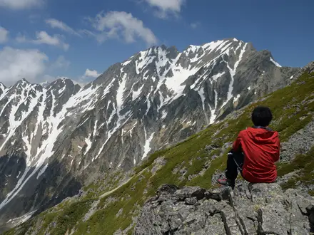
The Glencoaghan ridges: The classic spine of the traverse, with sharp quartzite tops rising above the Glencoaghan valley. This is the section that gives the day much of its ridge-walking character.
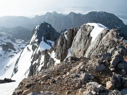
Bencorr and Bencollaghduff: Two of the highest, rockiest summits on the route, linked by narrow, exposed ridges. They are a key reason the traverse feels like a mountaineering route rather than a hill path.
Connemara National Park: The route finishes beside this protected landscape of blanket bog, heath and oak woodland. It is a Special Area of Conservation and is associated with red deer and Connemara ponies.
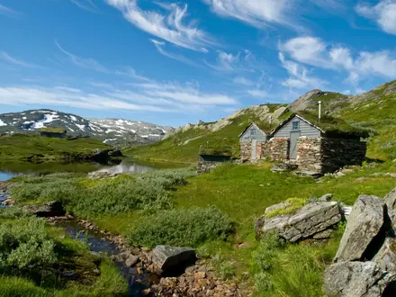
Quartzite scenery and glaciated glens: Pale, weathered quartzite ridges rise sharply from deep U-shaped valleys with lakes and bog. The geology is part of what makes the Bens so visually distinct.
Challenges to expect
Expect pathless, strenuous mountain terrain all day: hard quartzite, loose scree, steep grass and heather, wet blanket bog and sharp ascents and descents between every summit. Some rocky steps require hands-on scrambling, and exposure is real on the ridges. Weather changes fast; mist often sits below 500 m and the area is very wet. There are no huts, shelters, waymarks or public transport onto the mountains.
HikeList Score
Twelve Bens Traverse scored 70/100 on HikeList's trail-quality metrics.
See score breakdownHide breakdown
- Ideal length 55
- Balanced challenge 38
- Scenery & wildness 68
- Varied terrain 100
- Accommodation 100
- Food & support 61
- Path quality 98
- Season flexibility 89
Computed from length, challenge, scenery & wildness, terrain variety, accommodation, food & support, path quality and season flexibility.
 Ireland
Show more data Show less
- Mountainous
- Ridges
- Bog
- Glaciated Valleys
- Rocky
- Scree
- Grass
- Heather
- Bog
- Hotels
- Guesthouses
- B&Bs
- Hostels
- Camping
- Pet Friendly
- Campsites
Photos from hikers
Taken on the trail by people who've reviewed Twelve Bens Traverse.
A single very long mountain day crossing all twelve named Ben summits, typically from Derryclare through Bencorr, Bencollaghduff, Benbreen, Bengower, Benlettery, Benglenisky, Benbaun, Benfree, Bencullagh, Muckanaght and Benbrack before finishing near the Owenglen river / Connemara National Park forest road. Allow roughly 12–14 hours unless moving at fell-running pace.
Reviews
How would you rate Twelve Bens Traverse?
Tap a star to start your review — you could be the first.