The Caterthuns and Strathmore Circuit
How would you rate The Caterthuns and Strathmore Circuit?
Tap a star to share your experience and help other hikers.
The Caterthuns and Strathmore Circuit: Iron Age Hillfort Walk
HikeList Score
The Caterthuns and Strathmore Circuit scored 65/100 on HikeList's trail-quality metrics.
See score breakdownHide breakdown
- Ideal length 55
- Balanced challenge 60
- Scenery & wildness 98
- Varied terrain 59
- Accommodation 45
- Food & support 38
- Path quality 98
- Season flexibility 89
Computed from length, challenge, scenery & wildness, terrain variety, accommodation, food & support, path quality and season flexibility.
The Caterthuns walk is a short, easy hill walk in Angus, Scotland, visiting two Iron Age hillforts: Brown Caterthun and White Caterthun. The supported route is about 3 km, takes around 1–1.5 hours, and is an out-and-back from a roadside layby between the two summits. It suits walkers wanting a quick historical hilltop route, broad Strathmore views and modest ascent, rather than a long-distance hike.
Route Overview
Start and finish at the roadside layby on the minor road between the forts, signed from the B966 between Brechin/Little Brechin and Edzell, near Kirkton of Menmuir. From the central parking spot, visit White Caterthun west of the road on a clear path, then return to the layby and walk east to Brown Caterthun on a sometimes muddy heather/Land Rover track. Despite the "circuit" name, this is a short there-and-back walk to two neighbouring hillforts about 1 km apart, not a long valley loop. If you want a longer Scottish route, compare the Arran Coastal Way or the Annandale Way.
Iron Age hillforts above Strathmore
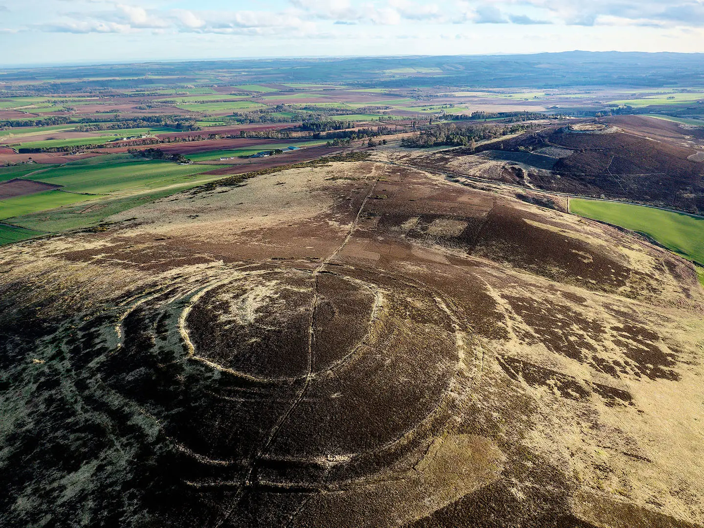
Brown Caterthun and White Caterthun are among Scotland’s notable Iron Age hilltop enclosures, treated almost as a paired site on neighbouring summits. Brown Caterthun’s concentric earthworks were raised and altered over several centuries in the latter half of the first millennium BC. White Caterthun’s large dry-stone rampart is usually linked to the Picts or their predecessors in the early centuries AD, with evidence of vitrification. Both monuments have been scheduled since 1882 and are cared for by Historic Environment Scotland.
Notable highlights
- White Caterthun (298 m): An exceptionally well-preserved Iron Age hillfort with a massive collapsed oval stone rampart and ditches. It gives wide views over Strathmore and is the high point of the walk.
- Brown Caterthun (287 m): A contrasting fort defined by concentric earthen ramparts and ditches, with several entrances radiating outwards. The approach is rougher and can be muddy.
- Views over Strathmore and the Angus glens: Both summits look south across the Strathmore valley and north towards the Grampian foothills and Angus glens.
- Iron Age heritage: The paired forts show different styles of hilltop enclosure and help explain why this high ground commanded the Strathmore corridor.
Challenges to expect
This is an easy walk, but it crosses exposed low hill terrain. Expect wind on the tops, no shelter, and no toilets, cafe or other facilities at the layby. The path to White Caterthun is clear and short; the Brown Caterthun approach is rougher and can be muddy through heather. Navigation is simple in clear weather, though suitable footwear is worthwhile after rain.
HikeList Score
The Caterthuns and Strathmore Circuit scored 65/100 on HikeList's trail-quality metrics.
See score breakdownHide breakdown
- Ideal length 55
- Balanced challenge 60
- Scenery & wildness 98
- Varied terrain 59
- Accommodation 45
- Food & support 38
- Path quality 98
- Season flexibility 89
Computed from length, challenge, scenery & wildness, terrain variety, accommodation, food & support, path quality and season flexibility.
 United Kingdom
 Scotland
Show more data Show less
- Hills
- Dirt
- Rocky
- Grass
- Accommodation Not Required
- Family Friendly
- Pet Friendly
Photos from hikers
Taken on the trail by people who've reviewed The Caterthuns and Strathmore Circuit.
Reviews
How would you rate The Caterthuns and Strathmore Circuit?
Tap a star to start your review — you could be the first.