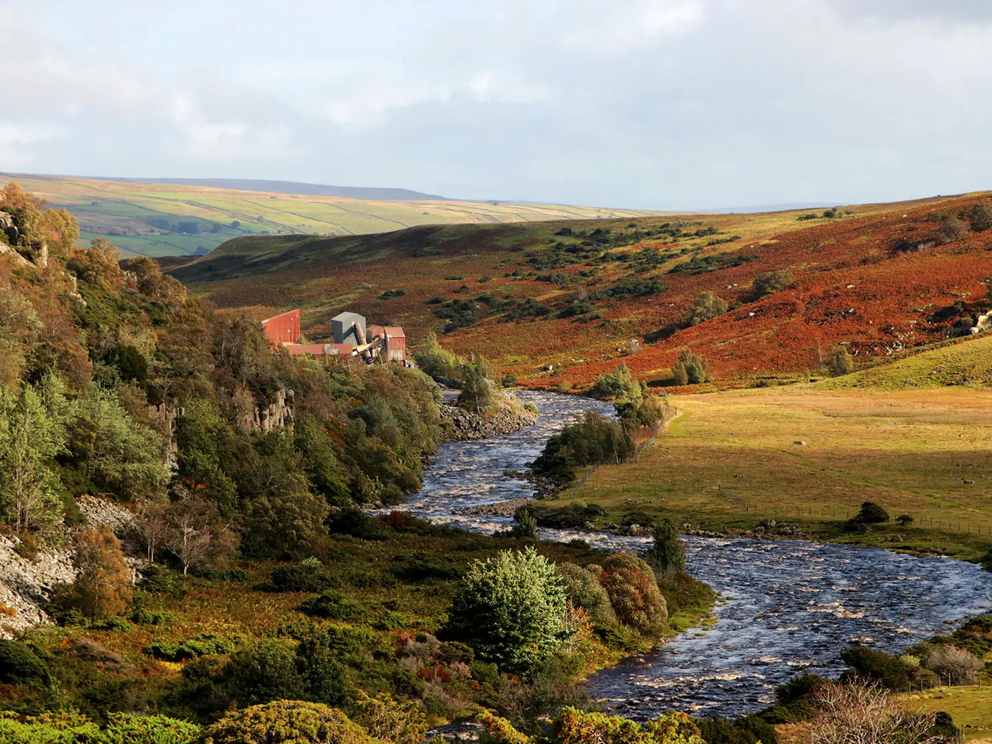
Teesdale Way
How would you rate Teesdale Way?
Tap a star to share your experience and help other hikers.
Teesdale Way: River Tees Source-to-Sea Walk
HikeList Score
Teesdale Way scored 91/100 on HikeList's trail-quality metrics.
See score breakdownHide breakdown
- Ideal length 96
- Balanced challenge 100
- Scenery & wildness 78
- Varied terrain 100
- Accommodation 100
- Food & support 81
- Path quality 84
- Season flexibility 89
Computed from length, challenge, scenery & wildness, terrain variety, accommodation, food & support, path quality and season flexibility.
The Teesdale Way is a 148 km / 92 mile waymarked point-to-point trail in northern England, following the River Tees from the North Pennines to the North Sea. Allow 6–7 days. It is best classed as moderate: the opening Pennine Way section from Dufton is exposed, boggy and hilly, while the long middle and lower sections are mostly gentler riverside, pastoral and urban walking. It suits hikers who want a varied river journey linking moorland, waterfalls, market towns and industrial Teesside.
Route Overview
The full Teesdale Way is commonly walked from Dufton in Cumbria towards the coast in Redcar & Cleveland, tracing the Tees east through County Durham and the Tees Valley. The route starts with the Pennine Way over High Cup Nick, Cauldron Snout and High Force, then continues down-valley through Middleton-in-Teesdale, Barnard Castle, Yarm, Stockton and Middlesbrough before reaching the North Sea. It is a point-to-point walk, so plan access and exit separately rather than expecting a loop. If you prefer shorter English lowland routes, compare it with the Amber Valley Route or the canal-side Ashby Canal Trail.
How the Teesdale Way was created
The Teesdale Way was created in the early 1990s by linking riverside rights of way with the existing Pennine Way. Its purpose is to follow the story of the Tees from wild Upper Teesdale, known for Whin Sill waterfalls and rare arctic-alpine flora, through historic market towns and into the shipbuilding, ironworking and chemical landscape of Teesside. Between Middleton-in-Teesdale and Middlesbrough it also runs jointly with the European long-distance path E2.
Notable highlights
- High Force (21 m / 70 ft drop): One of England’s most powerful waterfalls, where the River Tees drops over the hard dolerite of the Whin Sill near Middleton-in-Teesdale. It is a signature sight of the route.
- Cauldron Snout (upper Tees cataract): A long, stepped waterfall below Cow Green Reservoir, often cited as England’s longest waterfall. The Pennine Way section involves a rocky scramble beside it.
- High Cup Nick (glacial valley): A dramatic U-shaped valley above Dufton, framed by Whin Sill crags. It is the scenic climax of the exposed upland opening stage.
- Low Force and Wynch Bridge: A lower series of falls and rapids downstream of High Force, close to an early suspension footbridge over the Tees. It is one of the most accessible waterfall stops on the path.
- Barnard Castle: A historic market town above the Tees, named for its ruined 12th-century Norman castle and also home to the Bowes Museum. It makes a natural mid-route stop.
- Middlesbrough Transporter Bridge: A rare surviving 1911 transporter bridge near the route’s end, strongly associated with industrial Teesside and the river’s engineering heritage.
Challenges to expect
Expect the hardest walking at the start: exposed Pennine moorland, boggy ground, the biggest climbs, poor-visibility risk and the rocky scramble beside Cauldron Snout. After Middleton-in-Teesdale the trail becomes easier, but you still need a map or GPS for signed riverside paths, field crossings and more complex urban sections around Stockton, Middlesbrough and industrial Teesside. For a more mountainous UK comparison, see the Beacons Way; for another river-based route, see the Annandale Way.
HikeList Score
Teesdale Way scored 91/100 on HikeList's trail-quality metrics.
See score breakdownHide breakdown
- Ideal length 96
- Balanced challenge 100
- Scenery & wildness 78
- Varied terrain 100
- Accommodation 100
- Food & support 81
- Path quality 84
- Season flexibility 89
Computed from length, challenge, scenery & wildness, terrain variety, accommodation, food & support, path quality and season flexibility.
 United Kingdom
 England
Show more data Show less
- Mountainous
- Moorland
- River Valley
- Rolling Hills
- Coastal
- Urban
- Rocky
- Dirt
- Grass
- Paved
- Hotels
- Guesthouses
- Inns
- Campsites
- Family Friendly
- Pet Friendly
- Water Sources
- Campsites
- Picnic Areas
Download Our Full Guide to Teesdale Way FREE!
Get our comprehensive guide to this hike for free. Save it for later reading or print out at home.

In these collections
Photos from hikers
Taken on the trail by people who've reviewed Teesdale Way.
Teesdale Way: The Complete Guide
 i
Image by pncphotos
i
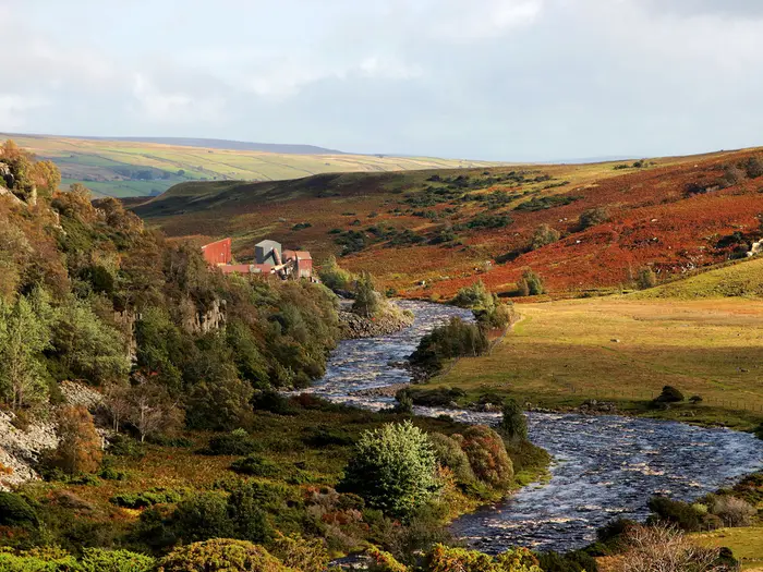
Image by pncphotos The Teesdale Way is a rare source-to-sea walk with a proper change of character: wild Pennine edge, wooded river dale, market-town country and industrial Teesside all in one continuous line. It follows the River Tees east from Dufton to South Gare, ending where the river reaches the North Sea near Redcar.
The opening is the serious part. From Dufton the route joins the Pennine Way, climbs towards High Cup Nick, crosses exposed moorland and takes in Cauldron Snout before dropping into Upper Teesdale.
After Middleton-in-Teesdale the walking becomes gentler but not dull. Low Force, High Force, Barnard Castle, Piercebridge, Yarm, Stockton-on-Tees, Middlesbrough and the Teesmouth estuary give the route a sequence of very different landscapes and useful stopping points.
This is a good choice for walkers who want variety rather than a single landscape repeated for a week. It suits independent hikers comfortable with mixed terrain, accommodation planning and some urban navigation, but the first day demands real hill-walking judgement, proper kit and the ability to navigate in poor visibility.
This guide covers stages, days, accommodation, food and water, transport, terrain, navigation, kit and common mistakes.
Stage-by-Stage Guide
The stages below follow the common 7-day split from Dufton to South Gare. Distances are approximate; accommodation choices, bus times, pub food hours and seasonal visitor-centre opening should be checked before travelling.
Stage 1: Dufton to Middleton-in-Teesdale — approx. 23 km
This is the hardest day of the Teesdale Way and should be treated as a proper Pennine hill stage, not a riverside walk. The route leaves Dufton village green, with its pink fountain, and follows the Pennine Way National Trail over exposed moorland towards High Cup Nick before crossing into Upper Teesdale.
Underfoot, expect rocky upland paths, boggy sections and open, weather-exposed ground. The high point is on the rim above High Cup Gill near High Cup Nick, where the Whin Sill crags frame one of the route’s strongest views. In mist or low cloud this same section can feel featureless, and cairns around Narrow Gate can be missed.
Beyond the High Cup Nick area, the route continues towards Maize Beck and Cow Green Reservoir before reaching Cauldron Snout. Use the footbridges over Maize Beck; the beck can be dangerous in spate and should not be treated casually. The descent beside Cauldron Snout includes a steep, rocky scramble beside the long stepped cataract, so poles may need to be stowed and hands used.
After the wild upper section, the walking gradually becomes easier downstream. The path passes the Whin Sill waterfall country of Upper Teesdale, including High Force, Low Force, the Wynch Bridge and Bowlees, before continuing into Middleton-in-Teesdale. This is also one of the best sections for appreciating the rare arctic-alpine flora of Upper Teesdale, especially in late spring.
Food and water planning matters on this stage. Dufton has limited village facilities, and there are no dependable services on the exposed upland crossing. Langdon Beck Hotel and YHA Langdon Beck are useful nearby options in Upper Teesdale, and Bowlees Visitor Centre has café/facilities near Low Force, but opening times should be checked before relying on them.
Middleton-in-Teesdale is the first natural overnight stop after the upland stage, with the Teesdale Hotel, B&Bs and self-catering options. The village also has food options including pubs, cafés and a fish and chip shop. Book ahead if arriving at a weekend or in the main walking season.
Transport at the start is the main logistical weakness of the whole route. Dufton is remote; the nearest mainline rail access is via Penrith or Appleby, followed by local bus or taxi. Middleton-in-Teesdale has bus links towards Barnard Castle and Darlington, but services are limited and should be checked before travelling.
Navigation is critical. The route is signed as the Pennine Way rather than the Teesdale Way on this opening section, using National Trail acorn waymarks, but a map and GPS track are strongly recommended. OS Explorer OL19 and Landranger 91 cover the key upland ground. Avoid this stage in poor winter conditions, and be prepared for the Helm Wind and very cold windchill even outside winter.
Stage 2: Middleton-in-Teesdale to Barnard Castle — approx. 22 km
From Middleton-in-Teesdale the route becomes the Teesdale Way proper, with E2 European long-distance path markers also appearing from here downstream. The character changes sharply from upland exposure to a softer dale of riverside meadows, woodland, field paths and farm tracks.
The walking is moderate rather than difficult. There are still minor climbs and damp riverside sections after wet weather, but nothing comparable with the Dufton crossing. The route passes Romaldkirk, Eggleston and the Eggleston Abbey area before reaching Barnard Castle.
Romaldkirk is one of the best village stops on this stage, with its green, 12th-century St Romald’s Church and the Rose and Crown pub. Eggleston adds another useful break point, with river crossings and the abbey ruins nearby. The approach to Barnard Castle brings the route into one of the most practical mid-route bases on the trail.
Barnard Castle has the ruined 12th-century Norman castle above the Tees, the Bowes Museum and a full spread of shops, cafés, pubs and takeaway options. It is a strong resupply point after the thinner upper dale. Supermarkets and food outlets make it a sensible place to restock for the next stage.
Accommodation choice is much better here than in the smaller dale villages. Options include coaching inns such as the Ancient Unicorn, pubs with rooms, hotels and B&Bs. Summer weekends can be busy, so booking ahead is sensible.
Barnard Castle has no railway station, but buses run towards Darlington, including services such as the X75. Timetables change and should be checked before committing to a start or finish here. Road access is straightforward compared with the upper dale.
Navigation is generally easier than Stage 1, with Teesdale Way waymarking and a clearer valley line. A GPS track remains useful through fields, estate edges and village approaches, especially where paths split near the river. Livestock and muddy field margins are the main day-to-day nuisances rather than serious hazards.
Stage 3: Barnard Castle to Piercebridge — approx. 21 km
This stage follows a broader, lower Tees valley where the river widens and the walking becomes mostly pastoral. Expect field paths, riverside tracks, woodland edges and short road or lane sections through villages. It is one of the easier days underfoot, though riverside mud can be persistent after rain.
The main places on the stage are Whorlton, Winston, Gainford and Piercebridge. Whorlton Suspension Bridge is a notable river landmark, while Winston Bridge is an important historic crossing. Gainford is an attractive village with a large green and Georgian character, and it makes a useful rest stop before the final section to Piercebridge.
Piercebridge brings Roman interest, including remains associated with Dere Street and the Roman bridge area. It is a small place rather than a major service centre, so do not assume full facilities on arrival without checking. The river setting and heritage make it a worthwhile overnight stop if accommodation is secured.
Food and water are more limited than the map might suggest. Whorlton and Gainford have pub options, and Piercebridge has The George Hotel, but not every village has a shop. Carry lunch and enough water from Barnard Castle unless specific stops have been checked in advance.
Accommodation between Barnard Castle and Piercebridge is thinner than in the larger towns. Gainford has some B&B options, and Piercebridge has inn accommodation at The George Hotel. Book before walking this stage, particularly if not prepared to continue or transfer by bus/taxi.
Public transport is limited in the mid-dale villages, with some bus connections from Gainford and Piercebridge towards Darlington. These services are useful for section-walkers but should not be assumed late in the day or on Sundays. Check current timetables before travelling.
Navigation is usually straightforward and well waymarked, but farmland walking still needs attention at field edges, gates and riverbank junctions. OS Explorer 307 is useful for this section. Avoid contact with giant hogweed if encountered along riverbanks; its sap can cause severe skin irritation in sunlight.
Stage 4: Piercebridge to Darlington — approx. 17 km
This is the transition stage from quiet lower dale into Darlington. The day remains gentle overall, with flat riverbank paths, field paths and some road or urban approach walking. It is shorter than the surrounding stages, making it a useful recovery day after the upper and middle dale sections.
The start at Piercebridge gives a final look at the Roman and historic bridge landscape before the route moves eastwards into more settled country. As Darlington approaches, the walking becomes increasingly urban, with riverside parkland and town streets replacing open farmland.
Darlington is the practical focus of the day. It is a major resupply and transport hub, with a Victorian market hall, the Head of Steam railway museum and the railway heritage associated with the Stockton and Darlington Railway. For walkers splitting the route, this is one of the easiest points to leave or rejoin the trail.
Food and water are not a concern once in Darlington, where there are supermarkets, cafés, restaurants and pubs. Before the town, carry enough for the day unless specific village stops have been checked. Sunday and evening opening in smaller places can be limited.
Accommodation choice in Darlington is broad, including chain hotels, B&Bs and budget options. It is the best-served overnight stop east of Barnard Castle and a good place to reset kit, dry clothing and restock food.
Darlington Station is on the East Coast Main Line, with excellent rail connections including services towards London, Edinburgh, York and Middlesbrough. This makes Stage 4 particularly useful for section-hikers. Local buses also make Darlington a practical base for filling gaps on either side.
Navigation is generally manageable, but the approach into and through Darlington is less intuitive than the rural riverside sections. Urban streets, park paths and junctions can make a GPS track more useful than waymarks alone. OS Explorer 304 covers this area.
Stage 5: Darlington to Yarm — approx. 22 km
This is a long but mostly easy lowland stage as the Tees loops through flatter country towards Yarm. The walking is a mix of riverside meadows, field paths, farm tracks and minor roads, with a more settled feel than the earlier dale stages.
The route passes through or near Croft-on-Tees, Hurworth-on-Tees, Middleton St George and Middleton One Row before reaching Yarm. Croft-on-Tees sits on the Yorkshire/Durham border and has literary associations with Lewis Carroll. Hurworth-on-Tees is a handsome village, while Middleton One Row is a distinctive one-sided terrace settlement above the river.
Yarm is one of the most attractive overnight stops on the lower route. The town sits on a tight bend of the Tees beneath its tall railway viaduct, with a Georgian high street, pubs, restaurants and shops. It is also a strong resupply point before the urban Teesside stages.
Food is much easier at the start and finish than through the middle of the stage. Darlington and Yarm both have full facilities, but rural sections between them should be treated as carry-your-own lunch territory unless stops have been checked. Yarm has supermarkets, cafés, pubs and restaurants.
Accommodation in Yarm includes hotels, B&Bs and pubs with rooms. It is a sensible end point because it combines character, food choice and nearby rail access. Book ahead for popular weekends.
Eaglescliffe Station, just across the river from Yarm, is on the Middlesbrough–Darlington–Bishop Auckland line. This gives good rail access for section-walkers and an escape option if needed. Bus and rail times should be checked before travelling.
Navigation is more variable on this stage than the easy terrain suggests. Some stretches, especially around the North Yorkshire side near Middleton St George and the approach towards Yarm, can have inconsistent waymarking, indistinct field paths or ploughed ground. A GPX track is strongly recommended, and long trousers help where riverside vegetation is high; avoid skin contact with giant hogweed if present.
Stage 6: Yarm to Stockton-on-Tees — approx. 18 km
This stage brings the route into urban Teesside. The walking is flat and easy underfoot, but the setting changes from market-town riverbanks to parks, paved riverside paths, former industrial riverside land and urban streets.
The stage passes the Eaglescliffe and Thornaby-on-Tees area before continuing towards Stockton-on-Tees. Preston Park, just north of the route, is a useful landmark and possible diversion, while the Tees Barrage is one of the day’s main features. Grey seals are sometimes seen near the barrage, where the river environment changes again.
Stockton-on-Tees provides several industrial and transport-history landmarks, including its association with the Stockton and Darlington Railway. The Infinity Bridge is a modern riverside marker, and the Newport Lift Bridge downstream is another distinctive Tees crossing.
Food and water are straightforward on this stage compared with the rural middle sections. Yarm, Thornaby and Stockton all have services, and Stockton town centre has supermarkets, cafés, restaurants and pubs. This is not a stage where heavy food carrying is normally necessary, though water should still be carried between stops.
Stockton-on-Tees has a broad accommodation range, including chain hotels, budget options and B&Bs. Thornaby also gives practical access to rail services just south of Stockton. Staying near the river or town centre reduces the need for extra walking at the end of the day.
Rail access is good. Thornaby Station is on the Middlesbrough–Darlington line, and Stockton has bus interchange facilities. This is a practical area for shortening, skipping or rejoining the route if time is limited.
Navigation is usually clear through the urban riverside, but signage should not replace a map or GPS. Urban walking brings more junctions, crossings and route choices than the countryside stages. Take care where the path shares space with cyclists and local riverside users.
Stage 7: Stockton-on-Tees to South Gare / Redcar — approx. 17 km
The final stage is the most industrial and unusual part of the Teesdale Way. It follows the lower Tees through Stockton, Middlesbrough, South Bank and the working estuary landscape before finishing at South Gare near Redcar. This is not a soft countryside finale; expect docks, steelworks, rail corridors, urban edges and estuary mudflats.
The terrain remains flat, but the underfoot experience is varied. There are riverside paths, urban streets, subways, footbridges, underpasses, industrial perimeter tracks and the Black Path corridor between Lackenby steelworks and the railway. Some boardwalks and wetland-edge sections can be awkward, and a section near Lackenby is prone to flooding, so a road alternative should be planned.
Middlesbrough is the major landmark town on the stage, with the 1911 Transporter Bridge standing as the route’s key industrial icon. The Middlesbrough football stadium is visible near the lower river. Beyond South Bank, the walk becomes increasingly estuarine, crossing towards Coatham Marsh and the South Gare breakwater.
South Gare is a memorable finish: a long breakwater built between 1861 and 1884, with the 1884 lighthouse, Second World War military remains and views over Teesmouth where the River Tees reaches the North Sea. Some walkers finish at South Gare for the breakwater and lighthouse experience; others continue or divert towards Redcar seafront or the Redcar Beacon for easier facilities and transport.
Food and water should be planned carefully. Stockton, Middlesbrough, South Bank and Redcar have services, but there are no dependable facilities at the South Gare breakwater itself. A café may be available near Paddy’s Hole, but this should be checked before relying on it.
Accommodation is best arranged in Redcar, Middlesbrough or Stockton rather than at the actual finish. Redcar has hotels, B&Bs and pubs, while Middlesbrough and Stockton have a wider urban range. South Bank has local services close to the route but is not the most obvious overnight base for most walkers.
Public transport is strong at the eastern end. Redcar Central Station is on the Middlesbrough–Saltburn line, with onward connections via Middlesbrough and Darlington. Middlesbrough, South Bank and Stockton also have rail or bus access, giving several exit points if the final stage needs to be shortened.
Navigation is the main challenge on this stage. Waymarking is inconsistent through the industrial sections, and the route uses a complicated mix of underpasses, crossings and urban links. Carry a GPX track and do not rely on spotting the next marker. Be prepared for noise, heavy industry, derelict edges and exposed weather on the breakwater, especially in strong wind.
Recommended Itinerary
The most practical schedule for most walkers is 7 days, travelling west to east from Dufton to South Gare / Redcar. This keeps the exposed Pennine opening as a single demanding hill day, then uses well-served towns for most later overnights.
Standard 7-day itinerary
| Day | From | To | Approx. distance | Why this stage makes sense | Services/accommodation notes |
|---|---|---|---|---|---|
| 1 | Dufton | Middleton-in-Teesdale | 23 km / 14 miles | This is the hardest day of the walk: the route climbs from Dufton onto the Pennine Way, passes High Cup Nick, crosses exposed upland and includes the rocky section beside Cauldron Snout before dropping into Upper Teesdale. It is a serious hill-walking day and should not be treated like the gentler river stages that follow. | Dufton has very limited accommodation, so book ahead. There are no reliable services on the hill; carry food, water, waterproofs, warm layers and navigation. Seasonal opening at High Force Hotel café and Bowlees Visitor Centre should be checked before travelling. Middleton-in-Teesdale has shops, pubs, cafés and a decent choice of beds. |
| 2 | Middleton-in-Teesdale | Barnard Castle | 22 km / 13 miles | A much easier but still varied Teesdale stage, following the river through a more pastoral section via places such as Romaldkirk and Eggleston before reaching the main market town on the route. | Middleton-in-Teesdale is a good place to restock before setting off. Barnard Castle has the best services on the western and middle part of the route, with hotels, inns, B&Bs, shops and a supermarket. It is also the best natural place for a rest day. |
| 3 | Barnard Castle | Piercebridge | 21 km / 13.5 miles | This is a logical middle-distance stage through the lower dale, passing Whorlton, Winston and Gainford before finishing at Piercebridge. The walking is gentler than the Pennine opening but still needs steady mileage. | Barnard Castle has full town services before departure. Piercebridge has limited accommodation, with the George Hotel the main on-route option, so book this night early or arrange a transfer if staying off-route. |
| 4 | Piercebridge | Darlington | 17 km / 10.5 miles | A shorter day after three longer stages, and a useful way to reach a major transport and accommodation hub without overextending the schedule. | Darlington has strong accommodation choice, full city services and a major railway station. It is a practical joining, leaving or rest point for section-walkers. |
| 5 | Darlington | Yarm | 22 km / 14 miles | This stage links the Darlington area back towards the Tees via Croft-on-Tees, Hurworth-on-Tees and Middleton St George / Middleton One Row before reaching Yarm. It is a solid but manageable day on easier terrain. | Darlington is the best place to stock up before leaving. Accommodation and services between Darlington and Yarm are more limited in the smaller villages. Yarm has a good choice of pubs, restaurants, some shops and accommodation. |
| 6 | Yarm | Stockton-on-Tees | 18 km / 11 miles | A moderate lower-river day through the increasingly urban Tees Valley, with easier gradients and good end-of-day services. | Yarm is a comfortable overnight with good food options. Stockton-on-Tees has full urban services and a reasonable accommodation choice. Keep map or GPS to hand through built-up sections. |
| 7 | Stockton-on-Tees | South Gare / Redcar | 17 km / 10.5 miles | The final stage follows the Tees towards industrial Teesside, South Bank, Teesmouth and the South Gare breakwater. It is less scenic in the traditional sense, but it completes the source-to-sea character of the walk at the mouth of the River Tees. | Stockton-on-Tees and Middlesbrough have full services. South Gare itself has limited accommodation, so many walkers continue or transfer to Redcar, where town accommodation and Redcar Central station are more practical. Some walkers finish at Redcar seafront / the Redcar Beacon instead of South Gare. |
Slower 8–9 day options
A slower schedule is strongly worth considering if the opening hill section feels marginal, if accommodation availability forces shorter stages, or if time in Barnard Castle is important.
| Option | How to split it | Who it suits | Planning notes |
|---|---|---|---|
| 8 days | Split the Dufton to Middleton-in-Teesdale opening into two days, using Langdon Beck as the key upper Teesdale staging point, then continue with the standard itinerary from Middleton. | Walkers who want to reduce the hardest day, those carrying camping or heavier kit, and anyone less confident about a long exposed first day. | Exact distances for the split should be checked on official mapping before booking. Langdon Beck has limited accommodation, with the Langdon Beck Hotel an important staging post, so book early. |
| 8 days | Walk the standard 7-day itinerary but add a rest or short day at Barnard Castle. | Walkers who want time for the castle, the Bowes Museum and a more relaxed mid-route break. | Barnard Castle has the strongest accommodation and services in the middle of the route, making it the easiest place to pause without complicated transfers. |
| 9 days | Combine both approaches: split the upland opening and add an extra night at Barnard Castle, or use shorter lower-river stages where accommodation is available. | Walkers wanting a less pressured holiday pace, or those using B&Bs and taxis to fit available beds. | Croft-on-Tees, Hurworth-on-Tees and Middleton One Row can be useful lower-route staging areas, but accommodation is limited and should be checked before travelling. |
Faster 5–6 day options
A faster itinerary is possible for strong walkers, but the first day from Dufton should still be treated with caution. The hard section is front-loaded, with exposure, boggy upland ground, the Cauldron Snout scramble and real navigation demands in poor visibility.
| Option | How it usually works | Who it suits | Planning notes |
|---|---|---|---|
| 6 days | Keep Dufton to Middleton-in-Teesdale as a full hill day, then merge one of the gentler lower sections, most naturally around Darlington, Yarm, Stockton-on-Tees or Middlesbrough. | Fit, experienced walkers comfortable with long days on mixed riverside, field, lane and urban paths. | Combining Piercebridge to Darlington and Darlington to Yarm creates a very long day of roughly 39 km / 24.5 miles using the standard stage distances. This is only sensible with an early start, light kit and secure accommodation at the finish. |
| 5 days | Compress several of the middle and lower stages while avoiding any attempt to make the Dufton upland opening more difficult than it already is. | Very strong walkers prioritising completion over time in the towns. | Exact overnight splits should be planned from current mapping and accommodation availability. The lower half is easier underfoot, but urban navigation through Stockton-on-Tees, Middlesbrough and the Teesmouth area still takes attention. |
Planning the Route
How many days to allow
Most walkers should plan on 6–7 walking days. A 7-day schedule keeps the daily distances manageable while still making steady progress between the natural overnight stops.
Strong walkers can compress the route into 5–6 days, but this makes less sense for many independent hikers because the hardest ground comes first and accommodation is sparse in the upper dale. A more leisurely schedule of up to 8 days works well if you want shorter days, time at the waterfalls, or easier section-hiking logistics.
The standard 7-stage pattern is:
| Day | Section | Approx. distance | Planning note |
|---|---|---|---|
| 1 | Dufton to Middleton-in-Teesdale | 23 km | The key committing day: exposed Pennine ground, limited escape options and very little accommodation en route. |
| 2 | Middleton-in-Teesdale to Barnard Castle | 22 km | A classic Upper Teesdale day with waterfalls and dale walking; book Barnard Castle ahead. |
| 3 | Barnard Castle to Piercebridge | 21 km | Gentler river and farmland walking; accommodation choice may influence whether to stop at Piercebridge or continue towards Darlington. |
| 4 | Piercebridge to Darlington | 17 km | Shorter day into a major transport and accommodation hub. |
| 5 | Darlington to Yarm | 22 km | Lower Tees walking with improving public transport options. |
| 6 | Yarm to Stockton-on-Tees | 18 km | Urban and riverside walking; navigation remains important through built-up sections. |
| 7 | Stockton-on-Tees to South Gare / Redcar | 17 km | Estuary, docks and Teesmouth walking; some walkers continue to Redcar seafront or the Redcar Beacon. |
The LDWA also divides the route into shorter sections averaging about 10.6 km, which is useful for section walkers or anyone building a bespoke itinerary around public transport.
Let accommodation shape the early stages
The route is most constrained between Dufton and Barnard Castle. After Barnard Castle, towns and transport links become much more frequent, so daily stages are easier to adjust.
The first day from Dufton to Middleton-in-Teesdale is the main planning bottleneck. Between the two, accommodation is very limited: YHA Langdon Beck is exclusive-hire only, the Langdon Beck Hotel is small, and there are only a handful of farmhouse B&B options around Forest-in-Teesdale. For solo walkers and small groups, this often makes the full Dufton-to-Middleton stage the practical choice rather than something easily split.
Book Middleton-in-Teesdale and Barnard Castle early, especially for May to September and bank holiday weekends. These are the key upper-route hubs, and losing a room here can force awkward taxi transfers or a changed itinerary.
From Darlington eastwards, accommodation is much easier. Darlington, Yarm, Stockton-on-Tees, Middlesbrough and Redcar all give far more flexibility, with hotels, pubs and guesthouses in or near the route corridor.
Direction and pacing
The usual direction is west to east, starting at Dufton and following the Tees downstream towards Teesmouth. This puts the hardest, highest and most weather-sensitive walking at the start, when legs are fresh but packs may be heaviest.
That front-loaded difficulty is important. The opening Pennine Way section over High Cup Nick, past Cow Green Reservoir and beside Cauldron Snout is genuine hill-walking, not simply a long riverside path. It needs a hill forecast, map or GPS, waterproofs, warm layers and the confidence to navigate in poor visibility.
After Middleton-in-Teesdale, the route eases noticeably into dale, farmland, market-town and lower-river walking. This makes a steady 7-day schedule sensible: it avoids overloading the first day, while allowing longer but easier stages later.
Shortening or extending the walk
The simplest way to shorten the Teesdale Way is to start at Middleton-in-Teesdale. This skips the exposed Pennine opening from Dufton and is the pattern used by some self-guided walking itineraries on the lower 61-mile section.
Middleton-in-Teesdale is accessible by bus via Barnard Castle and Darlington, but current services should be checked before travelling. This shortened version still includes the waterfalls, Barnard Castle, the lower Tees and the Teesmouth finish, but avoids the most committing hill section.
At the eastern end, some walkers finish at South Gare Breakwater, while others continue a little further to Redcar seafront or the Redcar Beacon for a more convenient town finish. Redcar is also easier for onward rail travel.
Section hiking
The Teesdale Way works well as a section hike, but not evenly along its whole length. The western end is more awkward because Dufton and the upper dale have limited public transport and fewer accommodation choices.
From Barnard Castle or Darlington eastwards, section hiking becomes much more practical. Darlington is a strong access point, and the lower route passes through or near rail-served places including Eaglescliffe, Thornaby-on-Tees, Stockton-on-Tees, Middlesbrough, South Bank and Redcar Central.
The Darlington-to-Redcar section is the easiest part to split into day walks because of these transport links. Timetables and service patterns should still be checked before travelling, especially for evening returns and Sunday services.
For those wanting to miss the upland start, Barnard Castle is a practical entry or exit point by bus from Darlington, including the Arriva X75/X76 services. This should be checked before travelling.
Transport planning
Getting to Dufton is the main transport challenge. The nearest mainline stations are Penrith and Appleby, with Appleby closer to the village; onward travel usually needs a local bus or taxi.
Local buses between Appleby and Dufton are infrequent, so a taxi from Appleby or Penrith is often the most practical option. Book ahead where possible, particularly if arriving late in the day or travelling on a Sunday.
Leaving the route is easier. Redcar Central has rail connections towards Darlington, with onward national rail links. If finishing at South Gare rather than Redcar seafront, allow for the extra logistics of getting from the breakwater area back to town.
Food and water
Food planning matters most on the first stage. Between Dufton and Middleton-in-Teesdale there are no shops, and the Langdon Beck Hotel is the main possible food stop; opening times and meal availability should be checked before relying on it.
Carry enough food for the full first day, plus emergency reserves in case poor weather slows progress. Water may be available from streams on the upland section, but it should be treated with care.
Middleton-in-Teesdale is the first reliable resupply point, with shops, pubs and cafés. From Barnard Castle eastwards, food and water are widely available in towns and villages, so there is far less need to carry heavy supplies.
Navigation and weather
The opening section from Dufton to Middleton-in-Teesdale follows the Pennine Way National Trail. It is signed, but exposed moorland, boggy ground, poor visibility and the rocky scramble beside Cauldron Snout make proper navigation essential.
Carry OS mapping or a reliable GPS route for the whole walk. From Middleton-in-Teesdale downstream the Teesdale Way is waymarked, but waymarking can be less obvious through the urban Teesside sections, where riverside paths, parks, roads and industrial land can make line-finding less intuitive.
Check the hill forecast carefully before committing to the first day. High wind, poor visibility or winter conditions can make the Pennine section hazardous, and the high opening section is best avoided in poor winter weather.
Permits, access and route status
No permit is required. The walk follows public rights of way and the Pennine Way National Trail on the upper section, then the signed Teesdale Way from Middleton-in-Teesdale downstream.
There are no route fees. Access is generally year-round, but practical access on the upland opening depends on weather and ground conditions.
From Middleton-in-Teesdale to Middlesbrough, the route also forms part of the E2 European Long Distance Path. This is useful to know if linking longer trails, but it does not change the day-to-day logistics of walking the Teesdale Way.
Towns, Villages and Overnight Stops
Accommodation is straightforward in the larger towns, but the first night needs particular care. Dufton is small, the opening day has no meaningful services until the waterfall area and Middleton-in-Teesdale is a natural bottleneck for both Teesdale Way and Pennine Way walkers.
For a standard 6–7 day itinerary, the most practical overnight sequence is usually Dufton before starting, then Middleton-in-Teesdale, Barnard Castle, Piercebridge or Darlington, Yarm, Stockton-on-Tees and the Redcar / Middlesbrough area after finishing. Book the upper dale accommodation first, then fill in the easier lower-route nights.
Dufton
Dufton is the starting village, with the route leaving from the village green at the foot of the Pennine Way climb towards High Cup Nick. Most walkers should arrive the evening before the first walking day rather than trying to reach Dufton and complete the long upland stage on the same day.
Services are limited. The Stag Inn is the village pub and a key food-and-drink stop for Pennine Way and Teesdale Way walkers, but there are no shops, so buy trail food before arrival.
Accommodation is small-scale and should be booked well ahead, especially in summer. Options include Dufton Youth Hostel, Dufton Caravan Park, Brow Farm B&B, Dufton Barn Holidays and Pennine Potting Shed glamping.
Transport is the main complication. The nearest mainline stations are Penrith and Appleby-in-Westmorland, with the final leg to Dufton by local bus or taxi. Local bus availability is limited, so this should be checked before travelling and taxis should be arranged in advance.
High Cup Nick, Cauldron Snout and Cow Green Reservoir
These are route landmarks rather than stopping places. There is no accommodation, food or reliable walker service between Dufton and the later Upper Teesdale waterfall area, so the first day must be treated as a self-sufficient hill day.
High Cup Nick is the high, exposed scenic point on the opening Pennine Way section. Cauldron Snout, below Cow Green Reservoir, involves a rocky scramble beside the stepped waterfall and the ground can be boggy and exposed.
Do not plan to resupply here. Carry food, water, waterproofs, warm layers, navigation and emergency kit from Dufton.
High Force, Low Force and Bowlees
High Force and Low Force sit on the upper River Tees before Middleton-in-Teesdale when walking west to east. They are useful places to pause on the long first stage, but they should not be relied on as full resupply points in the way a town can be.
High Force has the High Force Hotel and Visitor Centre on the north bank, with accommodation, bar and restaurant facilities. The Teesdale Way / Pennine Way runs along the south bank, which is normally the free side; the short gravelled viewing path down from the hotel car park on the north bank usually carries an entry charge. Current access, opening and prices should be checked before travelling.
Low Force is close to Wynch Bridge and Bowlees. Bowlees Visitor Centre has basic refreshments and toilets, making it one of the more practical daytime stops on the upper route.
Middleton-in-Teesdale
Middleton-in-Teesdale is the key first overnight stop and the point where the walk changes character. The hard Dufton-to-Middleton opening stage ends here, and the route leaves the Pennine Way section for the Teesdale Way proper downstream.
Accommodation is varied but finite, so early booking is strongly advised. Options include The Teesdale Hotel on the Market Place, Brunswick House B&B, Rose & Crown B&B, The Quirky Quarry at Snaisgill just outside the town, Leekworth Caravan & Camping Park and self-catering cottages.
For food and supplies, Middleton has pubs, tearooms, takeaways, a small selection of shops and a Post Office. It is the first proper resupply point after Dufton and is a sensible place to restock before the gentler valley stages.
There is no railway station. Weardale Motor Services 95/96 link Middleton-in-Teesdale with Barnard Castle, where buses continue to Darlington; current timetables should be checked before relying on this as a bail-out.
Romaldkirk
Romaldkirk is a quiet village between Middleton-in-Teesdale and Barnard Castle. It works well for walkers who want to split the second stage into shorter days rather than walking the full Middleton-to-Barnard Castle distance.
The Rose & Crown Inn is the main accommodation option, with en-suite rooms and food. The Kirk Inn sits on the village green and is another useful pub stop.
Do not expect town-level services. Romaldkirk is best treated as a peaceful overnight or meal stop, not as a major resupply point.
Eggleston
Eggleston is another small village on the Middleton-in-Teesdale to Barnard Castle section, close to the route as it passes near Eggleston Abbey. Most walkers continue to Barnard Castle, but Eggleston can work as a smaller-scale overnight if the stage needs shortening.
The Moorcock Inn offers food and en-suite B&B accommodation. Eggleston Hall provides large group accommodation.
Services are limited, so any overnight here should be planned around the accommodation’s food arrangements rather than assuming easy resupply on arrival.
Barnard Castle
Barnard Castle is the strongest overnight base in the middle of the route before Darlington. It sits above the River Tees and is the natural end of the second standard stage from Middleton-in-Teesdale.
Accommodation choice is broad compared with the upper dale, with hotels, guesthouses, B&Bs, self-catering options and a Caravan Club site outside the town. It is a good place to build in a rest or shorter day if accommodation is tight elsewhere.
Services are excellent for walkers: supermarkets, pharmacies, banks, outdoor gear, pubs, restaurants and tea shops. If kit, food or medication needs replacing, Barnard Castle is the first realistic opportunity after leaving the Pennine uplands.
There is no railway station. Buses link Barnard Castle with Darlington, including Arriva X75/X76 and Weardale Motor Services 84, while Weardale Motor Services 95/96 links back towards Middleton-in-Teesdale. Current bus times should be checked before booking onward rail connections.
Whorlton
Whorlton is a tiny village on the riverside stage between Barnard Castle and the lower Tees villages. It is mainly a passing point rather than a normal overnight stop.
The village is useful for route character and access around the Tees, including its suspension bridge, but services are limited. Do not plan on Whorlton for resupply unless a specific pub or accommodation arrangement has been checked in advance.
Winston
Winston is a small village on the Teesdale Way between Barnard Castle and Gainford. It has pubs and can be a useful refreshment stop on the third stage.
It is not usually the main overnight target, but it can help break up the day if combined with accommodation nearby. Availability should be checked before travelling, as services are much more limited than in Barnard Castle or Darlington.
Gainford
Gainford is one of the more useful villages between Barnard Castle and Piercebridge. It sits on the Tees and has enough local services to make it a practical daytime stop.
Facilities include B&Bs, boutique self-catering cottages, an organic farm shop and cafe, newsagents/general stores, a Post Office and a chippie. Headlam Hall Hotel is about a mile from Gainford and may suit walkers wanting a higher-comfort overnight off the immediate line.
Gainford can be used to shorten the Barnard Castle to Piercebridge stretch, but many walkers continue to Piercebridge for a cleaner stage break.
Piercebridge
Piercebridge is a practical overnight at the end of the standard Barnard Castle stage. It is a small village with Roman heritage and a historic crossing of the Tees, but its main value for walkers is that it gives a clear stopping point before the route heads towards Darlington.
The George of Piercebridge is the key accommodation and food option, with hotel rooms, bar and restaurant. East Greystone Farm Cottages are also nearby.
Basic local services are available within about a mile, including shop, Post Office and cafe facilities. Piercebridge is a good choice if the aim is to keep the next day into Darlington short and manageable.
Darlington
Darlington is the route’s major transport and resupply hub. It is the standard end point for the stage from Piercebridge and the easiest place on the whole walk to exit by rail.
Accommodation is plentiful, including chain hotels, B&Bs and guest houses. Food and town services are comprehensive: supermarkets, restaurants, pubs, pharmacies and outdoor shops are all available.
Darlington railway station is on the East Coast Main Line, with long-distance services including London King’s Cross, Edinburgh and Newcastle, plus regional connections. Buses also link Darlington with Barnard Castle and the surrounding villages.
For walkers with injury, poor weather or schedule problems, Darlington is the most practical bail-out point. It is also the last very easy mainline rail escape until the Eaglescliffe and Thornaby area near Yarm.
Croft-on-Tees
Croft-on-Tees lies on the Darlington to Yarm section. It is a pleasant riverside village rather than a major overnight centre.
The Croft Hotel is the main named local option and can serve as a pub or accommodation stop depending on availability. It is useful if the Darlington-to-Yarm day needs adjusting, but most through-walkers continue towards Yarm.
Hurworth-on-Tees
Hurworth-on-Tees is another practical village on the Darlington to Yarm stage. It makes a good lunch or refreshment stop if timings work.
The Bay Horse, a 15th-century coaching inn, serves food, and The Emerson Arms is another local pub. Accommodation is more limited than in Darlington or Yarm, so overnight plans here should be made in advance.
Middleton St George and Middleton One Row
Middleton St George and Middleton One Row sit near the route between Darlington and Yarm. They are mainly residential for the purposes of the Teesdale Way.
There are limited walker services, so these places are best treated as pass-through points rather than overnight bases. If accommodation or transport is needed here, this should be checked before travelling.
Yarm
Yarm is one of the best overnight stops on the lower half of the route. It is a historic market town on a bend of the Tees, with the tall railway viaduct forming a useful landmark.
Accommodation includes Yarm View Guest House, OYO Yarm Cottages, Teesdale Lodge for groups and other town options. Book ahead for weekends, when Yarm can be busy with visitors.
Food and drink are a strength here. The High Street and Market Place have many pubs, restaurants and cafes, including The Black Bull, The George & Dragon, The Ship Inn, Blue Bell, Crown Hotel, Bay Horse, New Cross Keys and Golden Jubilee.
Eaglescliffe railway station is about 1 km from Yarm town centre, with services to Darlington, Middlesbrough, Leeds and York. This makes Yarm a strong join, exit or late-arrival point for section walkers.
Eaglescliffe
Eaglescliffe is important mainly for transport. Its railway station serves the Yarm area and is useful for walkers who need to join or leave the route without going into central Darlington or Middlesbrough.
There is some accommodation nearby, but Yarm is generally the more appealing overnight base for walkers. Use Eaglescliffe primarily as the rail access point for this section.
Thornaby-on-Tees
Thornaby-on-Tees is part of the built-up Teesside section of the route. It has its own railway station with Northern services and is useful as a transport fallback.
For most walkers it is a pass-through urban section rather than a destination overnight. If the day needs shortening, Thornaby gives easier exit options than the more rural stages upstream.
Stockton-on-Tees
Stockton-on-Tees is the standard overnight before the final approach to Teesmouth and South Gare. The route passes through the town centre and follows the riverbank, so services are close to hand.
Accommodation options include hotels and B&Bs, with the usual town range of pubs, restaurants and supermarkets. It is a straightforward place to restock before the more industrial and exposed estuary finish.
Stockton-on-Tees railway station has Northern services to Darlington, Middlesbrough, Sunderland and other regional destinations. It is a useful exit point if not continuing to the coast.
Middlesbrough
Middlesbrough is the major urban centre on the final day. It is a practical bail-out point for walkers who decide not to continue all the way to South Gare.
The city has a full accommodation range and complete services. Middlesbrough railway station has LNER, Northern and TransPennine Express services, with connections including London, Leeds, Newcastle and Edinburgh.
The Middlesbrough Transporter Bridge is the key landmark on this section and a major marker of the shift into industrial Teesside. Route-finding through the urban stretches still needs attention, so keep map or GPS navigation available rather than relying only on waymarks.
South Bank
South Bank is a small post-industrial community on the south bank of the Tees near the estuary. It is usually a pass-through area on the way to Warrenby and South Gare, not a normal overnight stop.
Services for walkers are limited compared with Middlesbrough, Stockton or Redcar. Plan food, water and end-of-day transport before entering the final estuary section.
Warrenby, South Gare and Redcar
The Teesdale Way ends at South Gare Breakwater, Warrenby, where the River Tees reaches the North Sea. This is an industrial-estuary finish with the breakwater, South Gare lighthouse, mudflats and Teesmouth wildlife nearby, but very limited services at the actual end point.
Do not treat South Gare as a place to improvise transport. Pre-arrange a taxi from Redcar or plan the onward walk to Redcar seafront and Redcar Central station.
Redcar is the practical post-finish base, with seaside-town services, accommodation, food and rail access. Redcar Central has frequent trains to Middlesbrough, with onward connections, and buses also link Redcar with Middlesbrough.
Some walkers finish at South Gare as the formal route end; others continue to Redcar seafront or the Redcar Beacon for easier facilities and transport. Either way, the final logistics should be planned before leaving Stockton-on-Tees or Middlesbrough.
Getting to the Start
The Teesdale Way starts at Dufton village green in Cumbria, grid ref NY689251 / postcode CA16 6DB. Dufton is a small North Pennines village about 5.7 km / 3.5 miles from Appleby-in-Westmorland, and getting there is the main transport constraint of the whole route.
For most walkers, the practical plan is: train to Appleby-in-Westmorland, then a pre-booked taxi to Dufton. Do not rely on turning up and finding an easy onward connection.
By train
Appleby-in-Westmorland is the nearest railway station, about 5.7 km / 3.5 miles from Dufton. It is on the Settle–Carlisle Line, operated by Northern Trains.
Typical rail approaches are:
| Approach | Practical route |
|---|---|
| From Leeds | Direct trains to Appleby on the Settle–Carlisle Line, roughly every 2 hours, taking about 1.5–2 hours. |
| From Carlisle | Direct trains to Appleby, roughly every 2 hours, taking about 45 minutes. |
| From London and the south | Travel to Leeds on the East Coast Main Line, then take the Settle–Carlisle Line to Appleby; or travel via Carlisle on the West Coast Main Line and change there. |
| From Penrith | Penrith North Lakes is on the West Coast Main Line, but there is no direct train from Penrith to Appleby. A transfer or rail journey via Carlisle is needed. |
From Appleby station, take a taxi to Dufton. The drive is short, but taxis should be booked in advance, especially for early morning arrivals, evenings or weekends. Appleby operators include MMK Appleby Taxis (+44 7596 646 450) and Appleby Taxis (+44 1768 352 772); availability should be checked before relying on them.
Penrith North Lakes can be faster for walkers arriving on the West Coast Main Line, with Avanti West Coast services from London Euston, Glasgow and Manchester. From Penrith, a taxi to Dufton is about 14 miles / 22 km and takes around 20 minutes, making it a more expensive but sometimes simpler option than connecting via the Settle–Carlisle Line.
Train and connection times should be checked at National Rail and with the relevant operator before booking. This should be checked before travelling.
By bus
Bus access to Dufton is limited. There is no direct bus from major cities to the village, and the final leg from Appleby needs careful planning.
Stagecoach 563 links Penrith, Appleby and Kirkby Stephen, running through the area roughly every 3 hours, but it does not stop in Dufton village itself. Local and community transport services operate in the area, including Western Dales Community Transport, but frequencies are limited and may not fit late-afternoon rail arrivals.
Do not build the start of the walk around an unverified bus connection. Rural timetables change, and this should be checked before travelling.
By car
Dufton is reached from the A66 Penrith–Scotch Corner road, leaving at Temple Sowerby or Appleby and continuing by minor roads. It is about 14 miles from Penrith and about 35 miles from Carlisle.
There is a small free car park beside the public conveniences in the centre of Dufton, around grid ref NY689250. Overflow parking is around the village green or near the church, but this is a small village, so park considerately and avoid blocking residents, farm access or businesses.
Leaving a car in Dufton for the full walk is possible, but it creates a return-to-start problem at the end of a point-to-point route. For a 6–7 day through-walk, it is usually easier to use public transport and taxis to reach Dufton, or to leave a vehicle at the Teesside/Redcar end and travel back to Dufton before starting. Any long-stay parking arrangement should be checked locally or with accommodation before committing.
From the nearest airport
None of the nearby airports gives a direct, easy transfer to Dufton. All involve onward rail and at least one change, followed by a taxi or local transfer from Appleby or Penrith.
| Airport | Practical onward route |
|---|---|
| Newcastle Airport | About 42 miles from Dufton. Take the Metro to Newcastle city centre, then rail towards Carlisle or Leeds and change for Appleby. |
| Leeds Bradford Airport | About 70 miles from Dufton. Transfer to Leeds city centre, then take the Settle–Carlisle Line to Appleby. |
| Manchester Airport | About 100 miles from Dufton. Travel by train to Leeds, then continue on the Settle–Carlisle Line to Appleby. |
For international or long-distance arrivals, allow generous time. A late flight or missed rail connection can easily leave no practical same-day onward transport to Dufton.
Where to stay before starting
Dufton is the best place to stay if accommodation is available, because the first day begins straight from the village green and heads into the most exposed upland section of the walk. Options are limited and should be booked well ahead.
Dufton village options include The Stag Inn on the village green, Dufton Barn Holidays, Brow Farm B&B, Dufton Caravan Park, and Redstones Hotel, formerly YHA Dufton. Accommodation status, prices and availability should be checked directly before booking, especially where premises have changed use or ownership.
The village also has public toilets and the Post Box Pantry village store/tearoom, but opening times should not be assumed. Carry what is needed for the first day before leaving Dufton.
Appleby-in-Westmorland is the main fallback base, with a wider range of hotels, guesthouses and B&Bs. Staying in Appleby works well if a taxi to Dufton is pre-booked for the morning, but allow enough time: the Dufton-to-Middleton-in-Teesdale stage is the hardest day of the route and is not a stage to start late.
Getting Home from the Finish
The practical issue at the eastern end is the gap between the official finish and public transport. The Teesdale Way ends at South Gare Breakwater, Warrenby, near Redcar, and South Gare has no public transport links.
Plan the final leg before setting off for the day. From the breakwater, you either need a pre-booked taxi or lift, or you must add the walk back towards Redcar town centre before using trains or buses.
By train
The nearest useful railway station is Redcar Central, in Redcar town centre. It is roughly 4 miles from South Gare, so you need a taxi, lift or an extra beach/coastal walk to reach it from the finish.
Redcar Central is served by Northern and TransPennine Express. Northern runs on the Tees Valley Line, linking Redcar with Middlesbrough and Darlington; typical Monday–Saturday service is two trains per hour between Saltburn and Darlington via Middlesbrough, with one per hour continuing to Bishop Auckland. Sunday service is more limited, typically hourly between Saltburn and Bishop Auckland.
Typical rail journey times are short into Middlesbrough, at around 10–13 minutes, and around 45–60 minutes to Darlington depending on the service and whether a change is needed. Timetables change, so check National Rail before booking onward travel, especially if finishing on a Sunday or late in the day.
TransPennine Express also serves Redcar Central, with services towards Manchester Airport via York. This is useful for onward travel towards York, Manchester and airport connections, but the exact frequency and last train times should be checked before travelling.
For longer-distance rail, Middlesbrough is the main interchange from the finish area. It has services by LNER, TransPennine Express and Northern, with onward links towards Darlington, York, Newcastle, Edinburgh, Manchester and London King’s Cross. Darlington is also a major East Coast Main Line interchange and is useful if returning towards the Pennines or travelling north/south by mainline rail.
Redcar East is another station on the same Tees Valley Line and may suit some accommodation locations, but Redcar Central is usually the more convenient town-centre option.
By bus
Buses do not run to South Gare, so bus travel only becomes useful once you have reached Redcar town. Do not finish at the breakwater expecting to find a bus stop nearby.
Arriva Bus 63 links Redcar and Middlesbrough, with a journey of roughly 67 minutes. Other local buses may also be available around Redcar and Teesside, but current routes and times should be checked through Arriva North East or Connect Tees Valley before relying on them.
For most walkers, the train from Redcar Central is the simpler option for leaving the finish area. The bus is more useful for local Teesside journeys or if accommodation is not close to the railway station.
By car/taxi
A taxi is the cleanest way to leave the official finish at South Gare Breakwater. The drive to Redcar Central is around 12 minutes and about 4.4 miles; a typical fare is around £15–£19, but this should be checked with local operators before travelling.
Book the taxi in advance rather than assuming one will be available at South Gare. Red-Car Taxis operate locally on 01642 470 470; check current numbers and availability before the walk, particularly for evenings, Sundays and larger groups.
A private pickup also works well here, as the finish is road-accessible but isolated from public transport. If being collected, agree an exact meeting point at South Gare or Warrenby in advance.
Walking back to Redcar is possible and adds several miles at the end of the final day. It can be a good fallback in daylight and fair weather, but it should not be the default plan if onward trains are time-critical.
If a car has been left near the start at Dufton, the return journey is awkward. A practical route is to travel by train from Redcar towards Darlington, then continue towards Penrith or Appleby, followed by local bus or taxi back to Dufton. This should be checked before travelling, as the final link to Dufton is the weak point.
A direct taxi or private shuttle between Redcar and Dufton is possible in principle but will be a long and expensive journey. Walkers using a baggage-transfer or walking-holiday operator may be able to arrange car logistics as part of the package.
From the nearest airport
Teesside International Airport is the nearest airport, roughly 10–12 miles from Redcar, near the Darlington / Newton Aycliffe area. It is mainly useful for walkers with a specific flight connection rather than as the default way home.
Airlines using Teesside include Ryanair, TUI, KLM and Loganair. KLM services to Amsterdam can provide international connections, while UK domestic options are limited and schedules vary.
From Redcar, access to the airport is by taxi or by public transport via the Teesside rail and bus network, usually involving Middlesbrough or Darlington. Check current flight times and ground-transport connections before committing to this option.
Where to stay at the finish
Staying in Redcar is the most practical choice if finishing late, if rail connections are awkward, or if the final South Gare taxi adds uncertainty to the day. It also avoids rushing the last urban and estuary section from Stockton-on-Tees to the coast.
Redcar has a reasonable range of accommodation, including hotels, guesthouses and B&Bs. Options include the Claxton Hotel, Park Hotel, The Armada, The Believe Boutique, Red Barns B&B, Abbey Guest House and The Beaches En-Suite Rooms.
Budget rooms and mid-range hotel options are usually available, but prices vary by date and should be checked before booking. If arriving at South Gare in the evening, book both the bed and the transfer from the breakwater in advance.
Which Direction Should You Walk?
The Teesdale Way is best walked west to east, from Dufton to South Gare / Redcar. This is the traditional direction used by the main route descriptions, and it fits the river journey, the transport pattern and the walking difficulty better than the reverse.
The opposite direction is possible, but it puts the hardest, remotest hill section at the end of the walk and leaves the awkward Dufton transport problem until after you have finished.
West to east: Dufton to South Gare
Walking from Dufton gives the route its natural progression: high Pennine ground first, then Upper Teesdale waterfalls, then market towns, then the lower Tees and the industrial estuary. It feels like a genuine river journey from wild upland to the North Sea.
This direction is also the more practical one. Dufton is the awkward end to reach, so it is usually better to deal with that before the walk begins. Appleby-in-Westmorland is the nearest station, with limited onward local bus options to Dufton; services can be infrequent, so this should be checked before travelling. Penrith is another mainline option, normally followed by onward bus or taxi arrangements.
Finishing at the coast is much easier logistically. Redcar has rail access, and Middlesbrough, Stockton-on-Tees, Thornaby, Eaglescliffe and Darlington all give wider onward public-transport options if finishing or leaving the route nearby.
The climb profile also favours west to east. The hardest walking comes immediately: Dufton to High Cup Nick, the exposed Pennine Way section, Cauldron Snout and the high moorland above Upper Teesdale. After Middleton-in-Teesdale the route becomes steadily gentler, with more riverside, field, lane and urban walking.
Prevailing south-westerly winds are another small but useful advantage. On the exposed opening section above Dufton, walking west to east will often mean the weather is more likely to be behind you than in your face, which matters in rain or poor visibility on the Pennine ground.
Accommodation flow is better this way too. The thinnest accommodation is on or near the first long upland stage, so it can be booked firmly before setting off. From Middleton-in-Teesdale onwards, options improve through Barnard Castle, Darlington, Yarm, Stockton-on-Tees and Middlesbrough.
East to west: South Gare / Redcar to Dufton
The reverse direction can work for experienced walkers who want the Pennine climax at the end, or for anyone already based on Teesside. Starting from Redcar is easy by public transport, and the early stages through the lower Tees are physically gentler.
The drawbacks are significant. You finish with the hardest and most exposed day, climbing into the Pennine Way section from Middleton-in-Teesdale towards Cauldron Snout and High Cup Nick when fatigue may already be building. This is also the section where navigation, weather judgement and hill kit matter most.
Reverse walkers also need to handle waymarking with more care. The Dufton-to-Middleton section follows the Pennine Way National Trail, while Teesdale Way waymarking starts from Middleton-in-Teesdale downstream. Walking against the normal direction can make signs less intuitive, especially in poor weather or through more complex urban sections lower down.
The biggest practical issue is the finish. Ending at Dufton leaves you dependent on limited rural transport or a pre-booked taxi after completing the walk. That is less forgiving than finishing near Redcar and Middlesbrough, where onward rail and bus choices are much stronger.
Direction comparison
| Direction | Main advantages | Main drawbacks |
|---|---|---|
| West to east: Dufton to South Gare / Redcar | Traditional direction; follows the River Tees towards the sea; hardest terrain comes first; likely wind advantage; easier transport at the finish; accommodation improves as the walk progresses | Requires careful planning to reach Dufton at the start; first day is demanding and exposed |
| East to west: South Gare / Redcar to Dufton | Easy to reach the start by public transport; gentler opening days; Pennine scenery becomes the finale | Hardest walking comes last; more awkward transport from Dufton after finishing; reverse waymarking and navigation need more attention |
Recommendation
Walk the Teesdale Way west to east, from Dufton to South Gare / Redcar. It gives the best balance of scenery, weather, transport and accommodation logistics, and it ends with the satisfying finish of following the Tees out to the North Sea. Choose the reverse only if there is a specific reason to start on Teesside and the Dufton exit transport has been arranged in advance.
Accommodation Along the Route
Accommodation on the Teesdale Way is easiest once the route reaches the larger towns, but the first two nights need proper planning. Dufton, Upper Teesdale, Middleton-in-Teesdale and the rural middle section have limited beds, and they also attract Pennine Way walkers, weekend visitors and summer holiday demand.
The route works well as an inn-to-inn walk, provided the early accommodation is booked before transport is fixed. Campers have some useful options at Dufton, Middleton-in-Teesdale and near the upper dale, but this is not a route where campsites appear conveniently at every stage end.
Accommodation by place
| Place | Accommodation level | Best for | Notes |
|---|---|---|---|
| Dufton | Limited | Start night before the walk | A small village with very few beds. Options include the Stag Inn, Dufton Barn Holidays, Brow Farm B&B, Dufton Caravan Park and Redstones hotel, the former YHA Dufton. Book well ahead. |
| Langdon Beck / Forest-in-Teesdale | Limited | Splitting the exposed first stage | YHA Langdon Beck and Langdon Beck Hotel sit close to the Pennine Way / Teesdale Way line and are useful if the Dufton–Middleton day is too long. Availability is limited. |
| Holwick | Limited | Basic overnight near Upper Teesdale | Holwick Camping Barn is a practical simple stop near Middleton-in-Teesdale. Facilities and availability should be checked before travelling. |
| Middleton-in-Teesdale | Good for a small town | Key first or second night | The main upper-route base. Options include The Teesdale Hotel, Brunswick House, Forresters Bar & French Restaurant with Rooms, Belvedere House, The Quirky Quarry near Snaisgill, Leekworth Caravan & Camping Park and holiday cottages. Book ahead, especially weekends and summer. |
| Romaldkirk / Eggleston | Limited | Shorter stages between Middleton and Barnard Castle | Tuns House B&B at Eggleston is next to the Teesdale Way and suits walkers wanting a shorter day. Romaldkirk itself has limited choice. |
| Barnard Castle | Good | Mid-route base, rest day, flexible booking | The strongest choice between Middleton-in-Teesdale and Darlington, with guesthouses, B&Bs, inns and small hotels. The Old Well Inn is a central B&B option; The Morritt Hotel is nearby at Greta Bridge. Good facilities for food and resupply. |
| Whorlton / Winston / Gainford | Limited | Breaking up the rural middle section | There are few options directly on the path. The Bridgewater Arms at Winston is accessible off trail, while Gainford has options such as Whispering Waters Teesdale Lodges and The Loft & The Nook. Many walkers continue to Piercebridge or Darlington. |
| Piercebridge | Limited | Overnight before Darlington | A small village with limited choice. The George of Piercebridge is the key inn option and should be booked before committing to this stage plan. |
| Darlington | Good | Reliable town stop, transport, resupply | A major town with a wide hotel and B&B choice, including budget chains and guesthouses. Usually much easier to book than the rural sections, though bank holidays and events can tighten availability. |
| Croft-on-Tees / Hurworth-on-Tees / Middleton St George / Middleton One Row | Limited | Shorter stages between Darlington and Yarm | Smaller settlements with fewer dedicated walker options. Middleton One Row is used as an overnight stop by some self-guided itineraries. Check accommodation before designing a short-stage plan here. |
| Yarm | Moderate to good | Comfortable stop before Teesside | More choice than the surrounding villages, with options including Yarm Guest House, the Best Western Parkmore Hotel near Yarm and Crathorne Hall Hotel outside the town. |
| Eaglescliffe / Thornaby / Stockton-on-Tees | Good | Urban overnight, flexible logistics | Broad urban choice, including budget-chain hotels in Stockton and nearby. Booking pressure is generally lower than in Upper Teesdale. |
| Middlesbrough | Good | Final-night base or transport hub | A major urban centre with budget and mid-range business hotels. Useful if finishing at South Gare and returning by public transport via Redcar or Middlesbrough. |
| South Gare / Warrenby | None to very limited | Finish point only | The finish is an industrial breakwater area, not an accommodation base. Plan to continue to Redcar or return to Middlesbrough. |
| Redcar | Limited to moderate | Finish-night alternative | Redcar town centre and seafront have some guesthouses and B&Bs. Many walkers instead travel on after finishing. |
Best overnight stops for a standard 6–7 day walk
A practical hotel-and-B&B itinerary usually uses Dufton, Middleton-in-Teesdale, Barnard Castle, Piercebridge or Darlington, Yarm, Stockton-on-Tees or Middlesbrough, then Redcar or homeward travel after South Gare. The exact split depends on whether the opening upland day is walked in one push or broken at Langdon Beck.
The most important decision is the first stage. Dufton to Middleton-in-Teesdale is the hardest accommodation link because it combines the most demanding walking with the fewest beds. If the full day over High Cup Nick and past Cauldron Snout is too much, stopping at Langdon Beck gives a more manageable split, but there are still only a small number of places to stay.
Middleton-in-Teesdale is the natural upper-dale hub and should not be treated as a last-minute stop in peak season. Barnard Castle is much easier, with the best concentration of middle-route accommodation and enough facilities to make it a sensible rest-day choice.
The next awkward section is the rural stretch through Whorlton, Winston, Gainford and Piercebridge. There are inns and lodges in parts of this section, but not the depth of choice found in Barnard Castle or Darlington. If Piercebridge is full, the itinerary may need to be adjusted to stop earlier around Gainford or continue to Darlington.
From Darlington eastwards the accommodation problem largely eases. Yarm, Stockton-on-Tees and Middlesbrough give a much wider urban choice, and the final night can be arranged around transport rather than the trail itself.
Booking strategy
Book Dufton first, then Middleton-in-Teesdale, then any rural middle-section stop such as Gainford or Piercebridge. These places control the whole itinerary because there are few easy substitutes on foot.
For summer weekends, bank holidays and school-holiday periods, book Upper Teesdale well in advance. Middleton-in-Teesdale is also used by Pennine Way walkers, so demand is not limited to Teesdale Way traffic.
Barnard Castle, Darlington, Stockton-on-Tees and Middlesbrough are more forgiving, but advance booking is still sensible if fixed dates, single rooms or lower prices matter. Current prices and cancellation terms should be checked before booking.
Camping and simple accommodation
Camping is possible, but the route is better supplied with inns and B&Bs than with evenly spaced campsites. Dufton Caravan Park and Leekworth Caravan & Camping Park at Middleton-in-Teesdale are the clearest named camping options on the route, with Leekworth sitting on the banks of the River Tees where the Teesdale Way passes through the site.
Holwick Camping Barn provides a basic roofed option near Upper Teesdale. Anyone relying on camping barns, hostels or campsites should check opening dates, facilities and whether advance booking is required before travelling.
Luggage transfer and taxi transfers
Luggage transfer can make the Teesdale Way much easier to organise, particularly across the rural western half where accommodation is sparse and a heavy pack is unwelcome on the exposed opening stage. Let’s Go Walking offer a self-guided Teesdale Way holiday using guesthouses, inns and small hotels with daily luggage transfer; their advertised route starts from Langdon Beck rather than Dufton, so walkers wanting the full Dufton start should check the itinerary carefully before booking.
Taxi transfers can also solve awkward gaps, for example where accommodation is available off the line or where a preferred village is full. Rural taxis in Upper Teesdale and around the smaller villages should be pre-booked rather than assumed available at the end of the day.
Camping and Wild Camping
The Teesdale Way can be camped in parts, but it is not an easy end-to-end camping route. The best provision is in Upper and Middle Teesdale, especially around Middleton-in-Teesdale and Barnard Castle; the lower route through Darlington, Yarm, Stockton-on-Tees, Middlesbrough and towards South Gare is much more urban, with few practical tent-camping options close to the line.
Most walkers carrying a tent should plan a mixed itinerary: camp in the upper dale, then use B&Bs, inns or hotels for the lower Tees. Trying to camp every night will usually mean extra planning, detours, taxis, or explicit permission from landowners.
Wild camping legality and reality
Wild camping is not a legal right in England. The Countryside and Rights of Way Act gives access rights to some open country, but overnight camping is excluded. On the Teesdale Way, camping away from a formal campsite requires the landowner’s permission.
This matters particularly on the Dufton to Middleton-in-Teesdale opening section. It crosses exposed Pennine ground and passes through the North Pennines National Landscape, with sensitive habitats and Sites of Special Scientific Interest in Upper Teesdale, including around Cow Green Reservoir and Cauldron Snout. Do not wild camp on SSSI land or on fragile vegetation.
Lower down the route, most riverside land is private farmland, parkland, urban fringe or industrial land. Discreet camping without permission is still not permitted, and in the lower Tees Valley it is often impractical as well as legally risky.
Campsites on or near the route
| Area | Camping option | Practical notes for walkers |
|---|---|---|
| Dufton | No campsite in the village itself | The route starts on the Pennine Way and heads straight into exposed upland. If starting with a tent, plan the first night carefully rather than assuming there will be camping near Dufton. |
| Holwick / Upper Teesdale | Low Way Farm, Holwick | Small, simple farm camping beside the River Tees. Basic facilities, no electric hook-ups, and a very low hiker-style price of around £5 per person per night; confirm current price and availability before relying on it. Middleton-in-Teesdale is about 3 miles away by road or footpath. |
| Middleton-in-Teesdale | Leekworth Caravan & Camping Park | Very well placed: the Teesdale Way cuts through the site. Grass tent pitches are available, with a backpacker/hiker rate for a single adult with a small tent and no car. Facilities include toilets, showers, washing-up area, shop, WiFi and fire pits for hire. Opens 25 March to 31 October; prices and hiker rates should be checked before booking. |
| Middleton-in-Teesdale | Daleview Caravan Park and Campsite | On the outskirts of Middleton-in-Teesdale, with a tent field, electric hook-ups, shower and toilet block, launderette and covered washing-up area. A useful alternative for the end of the hard Dufton to Middleton stage. |
| Barnard Castle | Barnard Castle Camping & Caravanning Club Site | About 1 mile from Barnard Castle town centre. Tents are welcome and non-members can stay. Facilities include a modern block, small shop and a woodland dog walk leading to a riverside footpath into town. A strong option for the Middleton to Barnard Castle stage. |
| Barnard Castle | Teesdale Barnard Castle Caravan and Motorhome Club Site | Not suitable for backpacking tent campers: this site does not allow tents. Useful only for walkers using a caravan or motorhome support setup. |
| Greta Bridge / Barnard Castle area | Thorpe Farm Centre | Near Greta Bridge, south of Barnard Castle. Offers non-electric tent pitches, water points and an amenity block, with café, restaurant and farm shop on site. Allows off-the-ground BBQs and fire pits. Contact: 01833 627242. |
| Stockton-on-Tees | White Water Park Caravan & Motorhome Club Site | Beside the white water course on the Tees. It is geared to caravans and motorhomes, with hardstanding electric pitches; tent suitability should be checked before travelling. It may be useful only for walkers whose camping setup fits the site rules. |
| Darlington to Redcar / South Gare | Very limited direct tent-camping provision | Dedicated walker campsites on or close to the route are sparse to absent through the final urban and industrial stretch. Plan indoor accommodation in Darlington, Yarm, Stockton-on-Tees or Middlesbrough rather than expecting to camp. |
Best sections for camping
Dufton to Middleton-in-Teesdale is possible, but it is the most serious walking on the whole route. There is no campsite at Dufton itself, and the stage crosses exposed Pennine terrain before dropping into Teesdale. Campers should either continue to a formal site around Middleton-in-Teesdale or arrange permission in advance if stopping on farmland.
Middleton-in-Teesdale to Barnard Castle is the most straightforward camping section. Middleton has good campsite options, and Barnard Castle has a walker-friendly Camping and Caravanning Club site nearby.
Barnard Castle to Darlington becomes harder to plan as a camping itinerary. Thorpe Farm may work depending on the chosen staging, but there is no continuous chain of obvious campsites directly on the Teesdale Way.
Darlington to South Gare is not well suited to tent camping. The route becomes increasingly suburban, urban and industrial, and most walkers should book accommodation in towns instead.
Water, cooking and fires
The Tees is close for much of the route, but river water should always be filtered or treated before drinking. Agricultural runoff, livestock and upstream infrastructure all make untreated water a poor choice. Formal campsites are the reliable places for tap water.
Open fires need landowner permission and should not be lit on moorland, especially in dry conditions. Some formal sites have their own rules: Leekworth offers fire pits for hire, and Thorpe Farm allows off-the-ground BBQs and fire pits. Always follow the site’s current rules rather than assuming fires are permitted.
Leave No Trace on this route
Upper Teesdale has rare and sensitive plant life, especially in the protected upland sections. Camp only on durable ground where camping is permitted, avoid fragile grassland, and never pitch on SSSI vegetation.
If toileting away from facilities is unavoidable, dig a cat hole 15–20 cm deep at least 60 m from water, paths and camp spots, and pack out toilet paper in a sealed bag. Keep cooking and washing at least 60 m from streams and the River Tees, and carry all rubbish out.
Seasonal considerations for campers
The opening Pennine section from Dufton over High Cup Nick towards Cauldron Snout can be cold, wet and windswept outside summer. A tent itinerary here needs proper hill kit, reliable shelter and the ability to navigate in poor visibility.
Late spring is often the most attractive season for Upper Teesdale, while July and August are the busiest campsite months. Sites around Middleton-in-Teesdale and Barnard Castle should be booked ahead in peak weeks. Many formal sites operate mainly from March to October, although White Water Park at Stockton-on-Tees is open year-round.
Food, Water and Resupply
The Teesdale Way is uneven for resupply. The opening day from Dufton to Middleton-in-Teesdale is the serious gap: there is no general shop in Dufton and no guaranteed food or tap-water refill across the exposed Pennine Way section over High Cup Nick, Cauldron Snout and Cow Green Reservoir.
After Middleton-in-Teesdale, food becomes much easier. Barnard Castle, Darlington, Yarm, Stockton-on-Tees, Middlesbrough and Redcar all have strong town services, while the smaller villages between them are more dependent on pubs, cafés and variable opening hours.
Key resupply pattern
| Section | Food availability | Water availability | Notes |
|---|---|---|---|
| Dufton to Middleton-in-Teesdale | Very limited. The Stag Inn in Dufton serves food, but there is no general shop. No cafés, shops or pubs across the upland section. High Force Hotel may provide food and drink when open; Bowlees Visitor Centre / The Falls Café is the main stop before Middleton, but seasonal. | Carry from Dufton. Cow Green Reservoir and upland streams are possible natural sources, but all water should be filtered or treated. | Carry a full day’s food and at least 2 litres of water. Do not rely on High Force or Bowlees without checking opening times. |
| Middleton-in-Teesdale to Barnard Castle | Good at both ends; limited in between. Romaldkirk has pubs, Eggleston has The Moorcock Inn, and Cotherstone has pubs, but no general shop is confirmed in these villages. | Refill in Middleton, pubs/cafés if open, and Barnard Castle. Natural water should be treated. | Middleton-in-Teesdale is a key shop stop. Barnard Castle is an excellent full resupply point. Village pub hours can be irregular. |
| Barnard Castle to Piercebridge | Good start in Barnard Castle. Limited through Whorlton and Winston; The Bridgewater Arms at Winston is around 0.5 km off-trail. Gainford has The Cross Keys, a general store and fish and chip shop. Piercebridge has a farm shop café and The George. | Refill before leaving Barnard Castle and use pubs/cafés where open. Do not use the sulphurous spring at Gainford as drinking water. | The Whorlton to Gainford stretch has few hospitality options. Carry lunch unless opening times are known. |
| Piercebridge to Darlington | Limited until the Darlington area. The Bay Horse Inn at Hurworth-on-Tees is a notable food stop. | Refill at Piercebridge, Hurworth-on-Tees if stopping, and Darlington. A public fountain is noted near the Devonport Hotel at Middleton One Row. | A shorter stage, but still worth leaving Piercebridge with water and snacks. Darlington has full town services. |
| Darlington to Yarm | Good at the start and finish. Services are strongest in Darlington and Yarm. | Refill in Darlington and Yarm; use cafés, pubs and public facilities en route where available. | Yarm has cafés, bars, restaurants and a Co-op Food on Davenport Road. Public toilets are beside the library. |
| Yarm to Stockton-on-Tees | Increasingly good. Eaglescliffe and Thornaby-on-Tees have local shops, convenience stores and petrol stations. Stockton-on-Tees has supermarkets and town-centre food. | Easy in the urban sections through shops, cafés and public facilities. | This is one of the easier resupply days. Keep a map/GPS handy through the built-up areas rather than over-carrying food. |
| Stockton-on-Tees to South Gare / Redcar | Excellent through Stockton-on-Tees and Middlesbrough; very limited at South Bank, Warrenby and South Gare. Redcar has seafront cafés, fish and chip shops and convenience stores. | Refill in Stockton-on-Tees, Middlesbrough or Redcar. No facilities at the South Gare breakwater. | Do not expect food or water at the actual finish. Stock up before the final push to South Gare. |
Food planning by stage
Dufton to Middleton-in-Teesdale is the only stage that needs hill-day food discipline. Start with breakfast sorted, a packed lunch, emergency snacks and enough calories to reach Middleton-in-Teesdale even if every seasonal stop is closed. Dufton has The Stag Inn, and Dufton YHA has a small shop selling chocolate and soft drinks, but there is no village general shop.
On the upland section over High Cup Nick, Cauldron Snout and Cow Green Reservoir there are no shops, cafés or pubs. High Force Hotel and Bowlees Visitor Centre can be useful if open, but both should be treated as bonuses rather than guaranteed resupply. Bowlees Visitor Centre normally operates seasonally, with The Falls Café serving drinks, cakes, light bites and chips when open.
Middleton-in-Teesdale is the first proper resupply point. The Co-op Food on Chapel Row is a useful reliable shop, with daily opening from 7am to 10pm. There are also cafés and takeaway options, including Samuel James Deli & Café, Winter’s Café, Tees Pot café and Middleton Fish & Chip Shop, but individual opening days vary and should be checked before relying on them.
Between Middleton-in-Teesdale and Barnard Castle, food depends mainly on village pubs. Romaldkirk has The Kirk Inn and The Rose and Crown, Eggleston has The Moorcock Inn, and Cotherstone has The Red Lion and The Fox & Hounds. These are useful stops, but some open evenings only or close on certain days, so carry lunch unless timings are certain.
Barnard Castle is one of the best resupply points on the whole route. It has Lidl, Morrisons and Co-op, plus butchers, greengrocers, bakeries, cafés, pubs and restaurants. The Wednesday market and Saturday farmers market can be useful if they match the itinerary.
The Barnard Castle to Piercebridge stage is more rural. Whorlton has no reliable food stop on the route, Winston has The Bridgewater Arms around 0.5 km off-trail, and Gainford has The Cross Keys, a general store and fish and chip shop. Piercebridge is small but has Piercebridge Organic Farm Shop with a café, plus The George beside the river.
Darlington, Yarm, Stockton-on-Tees and Middlesbrough make the lower route much easier. Darlington has major supermarkets including Tesco, Sainsbury’s, Aldi, Lidl and Co-op, as well as pubs, cafés, restaurants and takeaways. Yarm has cafés, restaurants, bars and a Co-op Food on Davenport Road; Stockton-on-Tees and Middlesbrough have full urban services.
The final miles towards South Gare are the one late-route exception. South Bank, Warrenby and South Gare are industrial and have very limited services, and there are no cafés or shops at the breakwater itself. Stock up in Middlesbrough or Redcar before walking to the finish.
Water and refills
The River Tees is beside the route for much of the walk, but it should not be treated as a drinking-water supply. Agricultural runoff, grazing and the industrial lower river make untreated river water unsuitable. In the lower Teesdale and urban sections, river water should not be consumed.
In Upper Teesdale, streams and Cow Green Reservoir can provide emergency water, but filtration or treatment is still needed because of grazing and upland runoff. Carrying a filter or chemical treatment is sensible for the Dufton to Middleton-in-Teesdale stage, especially in warm weather.
For most of the route, the best water strategy is to refill from accommodation, cafés, pubs, visitor centres, public toilets and shops. Bowlees Visitor Centre, when open, is the key refill opportunity on the upper route. The market towns and larger urban centres — Middleton-in-Teesdale, Barnard Castle, Darlington, Yarm, Stockton-on-Tees, Middlesbrough and Redcar — are the practical places to reset bottles.
A sensible default is to leave each overnight stop with enough water for the full stage, then top up only where facilities are definitely open. For the Dufton start, carry at least 2 litres. On the later, lower stages, 1–2 litres is usually more practical, adjusted for heat, pace and whether planned café or pub stops are open.
Closures, Sundays and seasonal stops
Rural Teesdale pubs and cafés should not be assumed open all day. Romaldkirk, Eggleston, Cotherstone, Winston and Gainford are useful places to stop, but opening hours vary by season, day of week and time of day. This should be checked before travelling, especially for Sundays, Mondays and mid-week afternoons.
Bowlees Visitor Centre and The Falls Café are typically March to November with shorter or limited winter hours. High Force Hotel is also seasonal for walkers using it as a food or drink stop. If walking outside the main season, plan the Dufton to Middleton-in-Teesdale day as if there are no open services before Middleton.
Supermarkets in the larger towns are the dependable resupply backbone. Middleton-in-Teesdale, Barnard Castle, Darlington, Yarm, Stockton-on-Tees, Middlesbrough and Redcar are the places to buy packed-lunch food, snacks, gas-compatible stove food if needed, and extra water before any thinner section.
Terrain, Conditions and Difficulty in Practice
The Teesdale Way is moderate overall, but it is not evenly moderate. The first section from Dufton to Middleton-in-Teesdale is genuine Pennine hill-walking with exposed moorland, bog, rocky ground and a scramble beside Cauldron Snout. After Middleton, the route becomes much easier underfoot: first pastoral riverside and farm walking, then increasingly flat, surfaced and urban walking through Teesside.
The practical difficulty is therefore front-loaded. A walker who is comfortable on the lower Tees riverside paths may still find the opening day demanding in poor weather, while a hill-walker may find the later hard-surface kilometres more tiring on feet and hips than expected.
Dufton to Middleton-in-Teesdale: the serious upland section
From Dufton the route shares the Pennine Way and climbs towards High Cup Nick. The path begins well made, but becomes narrower, rockier and more rugged as it approaches the rim of High Cup Gill, with Whin Sill crags, scree near Narrowgate and exposed moorland terrain.
This is the highest and most committing part of the route. Poor visibility can make the line harder to follow, especially where stone cairns mark the way through scree. Carry a map and GPS/phone mapping, and do not rely only on waymarks in clag.
Beyond High Cup Nick, the route descends into the Maize Beck valley and continues towards Cow Green Reservoir and Cauldron Snout. Expect boggy Pennine ground, including blanket bog near Moss Shop, and wet or marshy sections where duckboarding and stone slabs help but do not remove the need for waterproof footwear.
Cauldron Snout is the most technical obstacle on the trail. The path involves a rocky clamber down beside the Whin Sill and the waterfall; it is not a graded rock climb, but it is awkward with a full pack, especially when wet. Take time here, keep both hands free where needed, and avoid rushing past other walkers.
The Falcon Clints section is also rough. The path is squeezed between the River Tees and Whin Sill cliffs, with unavoidable boulder-hopping over uneven rock. This can be slow, tiring and difficult underfoot, particularly after rain.
Between the upper river, Cronkley Bridge and the approach towards High Force, conditions ease in places onto constructed trails, tracks, duckboarding and slabbed sections. There are still marshy passages, stiles, footbridges and short sharp climbs, including steps and steeper ground near the High Force area.
The Low Force and Wynch Bridge section is less remote but still needs care. Paths near the falls can be rocky and very slippery, with fast-flowing water close by.
Middleton-in-Teesdale to Darlington: riverside fields, woods and market towns
After Middleton-in-Teesdale the Teesdale Way becomes predominantly a riverside walk. The going is generally easier: field paths, farm tracks, quiet lanes, hay meadows and woodland paths replace the exposed fell terrain.
The main difficulty here is not height but ground condition. Riverside fields and meadow edges can be muddy or boggy after wet weather, and some summer sections can become overgrown. Waterproof trail shoes may be enough in dry conditions, but boots are often more comfortable when the riverbank paths are wet.
Around the wooded gorge sections near Barnard Castle there are occasional steep climbs and descents, often on steps. These are short rather than mountainous, but they interrupt the otherwise gentle riverside rhythm and can be slippery in autumn or after rain.
Between Barnard Castle, Whorlton, Winston, Gainford and Piercebridge, the route stays close to the River Tees on low-lying paths with occasional lanes and field sections. Stiles and farm gates occur in places, so progress can be slower than the map suggests.
Whorlton Bridge is closed to all users, so walkers should not assume the old OS map line across the bridge is available. Use the available footpaths to the north of the river instead; this should be checked before travelling.
From Piercebridge towards Darlington the walking is generally straightforward. There are muddy sections, but the route is low difficulty overall, with only a short wooded incline standing out as a notable ascent. The approach to Darlington includes a brief section on the busy A67, so take care with traffic and wayfinding.
Darlington to South Gare: flat, hard-surfaced and urban
From Darlington downstream the route becomes increasingly flat, surfaced and urban. Expect riverside parks, recreation areas, promenades, footpaths, tracks and road walking rather than open countryside.
This lower section is physically easier in terms of ascent and navigation on the ground is usually straightforward, but it brings different problems. Long stretches of tarmac and consolidated trail can be hard on feet, knees and hips, especially if walking multiple sections back to back.
Through Stockton-on-Tees, Middlesbrough, South Bank and towards Teesmouth, the route passes through urban, semi-urban and industrial landscapes. There are no stiles or gates on some lower sections, but there are roads, bridges and urban junctions to manage.
At Newport Bridge there are steps on and off the vertical-lift bridge. The Middlesbrough docklands and Port of Middlesbrough area require more attention to the route line than the open riverbank sections, as town walking is less visually obvious than a single rural path.
The final approach towards South Gare crosses reclaimed industrial land and estuary-edge terrain, with mudflats, wetlands and the breakwater environment near the mouth of the Tees. Underfoot it is generally much easier than the Pennine start, but it is exposed in a different way: open, hard-surfaced and affected by weather coming off the North Sea.
Waymarking and navigation in practice
From Dufton to Middleton-in-Teesdale, follow Pennine Way National Trail signing. This includes the acorn symbol and National Trail waymarks, but the route still requires hill-navigation confidence in cloud, mist or winter conditions.
From Middleton-in-Teesdale towards Middlesbrough the Teesdale Way is waymarked with green route discs and also follows the E2 European long-distance path for much of this section. Waymarking is generally reasonable, but town sections can be less obvious, particularly where the path uses parks, roads, bridges or redeveloped riverside areas.
A map or GPS route is useful for the whole walk and essential for the upper section. Do not treat the lower half as navigation-free: the walking is easier, but urban route choices can still be missed.
Seasonal conditions
| Season | What changes underfoot |
|---|---|
| Spring | Upper Teesdale can still be cold and boggy, with wet meadow edges lower down. Late spring is also the key season for Upper Teesdale’s rare arctic-alpine flora, so keep to the path in sensitive areas. |
| Summer | The upland section is usually at its driest, but field paths in the middle Tees can become overgrown. Hard urban surfaces in the lower section can be tiring in warm weather. |
| Autumn | Moorland and riverside paths become wetter, wooded sections around the gorge can be slippery, and rising river levels may affect low riverside paths. |
| Winter | The Dufton to Middleton-in-Teesdale section is not recommended without winter hill skills in snow, ice or freezing fog. The lower sections remain more walkable, but mud, short daylight and slippery riverside paths still matter. |
Footwear and kit for the terrain
Full waterproof boots are the safest choice for the opening Pennine section. Ankle support is useful on the boulders around Cauldron Snout and Falcon Clints, and wet feet are likely if footwear is too light.
For the middle pastoral section, waterproof trail shoes or boots both work depending on season and personal preference. In wet periods, boots are more forgiving through mud, fields and riverside margins.
For the lower urban and estuary sections, trail shoes or cushioned walking shoes can be more comfortable than heavy boots. The main issue here is not technical ground but repeated hard surfaces, so socks, cushioning and blister management matter.
Weather and Best Time to Walk
The Teesdale Way has two very different weather profiles. The opening day from Dufton over High Cup Nick, past Cow Green Reservoir and Cauldron Snout to Middleton-in-Teesdale is exposed Pennine hill-walking, with real risk from mist, low cloud, wind, rain and winter snow. After Middleton-in-Teesdale the route becomes a lower, gentler river walk through dale, farmland, towns and finally Teesside, where weather is usually less serious but mud, rain and cold wind still affect comfort and pace.
Best months
May to September is the best overall window for most walkers. It gives the best balance of daylight, temperatures and ground conditions, especially for the long and exposed first stage.
Late spring, especially May and June, is the stand-out season for Upper Teesdale. This is when the rare arctic-alpine flora is at its best: spring gentians flower around late April and May near Cow Green and Widdybank Fell, with bird’s-eye primrose, mountain pansy and Teesdale violet following through May and June. These months also give long days, which is useful for the 23 km Dufton to Middleton-in-Teesdale stage.
June to August brings the warmest conditions and the longest daylight, with roughly 17 hours of daylight around midsummer. The lower Teesside sections can feel warm in settled summer weather, but the upland start can still be wet, windy and cold in poor conditions. Summer rain and thunderstorms are possible on the higher ground, so the first day still needs a proper mountain-weather forecast.
September can be excellent, with cooler walking temperatures and often good visibility. By October, daylight shortens noticeably, paths become wetter more often, and the upland section feels more serious again. Some walking-holiday operators use a season running from March to mid-October, but independent walkers should still treat March, April and October as shoulder-season months and check accommodation opening before booking.
Months to avoid or treat with caution
November to February is not recommended for the Dufton to Middleton-in-Teesdale section unless you have full winter hill skills and equipment. The route reaches about 588 m near High Cup Nick, and the high Pennine ground can have freezing temperatures, ice, snow, fog and very poor visibility. Snow can lie for prolonged periods on the higher Pennines, and winter daylight is short, with only about 7.5 hours in December.
The lower route from Barnard Castle towards Darlington, Yarm, Stockton-on-Tees and Redcar is much less serious in winter, but it is still not automatically easy. Riverside paths and field paths can be muddy, wet and slow, and the final Teesside and South Gare sections can be cold and windy in autumn and winter.
Typical temperatures and rain
Valley temperatures around Middleton-in-Teesdale are noticeably milder than the exposed North Pennines above Dufton and High Cup Nick. The higher ground is colder, wetter and more wind-affected than the towns and lower river sections.
| Season | What to expect |
|---|---|
| Winter | Middleton-in-Teesdale averages about 4–5°C by day in January and December, with nights around 0–1°C. On higher North Pennine ground, winter daytime averages are closer to 3–4°C, with nights often below freezing. |
| Spring | April and May bring improving temperatures, but the upland section can still be cold, wet and boggy. May is usually much better for daylight and flora. |
| Summer | July and August average about 17°C by day around Middleton-in-Teesdale, with higher ground slightly cooler and more exposed. Rain remains possible in any month. |
| Autumn | September is still practical for most walkers, with average valley highs around 14°C. October becomes cooler, wetter and darker, with worsening ground conditions. |
Rain is a year-round factor. Middleton-in-Teesdale averages roughly 7–10 rain days per month, and the broader North Pennines uplands can receive more than 1,800 mm of annual rainfall. Do not plan the first stage as if it were a benign lowland walk just because the rest of the route is mostly riverside.
Fog, wind and navigation on the upland opening
The most weather-sensitive part of the whole trail is the Dufton to Middleton-in-Teesdale day. Mist and low cloud can make High Cup Nick and the moorland beyond difficult to navigate, and fog can fill the valley, reducing visibility to almost nothing.
Carry a map, compass and GPS, and know how to use them before leaving Dufton. Do not rely on being able to follow a visible trod or flagstones in poor visibility, and be prepared to turn back if the weather deteriorates. Check the MWIS forecast for the Yorkshire Dales and North Pennines before committing to the high section.
Ground conditions by season
The upland start can be boggy at any time of year, particularly after rain. This is Pennine Way terrain, and waterproof boots or trail shoes with reliable grip are more important here than on the later town and riverside sections.
From Middleton-in-Teesdale downstream, the path is generally easier but still affected by wet weather. Field edges, wooded dale paths and riverside sections can become muddy, especially from late autumn through early spring. Urban stretches through Darlington, Stockton-on-Tees and Middlesbrough are less weather-dependent underfoot but can still be exposed to rain and wind.
Daylight and itinerary planning
Daylight matters most on the first day, which combines the longest and hardest stage with the most serious terrain. Around midsummer there is about 17 hours of daylight; in September, about 13 hours; in October, about 11 hours; and in December, about 7.5 hours.
For a spring or autumn crossing, start the Dufton stage early and avoid building an itinerary that depends on finishing the upland section late in the day. In poor visibility or wet ground, the stage can take longer than its distance suggests.
Insects and ticks
Ticks are present in moorland, long grass and wooded sections, so check skin and clothing after the upland opening and the dale sections. Midges are usually less of a major issue than on Scottish routes, but they can be a nuisance in still summer conditions in the upper dale.
Practical recommendation
For the best balance of safety, scenery and logistics, plan the full Teesdale Way between May and September, with May to June especially good for Upper Teesdale’s flowers and long daylight. Avoid committing to the Dufton to Middleton-in-Teesdale section in winter unless properly equipped for winter Pennine conditions, and always check the mountain forecast before starting the high-level opening day.
Safety Notes
Emergency procedure
In an emergency in the UK, call 999 or 112. On the upland sections, ask for Police, then Mountain Rescue.
The route is covered by the Teesdale and Weardale Search and Mountain Rescue Team, which operates across County Durham from the high Pennine fells to the North Sea coast. Leave a clear route plan with someone reliable, especially for the Dufton to Middleton-in-Teesdale day, as this can greatly improve search and rescue response if something goes wrong.
Mobile signal and remote ground
Do not rely on a phone for emergency contact on the opening upland section from Dufton to Middleton-in-Teesdale, including High Cup Nick, Maize Beck, Cow Green Reservoir and Cauldron Snout. Mobile signal here is very limited or absent on many networks.
Carry a paper map and compass, know how to use them, and have the route downloaded offline on a GPS device or phone app. Signal improves significantly from Middleton-in-Teesdale downstream, with full urban coverage through the lower Teesside towns.
The serious upland section: Dufton to Middleton-in-Teesdale
The first day is the most committing part of the Teesdale Way. It follows the Pennine Way over exposed North Pennines ground, with boggy moorland, poor-visibility risk and the route’s biggest hill-walking demands.
Take this section seriously even in summer. The path near High Cup Nick passes close to big drops above the glacial valley, and low cloud can make navigation difficult. Around Maize Beck, the ground can be wet and boggy, so waterproof boots are strongly recommended.
The scramble beside Cauldron Snout is a particular hazard. It is steep, rocky and slippery when wet, with big drops beside the falls; the path can disappear in places and hands may be needed. It is not suitable for walkers with knee problems or anyone unconfident on rough, exposed ground.
For this section, carry waterproofs, warm layers, food, water, a headtorch, first-aid kit, map, compass and a fully charged phone with backup power. OS Explorer OL31 North Pennines is essential for the upland section, with OS Explorer OL19 useful for the Dufton start.
Weather exposure, cold and heat
North Pennines weather can change quickly. Wind, rain and low cloud can move in fast on the open ground between Dufton, High Cup Nick and Cauldron Snout, and there is little shelter once committed.
Check the MWIS or Met Office forecast before setting out. In poor visibility, high winds, snow, ice or heavy rain, the opening section should only be attempted by walkers with suitable hill and navigation experience.
In hot weather, the main issue is exposure and limited reliable water on the upland day. Carry enough water from the start and do not assume that moorland streams are suitable to drink without treatment.
Waterfalls and river safety
Take care around High Force, Low Force and the Wynch Bridge area. High Force is one of England’s most powerful waterfalls, with a drop of about 21 m / 70 ft, and the southern bank has no safety barriers.
Never approach the edge of the falls or stand on wet riverside rock. Children and dogs should be kept under close control at all times. In wet weather, the rocks and riverside paths around High Force and Low Force can be very slippery; walking poles can help with balance.
The River Tees is prone to flooding after heavy rain. Low-lying riverside paths, including sections around Croft-on-Tees, may be affected when levels rise. Check Environment Agency flood alerts before lower valley stages, particularly from Piercebridge towards Darlington, Yarm and beyond.
Never wade flooded paths or roads. Around 15 cm / 6 in of fast-moving flood water can knock a person over.
Navigation and waymarking
The Dufton to Middleton-in-Teesdale section is signed as the Pennine Way, but open moorland navigation is still required in mist or poor weather. The line around Cauldron Snout is rough and not always obvious.
From Middleton-in-Teesdale to Darlington, the Teesdale Way is generally clearer, but farmland gates, stiles and riverside diversions need careful checking. From Darlington through Yarm, Stockton-on-Tees, Middlesbrough and towards South Gare, navigation becomes more urban and industrial; signage can be patchy, so keep a GPS or downloaded route active.
Road walking and industrial areas
The lower stages include road walking and urban sections, particularly through Stockton-on-Tees, Middlesbrough and the industrial approaches towards South Gare. Wear light-coloured or high-visibility clothing where traffic is present.
Do not assume the route will feel obvious through built-up areas. Keep checking the map, especially where riverside paths meet roads, bridges, docks, parks or industrial land.
Livestock and dogs
The middle stages pass through farmland, so cattle and sheep are a regular part of the walk after Middleton-in-Teesdale. Keep dogs on leads near livestock and close gates behind you.
Do not corner cattle. If cattle approach while you are with a dog, let go of the lead and move calmly away; the dog can usually get clear more easily than a person attached to it. Livestock may also be on or near roads around the approach to Cow Green Reservoir.
Solo hiking
Solo walking is most serious on the Dufton to Middleton-in-Teesdale day because of the remote ground, limited phone signal and rough terrain. Leave a detailed plan with a reliable contact, including your intended route and expected check-in time.
Solo walking on the lower stages is less remote, but it is still worth telling someone where you are going each day. If there is any doubt about conditions or fitness for the opening upland stage, delay the start or shorten the plan rather than pressing on into poor weather.
Daily safety checks before setting off
Before each stage, check:
- The weather forecast, especially wind, rain, low cloud and temperature on the upland day.
- Environment Agency flood alerts for low-lying riverside stages after heavy rain.
- That the route is downloaded offline and the phone or GPS is fully charged.
- That a paper map and compass are available for the upland section.
- That someone knows the day’s route and expected finish time.
- That waterproofs, warm layers, food, water and basic first aid are packed.
- That footwear is suitable for the day’s ground: sturdy waterproof boots for upland and riverside sections; lighter footwear only suits the easier urban stretches.
Gear Recommendations
Gear choice on the Teesdale Way should be planned around the first day. The Dufton to Middleton-in-Teesdale section is genuine Pennine hill-walking: exposed, boggy, rocky in places and vulnerable to mist, cold wind and rapid weather change. After Middleton-in-Teesdale the route becomes much gentler, but there are still long riverside days, field paths, paved urban sections and navigation through towns.
Footwear
Waterproof hiking boots are strongly recommended for the Dufton to Middleton-in-Teesdale stage. The opening section crosses wet moorland and rocky Pennine Way ground, and the scramble beside Cauldron Snout needs surefooted movement on wet rock. Boots with a supportive sole and ankle support are a better choice here than lightweight road-style shoes.
Gaiters are worthwhile for the upland day, especially after rain or in wet heather and boggy ground. Spare socks are useful throughout the route, as riverside grass and field paths can stay wet even in good weather.
From Middleton-in-Teesdale onwards, some walkers may prefer lighter trail shoes for the lower dale and Teesside stages. That can work in settled conditions, but waterproofing remains useful on wet field paths, riverbank sections and through long grass.
Waterproofs and warm layers
A proper waterproof jacket is essential, not optional, for the upland opening. A reliable hardshell or equivalent hill-walking waterproof is more appropriate than a light urban rain jacket, because there is little shelter between Dufton, High Cup Nick, Cow Green and the descent towards Middleton-in-Teesdale.
Waterproof trousers are recommended for the first day. Boggy ground, driven rain and the exposed Pennine plateau can make legs wet and cold quickly.
Carry a warm midlayer even in summer. The Helm Wind can make the high ground above Dufton feel extremely cold, and mist or rain can turn a warm forecast into a serious hill day. A hat and gloves are also sensible for Day 1 outside high summer, and still worth carrying in summer if the forecast is unsettled.
For the lower Teesdale and Teesside stages, layering can be lighter, but do not drop waterproofs completely. Long riverside stretches, urban edges and estuary sections still leave you exposed to wind and rain.
Navigation
Map and compass skills are non-negotiable for the Dufton to Middleton-in-Teesdale section. The route shares the Pennine Way here, but cairns and waymarks are not enough in poor visibility; mist can come down quickly on the moorland plateau.
A GPS device or phone with offline mapping is strongly advised. Download the relevant mapping before starting, as mobile signal can be patchy or absent on the Pennine moorland and in some dale sections.
The 1:25,000 OS Explorer maps needed for the full route are:
| Map | Coverage relevant to the Teesdale Way |
|---|---|
| OL19 Howgill Fells and Upper Eden Valley | Dufton start area |
| OL31 North Pennines – Teesdale and Weardale | Main upland and Upper Teesdale section, including the Barnard Castle area |
| 304 Darlington and Richmond | Middle Tees and Darlington area |
| OL26 North York Moors – Western Area | A short stretch of the lower-river coverage |
| 306 Middlesbrough and Hartlepool | Teesside, Middlesbrough and the estuary finish |
From Middleton-in-Teesdale onwards, the Teesdale Way is waymarked, but a map or GPS remains useful through Darlington, Stockton-on-Tees and Middlesbrough, where urban paths, road crossings and riverside diversions can be less intuitive than open countryside.
Water and food carry
For most stages after Middleton-in-Teesdale, 1–1.5 litres of water is usually a practical carrying capacity, with towns and villages frequent enough for regular refills or café stops. In hot weather, increase this for the more open lower-river and Teesside sections.
Day 1 needs more careful planning. Carry enough water for a full upland crossing unless deliberately using streams, in which case take a filter or treatment tablets. The route follows the River Tees later, but stream water on the moor should be treated before drinking.
Carry a full day’s food from Dufton. There are no reliable services until the Langdon Beck area, and opening hours should not be assumed. The Bowlees Visitor Centre near Low Force can be a useful stop if open, but this should be checked before travelling.
From Middleton-in-Teesdale onwards, villages and towns provide more regular resupply options, including Barnard Castle, Darlington, Yarm, Stockton-on-Tees and Middlesbrough.
Trekking poles
Trekking poles are useful on the first day for boggy ground, uneven Pennine paths and long descents. They can also help with balance near wet rock and after rain around stream crossings, although they should not replace careful foot placement on the Cauldron Snout scramble.
Poles are less essential after Middleton-in-Teesdale, but many walkers will still appreciate them on longer riverside stages and through field paths where the ground is soft.
Power and connectivity
Carry a power bank if using a phone for navigation. Offline maps are strongly recommended, because signal can be patchy on the Pennine moorland and in remoter dale sections.
For inn-to-inn walkers, one medium power bank is usually enough if devices are charged each evening. Campers or section hikers with longer gaps between charging points should carry more capacity.
Sun, insects and small extras
Sun protection is worth packing for the lower dale and Teesside sections, especially on open riverside paths and paved urban stretches. A brimmed hat, sunglasses and sunscreen are more useful here than the route’s upland reputation might suggest.
Midges can be a nuisance in sheltered dale sections in summer, so a small insect repellent is sensible. This is not a route that requires specialist insect kit, but ignoring midges can make still, damp evenings unpleasant.
A small first-aid kit should include blister treatment. The mix of wet moorland, hard paving through towns and long consecutive days can be tough on feet.
Inn-to-inn hikers
Most walkers can treat the Teesdale Way as an inn-to-inn walk, carrying a day sack rather than camping equipment. A typical load should prioritise hill safety for Day 1: waterproofs, warm layer, hat and gloves, map, compass, GPS or phone with offline maps, food, water and emergency essentials.
Baggage transfer can reduce pack weight, with operators such as Let’s Go Walking and Brigantes offering services for this style of walk. Current availability, prices and luggage limits should be checked before booking.
Even with luggage transfer, do not send all warm or waterproof kit ahead on the first day. The exposed section between Dufton and Middleton-in-Teesdale needs full hill kit on your back.
Campers
Campers need a more deliberate plan, as the wild upper moorland is not a casual camping area and no camping should be assumed on the open National Nature Reserve sections. Use recognised campsites and check availability before travelling.
A camping load will be substantially heavier once tent, sleeping bag, mat, stove and food are included. Keep weight under control, because the hardest terrain comes at the start of the route rather than after several easier days.
Middleton-in-Teesdale has camping provision, including Leekworth C&C Park, and there are scattered options elsewhere. These should be booked or checked in advance, particularly outside the main summer season.
Fast and section hikers
Fast walkers and section hikers can go lighter from Middleton-in-Teesdale onwards, where the route is lower, more settled and closer to towns. Lightweight shoes, smaller packs and shorter food carries are more realistic on these stages.
The Dufton to Middleton-in-Teesdale section should still be treated as a full hill day. Fast pace does not remove the need for waterproofs, warm layers, navigation equipment, food, water and a power backup.
Seasonal gear adjustments
| Season | Gear implications |
|---|---|
| Spring | Late snow is possible on the high moor, even when the lower dale feels mild. Stay on paths in Upper Teesdale to protect rare arctic-alpine flora. |
| Summer | Carry sun protection for open lower-river stages and insect repellent for sheltered dale sections. Day 1 still needs warm and waterproof kit. |
| Autumn | Shorter days make the long Dufton to Middleton-in-Teesdale crossing more committing. Carry a headtorch and start early. |
| Winter | The opening Pennine section is best avoided in winter or poor conditions. Ice and snow make the exposed plateau and the Cauldron Snout scramble significantly more hazardous. |
Budget and Costs
Costs on the Teesdale Way vary mainly by accommodation style. The lower half through Darlington, Yarm, Stockton-on-Tees, Middlesbrough and Redcar is easier to price competitively because there is more hotel and B&B choice; the upper end around Dufton, Langdon Beck and the first night into Middleton-in-Teesdale needs earlier booking and may limit budget options.
Prices below are realistic planning ranges in pounds sterling. They should be checked before booking, especially for accommodation, rail fares, taxi quotes and package holidays.
Typical end-to-end budgets
For a typical 7-day walk, allow roughly the following before any major kit purchases:
| Style | Daily spend | 7-day route spend | With main transport |
|---|---|---|---|
| Budget / camping | £40–65 per day | £280–455 | £380–675 |
| Mid-range / B&B | £85–130 per day | £595–910 | £695–1,130 |
| Comfortable / inn-to-inn | £100–150 per day | £700–1,050 | £800–1,270 |
These totals assume a continuous walk and typical food spending. A slower 8-day itinerary usually adds another night’s accommodation and another day of meals, while a faster 5–6 day crossing reduces accommodation nights but leaves less flexibility for cheaper rooms.
Accommodation costs
Camping is the cheapest approach, but it is not evenly convenient along the whole route. Around Middleton-in-Teesdale, tent pitches can start from about £20, with basic pitches sometimes around £12 per night and simple farm-style camping from roughly £5–12 per person. Leekworth Caravan and Camping Park near Middleton-in-Teesdale lists pitches from about £30 per night for 2026 prices.
B&B and guesthouse prices are usually the most practical baseline for an independent walker. Barnard Castle commonly has B&B options around £50–80 per person per night, while towns on the lower route such as Darlington, Stockton-on-Tees, Middlesbrough and Redcar often have off-season hotel or B&B rooms around £55–90 per night.
Comfortable inn or hotel-based walking is realistic, especially from Barnard Castle eastwards. Budget more like £80–120 per person per night for better inns or hotels where an evening meal is likely to be taken on site.
The key booking pressure is the upland opening. Accommodation near Dufton and Langdon Beck is limited, so the first night or two should be fixed well ahead rather than left to chance.
Food and drink
A pub main meal in County Durham is typically around £12–25. A simple café meal, sandwich or light lunch is more likely to be around £6–12. A pint in the North East is commonly about £4.50–5.50.
Self-catering is easiest where there are proper shops. Middleton-in-Teesdale has a Co-op and local shops, plus a fish and chip shop for a straightforward evening meal. Larger supermarkets are available later in Darlington, Stockton-on-Tees and Middlesbrough.
For budgeting, allow:
| Food style | Typical daily allowance |
|---|---|
| Self-catering with occasional café/pub stop | £20–35 |
| B&B breakfast, bought lunch and pub dinner | £25–40 |
| More relaxed cafés, coffees, snacks and evening meals | £40+ |
Carry food carefully on the Dufton to Middleton-in-Teesdale opening stage. It is the most remote section and not the place to rely on frequent shops or cafés.
Getting to the start and home from the finish
Dufton is the costly end to reach. The nearest mainline rail options are Penrith on the West Coast Main Line or Appleby on the Settle–Carlisle Line, followed by local bus or taxi. The Appleby–Dufton bus is only occasional and should not be treated as a dependable trip-planning backbone; this should be checked before travelling.
A taxi from Penrith to Dufton is a useful planning benchmark at about £30–40 one way. Advance rail fares from London to Penrith can be around £40–100 depending on timing.
The eastern end is cheaper and easier. Redcar Central has regular services towards Middlesbrough, with Redcar to Middlesbrough fares often around £1.50–6. Middlesbrough to Darlington is typically around £5–10, and advance fares from Darlington to London Kings Cross can be around £30–80.
For a London-based walker, a realistic total transport allowance is about £100–220, made up of train travel to Penrith or Appleby, a taxi or local transfer to Dufton, and rail travel home from Redcar, Middlesbrough or Darlington.
Taxis and luggage transfer
Local taxis are most useful at the western end, for reaching Dufton, and occasionally for linking accommodation that is not directly on the path. Private taxi luggage shuttles typically cost about £25–50 per move depending on distance, so using taxis for bags every day can become expensive quickly.
Dedicated baggage transfer is less straightforward here than on the busiest National Trails. Companies such as Brigantes English Walks operate seasonal baggage transfer across northern England, generally April to September, and package operators include luggage movement within their itineraries. If walking independently, arrange baggage transfer well before departure and confirm current prices before booking.
Self-guided package costs
A package can be good value if baggage transfer, accommodation booking and taxi links are worth paying for, particularly because the upper accommodation is limited.
| Operator | Example price | Notes |
|---|---|---|
| Let’s Go Walking | £976 per person sharing; £1,669 solo traveller | 7 nights, 6 walking days, Langdon Beck to Yarm; includes en-suite B&B accommodation, luggage transfer to 4pm daily and a Cicerone guidebook. Operates March to 15 October. |
| Walk With Williams | From £940 per person sharing; £1,255 solo traveller | 8 walking days, 9 nights B&B; includes personalised itinerary, OS Explorer downloadable maps, taxi transfers where accommodation is off-route, kit checklist and helpline support. |
Check the exact start, finish and included mileage before booking any package. Some commercial itineraries cover only part of the full Dufton to South Gare route, so they may not match an end-to-end plan without extra nights or transfers.
Luggage Transfer, Guided Tours and Support Services
The Teesdale Way is perfectly feasible as an independent walk, but support services make the route easier to organise, especially on the thinly serviced upper section between Dufton and Middleton-in-Teesdale. After Middleton-in-Teesdale, accommodation and transport options become progressively easier, with larger towns such as Barnard Castle, Darlington, Yarm, Stockton-on-Tees, Middlesbrough and Redcar giving more flexibility.
The main decision is whether to book a self-guided package with accommodation and support included, arrange local taxis yourself, or carry everything. There is not the same depth of dedicated baggage-transfer infrastructure as on some National Trails, so through-walkers should plan this early rather than assuming a courier will cover every stage.
Self-guided walking holidays
Self-guided packages suit walkers who want to walk independently but avoid the time-consuming work of booking accommodation, daily transfers and support. They are particularly useful on the Teesdale Way because the first part of the walk is remote, accommodation is limited, and the opening Dufton-to-Middleton-in-Teesdale stage is a proper Pennine hill day rather than a low-level riverside stroll.
| Operator | What they offer | Best for | Notes |
|---|---|---|---|
| Let’s Go Walking | Self-guided Teesdale Way holiday with accommodation and daily luggage transfer to the next accommodation, aiming for delivery by 4pm | Walkers wanting a supported through-walk with bags moved each day | Their Teesdale Way itinerary is listed as 8 days / 7 nights with 6 walking days, covering 61 miles. Walking in either direction is available. |
| Walk With Williams | Personalised self-guided itinerary with B&B accommodation, travel advice, downloadable OS Explorer mapping via the OS App, kit checklist, helpline support, and taxi drop-off or pick-up where accommodation is not close to the path | Walkers wanting a tailored package and help with logistics where accommodation does not sit directly on the route | Their itinerary is listed as 8 days / 9 nights and can be walked west-to-east or east-to-west. Ask directly what luggage arrangements are included for the current package. |
Let’s Go Walking’s listed Teesdale Way package includes hand-selected guesthouses, inns and small hotels, with en suite or private bathrooms where available, and can cater for special dietary needs. Their listed season runs from March to 15 October, with support available during the walking season from 9am to 9pm. Walkers booking this option still need to be competent navigators: the company states that walkers should be confident map readers able to navigate from a compass bearing.
Walk With Williams’ package is built around a personalised itinerary and practical trail support, including taxi links where the accommodation is away from the route. This is useful in rural Teesdale, where a perfect chain of accommodation directly on the path should not be assumed. Their advised walking season is April to October.
Published package prices change, but recent listed prices were around £940–£976 per person for two sharing, with higher prices for solo walkers or single occupancy. Single and solo rates can be substantially higher, so current prices, deposits, inclusions and cancellation terms should be checked before booking.
Luggage transfer and bag forwarding
For a full Dufton-to-South Gare through-walk, the simplest way to get daily bag transfer is usually through a self-guided package that includes it. Let’s Go Walking lists daily luggage transfer as part of its Teesdale Way walking holiday.
Sherpa Van covers Middleton-in-Teesdale as a Pennine Way stop, which is relevant because the opening Dufton-to-Middleton-in-Teesdale section follows the Pennine Way. It is not a dedicated full-route Teesdale Way baggage service for the whole route east from Middleton, so walkers wanting independent bag forwarding beyond that point should check coverage directly before building a plan around it.
Independent walkers can sometimes use local taxi firms to move bags between accommodation points, but this needs arranging in advance. Do not assume a B&B, inn or taxi company will accept same-day luggage requests, particularly on the upper route where services are thinner.
Guided walking options
A fully guided, end-to-end Teesdale Way through-walk is not the standard way this route is sold. The guided option that best fits the area is a based walking holiday in Upper Teesdale rather than a point-to-point journey to the coast.
Ramble Worldwide offers a guided walking week based at the Teesdale Hotel in Middleton-in-Teesdale. This is a hub-and-spoke holiday with guided day walks rather than a complete Teesdale Way traverse, with routes including High Force, Cauldron Snout, Cow Green Reservoir and Pennine Way sections. It suits walkers who want the best of Upper Teesdale with a guide, return rail travel, transfers, half-board accommodation and local transport arranged, rather than those aiming to walk continuously from Dufton to South Gare.
Taxi transfers and local support
Taxis are useful at three points on this route: reaching the remote start at Dufton from Penrith or Appleby, filling accommodation gaps in Upper Teesdale, and handling ad hoc transfers if a stage needs shortening. Hodgsons Taxis in Barnard Castle is a local Teesdale firm and is a practical contact for transfers in the dale.
Taxi plans should be booked ahead, especially for early starts, Sunday travel, or moves involving the more remote western end of the route. If using taxis to connect off-route accommodation, agree the pick-up point clearly using a recognised village, road access point or accommodation address rather than a vague riverside location.
When support is unnecessary
Strong, self-sufficient walkers can complete the Teesdale Way without formal support by carrying overnight kit and booking accommodation independently. This becomes easier after Middleton-in-Teesdale, where the route passes through or near more settlements and larger towns.
Support is most valuable if you want to travel light over the exposed Pennine opening stage, prefer pre-booked accommodation, or are walking on a fixed schedule with little room for improvisation. Budget walkers can also look at hostel-style options such as YHA Langdon Beck for the upper section, but this should be treated as accommodation planning rather than a formal baggage-transfer solution.
What to book ahead
Book the first nights early, especially around Dufton, Upper Teesdale and Middleton-in-Teesdale, where options are more limited than in the towns further east. If using a self-guided operator, check exactly what is included: luggage transfer, taxi links, maps or GPX, emergency support, dietary requirements, single supplements and rest-day options.
For independent trips, arrange any taxi transfers before travelling and check whether accommodation will accept luggage deliveries. The best supported walking season is broadly spring to autumn, with operators commonly focusing on March or April through October; the exposed Dufton-to-Middleton-in-Teesdale section should not be treated as a winter fallback unless properly equipped and experienced for poor Pennine conditions.
Shorter Hikes and Best Sections
The Teesdale Way works well as a section-hiking route because the official breakdown divides it into 14 shorter sections of roughly half-day to short-day length. The easiest sections to arrange are in the middle and lower Tees Valley, where Darlington, Yarm / Eaglescliffe, Stockton-on-Tees, Middlesbrough and Redcar give much stronger transport options than the remote Dufton end.
Official Short Sections
Use these sections to build shorter itineraries, especially if the full 148 km route is too long for one trip.
| Section | Start | Finish | Distance |
|---|---|---|---|
| 1 | Dufton | Cow Green | 14.3 km / 8.9 miles |
| 2 | Cow Green | Holwick Head | 10.9 km / 6.8 miles |
| 3 | Holwick Head | Middleton-in-Teesdale | 7.2 km / 4.5 miles |
| 4 | Middleton-in-Teesdale | Romaldkirk | 9 km / 5.6 miles |
| 5 | Romaldkirk | Barnard Castle | 9.7 km / 6 miles |
| 6 | Barnard Castle | Whorlton | 6.9 km / 4.3 miles |
| 7 | Whorlton | Gainford | 9.2 km / 5.7 miles |
| 8 | Gainford | Darlington | 12.6 km / 7.8 miles |
| 9 | Darlington | Hurworth-on-Tees | 9.3 km / 5.8 miles |
| 10 | Hurworth-on-Tees | Middleton One Row | 10 km / 6.2 miles |
| 11 | Middleton One Row | Yarm | 11.7 km / 7.3 miles |
| 12 | Yarm | Stockton-on-Tees | 12.2 km / 7.6 miles |
| 13 | Stockton-on-Tees | South Bank | 12.8 km / 7.9 miles |
| 14 | South Bank | Teesmouth / Redcar | 10.5–11.9 km / 6.5–7.4 miles |
Best Day Walk: Low Force to High Force from Bowlees
Start / finish: Bowlees Visitor Centre, or Middleton-in-Teesdale for a longer linear day
Approximate distance: about 9 km if walking Middleton-in-Teesdale to Bowlees, Low Force and High Force as a one-way section; shorter circular options are possible from Bowlees
Best for: waterfalls, Upper Teesdale scenery, a manageable taste of the route
This is the classic short outing on the Teesdale Way. From Bowlees, the path reaches Low Force and the Wynch Bridge, then continues upstream towards High Force, where the River Tees drops about 21 m over the Whin Sill.
Bowlees Visitor Centre has a car park and small café, making it the most straightforward base for a short visit. Middleton-in-Teesdale is served by bus 95 / 96 from Barnard Castle, with Barnard Castle linked to Darlington by the Arriva X75/X76 buses; current timetables should be checked before travelling.
Best Weekend Section: Middleton-in-Teesdale to Piercebridge
Start: Middleton-in-Teesdale
Finish: Piercebridge
Approximate distance: about 43 km over 2 days
Suggested split: Middleton-in-Teesdale to Barnard Castle, then Barnard Castle to Piercebridge
This is the strongest two-day sample of the middle route. The first day follows the Tees through Romaldkirk and Eggleston towards Barnard Castle, giving a good mix of dale walking, villages and a proper overnight stop.
The second day continues through Whorlton, Winston and Gainford towards Piercebridge, with gentler riverside walking, quiet villages and historic Tees crossings. Barnard Castle is the natural overnight base, with better accommodation choice than the smaller villages.
For transport, Middleton-in-Teesdale has bus 95 / 96 links with Barnard Castle, while Barnard Castle has the Arriva X75/X76 buses to Darlington. Piercebridge is within bus or taxi range of Darlington railway station; this should be checked before travelling.
Best 3-Day Section: Middleton-in-Teesdale to Darlington
Start: Middleton-in-Teesdale
Finish: Darlington
Approximate distance: about 65 km over 3 days
Best for: a balanced short trip with scenery, towns and a simple rail exit
This section gives a substantial taste of the route without taking on the exposed Dufton start. A practical split is Middleton-in-Teesdale to Barnard Castle, Barnard Castle to Gainford, then Gainford to Darlington.
The route includes the attractive middle dale, Barnard Castle, riverside pasture, village sections and a straightforward finish at Darlington. Darlington has a mainline railway station, making it one of the easiest end points on the route.
Best 3–5 Day Section for Beginners: Barnard Castle to Yarm
Start: Barnard Castle
Finish: Yarm
Approximate distance: about 75 km over 4–5 days
Best for: first-time long-distance hikers, easier terrain and regular settlements
This is the best longer section if the upland Pennine Way start feels too demanding. It avoids the exposed High Cup Nick and Cauldron Snout section completely, instead following mostly easier river and field paths through the lower dale.
The line passes Whorlton, Winston, Gainford, Piercebridge, Darlington, Croft-on-Tees, Hurworth-on-Tees, Middleton St George / Middleton One Row and Yarm. It has more accommodation and exit options than the remote upper route, though individual village availability still needs checking before booking.
Barnard Castle is reached by bus from Darlington on the Arriva X75/X76. Yarm is close to rail access on the Tees Valley line at Yarm / Eaglescliffe.
Best Section for Public Transport: Darlington to Yarm
Start: Darlington
Finish: Yarm
Approximate distance: about 40 km over 2–3 days
Best for: easy access, lower-river walking and simple logistics
Darlington to Yarm is the most convenient short multi-day section for walkers relying on public transport. It uses Sections 9–11: Darlington to Hurworth-on-Tees, Hurworth-on-Tees to Middleton One Row, and Middleton One Row to Yarm.
The walking is on the gentler lower River Tees, with little of the exposure or navigation risk found in the upper Pennine section. Darlington has a mainline station, while Yarm / Eaglescliffe sits on the Tees Valley rail network with onward links back towards Darlington.
Best Section for Scenery: Dufton to Middleton-in-Teesdale
Start: Dufton
Finish: Middleton-in-Teesdale
Approximate distance: about 32 km using the official Dufton–Cow Green, Cow Green–Holwick Head and Holwick Head–Middleton sections
Best for: High Cup Nick, Cauldron Snout, High Force, Low Force and the wildest part of the route
This is the most dramatic part of the Teesdale Way, but it is not a beginner-friendly shortcut. It follows the Pennine Way through the exposed upland opening, with the rim of High Cup Gill, the approach towards Cow Green, the rocky scramble beside Cauldron Snout and the upper waterfalls of the Tees.
Plan it as proper hill-walking rather than a riverside stroll. Navigation, poor-weather judgement, warm layers, waterproofs and a map or GPS are essential; late spring and summer are the most suitable seasons.
The Dufton start is the hardest to organise by public transport, with Penrith or Appleby the nearest main railway options followed by local bus or taxi. From Middleton-in-Teesdale, bus 95 / 96 links to Barnard Castle, where the Arriva X75/X76 connects with Darlington.
Best Easy Riverside Day: Yarm to Stockton-on-Tees
Start: Yarm
Finish: Stockton-on-Tees
Approximate distance: 12.2 km / 7.6 miles
Best for: a gentle lower-Tees section with good rail access
This is one of the easiest ways to sample the lower route. The section has only about 42 m of elevation gain and follows riverside trails along the Tees floodplain.
It starts in historic Yarm, with its old bridge and tall Victorian railway viaduct, then continues downstream towards Stockton-on-Tees. Preston Park provides a useful stop with a café, and Stockton-on-Tees railway station gives a straightforward exit.
Best for Villages and Accommodation: Barnard Castle to Darlington
Start: Barnard Castle
Finish: Darlington
Approximate distance: about 38–40 km, depending on the exact split
Best for: shorter days, villages, accommodation choice and an easy finish
Barnard Castle to Darlington is a practical section for walkers who want services without committing to the full lower route. It links Barnard Castle with Whorlton, Gainford, Piercebridge and Darlington, using shorter official sections that can be combined or split to suit accommodation.
Barnard Castle and Darlington have the strongest overnight options on this stretch, while the villages make useful intermediate stopping points if accommodation is available. Darlington’s mainline railway station makes the end of the section especially simple.
Camping Considerations for Short Sections
Camping is possible on parts of the wider route, but it is not the simplest way to section-hike the Teesdale Way. Campsites are less predictable than hotels, inns and B&Bs, especially around the remote upper section and the smaller villages.
A camping-based itinerary should be built around known campsites before committing to distances. Do not assume there will be a suitable site at every official section end; this should be checked before travelling.
Highlights and Points of Interest
High Cup Nick and the upland start from Dufton
High Cup Nick is the first major landmark and the finest viewpoint on the opening upland section. The path climbs from Dufton on the Pennine Way to the rim of High Cup Gill, a dramatic U-shaped glacial valley framed by near-symmetrical Whin Sill dolerite crags.
The Nick itself is at roughly 520 metres, with the route’s high point of about 588 metres reached nearby on the rim. In clear weather, this is the place to slow down, take in the scale of the valley and understand the geology that shapes much of the route downstream.
This section is also the most serious walking on the Teesdale Way. It is exposed Pennine country, so High Cup Nick is best enjoyed with good visibility, proper hill kit and enough time in the day to avoid rushing the descent towards Upper Teesdale.
Cauldron Snout and Cow Green Reservoir
Cauldron Snout is one of the route’s most memorable physical features. Below Cow Green Reservoir, the River Tees crashes down a roughly 200-metre run of huge dolerite steps, forming a long cataract often described as England’s longest waterfall.
For walkers, the interest is not just the spectacle but the terrain. The Pennine Way line scrambles beside the cascade, so this is a hands-on section rather than a simple riverside stroll, especially when the rock is wet.
Cauldron Snout lies within the Moor House–Upper Teesdale National Nature Reserve, one of England’s largest National Nature Reserves. Allow time here if conditions are safe, but do not treat it as a casual waterfall viewpoint: the route demands care.
Upper Teesdale’s rare plants and geology
Upper Teesdale is internationally important for arctic-alpine flora, particularly on the sugar limestone of Widdybank Fell and Cronkley Fell. Late May and June are the best months for wildflowers, with spring gentian the emblematic species.
Other notable plants associated with the area include Teesdale violet, Teesdale sandwort, mountain avens, spring sandwort, hoary whitlowgrass and dwarf milkwort. These habitats are highly sensitive, so stay on established paths and avoid trampling vegetation while stopping for photographs.
The North Pennines National Landscape is also a UNESCO Global Geopark. The Whin Sill dolerite seen at High Cup Nick reappears repeatedly along the route, most visibly in the waterfalls of Upper Teesdale.
High Force
High Force is one of England’s most powerful waterfalls and one of the best-known natural sights in County Durham. The River Tees drops about 21 metres over the hard dolerite edge of the Whin Sill in a single main fall (the water actually descends in two stages, and a second channel opens up on the right after heavy rain), making it especially impressive after wet weather.
There is a woodland trail with a viewing platform, and the High Force Hotel is nearby. If building extra time into a Teesdale Way itinerary, High Force is one of the most worthwhile stops, particularly for walkers who want a proper break between the rougher upper dale and the easier river sections ahead.
Low Force, Wynch Bridge and Bowlees
Low Force offers a more intimate waterfall setting than High Force, with the Tees running through exposed Whin Sill rocks in a wooded gorge. There are several good viewpoints, and it is one of the more accessible scenic stops on the route.
Wynch Bridge, a narrow chain suspension footbridge beside the falls, is a distinctive feature of this section and one of the earliest suspension footbridges in England. Bowlees Visitor Centre, run by Durham Wildlife Trust, is immediately adjacent and makes this a useful place to pause, orientate and learn more about the surrounding landscape.
Middleton-in-Teesdale
Middleton-in-Teesdale is the main service town of Upper Teesdale and a natural reset point after the exposed Dufton-to-Middleton stage. It has the character of a small market town and is the gateway to the quieter, lower river route.
For many walkers, this is the first practical place to take stock: dry kit, resupply, eat properly and prepare for the gentler but still long riverside stages ahead.
Romaldkirk and Eggleston Abbey
Romaldkirk is one of the most attractive villages on the route, with a traditional green and the Grade I listed parish church of St Romald. The church includes surviving Anglo-Saxon stonework, a 12th-century font and a late medieval rood stair.
The village is worth unhurried time if the day’s schedule allows. The Rose and Crown is a well-regarded local pub, and the stone-built setting makes Romaldkirk one of the most memorable settlements in the dale.
Near Eggleston, the ruins of Eggleston Abbey make a quiet historic detour close to the Tees. The remains of the 12th/13th-century Premonstratensian abbey include parts of the church and living quarters.
Barnard Castle
Barnard Castle is the strongest mid-route base and one of the best places to build in extra time. The ruined 12th-century Norman castle stands above the Tees on a dramatic site and is managed by English Heritage.
The town itself has good independent shops, pubs and cafés, making it the best resupply point before Darlington. It is also a useful place to shorten or split the route if the upper stages have taken more time or energy than expected.
The Bowes Museum is the major cultural stop here. Built in the 19th century as a full-scale French château by John Bowes and Joséphine Bowes, it houses European fine and decorative arts and is especially known for its Silver Swan mechanical automaton.
Piercebridge and Roman Teesdale
Piercebridge adds a different layer of history to the walk. The village has remains of a large 3rd/4th-century Roman fort of over 11 acres, along with a ruined Roman bridge over the Tees.
This was on the line of Dere Street, the major Roman road north. Cobbled interior streets and partial building excavations are visible, making Piercebridge a worthwhile stop for walkers interested in Roman Britain rather than just a convenient stage end.
Darlington’s railway heritage
Darlington is an important railway town and is closely associated with the Stockton and Darlington Railway of 1825, the world’s first public steam-hauled passenger railway. The Head of Steam, Darlington Railway Museum, occupies the original station building and is the key cultural stop for this part of the route.
For Teesdale Way logistics, Darlington is also a major urban break in the walk. It offers a wider range of services than the smaller villages and marks the transition towards the lower Tees and Teesside.
Yarm and the railway viaduct
Yarm is one of the most attractive towns on the lower route, almost enclosed by a loop of the River Tees. Its curving cobbled High Street is lined with Georgian and earlier buildings, with a good spread of pubs, restaurants and independent shops.
The dominant landmark is Yarm railway viaduct, built between 1849 and 1851. It is 695 metres long, has 43 arches and was built from around seven million bricks; the route passes beneath it.
Stockton-on-Tees to Middlesbrough: industrial Teesside
The lower route becomes increasingly urban and industrial, but this is part of the Teesdale Way’s character rather than a section to dismiss. The river corridor passes through Teesside, where parks, riverside paths, docks and industrial landmarks sit close together.
The Middlesbrough Transporter Bridge is the defining structure here. Opened in 1911, it is Grade II* listed and the longest existing transporter bridge in the world; its suspended gondola was built to carry passengers and vehicles across the river in about 90 seconds.
The bridge has been out of service since 2019 during safety and restoration works. Current access, visitor arrangements and any crossing options should be checked before travelling.
Teesmouth, South Gare and the North Sea finish
South Gare is a distinctive and fitting finish: a long breakwater on reclaimed industrial land at the mouth of the Tees, with an 1884 lighthouse and open views to the North Sea. Some walkers continue or finish slightly farther along at Redcar seafront or the Redcar Beacon, but South Gare is the route’s classic river-mouth endpoint.
Teesmouth is also a major wildlife area. Teesmouth National Nature Reserve protects internationally important estuary mudflats and wetlands, with grey seals hauling out at Seal Sands and significant bird populations using the reserve.
The final miles are memorable because of the contrast. Few long-distance walks end with such a close mix of working docks, estuary mudflats, protected wetlands, industrial structures and open sea.
Common Mistakes and Planning Tips
Underestimating the Dufton to Middleton-in-Teesdale opening day
Mistake: Treating the first stage as a normal riverside walking day. The Dufton to Middleton-in-Teesdale section is shared with the Pennine Way, crosses exposed Pennine moorland, reaches the route high point near High Cup Nick and includes the rocky descent beside Cauldron Snout.
Poor visibility can make the high ground difficult to follow, especially around Narrow Gate. Maize Beck now has a bridge, but the area can still flood, and the boulder fields around Falcon Clints are slow going. There are virtually no facilities or shelter between Dufton and the upper dale.
Fix: Treat Day 1 as a serious hill day. Carry full waterproofs, warm layers, food and water for the full day, a map and compass, plus GPS backup. OS Explorer OL19 or Landranger 91 covers the critical upland section; check the MWIS North Pennines forecast the evening before and be prepared to delay if high winds, poor visibility or winter conditions are forecast.
Assuming Teesdale Way waymarking starts at Dufton
Mistake: Looking for Teesdale Way signs on the upper section. From Dufton to Middleton-in-Teesdale the route follows the Pennine Way and is signed with Pennine Way National Trail acorn waymarks, not Teesdale Way waymarks.
Waymarking also becomes patchy in parts of urban Teesside, especially around Middlesbrough and the industrial river corridor. This is not a route where waymarks alone are enough.
Fix: Navigate by map, current route notes and GPX, not just fingerposts. Use section-by-section GPX files where possible rather than relying on one old full-route file, and pay particular attention through towns, bridges, dockside paths and road crossings.
Booking the upper-dale accommodation too late
Mistake: Leaving Dufton, Middleton-in-Teesdale and Barnard Castle accommodation until the last minute. The first part of the trail has limited choice, and there is effectively no on-route accommodation between Dufton and Middleton-in-Teesdale.
Later towns such as Darlington, Yarm, Stockton-on-Tees and Middlesbrough have more options, but the early nights can decide whether the itinerary works at all.
Fix: Book the night before in Dufton, the first night in Middleton-in-Teesdale and the Barnard Castle night as soon as the trip dates are fixed, especially from May to September. If everything close to the path is full, look for off-route accommodation and arrange a taxi pickup and drop-off in advance.
Assuming Dufton is easy to reach by public transport
Mistake: Arriving at Appleby-in-Westmorland or Penrith without a booked onward connection. Dufton is a small village with no railway station. Appleby-in-Westmorland is the nearest station, while Penrith is on the West Coast Main Line, but onward bus options are limited and should not be assumed.
Fix: Plan the journey to Dufton as its own logistics task. Pre-book a taxi from Appleby-in-Westmorland if using the Settle–Carlisle line, or check current bus options from Penrith and Appleby well ahead of travel. Bus timetables should be checked before travelling.
Walking east-to-west without understanding the trade-off
Mistake: Reversing the route from South Gare to Dufton without considering the weather and fatigue. West-to-east is the usual direction: the route moves downstream, the hardest hill day comes first, and prevailing weather is less likely to be in the face across the Pennine opening.
Going east-to-west means finishing with the most exposed, navigationally demanding section, potentially after several long days on foot.
Fix: Walk from Dufton to South Gare unless there is a specific reason to reverse it. If walking east-to-west, keep the final upland day short enough, check the North Pennines forecast carefully, and avoid committing to High Cup Nick and Cauldron Snout in poor visibility or high winds.
Planning stages by distance alone
Mistake: Assuming 23 km across the Pennines is equivalent to 23 km through riverside pasture or urban paths. The route is front-loaded: Dufton to Middleton-in-Teesdale is harder, slower and more exposed than later stages of similar distance.
After Middleton-in-Teesdale the walking eases into riverside paths, fields, lanes, market towns and eventually flatter urban Teesside sections. The effort profile changes sharply.
Fix: Build the itinerary around terrain, not just kilometres. Keep the first stage conservative, avoid adding unnecessary travel stress on the morning of Day 1, and consider starting at Middleton-in-Teesdale if the Pennine hill section is beyond the group’s fitness, balance or navigation ability.
Not carrying enough food and water
Mistake: Assuming each village will have a shop, café or open pub. Between Dufton and Middleton-in-Teesdale there are effectively no facilities. Smaller places in the middle dale, including Romaldkirk, Eggleston, Gainford and Piercebridge, may have limited services, and opening hours can be awkward outside peak times.
Sunday and winter closures are a particular risk in smaller villages.
Fix: Start each day with enough food and water to complete the full stage without buying anything en route. Check pub, café and shop opening times before relying on them for lunch or resupply, especially on Sundays, bank holidays and outside summer.
Treating Cauldron Snout as just another waterfall stop
Mistake: Underestimating the scramble beside Cauldron Snout. It is not technical climbing, but it is steep, rocky and awkward, with wet rock making footing less secure. It can be uncomfortable for walkers with poor balance or a strong dislike of steep, uneven ground.
Fix: Allow time, keep hands free where possible, and pack poles away if they get in the way on the rocky section. In wet or windy conditions, move slowly and keep spacing between walkers rather than bunching up on the scramble.
Relying on outdated route information
Mistake: Using an old guidebook, old map notes or a single downloaded GPX file without checking for route changes. The Teesdale Way has had diversions, and older route descriptions may not match the line currently used on the ground.
Fix: Carry current route notes and section-by-section GPX files, and check for route update notices before setting out. The LDWA Teesdale Way page and Durham Cow section-by-section route notes are useful planning references, but any downloaded files should still be checked against the map and conditions on the day.
Underestimating the final urban and estuary section
Mistake: Expecting the last stages through Stockton-on-Tees, Middlesbrough, South Bank, Warrenby and South Gare to be simple because they are flatter. The walking is less physically mountainous, but the navigation can be more intricate, with riverbank paths, bridges, urban streets, working industrial areas and estuary-edge walking.
The finish at South Gare Breakwater is not the same as finishing in Redcar town centre. South Gare is beyond Warrenby, and onward transport must be planned separately.
Fix: Keep GPS available for the Teesside stages and do not mentally switch off after Stockton-on-Tees. If finishing at South Gare, arrange onward transport back towards Redcar or Middlesbrough in advance, or allow for the extra logistics of getting from the breakwater to Redcar seafront or Redcar Central railway station. This should be checked before travelling.
Ignoring season and weather on the high ground
Mistake: Applying lower-Teesdale conditions to the whole route. The lower valley and Teesside sections may be mild and straightforward while the opening Pennine section is windy, cold, wet or in cloud.
The high opening section is best avoided in poor winter conditions. The Helm Wind can also make the Pennine edge feel much colder than expected.
Fix: Choose spring, summer or autumn for a full end-to-end walk, and check the specific North Pennines mountain forecast before leaving Dufton. Late spring is especially rewarding in Upper Teesdale for its rare arctic-alpine flora, but weatherproof hill kit is still needed.
Final Advice
Best for
The Teesdale Way is best for walkers who want a varied river journey rather than a consistently wild trail. It suits those who can handle one serious Pennine hill day, then enjoy the contrast of waterfalls, pasture, market towns, railway-linked sections and industrial Teesside.
The lower half is approachable for intermediate walkers, especially from Darlington eastwards. The opening from Dufton to Middleton-in-Teesdale is different: it follows the Pennine Way, crosses exposed upland ground, includes the Cauldron Snout scramble and needs confident navigation in poor visibility.
Plan this first
The main logistical problem is the western start. Dufton is remote, with Penrith and Appleby the nearest mainline stations, followed by local bus or taxi, so getting to the start needs more planning than getting home from Redcar or Middlesbrough.
Accommodation should also be booked early for the first nights around Dufton and the upper dale. Choice improves markedly in Middleton-in-Teesdale, Barnard Castle, Darlington, Yarm, Stockton-on-Tees and Middlesbrough.
The strongest sections
The most rewarding stretch is Upper Teesdale: High Cup Nick, Cauldron Snout, High Force, Low Force and the Whin Sill scenery make the start the scenic high point of the whole route. High Force and Low Force are the classic waterfall stops, while South Gare gives the route a clear end point at the North Sea, with the lighthouse, mudflats and estuary setting a proper finish.
There is also real interest beyond the obvious upland highlights. The route changes character gradually from moorland to dale, then to historic towns and urban Teesside; Barnard Castle, the Eggleston Abbey area, Yarm and the Middlesbrough Transporter Bridge all add variety to a walk that is not just about open country.
Thru-hike or section hike?
As a full 6–7 day walk, the Teesdale Way works well. The distance is manageable, the difficulty eases after the first day, and walking west-to-east gives the best sense of a source-to-sea journey down the River Tees.
Section hiking is easiest on the eastern half, where Darlington, Eaglescliffe, Thornaby, Stockton-on-Tees, Middlesbrough and Redcar have rail access. The western sections from Dufton through Upper Teesdale are harder to break up by public transport and are usually better tackled as part of a continuous walk, or with car support.
Final warning
Do not treat the whole route as a gentle riverside walk. Most of it is moderate, but the Dufton to Middleton-in-Teesdale stage is genuine hill-walking and should be approached with proper waterproofs, warm layers, map or GPS, and the ability to navigate in mist or low cloud.
The Teesside finish is also a change in tone. Stockton-on-Tees, Middlesbrough, South Bank and the approach to South Gare include urban and industrial walking; go in expecting working docks, estuary edges and heritage infrastructure rather than uninterrupted countryside. For most walkers, that contrast is part of what makes the Teesdale Way distinctive.
The route begins in the charming village of Dufton, set against the Pennine escarpment. Hikers ascend towards the source of the River Tees, where challenging moorland terrain introduces them to the wild beauty of the area. Descending through open countryside and alongside the river, walkers pass landmarks such as Cow Green Reservoir and Cauldron Snout before entering the lush valley leading to Middleton-in-Teesdale, a picturesque market village and ideal stopping point for the night.
Departing Middleton-in-Teesdale, the trail follows the river closely, showcasing highlights like the dramatic High Force and Low Force waterfalls. The journey continues through wooded valleys and peaceful meadows. You’ll cross Wynch Bridge and pass by Eggleston Abbey before reaching the historic town of Barnard Castle, home to impressive castle ruins and local amenities.
Departing the vibrant Barnard Castle, the route continues downstream through tranquil rural landscapes. The path meanders through farmlands and riverside tracks, with occasional glimpses of wildlife and old parish churches. Piercebridge, a village known for its Roman heritage and historical bridge over the Tees, welcomes walkers at the end of this section.
From Piercebridge, the trail enters gentler terrain, following the river through farmland and small hamlets. The countryside gradually gives way to more suburban landscapes as you approach Darlington—a large market town with railway heritage and plenty of services for hikers to enjoy a comfortable end to the day.
Leaving Darlington, the trail skirts urban development before returning to quieter riverside paths interspersed with stretches alongside country lanes. The route passes All Saints Church in Yarm and follows the meandering Tees into this attractive historic town, known for its iconic viaduct and cobbled streets.
Departing Yarm, the trail proceeds through riverbank woods and scenic wetlands, entering the vibrant urban surroundings of Stockton-on-Tees. Riverside parks and industrial relics mark the route as the river widens, offering urban views and plenty of options for refreshments and overnight stays.
The final section follows the Tees as it sweeps through Middlesbrough and industrial Teesside toward the estuary. The environment transitions from cityscapes and working docks to mudflats and protected wetlands as you approach North Gare and the open North Sea at Teesmouth, where the journey ends with wide coastal views.
Useful Links
Hand-picked external resources for planning and researching the Teesdale Way — official trail sites, maps and GPX downloads, baggage transfer and local information. Each link opens in a new tab.
Official & reference
-
 Teesdale Way – LDWA Long Distance Paths ldwa.org.uk
The Long Distance Walkers Association's authoritative record for the route: full description, distance, eight stages, grid references, OS map list, guidebook editions and downloadable GPX/route files. The go-to reference for planning the trail.
-
 Teesdale Way – Wikipedia en.wikipedia.org
Encyclopaedic overview of the trail, covering its history, the source-to-sea route from Dufton to South Gare, the towns it passes through and its links with the Pennine Way and the E2 European path.
-
 The Teesdale Way Walking Route – Visit Tees Valley teesvalley-ca.gov.uk
Official Tees Valley tourism page with a section-by-section breakdown of the whole 92-mile route, distances per stage, directional advice (west-to-east vs east-to-west) and an embedded planning map.
-
 Teesdale Way – This is Durham (official County Durham tourism) thisisdurham.com
The official Durham tourism listing for the Teesdale Way, focused on the Langdon Beck to Piercebridge stretch through the North Pennines, with grading, surface notes and nearby attractions such as High Force and Bowlees Visitor Centre.
Maps & GPX
-
 Teesdale Way map, GPS files and statistics – Walking Englishman walkingenglishman.com
Detailed planning hub with an interactive map, full route statistics and a downloadable GPX track plus a Google Earth KMZ file, along with the relevant OS Explorer map references for navigating the trail.
-
 Teesdale Way Walking Route – GPS Routes gps-routes.co.uk
Free downloadable GPX (and Memory Map) file for the full route, with an OS/OpenStreetMap viewer, elevation profile, section notes and pub stops to load onto a GPS device or phone.
Planning & logistics
-
 Teesdale Way Walking Holiday – Let's Go Walking letsgowalking.co.uk
Self-guided package operator covering the trail: pre-booked accommodation and door-to-door luggage transfer so you walk with a daypack. Useful even for independent walkers as a guide to a sensible day-by-day itinerary.
Local area & national parks
-
 Walking in the North Pennines National Landscape – Explore North Pennines explorenorthpennines.org.uk
Official North Pennines National Landscape (UNESCO Global Geopark) resource for the protected area the trail's upper section crosses, with walking information and visitor details for Upper Teesdale, High Force, Low Force and Bowlees Visitor Centre.
External links are provided for convenience and are not affiliated with HikeList. Always check official sources for the latest trail conditions before you set out.
Reviews
How would you rate Teesdale Way?
Tap a star to start your review — you could be the first.