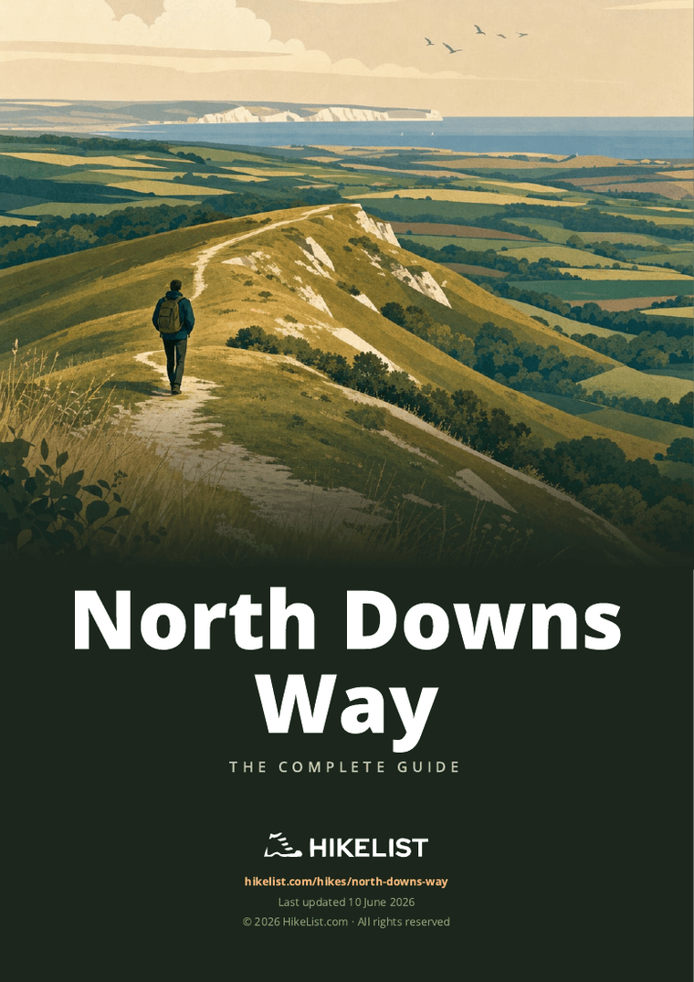
North Downs Way
How would you rate North Downs Way?
Tap a star to share your experience and help other hikers.
North Downs Way: Chalk Hills from Surrey to Dover
HikeList Score
North Downs Way scored 90/100 on HikeList's trail-quality metrics.
See score breakdownHide breakdown
- Ideal length 91
- Balanced challenge 100
- Scenery & wildness 85
- Varied terrain 83
- Accommodation 100
- Food & support 81
- Path quality 80
- Season flexibility 89
Computed from length, challenge, scenery & wildness, terrain variety, accommodation, food & support, path quality and season flexibility.
The North Downs Way is a 246 km waymarked National Trail across south-east England, running from Farnham in Surrey to Dover in Kent. Most walkers take about 12 days. It is a moderate point-to-point hike: low in altitude but with repeated chalk scarp climbs, mixed surfaces and some road walking. It suits first-time long-distance hikers who want reliable waymarking, frequent towns and classic downland scenery. See more England hiking trails for route comparisons.
Route Overview
The route starts at Farnham and heads east along the North Downs through the Surrey Hills and Kent Downs. Key points include Guildford, St Martha's Hill, Box Hill and the Mole Gap near Dorking, Reigate Hill, Colley Hill, Botley Hill, Otford, the Medway, Bluebell Hill, Detling, Charing and Wye. Near Wye it splits into two waymarked options: a southern route via Folkestone and a northern Canterbury Loop via Canterbury. Both lead to the finish at Dover and the White Cliffs. This is a linear trail, so plan onward or return transport from Dover. For other UK long-distance ideas, compare the Beacons Way route guide, Anglesey Coastal Path guide or Annandale Way guide.
History of the North Downs Way
The North Downs Way is a modern National Trail, opened in stages from May 1972 and formally completed in September 1978. It broadly shadows the older Pilgrims' Way between Winchester and Canterbury, but was routed along the chalk escarpment rather than strictly following the medieval line, much of which had become road. The ridge crosses older archaeological landscapes too, including prehistoric remains such as Kit's Coty House near the Medway.
Notable highlights
- Box Hill: A well-known chalk summit above the Mole Gap near Dorking in the Surrey Hills. The trail passes close to ancient box woodland and viewpoints over the Weald.
- St Martha's Hill and church: A hilltop church near Guildford, reached only on foot. It stands directly on the Pilgrims' Way and gives a memorable early ridge section.
- Botley Hill: The highest point of the North Downs Way, at about 270 m near Oxted. It is a modest summit, but the open ridge gives long views south across the Weald.
- Wye Crown: A large chalk crown cut into the downs above Wye in Kent to mark the coronation of King Edward VII. It sits just below the trail and is visible from the surrounding countryside.
- Canterbury Cathedral: On the northern Canterbury Loop, this is the mother church of the Church of England and a UNESCO World Heritage Site. It links the trail directly with the pilgrimage history of Thomas Becket.
- Dover and the White Cliffs: The eastern finish follows the famous White Cliffs above the English Channel. Dover Castle stands nearby above the town and harbour.
Challenges to expect
Expect repeated short climbs rather than mountain altitude, especially around St Martha's Hill, Box Hill, Reigate and Colley Hill, and the final approach to Dover. Surfaces vary between woodland tracks, chalk downland, farm tracks, lanes and minor roads. Chalk and clay can be slippery after rain and muddy in winter. Navigation is usually straightforward thanks to National Trail acorn waymarks, but the Wye split needs a clear route choice.
HikeList Score
North Downs Way scored 90/100 on HikeList's trail-quality metrics.
See score breakdownHide breakdown
- Ideal length 91
- Balanced challenge 100
- Scenery & wildness 85
- Varied terrain 83
- Accommodation 100
- Food & support 81
- Path quality 80
- Season flexibility 89
Computed from length, challenge, scenery & wildness, terrain variety, accommodation, food & support, path quality and season flexibility.
Show more data Show less
- Forest
- Grassland
- Hills
- Paved
- Gravel
- Dirt
- Hotels
- Guesthouses
- Hostels
- Campsites
- Family Friendly
- Dog Friendly On Leash
- Restrooms
- Picnic Areas
- Public Transport Access Points
Download Our Full Guide to North Downs Way FREE!
Get our comprehensive guide to this hike for free. Save it for later reading or print out at home.
In these collections
Photos from hikers
Taken on the trail by people who've reviewed North Downs Way.
North Downs Way: The Complete Guide
 i
Image by Ollie Craig
i
Image by Ollie Craig The North Downs Way is a long, well-waymarked chalk-country trail from Farnham to Dover, crossing the Surrey Hills and Kent Downs on its way to the Channel. It suits walkers who want a serious end-to-end journey without remote mountain logistics: frequent towns, good rail access and classic escarpment walking.
The route mixes open downland, ancient woodland, farm tracks, sunken lanes and river-valley crossings at the Mole, Darent, Medway and Stour. Highlights come steadily rather than in one dramatic block, from St Martha’s Hill and Box Hill to Reigate Hill, Botley Hill, Wye and the White Cliffs of Dover.
Near Wye, the trail gives a real planning choice. The Folkestone route heads for the Heritage Coast and the cliff-top finish into Dover, while the Canterbury Loop turns north through Chilham and Canterbury before also reaching Dover.
This is moderate rather than technical, but it should not be underestimated. The low altitude hides repeated short, steep chalk-scarp climbs, slippery chalk and clay after rain, exposed ridge and cliff sections, and enough road or lane walking to make footwear and pacing matter.
This guide covers route stages, realistic day planning, accommodation, food, transport, terrain and the common mistakes to avoid.
Stage-by-Stage Guide
Distances below are approximate and should be planned alongside current National Trail mapping, live rail times and accommodation availability. The North Downs Way is well waymarked with National Trail acorns, but the combination of ridge paths, woodland tracks, village approaches and the split near Wye still makes a map or GPX sensible.
Stage 1: Farnham to Guildford — 18 km
The trail leaves the official start in Farnham and heads east out of town past Farnham Castle towards the Hog's Back. This is an approachable opening stage, with a mix of town edge, lanes, farm tracks and chalk downland before the route works towards Puttenham and then Guildford.
Underfoot, expect typical North Downs surfaces: firm chalk and field paths in dry weather, with muddier clay and woodland sections after rain. The climbing is not mountainous, but the route begins the pattern of short, repeated rises onto the downs.
Landmarks and views: Farnham Castle gives an immediate sense of departure from town, while the Hog's Back area introduces the open chalk ridge character of the route. Puttenham is the main named village between Farnham and Guildford.
Food and water: Farnham and Guildford are the reliable places to stock up. Do not depend on finding open services in smaller villages without checking ahead, particularly on Sundays or later in the day.
Accommodation: Guildford is one of the more practical overnight stops on the trail, with a wider choice than the smaller ridge settlements. Book ahead if walking in summer or at weekends.
Transport and access: Farnham has direct trains from London Waterloo, making the start straightforward. Guildford also has rail access and is a strong point for joining, leaving or section-walking the route.
Navigation and cautions: The acorn waymarks lead out of Farnham, but pay attention through the transition from town streets to countryside tracks. Chalk can be slippery after rain, and lane sections require normal road-walking care.
Stage 2: Guildford to Westhumble / Box Hill — 21 km
This is one of the classic Surrey Hills stages, linking Guildford with St Martha's Hill, the Pilgrims' Way line and the approach to Box Hill above the Mole Gap. It is more demanding than the first day because the route repeatedly climbs and drops across the scarp landscape.
The path uses sandy and chalky tracks, woodland paths and open downland. In wet weather, shaded woodland and chalk descents can become greasy, especially where the trail has been polished by heavy use.
Landmarks and views: St Martha's Hill and its hilltop church are the key early highlight. Shere lies off route, while the route later approaches the Box Hill area, passing near Denbies vineyard and the River Mole landscape around Westhumble.
Food and water: Guildford is the safest place to start with a full water bottle and food. Westhumble, Box Hill and nearby Dorking are the practical end-of-stage service areas, but opening times should be checked before relying on cafés or pubs during the day.
Accommodation: Beds are usually planned in or near Westhumble, Box Hill or Dorking rather than directly on every ridge section. Some accommodation may require a short walk or taxi from the trail.
Transport and access: Guildford and nearby Dorking have rail access. This makes the stage particularly useful for weekend walkers from London.
Navigation and cautions: The route is well signed, but popular local paths around St Martha's Hill and Box Hill can make it easy to follow the wrong trodden line. Follow the National Trail acorns rather than the busiest path. Expect short steep climbs and potentially slippery chalk around Box Hill in poor weather.
Stage 3: Westhumble to Merstham — 16 km
This stage crosses some of the best-known chalk-scarp ground in Surrey, moving from the Box Hill area towards Reigate Hill, Colley Hill and Merstham. It is shorter than the previous day, but the climbs and descents make it feel more substantial than the distance suggests.
The terrain is a mixture of open downland, woodland and firm tracks, with occasional lanes and road approaches. The chalk scarp gives good walking in dry conditions but can be slick after rain.
Landmarks and views: Box Hill and the Mole Gap are major early features if not fully explored the previous day. Reigate Hill and Colley Hill give broad southward views across the Weald, with the Edwardian drinking fountain on Colley Hill and the wartime fort adding useful landmarks.
Food and water: Westhumble, Box Hill and the Dorking area are the best places to organise supplies at the start. Services directly on the ridge are limited, so carry enough food and water through to Merstham unless a definite stop has been planned.
Accommodation: Merstham is a practical overnight stop, though accommodation may be spread between the village, nearby towns and the rail corridor. Book before arrival rather than assuming a walk-in bed.
Transport and access: Merstham has rail access, and Dorking is near the western end of the stage. Road access is generally good at the named settlements, but the ridge sections between them are less convenient for pick-ups.
Navigation and cautions: There are several popular recreational areas on this stage, so keep checking the acorn waymarks at path junctions. Take care on chalk descents, especially after rain or in winter mud.
Stage 4: Merstham to Oxted — 13 km
This is a shorter stage, but it includes the high point of the North Downs Way at Botley Hill, around 270 m. The day stays close to the escarpment, with a mix of woodland, open ridge and downland views towards the Weald.
The walking is generally straightforward, but the path still rises and falls across the chalk edge. After rain, expect slippery chalk and muddy woodland sections; in dry summer weather, exposed stretches can feel hot with limited shade.
Landmarks and views: Gravelly Hill and Botley Hill are the main named points. Botley Hill is modest in height, but its position on the escarpment gives long views south across the Weald.
Food and water: Merstham and Oxted are the sensible places to plan around. There should not be an assumption of reliable daytime services on the ridge itself.
Accommodation: Oxted and nearby settlements are the usual planning base at the end of this stage. As with much of the North Downs Way, accommodation may not sit directly on the trail line.
Transport and access: Merstham and Oxted both have rail access, making this an easy stage to walk independently or as part of a section itinerary.
Navigation and cautions: The stage is relatively short, but do not underestimate it in poor weather: chalk paths on the escarpment can be awkward when wet. In mist or low light, pay attention where woodland paths and ridge tracks intersect.
Stage 5: Oxted to Otford — 19 km
This stage carries the route east from the Surrey Hills towards the Kent Downs, finishing with the drop into the Darent valley at Otford. It is a varied day of ridge walking, woodland and field paths, with the usual pattern of short climbs rather than one long ascent.
Surfaces are mixed: chalk tracks, woodland paths, field edges and some lane sections. Mud is most likely in shaded woods and on lower approaches after prolonged rain.
Landmarks and views: The escarpment remains the main feature, with long views opening where the path leaves the trees. Otford is the key end point, a historic Kentish village with the ruined Archbishop's Palace and the River Darent crossing nearby.
Food and water: Oxted and Otford are the dependable planning points. Carry what is needed for the day, as intermediate services can be limited and may involve leaving the route.
Accommodation: Otford has the advantage of being a recognised stage stop, but beds can be limited in smaller villages. If staying off route, factor the extra walking or transfer into the day.
Transport and access: Oxted and Otford both have stations. This is another stage that works well for rail-based section walking.
Navigation and cautions: The approach into the Darent valley involves leaving the higher ridge environment, so keep an eye on waymarks where the trail changes character near Otford. Wet chalk and leaf-covered woodland paths can be slippery in autumn and winter.
Stage 6: Otford to Cuxton — 24 km
At around 24 km, this is one of the longer stages in the standard schedule. It crosses a sequence of Kentish villages and downs, passing Kemsing, Wrotham and Trottiscliffe before heading towards Halling, Cuxton and the Medway corridor.
The day is varied rather than technically difficult: expect field paths, chalk tracks, wooded sections, lanes and village approaches. The accumulated distance is the main challenge, especially if conditions are muddy.
Landmarks and views: The route leaves the Darent valley at Otford and works east across the Kent Downs. Towards the end of the day, the Medway crossing area near Halling and Cuxton marks a clear change in landscape, with Rochester nearby across the river.
Food and water: Otford is the best place to start prepared. Kemsing, Wrotham and Trottiscliffe are useful route-planning names, but opening times and availability should be checked before depending on pubs, shops or cafés.
Accommodation: Cuxton and the Medway-side settlements are the natural end-of-stage area. If local beds are scarce, Rochester is near across the Medway and may be considered when planning, but this will add logistics beyond the trail line.
Transport and access: Otford, Kemsing and Cuxton have rail access or nearby station options listed for the trail corridor. Check current train times before committing to a late finish.
Navigation and cautions: Because this is a long day with several settlements and lane sections, fatigue-related navigation mistakes are more likely late on. Keep checking the acorn waymarks at field exits and village edges, and allow extra time in winter mud.
Stage 7: Cuxton to Detling — 20 km
This stage climbs away from the Medway area and follows the downs above Rochester towards Bluebell Hill, Kit's Coty and Detling. It is a strong Kent Downs day, combining wooded ridge walking, open chalk country and historic landmarks.
Underfoot, expect a mixture of chalk, woodland paths, farm tracks and short lane sections. The route is not technical, but some climbs out of valleys and onto the ridge are sharp enough to slow progress.
Landmarks and views: Kit's Coty House, the Neolithic chambered-tomb megalith near Bluebell Hill, is the standout historic feature. The higher ground also gives broad views back over the Medway and surrounding countryside when the route is out of the trees.
Food and water: Cuxton is the sensible start point for supplies. Services on or near the ridge can be intermittent, so carry enough food and water to reach Detling unless a definite stop has been identified.
Accommodation: Detling is the named stage end, but accommodation may be limited in the village itself. Many walkers need to look in the wider Detling area and arrange the extra access carefully.
Transport and access: Cuxton has rail access. The Detling area has rail access nearby, but the exact station or onward connection should be checked before travelling.
Navigation and cautions: Around Bluebell Hill and the Medway-side approaches, the trail interacts with a more complex landscape than the open ridge suggests. Stay with the National Trail waymarks, especially where local paths and access tracks meet.
Stage 8: Detling to Lenham — 15 km
This is a shorter and usually more manageable stage across the Kent Downs, linking Detling with Thurnham, Hollingbourne and Lenham. It can be a useful recovery day after the longer Otford to Cuxton and Cuxton to Detling stages.
The terrain remains typical of the trail: chalk and farm tracks, woodland, field paths and minor lanes. Mud is most likely on lower field sections and shaded tracks after rain.
Landmarks and views: Thurnham and Hollingbourne sit along the route corridor, with the downs continuing to give periodic views south over the Weald. Lenham is the key end point and a practical resupply and overnight location.
Food and water: Detling and Lenham are the main planning points. Do not assume that every intervening village service will be open; carry enough for the full stage if walking outside peak visitor hours.
Accommodation: Lenham is a common overnight stop on this part of the route. Book ahead, as smaller places on the Kent Downs do not have the accommodation depth of larger towns.
Transport and access: Lenham has a station, and the Detling area has nearby rail access. This makes the stage suitable for shorter section days as well as through-walking.
Navigation and cautions: The walking is not severe, but the mixture of field edges and woodland paths means waymarks still matter. After wet weather, allow for slower progress through mud even on a relatively short day.
Stage 9: Lenham to Wye — 18 km
This stage continues east through Charing and Boughton Lees to Wye, where the route choice becomes important. Near Boughton Lees the North Downs Way divides into two waymarked finishes: the southern Folkestone route and the Canterbury Loop.
The day mixes downland, farm tracks, woodland and approaches to villages. There are no technical difficulties, but the navigation decision at the split has practical consequences for accommodation and onward transport.
Landmarks and views: Charing is the main intermediate settlement. Wye sits by the Stour valley, and the surrounding downs lead towards the Wye Crown area on the Folkestone branch.
Food and water: Lenham, Charing and Wye are the sensible places to plan food and water around. Carry supplies between them rather than assuming small services will be open when needed.
Accommodation: Wye is the usual end point for this stage and a logical place to decide which finish to follow. Accommodation should be booked with the next day's branch in mind: Folkestone route walkers head towards Etchinghill and Folkestone, while Canterbury Loop walkers need a different itinerary.
Transport and access: Lenham, Charing and Wye have stations, making this a flexible section for rail access. Check current train times if using Wye as a join or exit point.
Navigation and cautions: Do not drift past the Boughton Lees split without checking the signs. Both branches are waymarked, but they lead to very different overnight stops before eventually finishing at Dover.
Stage 10: Wye to Etchinghill / Folkestone — 24 km, Folkestone route
This is the long southern branch from Wye towards the coast, using the Folkestone route. It is a substantial day by distance and should be treated as one of the bigger stages in the itinerary.
The terrain is mostly downland and ridge walking with field paths, tracks and lanes, gradually shifting towards the more exposed coastal end of the trail. In poor weather, mud and slippery chalk can make the distance feel longer.
Landmarks and views: The Wye Crown lies just below the trail on this branch, cut into the downs above Wye. Etchinghill is the key named point before Folkestone, where the route approaches the coast and the final White Cliffs stage.
Food and water: Start from Wye with enough food and water for a long day. Etchinghill and Folkestone are the main practical service points towards the end, but opening hours should be checked if arriving late.
Accommodation: Folkestone offers the most practical overnight base before the final stage to Dover. Some walkers may plan around Etchinghill, but accommodation and onward transport should be arranged in advance.
Transport and access: Wye and Folkestone both have stations. Folkestone is the stronger end-of-stage transport and accommodation hub.
Navigation and cautions: Make sure the southern Folkestone route is followed from the Wye/Boughton Lees area rather than the Canterbury Loop. The stage is long, and exposed open sections can be tiring in strong wind, heat or persistent rain.
Stage 11: Folkestone to Dover — 14 km, along the White Cliffs
The final stage follows the dramatic chalk coast from Folkestone towards Capel-le-Ferne and Dover. It is shorter than the previous day, but the cliff-top setting makes weather and path conditions more important than the distance alone suggests.
The walking is on exposed coastal chalk paths and cliff-top tracks, with open ground and little shelter in places. The route finishes at Dover by the seafront below Dover Castle, after the famous White Cliffs.
Landmarks and views: Capel-le-Ferne, the White Cliffs of Dover and Dover Castle are the defining features of the finale. On clear days the English Channel setting gives the route a very different feel from the inland downs.
Food and water: Folkestone and Dover are the reliable service points. Carry what is needed between them, as cliff-top facilities and seasonal opening times should not be assumed.
Accommodation: Dover has accommodation options and onward travel links, making it the normal end-of-walk base. Folkestone is the logical previous night if walking the Folkestone branch in this schedule.
Transport and access: Folkestone has rail access. Dover Priory station has regular trains to London, and Dover also has National Express coach services and Channel ferry connections.
Navigation and cautions: Stay on the signed path and keep well back from cliff edges. The final cliffs are exposed to wind and weather, and any cliff-path closures near Folkestone or Dover should be checked on the official National Trail information before travelling.
Canterbury Loop alternative: from Boughton Lees / Wye to Dover via Chilham, Canterbury and Shepherdswell
The Canterbury Loop is the northern waymarked finish from the split near Boughton Lees. It trades the direct Folkestone and White Cliffs approach for a more pilgrimage-focused line through Chilham, Canterbury, Shepherdswell and Waldershare before reaching Dover.
This alternative needs its own stage plan rather than being treated as a minor detour. Accommodation, food stops and transport should be booked around the Canterbury line before leaving Wye, because it does not pass through Folkestone.
Landmarks and views: Chilham is a major village highlight, with its timbered houses, square, castle and church in the Stour valley. Canterbury Cathedral is the key cultural landmark of the loop and links the trail directly with the medieval pilgrimage tradition associated with Thomas Becket.
Food, water and accommodation: Chilham, Canterbury and Shepherdswell are the main named planning points. Canterbury is the strongest service and accommodation hub on this branch, while smaller places should be checked before relying on them.
Transport and access: Chilham, Canterbury and Shepherdswell have rail access, and Dover is the shared finish for both branches. Current rail times and exact station access should be checked before booking fixed travel.
Navigation and cautions: The key navigational decision is at the Boughton Lees split. Once committed to the Canterbury Loop, keep following the relevant National Trail acorns and do not use Folkestone-stage accommodation or transport assumptions.
Recommended Itinerary
Distances below are approximate walking-stage figures. Accommodation detours off the ridge, rail transfers, and the choice of finish after Wye can change the practical daily mileage, so check official mapping before booking.
Standard itinerary: 11 walking days via Folkestone
This is the most direct end-to-end plan for walkers who are comfortable with repeated 15–24 km days and a few longer stages. It uses the Folkestone / White Cliffs finish, which gives the classic coastal approach to Dover.
| Day | From | To | Approx. distance | Why this stage makes sense | Services/accommodation notes |
|---|---|---|---|---|---|
| 1 | Farnham | Guildford | 18 km | A manageable opening day from the official start, leaving Farnham on the acorn-waymarked trail past Farnham Castle and onto the early chalk ridge. | Farnham and Guildford both have rail access. Guildford is a practical first overnight stop with a wider choice of services than the smaller villages on the ridge. |
| 2 | Guildford | Westhumble / Box Hill | 21 km | A strong Surrey Hills stage taking in St Martha’s Hill before continuing towards the Mole Gap and Box Hill. | Westhumble is useful for Box Hill and nearby Dorking. Accommodation may be on or off the route, so check the exact location before booking. |
| 3 | Westhumble | Merstham | 16 km | Shorter on paper, but it includes the Box Hill area and the chalk-scarp ground around Reigate Hill and Colley Hill. | Merstham has rail access and works well as a natural stop before the higher ridge towards Botley Hill. |
| 4 | Merstham | Oxted | 13 km | A deliberately shorter day over Gravelly Hill and towards Botley Hill, the high point of the North Downs Way. | Oxted is near the route and has rail access. This is a useful recovery stage after the early Surrey climbs. |
| 5 | Oxted | Otford | 19 km | Crosses from the Surrey section towards the Kent Downs, ending with the descent into the Darent valley at historic Otford. | Otford has rail access and village services. Book ahead, as accommodation choice on the ridge itself is limited. |
| 6 | Otford | Cuxton | 24 km | One of the longer standard days, crossing the Kent ridge through places such as Kemsing, Wrotham and Trottiscliffe before the Medway-side area around Halling / Cuxton. | Cuxton has rail access. If 24 km is too much, this is a sensible stage to split using accommodation or transport around the intermediate villages; check official mapping before booking. |
| 7 | Cuxton | Detling | 20 km | Continues above the Medway area past Rochester’s side of the valley, Kit’s Coty and Bluebell Hill before reaching the Detling area. | Detling-area accommodation and transport need planning, as the practical overnight stop may not sit directly on the trail. |
| 8 | Detling | Lenham | 15 km | A shorter Kent Downs day through Thurnham and Hollingbourne, keeping the schedule sustainable after the longer Cuxton–Detling stage. | Lenham has rail access and is a good resupply and overnight point before the approach to Wye. |
| 9 | Lenham | Wye | 18 km | Links Lenham, Charing and Boughton Lees before reaching Wye, where the route decision becomes important. | Wye has rail access. This is the key place to decide whether to continue by the Folkestone route or take the Canterbury Loop. |
| 10 | Wye | Etchinghill / Folkestone | 24 km | Commits to the Folkestone route, with the Wye Crown area early in the stage and a long push towards the coast. | Wye and Folkestone have rail access. Stopping at Etchinghill or continuing into Folkestone affects the final day, so check accommodation and onward mileage before booking. |
| 11 | Folkestone | Dover | 14 km | A shorter but memorable final stage along the White Cliffs approach to Dover, with exposed coastal walking before the finish below Dover Castle. | Dover has Dover Priory station, regular London trains and National Express coaches. Check for any current cliff-path closures near Folkestone or Dover before travelling. |
Canterbury Loop alternative
At Boughton Lees near Wye, the North Downs Way splits. The Folkestone route is the more direct coastal finish; the Canterbury Loop gives a pilgrimage-style finish via Chilham, Canterbury, Shepherdswell and Waldershare before rejoining the way to Dover.
Use this option if Canterbury Cathedral is a priority, or if the historical pilgrimage character of the trail matters more than taking the White Cliffs route from Folkestone. Exact daily distances for this variant should be checked on official mapping before booking.
| Stage | From | To | Approx. distance | Why this stage makes sense | Services/accommodation notes |
|---|---|---|---|---|---|
| A | Wye / Boughton Lees | Chilham | Check official mapping before booking | Leaves the shared route and follows the northern loop towards the Stour valley. | Chilham is a logical village stop on the loop, but accommodation availability should be checked early. |
| B | Chilham | Canterbury | Check official mapping before booking | Continues the pilgrimage line to Canterbury Cathedral, the major landmark of the loop. | Canterbury is the main service centre on this option and has rail access. |
| C | Canterbury | Shepherdswell | Check official mapping before booking | Starts the return south-east towards Dover through the eastern Kent Downs. | Shepherdswell has rail access. Confirm accommodation or plan a rail-assisted overnight if needed. |
| D | Shepherdswell | Dover via Waldershare | Check official mapping before booking | Completes the loop to the shared Dover finish. | Dover Priory station and coach connections make Dover the natural end point. |
Slower variant: 12–15 days
A slower schedule suits first-time long-distance walkers, winter or wet-weather trips, and anyone carrying a full pack. The North Downs Way is not high-altitude, but repeated chalk-scarp climbs, mud after rain and accommodation detours can make short-looking days feel longer.
Good places to add time include the Otford–Cuxton stage, which is 24 km in the standard plan, and the Wye–Etchinghill / Folkestone stage, also 24 km. Extra nights can also be built around the Canterbury Loop, using Chilham, Canterbury, Shepherdswell and Dover as the broad sequence.
Because many beds sit 20–30 minutes off the ridge in valley villages, a slower itinerary should be planned around confirmed accommodation rather than mileage alone. This should be checked before travelling.
Faster variant: 9–10 days
A faster itinerary is only sensible for fit walkers who are used to long back-to-back days on mixed surfaces. The obvious way to reduce the schedule is to combine shorter stages, such as Westhumble–Merstham with Merstham–Oxted, or Detling–Lenham with Lenham–Wye.
The trade-off is less flexibility: the already-long Otford–Cuxton and Wye–Etchinghill / Folkestone stages leave little margin for poor weather, muddy chalk, missed trains or accommodation that lies off-route. Faster walkers should still book each night carefully and check current train times before relying on rail-assisted starts or finishes.
Planning the Route
How many days to allow
Most walkers should plan the North Downs Way around accommodation and transport rather than trying to force perfectly equal daily distances. The official guidance of roughly 12 days works well for a steady end-to-end pace, with daily walking long enough to make progress but not so long that every chalk climb becomes a rush.
A 10-day itinerary is possible for fit walkers who are comfortable with repeated long days, limited sightseeing time and some off-route accommodation logistics. A 14–15 day itinerary is better if you want shorter days, more time in places such as Guildford, Box Hill, Otford, Wye, Canterbury or Dover, or a less tiring first long-distance walk.
The route is often walked in sections because rail access is unusually strong. This makes it easy to complete the trail over weekends or day walks from London, especially on the Surrey and west Kent sections.
Stage planning and overnight stops
The trail passes through populated countryside, but it does not always sleep where it walks. Much of the route follows the chalk ridge, while accommodation may be down in valley towns or villages, sometimes 20–30 minutes off the line of the trail.
Good planning means deciding each overnight stop before setting daily mileages. Logical stage ends include places such as Guildford, Westhumble / Box Hill, Merstham, Oxted, Otford, Cuxton, Detling, Lenham, Wye, Folkestone and Dover, but availability can change the shape of the walk.
Book accommodation ahead, especially in summer and at weekends. Do not assume that every village on or near the map has suitable beds, evening food or late check-in options.
Choosing the finish: Folkestone or Canterbury
Near Wye, at Boughton Lees, the North Downs Way divides into two waymarked finishes. This choice should be made before booking the final nights, because the two options use different towns and create different stage shapes.
| Finish option | Best for | Planning notes |
|---|---|---|
| Folkestone route | A direct finish with the Heritage Coast, Folkestone, Capel-le-Ferne, the White Cliffs and Dover | This is the official National Trail length and gives the classic coastal finale. Check current National Trail information before relying on the cliff path near Folkestone and Dover. |
| Canterbury Loop | A more pilgrimage-focused finish via Chilham, Canterbury, Shepherdswell and Waldershare | This option suits walkers who want Canterbury Cathedral and the historic pilgrimage link. It needs its own accommodation plan rather than being treated as a minor variation at the end. |
Both options finish in Dover. If using public transport home, plan around Dover Priory station or onward coach travel from Dover.
Fast, steady or slow?
A steady pace is usually the best fit for this trail. The North Downs are not high mountains, but the walking is rarely flat for long: the route repeatedly drops into gaps and valleys before climbing back to the scarp.
The harder days are not always the longest on paper. Short, steep chalk climbs around places such as St Martha’s Hill, Box Hill, Reigate Hill, Colley Hill and the Kent ridge can make a modest mileage feel heavier, particularly in wet weather or with a full pack.
Walking more slowly also gives useful flexibility. It allows time for off-route accommodation, rail transfers, food stops, and the final exposed coastal section into Dover.
Shortening, extending and section hiking
The North Downs Way is one of the easier National Trails to divide into short trips. Farnham, Guildford, Dorking, Merstham, Oxted, Otford, Kemsing, Cuxton, Lenham, Charing, Wye, Chilham, Canterbury, Shepherdswell, Folkestone and Dover all make practical rail-based planning points on or near the route.
This makes section hiking very practical. Many walkers complete one stage at a time, using trains to reach the start and return from the finish on the same day or over a weekend.
For an end-to-end walk, the same rail access gives useful escape points if weather, injury or accommodation problems disrupt the schedule. Current train times should be checked before travelling, especially for early starts, Sunday travel and rural stations.
Accommodation, food and water
Accommodation is mixed: hotels, guesthouses, B&Bs, inns, a few hostels and campsites in and around the trail towns. The key issue is not whether the wider area has beds, but whether there is a suitable place close enough to the route at the end of each planned day.
Food planning is generally straightforward compared with more remote trails, but do not rely on every ridge section having services. Carry enough food for the walking day and refill water when reliable opportunities arise in towns and villages.
Even where a day starts and ends in places with services, the middle of the stage may be open downland, woodland, farm tracks or minor lanes. In warm weather, the exposed chalk ridge and the final cliffs can feel dry and open.
Navigation and route information
The route is fully waymarked with National Trail acorn signs, so navigation is usually simple in good conditions. Still, a map or downloaded GPX is sensible, particularly through woodland, farmland, road crossings and around the split at Boughton Lees.
Official route information and GPX are available from the National Trails website. OS Explorer mapping for the trail is covered by sheets 145, 146, 147, 148, 149 and 138, and a dedicated Cicerone / National Trail guide is also available.
Check live trail information before setting off. Temporary diversions, path works and any cliff-path closures near Folkestone and Dover can affect the final stages.
Weather and ground conditions
The main weather-related issue is underfoot rather than altitude. Chalk and clay can be slippery after rain, and winter or prolonged wet spells can make woodland and field sections muddy.
The open scarp is also exposed in wind, sun and rain. This matters most on the higher ridge sections and on the coastal approach to Dover, where there is less shelter.
Spring, summer and autumn are the natural seasons for the route. In hot weather, start early on exposed stages and carry enough water; in wet weather, allow extra time for descents and chalk paths.
What matters most when planning
The most important planning decisions are the number of days, the overnight stops, and the finish option after Wye. Once those are fixed, transport and daily logistics are usually manageable.
Prioritise these points:
- Book beds early where stage ends have limited accommodation or require a walk off the ridge.
- Choose the Folkestone route or Canterbury Loop before booking the Kent finish.
- Check train times for section walks, late finishes and the journey home from Dover.
- Carry reliable navigation despite the waymarking, especially around the route split.
- Plan food and water by day, not just by town name on the map.
- Check current National Trail updates before relying on any coastal cliff section or listed diversion.
Permits are not normally the factor that shapes a standard North Downs Way itinerary. Accommodation rules, campsite arrangements and any private bookings should still be checked directly before travelling.
Towns, Villages and Overnight Stops
Accommodation planning on the North Downs Way is usually straightforward, but the best bed for the night is not always directly on the ridge. The trail runs through populated countryside, with hotels, guesthouses, B&Bs, inns, a few hostels and campsites in and near the towns, but many places to sleep sit 20-30 minutes off the main line of the trail in valley villages.
Book each night ahead if walking end-to-end, especially in summer. For food, do not assume every ridge-top village has a shop or reliable evening meal; check pub, cafe and shop opening times before travelling, and carry enough food between the larger service towns.
Farnham
Farnham is the official western start and one of the easiest places on the whole trail for logistics. It is a market town with its own railway station and direct trains from London Waterloo, making it a practical place to arrive the afternoon before starting.
It is a strong overnight stop before Day 1, with the best chance of a full range of town services at the western end of the route. The National Trail acorn waymarks lead east out of town past Farnham Castle towards the Hog's Back, so starting from accommodation in town is simple.
Puttenham
Puttenham comes early on the Surrey section between Farnham and Guildford. It is more useful as a short-rest or route-marker village than as a main end-to-end overnight base.
Do not plan on Puttenham as a guaranteed resupply point without checking current services. Most walkers will continue to Guildford for a fuller choice of accommodation, food and transport.
Guildford
Guildford is one of the key overnight stops on the western half of the North Downs Way. It sits at the end of the common first stage from Farnham and has rail access, making it very useful for both through-hikers and London-based section walkers.
Accommodation and food options are generally far better here than in the small ridge villages either side. It is also a good place to adjust plans after the first day, resupply properly, or join the trail for a weekend section.
St Martha's Hill
St Martha's Hill is a major trail landmark rather than a practical overnight stop. The route climbs to the hilltop church, with views across the Surrey Hills, but walkers should not treat the hill itself as a place for services.
Plan food and accommodation around Guildford, Shere or the next larger stops instead. The climb is short but noticeable, and it is worth leaving time rather than rushing this part of the route.
Shere (off route)
Shere lies off the main line of the North Downs Way and can be useful if accommodation on the ridge is limited. Any detour and return to the trail should be planned carefully so it does not accidentally lengthen the following day more than expected.
As with other off-route villages, current accommodation, pub and shop opening should be checked before travelling. Shere is best considered a flexible stop rather than an automatic stage end.
Westhumble / Box Hill
Westhumble and Box Hill form one of the classic overnight or stage-change points on the Surrey half of the trail. The route crosses the Mole Gap near Box Hill, with the famous chalk summit, ancient box woodland and the River Mole stepping-stones close to the line of the walk.
This is a practical place to break the route after Guildford, though accommodation may require careful booking. Services are more spread out than in a large town, so check where the bed, evening meal and breakfast actually are in relation to the trail.
Dorking (near)
Dorking is near the Box Hill section and is one of the most useful service towns close to the route. It has rail access and is a strong choice if Westhumble or Box Hill accommodation is full, or if a walker wants a wider range of food and resupply options.
Allow for the extra movement between the trail and town when calculating the day. This can work well for section-walkers using trains, but it needs to be built into timings rather than treated as part of the waymarked line.
Reigate Hill and Colley Hill
Reigate Hill and Colley Hill are high, open chalk-scarp sections above Reigate, not primary overnight stops in themselves. They are memorable for views, the Colley Hill drinking fountain and the wartime fort, but services are not the reason to stop here.
Most end-to-end itineraries continue towards Merstham rather than ending on the ridge. Carry water and food for this section unless specific open services have been checked in advance.
Merstham
Merstham is a practical stage end between the Reigate/Colley Hill section and the climb towards Botley Hill and Oxted. It has rail access, which makes it especially useful for section walking and for adjusting an itinerary from London.
Accommodation choice may be more limited than in larger towns, so book ahead and be prepared to stay slightly off the trail if necessary. It is a sensible place to stop if the short but repeated chalk climbs are beginning to add up.
Gravelly Hill and Botley Hill
Gravelly Hill and Botley Hill sit on the ridge between Merstham and Oxted. Botley Hill is the high point of the North Downs Way at about 270 m, but it is a ridge landmark rather than a town stop.
Do not rely on these high points for accommodation or resupply. The practical overnight planning here is usually based on Merstham, Oxted or nearby off-route options.
Oxted (near)
Oxted is the main practical stop after the Botley Hill section and has rail access. It works well as an overnight base, a join-or-leave point, or a shorter-stage alternative for walkers who do not want to push on to Otford in one go.
Because the trail often stays on the ridge while services sit lower down or off the main line, check the exact location of accommodation before booking. Oxted is one of the better places in this part of the route for food, transport and itinerary flexibility.
Otford
Otford is a key Kent stop where the trail drops off the ridge to cross the Darent valley. It is a historic village with the ruined Archbishop's Palace and has rail access, making it useful for both overnight walkers and day hikers.
This is a good point to pause before the longer stretch towards Cuxton. Accommodation should be booked ahead, and evening food should be checked rather than assumed.
Kemsing
Kemsing is near the Otford section and has rail access. It can be useful if Otford accommodation is unavailable or if a walker wants to adjust the stage length.
Treat Kemsing as an alternative logistics base rather than a compulsory stop. Check the walking route between accommodation, station and trail before committing to it.
Wrotham
Wrotham sits on the Kent section between Otford and the Medway crossing area. It can help break up this part of the route, particularly if a full Otford-to-Cuxton day is too long.
Accommodation and food availability should be checked carefully before using it as a planned overnight. Small-village services can be limited or operate reduced hours.
Trottiscliffe
Trottiscliffe is another village on the Kent Downs section before the Medway area. It is more of a local overnight possibility than a major service hub.
It can be useful for splitting a long stage, but only if accommodation and food are arranged in advance. Do not rely on spontaneous availability here during busy periods.
Halling / Cuxton
Halling and Cuxton sit around the Medway crossing section, with Cuxton a common stage end on many itineraries. Cuxton has rail access, making it a useful place to finish or start a section.
This is an important logistics point because the trail has crossed from the Darent and Wrotham area towards the Medway and the next day leads on towards Bluebell Hill and Detling. Book accommodation ahead and check whether the most practical bed is in Halling, Cuxton or slightly away from the exact trail line.
Rochester (near)
Rochester lies near the route across the Medway, rather than directly defining the main National Trail line. It can be useful where accommodation close to Cuxton or Halling is limited.
Using Rochester may involve extra travel or walking, so the connection back to the trail should be planned in advance. It is best treated as a nearby service option rather than a natural on-route stage end.
Kit's Coty / Bluebell Hill
Kit's Coty and Bluebell Hill are important landmarks above the Medway, with the route passing near the Neolithic chambered tomb at Kit's Coty House. They are not, however, practical overnight bases.
Plan this part of the trail around Cuxton, Detling or other nearby settlements with arranged accommodation. Carry food and water through the ridge section unless current services have been checked.
Detling
Detling is a useful Kent Downs overnight stop and a common stage end after Cuxton. It sits near the route before the trail continues towards Thurnham, Hollingbourne and Lenham.
Rail access is available in the Detling area rather than necessarily on the ridge itself, so onward transport should be checked before travelling. Accommodation can be limited compared with larger towns, making advance booking important.
Thurnham
Thurnham lies between Detling and Hollingbourne/Lenham and is more useful as a route settlement than a guaranteed overnight centre. It can help walkers fine-tune a shorter day if accommodation is available nearby.
Check food and accommodation before relying on it. For many itineraries, Lenham is the more practical overnight target after Detling.
Hollingbourne
Hollingbourne is near the trail between Detling and Lenham. It can work as an alternative stop if the standard Detling-to-Lenham stage does not suit the walker or if accommodation availability dictates a different split.
As with other smaller Kent villages, check the exact location of beds and evening food. A place that looks close on the map may still require a descent from the ridge or a road/lane approach.
Lenham
Lenham is one of the more useful overnight stops in the middle of the Kent half. It has rail access and is a common stage end after Detling.
It is a good place to resupply, reset and prepare for the next section towards Charing, Boughton Lees and Wye. Accommodation should still be booked ahead, particularly in summer or at weekends.
Charing
Charing sits between Lenham and Wye and has rail access, making it useful for section walkers and for shortening the Lenham-to-Wye day. It can be a practical alternative overnight if Wye accommodation is full or if a slower itinerary is preferred.
Check services before relying on it for a full resupply. It is especially useful as a flexible bail-out or start point on the Kent ridge.
Boughton Lees
Boughton Lees is important because the North Downs Way splits near here into the Folkestone route and the Canterbury Loop. It is more of a route-decision point than a major overnight base.
Make the choice before reaching this area, as it affects the remaining stages, accommodation pattern and transport planning. The Folkestone route heads towards Etchinghill, Folkestone, Capel-le-Ferne and Dover; the Canterbury Loop goes via Chilham, Canterbury, Shepherdswell and Waldershare before also finishing at Dover.
Wye
Wye is a key overnight stop and decision point on the eastern half of the trail. It has rail access and sits close to the route split area, making it a natural place to pause before choosing the Folkestone route or the Canterbury Loop.
For walkers taking the Folkestone route, Wye is the last major planning point before the long day towards Etchinghill or Folkestone. Accommodation and food should be booked ahead because the next stage can be one of the more demanding logistical stretches.
Etchinghill
Etchinghill lies on the Folkestone route after Wye and is a useful stopping option before the final coastal approach. It can break the Wye-to-Folkestone section if accommodation is available.
Do not assume a full range of services without checking. If planning to stop here rather than continue into Folkestone, confirm accommodation, evening food and the next morning's start point before travelling.
Folkestone
Folkestone is the main town stop on the southern finish and has rail access. It is a practical overnight before the final day to Dover along the White Cliffs.
This is one of the best places near the end of the route for accommodation choice, food and transport flexibility. It also allows walkers to start the final cliff section rested rather than adding it to a long approach from Wye.
Capel-le-Ferne
Capel-le-Ferne lies between Folkestone and Dover on the final coastal section. It is more useful as a point on the day than as the obvious overnight base, because most walkers will choose Folkestone before the final stage or Dover at the finish.
The cliff-top route is exposed, so food, water and weather planning matter even though the stage is not long by end-to-end standards. Any local services should be checked before relying on them.
Dover
Dover is the finish for both waymarked options, by the seafront below Dover Castle after the White Cliffs. It is the strongest end-of-route transport hub, with Dover Priory station offering regular trains to London and National Express coaches also serving the town.
Accommodation and food are generally easier to arrange here than in the smaller villages immediately before it. Dover is also the Channel ferry port, so allow extra time around travel connections rather than assuming a quiet rural finish.
Chilham
Chilham is on the Canterbury Loop, in the Stour valley, and is one of the most attractive village stops on that option. It has rail access and can be used to split the approach to Canterbury.
Accommodation should be booked ahead because this loop has a different service pattern from the Folkestone route. Chilham is especially useful for walkers who want the pilgrimage character of the northern finish rather than the direct coast-and-cliffs line.
Canterbury
Canterbury is the major overnight stop on the Canterbury Loop and one of the most practical service centres on the whole trail. It has rail access and a wide range of town services compared with the smaller villages on either side.
This is the best place on the loop for resupply, rest and flexible transport. It is also the point where the North Downs Way most clearly connects with the historic pilgrimage tradition, with Canterbury Cathedral as the major landmark.
Shepherdswell
Shepherdswell sits on the Canterbury Loop between Canterbury and Dover and has rail access. It is a useful final-stage planning point if the loop is being walked in shorter sections.
Accommodation and food should be checked before committing to an overnight here. It is most useful for transport flexibility and for breaking the approach to Dover.
Waldershare
Waldershare is on the Canterbury Loop approach towards Dover. It is not a major service centre, so it should be treated as a route point rather than a guaranteed overnight stop.
If using accommodation in or near this area, arrange it before travelling and check the route back to the National Trail. Many walkers on the loop will plan the final logistics around Shepherdswell and Dover instead.
Getting to the Start
By train
Farnham is the practical start point for the North Downs Way and has its own railway station. There are direct trains from London Waterloo to Farnham, making the trail especially straightforward to reach without a car.
The official start is in the market town of Farnham rather than at a remote trailhead. From town, follow the National Trail acorn waymarks eastwards past Farnham Castle towards the Hog's Back.
Train times, engineering works and first/last services should be checked before travelling, particularly if starting the first stage to Guildford on the same day.
By bus
Bus is usually a secondary option for reaching the start, as the railway station makes Farnham easier to access by train. If using buses to reach Farnham from nearby towns, or to link accommodation with the start, check current local timetables before relying on them.
A taxi can be useful if arriving late, staying outside the town centre, or wanting a simple transfer from accommodation to the official start. Taxi availability should be checked in advance for early morning starts.
By car
Driving to Farnham is possible, but the North Downs Way is a point-to-point trail finishing in Dover, so leaving a car at the start creates a return-journey problem. Most end-to-end walkers will find public transport simpler than arranging long-stay parking and a later rail journey back from Dover.
If parking in Farnham, use a proper long-stay car park or accommodation parking rather than assuming street parking will be suitable for several days. Parking rules, charges and overnight restrictions should be checked before travelling.
From the nearest airport
For international arrivals, the simplest approach is usually to travel into London and then take the train from London Waterloo to Farnham. Exact airport-to-station connections vary by airport, arrival time and engineering works, so this should be checked before travelling.
Because the trail starts in a well-connected town rather than a rural trailhead, there is normally no need for a private airport transfer unless arriving late or carrying unusually heavy luggage.
Where to stay before starting
Farnham is the best place to stay before beginning the trail, especially if starting the first stage to Guildford in the morning. Staying in town keeps the logistics simple and avoids needing a pre-walk taxi or bus connection.
Guildford is another practical base because it is on the early route and has good rail access, but staying there means travelling back to Farnham before starting the walk. Accommodation should be booked ahead in busy periods, especially if the first day’s plan depends on an early start.
Getting Home from the Finish
Both waymarked North Downs Way options finish in Dover, by the seafront below Dover Castle after the White Cliffs. Dover is one of the easier National Trail finishes to leave by public transport, but late arrivals should still check same-day train and coach times before committing to onward travel.
By train
The nearest railway station for the finish is Dover Priory. It has regular trains to London, making it the most straightforward way home for most walkers and the best option if returning to the start area by public transport.
If a car has been left near the start at Farnham, plan the return as a rail journey from Dover Priory towards London, then onward to Farnham. Exact routes, changes and last trains should be checked before travelling, especially on Sundays, bank holidays and during engineering works.
Dover is also useful for section-walkers who have used the rail-accessible stages across Surrey and Kent. If finishing the Folkestone route or the Canterbury Loop in shorter blocks, Dover Priory gives a clear end-point for the final section.
By bus
Dover has National Express coach services, including onward links towards London. Coach times and stops are timetable-dependent and should be checked before travelling, particularly if finishing late in the day or walking outside the main summer season.
Local bus options may be useful for short onward journeys around Dover or to nearby accommodation, but they should not be relied on without checking current timetables. After a long final day over the White Cliffs, build in enough time to reach the stop from the seafront finish.
By car/taxi
A taxi is useful for the short transfer from the seafront finish to Dover Priory, to accommodation, or to a pre-arranged pick-up point. This is especially sensible if arriving tired, in poor weather, or after dark.
Leaving a car at Dover and travelling to Farnham for the start can work, but it turns the access leg into a cross-country rail transfer before the walk begins. Most walkers using public transport will find it simpler to travel to Farnham at the start and leave Dover by train at the end.
Parking arrangements in Dover, long-stay rules and taxi availability change over time. This should be checked before travelling.
From the nearest airport
Dover is not an airport finish. For flights, the practical approach is usually to travel by train or coach towards London and connect from there to the relevant airport.
Specific airport routes, transfer times and late-evening connections vary by terminal and date. This should be checked before booking flights, and it is usually safer to avoid a tight same-day flight after completing the final cliff stage.
Where to stay at the finish
Dover is a substantial Channel port and a practical place to stop at the end of the trail. Staying overnight is a good choice if finishing late, if onward trains or coaches are limited, or if there is any risk of delays on the final stage from Folkestone or the Canterbury Loop approach.
An overnight in Dover also removes pressure from the White Cliffs finale, where weather, exposed ground and photo stops can slow progress. Book ahead in busy periods and check the location of accommodation against the seafront finish and Dover Priory before committing.
Which Direction Should You Walk?
Standard direction: Farnham to Dover
The North Downs Way is best planned eastbound, from Farnham to Dover. Farnham is the official start, the National Trail acorn waymarks lead east out of town past Farnham Castle, and both waymarked finishes ultimately end at Dover by the seafront below Dover Castle.
This direction gives the strongest sense of progression. The route begins with the Surrey Hills, crosses into the Kent Downs, then finishes either with the White Cliffs and English Channel on the Folkestone route, or with the pilgrimage feel of Chilham and Canterbury before the final approach to Dover on the Canterbury Loop.
Transport also works well eastbound. Farnham has a railway station with direct trains from London Waterloo, making it a straightforward place to reach for the first day. At the far end, Dover Priory has regular trains to London and National Express coaches, so finishing transport is also simple.
The psychological finish is the biggest argument for walking this way. Ending above the Channel, with Dover Castle and the White Cliffs as the final landmark, is a much more satisfying conclusion than arriving inland at Farnham after leaving the coast behind.
Reverse direction: Dover to Farnham
Walking westbound is perfectly workable, especially for section-walkers or anyone with accommodation already fixed. Dover is easy to reach by rail and coach, and Farnham is a convenient final town with direct trains back to London Waterloo.
The main drawback is the shape of the journey. Starting with the coast and White Cliffs gives an immediate highlight, but the route then becomes a long inland traverse of the Kent Downs and Surrey Hills. That is still excellent walking, but it lacks the natural build-up towards a coastal finale.
The climbs are not significantly easier in either direction. The North Downs Way is low in absolute altitude, but it repeatedly drops into river valleys and climbs back onto the chalk escarpment, including around the Mole at Box Hill, the Darent at Otford, the Medway near Cuxton and the Stour near Wye. Those short, steep chalk climbs have to be tackled whichever way you walk.
Weather is not a decisive reason to choose one direction. The open ridge, chalk grassland and final cliff sections can be exposed in poor weather or strong wind either way, so day-to-day forecasts matter more than the overall direction of travel.
Accommodation and stage flow
Accommodation planning is broadly similar in both directions because the trail passes close to frequent towns, villages and railway stations. Guildford, Westhumble, Merstham, Oxted, Otford, Cuxton, Detling, Lenham, Wye, Folkestone, Canterbury and Dover all help break the route into practical stages, though beds may sit off the ridge and should be booked ahead.
Eastbound has the advantage that common itineraries naturally build towards the route split near Wye. From there, it is easy to choose between the Folkestone finish, with the Heritage Coast and White Cliffs, or the Canterbury Loop, with Chilham, Canterbury and Shepherdswell before Dover.
Recommendation
Walk the North Downs Way eastbound from Farnham to Dover unless there is a specific transport, accommodation or section-walking reason to do otherwise. It follows the official start-to-finish logic, keeps transport straightforward at both ends, gives the best scenic progression, and saves the White Cliffs of Dover for the most memorable finish.
Accommodation Along the Route
The North Downs Way is a practical inn-to-inn trail, but it is not a route where every ridge-top stage ends beside a cluster of beds. Accommodation is spread through market towns, valley villages and nearby rail towns, and on several nights the best option may be 20–30 minutes off the line of the trail.
Book the overnight stops before fixing daily mileage. This is especially important in summer, on weekends, and around the more popular places such as Box Hill, Canterbury, Folkestone and Dover.
Main overnight stops
The easiest end-to-end accommodation pattern follows the established stage towns: Farnham, Guildford, Westhumble or Dorking, Merstham, Oxted, Otford, Cuxton, Detling, Lenham, Wye, then either Folkestone and Dover on the coastal finish, or Chilham, Canterbury, Shepherdswell and Dover on the Canterbury Loop.
The larger towns give the most flexibility. Guildford, Dorking, Canterbury, Folkestone and Dover are the strongest places to absorb a change of plan, a rest night or a late booking. Smaller villages such as Detling, Lenham, Charing, Wye, Chilham and Shepherdswell are useful walking stops but should not be treated as places where a bed will simply be available on arrival.
| Place | Accommodation level | Best for | Notes |
|---|---|---|---|
| Farnham | Good | Start night | A sensible place to stay before beginning the walk, with rail access and town services. |
| Puttenham / early Surrey ridge | Limited | Short first-day adjustment | Not a main overnight hub for most walkers; Guildford gives a much stronger first-stage finish. |
| Guildford | Good | First major overnight stop | One of the easiest places on the route for hotels, guesthouses and services. Useful if arriving by train from London. |
| St Martha's Hill | None | Not an overnight base | A scenic ridge section rather than a place to plan a stop; use Guildford or accommodation off route. |
| Westhumble / Box Hill / Dorking | Good | Box Hill stage | Westhumble is close to the trail, while Dorking nearby broadens the choice. Book ahead for weekends. |
| Merstham | Limited | Short Surrey stage stop | Practical for breaking the walk between Box Hill and Oxted, but options are more limited than in larger towns. |
| Oxted | Good | End of the Surrey ridge section | A useful overnight base near the trail, with rail access and services before the Kent stages. |
| Otford / Kemsing | Limited | Darent valley stop | Good for splitting the route after Oxted, but accommodation should be arranged in advance. |
| Wrotham / Trottiscliffe | Limited | Alternative split between Otford and Cuxton | Useful if adjusting the long Otford–Cuxton section. This should be checked before travelling. |
| Cuxton / Halling | Limited | Medway crossing stage | A practical stopping area with rail access, but not a large accommodation centre. |
| Detling | Limited | Kent ridge stop | A key overnight point on many itineraries. Book early or be prepared to transfer from nearby accommodation. |
| Hollingbourne / Lenham | Limited | Mid-Kent Downs stage | Lenham is a common stop, with nearby valley villages also useful. Availability can be tight. |
| Charing | Limited | Shorter-stage option before Wye | Helpful for walkers shortening the Lenham–Wye section or building a slower itinerary. |
| Wye | Limited | Route-split decision point | Important to book before choosing the Folkestone route or Canterbury Loop, as it is a natural staging point. |
| Etchinghill | Limited | Final inland stop on the Folkestone route | Useful before the coast, but if accommodation is unavailable, Folkestone is the stronger base. |
| Folkestone | Good | Coastal finish route overnight | The best-served stop before the final White Cliffs stage to Dover. |
| Capel-le-Ferne | Limited | Short final-stage adjustment | Usually more relevant as a point on the Folkestone–Dover day than as a main overnight stop. |
| Dover | Good | Finish night | Strongest finish-base choice, with Dover Priory station and onward transport options. |
| Chilham | Limited | Canterbury Loop village stop | Attractive and useful on the northern loop, but book ahead rather than relying on walk-up availability. |
| Canterbury | Good | Canterbury Loop rest or overnight stop | The strongest accommodation centre on the loop and a logical place for a rest night. |
| Shepherdswell | Limited | Final approach to Dover on the Canterbury Loop | Useful for breaking the last loop stages, but accommodation should be checked before travelling. |
Booking strategy
For a full continuous walk, arrange accommodation stage by stage rather than leaving gaps to solve en route. The trail passes through populated countryside, but the escarpment route often sits above the places where beds, pubs and shops are found.
The most awkward nights are usually the small-village stops rather than the big towns. Detling, Lenham, Wye, Chilham and Shepherdswell can all be convenient on paper, but limited supply means one unavailable night can force a longer day, a taxi transfer or a revised itinerary.
A 10–15 day schedule is usually easier to book than a very fast crossing because it gives more options to use larger towns and nearby rail-served places. Slower itineraries also make it easier to divert slightly off the trail for accommodation without turning the next morning into a rushed start.
Using transfers and nearby towns
Taxi transfers can make the accommodation plan much easier where the trail runs along the ridge but beds are down in the valley. This is particularly useful around the smaller Kent Downs stops and on stages where the planned endpoint has limited accommodation.
The rail network is a major advantage on this trail. Farnham, Guildford, Dorking, Merstham, Oxted, Otford, Kemsing, Cuxton, Lenham, Charing, Wye, Chilham, Canterbury, Shepherdswell, Folkestone and Dover all have, or are near, stations, so section-walkers can often sleep in a larger town and return to the trail the next day.
If using baggage transfer, check that the provider covers the exact overnight stops before booking non-refundable rooms. Some itineraries that look simple on a map become awkward if a bag cannot be delivered to a small village or an off-route guesthouse.
Camping, hostels and budget options
There are some hostels and campsites in and near the towns, but the North Downs Way is not the easiest trail to plan as a campsite-every-night route. Do not assume that each stage endpoint has a convenient campsite close to the path.
Budget walkers will usually find the route easier by combining occasional hostels, campsites, simple rooms and rail-based section walking. For camping-specific itineraries, each night should be checked individually before travelling.
Camping and Wild Camping
Is the North Downs Way suitable for camping?
Camping is possible on the North Downs Way, but it needs more planning than on a remote upland trail. The route passes through populated countryside with towns, villages and railway access, but it often stays high on the chalk ridge while accommodation and services sit down in the valleys or just off route.
The trail is better suited to a mixed accommodation plan than to a simple “camp anywhere” approach. There are campsites in and near some trail towns, but they are not evenly spaced, so each night should be planned before setting off. This should be checked before travelling.
Carrying camping kit is manageable, as the route has no technical ground and modest altitude, but the repeated short, steep chalk climbs make pack weight noticeable. In wet weather, chalk and clay can also become slippery and muddy, which makes heavy-load walking slower.
Campsites on or near the route
Expect to use campsites near towns and villages rather than directly on the ridge. Some nights may require a 20–30 minute walk off the North Downs Way to reach accommodation, and the same can apply to camping.
Useful planning points include:
- Book ahead in summer, especially for weekends and holiday periods.
- Check whether the site accepts walkers with small tents, as some rural sites are geared more towards caravans or longer stays.
- Confirm arrival times, particularly if a stage ends late after a long ridge section.
- Check food and water access before committing to a campsite, as not every off-route location will have nearby shops or evening services.
- Use railway access to split awkward camping gaps, as places such as Guildford, Dorking, Merstham, Oxted, Otford, Cuxton, Lenham, Wye, Folkestone, Canterbury and Dover make section logistics much easier.
The most practical camping nights are usually those close to larger settlements or transport points, where resupply and escape options are easier. The more exposed ridge sections, the Kent Downs farmland and the final approach towards the White Cliffs are less forgiving places to finish without a confirmed pitch.
Wild camping legality and practical reality
Wild camping is not a general legal right in England. On the North Downs Way, you should assume that land is private unless you have explicit permission from the landowner.
This matters on this route because much of the trail crosses farmland, woodland, chalk grassland, National Landscapes and managed countryside close to settlements. Discreet, unauthorised camping is not something to plan around, and it can create problems for landowners, conservation work and other trail users.
If a farm, pub, campsite or landowner offers a legal pitch by arrangement, confirm the details before relying on it. Otherwise, plan to use official campsites or indoor accommodation.
Where camping works best
Camping works best on the North Downs Way when it is built around known overnight stops rather than chosen spontaneously at the end of each day. The route’s strong rail access also makes it easy to combine camping with day or weekend sections.
A practical approach is to plan around settlements such as Guildford, Westhumble / Box Hill, Merstham, Oxted, Otford, Cuxton, Detling, Lenham, Wye, Folkestone, Canterbury and Dover, then check current campsite availability nearby. Not every place will have a convenient pitch, and some campsites may sit away from the actual trail.
The Folkestone route gives the classic coastal finish, but the final cliffs are exposed and not suitable for casual camping. The Canterbury Loop is more settlement-based, but still requires confirmed places to stay rather than assumptions about wild camping.
Water and resupply
Do not rely on finding water on the chalk ridge. The North Downs Way crosses rivers at the Mole, Darent, Medway and Stour, but these are route features, not guaranteed drinking-water sources.
Carry enough water between settlements and refill at accommodation, campsites and reliable public services where available. In warm weather, the open chalk grassland, scarp tops and final cliff sections can feel exposed, so start dry ridge sections with more water than a map distance alone might suggest.
Food resupply is easiest in the larger towns and transport points. If camping away from a town centre, buy food before leaving the valley or station area, rather than assuming there will be shops near the pitch.
Fires, stoves and impact
Open fires are not appropriate on this route. The North Downs Way passes through chalk grassland, ancient woodland, farmland and protected landscapes where fire risk, habitat damage and landowner concerns are serious issues.
Use a small camping stove only where it is permitted by the campsite or landowner, and never on dry grass, in woodland leaf litter or close to crops. In hot or very dry conditions, stove use may be restricted locally; this should be checked before travelling.
Follow strict low-impact practice:
- camp only where permitted;
- keep groups small and quiet;
- use existing facilities wherever possible;
- take all litter out, including food waste;
- never damage fences, gates, crops or woodland;
- avoid disturbing livestock and wildlife;
- leave no visible trace of the pitch.
Seasonal considerations
Spring, summer and autumn are the main camping seasons for the North Downs Way. Spring and autumn can mean muddy paths, slippery chalk and colder nights on exposed ridge sections.
Summer gives longer daylight and easier laundry/drying conditions, but accommodation and campsites are busier. Carry more water on warm days, particularly across open chalk downland and on the approach to Folkestone, Capel-le-Ferne and Dover.
Winter camping is possible only for well-prepared walkers with confirmed places to stay, but it is not the natural season for this trail. Short daylight, mud and limited campsite availability make indoor accommodation or section-walking by train more practical.
Food, Water and Resupply
The North Downs Way is not a wilderness route, but it is not a continuous village-to-village high street either. Much of the walking is on chalk ridge, woodland, farm tracks and scarp-top paths, while shops, cafés and pubs often sit below the trail in valley villages or towns. Plan each day’s food before leaving the overnight stop rather than assuming there will be something directly on the path.
Main resupply is easiest in the larger towns and transport hubs along or near the route: Farnham, Guildford, Dorking / Westhumble, Merstham, Oxted, Otford, Cuxton, Lenham, Charing, Wye, Folkestone, Canterbury and Dover. Smaller places such as Puttenham, Kemsing, Wrotham, Trottiscliffe, Detling, Hollingbourne, Etchinghill, Chilham, Shepherdswell and Capel-le-Ferne may be useful for pubs, cafés or village shops, but opening hours can be limited and should be checked before travelling.
How much food to carry
For most stages, carry a full day’s walking food: lunch, snacks and an emergency reserve. Even where a pub or café lies close to the route, it may be closed, fully booked, outside serving hours or require a detour off the ridge.
This is especially important on the longer and more rural-feeling stages, including Otford to Cuxton, Cuxton to Detling, Wye to Etchinghill / Folkestone, and any Canterbury Loop stages away from Canterbury itself. On these days, start with enough food to finish the stage without buying anything en route.
If staying in accommodation away from the trail, check evening meal arrangements when booking. Some B&Bs and guesthouses may not serve dinner, and the nearest pub or shop may be a further walk from the route.
Water planning
Do not rely on frequent public taps. The safest routine is to fill bottles at accommodation each morning, refill at cafés, pubs or shops when using them, and carry enough to complete the next ridge section if nothing is open.
A typical cool-weather day on the North Downs Way usually calls for at least 1.5–2 litres of water. In warm weather, on exposed chalk grassland, or on longer 20–24 km stages, many walkers will need more. The open ridge, the Kent Downs and the final White Cliffs section can feel dry and exposed in sun and wind.
The route crosses rivers at the Mole, Darent, Medway and Stour, but natural water should not be treated as a routine drinking supply. These are lowland river and farmland catchments, and any natural water used in an emergency should be filtered or treated.
Closures and opening hours
Rural pubs and cafés may close on certain weekdays, stop serving food between lunch and evening, or operate seasonal hours. Sunday and bank holiday services can be reduced, especially in smaller villages.
For a continuous end-to-end walk, check food options for every overnight stop before booking. For section-walking from London by train, buy food before leaving the station town if the day’s route heads quickly onto the ridge.
| Section | Food availability | Water availability | Notes |
|---|---|---|---|
| Farnham to Guildford | Good at the start and finish; limited once the route leaves Farnham and heads over the early ridge country. | Fill before leaving Farnham; refill reliably only where services are open. | Carry lunch from Farnham unless planning a checked stop. |
| Guildford to Westhumble / Box Hill | Good at Guildford and around the Dorking / Westhumble end; intermittent between ridge and woodland sections. | Start full from Guildford; expect refills mainly from cafés, pubs or accommodation. | St Martha’s Hill and the Box Hill area can be busy, but do not assume food is available exactly when needed. |
| Westhumble to Merstham | Food is easiest near the valley towns and at the finish; ridge sections can be sparse. | Carry enough water for the full day if not stopping in a serviced place. | The route includes repeated chalk-scarp walking, so allow for higher water use in warm weather. |
| Merstham to Oxted | Food options are best at the stage ends; the high ground around Botley Hill is not a place to depend on resupply. | Fill before leaving Merstham; refill at Oxted or an open service en route. | Shorter distance, but the exposed ridge can still be dry. |
| Oxted to Otford | Resupply is mainly at Oxted and Otford, with limited certainty between. | Carry sufficient water from Oxted unless a planned stop has been checked. | The trail crosses into the Kent Downs and continues to alternate ridge and valley walking. |
| Otford to Cuxton | Treat as a longer day with limited guaranteed food on the trail. | Start with a full water carry; refill only where open services are available. | At around 24 km, this is one of the days where carrying full lunch, snacks and extra water is sensible. |
| Cuxton to Detling | Food availability can be patchy between the Medway area and Detling. | Fill before departure and do not rely on natural water near the Medway. | Check any planned pub or shop stops before setting off. |
| Detling to Lenham | Limited between villages; better planned from the overnight stops. | Carry enough water to reach Lenham if no checked stop is available. | A shorter stage, but rural opening hours still matter. |
| Lenham to Wye | Food is most dependable at Lenham, Charing and Wye; availability between them should be checked. | Start full and refill only from open businesses or accommodation. | This is a practical resupply stretch before the route split near Boughton Lees. |
| Wye to Etchinghill / Folkestone | Carry full day food from Wye unless a stop has been checked. Folkestone offers the strongest end-of-day resupply. | Carry plenty of water, especially in warm weather and on exposed downland. | At around 24 km, this is a key stage for self-sufficiency. |
| Folkestone to Dover | Food is available at the town ends; options on the cliff section should not be relied on without checking. | Fill before leaving Folkestone; carry enough for the White Cliffs section to Dover. | Exposed coastal walking can increase water needs despite the modest distance. |
| Canterbury Loop: Wye / Boughton Lees to Dover via Chilham, Canterbury and Shepherdswell | Canterbury is the main resupply point on this option; smaller villages may have limited or variable services. | Refill in towns and accommodation; do not assume public taps or regular water points between settlements. | This option is longer overall and should be planned stage by stage, especially outside Canterbury. |
Terrain, Conditions and Difficulty in Practice
The North Downs Way is a moderate lowland trail, not a mountain route. Its difficulty comes from distance, accumulated ascent and changing surfaces rather than altitude, navigation or technical ground. The high point at Botley Hill is only about 270 m, but the route repeatedly drops into river valleys and climbs back to the chalk escarpment.
Expect a mix of open chalk grassland, woodland paths, farm tracks, sunken lanes and some minor-road walking. The National Trail acorn waymarking makes the line generally straightforward, but wet chalk, clay and winter mud can make an otherwise easy path feel tiring and slow.
Surfaces underfoot
Chalk downland is the defining surface. In dry weather it can be firm, fast and pleasant underfoot; after rain it can become greasy, especially on descents and shaded woodland sections. Clay-rich stretches and lower ground can also hold mud in winter and after prolonged wet weather.
Woodland sections through broadleaf and box woodland add shade and shelter, but they are also where paths can stay damp for longer. Sunken lanes can be rutted and slippery when wet. Farm tracks are usually non-technical, though hard surfaces can be tiring over long days.
There is no scrambling, no exposed mountain ridge walking and no rocky technical terrain. Lightweight walking shoes or trail shoes are often enough in settled dry weather, but grippy soles matter. In wet periods, many walkers will prefer waterproof footwear and poles for the steeper chalk climbs and descents.
Climbs, descents and cumulative effort
The route feels hillier than its modest altitude suggests. Total ascent is around 5,476 m, built from repeated short climbs rather than one sustained mountain day. This is the main reason a full end-to-end should not be underestimated.
The Surrey Hills section includes notable climbs around St Martha's Hill, Box Hill, Reigate Hill, Colley Hill and Botley Hill. These are not long alpine climbs, but they are steep enough to slow progress, especially with a full pack or on wet chalk.
The Kent Downs continue the same pattern: ridge walking broken by valley crossings, lanes, woodland and open downland. The route drops to cross the Darent at Otford, the Medway near Rochester and Cuxton, and the Stour near Wye, each adding descent and re-ascent to the day.
Road and lane sections
The North Downs Way is mainly a countryside trail, but it is not a continuous remote footpath. There are some minor-road and lane sections, particularly where the route links villages, crosses valleys or threads through settled countryside.
Road walking is not the hardest terrain physically, but it affects pacing and foot comfort. Hard tarmac can be tiring at the end of a long stage, and care is needed on narrow lanes where there may be limited verge.
Exposed sections
The open chalk ridge is exposed to wind, sun and rain in places, particularly on the escarpment edges with long views south across the Weald. Shelter can be limited on open grassland compared with the woodland sections.
The final Folkestone route to Dover adds the most obvious exposure, with the White Cliffs and the English Channel coastline near the finish. This is still a waymarked National Trail rather than technical coastal mountaineering, but weather and any cliff-path closures matter here. Check live trail diversions and cliff-path conditions before travelling.
Mud, chalk and seasonal conditions
Spring, summer and autumn are the natural walking seasons for the North Downs Way. Spring can bring good walking temperatures and wildflower-rich chalk grassland, but paths may still be soft after wet weather. Summer is usually the fastest season underfoot, though the open downs can feel hot and exposed.
Autumn is often comfortable for walking, with cooler days and generally manageable conditions, but rain can quickly make chalk descents slippery. Winter is possible for experienced day walkers and section walkers, but mud, short daylight and slippery clay make it a slower, less forgiving undertaking.
| Condition | Where it matters most | Practical effect |
|---|---|---|
| Wet chalk | Steeper scarp climbs and descents, including Surrey Hills and Kent ridge sections | Slippery underfoot; use grippy footwear and allow extra time |
| Mud and clay | Woodland, sunken lanes and lower ground after rain | Slower progress; waterproof footwear may be worthwhile |
| Open exposure | Chalk ridges and the final cliffs near Folkestone and Dover | Wind, sun and rain have more impact; carry layers and sun protection |
| Hard surfaces | Minor roads, lanes and some tracks | Can tire feet and joints on long days |
| Cumulative ascent | Throughout, especially around river-valley crossings | Moderate stages can feel harder than their distance suggests |
Livestock, fields and rights of way
The trail passes through farmed countryside as well as woodland and downland. Livestock is not the main difficulty of the North Downs Way, but normal countryside practice applies: keep dogs under close control, leave gates as found and do not assume every open field is free walking away from the signed line.
The route is a waymarked National Trail, so navigation is usually easier than on an unsigned network of local paths. Even so, field edges, woodland junctions and road crossings are the places where walkers most need to pay attention to the acorn waymarks and map line.
What makes it easier or harder in practice
The route is easier because it is well waymarked, low in altitude and never technically difficult. Frequent towns and transport links also make it simple to shorten stages, section-walk the trail or escape poor weather.
It becomes harder when several modest factors stack up: a long day, a full pack, wet chalk, muddy woodland and repeated climbs in and out of valleys. The North Downs Way rewards steady pacing more than speed; the steepest sections are short, but there are enough of them to matter over 10 to 15 days.
Weather and Best Time to Walk
Best season
The North Downs Way is best planned between spring and autumn, when daylight is long enough for full stages and the chalk ridges, woodland tracks and valley crossings are generally easier underfoot. Late spring and early autumn are often the most practical periods: usually mild, less pressured for accommodation than peak summer, and more comfortable for repeated climbs on open downland.
Summer is a good time to walk the whole trail, but book beds ahead, especially in the smaller places where accommodation may sit 20–30 minutes off the ridge. Exposed sections such as Reigate Hill, Colley Hill, Botley Hill, the Kent ridge and the final White Cliffs can feel hot in still weather, and shade is intermittent on open chalk grassland.
Winter is realistic for experienced walkers and section-hikers, particularly because rail access is excellent, but it is the least convenient season for a full end-to-end. Short daylight, muddy surfaces and slippery chalk make the repeated short climbs and descents more tiring than the route’s modest height suggests.
Weather hazards that matter on this trail
This is not a high mountain route: the high point at Botley Hill is only about 270 m. The main weather issues are surface conditions, exposure and daylight rather than altitude.
After rain, chalk and clay can become very slippery, especially on descents from the scarp and in sunken lanes. Poles are useful in wet weather, and shoes or boots with reliable grip matter more than heavy mountain footwear.
The open ridge is exposed in wind and poor visibility. On the final approach via Folkestone, Capel-le-Ferne and Dover, the cliff-top sections above the Channel should be treated with extra care in strong winds, fog or storms, and any live cliff-path closures near Folkestone and Dover should be checked before travelling.
Snow and ice are not the normal planning problem on the North Downs Way, but they can make chalk paths, lanes and wooded descents treacherous when they do occur. In freezing conditions, shorten stages and be ready to use the trail’s frequent railway access to stop early.
Trail conditions by season
| Season | What to expect | Planning advice |
|---|---|---|
| Spring | Good walking conditions, but wet spells can leave chalk and clay greasy. Woodland and valley sections may still be muddy. | A strong choice for a full traverse. Carry waterproofs and allow extra time after heavy rain. |
| Summer | Long daylight and generally the easiest logistics, but open ridges can be hot and accommodation demand is higher. | Start early on warm days, carry enough water between villages, and book overnight stops ahead. |
| Autumn | Often one of the best seasons for walking, with cooler temperatures and less heat on exposed downs. Wet weather can quickly make descents slippery. | Good for end-to-end walkers and weekend section hikes. Keep stages realistic as daylight shortens. |
| Winter | Short days, mud, slippery chalk and occasional ice. The route remains accessible, but progress can be slower. | Best suited to shorter sections using trains. A full traverse is possible, but less comfortable and more weather-dependent. |
Daylight and stage length
The official guidance assumes roughly 12 days at about 13 miles a day, and many walkers take 10–15 days. In late spring and summer that leaves a useful margin for café stops, detours to accommodation and slower climbs.
In winter, the same mileage can become tight once mud, early dusk and off-route accommodation are included. Stages such as Otford to Cuxton and Wye to Etchinghill / Folkestone are longer in the standard itinerary, so they need particular care when daylight is limited.
Accommodation and seasonal pressure
Accommodation is reasonably available along and near the trail, but it is not always directly on the ridge. In summer and at weekends, book ahead rather than assuming a bed will be available in the next village.
For winter walking, check that smaller B&Bs, campsites and inns are open before building an itinerary around them. This should be checked before travelling, especially on quieter midweek dates.
Safety Notes
The North Downs Way is a well-waymarked lowland National Trail, not a mountain route, but it still needs sensible day-to-day risk management. The main hazards are slippery chalk, repeated steep climbs and descents, exposed ridge sections, road and lane walking, livestock, and the cliff-top finish between Folkestone and Dover.
Emergency help
In an emergency in the UK, call 999 or 112 and ask for the relevant service. Give the nearest place name, road, landmark, grid reference or GPS location; the trail passes frequent towns and villages, but some ridge sections are away from immediate road access.
Mobile signal is generally more likely near settlements such as Guildford, Dorking, Merstham, Oxted, Otford, Cuxton, Lenham, Wye, Folkestone and Dover, but it should not be relied on everywhere. Carry an offline map or downloaded route file, plus a battery reserve, especially when walking solo or late in the day.
Ground conditions and slips
Chalk and clay can become very slippery after rain, and the route can be muddy in winter. Take particular care on the short, steep scarp climbs and descents around places such as St Martha's Hill, Box Hill, Reigate Hill, Colley Hill, the Kent ridge and the final approach to the coast.
Footwear with reliable grip is more important than heavy mountain boots for most walkers. Poles can be useful on wet chalk descents, especially with a multi-day pack.
Exposure, weather and temperature
The route is low in altitude, with Botley Hill at about 270 m, but the open chalk ridge can feel exposed in wind, rain, strong sun or cold easterly weather. There is also exposure on the final cliff-top sections near Folkestone, Capel-le-Ferne and Dover.
In hot weather, carry more water than usual before leaving towns and valley villages, as long ridge stretches may have limited services directly on the path. In cold, wet or windy conditions, pack a waterproof layer and an insulating layer even for a day walk; long stops on exposed ground can chill quickly.
Road walking and crossings
The trail includes some minor-road and lane sections, as well as crossings near towns, villages and valley gaps. Walk facing oncoming traffic where there is no pavement, use verges only where safe, and take extra care on bends, narrow lanes and in poor visibility.
Do not rely on hearing vehicles approaching, particularly in wind or rain. Headphones should be avoided on road sections.
Livestock and farmland
The North Downs Way crosses working farmland and grazed downland. Give livestock space, keep gates as found, and do not feed animals.
If walking with a dog, keep it under close control and use a lead around livestock, through farmyards and where signs require it. If cattle become unsettled, move calmly away and do not get between cows and calves.
Rivers, stepping stones and wet ground
The route crosses river valleys including the Mole at Box Hill, the Darent at Otford, the Medway near Halling / Cuxton and the Stour near Wye. These are not wilderness river crossings, but wet approaches, bridges, paths and stepping-stone areas can still be slippery after rain.
At Box Hill, take particular care around the River Mole stepping-stones. If water is high, fast or covering the stones, do not attempt an unsafe crossing; follow local signs and use a safer marked option. This should be checked before travelling after heavy rain.
Cliff-top walking near Folkestone and Dover
The White Cliffs section is one of the most exposed parts of the trail. Stay on the marked path, keep well back from cliff edges, and do not cross fences or warning signs.
Cliff paths can be affected by erosion, weather damage and temporary closures. Check the official National Trail information for live diversions and any cliff-path closures near Folkestone and Dover before setting off.
Solo walking
Solo hiking is realistic on this trail because of the waymarking and frequent transport access, but the full route still involves long days and some quieter ridge sections. Tell someone the planned stage and expected finish point, particularly on longer days such as Otford to Cuxton, Cuxton to Detling and Wye to Etchinghill / Folkestone.
Carry enough food, water and warm clothing to deal with a delay. If finishing after dark is possible, carry a head torch rather than relying on a phone light.
Check before each day
Before setting off each morning, check:
- the weather forecast, especially wind, heavy rain, heat and thunder risk;
- daylight hours and the realistic time needed for the stage;
- current National Trail diversions, especially near the coast;
- train or onward transport times for the intended finish;
- whether food and water will be available on or near the route that day;
- the exact location of accommodation, as some overnight stops may be off the ridge;
- phone battery, offline mapping and emergency contact details.
Gear Recommendations
The North Downs Way does not require mountain equipment, but it does reward sensible, weatherproof walking kit. The main gear issues are slippery chalk and clay after rain, repeated short steep climbs, exposed ridge walking, occasional road and lane sections, and the need to navigate a waymarked route that splits near Boughton Lees into two finishes.
Footwear
Choose footwear for mixed lowland terrain rather than high mountains. Lightweight walking boots or robust trail shoes with good grip are usually the best fit for chalk downland, woodland paths, farm tracks, sunken lanes and minor-road sections.
Waterproof footwear is useful in wet months and after prolonged rain, when chalk and clay can become slick and muddy. In dry summer conditions, breathable trail shoes may be more comfortable, but the sole still needs reliable traction for steep chalk-scarp climbs and descents around places such as Box Hill, Reigate Hill, Colley Hill and the Kent ridge.
Gaiters are optional, but short gaiters can help in winter mud, wet grass and overgrown field edges. They are less important for dry spring and summer section walks.
Waterproofs and Layers
Carry a proper waterproof jacket on every stage, even though the route stays low in altitude. The open ridge, Botley Hill area and the final White Cliffs section can feel exposed in wind and rain, and shelter is not always immediately available between villages.
A lightweight waterproof overtrouser is worth packing for multi-day walkers, especially in spring and autumn. Fast day walkers may choose a lighter system, but should still be able to deal with a wet, windy ridge walk or a delayed train connection at the end of the day.
For warmth, use layers rather than a heavy coat: a base layer, light fleece or insulated layer, and windproof/waterproof shell. The trail is low-level, but long days on exposed chalk tops can become cold quickly when moving slowly, stopping for navigation, or walking into wind near Folkestone, Capel-le-Ferne and Dover.
Navigation
The North Downs Way is a National Trail with acorn waymarks, but navigation kit still matters. Carry either paper mapping, a reliable offline mapping app, or both; the relevant OS Explorer sheets are 145, 146, 147, 148, 149 and 138, and a dedicated Cicerone/National Trail guide is also available.
Download the official GPX before setting out and keep it available offline. This is particularly useful through woodland, around road crossings, on field-edge paths, and at the split near Boughton Lees where the Folkestone route and Canterbury Loop diverge.
A small power bank is strongly recommended for multi-day walkers using phone navigation, rail apps and accommodation details. A headtorch is also sensible for late finishes, shaded woodland, winter section walks and short road or lane sections at dusk.
Water and Food Carry
The trail passes frequent towns and villages, but not every ridge section has convenient services directly on the path. Carry enough water for the full walking period between known stops, and increase capacity in warm weather on exposed chalk grassland and the final coastal approach.
For most walkers, a practical day capacity is around 1.5–2 litres, with more in hot summer conditions or on longer stages. The longer stage days, such as Otford to Cuxton and Wye to Etchinghill / Folkestone, deserve particular attention when planning food and water stops.
Carry lunch or substantial snacks unless a specific pub, shop or café stop has been planned. Accommodation is often 20–30 minutes off the ridge in valley villages, so do not assume an evening shop will be directly beside the trail.
Trekking Poles
Trekking poles are optional but useful on this route. They help on repeated short climbs and descents, reduce strain over a 10–15 day end-to-end, and add confidence on slippery chalk after rain.
They are most useful around the steeper scarp sections, including the Surrey Hills climbs, the Box Hill area, Reigate and Colley Hill, and the later Kent Downs ridge. Fast section hikers may prefer to leave them behind in dry conditions, but multi-day walkers with heavier packs will often benefit from carrying them.
Advice by Walking Style
| Walker type | Gear priorities |
|---|---|
| Inn-to-inn hikers | Keep the pack light, but do not strip out waterproofs, warm layers, offline navigation or a power bank. Accommodation is reasonably available but may sit off the ridge, so comfortable shoes for road approaches and evening walk-ins are useful. |
| Campers | Campsites exist in and near some towns, but there are not camping options at every natural stage end. Carry a lightweight shelter, sleeping system and stove only if booked or planned stops make camping practical; campsite availability and rules should be checked before travelling. |
| Fast and section hikers | A smaller pack works well because rail access is excellent, but each day still needs waterproofs, water, snacks, phone power and offline navigation. Do not rely solely on National Trail waymarks when moving quickly through woods, villages or the Boughton Lees route split. |
Seasonal Extras
In spring and autumn, prioritise waterproofs, a warm layer, gloves or a hat for windy ridges, and footwear that can handle mud. Paths through woodland and sunken lanes can stay wet even when the open downs are drying out.
In summer, take sun protection seriously. The chalk grassland, escarpment tops and White Cliffs section can be very exposed, so pack a sun hat, sunglasses, sunscreen and enough water capacity for warm ridge walking.
Insect repellent can be useful in warm weather, especially around woodland, long grass and river-valley crossings such as the Mole, Darent, Medway and Stour. After grassy sections, check for ticks as a normal countryside precaution.
Winter walking is possible as day walks or sections, but the main guide season is spring to autumn. If walking in winter, expect shorter daylight, more mud, colder exposed ridges and a greater need for a headtorch, warmer layers and footwear with secure grip.
Budget and Costs
The North Downs Way can be walked relatively cheaply compared with more remote UK trails because it passes frequent towns, has excellent rail access and does not require long private transfers. The main cost is accommodation: beds are reasonably available, but many places are off the ridge in valley towns and villages, so late booking can push costs up.
All figures below are broad planning allowances in GBP, not fixed prices. Accommodation, train fares, taxis and package costs change by season and availability, so confirm current prices before booking.
Typical daily budgets
| Style | Likely approach | Indicative daily spend |
|---|---|---|
| Budget | Camping where available, occasional hostel or simple room, supermarket food, trains for access | £35–£70 per person |
| Mid-range | B&Bs, inns or modest hotels, café/pub meals, limited taxi use | £90–£150 per person |
| Comfortable | Better hotels or private rooms, evening meals out, taxis to off-route accommodation, luggage transfer where arranged | £150–£230+ per person |
A full end-to-end is commonly planned over about 12 days, so accommodation choice has a large effect on the total. Section-walking from London can be much cheaper, especially if day trips avoid overnight stays.
Accommodation costs
Accommodation is mixed: hotels, guesthouses, B&Bs, inns, a few hostels and campsites in and near the towns. Farnham, Guildford, Dorking, Merstham, Oxted, Otford, Cuxton, Detling-area villages, Lenham, Wye, Folkestone, Canterbury and Dover all need checking individually, as availability varies along the route.
Indicative planning ranges:
| Accommodation type | Typical use on this trail | Indicative cost |
|---|---|---|
| Campsite | Cheapest option, but not evenly spaced on every stage | £10–£25 per person |
| Hostel/bunkhouse-style bed | Useful where available, but limited compared with B&Bs and inns | £25–£50 per person |
| B&B / inn / guesthouse | The standard practical choice for many end-to-end walkers | £60–£120+ per person or room, depending on room type |
| Hotel | Most likely in larger towns such as Guildford, Folkestone, Canterbury and Dover | £90–£180+ per room |
Book ahead for summer and weekends. The trail runs through popular countryside close to London, and some stages have accommodation 20–30 minutes off the ridge, which may add taxi cost or extra walking at the end of the day.
Food and drink
Food costs are manageable because the route passes or comes near regular towns and villages. Carry lunch and snacks between settlements, especially on ridge sections where services may sit below the trail rather than directly on it.
As a rough allowance, self-catering with supermarket supplies can be kept to around £10–£20 per day, while cafés, pubs and evening meals out can lift food spend to £25–£50+ per day. Breakfast may be included in some B&B or hotel rates, but this should be checked before booking.
Transport costs
Public transport is one of the North Downs Way’s biggest budget advantages. Farnham has direct trains from London Waterloo, and Dover Priory has regular trains to London; Dover also has National Express coaches. Many intermediate stages can be reached by train, including Guildford, Dorking, Merstham, Oxted, Otford, Kemsing, Cuxton, Lenham, Charing, Wye, Chilham, Canterbury, Shepherdswell and Folkestone.
Train fares vary significantly by time, ticket type and how far ahead they are bought. For a full walk, budget for travel to Farnham and back from Dover; for section-walking, add the return rail fare for each day or weekend. Current train and coach prices should be checked before travelling.
Taxis and off-route transfers
Taxis are not normally needed to complete the trail, but they can be useful where accommodation is off the ridge or where a stage is shortened. This is most relevant in rural stretches where the nearest bed may be in a valley village rather than directly on the National Trail.
Do not assume taxis will be waiting in smaller villages. Book ahead where possible, agree the fare or meter basis before travelling, and factor in the cost if staying away from the route on consecutive nights.
Luggage transfer and packages
A luggage transfer can make the repeated chalk climbs easier, particularly for walkers using B&Bs, inns and hotels. Availability, coverage and pricing vary by operator and itinerary, especially around the split near Wye between the Folkestone route and the Canterbury Loop. This should be checked before travelling.
Self-guided package holidays may also be available, usually bundling accommodation, route notes and luggage movement. These are likely to cost more than booking independently, but can reduce planning time and help secure beds on stages where accommodation is spread out.
Cost-saving tips
- Section-walk from London by train where practical; avoiding overnight stays cuts the biggest cost.
- Book accommodation early for summer weekends and popular towns.
- Compare staying on-route with staying slightly off-route; a cheaper room may stop being cheaper once taxi fares are added.
- Carry lunch from larger towns rather than relying on finding food directly on the ridge.
- Decide at Wye whether the Folkestone route or Canterbury Loop better fits the available accommodation and transport budget.
Luggage Transfer, Guided Tours and Support Services
The North Downs Way is one of the easier National Trails to organise independently, because towns, rail stations and road access points occur regularly. Support services are still useful if you want to walk with a light daypack, avoid daily route logistics, or link accommodation that sits off the ridge rather than directly on the path.
The main planning issue is not remoteness, but continuity: beds may be in valley towns or villages 20–30 minutes away from the ridge, and the trail splits near Wye at Boughton Lees into the Folkestone route and the Canterbury Loop. Any luggage, taxi or walking-holiday booking needs to match the finish you intend to take.
Luggage transfer
Luggage transfer can make the full end-to-end much more comfortable, especially on the longer days such as Otford to Cuxton and Wye to Etchinghill / Folkestone. The usual arrangement is that your main bag is collected from your overnight accommodation each morning and delivered to the next booked accommodation, leaving you to carry waterproofs, food, water, navigation and spare layers.
Because this is a populated trail rather than a remote hill route, luggage transfer is often arranged as part of a self-guided walking package rather than as a stand-alone courier booked stage by stage. If booking accommodation independently, ask each place before reserving whether they will accept and hold transferred bags, and whether there are collection-time restrictions.
Book luggage transfer ahead rather than trying to arrange it once on the trail. This matters particularly around the Kent sections, where the trail often runs along the downs while accommodation may be below the ridge in places such as Lenham, Charing, Wye, Folkestone, Canterbury, Shepherdswell or Dover.
Check current baggage limits, collection windows, prohibited items and charges when booking. Prices and operating seasons vary, and some services may not cover every accommodation or both route options after Boughton Lees.
Self-guided walking holidays
Self-guided packages suit walkers who want the independence of walking the trail without carrying overnight kit or building the itinerary from scratch. A typical package may include pre-booked accommodation, luggage transfer, route notes, maps or GPX files, and support contact details.
For the North Downs Way, this can be a sensible choice if you are walking the whole trail in one trip, have fixed dates, or want help balancing the stage lengths against where accommodation is actually available. It is also useful if taking the Canterbury Loop, as the route choice changes the overnight pattern after Wye.
Independent walkers with flexible dates may not need a package. The strong rail access from London, with stations at or near many stages including Farnham, Guildford, Dorking, Merstham, Oxted, Otford, Kemsing, Cuxton, Lenham, Charing, Wye, Chilham, Canterbury, Shepherdswell, Folkestone and Dover, makes section-walking and self-planning unusually practical.
Before booking a package, check exactly which finish is included. The Folkestone route gives the White Cliffs approach to Dover; the Canterbury Loop gives the cathedral and pilgrimage emphasis before rejoining the finish towards Dover.
Guided walking
Fully guided end-to-end trips are less essential on the North Downs Way than on more remote or technically difficult routes. The trail is waymarked with National Trail acorn signs, has no technical mountain ground, and passes through well-served countryside.
Guided day walks or short supported sections may still suit groups, first-time long-distance walkers, overseas visitors, or anyone who wants interpretation of the chalk landscape, Pilgrims' Way associations, historic sites and route choices. For a full traverse, guided availability, dates and group sizes should be checked before travelling.
If joining any guided or supported trip, clarify whether transport is included at the start and finish of each day. Some stages end away from the ridge or near a rail station rather than directly beside a wide choice of accommodation.
Taxi transfers and local support
Taxis are most useful for short links between the trail and accommodation, especially where beds are off route below the escarpment. They can also help with bad-weather bail-outs, missed train connections, or shortening a day if the repeated chalk climbs are taking longer than expected.
Rail access reduces the need for taxis on many stages, but do not assume every village has an available cab at short notice. Pre-book evening pick-ups where the day ends away from a larger town, and confirm the exact meeting point, as some ridge-top paths and minor-road crossings are not obvious to drivers.
Useful places to think about taxi or rail connections include the larger stage towns and station areas: Farnham, Guildford, Westhumble / Box Hill and Dorking, Merstham, Oxted, Otford, Cuxton, Lenham, Charing, Wye, Folkestone, Canterbury, Shepherdswell and Dover. Current train, coach and taxi details should be checked before travelling.
When support is worth paying for
Support is most worthwhile if walking the full route continuously, travelling from overseas, walking with limited time, or preferring guaranteed beds and bag movement. It also helps if you want to walk longer stages without carrying overnight gear.
It is usually unnecessary for experienced UK walkers section-walking from London by train. The North Downs Way is exceptionally well suited to day and weekend trips, and many stages can be planned around railway stations rather than luggage logistics.
Whichever approach you choose, book accommodation first, then arrange luggage or taxis around the actual overnight stops. The route is straightforward to follow, but the practical success of a North Downs Way trip depends on matching stage length, bed location and transport rather than on difficult navigation.
Shorter Hikes and Best Sections
The North Downs Way is one of the easiest National Trails to sample in sections because so many stage ends are on, or close to, railway stations. The most practical shorter hikes use the official stage towns rather than trying to force circular walks from the ridge.
Distances below use the stage lengths in this guide and should be treated as planning distances, not exact door-to-door mileage from stations or accommodation.
| Best for | Section | Approx. distance | Why choose it | Transport notes |
|---|---|---|---|---|
| Best day walk | Folkestone to Dover | 14 km | The strongest single-day finale: exposed chalk cliffs, English Channel views, Capel-le-Ferne, the White Cliffs of Dover and the finish below Dover Castle. | Folkestone and Dover both have rail access; Dover Priory has regular trains to London. Check current cliff-path conditions before travelling. |
| Best weekend section | Farnham to Westhumble / Box Hill via Guildford | 39 km over 2 days | A classic Surrey Hills introduction, starting at the official trailhead and taking in Puttenham, Guildford, St Martha’s Hill and Box Hill. | Farnham and Guildford have stations; Dorking is near the Box Hill / Westhumble finish area. This is a practical London-based weekend. |
| Best 3-day section | Lenham to Dover via Folkestone | 56 km over 3 days | A compact Kent finish with Lenham, Charing, Wye, the Wye Crown, the Folkestone route and the White Cliffs approach to Dover. | Lenham, Wye, Folkestone and Dover have rail access, making it easy to shorten or bail out if needed. |
| Best 4-day starter section | Farnham to Oxted | 68 km over 4 days | A manageable first multi-day block with varied Surrey downland, repeated but modest climbs, Box Hill, Reigate Hill, Colley Hill and Botley Hill. | Rail access at Farnham, Guildford, Dorking, Merstham and Oxted makes this one of the simplest parts to organise. |
| Best for scenery | Guildford to Westhumble / Box Hill | 21 km | One of the most rewarding standalone stages: St Martha’s Hill, open ridge walking, Surrey views, the Mole Gap, Box Hill and nearby Denbies. | Start at Guildford station; finish in the Dorking / Westhumble area with rail access nearby. Allow for a hillier day than the distance suggests. |
| Best for beginners | Merstham to Oxted | 13 km | A shorter official stage with clear waymarking, Botley Hill and open scarp-edge views without committing to a long day. | Merstham and Oxted both have stations. Good for testing chalk paths, climbs and navigation before a longer section. |
| Best for public transport | Farnham to Guildford | 18 km | Simple station-to-station walking from the official start, with no need for complex transfers. | Farnham has direct trains from London Waterloo; Guildford is also a major rail stop. |
| Best for villages and accommodation | Detling to Wye via Lenham | 33 km over 2 days | A good Kent Downs short break linking Detling, Thurnham, Hollingbourne, Lenham, Charing, Boughton Lees and Wye. | Detling-area, Lenham, Charing and Wye have, or are near, stations. Accommodation may sit off the ridge, so book ahead. |
Best single-day choice: Folkestone to Dover
For walkers wanting the most distinctive one-day version of the North Downs Way, Folkestone to Dover is the obvious pick. It gives the trail’s coastal finish in a short, satisfying stage: open cliff-top walking, Capel-le-Ferne, the White Cliffs and the final approach to Dover below the castle.
The distance is around 14 km, but the exposed cliff-top setting makes weather more important than on the inland stages. Check current path conditions and any cliff-path closures before relying on this as a fixed plan.
Best weekend: Farnham to Box Hill
Farnham to Westhumble / Box Hill works well as a two-day introduction because it starts at the official beginning and reaches one of the trail’s best-known summits. The usual split is Farnham to Guildford, about 18 km, then Guildford to Westhumble / Box Hill, about 21 km.
This section has excellent rail access and enough variety to feel like a real journey: market town start, sandy and chalk tracks, Puttenham, Guildford, St Martha’s Hill and the climb to Box Hill above the Mole Gap. Book accommodation in or around Guildford if using it as the overnight stop.
Best 3–5 day section: Farnham to Oxted or Lenham to Dover
For a first longer taste of the trail, Farnham to Oxted is the most straightforward 4-day block. It covers about 68 km and links Farnham, Guildford, Westhumble / Box Hill, Merstham and Oxted, with frequent rail options if plans change.
For a shorter but more dramatic 3-day finish, Lenham to Dover via Wye, Folkestone and the White Cliffs is about 56 km. This gives a strong Kent Downs and coast combination, with rail access at Lenham, Wye, Folkestone and Dover.
Best option for the Canterbury Loop
If the appeal is pilgrimage history rather than the cliff-top finish, use the Canterbury Loop from Boughton Lees / Wye towards Chilham, Canterbury, Shepherdswell and Dover. This is the better choice for Canterbury Cathedral and the Stour valley villages, but precise stage distances and overnight stops should be checked before booking.
The loop is still fully part of the waymarked North Downs Way system and finishes at Dover. Transport is practical because Wye, Chilham, Canterbury, Shepherdswell and Dover all have rail access.
Camping and low-cost section hiking
The North Downs Way has a few campsites in and near towns, but it is not a trail where every stage can be assumed to end beside a campsite. Campers should plan each night around named sites before setting off and be ready for short off-route walks from the ridge.
For camping or budget section hiking, the rail-served blocks are the safest structure: Farnham to Guildford, Guildford to Westhumble / Box Hill, Merstham to Oxted, Detling to Lenham and Lenham to Wye. Current campsite availability, seasonal opening and any booking requirements should be checked before travelling.
Highlights and Points of Interest
The North Downs Way is strongest as a ridge walk: long views from chalk escarpments, sudden drops into river valleys, historic villages below the downs and a finale on the White Cliffs. The best places to slow down are the major viewpoints, the old pilgrimage-linked sites and the two different eastern finishes — the coastal route via Folkestone and the Canterbury Loop.
Best viewpoints and ridge sections
| Place | Why it matters | Extra-time value |
|---|---|---|
| St Martha's Hill | A hilltop Norman church near Guildford, reached only on foot, on the line of the Pilgrims' Way. The ridge gives one of the first memorable Surrey views. | Worth a deliberate pause rather than treating it as just another climb out of Guildford. |
| Box Hill | A famous chalk summit above the Mole Gap near Dorking, with ancient box woodland, views over the Weald and the River Mole crossing below. | One of the best places on the Surrey half to allow extra time, especially if also using Westhumble or Dorking for transport or accommodation. |
| Reigate Hill and Colley Hill | Open chalk-scarp tops above Reigate, with long southward views, an Edwardian drinking fountain on Colley Hill and a wartime fort. | A good section to avoid rushing, as the viewpoints come close together and the ridge walking is a key part of the trail’s character. |
| Botley Hill | The highest point of the North Downs Way and of the North Downs, at about 270 m, on the escarpment near Oxted and Woldingham. | Not a dramatic mountain summit, but significant for end-to-end walkers and good for broad views from the ridge edge. |
| Wye Downs and Wye Crown | The Folkestone route passes above Wye, near the large chalk crown cut into the downs in 1902 for the coronation of King Edward VII. | A natural place to linger before choosing between the Folkestone route and the Canterbury Loop. |
| White Cliffs of Dover | The coastal finale above the English Channel, leading towards Dover and Dover Castle. | The most dramatic finish to the trail; allow time for weather, visibility and any cliff-path diversions. This should be checked before travelling. |
Historic and cultural stops
Farnham Castle and the Hog’s Back mark the opening of the trail, as the National Trail acorn waymarks lead east out of Farnham towards the chalk ridge. It is a practical start point rather than a remote trailhead, so walkers with an early train can still begin with a recognisable landmark.
St Martha’s Hill is one of the route’s clearest links with the old Pilgrims’ Way tradition. The church stands apart from road access, which makes it feel more like a trail landmark than a roadside attraction.
Otford is a useful place to spend a little extra time on the Kent half. The trail drops from the ridge to the Darent valley here, and the village has the ruins of the Archbishop’s Palace as well as a strong sense of the older settlement pattern below the downs.
Kit’s Coty House and Bluebell Hill give the trail one of its most distinctive prehistoric moments. The Neolithic chambered-tomb megalith sits near the Medway section, above the Rochester/Cuxton area.
Canterbury Cathedral is the major cultural reason to choose the Canterbury Loop. It connects the North Downs Way directly with the medieval pilgrimage tradition to the shrine of Thomas Becket and is a UNESCO World Heritage Site; entry arrangements and opening times should be checked before travelling.
Dover Castle dominates the finish above the Channel port. Even walkers taking the coastal Folkestone route should decide in advance whether to build in time for the castle area after completing the trail, as the final day already includes exposed cliff walking.
Villages and settlements worth not rushing
Guildford is the first major town after Farnham and works well as a natural overnight stop or section-break point. The interest here is less about remoteness and more about the contrast between an accessible town and the quick return to sandy heath, woodland and chalk ridge walking towards St Martha’s Hill.
Westhumble, Box Hill and nearby Dorking form one of the most useful hubs on the route. The trail passes close to Denbies vineyard and crosses the River Mole area, making this a good place to build in time rather than just treating it as a transport stop.
Otford, Kemsing, Wrotham and Trottiscliffe sit around the Kentish ridge and valley transitions. They are useful places to think about accommodation and food logistics, but also give the route a more settled, historic village character after the Surrey Hills.
Lenham, Charing and Wye are key places on the eastern Kent stretch before the route split. Wye is especially important because the trail divides near Boughton Lees into the Folkestone route and the Canterbury Loop.
Chilham is the standout village on the Canterbury Loop, with timbered houses around a square, a castle and a church in the Stour valley. It is one of the best places on that option to slow the pace.
Folkestone gives the southern finish its coastal transition before the final White Cliffs stage to Dover. For walkers taking the Folkestone route, this is the place where the downland walk becomes a Channel coast walk.
Natural features and landscape changes
The route’s defining landscape is chalk downland: open calcareous grassland, wildflower scarp, ancient broadleaf woodland, box woodland, farm tracks and sunken lanes. The scenery changes subtly rather than abruptly, so the best highlights often come from the combination of ridge, valley crossing and village rather than from single viewpoints.
The main river-valley crossings break up the ridge walking and make good mental landmarks: the Mole at Box Hill, the Darent at Otford, the Medway near Rochester and Cuxton, and the Stour near Wye and on the Canterbury Loop. These crossings usually mean a descent off the downs followed by another climb, so they are also important when judging the effort of a day.
The final coast is the route’s sharpest landscape change. After the inland chalk ridges of Surrey and Kent, the Folkestone finish leads to the exposed White Cliffs above the English Channel and the descent into Dover below the castle.
The two eastern finishes: which highlights matter most?
From near Boughton Lees, the North Downs Way splits into two waymarked endings, both finishing at Dover. The choice affects the character of the final part of the walk.
| Option | Main highlights | Best for |
|---|---|---|
| Folkestone route | Wye Crown, Etchinghill, Folkestone, Capel-le-Ferne, White Cliffs of Dover, Dover Castle | Walkers who want the strongest coastal finale and the classic cliff-top approach to Dover. |
| Canterbury Loop | Chilham, Canterbury, Canterbury Cathedral, Shepherdswell, Waldershare, Dover | Walkers most interested in pilgrimage history, historic towns and the cathedral connection. |
Neither option is merely a way to reach the finish. The Folkestone route gives the dramatic Heritage Coast ending; the Canterbury Loop gives the strongest cultural and pilgrimage focus before rejoining the approach to Dover.
Common Mistakes and Planning Tips
The North Downs Way is well waymarked and unusually easy to reach by rail, but most problems come from treating it as a string of simple day walks rather than a long, ridge-based trail. The fixes are straightforward: choose the finish, book beds sensibly, check live transport, and plan for chalk underfoot.
| Common mistake | Practical fix |
|---|---|
| Leaving accommodation too late | Book overnight stops ahead, especially in summer. The trail passes through populated countryside, but accommodation is often 20–30 minutes off the ridge in valley villages rather than directly on the path. |
| Assuming every trail village has a shop or pub open when needed | Plan food and water around known towns and larger stops such as Farnham, Guildford, Dorking/Westhumble, Merstham, Oxted, Otford, Cuxton, Lenham, Wye, Folkestone, Canterbury and Dover. Smaller villages and off-route stops should not be relied on without checking opening days and times. |
| Underestimating the climbing because the high point is only about 270 m | Expect repeated short, steep chalk-scarp climbs rather than mountain altitude. Box Hill, Reigate Hill, Colley Hill, Botley Hill, the Kent ridge and the final cliffs can make a moderate-distance day feel harder than the map profile suggests. |
| Planning stages that are too long for a first long-distance walk | The official guidance is around 12 days at roughly 13 miles a day, while many walkers take 10–15 days. If fitness, pack weight or winter daylight are uncertain, build in shorter days around the hillier Surrey and Kent ridge sections rather than trying to force a fast schedule. |
| Confusing the two finishes after Wye | Decide before booking whether to take the Folkestone route to the White Cliffs and Dover, or the Canterbury Loop via Chilham, Canterbury and Shepherdswell. The route splits near Boughton Lees, and the two options need different accommodation and transport planning. |
| Mixing distance figures from different versions of the route | Use one consistent itinerary and GPX from start to finish. The official National Trail length is 246 km / 153 miles via the Folkestone route, while the Canterbury Loop uses a different finish line and stage pattern. |
| Relying only on acorn waymarks | The National Trail signage is generally reliable, but carry OS mapping, a guidebook or an up-to-date GPX as backup. This is especially useful through towns, road/lane sections, woodland, and at the Wye/Boughton Lees split. |
| Using an old GPX without checking diversions | Download the latest trail information before walking and check the National Trail website for live diversions. This matters particularly near the Folkestone/Dover end, where cliff-path closures can affect the final stages. |
| Treating chalk as easy underfoot in all weather | Choose footwear for slippery chalk, clay and winter mud, not just dry downland paths. The route includes open grassland, farm tracks, sunken lanes, woodland and minor-road sections, so grip and comfort both matter. |
| Not adjusting for exposed sections | Check the forecast before the open ridge sections and the final White Cliffs. The North Downs are low, but the escarpment edge and coastal finish can be windy and exposed in poor weather. |
| Assuming rail access removes the need to plan transport | The route is excellent for trains, with stations at or near many stage points and Dover Priory at the finish, but timetables still need checking before committing to a day stage. Sunday, evening and disruption plans should be checked before travelling. |
| Forgetting that some useful places are off route | Build extra walking time into days where the overnight stop, station or shop is down in a valley or away from the ridge. Shere, Dorking, Oxted and other nearby service points can be useful, but they may add time and ascent/descent. |
| Assuming camping will be available at every stage | Campsites are limited compared with hotels, inns, B&Bs and guesthouses. If camping, identify each legal overnight option in advance rather than expecting a convenient site at the end of every day. |
Simple planning rules that prevent most problems
Choose the Folkestone or Canterbury finish before booking anything east of Wye. This decision affects overnight stops, transport, distance and the character of the final days.
Book accommodation first, then shape the daily distances around it. On this trail the most convenient bed is not always in the exact place where the stage naturally ends.
Carry enough food and water to be independent between planned resupply points. The countryside is settled, but the ridge can keep you away from shops for long stretches of the walking day.
Check current train times before using the North Downs Way as a section walk from London. The trail is very rail-friendly, but missed connections can turn a straightforward day into a late finish.
Treat the route as moderate, not easy. The waymarking and low altitude make it approachable, but the full Farnham to Dover crossing is still a long-distance walk with repeated climbs, changeable surfaces and exposed high ground.
Final Advice
The North Downs Way is best suited to walkers who want a well-waymarked long-distance trail with strong public transport, regular towns and villages, and varied chalk-country walking rather than remote mountain terrain. It is a particularly good first National Trail for fit walkers, but the full Farnham to Dover journey should still be treated as a serious undertaking: the climbs are short rather than high, yet they repeat throughout the Surrey Hills, the Kent Downs and the final approach to the coast.
The main planning task is accommodation. Beds are reasonably available across much of the route, but they are not always directly on the ridge, and some overnight stops may involve walking 20–30 minutes off the trail into valley villages or nearby towns. Book each night ahead, especially in summer, and check how each accommodation stop connects back to the route the next morning.
The route split near Wye is the other key decision. Choose the Folkestone route for the classic White Cliffs and Heritage Coast finish into Dover; choose the Canterbury Loop if the cathedral, Chilham and the pilgrimage history are the priority. Both are legitimate waymarked finishes, but they create different logistics and a different final character, so decide before booking the Kent stages.
For many walkers, the most rewarding sections are the chalk-scarp viewpoints: St Martha’s Hill, Box Hill, Reigate Hill and Colley Hill, Botley Hill, the Wye area and the final cliffs above the Channel. The trail’s appeal builds from repeated ridge walking rather than one single summit, so allow enough time to enjoy the views rather than forcing every stage into a tight schedule.
A full thru-hike gives the strongest sense of progression from the Surrey market town of Farnham to the Channel at Dover. However, the North Downs Way is also one of England’s best section-hiking trails because Farnham, Guildford, Dorking, Merstham, Oxted, Otford, Cuxton, Lenham, Wye, Folkestone, Canterbury and Dover all make access practical by rail or nearby rail connections.
Final practical recommendation: carry reliable mapping or GPX as well as following the National Trail acorn waymarks, wear footwear that copes with slippery chalk and winter mud, and check live trail diversions, current train or coach times, and any cliff-path closures near Folkestone and Dover before travelling.
Starting in the historic market town of Farnham, the route leads eastwards along quiet lanes and forested paths. Hikers traverse the gentle rolling hills of the Surrey countryside, passing through the quaint villages of Moor Park and Puttenham. The trail then crosses the Hog’s Back, offering views across the North Downs, before descending into Guildford, a picturesque town on the River Wey.
Leaving Guildford, the trail moves through shaded woodlands toward St Martha’s Hill with its panoramic views. The path continues through the charming village of Shere before following the downs to Westhumble, near Dorking. This section includes a mix of dense woodland, open fields, and chalk escarpments, finishing at the base of the renowned Box Hill.
This stage features some of the route’s more challenging terrain. The trail ascends Box Hill for commanding views before undulating east over Mickleham Downs and passing through Denbies Wine Estate. It rolls across open grassland and woodlands, passing under the M25 and across Reigate Hill before reaching Merstham.
From Merstham, the route climbs into the Surrey Hills, passing gravel tracks and chalky paths with frequent woodland. Hikers will cross areas like Gravelly Hill and continue through rural farmland before reaching the outskirts of Oxted, a bustling small town with good amenities for walkers.
Following more open ridges and wooded stretches, the trail leaves Oxted, passing through the hamlet of Westerham Hill and skirting woodland edges. Panoramic views over Kent’s rolling countryside are a highlight before the path descends into the village of Otford. The route crosses varied landscapes including fields, woods, and farm tracks.
Leaving Otford behind, the North Downs Way meanders across rural Kent, passing through villages such as Wrotham and Upper Halling. The route crosses the River Medway via the Medway Viaduct and continues to Cuxton. Expect a mix of open downs, woodlands, farmland, and riverbank walking.
This section covers the ridge of the North Downs, where walkers will pass through the ancient village of Kit’s Coty, known for its Neolithic burial chamber, and cross thick woods and open escarpments. The route approaches Detling with far-reaching views across the Kent Downs and scenic valley farmland.
Today’s walk leads along wooded crests and high chalk ridges, providing stunning outlooks over the Weald. The way passes through Hollingbourne and over gently undulating countryside, with sections through woods, arable land, and picturesque valleys on the approach to Lenham.
The route from Lenham follows a high ridge, passing through hamlets like Charing and gently declining into the Stour Valley. Walkers enjoy a combination of chalk grasslands, wooded slopes, and open farmland before a gradual descent into the village of Wye, nestled beneath the downs.
From Wye, the trail rises onto the open crests of the Downs, passing through the Wye Downs National Nature Reserve, renowned for its wildflowers and butterflies. The route heads through rolling hills and quiet woodlands, eventually descending to Etchinghill, with views towards the coast on clear days.
The final day features exhilarating walking over exposed downland as the trail approaches the Channel coastline. Hikers enjoy the dramatic cliffs around Folkestone and Capel-le-Ferne, before the path finishes with a memorable stretch along the iconic White Cliffs, descending into the historic port town of Dover.
Useful Links
Hand-picked external resources for planning and researching the North Downs Way — official trail sites, maps and GPX downloads, baggage transfer and local information. Each link opens in a new tab.
Official & reference
-
 North Downs Way - National Trails (official site) nationaltrail.co.uk
The official National Trail website managed for Natural England, with route descriptions, an interactive map of accommodation, transport and attractions, circular walks, leaflets and completion certificates for the 246 km Farnham-to-Dover trail.
-
 North Downs Way - Wikipedia en.wikipedia.org
Encyclopedic overview of the trail: its 15 sections, the Wye split into the Folkestone and Canterbury routes, history from the 1944 Greater London Plan to its 1978 opening, and the chalk-downland geography.
Maps & GPX
- North Downs Way - Trail Information & GPX downloads nationaltrail.co.uk
Official planning hub with a free full-route GPX download, Ordnance Survey map coverage, an interactive filterable map, and practical guidance on rail/coach access, accommodation, difficulty and seasons.
-
 North Downs Way OS Map & GPX Download - gps-routes.co.uk gps-routes.co.uk
A downloadable GPX track and viewable/printable Ordnance Survey mapping for the full walking route, plus route highlights and a mobile GPS map option for navigation on the trail.
-
 North Downs Way National Trail - LDWA ldwa.org.uk
The Long Distance Walkers Association's reference page with a detailed route description, distance/ascent profile and a comprehensive list of guidebooks and OS/Harvey maps (downloadable GPX route files require LDWA membership).
Local area & national parks
-
 Kent Downs National Landscape - North Downs Way kentdowns.org.uk
The official protected-area site for the eastern (Kent) half of the trail, covering its chalk ridges, orchids and butterflies, vineyards and breweries, the art trail, sustainable transport and the pilgrimage heritage to Canterbury and Dover.
-
 Surrey Hills National Landscape surreyhills.org
The official National Landscape (AONB) site for the western part of the route, with information on landmarks the trail passes such as Box Hill and Newlands Corner, plus a Rail to Ramble scheme for car-free access.
External links are provided for convenience and are not affiliated with HikeList. Always check official sources for the latest trail conditions before you set out.
How long does it take to walk the North Downs Way?
Most hikers take between 10 and 15 days to walk the entire North Downs Way, depending on daily distance, pace, and chosen route variations. Section hikers may complete the trail over multiple weekends or day trips.
Is the North Downs Way signposted?
Yes, the North Downs Way is well signposted throughout its length with distinctive acorn symbols and directional waymarks, making the route easy to follow.
Is North Downs hilly?
Yes, the North Downs are characterized by rolling hills and chalk ridges, with several steep ascents and descents along the trail, especially at places like Box Hill and Reigate Hill. However, the overall elevation changes are moderate compared to mountain routes.
Can you cycle the North Downs Way?
Some sections of the North Downs Way are open to cyclists, particularly where the path follows bridleways and byways. However, significant parts of the route are restricted to walkers only, so cyclists need to use alternative parallel routes or roads for those sections. Always check local signage and official maps before planning a cycling trip.
What is the highest point in the North Downs Way?
The highest point on the North Downs Way is Botley Hill, which reaches an elevation of 267 metres (876 feet) above sea level near Oxted in Surrey.
Is the North Downs Way a bridleway?
The North Downs Way is primarily a footpath, but some sections are designated as bridleways or byways, allowing use by cyclists and horse riders. Most of the trail, however, is intended for walkers only, so it’s important to consult official maps to identify bridleway sections.
Where does the North Downs Way start and finish?
The North Downs Way starts in Farnham, Surrey and finishes in Dover, Kent, stretching across approximately 153 miles (246 km) of scenic countryside in southern England.
How far is the North Downs Run?
The North Downs Run is an annual trail race covering approximately 30 kilometers (18.6 miles) along sections of the North Downs Way and surrounding countryside near Gravesend, Kent.
What is the difference between the Pilgrims Way and the North Downs Way?
The Pilgrims Way is an ancient historical route between Winchester and Canterbury, traditionally followed by medieval pilgrims. The North Downs Way is a modern National Trail that largely follows the Pilgrims Way but sometimes diverges for better access, scenery, or land rights. The North Downs Way is fully waymarked and maintained for walkers.
Why are the North Downs called Downs?
The term "Downs" comes from the Old English word "dūn," meaning hill. The North Downs are named for their characteristic chalk hills, which form a prominent ridge across southeast England.
Are the Surrey Hills part of the North Downs?
Yes, the Surrey Hills are part of the North Downs, forming a section of the chalk ridge that the North Downs Way follows through Surrey. This area is also designated as an Area of Outstanding Natural Beauty (AONB).
What is the old way to Canterbury?
The "old way to Canterbury" refers to the historic Pilgrims Way, a route used by medieval pilgrims traveling from Winchester to the shrine of Thomas Becket at Canterbury Cathedral. The North Downs Way National Trail largely follows this ancient path across southern England.
Where does the North Downs Way start?
The North Downs Way starts in the town of Farnham, located in Surrey, England.
Where does the North Downs Way end in Dover?
The North Downs Way ends in the center of Dover, Kent, finishing near the seafront and Dover Castle, following a path that includes the iconic White Cliffs.
Is Leith Hill part of the North Downs?
No, Leith Hill is not part of the North Downs. It is located in the nearby Greensand Ridge, to the south of the North Downs, and is the highest point in Surrey.
What is the difference between the North Downs Way and the South Downs Way?
The North Downs Way and South Downs Way are separate National Trails in southern England. The North Downs Way runs from Farnham to Dover along the chalk ridge of the North Downs, while the South Downs Way stretches from Winchester to Eastbourne along the South Downs. Each trail offers different scenery, landscapes, and route options.
What is the longest walking trail in the UK?
The longest walking trail in the UK is the England Coast Path, which, when completed, will stretch around 2,700 miles (4,345 km) along the entire coast of England.
Where does the Pilgrims Way start and finish map?
The traditional Pilgrims Way starts in Winchester and finishes at Canterbury Cathedral in Kent. Maps of the route show it running across southern England, and much of its path is now followed by the North Downs Way National Trail.
Why are the pilgrims on their way to Canterbury?
Pilgrims traveled to Canterbury to visit the shrine of Saint Thomas Becket, the Archbishop of Canterbury, who was murdered in the cathedral in 1170 and became a major pilgrimage destination during the Middle Ages.
What is the easiest National Trail in the UK?
The Thames Path is often considered the easiest National Trail in the UK, as it follows a mostly flat route along the River Thames and is accessible for walkers of all abilities. The North Downs Way is more challenging due to its hilly terrain.
Reviews
How would you rate North Downs Way?
Tap a star to start your review — you could be the first.