Serras de Aire e Candeeiros Trail
How would you rate Serras de Aire e Candeeiros Trail?
Tap a star to share your experience and help other hikers.
Serras de Aire e Candeeiros Trail: Karst Day Hiking in Central Portugal
HikeList Score
Serras de Aire e Candeeiros Trail scored 79/100 on HikeList's trail-quality metrics.
See score breakdownHide breakdown
- Ideal length 55
- Balanced challenge 100
- Scenery & wildness 71
- Varied terrain 83
- Accommodation 83
- Food & support 81
- Path quality 98
- Season flexibility 76
Computed from length, challenge, scenery & wildness, terrain variety, accommodation, food & support, path quality and season flexibility.
The Serras de Aire e Candeeiros Trail is best understood as a 17.5 km representative day loop in the Serras de Aire e Candeeiros Natural Park, central-west Portugal, rather than one single official long-distance trail. It suits hikers who want a moderate one-day walk on limestone plateau, rocky PR paths and dirt tracks, with the Fórnea, dry-stone walls, caves and orchid-rich karst scenery as the main draw. Expect exposed ground, limited shade and little surface water.
Route Overview
Most walks here are circular PR Pequena Rota routes marked with red-and-yellow flashes, starting and finishing in gateway villages such as Alvados, Alcaria, Porto de Mós, Serro Ventoso, Mira de Aire, Chão das Pias or Chãos. The 17.5 km distance represents a full-day moderate loop across the central plateau and around the Fórnea, comparable to the park’s longer signposted circuits such as the Fórnea/Alvados and Chãos das Alcobertas routes. Access is easiest by car via the A1/IC2; there is no through public transport along the trails. For longer Portuguese walks, compare the coastal Fishermen's Trail, the river-based Grande Rota do Zêzere or northern Peneda-Gerês National Park trails.
Landscape and Human History of the Limestone Massif
The Parque Natural das Serras de Aire e Candeeiros was created in 1979 to protect Portugal’s key limestone massif, covering about 38,393 hectares across the Leiria and Santarém districts. Its Jurassic limestone has been dissolved over time into caves, sinkholes and poljes, while centuries of pastoral farming shaped the dry-stone walls, shepherd shelters, windmills and water mills still visible on walks. The same rock preserves dinosaur footprints around 175 million years old, discovered in 1994.
Notable highlights
- Fórnea: A huge natural limestone amphitheatre near Alvados and Alcaria, formed in the karst landscape and ringed by cliffs. After rain, temporary springs can feed a seasonal waterfall from the Cova da Velha cave.
- Grutas de Mira de Aire: Portugal’s largest show cave, in the village of Mira de Aire. The visitor route descends about 110 m over roughly 600 m underground past stalactites, stalagmites and underground lakes.
- Dinosaur Footprints Natural Monument: The former Pedreira do Galinha quarry near Fátima preserves important Middle Jurassic sauropod trackways, including one 147 m trackway. It is a worthwhile add-on if you have a car.
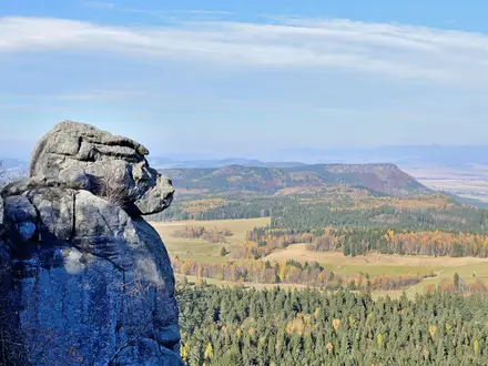
- Karst plateau and dry-stone walls: The planalto is dry, stony limestone country with lapiás, sinkholes, poljes and traditional walls known locally as chousos or cerrados.
- Caves and orchids: The park has over 130 catalogued caves, 18 bat species and around 35 orchid species, with many orchids flowering in spring.
- Windmills and water mills: Restored windmills on ridgelines and old water mills in valleys show the area’s farming and milling heritage; some marked walks link them directly.
Challenges to expect
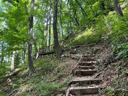
The main difficulty is underfoot rather than altitude: rocky limestone paths, lapiás, dirt tracks and exposed plateau walking. Climbs are generally modest, but a longer combined loop may total about 600 m of ascent. Summer is hot, dry and shade-poor, while winter can be wetter. Karst drainage means little surface water, so carry all water. Navigation is usually by PR red-and-yellow waymarks, but route choice matters because this is a trail network, not one fixed path.
HikeList Score
Serras de Aire e Candeeiros Trail scored 79/100 on HikeList's trail-quality metrics.
See score breakdownHide breakdown
- Ideal length 55
- Balanced challenge 100
- Scenery & wildness 71
- Varied terrain 83
- Accommodation 83
- Food & support 81
- Path quality 98
- Season flexibility 76
Computed from length, challenge, scenery & wildness, terrain variety, accommodation, food & support, path quality and season flexibility.
 Portugal
Show more data Show less
- Hilly
- Forest
- Scrub
- Rocky
- Dirt
- Gravel
- Guesthouses
- Hotels
- Campsites
- Water Sources
- Campsites
- Picnic Areas
Photos from hikers
Taken on the trail by people who've reviewed Serras de Aire e Candeeiros Trail.
Reviews
How would you rate Serras de Aire e Candeeiros Trail?
Tap a star to start your review — you could be the first.