Mljet National Park Trail
How would you rate Mljet National Park Trail?
Tap a star to share your experience and help other hikers.
Mljet National Park Trail: Lakes, Forest and Montokuc
HikeList Score
Mljet National Park Trail scored 82/100 on HikeList's trail-quality metrics.
See score breakdownHide breakdown
- Ideal length 55
- Balanced challenge 100
- Scenery & wildness 98
- Varied terrain 71
- Accommodation 66
- Food & support 88
- Path quality 98
- Season flexibility 89
Computed from length, challenge, scenery & wildness, terrain variety, accommodation, food & support, path quality and season flexibility.
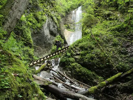
The Mljet National Park Trail is a moderate 10.5 km day hike on the western end of Mljet, a forested Adriatic island in southern Croatia. The standard loop circuits Veliko Jezero and Malo Jezero, then adds the steeper out-and-back climb to Montokuc viewpoint. It suits hikers wanting a short, well-marked Croatia island walk with swimming, forest shade and easy logistics from the park villages rather than a multi-day thru-hike.
Route Overview
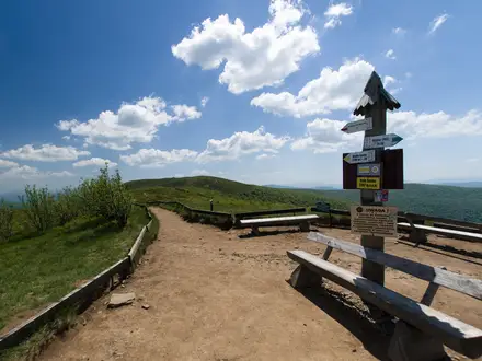
This is a loop: start at one of the usual park entrances or kiosks in Pomena, Polace or Pristaniste, then return to the same point. The main walking follows the lakeside paths around Veliko Jezero and Malo Jezero, linked by Mali Most, with Veliki Most marking the Soline channel where Veliko Jezero connects to the open sea. The optional Montokuc spur leaves the flatter lake paths for a rockier forest climb to the fire lookout. A park solar boat links to St Mary’s Islet in Veliko Jezero and is included with the entry ticket. Sobra is the ferry gateway from the mainland. Near Dubrovnik, pair this with the Dubrovnik City Walls Trail or Dubrovnik to Cavtat Coastal Trail; for another Adriatic island route, see the Hvar Island Ridge Trail.
Mljet National Park history
Mljet National Park was established in 1960 to protect the western lakes and forests of Mljet. St Mary’s Islet in Veliko Jezero has held a Benedictine monastery since the 12th century, and the monks managed land around the lake for centuries. The island is also linked to classical legend: local tradition often identifies Mljet as the island where Odysseus was held by the nymph Calypso. The saltwater lakes were originally separated from the sea before being opened via the Soline channel.
Notable highlights
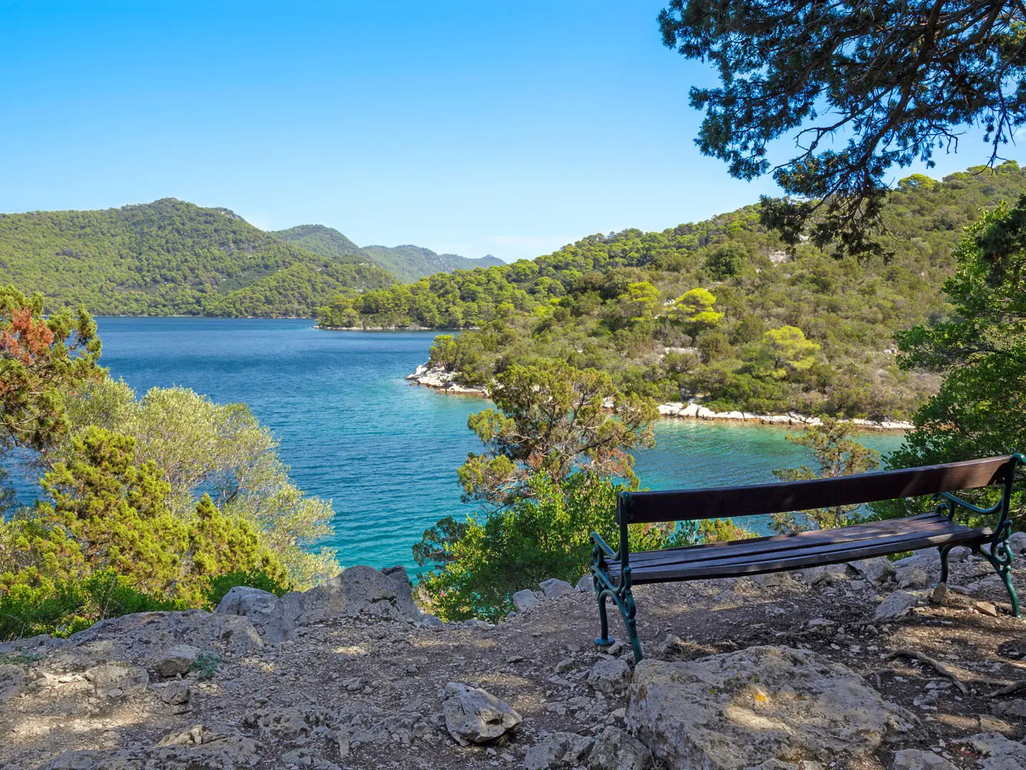
- Veliko Jezero (Great Lake): The park’s larger saltwater lake is the core of the walk, with a flat shoreline path, swimming spots and views towards St Mary’s Islet.
- St Mary’s Islet & Benedictine monastery: A small islet in Veliko Jezero with a 12th-century Benedictine monastery, reached by the park’s electric or solar shuttle boat.
- Malo Jezero (Small Lake): The smaller linked lake sits beside Veliko Jezero and is joined to it by the narrow channel at Mali Most; its sheltered water is popular for swimming and kayaking.
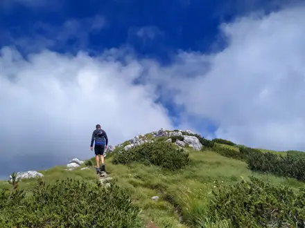
- Montokuc viewpoint & fire lookout: The trail’s high point at about 253 m, reached by a short, steeper out-and-back through forest for views over the lakes and Adriatic.
- Mali Most & Veliki Most: These two bridges define the lake system: Mali Most links the two lakes, while Veliki Most crosses the Soline channel to the sea.
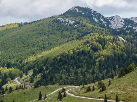
- Aleppo pine and holm oak forest: Much of the walk passes through shady Mediterranean woodland, one of the reasons Mljet feels quieter and greener than many coastal day hikes.
Challenges to expect
The lake circuit is mostly easy on good gravel and dirt paths, but the Montokuc detour makes the day moderate: expect a sustained climb of about 200 m on rockier forest trail. Summer brings heat and crowds, so start early if walking in July or August. Park entry is required, with tickets sold at Sobra, Pomena and Polace kiosks. Navigation is straightforward on marked park trails, but remember this is a trail network, not one single corridor.
HikeList Score
Mljet National Park Trail scored 82/100 on HikeList's trail-quality metrics.
See score breakdownHide breakdown
- Ideal length 55
- Balanced challenge 100
- Scenery & wildness 98
- Varied terrain 71
- Accommodation 66
- Food & support 88
- Path quality 98
- Season flexibility 89
Computed from length, challenge, scenery & wildness, terrain variety, accommodation, food & support, path quality and season flexibility.
Show more data Show less
- Forest
- Coastal
- Dirt
- Gravel
- Rocky
- Hotels
- Campsites
- Family Friendly
- Pet Friendly
- Restrooms
- Water Sources
- Campsites
- Picnic Areas
Photos from hikers
Taken on the trail by people who've reviewed Mljet National Park Trail.
Reviews
How would you rate Mljet National Park Trail?
Tap a star to start your review — you could be the first.