Komovi Mountain Ridge Trail
How would you rate Komovi Mountain Ridge Trail?
Tap a star to share your experience and help other hikers.
Komovi Mountain Ridge Trail: Kucki Kom from Stavna
HikeList Score
Komovi Mountain Ridge Trail scored 75/100 on HikeList's trail-quality metrics.
See score breakdownHide breakdown
- Ideal length 55
- Balanced challenge 80
- Scenery & wildness 98
- Varied terrain 64
- Accommodation 67
- Food & support 65
- Path quality 98
- Season flexibility 89
Computed from length, challenge, scenery & wildness, terrain variety, accommodation, food & support, path quality and season flexibility.
The Komovi Mountain Ridge Trail is a hard 10 km out-and-back day hike to Kucki Kom (2,487 m), the highest summit of the Komovi massif in eastern Montenegro. Starting from the Stavna eco-katun plateau in Komovi Nature Park, it climbs about 720 m through woodland, alpine meadow, scree and rocky scrambling. It suits fit hikers comfortable with steep, loose ground, exposed ledges and a knife-like summit ridge, not walkers looking for an easy ridge stroll.
Route Overview
Start and finish at Eko-Katun Stavna, a high pastoral settlement reached by road via the Tresnjevik saddle from Matesevo/Kolasin or Andrijevica. The route is an out-and-back: leave Stavna on dirt/gravel and meadow tracks, climb towards Carina pass at about 2,000 m, then continue onto steeper scree and rockfall terrain below Kucki Kom. The final approach follows a sharp rocky ridge with scrambling before returning the same way. This is the summit ascent, not the separate longer non-summit Circuit of the Komovi. For other Montenegro mountain days, compare Bobotov Kuk Summit Trail, Grbaja Valley to Karanfili or the gentler-sounding Biogradska Gora Lake Loop.
Komovi, Katuns and Highland Grazing
The Komovi take their name from “kom”, an old word for the wider highland region. The three main peaks are named for Montenegrin tribes and clans whose shepherds grazed these pastures: Kuci, Vasojevici and Ljevorijeci. Seasonal katuns, including Stavna, still mark the mountain approach. The massif sits in the eastern Dinaric Alps, between Prokletije, Bjelasica and the Tara region, and was designated Komovi Nature Park in 2018.
Notable highlights
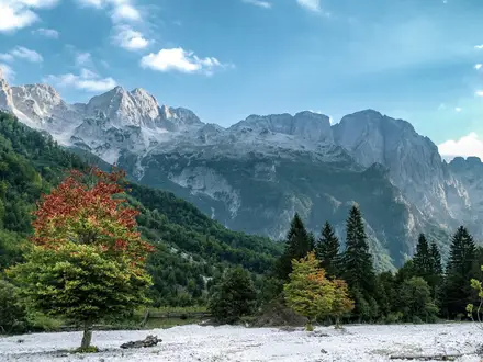
- Kucki Kom summit (2,487 m): The high point of the Komovi massif and the objective of this hike. On a clear day the panorama reaches towards Durmitor and the Albanian Accursed Mountains, also known as Prokletije.
- The three Komovi peaks: Kucki Kom, Ljevorecki Kom and Vasojevicki Kom form a tight cluster of horn-like summits. From the high meadows you see the massif rise sharply above Stavna.
- Carina pass and summit ridge: Carina marks the shift from easier walking to the serious upper mountain. Above it, steep scree, rocky ledges and a cleft to climb through lead to the exposed final ridge.
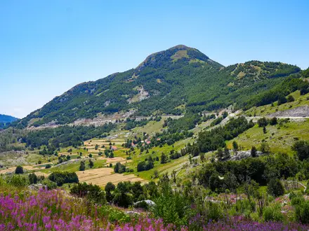
- Stavna katun plateau: The trailhead is a traditional highland shepherds’ settlement below the peaks. Today its eco-katuns and guest accommodation make it the practical base for the ascent.
- Komovi Nature Park: Protected since 2018, the park covers alpine pasture, woodland and jagged limestone and dolomite peaks. The lower trail is known for flower-rich meadows before the rockier ground begins.
Challenges to expect
Do not treat this as a simple ridge walk. The final third is steep and loose, with scree, rock slabs, exposed ledges, scrambling and a narrow summit ridge. Snow can linger on high rock into early summer, weather changes quickly, and upper waymarking can fade, so carry an offline map or GPS. The route is short but committing; allow around 5–6 hours, with some sources allowing up to 8.
HikeList Score
Komovi Mountain Ridge Trail scored 75/100 on HikeList's trail-quality metrics.
See score breakdownHide breakdown
- Ideal length 55
- Balanced challenge 80
- Scenery & wildness 98
- Varied terrain 64
- Accommodation 67
- Food & support 65
- Path quality 98
- Season flexibility 89
Computed from length, challenge, scenery & wildness, terrain variety, accommodation, food & support, path quality and season flexibility.
Show more data Show less
- Mountainous
- Forest
- Dirt
- Rocky
- Huts
- Campsites
- Wild Camping Spots
- Pet Friendly
- Water Sources
- Campsites
- Shelters
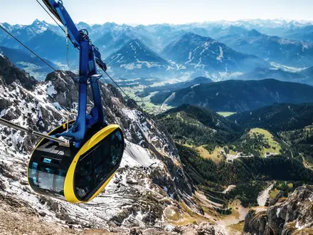
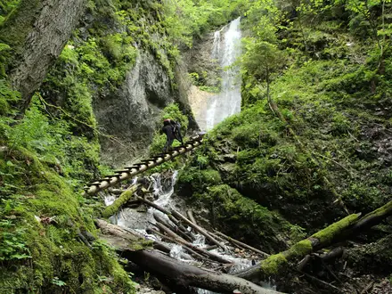
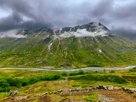
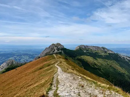
Photos from hikers
Taken on the trail by people who've reviewed Komovi Mountain Ridge Trail.
From Eko-Katun Stavna, follow the out-and-back route towards Carina pass, about 3.9 km from the start, then climb roughly 1.1 km more to Kucki Kom summit. Return by the same line, taking care on the loose scree and rocky scrambling sections below the top.
Reviews
How would you rate Komovi Mountain Ridge Trail?
Tap a star to start your review — you could be the first.