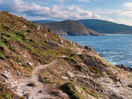
Kerry Way
How would you rate Kerry Way?
Tap a star to share your experience and help other hikers.
Kerry Way: A Complete Hiking Guide
HikeList Score
Kerry Way scored 91/100 on HikeList's trail-quality metrics.
See score breakdownHide breakdown
- Ideal length 96
- Balanced challenge 84
- Scenery & wildness 90
- Varied terrain 100
- Accommodation 100
- Food & support 81
- Path quality 84
- Season flexibility 89
Computed from length, challenge, scenery & wildness, terrain variety, accommodation, food & support, path quality and season flexibility.
The Kerry Way is a 214 km circular National Waymarked Trail around the Iveragh Peninsula and Killarney area in County Kerry, south-west Ireland. Most walkers take 9 days, with the route traditionally split into 9 stages. It is a hard long-distance hike: expect consecutive 6–8 hour days, wet boggy ground, exposed passes and about 5,310 m of total ascent, but no technical scrambling on the waymarked route. For more Irish routes, see our Ireland hiking guides.
Route Overview
The trail starts and finishes in Killarney, making a walkers’ loop around the Iveragh Peninsula rather than following the road-heavy Ring of Kerry. It passes Muckross, Torc Waterfall, the Black Valley, Glencar, Glenbeigh, Foilmore, Waterville, Caherdaniel, Sneem and Kenmare before returning to Killarney; Cahersiveen is reached by a spur. The route skirts below MacGillycuddy’s Reeks but does not climb Carrauntoohil. Waymarking is the standard yellow walking-man arrow on a black background. If you want another Kerry peninsula circuit, compare it with the Dingle Way or the more southerly Beara Way.
History of the Kerry Way
The Kerry Way was first proposed in 1982, with the first section opened in 1985 and the full route completed in 1989. It is the longest of Ireland’s National Waymarked Trails. Much of the walk uses historic “green roads”: old droving, butter and coach roads that linked remote communities before modern roads. The route was deliberately developed as a walking version of the famous Ring of Kerry circuit around the Iveragh Peninsula.
Notable highlights
- Killarney National Park: Ireland’s oldest national park, where the Kerry Way begins and ends. The trail takes in native oak woodland, the Killarney lakes, Torc Waterfall and views towards MacGillycuddy’s Reeks.
- Black Valley (Cummeenduff): A remote glacial valley below the Reeks and one of the trail’s most isolated sections. It is known as one of the last inhabited places in Ireland to receive mains electricity.
- MacGillycuddy’s Reeks and Carrauntoohil: The route passes below Ireland’s highest mountain range. Carrauntoohil is an optional side trip, not part of the waymarked Kerry Way.
- Muckross House and Abbey: A 19th-century Victorian mansion and a 15th-century Franciscan friary within Killarney National Park, passed near the Killarney end of the route.
- Windy Gap (385 m): The highest point on the trail, an open mountain pass on the inland route to Caherdaniel with views towards the southern coast and Kenmare River.
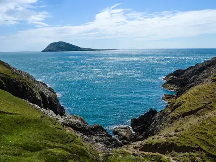
- Atlantic coastal views: Western and southern sections near Glenbeigh, Cahersiveen and Waterville look over Dingle Bay, Ballinskelligs Bay and the Kenmare River; the Skellig and Blasket island groups may be visible in clear weather.
Challenges to expect
Sport Ireland grades the Kerry Way as strenuous, and the hardest section is the Glencar/Black Valley high ground. Expect wet bog, mud after rain, more than 200 stiles, six footbridges, farm boreens, forest tracks, quiet tarmac and exposed mountain passes. Atlantic weather brings frequent rain, mist and wind, so navigation and waterproofing matter. Dogs are not permitted on the Kerry Way. For a shorter Irish mountain objective, see the Galtymore Ascent.
HikeList Score
Kerry Way scored 91/100 on HikeList's trail-quality metrics.
See score breakdownHide breakdown
- Ideal length 96
- Balanced challenge 84
- Scenery & wildness 90
- Varied terrain 100
- Accommodation 100
- Food & support 81
- Path quality 84
- Season flexibility 89
Computed from length, challenge, scenery & wildness, terrain variety, accommodation, food & support, path quality and season flexibility.
 Ireland
Show more data Show less
- Mountainous
- Coastal
- Forest
- Moorland
- Farmland
- Dirt
- Rocky
- Gravel
- Paved
- B&Bs
- Guesthouses
- Hotels
- Hostels
- Family Friendly
- Restrooms
- Water Sources
- Campsites
Download Our Full Guide to Kerry Way FREE!
Get our comprehensive guide to this hike for free. Save it for later reading or print out at home.
In these collections
Photos from hikers
Taken on the trail by people who've reviewed Kerry Way.
Kerry Way: The Complete Guide
The Kerry Way is a long, serious circuit of the Iveragh Peninsula, starting and finishing in Killarney (Cill Airne). It gives walkers the mountain-and-coast version of the Ring of Kerry: Killarney National Park, the Black Valley, old green roads, exposed passes and Atlantic views without climbing the high summits.
The route passes below MacGillycuddy's Reeks (Na Cruacha Dubha), threads remote valleys such as Glencar (Gleann Cártha), and swings west towards Glenbeigh (Gleann Beithe), Waterville (An Coireán) and Caherdaniel (Cathair Dónall). Later stages turn through Sneem (An tSnaidhm) and Kenmare (Neidín / An Neidín) before the final return over the hills to Killarney.
This is not a technical mountain route, but it is a demanding long-distance walk. Expect repeated 6–8 hour days, wet boggy ground, more than 200 stiles, quiet lanes, open hillside and Atlantic weather that can make navigation and comfort harder than the map suggests.
The Kerry Way suits fit walkers who want a waymarked Irish trail with real remoteness between serviced towns. Accommodation is available, but thin in places, so the practical challenge is as much about booking the right nights and managing food, taxis and baggage as it is about walking the miles.
This guide covers stages, daily planning, accommodation, food, transport, terrain and the common mistakes to avoid.
Stage-by-Stage Guide
Distances on the Kerry Way vary slightly with route variants, the Cahersiveen (Cathair Saidhbhín) spur and local diversions. Treat the kilometre figures below as planning distances, not exact daily mileage, and check current route notices before travelling.
The trail is waymarked with the yellow walking-man arrow on a black background, but this is still a serious upland and coastal long-distance route. Carry mapping for the full route — OSi Discovery sheets 78, 83 and 84, a dedicated Kerry Way map or a guidebook — and expect wet ground, stiles, boggy sections, quiet road walking and fast-changing Atlantic weather on most days.
Stage 1: Killarney to Black Valley — approx. 22 km
The opening stage leaves Killarney (Cill Airne) and heads south through Killarney National Park, giving a relatively direct but varied start to the loop. It passes the Muckross area and Torc Waterfall before moving into quieter country towards the Black Valley / Cummeenduff (An Gleann Garbh), beneath the MacGillycuddy's Reeks (Na Cruacha Dubha).
Underfoot, expect a mix of park paths, tracks, old routes, lanes and wetter ground as the route leaves the busier Killarney end behind. The walking is not technically difficult, but the first day is long enough to expose any problems with footwear, pack weight or pacing.
The main landmarks are Killarney National Park, Muckross, Torc Waterfall and the transition into the more enclosed glacial landscape of the Black Valley. Views towards the Killarney lakes and the Reeks are a major part of the day, though mist can remove visibility quickly.
Killarney has the best pre-walk food, accommodation and transport options on the whole route, including its railway station and bus links. Once committed to the Black Valley, services become thin, so carry lunch and enough water for the full stage unless accommodation has specifically arranged otherwise.
Accommodation in the Black Valley area is limited and should be booked well ahead. Public transport should not be relied on at the end of this stage; road access and local taxis are the practical fallback, but this should be checked before travelling.
Navigation is generally straightforward leaving Killarney, but the number of paths and visitor routes in the national park means it is worth paying close attention to the Kerry Way waymarks. In poor visibility, do not assume that every clear track is the correct onward route.
Stage 2: Black Valley to Glencar — approx. 21 km
This is one of the more remote-feeling stages of the Kerry Way, crossing from the Black Valley towards Glencar (Gleann Cártha) through rougher hill and valley country. The route remains below the main summits of the Reeks, but the setting is wilder than the first day and the escape options are fewer.
Terrain is typically a mix of old green roads, farm tracks, boreens, open hillside and wet ground. Boggy going is common after rain, and progress can be slower than the distance suggests.
The stage is defined by mountain scenery rather than villages. The Black Valley itself is one of the trail’s most isolated sections, and the route gives close views of the surrounding hills without requiring any scrambling or summit work.
Food and water planning matters here. There are no large service centres between the overnight points, so carry a packed lunch and do not assume there will be a shop or café en route. Water from natural sources should not be treated as a guaranteed or safe supply without proper treatment.
Glencar has limited accommodation compared with Killarney or Kenmare (Neidín / An Neidín), so bookings need to be made early. Road access exists in the wider area, and taxis are often the most practical option for off-route accommodation, but arrangements should be confirmed before walking.
Navigation is mostly by waymarking and mapped tracks, but mist can make open ground and junctions less obvious. Keep a map or GPS accessible rather than packed away, especially if cloud is sitting low on the hills.
Stage 3: Glencar to Glenbeigh — approx. 16 km
This is a shorter stage on paper, but it still crosses hill country and should not be treated as a rest day in poor conditions. The route runs from Glencar towards Glenbeigh (Gleann Beithe), with the Kerry Way beginning to swing towards the western side of the peninsula.
The walking uses a familiar Kerry Way mixture of rough tracks, old routes, lanes and potentially boggy upland sections. The day includes the Windy Gap / Lack Road area in the western hills, and the trail’s highest point is 385 m at a Windy Gap on the route, though several gaps with this name occur around the circuit.
Views open towards the coast and Dingle Bay as the route approaches Glenbeigh. In clear weather this is one of the points where the character of the walk changes from inland mountain valleys to broader Atlantic scenery.
Glencar has limited services, so leave with food and water. Glenbeigh is a more useful overnight stop than the previous two ends, but accommodation should still be booked ahead, especially in busy walking months.
Road access at Glenbeigh makes it a more practical place for taxis and itinerary adjustments than the Black Valley. Public transport details should be checked before travelling rather than assumed.
Navigation around high, open ground needs care in mist, wind or heavy rain. The waymarking is helpful, but boggy trods and tracks can look alike, and the exposed sections are less forgiving in bad weather.
Stage 4: Glenbeigh to Cahersiveen — approx. 28 km
This is a long stage and one of the more committing days in the standard nine-day itinerary. The route leaves Glenbeigh and follows the old Glenbeigh–Cahersiveen green road over Drung Hill, with high coastal walking and views over Dingle Bay.
The line follows historic travel corridors, including the route associated with the former Great Southern & Western Railway. Expect a mix of green road, track, rougher ground and quiet lanes, with exposed stretches where wind and rain can make the day feel significantly harder.
Drung Hill is the headline section, giving a higher traverse above the coast and some of the finest western views on the route when visibility is good. This is also a stage where the sense of distance is important: the 28 km figure is substantial even without technical terrain.
Cahersiveen (Cathair Saidhbhín) is reached by a spur off the main loop rather than by the principal waymarked line running neatly through the town centre. Plan this in advance, especially if accommodation or luggage transfer depends on a particular pickup point near Foilmore (Faill Mhór) or the spur.
Carry enough food and water for the full stage. Do not rely on finding services until reaching the Cahersiveen area, and check accommodation arrangements carefully because this western stretch is one of the places where beds can be thin relative to demand.
Road access and local taxi networks are important for this stage, particularly because Cahersiveen sits off the main loop. Public transport should be checked before travelling, and a taxi plan is sensible if staying away from the exact walking line.
Navigation is not difficult in clear weather, but the length, exposure and the off-route nature of Cahersiveen make this a day to plan carefully. Know where the spur leaves or rejoins the main Kerry Way before setting out.
Stage 5: Cahersiveen to Waterville — approx. 29 km
This is another long western stage, running from the Cahersiveen area towards Waterville (An Coireán). The day continues through the Atlantic-facing side of the Iveragh Peninsula, with broad coastal and island views possible in clear weather.
Because Cahersiveen is off the main loop, the first part of the day may involve returning from the town or accommodation to the Kerry Way line. This needs to be built into the day’s timing, especially if walking the full distance with a loaded pack.
Terrain remains mixed: lanes, old tracks, farm boreens, wet sections and rougher ground. After rain, boggy or waterlogged paths can slow progress, and quiet tarmac stretches can be tiring on feet over a near-30 km day.
Views around this part of the peninsula can include Ballinskelligs Bay and, in clear conditions, offshore islands. Weather is the controlling factor: in cloud or heavy rain, the day becomes more about steady navigation and pace management than scenery.
Food and water should be carried from the start. Waterville is a recognised overnight point on the route, but intermediate services should not be assumed without checking current opening and location details.
Accommodation in Waterville should be booked ahead, particularly if walking in the main season or using luggage transfer. Road access at either end helps with taxi logistics, but public transport should be checked before travelling.
The key navigation issue is managing the Cahersiveen spur and making sure the main Kerry Way line is rejoined correctly. The distance also makes this a day where an early start is sensible, especially in wet weather or outside high summer.
Stage 6: Waterville to Caherdaniel — approx. 14 km
The Waterville to Caherdaniel (Cathair Dónall) stage is much shorter than the two previous days, but it includes important route-choice considerations. Between Waterville and Caherdaniel there are coastal and inland options, including a route via a Windy Gap, so distances and difficulty can shift depending on the variant walked.
The walking can include exposed hillside, tracks, lanes and wetter ground, with Atlantic weather still very much in play. A shorter distance does not remove the need for waterproofs, spare layers and proper navigation.
This section gives access to some of the Kerry Way’s strongest south-western coastal scenery, with views towards Ballinskelligs Bay and the surrounding coastline in good visibility. The end point, Caherdaniel, is closely associated with Derrynane and the south-coast landscape of beaches, dunes and headlands.
Waterville is the place to sort food before setting out. Given the short distance, many walkers will manage with a carried lunch and water, but do not assume cafés or shops will appear mid-stage.
Accommodation around Caherdaniel should be booked in advance. If staying off the walking line, arrange exactly where to leave the trail and how to reach the accommodation, as rural distances can feel longer at the end of the day.
Public transport options should be checked before travelling. Road access is useful for taxis and itinerary adjustments, but it should not replace proper stage planning.
Navigation attention is needed where coastal and inland variants are available. Decide the intended line before leaving Waterville and follow the waymarks and map accordingly, rather than choosing at an unsigned junction in poor visibility.
Stage 7: Caherdaniel to Sneem — approx. 18 km
This stage continues eastwards from Caherdaniel towards Sneem (An tSnaidhm), moving along the southern side of the peninsula with views towards the Kenmare River. It is a moderate-distance day by Kerry Way standards, but still contains the usual mix of rough ground, lanes and wet sections.
The route passes through the Derrynane area, known for Derrynane House, the ancestral home of Daniel O’Connell, and for its sandy beaches and dunes. Staigue Fort (Cathair na Stéige), a large Iron-Age dry-stone ringfort, is reached by a short detour rather than being directly on the main line.
Underfoot, expect a changing combination of tracks, boreens, quiet roads and open sections. The south-coast walking can feel exposed in wind and rain, and boggy patches are possible after wet weather.
Caherdaniel is not a place to leave without food and water unless current services have been checked. Sneem is a classic Ring of Kerry stop and a practical overnight village, but accommodation should still be reserved before arrival.
Road access near both ends makes this a more manageable stage for taxis or baggage arrangements than the remote Black Valley sections. Public transport should be checked before travelling.
Navigation is usually manageable in normal conditions, but detours such as Staigue Fort need time and energy added to the day. If visiting off-route sites, make sure the return to the Kerry Way is planned rather than improvised late in the afternoon.
Stage 8: Sneem to Kenmare — approx. 31 km
Sneem to Kenmare is the longest standard stage in this itinerary and deserves careful planning. It runs from Sneem through the Templenoe (Teampall Nua) area to Kenmare, combining southern peninsula scenery with a long day on mixed surfaces.
Expect farm boreens, forest tracks, old green roads, quiet tarmac and wet sections. The cumulative effect of 31 km is the main challenge: even easy-looking lanes become hard work late in the day, particularly with sore feet or a heavy pack.
The stage gives views across the Kenmare River and marks the gradual transition from the quieter south side of the peninsula towards the larger service centre of Kenmare. It is a less remote-feeling finish than the Black Valley or western stages, but the day is long enough to require an early start.
Carry lunch and adequate water from Sneem. Do not rely on intermediate services without checking them before setting out, especially outside the main visitor season.
Kenmare is one of the best-equipped overnight stops on the Kerry Way, with a broader choice of accommodation than the smaller villages. It is also the final main town before the closing stage back to Killarney, so it is a sensible place to resupply and sort any transport or luggage issues.
Road access is generally better at both ends than in the remote hill sections, but public transport details should be checked before travelling. If shortening the stage by taxi or using off-route accommodation, agree pickup points carefully.
Navigation is mainly about staying disciplined over a long distance. Fatigue increases the chance of missing waymarks at lane and track junctions, so keep the map accessible even when the walking feels straightforward.
Stage 9: Kenmare to Killarney — approx. 24 km
The final stage leaves Kenmare and crosses back over the hills towards Killarney, returning to the national park landscape near Muckross Lake and Lough Leane. It is a fittingly tough finish rather than a simple low-level stroll into town.
The terrain includes hill tracks, open ground, lanes, forest or estate-style tracks and lakeside approaches near the Killarney end. Wet, muddy going is possible, and the upland section can be exposed in wind, rain or mist.
The main highlight is the return into Killarney National Park, with views towards the lakes and the surrounding hills. Muckross House and Muckross Abbey lie in the Killarney end of the park, and the route finishes back in Killarney town.
Kenmare is the place to buy food before the stage. Carry enough water and lunch for the full crossing, as the hill section should be treated as a self-sufficient day rather than a walk between cafés.
Killarney has the strongest accommodation and onward transport options on the route, including its railway station and bus services. As the Kerry Way is a loop, no separate endpoint transfer is needed once back in town.
Navigation needs care leaving Kenmare and again through the network of paths and tracks near Killarney National Park. In poor visibility on the hills, follow the waymarks closely and use the map rather than aiming broadly for the town.
The main warnings are fatigue and weather. After eight previous stages, tired legs can make the final climb and descent feel harder than the distance suggests, so allow enough daylight and avoid treating the last day as a formality.
Recommended Itinerary
The standard Kerry Way itinerary is the 9-day anticlockwise circuit from Killarney (Cill Airne) via the Black Valley, Glencar, Glenbeigh, Cahersiveen, Waterville, Caherdaniel, Sneem and Kenmare. It is the most practical schedule for fit walkers because it follows the established stage pattern and keeps most days within a long but realistic walking day.
Distances on the Kerry Way vary slightly depending on mapping, the Cahersiveen spur and the Waterville–Caherdaniel route option. Use the figures below for planning, but check official mapping before booking accommodation around the longer western stages.
Standard 9-day itinerary
| Day | From | To | Approx. distance | Why this stage makes sense | Services/accommodation notes |
|---|---|---|---|---|---|
| 1 | Killarney (Cill Airne) | Black Valley / Cummeenduff | 22 km | A strong opening stage through Killarney National Park, passing Muckross and Torc Waterfall before committing to the more remote ground below MacGillycuddy's Reeks. It gets you clear of the busy Killarney end and into the proper upland character of the route. | Killarney has the widest choice of accommodation and supplies on the whole route. The Black Valley is remote with limited beds, so this night should be booked well ahead. Carry food for the day rather than relying on services en route. |
| 2 | Black Valley / Cummeenduff | Glencar (Gleann Cártha) | 21 km | This keeps the remote northern section in manageable daily blocks rather than forcing a very long first or second day. Expect a full day of valley, pass and hillside walking rather than easy lowland trail. | Accommodation is limited in and around the remote valleys. Book before travel and check whether evening meals, packed lunches or transfers are available at the place booked. |
| 3 | Glencar (Gleann Cártha) | Glenbeigh (Gleann Beithe) | 16 km | A shorter day after two substantial opening stages, with a descent towards the coast and a more settled overnight stop. It also creates a sensible buffer before the long Glenbeigh–Cahersiveen stage. | Glenbeigh has more options than the high valleys, but it is still part of a stretch where accommodation can be thin in peak season. Book ahead rather than arriving without a reservation. |
| 4 | Glenbeigh (Gleann Beithe) | Cahersiveen (Cathair Saidhbhín) | 28 km | A long and exposed-feeling western stage, including the Drung Hill area and the old Glenbeigh–Cahersiveen green road, with views towards Dingle Bay in clear weather. It is one of the days where an early start is sensible. | Cahersiveen is reached by a spur off the main loop, often with local taxi arrangements from Foilmore or near the route. Do not assume the waymarked line runs through the town centre; plan the spur, transfer and overnight stop in advance. |
| 5 | Cahersiveen (Cathair Saidhbhín) | Waterville (An Coireán) | 29 km | Another long day, and one of the key reasons the standard itinerary is graded as demanding rather than merely moderate. It keeps the western side of the peninsula moving without needing an extra overnight in a thinly served area. | If a taxi or off-route overnight was used for Cahersiveen, arrange how to rejoin the route before setting off. Accommodation and food should be booked in Waterville, and carrying enough food and water during the day is important. |
| 6 | Waterville (An Coireán) | Caherdaniel (Cathair Dónall) | 14 km | A deliberately shorter recovery stage after two long days. This is also the section where coastal and inland options can affect the exact distance and character of the day. | Choose the route option according to weather, time and current conditions, and check mapping before leaving Waterville. Caherdaniel and the Derrynane area have limited capacity compared with larger towns, so book ahead. |
| 7 | Caherdaniel (Cathair Dónall) | Sneem (An tSnaidhm) | 18 km | A moderate-length stage that gives enough time for the south-coast section without turning the day into a route march. A detour to Staigue Fort is possible from this part of the route, but it adds distance and time. | Sneem is a useful overnight stop with better services than the smaller rural sections. If adding any detour, confirm the extra distance before committing, especially in poor weather. |
| 8 | Sneem (An tSnaidhm) | Kenmare (Neidín / An Neidín) | 31 km | The longest standard stage, passing through the Templenoe area towards Kenmare and requiring a steady pace. Many walkers find this the hardest logistical day because it is long even before allowing for wet ground or poor visibility. | Kenmare has a good range of accommodation compared with the smaller villages. This is the obvious stage to split or shorten on a slower itinerary if accommodation or taxi arrangements allow. |
| 9 | Kenmare (Neidín / An Neidín) | Killarney (Cill Airne) | 24 km | A final hill stage back to Killarney, descending towards Muckross Lake and Lough Leane. It is long enough to feel like a proper final day, but the loop finish means there is no onward transfer from a remote endpoint. | Killarney has the best onward transport options, including rail and bus connections. If travelling home the same day, check current departure times before booking; a post-walk night in Killarney gives more margin. |
Slower variants: 10–12 days
A 10- or 11-day itinerary is often the better choice for walkers carrying a full pack, anyone new to long-distance walking, or anyone who wants more margin for Atlantic weather. The best stages to split are usually the long western and southern days: Glenbeigh to Cahersiveen, Cahersiveen to Waterville, and especially Sneem to Kenmare.
Exact slower-stage breaks depend heavily on accommodation and local taxi availability, particularly around Foilmore, Cahersiveen and the thinner rural sections. This should be checked before travelling.
| Itinerary | Pattern | Who it suits | Main planning point |
|---|---|---|---|
| 10 days | Follow the standard 9-day itinerary but split one long stage, most commonly Sneem–Kenmare or one of the Glenbeigh–Cahersiveen–Waterville days. | Fit walkers who want the standard route but less pressure on the longest day. | Book the extra overnight or taxi-supported split before confirming the rest of the trip. |
| 11 days | Split two of the long stages and keep the short Waterville–Caherdaniel day as a recovery stage. | Walkers carrying heavier packs, first-time long-distance hikers, or anyone wanting more daylight margin in poor weather. | Accommodation is the limiting factor, not distance. Remote nights must be arranged early. |
| 12 days | Add further shortening or a rest day in a larger service centre such as Kenmare or Killarney. | Walkers prioritising comfort, slower pace, photography or poor-weather flexibility. | Avoid assuming small places have spare beds; the extra time only works if the accommodation plan is secure. |
Faster variants: 6–8 days
A faster Kerry Way schedule is possible, but it changes the nature of the walk. The route has repeated 6–8 hour days, boggy ground, exposed passes and over 200 stiles, so reducing the number of days usually means stacking already long stages back to back.
An 8-day itinerary is the most realistic faster option, typically by combining or compressing the shorter Waterville–Caherdaniel day with adjacent planning. A 6- or 7-day itinerary is best reserved for very fit, experienced walkers travelling light, and should be planned around current accommodation and transfer options rather than assumed from the map.
| Itinerary | Pattern | Who it suits | Main planning point |
|---|---|---|---|
| 8 days | Compress the standard schedule by removing the short recovery day or using taxi-supported logistics around one section. | Strong walkers used to repeated long days on wet, uneven ground. | Check official mapping before booking, as route variants can turn a manageable plan into an overlong day. |
| 7 days | Requires several very long days and little margin for weather, delays or sore feet. | Fast, experienced long-distance walkers only. | Accommodation spacing and the Cahersiveen spur need careful handling. This should be checked before travelling. |
| 6 days | A fastpacking-style schedule rather than a conventional walking holiday. | Very fit hikers with light kit and a robust bad-weather plan. | Do not plan this on distance alone; terrain, stiles, bog and exposure make the daily effort much higher than the numbers suggest. |
Planning the Route
How many days to allow
The standard Kerry Way plan is 9 walking days, following the traditional sequence from Killarney (Cill Airne) through the Black Valley, Glencar (Gleann Cártha), Glenbeigh (Gleann Beithe), Cahersiveen (Cathair Saidhbhín), Waterville (An Coireán), Caherdaniel (Cathair Dónall), Sneem (An tSnaidhm), Kenmare (Neidín / An Neidín) and back to Killarney.
For most independent walkers, 9–11 days is the sensible range. A 9-day itinerary is efficient but includes several long days, notably the Glenbeigh–Cahersiveen, Cahersiveen–Waterville and Sneem–Kenmare sections. Adding an extra day or two makes the walk easier to book, gives more margin for wet weather, and reduces the pressure on the longest stages.
Shorter 6–8 day itineraries are possible, but they suit strong walkers who are comfortable with consecutive long days on wet ground and who have accommodation and transfers tightly arranged. The Kerry Way is not a route to rush casually: the challenge is cumulative rather than technical, with repeated climbs, boggy sections, stiles and exposed passes.
Why the stages matter
The Kerry Way is shaped by where you can sleep as much as by the terrain. Killarney and Kenmare have the broadest choice of accommodation, while places such as the Black Valley and parts of the Glenbeigh–Cahersiveen–Waterville stretch have much less capacity.
Book the remote nights first, then build the rest of the itinerary around them. This is especially important in peak walking season and on weekends, when small B&Bs, pubs-with-rooms and guesthouses can fill quickly.
Cahersiveen is an important planning detail: it is reached by a spur off the main loop rather than sitting directly on the waymarked line. Many walkers use Cahersiveen because it has more services than the immediate trail corridor; local taxi arrangements are commonly used around this part of the route, but exact pick-up points and costs should be agreed before travelling.
Standard 9-day planning pattern
The usual 9-stage structure works well because it links the main overnight places around the peninsula. Distances vary slightly depending on route variants, mapping and whether the Cahersiveen spur is included.
| Stage | Usual overnight plan | Planning notes |
|---|---|---|
| Killarney to Black Valley | 22 km | Book ahead: the Black Valley is one of the most remote overnight stops. |
| Black Valley to Glencar | 21 km | A committing mountain-and-valley day with limited services en route. |
| Glencar to Glenbeigh | 16 km | Shorter on paper, but still affected by weather and underfoot conditions. |
| Glenbeigh to Cahersiveen | 28 km | Long stage; remember Cahersiveen is reached by a spur/off-route arrangement. |
| Cahersiveen to Waterville | 29 km | Another long stage, so check food, water and transfer logistics in advance. |
| Waterville to Caherdaniel | 14 km | Shorter stage, with route choice affecting distance and character. |
| Caherdaniel to Sneem | 18 km | Allows time for detours only if weather, daylight and accommodation timings permit. |
| Sneem to Kenmare | 31 km | One of the longest standard days; many walkers consider splitting or using support. |
| Kenmare to Killarney | 24 km | Final hill crossing back towards Killarney National Park. |
Walking direction
The Kerry Way is normally walked anticlockwise from Killarney, heading first through Killarney National Park towards Muckross, Torc Waterfall and the Black Valley. This direction follows the common stage structure and fits most published itineraries and baggage-transfer arrangements.
Walking clockwise is possible in practical terms, but it can make accommodation planning less straightforward because many services and stage descriptions assume the anticlockwise pattern. If walking clockwise, confirm every overnight, luggage transfer and taxi arrangement in that direction before booking transport to Killarney.
Shortening, extending and splitting stages
The easiest way to make the Kerry Way more manageable is to add nights rather than cut corners. Splitting the longest days can be particularly useful around Glenbeigh, Cahersiveen, Waterville, Sneem and Kenmare, where stage length and accommodation availability need to be balanced carefully.
Shortening individual days often depends on taxis rather than public transport. Local taxi networks are useful around off-route villages and remote trailheads, but they should be booked in advance rather than assumed on the day.
Extending the walk is also possible through rest days or short detours. Killarney, Kenmare, Waterville, Caherdaniel and Sneem are the most obvious places to slow the pace, depending on accommodation. Carrauntoohil (Corrán Tuathail) is not on the Kerry Way; it is an optional off-route mountain outing below MacGillycuddy's Reeks (Na Cruacha Dubha) and should be treated as a separate hillwalking objective, not as part of the waymarked trail.
Route variants and distance differences
Do not plan the Kerry Way using a single distance figure too rigidly. The commonly quoted length is 214 km, while Sport Ireland lists a longer official measured figure of around 230 km. The difference is partly a planning issue because route variants, spurs and measuring methods affect the total.
The Waterville to Caherdaniel section has coastal and inland options, including an inland line via Windy Gap. Other minor road and hill variants can also shift daily distances. Choose the exact line before booking accommodation and share the same plan with any luggage-transfer provider or taxi driver.
Section hiking
Section hiking is practical because the trail is a loop based on Killarney, which has rail and bus connections and is the natural gateway. The simplest approach is to divide the route into logical blocks between larger service points, then use local transport or taxis to return to a base or reconnect with the trail.
The main limitation is not navigation but logistics. Some sections pass through small settlements and remote valleys where public transport is limited or not convenient for a walking schedule. If section hiking, plan each start and finish point around actual accommodation, taxi availability and current bus or rail times. This should be checked before travelling.
Accommodation and baggage planning
Accommodation should be treated as the first booking priority. Killarney and Kenmare offer the most flexibility; the Black Valley and the western stretch through Glenbeigh, Cahersiveen and Waterville require earlier booking.
Baggage transfer is commonly arranged on the Kerry Way, including through companies serving the Kerry Way and Dingle Way. This can make the route much more manageable, especially in wet weather, but it does not remove the need to carry waterproofs, warm layers, food, water, navigation and emergency essentials each day.
If using baggage transfer, check whether the provider serves every overnight address on the chosen itinerary, including any off-route accommodation near Cahersiveen. Confirm current prices, bag limits, pick-up times and delivery rules before booking.
Food and water
Food planning is uneven across the route. Larger towns and villages have more options, while the remote valleys and longer crossings can have little or nothing available during the walking day.
Carry lunch and high-energy snacks each day, especially on the Black Valley, Glencar, Glenbeigh, Cahersiveen and Waterville sections. Do not rely on finding an open café or shop mid-stage unless it has been checked locally.
Water should be carried from the overnight stop each morning. Streams and wet ground are common, but safe drinking-water availability on the trail should not be assumed.
Navigation and weather
The Kerry Way is waymarked with the yellow walking-man arrow on a black background, but a map and independent navigation are still needed. Mist, rain, forestry tracks, farm lanes and route variants can all make waymarking harder to follow.
Recommended mapping for planning includes OSi Discovery sheets 78, 83 and 84, plus dedicated Kerry Way mapping and guidebooks. A GPS track or offline mapping app is useful, but it should not replace the ability to navigate from a map when visibility drops or a phone battery fails.
Weather is one of the main planning variables. Atlantic rain, wind and mist can turn a moderate-looking stage into a slow, wet day, particularly on exposed passes and boggy high ground. Build in time margins, start long stages early, and check Sport Ireland and kerryway.com for temporary closures, flooding and diversions before travelling.
Access rules and practical restrictions
Dogs are not permitted on the Kerry Way, which is a critical planning point for anyone arranging accommodation or transport.
Permits are not usually the deciding issue on this route; accommodation, weather, transport connections and route conditions matter far more. Current access notices, diversions and any temporary restrictions should still be checked before travelling.
Towns, Villages and Overnight Stops
Accommodation planning is one of the main logistics on the Kerry Way. Killarney and Kenmare have the broadest choice, while the Black Valley and the Glenbeigh–Cahersiveen–Waterville part of the route are much thinner and should be booked well ahead.
Do not assume that every stage has reliable daytime food or shops between overnight stops. Carry lunch, snacks and enough water for the day, especially on the remote valley and pass sections.
| Place | Role for walkers | Overnight usefulness |
|---|---|---|
| Killarney (Cill Airne) | Official start and finish; main gateway | Excellent pre- and post-walk base |
| Black Valley / Cummeenduff | Remote first overnight on the standard anticlockwise itinerary | Essential to book early |
| Glencar (Gleann Cártha) | Standard stage end after the Black Valley | Useful but limited |
| Glenbeigh (Gleann Beithe) | Standard stage end before the long western section | Important booking point |
| Cahersiveen (Cathair Saidhbhín) | Off-route town reached by spur or local transfer | Practical overnight and resupply stop |
| Waterville (An Coireán) | Standard west-coast stage end | Useful but book ahead |
| Caherdaniel (Cathair Dónall) | Standard stage end near Derrynane | Useful but limited |
| Sneem (An tSnaidhm) | Standard south-coast stage end | Good village stop |
| Kenmare (Neidín / An Neidín) | Last main town before returning to Killarney | Excellent final-night base |
Killarney (Cill Airne)
Killarney is the official start and finish of the Kerry Way, and the most practical place to spend the night before starting and after finishing. The route leaves the town southwards through Killarney National Park, and returns from Kenmare down beside Muckross Lake and Lough Leane.
This is the strongest service centre on the walk, with the widest choice of hotels, B&Bs, guesthouses, pubs and food options. It is the best place to buy supplies, sort luggage-transfer arrangements and build in a spare night if arriving late.
Killarney has its own railway station on the Mallow–Tralee line, with direct or connecting trains from Dublin Heuston, Cork, Limerick and Galway. Bus Éireann also serves the town, and Kerry Airport at Farranfore is the nearest airport, with Farranfore station one stop from Killarney; current train, bus and airport connections should be checked before travelling.
Muckross
Muckross is passed near the Killarney end of the loop, within Killarney National Park. It is useful more as a landmark and rest point than as a standard Kerry Way overnight stop.
The trail passes near Muckross House and Muckross Abbey, making this an easy place to slow down if starting late from Killarney or returning with time in hand. For accommodation and full services, Killarney is the practical base.
Torc Waterfall
Torc Waterfall is another early-stage landmark south of Killarney, also passed on the final approach back into town depending on direction and timing. It is a 20 m cascade and a popular place, so expect more people here than on the remote western stages.
It is not an overnight stop. Treat it as part of the Killarney National Park section and continue with enough food and water for the onward walk into the Black Valley or back to Killarney.
Black Valley / Cummeenduff (Com an Chiste / An Gleann Garbh)
The Black Valley is the first standard overnight stop when walking anticlockwise from Killarney. It is one of the most isolated sections of the Kerry Way, lying below MacGillycuddy's Reeks (Na Cruacha Dubha), and should not be treated like a town stop.
Accommodation is limited and must be booked well ahead, particularly in the main walking season. Food options are correspondingly limited, so walkers should check with accommodation providers about evening meals, packed lunches and any supply needs before arrival.
This is a key point for itinerary planning: if accommodation is not available in the valley, the day may need restructuring with a transfer or a different stopping pattern. Any taxi or accommodation pick-up should be arranged in advance, not left until the end of the walking day.
Bridia Valley
The Bridia Valley lies between the Black Valley and Glencar on the standard route. It is a remote walking section rather than a normal overnight base.
Do not plan around finding shops or regular food stops here. Carry what is needed from the previous overnight stop and keep enough daylight for the full stage to Glencar.
Glencar (Gleann Cártha)
Glencar is the standard second-night stop on the nine-stage itinerary, after the Black Valley. It is a practical rural overnight point before the route continues towards Windy Gap, Lack Road and Glenbeigh.
Accommodation is more limited than in the larger towns, so reservations should be made in advance. Check directly whether evening food and packed lunches are available, as this affects what needs to be carried from the previous day.
Windy Gap / Lack Road
Windy Gap and the Lack Road area are important route features rather than places to stay. The Kerry Way crosses exposed high ground here, and weather can make this section feel much more serious than the altitude suggests.
There are no town services to rely on at the pass. Plan this as a committed hill section between overnight bases, with waterproofs, food and enough time in hand.
Glenbeigh (Gleann Beithe)
Glenbeigh is the standard stage end after Glencar and an important accommodation stop before the longer western side of the route. It sits before the old Glenbeigh–Cahersiveen green road and the Drung Hill section.
This is one of the areas where accommodation can become tight, so book early rather than assuming a bed will be available on arrival. Food and pub availability can vary by season and day of week; this should be checked before travelling.
Drung Hill
Drung Hill is a high coastal traverse on the old Glenbeigh–Cahersiveen green road, with views over Dingle Bay in clear weather. It is a walking section, not a service stop.
Start this stage with food and water already packed. It is part of the longer Glenbeigh-to-Cahersiveen day on the standard itinerary, so timing matters if also arranging a spur, taxi or off-route accommodation.
Foilmore (Faill Mhór)
Foilmore is a useful route waypoint on the approach to the Cahersiveen option. Cahersiveen itself is off the main loop, so walkers often need to think carefully about the spur or arrange a local transfer from near the route.
Do not assume that the main waymarked line simply passes through the centre of Cahersiveen. If staying in Cahersiveen, confirm the exact walking route, pick-up point or taxi arrangement before setting out from Glenbeigh.
Cahersiveen (Cathair Saidhbhín)
Cahersiveen is reached by a spur off the main Kerry Way loop and is commonly used as the overnight stop for the long western stage. It is a practical choice because accommodation and services are better than on the immediate line of the trail.
Local taxi networks are well developed for reaching off-route places such as Cahersiveen, but arrangements should be made in advance. This is especially important if arriving late from Glenbeigh or trying to shorten a long day.
Cahersiveen is also a useful resupply point before continuing towards Waterville. Check food, shop and accommodation details before travelling, particularly outside the busiest season.
Waterville (An Coireán)
Waterville is the standard overnight stop after Cahersiveen on the nine-stage itinerary. It is one of the key western stops, with Atlantic and Ballinskelligs Bay views in this part of the route.
Accommodation should be booked ahead, as the Glenbeigh–Cahersiveen–Waterville stretch is specifically one of the thinner sections for walkers. Confirm evening meal options and packed-lunch availability when booking.
The following stage to Caherdaniel is shorter than the previous two standard days, but there are route variants between Waterville and Caherdaniel, including coastal and inland options. Distances and timings can change depending on the variant chosen.
Caherdaniel (Cathair Dónall)
Caherdaniel is the standard stop between Waterville and Sneem. It is a useful overnight base for the Derrynane area, including Derrynane House and the nearby beaches and dunes.
Accommodation is more limited than in Killarney or Kenmare, so advance booking is strongly advised. Check food arrangements before arrival, especially if planning the next day’s walk to Sneem without a long stop en route.
Derrynane (Doire Fhionáin)
Derrynane lies near Caherdaniel and is a worthwhile local area for walkers who have time or are using a shorter itinerary. Its main relevance is as a nearby point of interest rather than a core stage-end town.
If adding time around Derrynane House or the coast, make sure this fits the booked accommodation plan. On a point-to-point walking day, extra detours can make a modest stage longer than expected.
Staigue Fort
Staigue Fort is off route near the Caherdaniel-to-Sneem stage. It is a large dry-stone ringfort and can be added as a detour if time, weather and energy allow.
Treat it as an optional side trip, not an overnight planning point. Any detour should be balanced against the distance still to cover to Sneem.
Sneem (An tSnaidhm)
Sneem is the standard overnight stop between Caherdaniel and Kenmare. It is a village on the Kenmare River estuary and one of the more practical south-coast stops on the Kerry Way.
It is a good place to break the walk before the long Sneem-to-Kenmare stage. Accommodation and food should still be booked and checked in advance, particularly during busy periods on the Ring of Kerry.
Templenoe (Teampall Nua)
Templenoe lies between Sneem and Kenmare on the south-eastern part of the loop. For most walkers it is a route locality rather than a main overnight target.
The standard itinerary continues to Kenmare, which has much stronger services. If considering a shorter day or an off-stage stop near Templenoe, accommodation and transport details should be checked before travelling.
Kenmare (Neidín / An Neidín)
Kenmare is the last main town before the final stage back to Killarney. It is a strong overnight choice, with larger hotels as well as the smaller accommodation styles found along the route.
This is the best place after Killarney for a proper reset: food, laundry, restocking and a more flexible accommodation choice are all easier here than in the remote valleys. It is also a sensible place to build in a rest night if using a longer itinerary.
The final stage climbs back over the hills before descending into the Killarney National Park area. Leave Kenmare with food and waterproofs ready, as the day is a full walking stage rather than a simple road transfer back to Killarney.
Killarney (Cill Airne) — finish
Because the Kerry Way is a loop, the walk finishes back in Killarney and no separate end-to-end return transfer is needed. This makes onward travel simpler than on many long-distance trails.
Book the final night if arriving late, travelling onward the next morning or allowing a weather buffer. Current Irish Rail, Bus Éireann and Kerry Airport connections should be checked before travelling.
Getting to the Start
The Kerry Way starts and finishes in Killarney (Cill Airne), County Kerry. This makes the access logistics simpler than most point-to-point trails: reach Killarney, walk the loop, and return to the same town at the end.
Most walkers start from Killarney town and follow the waymarks south into Killarney National Park, passing Muckross and Torc Waterfall on the opening stage towards the Black Valley. If walking the standard first stage to the Black Valley, it is worth arriving in Killarney the day before rather than trying to combine long-distance travel with the first day on the trail.
By train
Killarney has its own railway station, Killarney (Cill Airne), on the Mallow–Tralee line. It is the most convenient public-transport arrival point for the Kerry Way.
There are direct or connecting trains to Killarney from Dublin Heuston via Mallow, from Cork Kent via Mallow, and from Limerick and Galway with connections. Timetables, connection times and engineering works change, so Irish Rail times should be checked before travelling.
From Killarney station, the town centre and the start area are close enough for most walkers to manage on foot with a rucksack, depending on where accommodation has been booked. If staying on the edge of town or carrying heavy luggage, use a local taxi.
By bus
Killarney is served by Bus Éireann services and is a practical bus gateway for the trail. Bus can also be useful if combining the Kerry Way with other travel in County Kerry or arriving from places not convenient by rail.
Current Bus Éireann routes, stopping points and seasonal timetables should be checked before travelling. This is especially important if arriving late in the day, as onward taxi availability and accommodation check-in times may affect the plan.
By car
Driving to Killarney is straightforward logistically because the Kerry Way is a loop. A car left in Killarney can be collected at the end without needing a transfer back from a distant finish.
Long-stay parking arrangements should be made before the walk. Ask accommodation in Killarney whether they can hold a car for the duration of the hike, or check current public parking rules and maximum-stay limits locally. This should be checked before travelling.
Do not assume that remote overnight stops on the route will have easy parking, public transport or late taxi cover. If using a car to support a section-hike, plan each pick-up point carefully and confirm local taxi availability in advance.
From the nearest airport
Kerry Airport at Farranfore is the nearest airport, about 15 km from Killarney. Farranfore has its own railway station, one stop from Killarney, and Bus Éireann links also serve the area. Flight schedules, train times and bus connections should be checked before travelling.
Cork Airport is the larger regional gateway and is about 1.5 hours from Killarney by road/rail arrangements. If flying into Cork, allow enough time for the onward transfer to Killarney and check current public-transport connections before booking a same-day start.
Taxis can be useful from Kerry Airport, particularly for late arrivals or if public transport connections do not line up with flight times. Fares and availability should be confirmed before travelling.
Where to stay before starting
Killarney has the widest choice of accommodation on the Kerry Way, including hotels, guesthouses, B&Bs and hostels. Staying in town the night before starting gives time to buy food, check the weather, organise luggage transfer if using one, and start early for the first stage through Killarney National Park to the Black Valley.
Accommodation in Killarney is much more plentiful than in the remote early stages, but it should still be booked ahead in busy walking months. If using baggage transfer or taxis, confirm pick-up details before leaving town, as the Black Valley and other rural sections have limited services compared with Killarney.
Getting Home from the Finish
The Kerry Way is a loop, so the finish is back in Killarney (Cill Airne). This makes onward travel much simpler than on a point-to-point trail: there is no need to arrange a transfer back from a remote endpoint, and any car, spare luggage or final-night accommodation can be based in Killarney.
By train
Killarney railway station is the nearest station to the finish and the main rail gateway for the route. It sits on the Mallow–Tralee line, with direct or connecting trains to Dublin Heuston via Mallow, Cork Kent via Mallow, and onward connections for Limerick and Galway.
Train times vary by day and season, and late-day connections should not be assumed after the final walk in from Kenmare. Check Irish Rail times before fixing the last day’s plan, especially if aiming to travel on the same evening as finishing.
By bus
Bus Éireann serves Killarney, making it possible to leave by bus as well as by train. Exact routes, departure points and evening services are timetable-dependent, so check current Bus Éireann information before booking onward travel.
For most walkers, Killarney is the best place on the whole route to rely on public transport. Even so, the final stage from Kenmare to Killarney is a full walking day, and finishing later than planned can easily make same-day onward travel awkward.
By car/taxi
If travelling by car, the circular route is convenient because the walk ends where it began. Any long-stay parking arrangement should be agreed in advance with the accommodation provider or car park being used; this should be checked before travelling.
Taxis are useful for short local moves within Killarney at the end of the walk, particularly if accommodation is away from the station or if arriving tired after the final descent past Muckross Lake and Lough Leane. If skipping or shortening the final Kenmare–Killarney stage, taxi availability and costs should be arranged ahead rather than left until the day.
From the nearest airport
Kerry Airport at Farranfore is the nearest airport, about 15 km from Killarney. Farranfore has its own railway station, one stop from Killarney, and Bus Éireann links also serve the area.
Cork Airport is the larger gateway and is about 1.5 hours away by road/rail connections. Airport transfers and onward train or bus timings are particularly dependent on the day of the week, so flight connections should be checked carefully before committing to same-day travel from the trail finish.
Where to stay at the finish
Staying in Killarney at the end is usually the safest plan, especially after the final 24 km stage from Kenmare. Killarney has the widest choice of accommodation on the route, including larger hotels, B&Bs, guesthouses and hostels.
An overnight stop also gives more margin for bad weather, slow ground underfoot and any delays on the last mountain section. It is the better option if catching a morning train, bus or Kerry Airport connection the next day.
Which Direction Should You Walk?
The Kerry Way is a loop, so transport is simple whichever way you walk: Killarney (Cill Airne) is both the official start and finish, with the railway station and onward bus links in the same town. There is no separate end-point transfer to solve, unlike a linear trail.
The practical choice is direction. The Kerry Way is normally walked anticlockwise, leaving Killarney through Killarney National Park, Muckross and Torc Waterfall, then continuing to the Black Valley, Glencar, Glenbeigh, the Cahersiveen spur, Waterville, Caherdaniel, Sneem, Kenmare and back to Killarney.
Anticlockwise: the standard direction
Anticlockwise is the traditional and most common direction, and it fits the standard nine-stage itinerary used by many walkers and operators:
- Killarney to Black Valley
- Black Valley to Glencar
- Glencar to Glenbeigh
- Glenbeigh to Cahersiveen
- Cahersiveen to Waterville
- Waterville to Caherdaniel
- Caherdaniel to Sneem
- Sneem to Kenmare
- Kenmare to Killarney
This makes planning easier. Accommodation owners, baggage-transfer providers and walking-holiday companies are used to the anticlockwise flow, especially through thinner accommodation areas such as the Black Valley and the Glenbeigh-Cahersiveen-Waterville stretch.
The scenic progression also works well. The route starts with the familiar Killarney National Park section, then moves into the more remote Black Valley and the foothills of MacGillycuddy's Reeks (Na Cruacha Dubha), before opening out towards the western and southern coastal sections around Glenbeigh, Waterville, Caherdaniel and Sneem. The final day from Kenmare (Neidín / An Neidín) brings the walk back over the hills and down beside Muckross Lake and Lough Leane into Killarney.
Clockwise: possible, but less convenient
Walking clockwise is perfectly possible on a waymarked loop, but it is less common. The main advantage is simply personal preference: some walkers may want Kenmare early in the route, or may be working around specific accommodation availability.
The disadvantages are mostly logistical rather than navigational. Published stage plans, baggage services and many accommodation patterns tend to assume the standard anticlockwise sequence. In the remote sections, a reverse itinerary may require more careful booking and clearer communication with hosts or luggage-transfer providers.
Scenically, a clockwise walk reverses the rhythm of the route. You leave Killarney towards Kenmare first and save the Black Valley and Torc Waterfall approach for the end. That can still make a strong finish, but it is not the usual Kerry Way build-up.
Is one direction easier?
There is no major difficulty advantage in either direction. The total ascent, boggy ground, exposed passes, stiles and long days are the same whichever way you travel.
Individual climbs and descents will feel different in reverse, but the Kerry Way is not a route where direction removes the main challenges. Fitness, weather, underfoot conditions and the length of your booked stages matter more than whether you walk clockwise or anticlockwise.
Atlantic weather is too changeable to choose a direction around wind alone. Rain, mist and strong winds can affect exposed ground in either direction, so daily forecasts and sensible decision-making are more important than trying to outguess the weather pattern before booking.
Recommendation
Walk the Kerry Way anticlockwise from Killarney via the Black Valley unless there is a specific accommodation or scheduling reason to do otherwise. It matches the traditional route flow, the standard nine-stage breakdown, the most familiar accommodation pattern and the natural finish back into Killarney from Kenmare.
Accommodation Along the Route
The Kerry Way works well as an inn-to-inn walk, but accommodation has to be treated as part of the route planning. The larger choice is at the two ends of the loop in Killarney (Cill Airne) and Kenmare (Neidín / An Neidín), while the remote and western sections have far fewer beds and should be booked well ahead.
Most walkers use a mix of B&Bs, guesthouses, country pubs with rooms, small hotels and occasional hostels. Larger hotels are mainly found in Killarney and Kenmare. In the Black Valley, around Glencar, and across the Glenbeigh–Cahersiveen–Waterville stretch, options are much thinner and late changes can be difficult.
Main overnight stops
| Place | Accommodation level (good/limited/none) | Best for | Notes |
|---|---|---|---|
| Killarney (Cill Airne) | Good | Start, finish, pre- and post-walk nights | The easiest place to build in flexibility, with the widest range of hotels, guesthouses and services on the route. Useful for arriving the day before the first stage and avoiding a rushed start through Killarney National Park. |
| Black Valley / Cummeenduff | Limited | Night 1 on the standard anticlockwise itinerary | One of the most important nights to secure early. The valley is remote and there is little margin for simply walking on to the next settlement after a long first day. |
| Glencar (Gleann Cártha) | Limited | Breaking the remote interior section | A practical stop between the Black Valley and Glenbeigh, but not a place to rely on last-minute availability. Check meal arrangements when booking, as services are limited compared with the larger towns. |
| Glenbeigh (Gleann Beithe) | Limited | End of the first western section | A useful overnight before the long stage towards the Cahersiveen area. Accommodation should be fixed in advance, particularly if walking on a standard nine-stage schedule. |
| Cahersiveen (Cathair Saidhbhín) | Limited | Breaking the Glenbeigh–Waterville section | Cahersiveen is reached by a spur off the main Kerry Way loop rather than by the main line running through the town centre. Local taxis are commonly used to handle this awkward link from around the route near Foilmore. |
| Waterville (An Coireán) | Limited | Western coastal overnight | A key stop before the shorter stage to Caherdaniel. Beds can be under pressure because there are few obvious alternatives nearby on foot. |
| Caherdaniel (Cathair Dónall) | Limited | Shorter day after Waterville; access to the Derrynane area | Useful for keeping the itinerary manageable before the walk on towards Sneem. Book ahead and check food arrangements before arrival. |
| Sneem (An tSnaidhm) | Limited | Overnight before the long Sneem–Kenmare stage | A classic Kerry Way stop, but still a small village rather than a major accommodation hub. It is a sensible place to secure early if walking during the main spring, summer or autumn season. |
| Kenmare (Neidín / An Neidín) | Good | Final overnight before returning to Killarney | One of the best-served places on the route, with a broader range of accommodation than the smaller villages. Also a useful place for a rest night on longer itineraries. |
Booking strategy
For a standard nine-day itinerary, book every night before travelling. The Kerry Way is not a trail where it is sensible to arrive in the remote stages and assume a bed will be available, especially in the Black Valley and on the western side of the peninsula.
The most critical bookings are Black Valley, Glencar, Glenbeigh, Cahersiveen or its taxi-linked alternative, Waterville and Caherdaniel. If these nights are not available, the walking schedule may need to change rather than simply shifting to the next village.
Killarney and Kenmare give the most flexibility, but they should still be booked in advance for weekends and busy walking periods. If using a shorter 6–8 day itinerary, expect longer days and more reliance on transfers; if using a 10–12 day itinerary, accommodation gaps are easier to manage but still need confirming.
Using taxis and luggage transfer
Taxi transfers are a practical part of Kerry Way logistics, especially around the Cahersiveen spur and other places where the best accommodation is not directly on the main waymarked line. This can turn an awkward accommodation gap into a manageable walking day, but pick-up points and times should be agreed before setting out.
Luggage transfer also suits this route well. Companies operating on the Kerry Way, including services covering Kerry Way and Dingle Way luggage transfers, can move main bags between booked accommodation, leaving walkers to carry a daypack. Check that each overnight stop is covered by the service before committing to bookings.
Practical checks when booking
Ask each accommodation provider about evening meals, breakfast times and packed lunches. Several stages involve long days on exposed ground, and small settlements may not have the same range of food options as Killarney or Kenmare.
If staying off the main line, confirm exactly how far the accommodation is from the waymarked route and whether a transfer is needed. This matters most after long days such as Glenbeigh to the Cahersiveen area, Cahersiveen to Waterville, and Sneem to Kenmare.
Dogs are not permitted on the Kerry Way, so dog-friendly accommodation does not solve access to the trail itself. Camping and non-roofed options are not covered here; availability and rules should be checked before travelling.
Camping and Wild Camping
The Kerry Way is not the easiest Irish long-distance route to plan as a camping trek. It is normally walked using B&Bs, guesthouses, pubs-with-rooms, small hotels and a few hostels, with indoor accommodation especially important on the more remote stages.
Do not assume there will be a formal campsite at every standard stage end. Any plan based on campsites near Killarney (Cill Airne), Glenbeigh (Gleann Beithe), Waterville (An Coireán), Caherdaniel (Cathair Dónall), Sneem (An tSnaidhm), Kenmare (Neidín / An Neidín) or elsewhere should be checked before travelling.
Does the Kerry Way suit camping?
Camping is possible only with careful planning, but it is a demanding way to walk the route. The trail has consecutive long days, wet and boggy ground, exposed passes, more than 200 stiles and frequent sections through farmland, forest, lanes and open hillside. Carrying a full camping load makes the 28–31 km stages much harder.
The route is better suited to fit, experienced backpackers who are comfortable with Irish mountain weather and who are willing to divert for legal camping options or obtain permission. For most walkers, a mixed approach — indoor accommodation on the remote or longest stages, camping only where a proper campsite or permission is arranged — is more practical.
Formal campsites
Formal camping options should be treated as a separate booking task, not as something guaranteed by the waymarked trail. The Kerry Way’s standard stage structure is built around villages and accommodation stops rather than a chain of campsites.
Before committing to a camping itinerary, check whether each intended overnight stop has:
- a campsite within reasonable walking distance of the trail;
- current opening dates for the season being walked;
- space for backpacking tents;
- showers, toilets and drinking water;
- a shop, pub or food option nearby;
- any minimum-stay or advance-booking requirement.
This matters most on the Black Valley / Cummeenduff, Glencar (Gleann Cártha), Glenbeigh–Cahersiveen (Cathair Saidhbhín) and Waterville sections, where services and accommodation are thinner and a failed booking can leave a long onward walk.
Wild camping and permission
Do not treat wild camping as a right on the Kerry Way. Much of the route crosses private farmland, boreens, open hillside and access land where walkers are permitted to pass through, not necessarily to camp. Permission should be sought from the landowner wherever possible.
Killarney National Park is a protected area at the start and finish of the route, around Muckross, Torc Waterfall, Muckross Lake and Lough Leane. Camping rules in and around the National Park should be checked with the National Parks of Ireland before travelling.
Avoid camping beside homes, farm buildings, livestock, gates, stiles, footbridges, narrow lanes or directly on the line of the waymarked path. Never block farm access or damage walls, fences or vegetation.
Practical pitching areas and sections
The most practical camping strategy is to aim for legal campsites or permission near stage settlements, rather than trying to sleep high on the route. Exposed gaps, boggy high ground and wet pasture can be poor places to pitch, especially in wind, mist or heavy rain.
| Part of the route | Camping practicality |
|---|---|
| Killarney to Black Valley | Starts in Killarney National Park, so check protected-area rules carefully. The Black Valley is remote and accommodation must be planned ahead. |
| Black Valley to Glencar | Remote, upland-feeling terrain below MacGillycuddy's Reeks. Permission and weather exposure are the key issues. |
| Glencar to Glenbeigh | More manageable as a shorter stage, but still includes wet ground and open sections. Do not rely on finding an informal pitch. |
| Glenbeigh to Cahersiveen / Waterville | Longer western stages with limited services in places. A camping plan needs firm overnight arrangements or realistic taxi/back-up options. |
| Waterville to Caherdaniel to Sneem | Shorter daily distances can make camping logistics easier, but only where a campsite or permission is arranged. |
| Sneem to Kenmare | A long stage, so a full camping load is a significant burden. Check any camping option before setting off. |
| Kenmare to Killarney | Returns through hill country and back into the Killarney National Park area; check National Park rules before considering any camp near the Killarney end. |
Water and food when camping
Carry enough water capacity for long stages and refill in settlements, accommodation stops, cafés, pubs or other reliable serviced locations where possible. Do not rely on untreated water from boggy ground, field drains, streams through grazing land or lakeside areas.
If natural water is used, it should be treated. Wet ground on the Kerry Way does not automatically mean safe drinking water, and after heavy rain sources can be peaty, silty or affected by livestock.
Food planning also needs care. The route passes through towns and villages, but remote sections do not have frequent resupply. Carry enough food for the day ahead and avoid depending on a shop or pub being open late in a small village.
Leave No Trace and fire safety
Leave No Trace standards are essential on the Kerry Way. Pack out all litter, leftover food, wipes and hygiene products. Use toilets in settlements where possible, and keep any camp discreet, short-stay and low-impact.
Do not light open fires. Use a small camping stove only where it is safe and permitted, and take extra care in dry, windy conditions or near woodland, heath, gorse, peat and farmland.
A good Kerry Way wild-camping pitch, where permission has been granted, should be out of sight of houses, away from livestock and watercourses, on durable ground, and left with no visible sign of the stay. If permission, land status or local rules are unclear, do not camp there.
Food, Water and Resupply
Food planning on the Kerry Way is straightforward in the main towns and much more tactical on the remote stages. Killarney (Cill Airne) and Kenmare (Neidín / An Neidín) are the safest places to stock up properly before or after long sections, while villages such as Glenbeigh (Gleann Beithe), Waterville (An Coireán), Caherdaniel (Cathair Dónall) and Sneem (An tSnaidhm) usually give walkers more options than the Black Valley, Bridia Valley, Glencar (Gleann Cártha) and the high ground in between.
Do not plan the day around finding food on the trail itself. Several stages cross open hillside, bog, old green roads and quiet lanes with no guaranteed café, pub or shop between overnight stops. Rural opening hours can be short, seasonal and affected by Sundays, public holidays and weather, so packed lunches should be arranged the night before whenever the next day is remote.
Practical food strategy
Start from Killarney with enough supplies for the first remote stretch into the Black Valley and on towards Glencar. If staying in B&Bs, guesthouses or pubs-with-rooms, ask in advance whether an evening meal and packed lunch are available; in the thinner accommodation areas this can be as important as booking the bed.
Cahersiveen (Cathair Saidhbhín) is reached by a spur off the main loop rather than sitting directly on the main waymarked line. If using Cahersiveen for accommodation or resupply, plan how the spur, taxi transfer or pick-up fits with the Glenbeigh–Foilmore–Waterville section.
For a typical Kerry Way day, carry:
- A packed lunch, not just snacks, unless a definite stop has been arranged.
- High-energy food for 6–8 hours of walking in wet or windy weather.
- An emergency reserve meal or substantial snack on the longer and more exposed stages.
- Breakfast items if leaving accommodation before food service, or if staying somewhere with limited catering.
Water and refills
The most reliable water is from accommodation, cafés, pubs and shops where available. Fill bottles before leaving each morning and top up whenever there is a definite opportunity, especially before the longer Glenbeigh–Cahersiveen, Cahersiveen–Waterville, Sneem–Kenmare and Kenmare–Killarney days.
Natural water is common in this wet, boggy upland landscape, but it should not be treated as automatically safe. Streams and drains may pass through farmland, bog or grazing areas, and water can be discoloured after rain. If relying on natural sources, carry a filter, purifier or treatment tablets and avoid taking water from stagnant pools, roadside drains or below livestock.
Most walkers should start each stage with at least 1.5–2 litres of water, with more in warm weather or if moving slowly. The route is often wet underfoot, but that does not mean drinkable water will be conveniently available at the right time.
Section-by-section resupply notes
| Section | Food availability | Water availability | Notes |
|---|---|---|---|
| Killarney to Black Valley | Stock up in Killarney before leaving. Food after Muckross and Torc Waterfall should not be assumed. | Fill in Killarney before departure; reliable refills depend on services being open. | The route quickly leaves the town for Killarney National Park and remote valley walking, so carry lunch from the start. |
| Black Valley to Glencar | Limited; arrange meals and packed lunch through accommodation where possible. | Fill before leaving accommodation; treat natural water if used. | One of the more isolated parts of the route, with no dependable mid-stage resupply. |
| Glencar to Glenbeigh | Limited until Glenbeigh. | Start full; natural water may be available but should be treated. | A shorter stage by Kerry Way standards, but still plan it as a self-sufficient walking day. |
| Glenbeigh to Cahersiveen | Glenbeigh is the key place to organise supplies; Cahersiveen is reached by spur or transfer from the main loop. | Carry enough from Glenbeigh; treat any natural sources. | Long, exposed walking over the Drung Hill/Foilmore side of the route. Do not rely on food between settlements. |
| Cahersiveen to Waterville | Use Cahersiveen for resupply if staying there; Waterville is the next main stop. | Fill before leaving; carry enough for a long day. | Another long stage where services between the endpoints should not be assumed. |
| Waterville to Caherdaniel | Food is more manageable at the start and finish, but check current opening hours. | Fill in Waterville; top up only where services are open or treat natural water. | Stage length varies if using inland or coastal options, so match food and water to the chosen line. |
| Caherdaniel to Sneem | Arrange lunch before leaving Caherdaniel; Sneem is the next main resupply point. | Start full; natural sources should be treated. | Staigue Fort is an off-route detour, so extra time and food may be needed if visiting. |
| Sneem to Kenmare | Stock up in Sneem; Kenmare has the best resupply before the final stage. | Carry enough for a long day; refill only at confirmed services. | One of the longest standard stages, so leave with a full day’s food rather than expecting useful options en route. |
| Kenmare to Killarney | Kenmare is the last reliable resupply point; Killarney has full services at the finish. | Fill in Kenmare; carry enough over the hills back towards Killarney. | A final exposed stage before descending towards Muckross Lake, Lough Leane and Killarney. |
Opening hours and booking ahead
In rural County Kerry, cafés, pubs and village shops may keep seasonal hours, close on certain weekdays, or stop serving food earlier than expected. Sunday and public-holiday trading can also be limited. This should be checked before travelling, especially outside the main summer season.
When booking accommodation, ask three practical questions: whether dinner is available, whether a packed lunch can be provided, and where the nearest shop or pub is if it cannot. On the Kerry Way’s quieter stages, that information can decide how much food needs to be carried the next day.
Terrain, Conditions and Difficulty in Practice
What the ground is like
The Kerry Way is not technically difficult in the sense of scrambling or mountaineering. The challenge comes from distance, repeated climbs, wet ground, exposed passes and the cumulative fatigue of several long days in a row.
Underfoot, expect a varied mix of old green roads, farm boreens, forest tracks, open hillside, mountain passes, lakeshore paths, gravel tracks and quiet tarmac lanes. Dirt, bog, rock and paved surfaces all occur, often within the same day.
The route is well waymarked with the yellow walking-man arrow on a black background, but that does not make it an easy path. Mist, rain and low cloud can make open sections slower and more serious, especially where the line crosses high, boggy ground or broad passes.
Mud, bog and wet ground
Wet and boggy ground is one of the defining practical difficulties of the Kerry Way. The peninsula sits in Atlantic weather, and sections can be muddy, waterlogged or slippery after rain, particularly on open hillside and higher ground.
Waterproof boots or trail shoes with strong grip are more important than speed-focused footwear. Gaiters are useful in wet periods, not because the trail is technical, but because repeated boggy stretches and muddy field edges can soak socks early in the day.
Do not judge the route only by its highest point of 385 m. The walking is lower than many mountain routes, but Kerry’s wet ground can make modest gradients feel slow, and boggy descents can be harder on tired legs than a clean, steep track.
Climbs, descents and exposure
The Kerry Way has roughly 5,310 m of cumulative ascent, spread across the full loop. There is no single huge mountain day, but the repeated climbs and descents build up over nine standard stages.
The trail skirts below MacGillycuddy's Reeks (Na Cruacha Dubha) and does not climb Carrauntoohil (Corrán Tuathail). Any ascent of Carrauntoohil is an off-route mountain day and should not be treated as part of the waymarked Kerry Way.
Several passes and high traverses are open to wind and weather. Windy Gap is the route’s high point at 385 m, and the trail crosses more than one place known as Windy Gap, so do not rely on the name alone when judging where the hardest high ground will be on a given itinerary.
In poor visibility, the exposed sections are still walkable for competent hikers, but navigation and pacing become more important. Carry proper mapping and be ready for slower progress than the distance suggests.
Road walking, tracks and stiles
The Kerry Way includes stretches of quiet tarmac as well as old roads, boreens and tracks. These sections can be faster underfoot, but long paved stretches are tiring in a different way, especially late in the walk or with a heavy pack.
There are more than 200 stiles along the route, plus gates, fences and several footbridges. This matters in practice: stiles slow the day down, interrupt rhythm and add strain when carrying a full backpack.
The trail passes through working rural landscapes as well as national park, woodland, open hillside and coast-facing country. Gates should be left as found, and dogs are not permitted on the Kerry Way.
Stage-by-stage terrain feel
| Standard stage | Terrain and difficulty in practice |
|---|---|
| Killarney (Cill Airne) to Black Valley | A varied opening day through Killarney National Park, passing Muckross and Torc Waterfall before the route heads into more remote country. Paths, tracks and wetter ground all feature, and the day is long enough to expose poor pacing early. |
| Black Valley to Glencar (Gleann Cártha) | Remote valley and hill country below the Reeks. This is one of the sections where weather, wet ground and limited services make the walk feel more serious than the map height suggests. |
| Glencar to Glenbeigh (Gleann Beithe) | A shorter standard stage, but still part of the western hill section of the route. Wind, rain and boggy going can make progress slower than the distance implies. |
| Glenbeigh to Cahersiveen (Cathair Saidhbhín) | A long day on the standard itinerary, with the Cahersiveen town stop reached by spur or local transfer rather than the main loop running neatly through the centre. The Drung Hill area and old Glenbeigh-Cahersiveen green road give a more open, elevated feel. |
| Cahersiveen to Waterville (An Coireán) | Another long stage on the usual nine-day schedule. The difficulty here is primarily endurance: sustained distance, mixed surfaces and the need to keep moving efficiently over a full day. |
| Waterville to Caherdaniel (Cathair Dónall) | A shorter stage, but route choice matters because there are coastal and inland options between Waterville and Caherdaniel, including an inland alternative via Windy Gap. Distances and exposure vary with the option walked. |
| Caherdaniel to Sneem (An tSnaidhm) | Mixed walking on the south side of the peninsula, with the option of a detour to Staigue Fort off route. Even on moderate-distance days, wet ground and repeated stiles can make the stage slower than expected. |
| Sneem to Kenmare (Neidín / An Neidín) | One of the longest standard stages at about 31 km. This is a stamina day: even if the terrain is not technical, the combination of distance, hard surfaces, tracks and cumulative fatigue makes it demanding. |
| Kenmare to Killarney | A final crossing back towards Killarney, descending beside Muckross Lake and Lough Leane. It is a substantial last day, and the return to familiar national park paths should not lead to underestimating the remaining ascent and distance. |
Seasonal conditions
The practical walking season is spring, summer and autumn, but conditions vary more with recent weather than with the calendar. A fine summer week can make the route feel straightforward for a fit walker; a wet spell can turn the same stages into slow, muddy days.
Spring can bring saturated ground from previous rain, while autumn often means shorter days and a greater need to manage timing carefully. Summer gives the longest daylight window, but Atlantic rain, mist and wind are still normal hazards rather than exceptions.
After heavy rain, expect boggy sections, muddy tracks and possible local flooding or diversions. Sport Ireland and kerryway.com should be checked for current closures, flooding and diversion notices before travelling.
What makes the Kerry Way harder or easier
The route feels easier when walked over a longer itinerary, with accommodation booked close to the trail and baggage transfer used to reduce pack weight. It feels significantly harder when the standard long stages are combined with a full pack, wet ground and poor visibility.
The hardest days are not necessarily the highest. Long stages such as Glenbeigh to Cahersiveen, Cahersiveen to Waterville and Sneem to Kenmare can be demanding because of sustained distance and accumulated fatigue, while shorter stages can still be slow if the ground is wet.
Fit walkers comfortable with six- to eight-hour days, repeated stiles, bog and exposed Irish hill weather should find the Kerry Way manageable without technical climbing skills. Less experienced long-distance walkers should train for consecutive days on mixed ground rather than judging the walk by any single stage profile.
Weather and Best Time to Walk
Best time to walk
The Kerry Way is best planned for spring, summer or autumn. These seasons give the best balance of usable daylight, open accommodation and manageable conditions on the long 6–8 hour stages.
Summer gives the most daylight, which helps on the longer days such as Glenbeigh to Cahersiveen, Cahersiveen to Waterville and Sneem to Kenmare. It is also the period when accommodation pressure is highest in places such as Killarney, Kenmare and the smaller overnight stops, so book well ahead — especially in the Black Valley and on the Glenbeigh–Cahersiveen–Waterville stretch.
Spring and autumn can be excellent for fit walkers who are prepared for wet ground and changeable weather. The route is still a strenuous long-distance walk in these seasons: boggy sections, exposed passes and long days should be expected, not treated as occasional inconveniences.
Weather to expect
This is an Atlantic route, and the main weather issues are rain, mist and wind. Even though the Kerry Way does not climb high summits, it crosses open mountain passes and hillside ground where visibility and wind exposure can change the character of a stage quickly.
Rain affects both comfort and speed. Much of the route uses old green roads, farm boreens, forest tracks, open hillside and boggy ground; after wet weather, expect mud, standing water and slower progress, particularly on the higher and more remote sections.
Mist and low cloud matter because the trail crosses open country below MacGillycuddy's Reeks (Na Cruacha Dubha) and over passes including Windy Gap. The route is waymarked, but map-and-compass or reliable offline navigation is still sensible when visibility drops.
Strong wind is a real planning factor on exposed ground. If a forecast includes severe wind or storm conditions, adjust the stage plan rather than committing to a high or remote crossing simply because accommodation is booked.
Winter walking
The Kerry Way is not best treated as a winter long-distance itinerary. Short daylight, colder conditions, saturated ground and a greater chance of severe Atlantic weather make the standard 9-stage schedule much harder.
A winter traverse is realistic only for experienced, well-equipped walkers who are comfortable with long wet days, navigation in poor visibility and limited service availability. Accommodation, transport links and local services outside the main walking season should be checked before travelling.
Snow and ice are not the defining hazards of the normal walking season, but winter conditions can still make the open passes and boggy ground significantly more serious. The route has no technical scrambling, but that does not make it a low-risk winter walk.
Seasonal trail conditions and planning
Expect wet feet and muddy sections in any season. Waterproof footwear, gaiters or quick-drying trail footwear are more useful here than assuming dry tracks will last for several days.
The longer stages need particular respect in poor weather. On wet or windy days, the 28–31 km stages can take substantially longer than their distance suggests because of boggy ground, stiles, exposed sections and route-finding in mist.
Before travelling, check Sport Ireland and kerryway.com for temporary closures, flooding, diversions and current trail notices. This is especially important after prolonged rain or storms.
Safety Notes
The Kerry Way is a waymarked trail rather than a technical mountain route, but it is still a strenuous long-distance walk with long days, exposed passes, boggy ground and frequent Atlantic weather. Treat it as a serious multi-day hill walk, not a low-level town-to-town stroll.
For emergency help in Ireland, call 999 or 112 and ask for the appropriate emergency service. In remote or exposed sections, be ready to give a clear location using a map reference, GPS coordinates or the nearest named trail feature.
Weather and exposure
Rain, mist and strong wind are normal hazards on the Kerry Way, especially on open hillside, mountain passes and the boggier high ground. Visibility can drop quickly, making the yellow walking-man waymarks harder to follow, so carry proper mapping as well as any phone-based navigation.
Waterproofs, warm layers and gloves are sensible even outside winter. In warm weather, exposed road and hill sections can still become tiring over consecutive 6–8 hour days, so carry enough water and sun protection as well as wet-weather kit.
Check the forecast before leaving each morning, particularly before the higher and more exposed sections around the passes and western hills. If wind, heavy rain or poor visibility is forecast, build in extra time and avoid optional side trips.
Navigation and waymarking
The route is waymarked with the yellow walking-man arrow on a black background, but signs do not remove the need for navigation. Carry a map covering the day’s stage and know whether the itinerary follows the main line, the Cahersiveen spur, or any Waterville–Caherdaniel variant.
Bog, forestry, farm tracks and quiet lanes can make junctions feel less obvious in poor weather. If waymarks disappear, stop and relocate rather than pushing on and hoping the route reappears.
Remote sections and mobile signal
The Black Valley, the Glencar and Glenbeigh approaches, and parts of the Glenbeigh–Cahersiveen–Waterville stretch are among the more isolated parts of the route. Accommodation and services are thinner here, and a simple delay can become awkward if the day is already long.
Mobile signal should not be relied on throughout the trail. Download maps for offline use, carry a power bank, and make sure accommodation hosts or walking companions know the day’s intended destination.
Road walking and lanes
The Kerry Way includes stretches of quiet tarmac, boreens and access roads as well as tracks and open hillside. Walk facing oncoming traffic where there is no pavement, take extra care on bends and in poor visibility, and make yourself visible in rain or dusk.
Do not assume rural roads are traffic-free. Local vehicles, farm machinery and Ring of Kerry traffic can appear quickly, especially near towns and villages.
Bog, mud, stiles and footbridges
Wet, muddy and waterlogged ground is common after rain. Waterproof boots with good grip are strongly recommended, and walking poles can help on boggy ground and slippery descents.
The route has more than 200 stiles and several footbridges. Cross stiles carefully when tired or carrying a large pack, and take extra care on wet timber, rock and grass.
Livestock and dogs
The trail crosses farmland and uses working rural access routes. Leave gates as found, give livestock plenty of space, and avoid getting between animals and their young.
Dogs are not permitted on the Kerry Way. This is both a route rule and a practical livestock safety issue.
Water, lakes and wet ground
The route passes lakeshore paths, footbridges and boggy areas, but water should not be treated as automatically safe to drink. Carry enough water for the day or use known resupply points in towns and villages.
After heavy rain, paths can be slippery and drainage channels may be running strongly. Take care near lake edges, wet rock and footbridges, especially in poor visibility or strong wind.
Solo hiking
Solo hikers should be comfortable with long days, variable weather and periods without easy services. The route is popular, but some stages can still feel quiet, especially outside peak summer or in bad weather.
Leave a daily plan with accommodation or a trusted contact, including the intended stage and expected arrival point. If plans change, update that contact as soon as possible.
Check before setting off each day
Before leaving accommodation, check:
- the day’s weather forecast, including wind and visibility;
- whether Sport Ireland or kerryway.com lists flooding, closures or diversions;
- the exact stage line being followed, including any spur to Cahersiveen or route variant;
- food and water availability before the next overnight stop;
- phone battery, offline maps and backup navigation;
- daylight remaining for the expected 6–8 hour walking day;
- onward accommodation or taxi arrangements where the trail does not pass directly through the overnight town.
A conservative start time is worthwhile on the longer stages, particularly Glenbeigh to Cahersiveen, Cahersiveen to Waterville, Sneem to Kenmare and Kenmare to Killarney.
Gear Recommendations
The Kerry Way is not a technical mountain route, but it is hard on kit: long wet days, boggy ground, quiet tarmac, exposed passes, more than 200 stiles and repeated 6–8 hour stages. Pack for Irish Atlantic weather rather than for the trail’s modest high point.
Footwear
Choose footwear that copes with wet ground for several days in a row. Waterproof walking boots or robust trail shoes with an aggressive sole are the safest choices; very light road-style shoes are a poor match for bog, mud, rock, gravel and farm tracks.
Gaiters are worth considering, especially in spring and autumn or after rain. They help keep mud, water and grit out on boggy high ground and old green roads.
Break footwear in before reaching Killarney (Cill Airne). The route includes long tarmac and boreen sections as well as soft ground, so blister prevention matters as much as grip.
Waterproofs and warm layers
Carry a proper waterproof jacket and waterproof trousers every day, even in summer. Rain, mist and wind can arrive quickly on the open passes and high ground above the valleys.
A warm mid-layer should be accessible, not buried at the bottom of the pack. A light hat and gloves are sensible outside high summer, and still useful for walkers who feel the cold in wind and rain.
Use a pack liner or dry bags for spare clothes, electronics and maps. A rain cover alone is rarely enough for a multi-day wet Irish walk.
Navigation
The Kerry Way is waymarked with the yellow walking-man arrow on a black background, but navigation kit is still essential. Mist, road crossings, route variants and the Cahersiveen (Cathair Saidhbhín) spur can all make it important to know exactly which line is being followed.
Carry offline mapping on a phone or GPS, plus a paper backup. OSi Discovery sheets 78, 83 and 84 cover the route, and dedicated Kerry Way mapping and guidebooks are available. Make sure the chosen map or GPX matches the intended itinerary, especially between Waterville (An Coireán) and Caherdaniel (Cathair Dónall), where coastal and inland options can alter the day.
Check Sport Ireland and kerryway.com for temporary closures, flooding and diversions before travelling.
Water and food carry
Carry enough water for a full walking day, not just for the distance to the next village. Several stages pass through remote ground where services are thin, especially around the Black Valley, Glencar (Gleann Cártha), and the Glenbeigh (Gleann Beithe)–Cahersiveen–Waterville stretch.
Pack lunch and high-energy snacks each morning unless food has been firmly arranged. If staying in small guesthouses or pubs, ask the night before about breakfast times, packed lunches and evening meals.
Trekking poles
Trekking poles are useful on the Kerry Way. They help with balance on boggy ground, reduce strain on long descents, and can make wet lanes and rough tracks less tiring over consecutive days.
Fold or stow them when crossing stiles. With more than 200 stiles on the route, poles that collapse quickly are more convenient than fixed-length models.
Power and electronics
A power bank is strongly recommended if using a phone for navigation, photos and accommodation contact. Keep the phone and battery in separate dry bags so one wet pocket does not compromise both.
Download maps before leaving Killarney and before each stage. Do not rely on being able to sort navigation online midway through a remote section.
Sun and insect protection
The Kerry Way needs sun protection as well as rain gear. Exposed hillside and coastal sections can give long periods without shade when the weather clears, so carry sunscreen, sunglasses and a cap or brimmed hat in spring, summer and early autumn.
Insect repellent is a small but useful addition in warmer, still conditions, particularly around damp valleys and sheltered accommodation stops.
Inn-to-inn hikers
Inn-to-inn walkers can keep the pack relatively light, but should still carry full waterproofs, warm layers, navigation, lunch, water and emergency snacks every day. Luggage transfer can reduce the load, but the day pack must be sufficient for a wet 6–8 hour stage without access to the main bag.
Spare socks and blister care are especially important. The combination of wet grass, bog and tarmac can punish feet even when daily distances look manageable on paper.
Campers
Camping is not the simplest planning model for the Kerry Way, which is commonly walked using B&Bs, guesthouses, pubs, small hotels and hostels. If camping, confirm where camping is permitted and where pitches are available before travelling.
A tent, sleeping bag and sleeping mat must be suitable for wet, windy conditions rather than fair-weather camping. Keep sleeping kit in dry bags, and allow for the extra effort of carrying camping weight over roughly 5,300 m of cumulative ascent.
Campers should be more conservative with food and power. Do not assume every overnight stop or remote valley will provide reliable resupply, charging or indoor drying space.
Fast and section hikers
Fast hikers should resist stripping kit too far. Even on a single stage, the exposed passes, boggy ground and Atlantic weather justify waterproofs, insulation, navigation, food and a power bank.
For section hikers using taxis or public transport from off-route bases, carry enough kit to finish the stage if plans slip. Remote sections such as the Black Valley and the western stages are not places to depend on a quick escape once conditions deteriorate.
Seasonal adjustments
Spring and autumn require warmer layers, gloves, hat and a headtorch, especially for the longer stages such as Glenbeigh to Cahersiveen, Cahersiveen to Waterville, Sneem (An tSnaidhm) to Kenmare (Neidín / An Neidín), and Kenmare back to Killarney.
Summer does not remove the need for waterproofs. It mainly adds stronger sun protection and a higher water carry on exposed days.
Winter is outside the usual recommended season for most walkers on this route. If attempting any stage in winter conditions, reassess daylight, weather, ground conditions and transport before setting out.
Budget and Costs
All costs on the Kerry Way are in euros (€). There is no single trail tariff: the final budget depends heavily on season, room availability, whether you need single occupancy, how often taxis are used, and whether luggage transfer is added. Current prices should be checked before booking.
Main cost drivers
| Cost item | Budget impact | Practical notes |
|---|---|---|
| Accommodation | High | This is usually the largest cost. Killarney (Cill Airne) and Kenmare (Neidín / An Neidín) have the widest choice, while remote nights such as the Black Valley and the Glenbeigh–Cahersiveen–Waterville stretch can be harder to source and should be booked well ahead. |
| Food and drink | Medium | Pub meals, packed lunches and café stops add up over a 9-day itinerary. Do not assume every stage-end has late-opening shops; buy lunch supplies when available. |
| Transport to Killarney | Variable | Killarney has its own railway station and Bus Éireann services. As the route is a loop, there is no separate end-point transfer back from a distant finish. |
| Local taxis | Medium to high if used often | Taxis are useful for off-route accommodation, the Cahersiveen (Cathair Saidhbhín) spur, or shortening awkward logistics. Pre-book in quieter areas. |
| Luggage transfer | Medium | Companies such as Ireland Walk Hike Bike offer Kerry Way luggage transfer. Check current per-bag and itinerary prices before booking. |
| Packages | High, but simpler | Self-guided operators offer Kerry Way itineraries of around 6–12 days, usually bundling accommodation and luggage logistics. These cost more than arranging everything independently but reduce admin. |
Budget approach
A lower-cost Kerry Way trip means booking the simplest available accommodation, using hostels where they exist, carrying your own pack, eating simply, and avoiding taxis except where essential. This approach is easiest in the larger towns, but it becomes harder in remote sections where accommodation choice is limited.
Do not plan a shoestring itinerary that depends on finding last-minute beds in the Black Valley, around Glenbeigh (Gleann Beithe), or on the Cahersiveen–Waterville (An Coireán) side of the route. A cheap room that requires a long taxi transfer can quickly stop being cheap.
Camping is not the default accommodation model for the Kerry Way. If planning to camp, confirm suitable legal campsites and any local rules before travelling rather than assuming camping will be available at each stage end.
Mid-range approach
Most independent walkers should budget for B&Bs, guesthouses, country pubs with rooms, and small hotels, plus pub meals and packed lunches. This is the most realistic balance for the standard 9-day itinerary.
A mid-range budget may also include luggage transfer for the full route and occasional taxis for the Cahersiveen spur or off-route accommodation. This keeps walking days more manageable without moving into fully packaged holiday territory.
Comfortable approach
A more comfortable budget allows for better hotel options in Killarney and Kenmare, private rooms throughout, luggage transfer, booked taxis where convenient, and possibly a rest night or shorter itinerary. This is also the sensible approach for walkers who want more flexibility in poor weather or who prefer not to carry a full pack over several strenuous days.
Self-guided packages sit in this category. They are usually more expensive than booking accommodation and transfers yourself, but they can be worthwhile on the Kerry Way because the route has several thin accommodation sections and multiple points where local taxi logistics may be needed.
Transport costs
Killarney is the natural budget advantage of the Kerry Way. The trail starts and finishes in the same town, so return travel can be booked to and from Killarney rather than arranging an onward transfer from a remote endpoint.
Killarney railway station is on the Mallow–Tralee line, with direct or connecting rail options from Dublin Heuston via Mallow, Cork Kent via Mallow, Limerick and Galway. Kerry Airport at Farranfore is the nearest airport, with Farranfore station one stop from Killarney and Bus Éireann links. Cork Airport is the larger gateway. Current rail, bus and airport-connection fares should be checked before booking.
Taxis and off-route costs
Local taxi costs are most relevant where accommodation is not directly on the waymarked line. Cahersiveen is reached by a spur off the main loop, and some walkers use taxis between the route, Foilmore area, Cahersiveen and accommodation.
Taxis can also solve accommodation shortages in remote stages, but they should be treated as part of the budget rather than an emergency extra. In rural Kerry, pre-booking is sensible, especially if the transfer is needed early in the morning or after a long walking day.
A sensible budgeting method
Build the trip budget in this order:
- Book or price every night’s accommodation first, especially the Black Valley and the Glenbeigh–Cahersiveen–Waterville stretch.
- Add transport to and from Killarney, using current Irish Rail, Bus Éireann and airport-connection fares.
- Add any required taxis, especially for Cahersiveen or off-route accommodation.
- Decide whether luggage transfer is needed and get a current quote.
- Allow for food each day, including packed lunches where facilities are limited.
- Keep a contingency fund for weather delays, route diversions, extra taxis or an unplanned rest night.
For most walkers, accommodation availability rather than trail fees determines the Kerry Way budget. Book the scarce nights early, then let the rest of the cost plan follow from those confirmed reservations.
Luggage Transfer, Guided Tours and Support Services
The Kerry Way is a good route for using support services: it is long, strenuous, frequently wet underfoot, and has several remote accommodation pinch-points. Most walkers who book luggage transfer or a self-guided package do so to avoid carrying a full multi-day pack over boggy ground, stiles and exposed passes.
Because the trail is a loop starting and finishing in Killarney (Cill Airne), spare travel luggage can often be left in Killarney by arrangement with accommodation. This should be agreed before arrival rather than assumed.
Luggage transfer
Dedicated baggage transfer is available on the Kerry Way. Companies such as Ireland Walk Hike Bike offer Kerry Way luggage transfers, moving a main bag between booked overnight stops while you carry a daypack.
This is most useful on the longer and rougher stages, especially around the Black Valley, Glencar (Gleann Cártha), Glenbeigh (Gleann Beithe), the Cahersiveen (Cathair Saidhbhín) spur, Waterville (An Coireán), Sneem (An tSnaidhm) and the long Sneem–Kenmare stage. It also makes the route more manageable in wet weather, when boggy sections and repeated stiles become noticeably harder with a heavy pack.
Book luggage transfer at the same time as accommodation. Remote overnight points have fewer options, and couriers need clear collection and drop-off addresses, especially where accommodation is off the waymarked line or where a taxi link is being used.
Check the following before booking:
| Item | Why it matters |
|---|---|
| Bag limit and weight limit | Couriers may restrict number, size or weight of bags. |
| Exact overnight addresses | Some Kerry Way stops are small settlements, rural B&Bs or off-route accommodation. |
| Cahersiveen arrangements | Cahersiveen is reached by a spur off the main loop, not directly on the main waymarked line. |
| Start and finish logistics | The loop begins and ends in Killarney, so transfer may only be needed between walking nights, not for a distant endpoint return. |
| Current prices and dates | These vary by operator, season and itinerary length; confirm current prices before booking. |
Self-guided walking-holiday packages
The Kerry Way is widely offered as a self-guided walking holiday. Operators typically arrange accommodation, baggage transfer, route notes or maps, and local support contacts, while you walk independently each day.
Itineraries vary from shorter 6-day versions to more relaxed 10–12 day schedules, with 9–11 days the common choice for the full route. A longer itinerary is worth considering if you want shorter days, more time in places such as Kenmare (Neidín / An Neidín), Sneem and Waterville, or a buffer against Atlantic weather.
Companies associated with Kerry Way walking packages and information include Hillwalk Tours and Alpine Exploratory. Check current itineraries carefully, as some packages may use route variants, omit sections, add rest days, or use taxi transfers where accommodation is limited.
Self-guided packages suit walkers who want the route logistics handled but do not need a guide on the trail. They are less necessary for experienced independent hikers who are happy booking accommodation, arranging luggage transfer separately and using maps or GPS.
Guided options
Fully guided Kerry Way trips are less essential than on unmarked mountain routes because the trail is waymarked with the yellow walking-man arrow on a black background. However, a guided group can still be useful for walkers who prefer fixed daily structure, local interpretation, and support in poor weather.
Before booking a guided trip, check whether it covers the full circular route from Killarney or only selected sections. Also check group size, what happens in bad weather, whether luggage transfer is included, and whether any transfers are used to bypass long or awkward sections.
Taxi transfers and off-route support
Local taxi transfers are a normal part of Kerry Way planning, particularly where accommodation is scarce or off the waymarked line. This is especially relevant around the Glenbeigh–Cahersiveen–Waterville stretch and for the Cahersiveen spur, where walkers may use a taxi from near the route rather than walking extra road distance into town.
Taxis can also be useful for shortening a stage after injury, bad weather or late arrival. Do not rely on last-minute availability in the more remote areas; book evening pick-ups and next-morning returns in advance where they form part of the itinerary.
What to book early
Accommodation should come first, especially in the Black Valley, around Glencar, and on the Glenbeigh–Cahersiveen–Waterville section. Once overnight stops are fixed, luggage transfer and taxis can be arranged around the actual addresses.
For a straightforward independent Kerry Way, the usual order is:
- Decide the stage plan and whether to walk the standard 9-stage route or a longer itinerary.
- Book accommodation in the remote sections before committing to transport times.
- Arrange luggage transfer between confirmed overnight stops.
- Pre-book any taxi links to or from off-route accommodation, especially around Cahersiveen.
- Recheck current operator details, costs, pick-up rules and any route diversions before travelling.
Shorter Hikes and Best Sections
The Kerry Way works well as a section hike because the standard stages link real settlements, but not every stage is equally easy to access. Killarney (Cill Airne) is by far the simplest start or finish point, with rail and Bus Éireann services, while remoter places such as the Black Valley, Glencar and parts of the Glenbeigh–Cahersiveen–Waterville stretch need accommodation and transport arranged ahead.
Distances below use the standard nine-stage breakdown. They can vary where walkers use the Cahersiveen spur or the coastal/inland alternatives between Waterville and Caherdaniel.
| Best for | Start → end | Approx. distance | Why choose it | Transport notes |
|---|---|---|---|---|
| Best day walk | Waterville (An Coireán) → Caherdaniel (Cathair Dónall) | 14 km | The shortest standard stage, with Atlantic and south-coast scenery and the choice of coastal or inland options depending on conditions and route preference. | Arrange onward transport or an accommodation pick-up in advance. Public transport options should be checked before travelling. |
| Best weekend section | Killarney (Cill Airne) → Glencar (Gleann Cártha), via the Black Valley | 43 km over 2 days | A concentrated taste of the trail: Killarney National Park, Muckross, Torc Waterfall, the Black Valley and the foothills below MacGillycuddy's Reeks (Na Cruacha Dubha). | Killarney is the easiest access point by train or bus. Black Valley accommodation is limited and should be booked early; onward transport from Glencar should be arranged in advance. |
| Best 3-day section | Killarney → Glenbeigh (Gleann Beithe) | 59 km over 3 days | The classic opening third: national park woodland and lakes, remote valley walking, old green roads and the mountain approach towards Glenbeigh. | Start in Killarney for the simplest logistics. Nights in the Black Valley and Glencar/Glenbeigh area should be booked well ahead. |
| Best 4–5 day section | Glenbeigh → Caherdaniel, via Cahersiveen (Cathair Saidhbhín) and Waterville | About 71 km over 3 standard stages; allow 4 days for a more relaxed trip | The strongest coastal-feel section, with Drung Hill, Dingle Bay views, the Cahersiveen spur, Waterville and the approach to Derrynane/Caherdaniel. | Cahersiveen is reached by a spur off the main loop, often using local taxi arrangements from near the route. Accommodation and transfers on this side of the peninsula should be planned before committing to dates. |
| Best for scenery | Glenbeigh → Waterville | 57 km over 2 long stages | Big western views over Dingle Bay and Ballinskelligs Bay, plus the high coastal traverse around Drung Hill and the quieter western side of the peninsula. | These are long days by the standard itinerary, especially Glenbeigh to Cahersiveen and Cahersiveen to Waterville. Consider splitting or using off-route accommodation/taxi support if available; this should be checked before travelling. |
| Best for beginners | Waterville → Caherdaniel | 14 km | A manageable single stage for fit walkers who want one Kerry Way day without committing to repeated 6–8 hour stages. It still needs proper footwear, waterproofs and navigation backup. | Start and finish logistics are the main issue. Book accommodation at one end and arrange a taxi, lift or other local transport in advance. |
| Best for public transport access | Killarney-based walking towards Muckross, Torc Waterfall and Killarney National Park | Flexible; the full Killarney → Black Valley stage is 22 km one-way | The easiest section to reach without a car, giving immediate access to the official route, the national park, Muckross, Torc Waterfall and the lakes. | Killarney has the trail’s best transport links, including its railway station and Bus Éireann services. If continuing beyond the national park to the Black Valley, do not assume same-day return transport; arrange it before setting out. |
| Best for villages and accommodation | Caherdaniel → Kenmare (Neidín / An Neidín), via Sneem (An tSnaidhm) | 49 km over 2 stages | Links two attractive south-coast villages and finishes in Kenmare, one of the larger service towns on the route. Good for walkers who want regular settlement stops rather than the most isolated sections. | Caherdaniel, Sneem and Kenmare have more practical overnight potential than the remotest stages, but availability still tightens in season. Onward transport from Kenmare to Killarney should be checked before travelling. |
Camping and low-cost section hiking
No specific Kerry Way camping itinerary should be assumed from the waymarked stages alone. The route is better planned around B&Bs, guesthouses, pubs-with-rooms, hostels where available and small hotels, especially because several stages cross private farmland, boggy ground and exposed passes.
Anyone intending to camp should check current campsite availability, access rules and landowner permissions before travelling. This is particularly important on the Black Valley and western sections, where services are thin and poor weather can make exposed ground a poor overnight choice.
Highlights and Points of Interest
The Kerry Way has several places that are worth more than a brief pass-through, especially where accommodation, daylight and weather allow. The most useful extra time is usually around Killarney, Derrynane/Caherdaniel, Sneem or Kenmare, where there is more to do without disrupting the walking schedule.
Killarney National Park, Muckross and Torc Waterfall
Killarney National Park (Páirc Náisiúnta Chill Airne) is the strongest natural and cultural highlight at both ends of the trail. The route leaves and returns to Killarney (Cill Airne) through a landscape of native oak and yew woodland, the Killarney lakes, Muckross Lake and Lough Leane, with views towards MacGillycuddy's Reeks (Na Cruacha Dubha).
Torc Waterfall (Easach Toirc) is passed on the opening stage out of Killarney. It is a 20 m cascade and one of the easiest major sights on the whole route to include without any extra logistics.
Muckross House and Muckross Abbey also sit close to the Killarney end of the loop. Muckross House is a 19th-century Victorian mansion, while Muckross Abbey is a 15th-century Franciscan friary. If planning to visit the house rather than simply pass nearby, opening arrangements should be checked before travelling.
The Black Valley and the Reeks
The Black Valley / Cummeenduff (An Gleann Garbh) is one of the most memorable remote sections of the Kerry Way. It lies below the Reeks in a glacial valley and has a markedly quieter feel than the busier Killarney approaches.
The valley is also notable locally as one of the last places in Ireland to receive mains electricity, in 1976, and the telephone. Accommodation here is limited, so any plan to linger or shorten the first two stages needs to be arranged well ahead.
MacGillycuddy's Reeks dominate the early part of the walk, but the waymarked Kerry Way stays below the main summits. Carrauntoohil (Corrán Tuathail), Ireland's highest mountain, is not on the route; it is an off-route mountain objective that should be treated as a separate hillwalking day, not as a casual extension of the waymarked trail.
Windy Gap and the high passes
Windy Gap is the high-point theme of the Kerry Way rather than a single simple landmark to treat casually. The trail crosses more than one pass called Windy Gap as it circles the peninsula, and the route’s firm high-point figure is 385 m.
These open gaps are where the walking feels most exposed. In clear weather they give broad mountain and coastal views; in mist, rain or strong wind they become navigation and pacing points rather than places to stop for long.
Drung Hill and the Glenbeigh–Cahersiveen side
The traverse around Drung Hill is one of the key western highlights. It follows the old Glenbeigh–Cahersiveen green road and the line of the former Great Southern & Western Railway, with views over Dingle Bay.
Cahersiveen (Cathair Saidhbhín) is not directly on the main loop in the same way as the stage towns. It is reached by a spur or by using local transport from around the route near Foilmore (Faill Mhór), so walkers wanting time in the town should plan that detour deliberately rather than assume the waymarked line passes through the centre.
Atlantic views around Waterville and Caherdaniel
The western and southern sections near Waterville (An Coireán), Cahersiveen, Caherdaniel (Cathair Dónall) and Glenbeigh (Gleann Beithe) provide many of the route’s best sea views. In clear weather, the line of sight can include Dingle Bay, Ballinskelligs Bay, the Kenmare River, the Skellig islands and, occasionally, the Blasket islands.
Between Waterville and Caherdaniel, route variants can affect the exact walking experience, including coastal and inland options via Windy Gap. Distances and timing can shift depending on the chosen line, so this should be checked before travelling if accommodation or baggage transfer depends on a precise stage plan.
Derrynane, Caherdaniel and Staigue Fort
Derrynane and Caherdaniel are among the best places on the route to allow extra time if the itinerary permits. Derrynane House, the ancestral home of Daniel O'Connell, “The Liberator”, sits beside Derrynane’s sandy beaches and dunes on the south coast.
Staigue Fort (Cathair na Stéige) is a large, well-preserved Iron-Age dry-stone ringfort near the Caherdaniel–Sneem stage. It is reached by a short detour, so it needs to be built into the day rather than assumed to fall directly on the waymarked line.
Sneem and Kenmare
Sneem (An tSnaidhm) is a colourful village on the Kenmare River estuary and a useful stop for walkers who want a less hurried evening on the south side of the peninsula. Its Irish name means “the knot”, fitting its position as a classic Ring of Kerry stopping point.
Kenmare (Neidín / An Neidín) is the final main town before the return to Killarney. It is a planned 18th-century market town at the head of the Kenmare River and is one of the more practical places to add a rest night before the last climb back over the hills towards Muckross Lake and Lough Leane.
Common Mistakes and Planning Tips
The Kerry Way is well waymarked, but most planning problems come from treating it like a simple village-to-village ramble. It is a long, wet, hilly loop with remote overnight points, route variants and some long days where a small booking or navigation mistake can become awkward.
| Common mistake | Practical fix |
|---|---|
| Leaving accommodation too late in the remote sections | Book early for the Black Valley, the Glenbeigh–Cahersiveen–Waterville stretch and any other small overnight stop with limited beds. Killarney (Cill Airne) and Kenmare (Neidín / An Neidín) have more choice, but the remote valleys do not. |
| Assuming Cahersiveen is directly on the main loop | Cahersiveen (Cathair Saidhbhín) is reached by a spur off the main Kerry Way. Plan the extra distance, a taxi link, or an itinerary that makes the detour explicit rather than treating it as a normal through-stage town. |
| Underestimating the standard nine-day itinerary | The traditional stages include long days such as Glenbeigh (Gleann Beithe) to Cahersiveen, Cahersiveen to Waterville (An Coireán), and Sneem (An tSnaidhm) to Kenmare. If 6–8 hour walking days on wet ground sound marginal, choose a 10–12 day itinerary rather than compressing the route. |
| Planning from one distance figure only | Use 214 km / 133 miles as the common headline distance, but note that Sport Ireland lists the official measured route at around 230 km / 232 km. Stage totals can also shift with the Cahersiveen spur and the Waterville–Caherdaniel variants, so build in time rather than planning to the last kilometre. |
| Treating the waymarks as the only navigation needed | The yellow walking-man waymarks are generally the main guide, but carry proper mapping as well. OSi Discovery sheets 78, 83 and 84 cover the route, and a dedicated Kerry Way map or guidebook is useful for variants, road crossings, off-route accommodation and bad-weather decisions. |
| Using old route notes without checking diversions | Flooding, temporary closures and local diversions can affect a wet, waymarked trail. Check Sport Ireland and kerryway.com for current conditions before travelling, and use an up-to-date GPX or map rather than relying on an old file. |
| Forgetting that the route crosses exposed passes, not high summits | The Kerry Way does not climb Carrauntoohil (Corrán Tuathail), but it still crosses open mountain passes including Windy Gap, with Atlantic rain, mist and wind a real planning factor. Carry waterproofs, warm layers and enough navigation confidence for poor visibility. |
| Adding Carrauntoohil casually as a “Kerry Way day” | Carrauntoohil is an optional, off-route mountain objective in MacGillycuddy's Reeks (Na Cruacha Dubha), not part of the waymarked trail. Treat it as a separate hill day requiring suitable weather, time, equipment and route planning. |
| Assuming every village stop solves food and water logistics | Do not rely on late-opening shops, pubs or cafés in smaller places, especially outside the main season. Check opening times before each stage and carry lunch, snacks and water for the day, particularly through the Black Valley and the longer western stages. |
| Ignoring the underfoot difficulty because the high point is only 385 m | The challenge is cumulative: roughly 5,310 m of ascent, boggy ground, wet lanes, open hillside and more than 200 stiles. Waterproof footwear, trekking poles and a realistic daily pace matter more here than the headline altitude. |
| Bringing a dog | Dogs are not permitted on the Kerry Way. Do not book accommodation or transport on the assumption that a dog can be taken on the trail. |
| Overcomplicating finish transport | The route is circular and finishes back in Killarney, so there is no distant end-point transfer to arrange. Focus instead on getting to and from Killarney by rail, bus, Kerry Airport via Farranfore, or a larger gateway such as Cork, and confirm current timetables before travelling. |
| Failing to pre-arrange off-route taxis or luggage moves | Local taxi networks are useful for off-route villages such as Cahersiveen, and luggage-transfer companies serve the Kerry Way, but do not leave key transfers to chance in remote areas. Book ahead and reconfirm pick-up points, especially where the trail itself does not pass through the accommodation town. |
| Missing the Waterville–Caherdaniel route choice | There are coastal and inland options between Waterville and Caherdaniel (Cathair Dónall), with the inland option involving a Windy Gap. Decide which line is being walked before booking or setting out, because distances, ascent and timings vary. |
Quick planning tips
- Book the scarce nights first: Black Valley, the Glenbeigh–Cahersiveen area and Waterville are the key places to secure before filling in easier town nights.
- Add slack if walking in shoulder season: spring and autumn can be excellent, but daylight, weather and service availability need more care than in high summer. This should be checked before travelling.
- Carry navigation beyond phone apps: wet weather, mist and battery drain are normal enough on this route to justify paper mapping or a dedicated backup.
- Start each day with a food plan: assume the day’s lunch must be carried unless a specific open service has been checked.
- Respect the loop direction in bookings: the usual anticlockwise order is Killarney, Black Valley, Glencar (Gleann Cártha), Glenbeigh, Cahersiveen, Waterville, Caherdaniel, Sneem, Kenmare and back to Killarney. Reversing or altering this affects accommodation, taxi and luggage-transfer arrangements.
Final Advice
The Kerry Way is best suited to fit, self-reliant walkers who are comfortable with long wet days, boggy ground, exposed passes and repeated climbing rather than technical mountain terrain. It is well waymarked, but the combination of distance, Atlantic weather, more than 200 stiles and remote sections makes it a serious long-distance walk rather than a casual Ring of Kerry ramble.
The most important planning task is accommodation. Killarney, Kenmare and the larger villages offer more choice, but beds are much thinner around the Black Valley and parts of the Glenbeigh–Cahersiveen–Waterville stretch. Book these nights early, and allow for taxis where accommodation lies off the main loop, especially around Cahersiveen.
The route works very well as a full thru-hike because it starts and finishes in Killarney, removing the need to organise transport back from a distant endpoint. A 9-day schedule is the classic approach, but 10 or 11 days will suit many walkers better, especially if carrying a full pack or walking in unsettled weather. Section-hiking is also realistic, with Killarney as the natural base and transport gateway, but some remote stages need more careful logistics.
The finest rewards come from the contrast between the inland valleys below MacGillycuddy's Reeks, the high green-road crossings such as Windy Gap, and the western and southern views towards Dingle Bay, Ballinskelligs Bay and the Kenmare River. The opening and closing kilometres through Killarney National Park also make the loop feel properly complete.
Check Sport Ireland and kerryway.com before travelling for temporary closures, flooding, diversions and current trail conditions. Confirm Irish Rail, Bus Éireann and Kerry Airport connections close to departure, and do not rely on dogs being accepted: dogs are not permitted on the Kerry Way. Treat Carrauntoohil as a separate mountain day only if conditions, navigation skills and time allow; it is not part of the waymarked trail.
Useful Links
Hand-picked external resources for planning and researching the Kerry Way — official trail sites, maps and GPX downloads, baggage transfer and local information. Each link opens in a new tab.
Official & reference
-
 Kerry Way – Sport Ireland (official trail authority) sportireland.ie
The national trail-authority listing for the Kerry Way, with the official grade (Strenuous), distance, 9-day duration, ascent, waymarking notes and downloadable section maps plus any temporary closure or flooding alerts.
-
 Kerry Way – Wikipedia en.wikipedia.org
A neutral overview of the Kerry Way's 214 km circular route around the Iveragh Peninsula, its nine stages, history (proposed 1982, completed 1989) and the towns and landmarks it passes.
Maps & GPX
-
 The Kerry Way – komoot (9-stage collection with GPS routes) komoot.com
An interactive map collection breaking the Kerry Way into its nine daily stages, with per-stage distance, elevation profiles, photos and downloadable GPS tracks for offline navigation.
Planning & logistics
-
 Kerry Way & Dingle Way Luggage Transfers – Ireland Walk Hike Bike irelandwalkhikebike.com
A baggage-transfer service that moves your bags between accommodation along the Kerry Way so you can walk each stage with only a daypack; priced per bag with electric-vehicle delivery.
Local area & national parks
-
 Killarney National Park – National Parks of Ireland nationalparks.ie
The official site for Killarney National Park, where the Kerry Way starts and finishes; covers access, parking, trails, facilities and the lakes, oak woodland and Muckross sites the route passes.
External links are provided for convenience and are not affiliated with HikeList. Always check official sources for the latest trail conditions before you set out.
Reviews
How would you rate Kerry Way?
Tap a star to start your review — you could be the first.