Jubilee Trail
How would you rate Jubilee Trail?
Tap a star to share your experience and help other hikers.
Jubilee Trail: Dorset’s Quiet Border-to-Border Walk
HikeList Score
Jubilee Trail scored 88/100 on HikeList's trail-quality metrics.
See score breakdownHide breakdown
- Ideal length 93
- Balanced challenge 100
- Scenery & wildness 71
- Varied terrain 100
- Accommodation 83
- Food & support 88
- Path quality 84
- Season flexibility 89
Computed from length, challenge, scenery & wildness, terrain variety, accommodation, food & support, path quality and season flexibility.
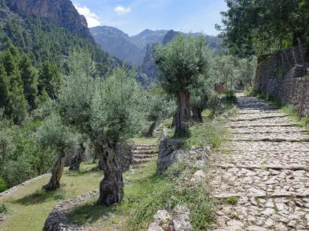
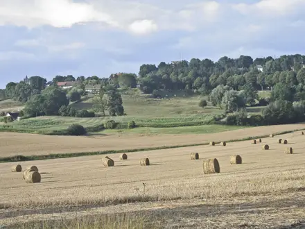
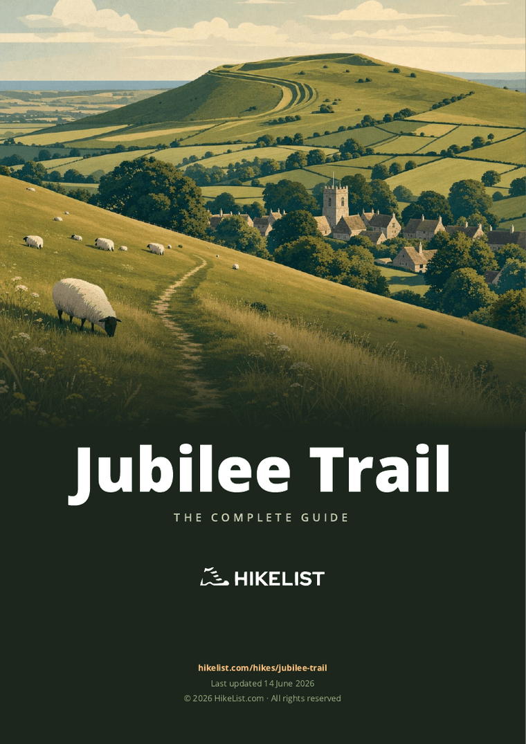
The Jubilee Trail is a 143 km waymarked long-distance footpath across Dorset in England, running west to east from Forde Abbey on the Somerset border to Bokerley Dyke on the Hampshire border. Allow about 6 days. It is a moderate, rural point-to-point walk: undulating rather than mountainous, but with around 2,580 m of ascent and many lesser-used paths. It suits hikers who want quiet villages, chalk downs, field paths and low-key logistics rather than a busy trail-town route.
Route Overview
Walked west to east, the Jubilee Trail starts at Forde Abbey and crosses rural Dorset via Thorncombe, Pilsdon Pen, Stoke Abbott, Mapperton, Toller Porcorum, Winterborne Abbas, Upwey, West Knighton, Winterborne Came, Crossways, Moreton, Bere Regis, Milton Abbas, Durweston, Stourpaine, Pimperne, Tarrant Gunville, Chettle and Cranborne before finishing at Bokerley Dyke near Martin Down National Nature Reserve. It is a point-to-point route, so plan start and finish logistics carefully; accommodation and provisions are spread out. If you prefer similarly lowland English walking, compare it with the Amber Valley Route or the gentler canal-side feel of the Ashby Canal Trail.
Why the Jubilee Trail was created
The trail opened on 24 September 1995 to mark the Diamond Jubilee of the Ramblers’ Association, founded in 1935. It was compiled and surveyed by the Ramblers’ Dorset Area, working with county and parish councils, landowners and farmers. Its purpose was deliberately different from many promoted trails: it was routed away from established long-distance paths and popular rights of way, using little-known field paths, quiet lanes and rural churches to open up quieter corners of Dorset.
Notable highlights
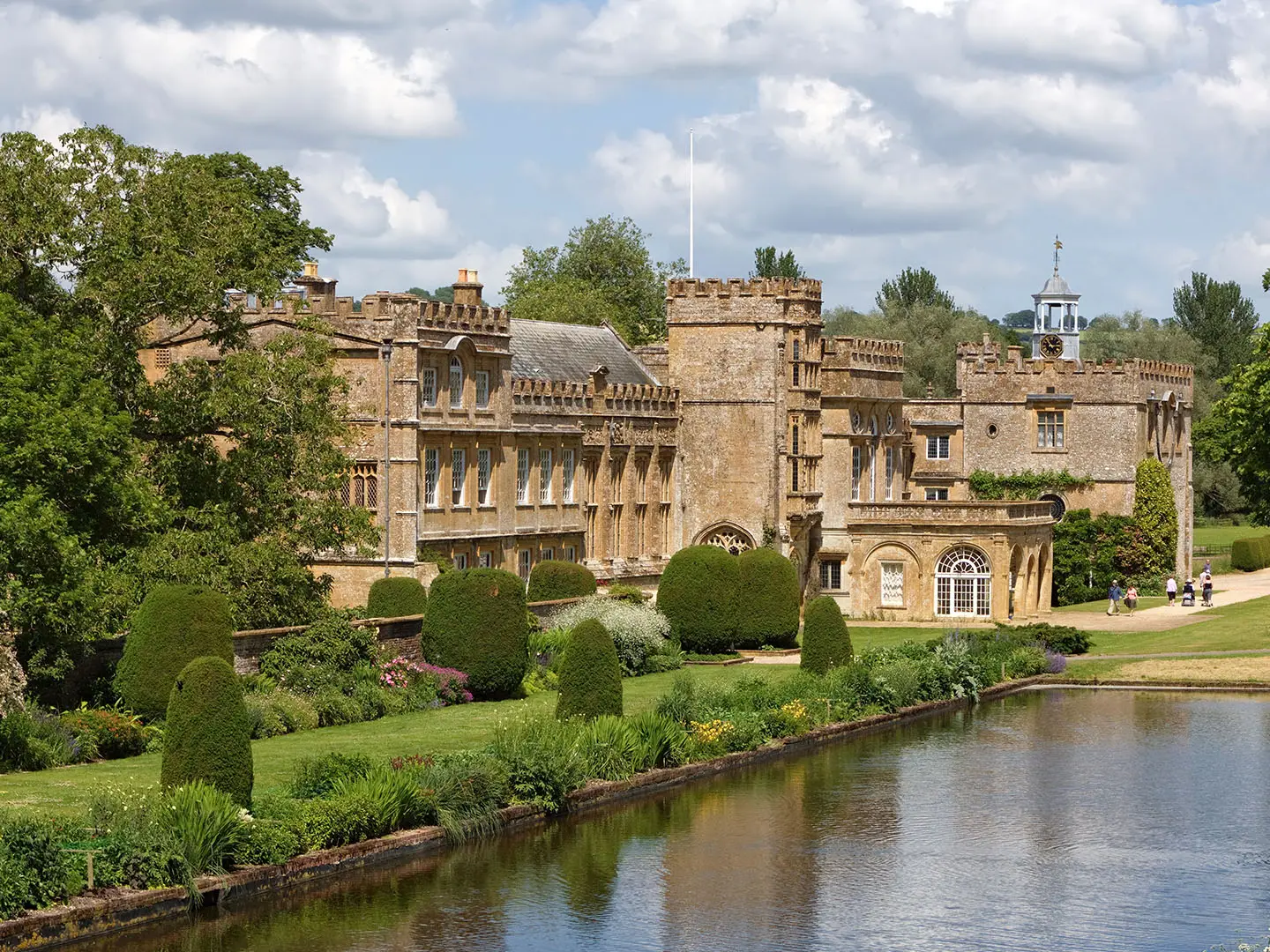
- Forde Abbey: The western trailhead is a former Cistercian monastery near the Somerset border, later converted to a private house. Its gardens are an optional paid visit before or after the walk.
- Pilsdon Pen: An Iron Age hillfort and Dorset’s second-highest hill at 277 m. The route passes near it on the western section, giving broad views across the surrounding countryside.
- Mapperton: A manor house in a hidden valley near Beaminster, known for its terraced gardens. It is one of the more distinctive estate landscapes on the route.
- Milton Abbas: An 18th-century model village of thatched cottages associated with the landscaping of Milton Abbey’s grounds. It makes one of the trail’s most memorable village stops.
- Cranborne and Cranborne Chase: Near the eastern end, Cranborne sits by Cranborne Chase, a chalk landscape noted for ancient downland and prehistoric earthworks.
- Bokerley Dyke: The eastern terminus is a major linear Iron Age/Romano-British earthwork on the Dorset-Hampshire border, beside Martin Down nature reserve.
Challenges to expect
Expect rolling rural terrain, not mountains, but the total ascent is still about 2,580 m. Surfaces include field paths, grass, dirt, gravel, woodland tracks, chalk downland and tarmac lanes; mud is likely after rain. Waymarking uses the Jubilee Trail logo, but navigation can be the main challenge because the route deliberately uses obscure, lesser-walked paths. Carry a map, guidebook or GPS. Accommodation and food stops are intermittent.
HikeList Score
Jubilee Trail scored 88/100 on HikeList's trail-quality metrics.
See score breakdownHide breakdown
- Ideal length 93
- Balanced challenge 100
- Scenery & wildness 71
- Varied terrain 100
- Accommodation 83
- Food & support 88
- Path quality 84
- Season flexibility 89
Computed from length, challenge, scenery & wildness, terrain variety, accommodation, food & support, path quality and season flexibility.
Show more data Show less
- Rural
- Undulating
- Agricultural
- Chalk Downland
- Woodland
- Riverside
- Dirt
- Grass
- Gravel
- Paved
- B&Bs
- Inns
- Campsites
- Family Friendly
- Pet Friendly
- Restrooms
- Water Sources
- Campsites
- Picnic Areas
Download Our Full Guide to Jubilee Trail FREE!
Get our comprehensive guide to this hike for free. Save it for later reading or print out at home.
Photos from hikers
Taken on the trail by people who've reviewed Jubilee Trail.
Jubilee Trail: The Complete Guide
 i
Image by Julie
i
Image by Julie The Jubilee Trail is a quiet coast-to-border traverse of rural Dorset, running 143 km from Forde Abbey on the Somerset border to Bokerley Dyke beside Martin Down on the Hampshire border. It suits walkers who prefer field paths, chalk downs, hidden valleys and small villages over busy trail hubs.
This is not a mountain route, but it is a proper long-distance walk. The line rolls over Dorset’s chalk hills and valleys, passes beneath Pilsdon Pen, threads through places such as Mapperton, Kingcombe, Moreton, Milton Abbas and Cranborne, and finishes on one of the county’s great ancient earthworks.
Its appeal is its low-key character. The route was deliberately drawn through lesser-used rights of way, quiet lanes, rural churches, estate landscapes and farmland rather than simply following the most obvious paths.
That also makes it a walk that rewards preparation. Waymarking can be sparse, paths can be faint or overgrown, accommodation and food are spread thinly, and neither trailhead has a railway station, so navigation, booking ahead and transport planning matter.
This guide covers stages, days, accommodation, food, transport, terrain and the common mistakes to avoid.
Stage-by-Stage Guide
The notes below follow the nine practical stage ends used for walking the Jubilee Trail in shorter days. Treat them as planning notes rather than turn-by-turn directions: the route deliberately uses quiet rights of way, field paths and lanes, so a current map, GPX and the Dorset Ramblers guide are important on every stage.
Food, water and accommodation are the limiting factors across much of the route. Unless a service has been booked or checked for the exact day of travel, carry enough food and water to finish the stage and assume that rural pubs, shops, buses and taxis may be limited or unavailable. This should be checked before travelling.
Stage 1: Forde Abbey to Stoke Abbott — approx. 13 km
The opening stage leaves Forde Abbey on the Somerset–Dorset border and heads into the quiet hill country around Thorncombe. It is a rural start rather than a town-to-town walk, so the first logistical job is simply reaching the trailhead: there is no railway station at Forde Abbey, and most walkers will need a taxi or pre-arranged lift from the wider Crewkerne area.
The walking is typical west Dorset: field paths, grassy tracks, hedged lanes and undulating farmland. The route passes beneath Pilsdon Pen, the Iron Age hillfort that rises to 277 m, but it does not climb to the summit. Expect broad views across the Marshwood Vale when the ground opens out, followed by quieter enclosed sections through lanes and fields.
Navigation matters from the first day. Some paths are little-used and can be faint across pasture or cropped fields, especially after summer growth or in wet weather. The green Jubilee Trail waymarks are useful when present, but should not be treated as the only means of navigation.
Planning notes:
- Food and water: do not rely on finding supplies between Forde Abbey and Stoke Abbott unless checked in advance. Carry a full day’s food and water.
- Accommodation: Stoke Abbott is a small village, so beds at or near the stage end should be booked ahead. A taxi or short transfer may be needed if staying elsewhere.
- Transport and access: Forde Abbey usually requires a road transfer from a railhead or nearby settlement. Stoke Abbott has rural road access, but public transport options should be checked before travelling.
- Warnings: muddy field paths, overgrown rights of way and livestock are realistic on this stage. Keep dogs under close control and allow extra time for uncertain path lines.
Stage 2: Stoke Abbott to Lower Kingcombe — approx. 13 km
This is a compact but rewarding west Dorset stage, moving from Stoke Abbott through hidden combes and estate countryside towards the Kingcombe area. The route skirts south of Beaminster, passes Parnham deer park and continues to Mapperton, one of the most distinctive estate landscapes on the trail.
Terrain remains gently hilly rather than strenuous, with a mixture of field paths, woodland or estate tracks, lanes and enclosed valley walking. Mapperton is a key landmark, known for its Tudor and Jacobean manor house and terraced Italianate gardens, though any visit to house or gardens is separate from the walking day and should be checked for opening times.
The stage ends around Lower Kingcombe / Kingcombe, close to traditional meadow country in the Hooke valley. Kingcombe Meadows is one of the quiet natural highlights of the route, with old field patterns and unimproved hay meadows giving this section a notably older rural character.
Planning notes:
- Food and water: services are not frequent on this stage. Carry enough for the full walk unless specific stops have been checked.
- Accommodation: Lower Kingcombe is a small rural stage end; book ahead and be prepared for accommodation to be off-route or to require a short transfer.
- Transport and access: road access is possible at the villages, but rural bus options are limited. This should be checked before travelling.
- Navigation: pay particular attention around estate edges, field corners and minor lanes, where waymarks can be missed.
- Warnings: after rain, field paths and gateways can be muddy. Summer vegetation can make little-used paths harder to identify.
Stage 3: Lower Kingcombe to Upwey — approx. 23 km
This is the longest of the nine stages and should be treated as a full walking day. From Lower Kingcombe the route passes through or near Toller Porcorum and Wynford Eagle before climbing into more open downland country towards the Hardy Monument area, then continuing via Winterborne Abbas to Upwey.
The stage gives a strong sense of the trail’s range: enclosed valleys, farmland, chalk downs, quiet lanes and wider views from the western high ground. The Hardy Monument is passed nearby on Black Down above the Frome valley; it commemorates Vice-Admiral Sir Thomas Masterman Hardy of HMS Victory, not the novelist Thomas Hardy.
Underfoot, expect a varied mix of grass, dirt, gravel, field edges and tarmac lanes. The length of the day is the main difficulty, especially if paths are wet, overgrown or slow to follow. Build in a margin for navigation rather than planning this as a fast, straightforward 23 km.
Upwey is one of the more useful logistical points on the Jubilee Trail because it has Upwey station on the Weymouth–Bristol line. This makes it a practical break point for section-walkers and a sensible place to reset plans, but accommodation and food should still be arranged in advance.
Planning notes:
- Food and water: carry enough for a long day. Settlements on the line of the stage should not be assumed to have open, convenient supplies.
- Accommodation: Upwey gives better access than most stage ends, but beds should still be booked ahead.
- Transport and access: Upwey station is the key public-transport asset on the route. If using the train, check current timetables before travelling.
- Navigation: the combination of downland, field paths and minor lanes makes map-checking essential. Do not rely on waymarks alone.
- Warnings: this is a longer, more exposed-to-weather day than the earlier stages. Mud, wind on open chalk ground and slow field crossings can all affect timings.
Stage 4: Upwey to Crossways — approx. 14 km
From Upwey the route turns inland through the villages and quiet countryside east of the Weymouth–Dorchester corridor. It passes West Knighton, Winterborne Came and Whitcombe before reaching Crossways.
This stage is shorter than the previous day and generally more moderate in feel, but it is still a rural Dorset walk rather than an easy surfaced trail. Expect field paths, tracks, lanes and farmland, with navigation required at field boundaries and village exits.
The main interest is the transition from the western downs into the gentler landscapes around the Frome valley and the villages east of Dorchester. The stage has useful access at the start because of Upwey station, but Crossways should be treated as a rural stage end where accommodation, onward transport and supplies need advance planning.
Planning notes:
- Food and water: start with what is needed for the day unless specific services in villages have been checked.
- Accommodation: options at or near Crossways may be limited; book ahead and allow for a transfer if necessary.
- Transport and access: Upwey station is useful at the start. Public transport from Crossways should be checked before travelling.
- Navigation: take care leaving and entering villages, where paths can thread between lanes, fields and minor roads.
- Warnings: wet fields and muddy gateways are the most likely underfoot issues. There is no technical ground.
Stage 5: Crossways to Bere Regis — approx. 17 km
This stage crosses one of the softer, more water-influenced parts of the Jubilee Trail, passing Moreton and Briantspuddle on the way to Bere Regis. Moreton and the Frome valley are a major highlight, with riverside and water-meadow walking in the heart of Hardy country.
The terrain is a mix of field paths, lanes, village approaches and stretches near the river landscape. In dry weather this can be gentle, attractive walking; after rain, riverside fields, meadows and low-lying paths may be muddy or waterlogged.
Moreton is one of the most memorable stops on the stage, particularly for its church with engraved glass windows. Briantspuddle adds another small-village waypoint before the route continues to Bere Regis, a useful stage end but still one that needs accommodation and supply planning.
Planning notes:
- Food and water: carry what is needed unless services in Moreton, Briantspuddle or Bere Regis have been checked for the relevant day.
- Accommodation: book Bere Regis accommodation ahead. If staying off-route, arrange the transfer before starting the stage.
- Transport and access: road access is available through the villages, but rural public transport is limited and should be checked before travelling.
- Navigation: riverside and meadow sections can make the path line less obvious, especially where grass is long.
- Warnings: this is one of the stages where wet ground is most likely to slow progress after rain.
Stage 6: Bere Regis to Winterborne Stickland — approx. 15 km
The route leaves Bere Regis for a quieter inland stage towards Milton Abbas and Winterborne Stickland. Milton Abbas is the standout landmark: an 18th-century model village of near-identical thatched cottages, created when the settlement was moved to landscape the grounds of Milton Abbey.
Walking is again mixed: field paths, lanes, chalky rises and enclosed rural sections. The day is moderate in distance, but the accumulated ascent and descent across valleys can make it feel more effortful than the map distance suggests.
Milton Abbas is worth allowing time for, but do not let the interest of the village distract from the basic logistics. The stage ends at Winterborne Stickland, another small Dorset village where accommodation and food cannot be left to chance.
Planning notes:
- Food and water: carry enough for the stage unless specific options have been checked in advance.
- Accommodation: Winterborne Stickland is a small stage end; book ahead and consider nearby alternatives only if transport is arranged.
- Transport and access: expect rural road access rather than simple public transport. This should be checked before travelling.
- Navigation: be attentive around field-path junctions and village lanes, particularly where the trail uses less obvious rights of way.
- Warnings: muddy field entrances and livestock are the main practical issues. Keep gates secure and follow the signed line across farmland.
Stage 7: Winterborne Stickland to Tarrant Gunville — approx. 18 km
This stage moves east through a chain of villages and chalk-country paths, passing Durweston, Stourpaine and Pimperne before reaching Tarrant Gunville. It is one of the longer middle-to-late stages, so it suits an early start, especially in shorter daylight months.
The character is classic inland Dorset: downs, farmland, quiet lanes and village approaches. The walking is not technical, but the route’s deliberate use of lesser-known paths means the day can be slower than a more heavily trodden national trail.
Durweston, Stourpaine and Pimperne provide useful route markers, but they should not be treated as guaranteed resupply points without checking. The approach to Tarrant Gunville brings the route deeper towards the chalk landscapes associated with Cranborne Chase.
Planning notes:
- Food and water: start with a full day’s supplies unless services have been checked in the villages en route.
- Accommodation: Tarrant Gunville is a small rural endpoint; book ahead or arrange a transfer to accommodation elsewhere.
- Transport and access: road access exists through the villages, but bus and taxi availability should be checked before travelling.
- Navigation: expect several transitions between lanes, fields and tracks. Check the map frequently rather than waiting for uncertainty.
- Warnings: allow for slow going where paths are faint, overgrown or wet. Open chalk sections can feel more tiring in hot weather, so carry sufficient water.
Stage 8: Tarrant Gunville to Cranborne — approx. 16 km
From Tarrant Gunville the trail continues through the eastern Dorset countryside towards Chettle and Cranborne. This stage has a strong Cranborne Chase character: chalk downland, woodland edges, farmland and quiet villages.
The walking remains moderate, with no technical difficulties, but the navigation stays important. The path can switch between little-used rights of way and minor roads, and waymarks may be intermittent or easy to miss at field boundaries.
Chettle is the main intermediate village before Cranborne. The stage end at Cranborne is one of the key eastern route points, well placed for the final short walk to Bokerley Dyke, but accommodation and onward travel still need advance planning.
Planning notes:
- Food and water: carry supplies for the stage unless current village services have been checked.
- Accommodation: Cranborne is the logical overnight stop before the final stage. Book ahead, particularly because there are no large trail towns on the route.
- Transport and access: Cranborne has road access and may be useful for arranging taxis or lifts for the finish, but public transport details should be checked before travelling.
- Navigation: take care through woodland and field-edge sections, where the correct right of way may not be visually obvious.
- Warnings: after rain, chalky or grassy paths can become slippery or muddy. In summer, vegetation can obscure stiles, gates and waymarks.
Stage 9: Cranborne to Bokerley Dyke / Martin Down — approx. 11 km
The final stage is the shortest, but it needs more transport planning than its distance suggests. From Cranborne the route heads to Bokerley Dyke on the Dorset–Hampshire border, finishing beside Martin Down National Nature Reserve.
The landscape is ancient chalk country, with the route ending at one of the most significant earthworks on the trail. Bokerley Dyke is a major linear Iron Age/Romano-British defensive earthwork, and it gives the Jubilee Trail a clear historical finish rather than a town-centre endpoint.
There are no trailhead-style facilities at the finish, and there is no railway station at Bokerley Dyke. Arrange a lift or taxi in advance, or plan a wider bus/train connection via the eastern Dorset or Salisbury area. This should be checked before travelling.
Planning notes:
- Food and water: carry everything needed from Cranborne. Do not rely on supplies at the finish.
- Accommodation: most end-to-end walkers will either stay in Cranborne before this stage or transfer away after finishing. Book any post-walk accommodation and transport in advance.
- Transport and access: the finish is by road near Martin Down, but onward travel is not straightforward without a pre-arranged lift or taxi.
- Navigation: make sure the final approach and endpoint are clear on the map or GPX; the trail finishes at the border earthwork, not in a settlement.
- Warnings: open chalk ground can be hot and dry in summer or muddy and slippery after rain. Leave enough time for the onward transfer, as missed rural connections can be difficult to recover from.
Recommended Itinerary
The most practical planning framework for the Jubilee Trail is the 9-stage village-to-village itinerary used by the Dorset Ramblers. It is slower than a direct 6-day crossing, but it keeps daily distances manageable and gives more room for navigation delays on faint field paths and quiet rights of way.
Distances below are approximate. Accommodation, food and onward transport are intermittent across rural Dorset, so do not treat a stage end as a guaranteed overnight stop until beds, meals and any taxi or bus links are arranged.
Standard itinerary: 9 days
| Day | From | To | Approx. distance | Why this stage makes sense | Services/accommodation notes |
|---|---|---|---|---|---|
| 1 | Forde Abbey | Stoke Abbott | 13 km | A sensible first day from the western trailhead, passing Thorncombe and beneath Pilsdon Pen before finishing in a settlement. It allows time for start-line transport, which is useful because Forde Abbey has no railway station. | Reaching Forde Abbey usually needs a taxi or pre-arranged lift from the wider Crewkerne area. Stoke Abbott is a small village, so book accommodation ahead or arrange a short transfer if needed. |
| 2 | Stoke Abbott | Lower Kingcombe | 13 km | A short but worthwhile West Dorset stage, skirting south of Beaminster and continuing through the Mapperton and Kingcombe area. The lower mileage suits the undulating, enclosed countryside and navigation-heavy field paths. | Lower Kingcombe and Kingcombe are rural, with limited facilities. Carry food for the day and have the evening stop arranged before setting out. |
| 3 | Lower Kingcombe | Upwey | 23 km | The longest standard stage, crossing towards the Frome valley side of the route via places such as Toller Porcorum and Wynford Eagle, and passing near the Hardy Monument area before reaching Upwey. This is a key day to start early. | Upwey is the most useful mid-route transport point, with Upwey station on the Weymouth–Bristol line. Accommodation and food should still be checked and booked ahead. |
| 4 | Upwey | Crossways | 14 km | A shorter recovery stage after the previous long day, continuing through West Knighton, Winterborne Came and Whitcombe towards Crossways. It keeps the central section balanced without forcing a very long push through the Frome valley. | Upwey station makes this a good place to join, leave or restart the trail. Crossways services and accommodation should be checked before travelling. |
| 5 | Crossways | Bere Regis | 17 km | A moderate central stage through Moreton and Briantspuddle before reaching Bere Regis. The distance is manageable while still making useful progress east. | Expect small-settlement logistics rather than trail-town convenience. Carry lunch and do not rely on finding food exactly when needed. |
| 6 | Bere Regis | Winterborne Stickland | 15 km | A well-paced day through the Milton Abbas area, giving time to appreciate one of the route’s most distinctive villages without creating an excessive mileage day. | Winterborne Stickland is a small overnight target. Book beds and evening food in advance, or arrange a transfer to nearby accommodation. |
| 7 | Winterborne Stickland | Tarrant Gunville | 18 km | A longer eastern stage through the Durweston, Stourpaine and Pimperne side of the route, setting up a practical final approach to Cranborne Chase. | Accommodation is thinly spread in this part of Dorset. If no suitable bed is available at the stage end, a taxi or lift may be needed; this should be checked before travelling. |
| 8 | Tarrant Gunville | Cranborne | 16 km | A steady day through quiet villages including Chettle before reaching Cranborne, the main eastern settlement before the finish. It leaves only a short final stage to Bokerley Dyke. | Cranborne is the logical place to overnight before the final leg, but services are still limited compared with a large town. Arrange the final day’s transport before arrival. |
| 9 | Cranborne | Bokerley Dyke / Martin Down | 11 km | A short final stage to the Dorset–Hampshire border, finishing at Bokerley Dyke beside Martin Down National Nature Reserve. The shorter distance is useful because the finish is not a transport hub. | There is no railway station at Bokerley Dyke. Plan a pre-arranged lift or taxi, with onward travel via the wider Salisbury or Dorset transport network; current bus and taxi options should be checked before travelling. |
Slower variant: section-walking or extra buffer days
A slower approach suits walkers using public transport, anyone wanting time for places such as Mapperton, Kingcombe, Moreton, Milton Abbas and Cranborne, or anyone who prefers not to combine long rural stages with uncertain services.
The simplest slower plan is to follow the 9-stage itinerary above and add buffer nights where logistics are easiest, especially around Upwey because it has a railway station. Another option is to break the longest day, Lower Kingcombe to Upwey, by arranging a taxi or bus link from one of the route settlements such as Toller Porcorum, Wynford Eagle or Winterborne Abbas. This should be checked before travelling.
For section-hikers, Upwey is the clearest mid-route access point. Forde Abbey and Bokerley Dyke are both less straightforward because neither has a station, so start and finish transfers need planning rather than being left until the day.
Faster variant: about 6 days
A 6-day crossing suits fit, efficient walkers who are comfortable with repeated long days, self-reliant navigation and carrying enough food between limited village services. It is not the best choice for walkers who want guaranteed short days or who are depending entirely on infrequent rural public transport.
Do not assume the 9 stages can simply be doubled neatly: combining them creates uneven days, and accommodation may not fall where the mileage looks convenient. A faster itinerary should be built around available beds first, then checked against the Dorset Ramblers guide, GPX or OS mapping before booking.
As a broad planning target, 143 km over 6 days means averaging roughly 24 km per day. Upwey is the most useful halfway transport anchor, while Cranborne is the practical final overnight before the short walk out to Bokerley Dyke. Exact overnight splits for a 6-day schedule should be checked against official mapping and current accommodation availability before booking.
Planning the Route
How many days to allow
Most walkers should plan the Jubilee Trail around the practicalities of rural Dorset rather than around a fixed mileage target. The route can be completed in about 6 days by fit walkers, but that means averaging just under 24 km per day and accepting some long, quiet days where services are thin.
A 9-day itinerary is often the more manageable way to walk it. The Dorset Ramblers divide the route into day stages of roughly 11–23 km, each ending in or near a settlement, which suits the character of the trail: small villages, intermittent accommodation, few large service centres and a route that rewards unhurried navigation.
The longest named stage in the 9-day pattern is Lower Kingcombe to Upwey at about 23 km. Treat that as a realistic warning about the route: the walking is not technical, but progress can be slower than the map distance suggests when field paths are faint, waymarks are sparse or ground is muddy after rain.
A practical 9-stage structure
| Stage | From | To | Approx. distance |
|---|---|---|---|
| 1 | Forde Abbey | Stoke Abbott | 13 km |
| 2 | Stoke Abbott | Lower Kingcombe | 13 km |
| 3 | Lower Kingcombe | Upwey | 23 km |
| 4 | Upwey | Crossways | 14 km |
| 5 | Crossways | Bere Regis | 17 km |
| 6 | Bere Regis | Winterborne Stickland | 15 km |
| 7 | Winterborne Stickland | Tarrant Gunville | 18 km |
| 8 | Tarrant Gunville | Cranborne | 16 km |
| 9 | Cranborne | Bokerley Dyke / Martin Down | 11 km |
This structure is useful because the stage ends are tied to settlements rather than arbitrary points in the countryside. Even so, a village at the end of a stage does not guarantee beds, food or onward transport, so each overnight stop should be planned before travel.
A 6-day crossing is better treated as a faster variant, not the default for a first visit. It will require combining stages and may force accommodation away from the trail, especially where small villages have limited lodging.
Accommodation drives the itinerary
Accommodation is the main constraint on the Jubilee Trail. B&Bs, country inns, pubs with rooms and a few campsites are spread thinly across small Dorset villages, with no continuous chain of trail towns.
Book beds before committing to daily distances. In places, the most workable plan may involve a short taxi or bus hop from a stage end to a nearby village, then returning to the same point the next morning.
Do not assume that a settlement listed on the route has year-round accommodation, evening meals or a shop. Opening days, food service times and seasonal availability should be checked before travelling.
Food and water planning
Carry enough food for the full walking day, including a spare snack or meal if a pub, café or shop is closed. The route intentionally links quiet villages and rural rights of way, so resupply is not as predictable as on busier national trails.
Water should be treated in the same way. Start each day with enough to cover the stage, particularly across open downland and farmland where there may be long gaps between reliable services.
Upwey is a useful planning point because it has a railway station and sits roughly midway along the route. It is a logical place to reset plans, join or leave the trail, or split the walk into western and eastern sections.
Navigation is a core part of the route
The Jubilee Trail is waymarked, but it is not a route to follow on waymarks alone. It deliberately uses little-walked field paths, quiet lanes and obscure rights of way, so a map and reliable GPS track are important.
Carry the Dorset Ramblers’ guide or current route notes, plus appropriate OS mapping. Recommended mapping includes OS Explorer 116, 117, 118 and OL45; Explorer 110 may also be useful at the eastern end.
Before setting off, check the current route, waymarking and any path diversions. Field-edge paths can be faint, overgrown or awkward after crops have grown up, and some downland or valley sections can become muddy or waterlogged after rain.
Transport at the start, finish and midway
Neither trailhead has a railway station. For the western start at Forde Abbey, the nearest main-line station is Crewkerne, but the final approach to the abbey near Thorncombe usually needs a taxi, bus connection or pre-arranged lift.
The eastern finish at Bokerley Dyke is beside Martin Down National Nature Reserve on the Dorset–Hampshire border. Leaving the finish usually requires planning around rural buses, a taxi or a lift; Dorchester and Salisbury are the main-line rail options for the eastern half of the route.
Upwey station, on the Weymouth–Bristol line, gives the route its most useful mid-walk rail access. Local buses serve some villages, but rural Dorset services can be infrequent, so current timetables should be checked before travelling.
Section hiking and shorter trips
The Jubilee Trail works well as a section hike because the Ramblers’ stage pattern breaks the route into manageable day walks. The main limitation is not the walking distance, but getting to and from small villages without relying on frequent public transport.
For weekend planning, Upwey is the easiest anchor point because of its station. Elsewhere, a practical section-hike plan may need two cars, taxis, or overnight stops positioned slightly off the line of the trail.
The route can also be shortened by walking individual stages, especially where accommodation or transport is available nearby. Extending the walk beyond either end is possible only with separate route planning; the Jubilee Trail itself is a point-to-point traverse from Forde Abbey to Bokerley Dyke.
Direction and pacing
The route is normally described west to east, from Forde Abbey to Bokerley Dyke, and the stage sequence follows that direction. Walking east to west is feasible, but transport and accommodation should be checked in reverse before assuming the same plan will work.
Pacing should allow for navigation time. On a quiet rural trail with faint paths and intermittent services, a shorter planned day can be more useful than a fast schedule that leaves no margin for route-finding, mud, closed facilities or a late taxi connection.
What matters most before booking
Prioritise these checks before fixing dates:
- overnight accommodation at or near each intended stage end;
- evening meal options and next-day food supplies;
- water availability and the need to carry a full day’s supply;
- current bus, train and taxi options, especially at Forde Abbey and Bokerley Dyke;
- current route notes, GPX and OS mapping;
- seasonal ground conditions, especially after prolonged rain;
- any path diversions or access changes on little-used rights of way.
Permits are not the main planning issue on this route. The critical work is matching daily stages to beds, food, transport and reliable navigation.
Towns, Villages and Overnight Stops
The Jubilee Trail is not a route with obvious trail towns at regular intervals. Most overnight planning revolves around small villages, country inns, B&Bs, occasional campsites and, where beds are full or absent, short taxi or bus hops to nearby settlements.
Book accommodation before committing to daily distances. Food and public transport are also intermittent, and opening days in rural Dorset can change; pubs, shops, cafés, buses and taxis should all be checked before travelling.
Forde Abbey and Thorncombe
Forde Abbey is the western trailhead, close to the Somerset–Dorset border near Thorncombe and north-west of Beaminster. It is a start point rather than a natural overnight trail base, so most walkers will need to arrange access in advance rather than expect to arrive easily by public transport.
There is no railway station at the trailhead. Crewkerne is the nearest main-line rail option for the western end, on the London Waterloo–Exeter line, but the final approach to Forde Abbey normally needs a taxi or pre-arranged lift.
Forde Abbey itself is worth factoring into the start of the walk if time allows, as the abbey and formal gardens can be visited separately from the hike. Thorncombe is the nearest named village on this opening section, but accommodation, meals and onward transport should be arranged before arrival.
Stoke Abbott
Stoke Abbott is the first named stage end on the 9-stage version of the route, around 13 km from Forde Abbey. It is a practical first overnight target for walkers using the shorter stage pattern, especially because the western section has already crossed quiet rural ground beneath the Pilsdon Pen area.
Treat Stoke Abbott as a small-village stop, not a guaranteed service centre. Beds, evening meals and breakfast arrangements should be booked ahead, and any reliance on a pub, shop or local bus should be checked before travelling.
This is also a useful place to pause if starting the trail late in the day after travelling to Crewkerne and transferring to Forde Abbey. The opening stage is short by long-distance standards, but navigation on little-used paths can still slow progress.
Beaminster, Parnham and Mapperton
The trail skirts Beaminster to the south rather than passing through it as a main trail-town stop. That makes it a possible off-route service or accommodation target, but using it may involve leaving and rejoining the line of the Jubilee Trail.
Parnham deer park and Mapperton sit on the route corridor east of Beaminster. Mapperton is one of the more distinctive estate landscapes on the trail, with a Tudor and Jacobean manor house in a hidden combe and notable gardens, but it should not be treated as a guaranteed resupply point.
For overnight planning, this part of West Dorset is best handled flexibly. If accommodation near Stoke Abbott or Lower Kingcombe is unavailable, Beaminster may be a useful alternative search area, but distances, access and local transport should be checked before booking.
Lower Kingcombe and Kingcombe
Lower Kingcombe is the second named stage end, about 13 km beyond Stoke Abbott. It sits in the Kingcombe area, close to the traditional hay meadows and old field patterns of the Hooke valley, making it one of the most attractive rural pauses on the western half of the trail.
It can work well as an overnight stop, but availability is likely to be limited and should be arranged well in advance. Do not assume there will be evening food, a shop or a late transport option without checking directly.
This is a good place to break the western section before the longer stage towards Upwey. Walkers combining stages into a 6-day itinerary should pay particular attention to where the next confirmed bed and meal are, because the following section is longer and crosses more quiet countryside.
Toller Porcorum and Wynford Eagle
Toller Porcorum and Wynford Eagle lie on the route between Lower Kingcombe and the Winterborne Abbas/Upwey section. They are useful navigation and pacing points rather than major overnight hubs.
Accommodation and food should be treated as uncertain unless booked or checked in advance. These villages may help break up the longest 9-stage day, but they should not be relied on as spontaneous resupply stops.
The practical value of this stretch is in planning time and water carefully. The trail uses quiet lanes, field paths and hidden valleys here, so progress can be slower than the map distance suggests if paths are overgrown, muddy or faint.
Hardy Monument area and Winterborne Abbas
The route passes near the Hardy Monument on Black Down before heading on towards Winterborne Abbas. The monument commemorates Vice-Admiral Sir Thomas Masterman Hardy of HMS Victory, not the novelist Thomas Hardy, although this wider landscape is also Hardy country in the literary sense.
Winterborne Abbas is a named place on the route and a sensible planning point before the trail continues towards Upwey. Whether it suits an overnight stop depends on current accommodation and food availability, which should be checked before travelling.
This area can be exposed compared with the enclosed valleys to the west. Weather, daylight and underfoot conditions should be considered carefully if continuing beyond Winterborne Abbas towards Upwey on the same day.
Upwey
Upwey is one of the most useful logistical points on the whole Jubilee Trail. It is the end of the third named stage, around 23 km from Lower Kingcombe, and it has Upwey station on the Weymouth–Bristol line, giving the route its best mid-walk rail access.
For section-walkers, Upwey is the obvious place to split the route into western and eastern halves. It can also be used as a start or finish point for walkers who do not want to commit to the full Forde Abbey to Bokerley Dyke traverse.
Accommodation and food still need checking in advance, but Upwey is more practical than many of the smaller villages because of the rail connection. If baggage transfer, taxis or rest-day logistics are being arranged, this is one of the strongest points on the route to organise them around.
West Knighton, Winterborne Came and Whitcombe
West Knighton, Winterborne Came and Whitcombe sit on the section east of Upwey, before the route reaches Crossways. They are useful named points for navigation through the Frome valley and surrounding rural lanes and paths.
These places should not be treated as guaranteed overnight stops unless a bed has been booked. Shops, cafés, pubs and bus options should be checked before travelling, as services in the smaller villages on this route are thin and may not align with walking hours.
For most end-to-end walkers, this section is more likely to be walked through than stopped in. It is a manageable day from Upwey to Crossways on the 9-stage schedule, but muddy or waterlogged field paths after rain can still affect timings.
Crossways
Crossways is the fourth named stage end, about 14 km from Upwey. It is a practical overnight marker on the central part of the trail, especially for walkers keeping to the shorter 9-stage itinerary.
Accommodation and meals should be arranged ahead rather than left to chance. Public transport may be available in the wider area, but rural Dorset bus services are infrequent and current timetables should be checked before relying on them.
Crossways is also useful because it breaks the route before the Frome valley section towards Moreton and Bere Regis. If beds are limited, consider whether staying off-route and using a taxi is simpler than forcing an unsuitable daily distance.
Moreton
Moreton lies between Crossways and Bere Regis and is one of the notable stops in the Frome valley. The route here includes riverside and water-meadow walking, and Moreton church is known for its engraved glass windows.
It is a worthwhile pause during the day, but overnight use depends on current accommodation availability. Food and opening times should be checked before planning a lunch stop or evening arrival around the village.
This is a good section for walkers interested in Hardy country and gentler valley walking, but it is still rural rather than built-up. Carry enough food and water to avoid depending on unconfirmed services.
Briantspuddle
Briantspuddle is passed on the approach to Bere Regis. It is a useful intermediate settlement on the fifth named stage, which runs about 17 km from Crossways to Bere Regis.
Do not assume that Briantspuddle will solve resupply or accommodation gaps. It is best used as a route and rest point unless specific arrangements have been made in advance.
If the Crossways to Bere Regis day feels long in poor weather or under heavy pack, Briantspuddle may help with pacing. Any taxi pick-up or off-route accommodation plan should be arranged before setting out, as mobile signal and rural availability can be unreliable in practice.
Bere Regis
Bere Regis is the fifth named stage end and one of the more important overnight planning anchors on the eastern half of the trail. It comes after the Frome valley section and before the route turns towards Milton Abbas and Winterborne Stickland.
This is a logical overnight stop for most 9-stage itineraries. Even so, beds, evening meals and breakfast should be booked ahead, particularly in busier walking months or where only a small number of rooms are available locally.
Bere Regis is also a useful place to reassess the eastern half of the walk. From here the route continues through a chain of small Dorset villages, and the same planning rule applies: do not rely on finding provisions or transport spontaneously.
Milton Abbas
Milton Abbas lies between Bere Regis and Winterborne Stickland and is one of the most memorable villages on the Jubilee Trail. It is known for its 18th-century model-village layout of near-identical thatched cottages, created when the village was moved to landscape the grounds of Milton Abbey.
It is a strong daytime stop and photo point, but accommodation and food should still be checked before travelling. Its appeal can make it tempting to plan a longer break here, but that should be balanced against the remaining distance to the booked overnight stop.
For hikers on the 9-stage schedule, Milton Abbas falls within the Bere Regis to Winterborne Stickland day. It is not listed as a stage end in that schedule, so staying here may require adjusting the previous or following day’s mileage.
Winterborne Stickland
Winterborne Stickland is the sixth named stage end, about 15 km from Bere Regis. It is a practical overnight point before the route continues north-east through Durweston, Stourpaine and Pimperne towards Tarrant Gunville.
Accommodation is likely to be limited and should be secured before setting out. Confirm evening food and breakfast options as part of the booking process, because small-village services may not be available every day.
This is a useful place to stop if walking the eastern half at a steady pace. It keeps the following day to a reasonable length and avoids pushing too far through a section where public transport and resupply are not dependable.
Durweston, Stourpaine and Pimperne
Durweston, Stourpaine and Pimperne are passed on the stage from Winterborne Stickland to Tarrant Gunville. They provide useful route markers through the middle of the eastern half, but the stage pattern does not use them as overnight ends.
Any accommodation, pub, shop or bus connection in these villages should be checked before travelling. They may be useful for splitting a day, arranging a pick-up or diverting to a pre-booked bed, but they should not be assumed to have walk-up services.
This is a section where navigation still matters. The Jubilee Trail deliberately uses quieter rights of way rather than simply linking the most obvious settlements, so keep map or GPS checks frequent even when villages appear close together on paper.
Tarrant Gunville
Tarrant Gunville is the seventh named stage end, about 18 km from Winterborne Stickland. It is an important overnight planning point before the route continues towards Chettle and Cranborne.
Treat this as a small-village stop with limited capacity. Accommodation, food and any transport arrangements should be booked or checked in advance, especially if walking on a fixed end-to-end schedule.
Because the next stage to Cranborne is shorter than some western days, Tarrant Gunville can help create a balanced itinerary. It also avoids arriving late into Cranborne after a long day across quiet rural paths.
Chettle
Chettle lies between Tarrant Gunville and Cranborne. It is a useful intermediate point on the eighth named stage, but not a stage end in the standard 9-stage breakdown.
Use Chettle primarily as a navigation and pacing marker unless specific accommodation or food arrangements have been made. This should be checked before travelling.
The practical issue here is not difficulty but certainty. With the trail nearing Cranborne Chase, it remains a low-key rural walk where services are spaced out and a missed meal stop can mean carrying on without an easy alternative.
Cranborne
Cranborne is the eighth named stage end and the main base before the final walk to Bokerley Dyke and Martin Down. It sits beside Cranborne Chase, an ancient chalk landscape of downland, woodland and prehistoric earthworks.
For most end-to-end walkers, Cranborne is the best overnight stop before finishing the trail. It allows the final day to be kept short, at around 11 km to Bokerley Dyke / Martin Down.
Accommodation and food should still be booked ahead, and onward transport for the finish should be arranged before leaving Cranborne. The eastern terminus has no railway station, so a taxi, lift or carefully planned bus connection will usually be needed after the walk.
Bokerley Dyke and Martin Down
Bokerley Dyke is the eastern terminus of the Jubilee Trail, on the Dorset–Hampshire border beside Martin Down National Nature Reserve. It is a finish point, not a trail town, and should not be treated as a place to find accommodation, food or onward transport on arrival.
Plan the exit before starting the final stage from Cranborne. The nearest practical onward rail options for the eastern half are Dorchester or Salisbury, but reaching them from the finish will normally require a taxi, lift or a bus connection checked in advance.
The final section is short compared with earlier days, but the logistics matter. Finish-day plans should allow for time at Bokerley Dyke, any navigation delays on the approach and the arranged transfer away from Martin Down.
Getting to the Start
The Jubilee Trail starts at Forde Abbey on the Somerset–Dorset border, near Thorncombe and north-west of Beaminster. There is no railway station at the trailhead, so most walkers need to combine train travel with a taxi or pre-arranged lift for the final approach.
By train
The nearest main-line station for the western start is Crewkerne, on the London Waterloo–Exeter line. This makes the start reasonably accessible from London and Exeter, but not directly rail-served.
From Crewkerne, arrange a taxi or lift to Forde Abbey before travel. Rural taxi availability can be limited, especially early in the morning, late in the day or on Sundays, so booking ahead is strongly recommended.
Do not assume there will be a waiting taxi at the station or an easy onward bus connection to the abbey. This should be checked before travelling.
By bus
Local buses serve some villages in rural Dorset and Somerset, but services around the start are limited and may not line up neatly with a walking itinerary. The trail begins at Forde Abbey near Thorncombe, rather than in a large town or transport hub.
If using buses, plan the whole chain in advance: main-line train to the area, bus as far as practical, then a taxi or lift for the final leg if needed. Current rural bus timetables should be checked before travelling.
By car
Driving to the western end is straightforward in principle, but the Jubilee Trail is a point-to-point route ending far away at Bokerley Dyke on the Dorset–Hampshire border. Leaving a car at Forde Abbey creates a retrieval problem at the end of the walk.
For an end-to-end walk, the usual practical options are:
| Option | Practical notes |
|---|---|
| Drop-off at Forde Abbey | Often the simplest arrangement if someone can drive you to the start. |
| Taxi from Crewkerne or nearby accommodation | Sensible if arriving by train the previous evening or morning of Day 1. Book ahead. |
| Two-car arrangement | Possible, but the finish is at Bokerley Dyke / Martin Down, not a rail-served town. |
| Leave a car and return later | Requires a planned taxi, lift or public-transport chain back to the western end. This should be checked before travelling. |
Long-stay parking at or near Forde Abbey should not be assumed. Any parking arrangement must be agreed in advance with the relevant landowner, accommodation provider or car park operator.
From the nearest airport
There is no airport-to-trailhead transfer that makes the start especially direct. For most visitors flying into the UK, the simplest plan is to travel first to a main-line rail connection for the London Waterloo–Exeter line, then continue to Crewkerne and use a pre-booked taxi or lift to Forde Abbey.
Airport rail and coach connections change, so the complete journey to Crewkerne and onward to Forde Abbey should be checked before travelling.
Where to stay before starting
The most convenient pre-walk bases are the settlements around the western start, such as Thorncombe, Crewkerne or Beaminster, depending on available beds and transport. Forde Abbey itself is the trailhead, but accommodation and evening services in this part of rural Dorset and Somerset are not dense.
Staying near Crewkerne can work well for train arrivals, provided a taxi to Forde Abbey is booked for the morning. Staying closer to Thorncombe or Beaminster may reduce the morning transfer, but local accommodation should be booked ahead.
If starting with the standard first stage from Forde Abbey to Stoke Abbott, avoid beginning the day with unresolved transport. The route quickly enters quiet rural walking, and the main planning risk is losing time before even reaching the trailhead.
Getting Home from the Finish
The Jubilee Trail ends at Bokerley Dyke on the Dorset–Hampshire border, beside Martin Down National Nature Reserve. There is no railway station at the finish, and this is not a place to rely on turning up and finding onward transport. Plan the exit before setting off, especially if walking the final Cranborne to Bokerley Dyke stage late in the day.
By train
The nearest practical main-line railheads for the eastern end are Salisbury and Dorchester. Neither is at the trailhead itself, so a taxi, lift or bus connection is normally needed from Bokerley Dyke or Cranborne.
For most end-to-end walkers, Salisbury is likely to be the more natural rail target from the eastern finish, while Dorchester is another useful rail option for the eastern half of the route. Exact journey times, service frequency and onward connections should be checked before travelling.
If using public transport, build in a generous buffer between reaching Bokerley Dyke and any booked train. The final stage is only about 11 km from Cranborne, but the limiting factor is the rural onward connection, not the walking distance.
By bus
Local buses serve some Dorset villages, but services in this part of rural Dorset are limited and may not be convenient for a same-day finish. Cranborne is the key nearby village to consider for bus planning, as it is the final stage-start settlement before Bokerley Dyke.
Do not assume there will be a useful bus from the finish itself. Current routes, operating days and last departures should be checked before travelling, particularly at weekends, on bank holidays and outside school-term patterns.
If a bus is part of the plan, it is usually safer to arrange the final day around a known departure from Cranborne or another reachable village rather than trying to improvise from Martin Down after finishing.
By car/taxi
A pre-booked taxi or arranged lift is the most reliable way to leave Bokerley Dyke. This can be used either to reach Salisbury or Dorchester for trains, or to return to accommodation in Cranborne or another nearby village.
Book the taxi in advance and give a clear rural pick-up point. Mobile reception, exact meeting locations and driver familiarity with Bokerley Dyke/Martin Down can all matter at a quiet border finish, so agree the pick-up details before the final stage.
If leaving a car near the finish, parking arrangements and access should be checked before travelling. The route ends by a nature reserve and ancient earthwork, so avoid assuming there will be convenient long-stay parking exactly where the trail finishes.
From the nearest airport
There is no airport directly useful to the finish in the way a railway station would be. For air travel, the practical approach is to connect first to a main-line rail hub such as Salisbury or Dorchester, then use a pre-arranged taxi, lift or suitable bus connection for the final rural leg.
Airport-to-trail logistics are timetable-dependent and should be checked before booking flights, especially if arriving late in the day.
Where to stay at the finish
Bokerley Dyke itself is not a trail town, and accommodation across the eastern end of the Jubilee Trail is thinly spread. Cranborne is the most relevant nearby settlement for the final stage, but beds should be booked ahead rather than treated as a walk-up option.
If finishing late, staying overnight near Cranborne or arranging a taxi straight to pre-booked accommodation is usually more sensible than depending on evening public transport. This is particularly important after a full end-to-end itinerary, when delays from navigation, mud or overgrown field paths can push the finish later than planned.
Which Direction Should You Walk?
Standard direction: Forde Abbey to Bokerley Dyke
The Jubilee Trail is best treated as a west-to-east walk, from Forde Abbey on the Somerset–Dorset border to Bokerley Dyke on the Dorset–Hampshire border. This follows the route’s stated start and finish, and matches the natural order of the main stage settlements: Thorncombe, Stoke Abbott, Lower Kingcombe, Upwey, Crossways, Bere Regis, Milton Abbas, Tarrant Gunville, Cranborne and then Bokerley Dyke / Martin Down.
This direction also gives the walk a clear coast-to-border-style progression across rural Dorset: western hills and hidden valleys first, the Frome valley and Upwey around the middle, then the quieter chalk and village country of Cranborne Chase towards the finish. The ending at Bokerley Dyke is psychologically neat: the trail finishes on a major ancient earthwork exactly at the county edge.
The main drawback is practical rather than scenic. Bokerley Dyke is not a service hub, so the final day needs onward transport arranged from the Martin Down / Cranborne area. Do not assume there will be easy walk-up public transport at the finish; taxis, lifts and bus connections should be checked before travelling.
Reverse direction: Bokerley Dyke to Forde Abbey
Walking east-to-west is perfectly possible, but it is less straightforward as a default choice. It means starting from a remote border point near Martin Down, then working back through Cranborne, Tarrant Gunville, Milton Abbas, Bere Regis, Crossways, Upwey and the western villages before finishing at Forde Abbey.
The reverse has one practical appeal: Forde Abbey is a more distinct landmark to finish at than a rural earthwork, and an optional paid visit to the abbey gardens can make a satisfying end to the route. However, the western trailhead is still not on the railway, so a taxi or lift towards Crewkerne is likely to be needed at the end.
Reverse walking also means reading any published stage notes, accommodation plans and waymarking expectations backwards. On a route that deliberately uses faint field paths, quiet lanes and less-obvious rights of way, that adds a small but real navigational burden.
Transport and accommodation considerations
Neither end has a railway station, so direction does not remove the need for careful access planning. Crewkerne is the nearest main-line station for the western end, while Dorchester or Salisbury are the broader rail options for the eastern side; Upwey station is useful around the middle of the route.
For accommodation, the west-to-east direction is generally easier to organise because it follows the standard settlement order and the Ramblers’ stage pattern. Beds, food and transport are thinly spread across small villages whichever way you walk, so the key issue is not direction but booking ahead and being realistic about taxi or bus hops where a stage end has limited services.
Are the climbs easier one way?
There is no strong climbing advantage in either direction. The Jubilee Trail is undulating rather than mountainous, with repeated modest ascents and descents across chalk downs, farmland and valley country.
The total ascent is about 2,581 m over the full route, and walking it backwards does not materially change the effort. The harder days are likely to be shaped more by stage length, mud, overgrowth, heat, rain and navigation than by the direction of travel.
Recommendation
Walk the Jubilee Trail west to east, from Forde Abbey to Bokerley Dyke, unless accommodation availability or transport connections make the reverse more convenient. West-to-east follows the trail’s standard start-to-finish logic, keeps planning simpler, gives a satisfying county-border finish, and avoids adding unnecessary complication to a route where navigation and rural logistics already need attention.
Accommodation Along the Route
Accommodation on the Jubilee Trail is rural, intermittent and best treated as a core part of the route planning rather than an afterthought. This is not a trail with big walking bases at regular intervals; most overnight stops are small Dorset villages, with B&Bs, country inns, pubs with rooms and a few campsites spread thinly along or near the line.
Booking ahead is strongly recommended. Beds, evening meals and shops are widely spaced, and some of the neatest walking stages end in places where accommodation may be very limited or where a short taxi or bus hop to a nearby village is the practical solution. Do not rely on turning up and finding a room.
Best Overnight Strategy
The Dorset Ramblers’ 9-stage pattern gives the most manageable accommodation framework, because each stage ends in a settlement: Stoke Abbott, Lower Kingcombe, Upwey, Crossways, Bere Regis, Winterborne Stickland, Tarrant Gunville, Cranborne and the finish at Bokerley Dyke / Martin Down. A faster 6-day itinerary is possible, but it reduces flexibility and may force longer days or off-route transfers where accommodation does not line up cleanly.
Upwey is one of the more useful mid-route stops because it has a railway station nearby, making it a practical break point for section walkers. Bere Regis and Cranborne are also natural planning anchors on the eastern half because they are named stage ends and larger village stops by the standards of this route. Even so, availability should be checked before committing to daily distances.
The western section needs particular care. Forde Abbey is the start point rather than a trail town, and the route soon passes through or near small places such as Thorncombe, Stoke Abbott, Mapperton, Lower Kingcombe and Toller Porcorum. Accommodation may exist in the wider area, but walkers should not assume a room exactly at the day’s endpoint.
Accommodation by Place
| Place | Accommodation level | Best for | Notes |
|---|---|---|---|
| Forde Abbey / Thorncombe | Limited | Pre-walk night or taxi drop-off to the start | The trail starts at Forde Abbey, not at a transport or accommodation hub. Many walkers will need a taxi or lift from the Crewkerne area. This should be checked before travelling. |
| Stoke Abbott | Limited | First-night stop on the 9-stage schedule | Small village stage end. Book early or plan a short transfer if no suitable room is available. |
| Beaminster area | Good | Western-section fallback or resupply/accommodation base | The trail skirts Beaminster to the south rather than passing straight through it, but it is one of the more useful nearby settlements for planning the western stages. Check walking or taxi links before booking. |
| Lower Kingcombe / Kingcombe | Limited | Quiet rural overnight on the second stage | Useful for keeping the western stages short, but options are likely to be limited. Secure accommodation before fixing the itinerary. |
| Winterborne Abbas | Limited | Possible western/mid-route staging point | The route passes through this part of the downs before Upwey. Treat it as a possible stop only after checking current availability. |
| Upwey | Good | Mid-route overnight, section break, rail access | One of the strongest logistics points on the trail because Upwey station is nearby. A sensible place to split the route or restart a section walk. |
| Crossways | Limited | Overnight between Upwey and Moreton/Bere Regis | Stage-end settlement on the 9-stage itinerary. Accommodation and evening food should be checked in advance. |
| Moreton | Limited | Frome valley stop or short-stage adjustment | Useful if reshaping the Crossways–Bere Regis section, but do not assume reliable availability without booking. |
| Bere Regis | Good | Eastern-half anchor stop | A natural overnight point on the 9-stage schedule and one of the more practical settlements on the eastern half. Book ahead, especially for weekends. |
| Milton Abbas | Limited | Scenic overnight or itinerary adjustment | The route passes through this distinctive village, but accommodation choice should be treated as limited. Check availability before building a stage around it. |
| Winterborne Stickland | Limited | Stage-end overnight between Bere Regis and Tarrant Gunville | Works on paper as a walking-stage finish, but may need an off-route transfer if no bed is available. |
| Durweston / Stourpaine / Pimperne | Limited | Alternative stops on the approach to Cranborne Chase | These villages can help reshape the eastern stages, but availability is likely to be patchy. Confirm beds, food and onward walking distance before booking. |
| Tarrant Gunville | Limited | Stage-end overnight before Cranborne | Small settlement stage end. Plan conservatively and have a taxi fallback if needed. |
| Chettle | Limited | Possible stop between Tarrant Gunville and Cranborne | Useful only if accommodation is available and the day’s distance fits. This should be checked before travelling. |
| Cranborne | Good | Final trail night, eastern-section base | The most obvious overnight base before the short final stage to Bokerley Dyke / Martin Down. Also useful for arranging onward transport from the finish. |
| Bokerley Dyke / Martin Down | None | Finish point only | The eastern terminus is an ancient earthwork beside Martin Down, not a village stop. Arrange pickup, taxi transfer or onward travel in advance. |
Booking, Meals and Transfers
For an end-to-end walk, book accommodation before arranging trains and taxis. The limiting factor is more likely to be bed availability than walking distance, especially in the smaller stage-end villages.
Ask each accommodation provider about evening meals, breakfast times and packed lunches before booking. On a route of small villages and rural lanes, a bed does not automatically mean there will be food available at the right time for walkers.
Taxi transfers are a practical way to make the Jubilee Trail work when accommodation does not match the ideal stage plan. A short transfer can allow walkers to stay in a nearby village or town and return to the trail the next morning, but rural taxis should be booked in advance rather than left to the end of the day.
Camping and Luggage Transfer
The route has a few campsites in the wider accommodation mix, but camping should not be assumed at every stage end. Anyone planning to camp should map each legal overnight stop carefully and check current opening dates, rules and facilities before travelling.
The Jubilee Trail can work as an inn-to-inn walk, but it suits organised, self-reliant walkers rather than those expecting a polished trail-town infrastructure. If luggage transfer is important, arrange it directly with accommodation providers, local taxi firms or a walking-holiday operator before committing to the itinerary. Do not assume baggage transfer is automatically available on this route.
Camping and Wild Camping
Camping the Jubilee Trail is possible, but it is not the easiest accommodation style for this route. The trail crosses rural Dorset through small villages, farmland, chalk downland, woodland edges and nature-rich valleys, with services spread thinly and no large trail towns. A lightweight camping plan needs more preparation than on busier national trails.
There are a few campsites on or near the wider route corridor, but they are intermittent rather than conveniently spaced at every stage end. Do not assume that each of the 9 day-stage settlements has a campsite, shop, pub or reliable onward transport. Campsites should be identified and booked before setting out, and any off-route distance or taxi/bus link should be planned in advance.
Does the Jubilee Trail suit camping?
The route suits self-reliant campers who are comfortable carrying extra food and water, navigating faint rights of way and adjusting stages around where camping is actually available. It is less suitable for anyone expecting a simple village-to-village campsite chain.
A mixed approach often works better: use campsites where they fit the route, then use B&Bs, inns, pubs with rooms, taxis or short public-transport hops where camping options are too sparse. This is especially useful because the official-style stage ends are small places such as Stoke Abbott, Lower Kingcombe, Crossways, Winterborne Stickland and Tarrant Gunville, where accommodation and supplies can be limited.
Wild camping legality and practical reality
There is no general legal right to wild camp on private land in England without the landowner’s permission. The Jubilee Trail is mainly an inland rights-of-way route across farms, estates, villages, lanes, downland and woodland, so most appealing-looking fields and copses are private land.
Do not treat quiet countryside as permission to camp. If a discreet overnight stop is needed, permission should be sought from the landowner, farmer, pub, campsite or accommodation provider locally. Where permission is not clear, do not camp.
Protected and sensitive areas need particular care. The trail finishes beside Bokerley Dyke and Martin Down National Nature Reserve, and also passes through nature-rich landscapes such as Kingcombe Meadows and the Frome valley. Do not camp on nature reserves, archaeological earthworks, hay meadows, churchyards, access land or estate ground unless camping is explicitly allowed.
Where camping is most practical
Camping logistics are usually easiest near larger or better-served settlements on or close to the route, rather than in the quieter middle of a stage. Upwey, Crossways, Moreton, Bere Regis, Milton Abbas, Cranborne and villages near road links are more realistic places to investigate than isolated downland or field-path sections.
The western stages around Forde Abbey, Thorncombe, Stoke Abbott, Mapperton and Lower Kingcombe are rural and attractive, but services can be thin. The long Lower Kingcombe to Upwey section also needs careful planning because it is one of the longer days and crosses open downs and quiet villages before reaching a better transport point at Upwey.
The eastern stages through Tarrant Gunville, Chettle, Cranborne and on to Bokerley Dyke are similarly rural. The finish is not a service hub, so camping at or near the end should not be assumed; leaving Bokerley Dyke usually needs a pre-arranged lift, taxi or local transport plan.
Water, food and resupply when camping
Water is a key constraint for campers. The trail passes villages and some riverside or valley sections, but reliable drinking water should be planned around accommodation, pubs, cafés, shops or agreed taps rather than streams, field troughs or minor watercourses.
Carry enough water for the next rural stretch, especially in warm weather and on the chalk downland. Chalk paths and open fields can feel exposed in summer, and some village facilities may have limited opening hours.
Food resupply is also not guaranteed daily. Small Dorset villages do not always have shops, and pubs may not open all day or every day. Campers should carry more food than a B&B-based walker and avoid relying on an unplanned evening meal at the next stage end.
Leave No Trace and fire rules
If camping with permission, keep the impact minimal:
- use an established campsite wherever possible;
- arrive late and leave early if given permission for a simple overnight pitch;
- pitch out of sight of houses, roads, livestock and rights of way;
- leave gates, fences and crops exactly as found;
- take all litter, food waste and sanitary waste away;
- never disturb livestock, hay meadows, game cover or nesting birds;
- do not camp on archaeological features such as Bokerley Dyke or other earthworks;
- avoid bright lights, noise and large groups.
Open fires are not appropriate on this route. Much of the trail crosses farmland, woodland margins, downland and conservation land where fire risk, ground damage and landowner concerns are serious. Use a stove only where permitted, and never use one in dry grass, near crops, in woodland litter or where a campsite or landowner prohibits it.
Seasonal considerations
Spring, summer and autumn are the natural walking seasons for the Jubilee Trail, but each affects camping differently. Spring can bring wet fields, muddy paths and cool nights; summer brings longer evenings but greater water demand and more pressure on small campsites; autumn can be quieter but has shorter daylight and damper ground.
After heavy rain, low field paths, the Frome valley sections and lesser-used rights of way can be muddy or waterlogged. A tent pitch that looks workable on the map may be unsuitable on the ground, particularly on enclosed farmland or near field margins.
Practical booking advice
Because campsite coverage is patchy, plan camping stages around real, bookable places rather than the standard day-stage list alone. Check whether each campsite accepts backpacking tents, whether it has seasonal opening dates, whether late arrival is allowed, and whether food is available nearby.
Any wild-camping arrangement, farm pitch or pub-garden pitch must be agreed directly with the landowner or operator before relying on it. This should be checked before travelling.
Food, Water and Resupply
The Jubilee Trail is a rural Dorset route with thin, uneven services. It links many small villages, but it does not have a regular chain of trail towns, supermarkets or all-day cafés. Food planning should be treated as part of the route plan, not something to solve casually at the end of each day.
Accommodation, pubs and shops can be widely spaced, and some stage ends may have little more than a village setting. Opening hours in rural Dorset can be short, seasonal and affected by Sunday or Monday closures. This should be checked before travelling, especially if relying on an evening meal, breakfast, a packed lunch or a shop stop.
Food strategy
Carry lunch and emergency food every day. Even on shorter stages, the trail deliberately uses quiet field paths, lanes and lesser-used rights of way, so it may not pass directly through the most useful services.
The safest approach is to start each stage with breakfast arranged, lunch already packed, and dinner booked or confirmed at the overnight stop. Ask accommodation in advance whether packed lunches are available; if not, buy supplies before arrival or arrange a taxi/bus hop to a nearby larger village where needed.
Upwey is the most obvious mid-route transport point because it has a railway station nearby. Beaminster is skirted to the south rather than crossed, so it may be useful for provisions only if you are prepared to detour or arrange transport. Larger settlements later on the route, including Crossways, Bere Regis and Cranborne, are better planning points than the smaller villages, but current services and opening hours should still be checked before travelling.
Water strategy
There are no guaranteed frequent public water points along the trail. Start each day with full bottles and refill at accommodation, pubs, cafés or shops where available and with permission.
A normal day’s carry should be at least 1.5–2 litres in mild conditions, with more in warm weather or if walking long exposed chalk sections. The 23 km Lower Kingcombe to Upwey stage especially deserves a conservative water carry because it is the longest of the listed day stages.
The route includes valleys, farmland and riverside stretches, including the Frome valley, but natural water should not be treated as automatically safe. Agricultural run-off, livestock and low summer flows can all affect quality. If using streams or other natural sources in an emergency, filter and treat the water.
Stage-by-stage resupply planning
| Section | Food availability | Water availability | Notes |
|---|---|---|---|
| Forde Abbey to Stoke Abbott | Limited. Do not assume food on the trail; start with lunch and snacks. | Fill before starting. Refill only where businesses or accommodation allow. | The western start is rural and not served by its own railway station, so arrive already supplied. |
| Stoke Abbott to Lower Kingcombe | Limited. Plan a packed lunch from the previous night’s stop. | Start full; refill at overnight accommodation or any open village service. | Small-village walking with no reliable mid-stage resupply to depend on. |
| Lower Kingcombe to Upwey | Limited during the day; carry a full lunch and spare food. | Carry more than usual, especially in warm weather. | At about 23 km, this is the longest listed stage. Upwey is the key mid-route transport point and a sensible place to reset supplies, but current services should be checked. |
| Upwey to Crossways | Better than the remoter stages at the start and end points, but still plan food in advance. | Fill before leaving Upwey; refill at Crossways or accommodation. | Useful stage for reorganising supplies after the western half of the trail. |
| Crossways to Bere Regis | Some resupply may be easier at the stage settlements than on the intervening path. | Start full and refill at the end of the stage. | Do not rely on finding food between villages unless a specific stop has been checked in advance. |
| Bere Regis to Winterborne Stickland | Limited. Carry lunch from Bere Regis or arrange it with accommodation. | Fill before leaving; refill where staying. | Rural lanes and field paths mean services are not continuous. |
| Winterborne Stickland to Tarrant Gunville | Limited. Carry a full day’s food. | Start full; ask at accommodation or open businesses for refills. | An 18 km stage with no dependable resupply unless pre-checked. |
| Tarrant Gunville to Cranborne | Limited to moderate by rural standards, with Cranborne a key end-of-day planning point. | Carry enough for the full stage and refill at Cranborne. | Check evening meal options before committing to the stage end, especially outside peak season. |
| Cranborne to Bokerley Dyke / Martin Down | Start fully supplied; do not plan on buying food at the finish itself. | Carry enough water to reach the finish and onward transport. | Bokerley Dyke is a border earthwork beside Martin Down, not a trail town. Arrange onward travel and post-walk food in advance. |
Practical resupply tips
Book evening meals where possible, particularly in villages with only one likely option. A bed for the night does not always mean food will be available nearby.
Carry one extra meal or substantial snack as a buffer. This is useful if a pub is closed, a village shop has short hours, or a taxi connection to supplies falls through.
Check Sunday arrangements carefully. Rural shops, pubs and cafés may have reduced hours, stop serving food early, or close entirely on certain days.
For a six-day end-to-end schedule, resupply pressure increases because daily distances are longer and stages are combined. In that case, carry more food between the larger settlements and use accommodation stops to refill water and collect packed lunches wherever possible.
Terrain, Conditions and Difficulty in Practice
The Jubilee Trail is physically moderate rather than technically difficult. There is no scrambling, no mountain ground and no rocky terrain that should trouble a competent walker, but the route is not a simple waymarked promenade: the work comes from repeated short climbs, field-path navigation, muddy ground after rain and the need to keep moving through quiet countryside with few large service points.
Across 143 km, the route accumulates about 2,581 m of ascent. That ascent is spread across Dorset’s chalk hills, hidden valleys and rolling farmland rather than concentrated into major climbs, so the walking often feels like a steady pattern of dropping into a valley, crossing a village or streamside area, then climbing back onto higher ground.
Underfoot: fields, downland, lanes and woodland tracks
Expect a mixed rural surface: grass field paths, dirt tracks, chalk downland, woodland tracks, gravel and stretches of quiet tarmac lane. The lane sections are part of the character of the route, linking villages and rights of way, and can give easier walking underfoot, but they still require normal road awareness.
The field and downland paths are the sections most affected by weather and use. Because the trail deliberately seeks out quieter and less-used rights of way, some paths can be faint, narrow, overgrown or less obvious on the ground than on the map.
After rain, field paths, gateways, wooded sections and valley bottoms can become muddy or waterlogged. Waterproof boots or trail shoes with reliable grip are more useful here than lightweight footwear with a smooth sole, especially outside a dry summer spell.
Climbs, descents and high ground
The Jubilee Trail is gently undulating, but “gentle” should not be confused with flat. The repeated ups and downs over chalk country are enough to make long days tiring, particularly when combined into a 6-day itinerary.
The trail’s verified maximum height is about 258 m. It passes beneath Pilsdon Pen, whose summit is 277 m, and runs near the Lewesdon Hill area, but it does not cross either summit, so the highest walking on the route is lower than those well-known Dorset hilltops.
There are no alpine-style exposed ridges, but open chalk downland can feel exposed to wind, rain or strong sun. On these sections, there may be little immediate shelter compared with the wooded tracks, valley lanes and village approaches.
Navigation is part of the difficulty
Navigation is one of the main practical challenges. The route is waymarked with a green Jubilee Trail logo, but it uses little-known field paths, quiet lanes and obscure rights of way rather than following busier long-distance trails.
A map and/or GPX should be treated as essential, not optional. The recommended OS Explorer mapping for the route is 116, 117, 118 and OL45, with Explorer 110 also potentially useful towards the eastern end. Current route details, waymarking and diversions should be checked against the Dorset Ramblers guide or an up-to-date GPX before travelling.
The places most likely to slow progress are not dramatic hazards, but ordinary rural junctions: field corners, farm tracks, lane crossings, woodland edges and places where a faint path leaves a clearer track. In poor visibility, long grass or after hedge growth, these can cost more time than the climbs themselves.
Mud, vegetation and seasonal conditions
Spring, summer and autumn are the main walking seasons for the Jubilee Trail. Spring brings softer ground and muddy field sections after wet weather; summer generally gives firmer going, but faint paths can become overgrown; autumn can offer good walking conditions, but rain can quickly make low-lying field paths and woodland tracks slippery.
In wet periods, plan for slower daily speeds than the distance alone suggests. Mud at field entrances, churned sections of path and waterlogged ground in valleys can make a nominally moderate day feel harder, especially with a multi-day pack.
In dry weather, the chalk and grassland walking can be much quicker. However, open downland also means more exposure to sun and wind, so carrying adequate water and sun protection matters on warm days, particularly where services between villages are limited.
Farmland, livestock and access furniture
This is a working rural route through farmland, villages, downland and hidden valleys. Field paths may pass through grazed or cultivated land, so dogs should be kept under close control and all gates left as found.
Access furniture is part of the likely pace of the walk. Where field boundaries are crossed, gates, stiles or other rights-of-way features may slow progress, particularly with a large pack or in wet conditions. Anyone needing step-free or stile-free access should check the current route before travelling.
Which days feel hardest?
On a 9-stage schedule, the longest listed stage is Lower Kingcombe to Upwey at about 23 km, and it is likely to feel more demanding simply because of distance and accumulated undulation. Other stages are shorter on paper, but can still be slow if the paths are wet, overgrown or hard to follow.
On a 6-day end-to-end schedule, the difficulty increases noticeably because several of the Ramblers’ shorter day stages are combined. Fitness does not need to be exceptional, but walkers should be comfortable with successive full days on mixed rural terrain, carrying enough food, water and waterproof clothing for long gaps between services.
What makes the Jubilee Trail easier or harder in practice
| Factor | Effect on the walk |
|---|---|
| No technical terrain | Makes the route suitable for competent walkers without scrambling or mountain skills. |
| 2,581 m cumulative ascent | Adds steady fatigue over the full route, despite the modest maximum height. |
| Quiet field paths and obscure rights of way | Increases the navigation burden and can slow progress. |
| Mud and waterlogging after rain | Makes field paths, gateways, wooded tracks and valleys more tiring. |
| Quiet tarmac lanes | Usually easier underfoot, but require attention to rural traffic. |
| Open chalk downland | Fast in good weather, but more exposed to wind, rain and sun. |
| Thin services and small villages | Raises the consequence of slow progress, missed turns or poor planning. |
Overall, the Jubilee Trail is best judged as a moderate rural long-distance walk with a navigational edge. The terrain is rarely severe, but the combination of undulation, faint paths, mud-prone fields and sparse services rewards walkers who plan each day carefully and stay attentive on the ground.
Weather and Best Time to Walk
The Jubilee Trail is best treated as a spring, summer or autumn walk. It is not high or technical — the route tops out at about 258 m — but it crosses exposed chalk downland, farmland, hidden valleys, woodland tracks and riverside sections where weather affects both navigation and underfoot conditions.
The main practical issue is not mountain weather, but mud, overgrowth, waterlogged field paths and poor visibility on little-used rights of way. Because the route deliberately follows quieter paths rather than busy national trails, wet or misty weather can make faint field lines and waymarks harder to follow.
Best months
Late spring to early autumn is the most reliable window for an end-to-end walk. Longer daylight helps on the more remote rural sections, especially if accommodation or transport requires a short detour at the end of the day.
Spring can be an excellent time for walking the chalk downs, valleys and traditional meadows around places such as Kingcombe, but expect wet grass, muddy gateways and soft field edges after rain. Summer gives the longest days and generally easiest logistics, though exposed downland can feel hot and shade may be limited between villages.
Autumn is also a good option, particularly for cooler walking conditions. After sustained rain, however, the mix of farmland, woodland tracks and riverside ground in the Frome valley can become muddy or waterlogged.
Winter walking
The Jubilee Trail is possible in winter for experienced, well-equipped walkers, but it is not the best season for a first end-to-end attempt. Short daylight, muddy fields, wet chalk, overgrown or indistinct paths and reduced rural services all make the route more demanding than its moderate height suggests.
Snow is not the main planning concern on this route, but cold rain, wind on open downs, fog and saturated ground can slow progress significantly. Winter section walks are more realistic than a continuous traverse, particularly where transport can be pre-arranged.
Rain, mud and trail surfaces
Underfoot conditions vary a lot. The route uses grass, dirt, gravel, tarmac lanes, field paths, woodland tracks, chalk downland and riverside stretches, so a wet week can turn an otherwise straightforward stage into slow walking.
The muddiest sections are likely to be field paths, woodland tracks, gateways and low-lying valley ground. Waterproof footwear is sensible outside dry summer spells, and gaiters are useful when grass is wet or paths are overgrown.
On chalk downland, wet grass and chalky soil can be slippery on climbs and descents. Poles are not essential, but many walkers will find them useful after rain.
Heat, wind and exposure
This is a rural inland Dorset route rather than a mountain traverse, but the open chalk downs can still feel exposed. In summer, carry enough water between villages and do not assume that every small settlement has a shop, café or pub open when needed.
Wind is most noticeable on the higher open ground and around downland sections near landmarks such as the Hardy Monument area and Cranborne Chase. In poor weather, add a warm layer even in mild seasons; there may be long stretches without indoor shelter.
Fog, storms and navigation
Fog or low cloud can make the route harder than expected, especially where the trail crosses open fields or faint downland paths. A map, compass and/or reliable GPS track should be used rather than depending only on waymarks.
Thunderstorms and heavy rain are most awkward on open downs and exposed field sections. If storms are forecast, build in flexibility rather than committing to a long day across isolated countryside.
Daylight and stage planning
The route is commonly split into day stages of roughly 11–23 km, with some longer days if walked in about six days. In winter or poor weather, those longer stages can become difficult because progress is slower and the route-finding demands more concentration.
In spring and autumn, start early enough to allow for navigation delays, muddy ground and any onward taxi, bus or accommodation transfer. Rural Dorset transport is infrequent in places, so missing the last practical connection can create a real problem.
Accommodation and seasonal availability
Accommodation is intermittent along the Jubilee Trail, with B&Bs, inns, pubs with rooms and a few campsites spread thinly across small villages. Availability should be arranged before setting out, whatever the season.
Summer can bring higher demand, while winter and shoulder-season opening days may be more limited in rural pubs, campsites and smaller accommodation. Confirm current opening, check-in arrangements, evening meals and transport links before booking each stage.
Safety Notes
The Jubilee Trail is not a technical mountain route, but it does ask for steady judgement. The main risks are losing the line on little-used rights of way, being caught out by rural logistics, road walking, livestock, mud and weather exposure on open downland.
Emergency help
In an emergency in the UK, call 999 or 112 and ask for the relevant service. Give the nearest village, road, grid reference or what3words/GPS location if available.
Mobile signal can be unreliable in rural Dorset, especially in valleys, woodland and away from settlements. Do not rely on a phone alone for navigation or emergency contact: carry a charged phone, power bank, offline mapping and a paper map/compass.
Navigation and isolation
Navigation is the key safety issue on this route. The trail deliberately uses quiet lanes, field paths, woodland tracks and obscure rights of way, so the waymarking may be sparse and some paths can be faint, overgrown or hard to pick up after ploughing or summer growth.
Carry the current route on a GPS app or device, but also have paper mapping. The recommended OS Explorer maps for the route are 116, 117, 118 and OL45, with Explorer 110 potentially useful at the eastern end. Check the Dorset Ramblers guide/GPX and any path diversions before setting off.
Plan each day so there is enough daylight to deal with slow navigation. This matters particularly on longer stages such as Lower Kingcombe to Upwey and on the quieter eastern sections towards Tarrant Gunville, Cranborne and Bokerley Dyke.
Road walking and lanes
The trail includes quiet tarmac lanes between villages and farms. These can still carry fast local traffic, farm vehicles and blind bends.
Walk facing oncoming traffic where there is no pavement, step well in on bends, and use high-visibility clothing or a light in poor visibility. Extra care is needed at the start and end of days when tiredness makes road sections feel easier than they are.
Livestock, fields and farm access
Much of the Jubilee Trail crosses working farmland. Expect gates, stiles, field margins and livestock, including sheep and cattle where grazing is in use.
Keep dogs under close control and on a lead around livestock. Give animals space, avoid getting between cows and calves, close gates behind you, and use the signed right of way rather than cutting corners across crops or pasture.
Weather exposure, mud and ground conditions
The route is gently undulating rather than mountainous, with a maximum height of about 258 m, but the open chalk downland can feel exposed in wind, rain, hot sun or poor visibility. Carry waterproofs and an insulating layer even in settled spring or autumn weather.
After rain, field paths, woodland tracks and riverside sections in the Frome valley can be muddy, slippery or waterlogged. Waterproof footwear with decent grip is sensible, and progress may be slower than the distance suggests.
In summer, open downland and lanes can be hot with limited shade. Start early in hot weather, carry more water than usual, and do not assume every village has a shop, pub or public tap available.
Water and riverside sections
The trail includes riverside and water-meadow walking in the Frome valley, but this is not a route defined by major water crossings. The practical risk is usually wet ground, slippery banks and flooded or boggy paths after prolonged rain.
Do not enter fast or swollen water to stay on a line. If a riverside path is flooded or unsafe, turn back and use a lawful alternative route; any diversion should be checked locally before committing to it.
Solo walking
Solo walkers should be comfortable with rural navigation and self-sufficiency. Leave the day’s intended route and expected finish point with someone reliable, especially on quieter stretches with thin services.
Because accommodation, food and transport are widely spaced, avoid starting a stage without a clear finish plan. At the eastern end, the finish at Bokerley Dyke / Martin Down has no railway station, so onward transport should be arranged in advance.
Check before setting off each day
- Weather forecast, including wind, rain, heat and visibility on open downs.
- Current route line, guidebook notes, GPX track and any path diversions.
- Phone charge, power bank, offline maps and paper map/compass.
- Food and water for the full stage, allowing for limited village services.
- Accommodation or pickup arrangements at the end of the day.
- Public transport and taxi timings where needed; rural Dorset services can be infrequent and this should be checked before travelling.
- Daylight available for the planned distance and the likely pace over muddy, overgrown or faint paths.
Gear Recommendations
The Jubilee Trail is not a technical hill route, but it is a long rural walk with muddy field paths, chalk downs, quiet lanes and deliberately obscure rights of way. Gear should prioritise reliable navigation, all-weather protection and enough food and water to cover stages where villages and services are widely spaced.
Footwear
Choose footwear for mixed Dorset countryside rather than mountain terrain. Lightweight walking boots or robust trail shoes with good grip suit most walkers, provided they handle wet grass, mud, chalky slopes and farm tracks well.
Waterproof footwear is useful in spring and autumn, and after prolonged rain, when field paths and downland tracks can become muddy or waterlogged. In dry summer conditions, breathable trail shoes may be more comfortable, but they should still have enough sole grip for greasy chalk and shaded woodland sections.
Low gaiters or long trousers are sensible if the route has not been recently cut back. Some of the trail uses little-walked field paths, so wet vegetation, nettles and overgrown margins can be more of a nuisance than the height gain.
Waterproofs and Layers
Carry a proper waterproof jacket on every stage, even in summer. The route crosses exposed chalk downland as well as sheltered valleys, and there are limited places to sit out poor weather between small villages.
Waterproof trousers are strongly recommended for multi-day walkers in spring and autumn, and worth carrying whenever the forecast is unsettled. A pack liner or dry bags are also useful, as wet grass and persistent rain can soak gear even on moderate lowland days.
A warm mid-layer is enough for most three-season schedules, with an extra lightweight layer for early starts, windy ridges and cooler evenings. The trail’s high point is only about 258 m, but open downland can still feel exposed in poor weather.
Navigation: Do Not Rely on Waymarks Alone
Navigation is the most important gear category on the Jubilee Trail. The route is waymarked with a green Jubilee Trail logo, but it deliberately follows quiet, little-used paths and obscure rights of way, so waymarking can be sparse or easy to miss.
Carry mapping that covers the whole route and know how to use it. Recommended OS Explorer mapping includes OS Explorer 116, 117, 118 and OL45; Explorer 110 may also be useful at the eastern end. The Dorset Ramblers’ own Jubilee Trail guide and a current GPX track are highly advisable.
A phone with offline maps is useful, but should not be the only navigation tool. Carry a power bank for multi-day use, especially if using GPS frequently, and keep a paper map and compass accessible rather than buried in the pack.
Before setting out, check the current route, waymarking and any path diversions. This matters more here than on busier national trails, because faint paths across fields can be missed quickly and may not look like obvious walking routes on the ground.
Water and Food Carry
Do not assume there will be a shop, café or pub at every stage end or every village. Accommodation, provisions and transport are thinly spread across rural Dorset, and some stage ends may require a taxi or bus hop to reach booked services.
Start each day with enough water for the full planned stage unless a reliable stop has been arranged in advance. Many walkers will want around 1.5–2 litres in normal conditions, with more in hot weather or on the longer stages such as Lower Kingcombe to Upwey.
Carry lunch and emergency snacks each day. This is particularly important for inn-to-inn walkers trying to keep pack weight low: a light pack is useful, but not at the expense of food security on a route without large trail towns.
Trekking Poles
Trekking poles are optional rather than essential. The terrain is undulating rather than mountainous, but the trail still accumulates about 2,581 m of ascent over its full 143 km.
Poles can help on muddy field edges, slippery chalk descents and longer back-to-back days. They are less useful on the quieter tarmac lanes, so collapsible poles are the most practical choice if carrying them.
For Inn-to-Inn Walkers
Inn-to-inn walkers can keep the main pack relatively light, but should still carry full waterproofs, spare warm layer, navigation kit, water, lunch and a power bank. Do not strip the day kit down as if walking a short waymarked leisure path.
Because beds and food are widely spaced, carry confirmation details for each night’s accommodation and a transport fallback. Rural buses are infrequent and neither trailhead has its own railway station, so phone battery and taxi contact details can become practical safety items rather than luxuries.
For Campers
Camping is possible only where campsites or permitted overnight stops fit the route plan; do not assume there will be somewhere suitable at every stage end. The brief accommodation pattern is intermittent, with only a few campsites, so pitches should be planned and booked ahead.
A lightweight three-season shelter, warm sleeping bag, insulating mat and reliable stove setup are appropriate if camping. Keep the camping load disciplined: the route is moderate, but repeated undulations, muddy paths and long rural stages will make an over-heavy pack tiring.
Campers should pay particular attention to water and food planning. Some villages are small, and resupply cannot be treated as guaranteed without checking opening times and facilities before travelling.
For Fast or Section Hikers
Fast walkers and day-section hikers should still carry navigation redundancy. A GPX track on a phone or GPS unit is helpful, but faint rights of way, field crossings and sparse waymarks mean a paper map remains worthwhile.
A compact waterproof, warm layer, head torch, snacks, water and power bank are sensible even for single-day sections. Transport should be arranged before the walk, especially at Forde Abbey, Bokerley Dyke and the smaller villages where public transport is limited.
Trail runners or fast hikers may prefer grippy trail shoes over boots in dry conditions. After rain, mud and wet vegetation can slow the route significantly, so footwear choice should be based on conditions rather than distance alone.
Seasonal Extras
In spring, expect wet grass, mud and changeable temperatures: waterproof footwear, gaiters and dry bags are worthwhile. In summer, carry sun cream, a hat and extra water for open downland sections, plus insect repellent for meadows, wooded valleys and riverside stretches.
In autumn, shorter daylight and softer ground make a head torch and warmer layer more important. If walking outside the usual spring-to-autumn season, daylight, weather, accommodation and transport arrangements should be checked before travelling.
Budget and Costs
The Jubilee Trail is a low-infrastructure rural walk, so the budget is driven less by trail fees and more by accommodation, taxis and how often you can resupply. There are no permit costs for walking the route, but Forde Abbey and other attractions may charge separately if visited.
Exact prices vary by season, room availability and how far you need to travel off-route for beds. Current accommodation, taxi and transport prices should be checked before booking.
Main cost factors
| Cost item | What to expect on the Jubilee Trail |
|---|---|
| Accommodation | B&Bs, country inns and pubs with rooms are spread thinly through small Dorset villages. Book ahead, especially if following the 6-day schedule where each overnight stop has less flexibility. |
| Camping | A few campsites exist in the wider area, but camping is not consistently available at every stage end. Do not plan a fully camping-based itinerary without checking each night in advance. |
| Food | Villages are small and services are widely spaced. Budget for packed lunches, snacks and at least some pub or accommodation meals where shops are absent. |
| Transport | Neither trailhead has a railway station. Expect train travel to nearby hubs such as Crewkerne, Dorchester, Salisbury or Upwey, plus local buses, taxis or pre-arranged lifts. |
| Local taxis | Likely to be needed for Forde Abbey at the western end, Bokerley Dyke / Martin Down at the eastern end, and possibly for accommodation away from stage ends. Rural taxi availability should be arranged in advance. |
| Luggage transfer | The Jubilee Trail is not a route with an obvious trail-wide baggage-transfer network. If luggage moves are essential, arrange them directly with local taxi firms or accommodation providers and confirm prices before booking. |
Budget approach
A budget trip means using campsites where they genuinely fit the itinerary, taking public transport where possible, carrying food between villages, and accepting simple accommodation when camping is not practical. This approach needs the most planning because the route does not pass through large trail towns with frequent cheap beds.
The main risk with a very low-cost plan is being forced into last-minute taxis or more expensive rooms because a village has no available campsite, shop or public transport connection. Budget walkers should map every overnight stop before committing to daily distances.
Mid-range approach
Most independent walkers should plan for a mid-range budget: pre-booked B&Bs or pub rooms, packed lunches, occasional shop resupply, evening meals in pubs or at accommodation, and taxis for the start, finish and any awkward overnight transfers.
This is the most realistic style for a 6-day end-to-end walk. It gives enough flexibility to use stage ends such as Stoke Abbott, Lower Kingcombe, Upwey, Crossways, Bere Regis, Winterborne Stickland, Tarrant Gunville and Cranborne without relying on uncertain same-day availability.
Comfortable approach
A comfortable itinerary usually means private rooms throughout, shorter walking days, extra nights before or after the route, more taxi transfers, and possibly paying for baggage moves where local providers can arrange them. This can make sense on the Jubilee Trail because services are intermittent and some accommodation may sit away from the line of the path.
Walking the Dorset Ramblers’ 9-stage version rather than a compressed 6-day itinerary can also increase the accommodation total, but it reduces daily pressure and makes the 23 km Lower Kingcombe to Upwey stage easier to manage within the wider trip.
Practical budgeting tips
Book accommodation before arranging transport. On this route, beds are the limiting factor, not the walking itself.
Allow a contingency for taxis. Rural Dorset buses can be infrequent, and the start at Forde Abbey and finish at Bokerley Dyke / Martin Down are not directly served by rail.
Carry more food than on a busier national trail. Some stage ends are villages rather than service centres, and opening hours can be limited.
If travelling by train, Upwey is useful for splitting the walk because it lies roughly midway and has a station on the Weymouth–Bristol line. Crewkerne is the practical railhead for the western start, while Dorchester or Salisbury are the larger rail options for the eastern half.
For any paid garden, house or attraction visits, including Forde Abbey or Mapperton, check opening times and admission prices separately. These are optional extras rather than walking costs.
Luggage Transfer, Guided Tours and Support Services
The Jubilee Trail is a quiet rural Dorset route, not a heavily serviced national trail. Treat support as something to arrange deliberately rather than something that will be waiting at each stage end.
Accommodation, food, taxis and transport are spread thinly across small villages, and neither Forde Abbey nor Bokerley Dyke has a railway station. If you want luggage moved, taxis arranged or accommodation linked into a neat itinerary, it is worth organising this before the first walking day.
Luggage transfer
There is no built-in baggage-transfer system on the Jubilee Trail in the way walkers may find on busier routes. Daily bag movement may still be possible, but it normally needs to be arranged as a bespoke service through accommodation hosts, local taxi firms or a walking-holiday organiser.
This matters most on the quieter stage ends such as Stoke Abbott, Lower Kingcombe, Winterborne Stickland and Tarrant Gunville, where services are limited. Do not assume that every village has a taxi firm, shop, pub with rooms or luggage courier able to take a same-day request.
If arranging luggage transfer independently, ask the following before booking accommodation:
- whether the property will accept luggage before check-in;
- whether luggage can be left somewhere secure after checkout;
- whether the host can recommend a local taxi or courier willing to move bags to the next overnight stop;
- whether there are access restrictions or awkward drop-off points on narrow lanes;
- what happens if the next accommodation is off-route and needs a separate transfer.
Prices will depend on distance, waiting time, vehicle availability and whether several bags are being moved together. Confirm current costs directly when booking.
Self-guided walking packages
A self-guided package is the most practical supported option for walkers who want the route planned but still want to walk independently. On a trail like this, a package would typically be useful for linking accommodation, arranging off-route transfers where needed and coordinating luggage moves across sparsely served villages.
Because the Jubilee Trail is less commercially packaged than better-known long-distance walks, availability can vary. Check current itineraries, baggage arrangements, cancellation terms and what is included before committing.
A self-guided arrangement suits walkers who:
- want to walk end-to-end without carrying a full pack;
- are travelling without a car and need help joining up stations, taxis and rural stage ends;
- prefer accommodation to be booked as one itinerary;
- are walking the route in a six-day schedule, where longer days leave less time for transport complications.
It is less necessary for confident walkers using the nine shorter stage pattern, especially if walking with a light pack and booking accommodation directly.
Guided walking
The Jubilee Trail is better suited to independent walking than to a regular guided-tour format. Its appeal is in quiet field paths, chalk valleys, small villages and lesser-used rights of way rather than a busy trail-town structure.
A private guide may still be useful for groups that want navigation support, local landscape interpretation or a single guided day on a harder-to-follow section. This is especially relevant because the route deliberately uses obscure paths and quiet lanes, and waymarking can be sparse or easy to miss.
If booking any guided day, make sure the guide is comfortable with rural rights-of-way navigation and has the current route information for the Jubilee Trail. The Dorset Ramblers’ own guide and current mapping or GPX should still be carried by the walking party.
Taxi transfers and public-transport links
Taxis are often the most important support service on this route. They are particularly useful for reaching Forde Abbey at the western end, leaving Bokerley Dyke or Martin Down at the eastern end, and connecting accommodation that sits away from the line of the trail.
Useful rail access points include Crewkerne for the western start, Upwey around the middle of the route, and Dorchester or Salisbury for the eastern half. Local buses serve some Dorset villages, but services can be infrequent, so do not build a tight schedule around an unverified bus connection.
Book taxis ahead for:
- the approach to Forde Abbey from the nearest practical rail or bus point;
- the final pick-up from Bokerley Dyke / Martin Down;
- any overnight stop that is not directly on the trail;
- evening meal transfers where a village has no convenient food option;
- rest-day or bad-weather bail-out plans.
Mobile reception and vehicle availability can both be unreliable in rural areas, so same-day taxi calls are a poor fallback. Agree the collection point carefully, using village names, road access and grid references where helpful.
When support is unnecessary
Fit, experienced walkers can complete the Jubilee Trail without formal support by carrying a light overnight pack, booking accommodation ahead and using train, bus and taxi links sensibly. The terrain is moderate rather than technical, so paid support is mainly about logistics, not safety on difficult ground.
For many walkers, the best compromise is simple: carry the essentials, pre-book every bed, use taxis only for the start, finish and any awkward accommodation link, and keep the route files and maps up to date. That approach preserves the independent character of the trail while avoiding the common weak points of rural Dorset walking: sparse services, thin transport and long gaps between reliable resupply.
Shorter Hikes and Best Sections
The Jubilee Trail works well as a section-hike because the Dorset Ramblers’ 9-stage split uses settlement-to-settlement days of roughly 11–23 km. The main constraint is not the walking distance, but the logistics: many stage ends are small villages, buses are limited, and neither trailhead has a railway station.
For most shorter trips, plan the walk first and the transport second. Upwey is the most useful rail access point on the route itself; elsewhere, expect to use a taxi, local bus or pre-arranged lift, and check current timetables before travelling.
| Best for | Section | Approx. distance | Why choose it | Transport notes |
|---|---|---|---|---|
| Best day walk | Cranborne to Bokerley Dyke / Martin Down | 11 km | The shortest listed stage, finishing at the eastern terminus on the ancient earthwork of Bokerley Dyke beside Martin Down National Nature Reserve. Good if you want a compact taste of Cranborne Chase and the trail’s border-to-border character. | Cranborne is the practical starting settlement. There is no railway station at Bokerley Dyke; arrange a pick-up, taxi or onward link in advance. This should be checked before travelling. |
| Best weekend section | Crossways to Winterborne Stickland via Bere Regis | 32 km over 2 stages | A varied two-day outing through Moreton, the Frome valley and Briantspuddle, then on to Milton Abbas and Winterborne Stickland. It gives a strong sample of the trail’s riverside walking, villages and downland without committing to the full route. | No simple rail-to-rail itinerary is supplied for this section. Crossways, Bere Regis and Winterborne Stickland need accommodation and onward transport planned ahead. |
| Best 3-day section | Forde Abbey to Upwey | 49 km over 3 stages | The strongest short end-to-end slice of the western trail: Forde Abbey, the slopes beneath Pilsdon Pen, Stoke Abbott, Mapperton, Kingcombe, the approach to the Hardy Monument area and the finish at Upwey. It has the most satisfying combination of historic places, hidden valleys and practical exit by rail. | Reach Forde Abbey by taxi or lift from the west; Crewkerne is the nearest main-line station in that direction. Upwey has a station on the Weymouth–Bristol line, making the finish comparatively straightforward. |
| Best for scenery | Lower Kingcombe to Upwey | 23 km | A long but rewarding day across the quieter western-middle part of the trail, linking Kingcombe and the Kingcombe Meadows area with Toller Porcorum, Wynford Eagle, the downs near Hardy Monument, Winterborne Abbas and Upwey. Choose this for open countryside, meadows, downs and broad rural views. | This is one of the longer official stages, so start early. Upwey is the useful rail end; Lower Kingcombe will usually need a taxi, lift or carefully checked local bus connection. |
| Best for beginners | Cranborne to Bokerley Dyke / Martin Down | 11 km | The distance is modest and the navigation task is more manageable than on a multi-day section. It still feels like a real Jubilee Trail walk, ending on one of the route’s clearest historic landmarks. | Suitable only if the finish transport is arranged before setting out. Carry map or GPS: even the shorter stages use quiet and sometimes faint rights of way. |
| Best for public transport | Any section starting or finishing at Upwey | 14–23 km typical stage options | Upwey is the key access point because the route passes through or near the village and it has a railway station. The most useful options are Lower Kingcombe to Upwey for a longer one-day walk, or Upwey to Crossways for a shorter onward section. | Upwey is the only clearly useful on-route rail point in the stage breakdown. The other end of the walk is unlikely to be as simple, so check buses or book a taxi before committing. |
| Best for villages and overnight stops | Bere Regis to Cranborne | 49 km over 3 stages | A good choice for walkers more interested in Dorset villages than high mileage: Bere Regis, Milton Abbas, Winterborne Stickland, Durweston, Stourpaine, Pimperne, Tarrant Gunville, Chettle and Cranborne all sit along this eastern run. | Accommodation is intermittent rather than abundant. Book beds ahead and do not assume every stage-end village has suitable availability on the night required. |
Camping options
Camping is possible only where a suitable campsite or private arrangement lines up with the stage plan. The route has a few campsites in the wider accommodation mix, but they are thinly spread and not enough to make camping the default way to walk the Jubilee Trail.
For a camping-based section, build the itinerary around confirmed overnight stops rather than simply following the standard stage lengths. Do not rely on finding somewhere at the end of the day; availability, opening dates and the distance from the trail should all be checked before travelling.
Highlights and Points of Interest
The Jubilee Trail’s interest is spread through small villages, estate landscapes, chalk downs and historic earthworks rather than concentrated in big trail towns. The places below are the main spots where it is worth allowing extra time, especially if you are walking the route in shorter sections rather than pushing through on a six-day schedule.
Western trailhead and the high Dorset hills
| Place | Why it matters | Planning note |
|---|---|---|
| Forde Abbey | The western trailhead is a former 12th-century Cistercian monastery near the Somerset border, later converted into a private house. Its formal gardens make it one of the strongest cultural stops on the whole route. | Treat this as a pre-walk or post-walk visit rather than something to rush past with a full pack. Garden/house access is paid and opening times should be checked before travelling. |
| Thorncombe and the western field paths | The first part of the trail quickly establishes the character of the route: quiet Dorset lanes, field paths and small settlements rather than a busy national-trail feel. | Navigation matters from the start; do not rely only on occasional waymarks. |
| Pilsdon Pen area | Pilsdon Pen is an Iron Age hillfort and, at 277 m, one of Dorset’s highest hills. The Jubilee Trail passes beneath it, giving broad views over the Marshwood Vale, but does not cross the summit. | Do not confuse the hill’s height with the trail’s high point. The Jubilee Trail’s maximum height is about 258 m on open chalk downland. |
Estate landscapes and hidden valleys
Mapperton is one of the route’s most distinctive estate landscapes. The trail reaches this hidden combe near Beaminster, where the Tudor and Jacobean manor house and terraced Italianate gardens make a good candidate for a longer stop if time allows.
Parnham deer park, near the Beaminster section, adds to the estate character of the western trail. This part of Dorset is less about dramatic summits and more about enclosed valleys, old field patterns and quiet approaches between villages.
Kingcombe and Kingcombe Meadows are a major natural highlight. The meadows preserve unimproved traditional Dorset hay meadow and old field patterns in the Hooke valley, giving a strong sense of pre-industrial farmed countryside. This is one of the best places on the route to slow the pace rather than simply cover distance.
Chalk downs, monuments and Hardy country
The trail’s middle-western section rises and falls across open downland and the Frome valley. The walking is not technical, but the views are among the best on the route when the path breaks out of lanes and enclosed fields.
The Hardy Monument, passed near on Black Down above the Frome valley, is a clear landmark on this part of the walk. It commemorates Vice-Admiral Sir Thomas Masterman Hardy of HMS Victory, not the novelist Thomas Hardy. The surrounding country is still part of the wider literary landscape often associated with Hardy’s Wessex, but the monument itself has a naval connection.
Frome valley, Moreton and the central villages
Moreton and the Frome valley provide one of the gentler, greener changes of mood on the Jubilee Trail. Expect riverside and water-meadow walking rather than high downland, with the River Frome giving this section a more settled valley feel.
Moreton’s church is known for its engraved glass windows and is one of the most worthwhile village stops on the central part of the trail. If building access matters to your day, opening arrangements should be checked before travelling.
Upwey is also significant for practical reasons as well as route interest: it sits roughly midway on the trail and has a railway station on the Weymouth–Bristol line. For section walkers, this makes it one of the most useful points for joining, leaving or splitting the route.
Milton Abbas and the eastern villages
Milton Abbas is one of the most memorable settlements on the Jubilee Trail. The 18th-century model village is known for its near-identical thatched cottages, created when the village was moved to landscape the grounds of Milton Abbey. It is worth allowing time here rather than treating it as just another stage-end village.
The following eastern stretch through places such as Winterborne Stickland, Durweston, Stourpaine, Pimperne, Tarrant Gunville and Chettle keeps the route’s low-key rural character. The appeal is in the sequence of small Dorset settlements, churches, lanes and field paths rather than a single headline attraction.
Cranborne Chase and the eastern finish
Cranborne is the main village of interest near the eastern end. It sits beside Cranborne Chase, an ancient chalk landscape of downland, woodland and prehistoric earthworks. This is a sensible place to pause before the final approach to the Dorset–Hampshire border, especially because onward transport from the finish needs planning.
The trail ends at Bokerley Dyke, a major linear Iron Age/Romano-British defensive earthwork on the Dorset–Hampshire border beside Martin Down National Nature Reserve. It is a fittingly archaeological finish for a route that repeatedly brushes past older landscapes, hillforts, estate boundaries and ancient field patterns.
Martin Down adds a final natural-interest element at the end of the walk, though the practical challenge is that there is no railway station at the trailhead. If time is tight, arrange the taxi or lift in advance rather than assuming easy onward travel from Bokerley Dyke.
Common Mistakes and Planning Tips
The Jubilee Trail is not a difficult mountain route, but it is easy to plan badly. The main traps are logistical rather than technical: thin accommodation, infrequent transport, obscure field paths and villages that may not have the services walkers expect.
| Common mistake | Why it matters on the Jubilee Trail | Better plan |
|---|---|---|
| Relying only on waymarks | The route deliberately uses little-walked field paths, quiet lanes and obscure rights of way. Waymarking uses the green Jubilee Trail logo, but it can be sparse or easy to miss in farmland. | Carry proper mapping and a current GPX, and know how to use both. Recommended OS mapping is Explorer 116, 117, 118 and OL45; Explorer 110 may also be useful at the eastern end. |
| Assuming every village has food | Many stage ends are small Dorset villages, not trail towns. A place on the route does not automatically mean a shop, pub meal or reliable opening hours. | Plan food day by day. Carry lunch and emergency snacks, and check pub/shop opening times before each stage. This should be checked before travelling. |
| Leaving accommodation until late | Beds are intermittent: B&Bs, inns, pubs with rooms and a few campsites are spread thinly across villages. Some stage ends may need a taxi or bus hop to nearby accommodation. | Book accommodation before committing to dates, especially if walking end-to-end. Build the itinerary around available beds rather than assuming each stage end will have somewhere suitable. |
| Treating the 6-day schedule as automatically easy | The full trail is 143 km with about 2,581 m of ascent. A 6-day walk is realistic for fit walkers, but it requires combining the shorter Ramblers-style stages and leaves less margin for navigation delays. | If steady progress, shorter days or more time in villages matters, use the 9-stage pattern instead. The longest of those listed stages is Lower Kingcombe to Upwey at about 23 km, which is already a full rural walking day. |
| Underestimating the start and finish logistics | There is no railway station at Forde Abbey or Bokerley Dyke. The western start normally needs onward transport from the Crewkerne area; the eastern finish near Martin Down/Cranborne usually needs a taxi or pre-arranged lift as well as any train or bus connection. | Arrange the first and last mile before booking the walk. Do not assume a bus will line up with the day’s walking; rural Dorset services can be infrequent and current timetables should be checked before travelling. |
| Forgetting that Upwey is the key mid-route rail point | Upwey is the main practical rail break on or near the route, using Upwey station on the Weymouth–Bristol line. Missing this can make section-hiking harder than necessary. | For a two-part walk, consider using Upwey as the natural split point. It is also useful as a bailout or restart location if weather, time or accommodation changes force a revised plan. |
| Using an old GPX without checking it | Field-edge routes, rights of way, waymarking and diversions can change. On a trail that already favours quieter paths, a small discrepancy can lead to wasted time at hedges, gates or farm tracks. | Check the current route against the Dorset Ramblers’ guide and a recent GPX before setting off. Carry enough battery capacity for phone/GPS navigation, but do not make it the only navigation tool. |
| Assuming chalk downland means dry, fast walking | The route mixes grass, dirt, gravel, tarmac, farmland and woodland tracks. Field and downland paths can be muddy, overgrown or waterlogged after rain. | Allow slower timings after wet weather and in high-growth seasons. Waterproof footwear, gaiters and a willingness to navigate carefully through field boundaries are more useful here than lightweight road-walking assumptions. |
| Planning around Pilsdon Pen or Lewesdon Hill as if they are summits on the trail | The trail passes beneath Pilsdon Pen and near the Lewesdon Hill area, but it does not summit either. The trail’s actual high point is about 258 m, not 277 m or 279 m. | Treat those hills as optional nearby interests, not as part of the line. Any detour should be planned separately and not counted as part of the official Jubilee Trail distance or ascent. |
| Depending on pubs for evening meals without checking | Rural pubs can have limited food service, rest days or seasonal hours. This matters because some villages have few alternatives. | Confirm meal availability when booking accommodation. If staying somewhere without food, arrange a lift, taxi, packed meal or carried food in advance. |
| Assuming camping removes the need to book | There are only a few campsites along the route, and they are not evenly spaced. Camping can reduce cost, but it does not remove the need for careful stage planning. | Identify legal, bookable campsites before designing a camping itinerary. If a campsite is off-route, factor in the extra walking or transport. This should be checked before travelling. |
| Ignoring exposed sections because the trail is low-level | The Jubilee Trail is not high mountain country, but open chalk downland can feel exposed in wind, rain, heat or poor visibility. | Check the forecast before committing to long days, especially on the more open downland stretches. Carry sun protection in summer and an extra layer or waterproof shell outside settled weather. |
| Finishing at Bokerley Dyke without an exit plan | Bokerley Dyke is an ancient earthwork on the Dorset–Hampshire border beside Martin Down National Nature Reserve, not a town-centre finish with obvious onward connections. | Pre-book a taxi or arrange a lift from the finish area, or plan the final day around transport from Cranborne or another suitable nearby settlement. Current options should be checked before travelling. |
Final Advice
The Jubilee Trail suits walkers who enjoy quiet countryside, field paths, old villages and low-key rural travel more than busy trail infrastructure. It is not technically difficult, but it rewards self-reliance: the main challenge is staying on route through little-used rights of way, farmland, lanes and faint paths rather than coping with severe gradients or exposed ground.
The most important planning task is logistics. Accommodation, food stops and public transport are thinly spread, neither trailhead has a railway station, and some stage ends may require a taxi, bus hop or lift to reach a bed. Book accommodation ahead, check current bus and train times before travelling, and do not assume that every village has supplies.
Navigation deserves the same attention. Carry proper mapping, a reliable GPX and enough phone or GPS battery for long rural days. The green Jubilee Trail waymarks are useful where present, but the route’s deliberate use of obscure paths means waymarking should not be treated as the only navigation tool.
The trail is especially rewarding in its western and central sections, where the route threads beneath Pilsdon Pen, through Mapperton and Kingcombe, past the Hardy Monument area, and into the Frome valley around Moreton. The eastern approach through Cranborne Chase and the finish at Bokerley Dyke give the route a strong historical ending without needing mountain terrain.
For a continuous walk, six days is a comfortable end-to-end schedule for fit walkers who are happy with longer rural days and pre-booked logistics. For most walkers, the nine shorter stages are the easier and more flexible way to enjoy the route, particularly because each ends in or near a settlement and can be linked into weekends or day walks.
Do not underestimate the trail because it stays below 258 m. Mud, overgrowth, indistinct field edges, widely spaced services and awkward transport can make progress slower than the profile suggests. Arrive with the route checked, beds booked and transport arranged, and the Jubilee Trail becomes exactly what it is meant to be: a quiet, rewarding traverse of inland Dorset away from the busiest long-distance paths.
Reviews
How would you rate Jubilee Trail?
Tap a star to start your review — you could be the first.