Herefordshire Trail
How would you rate Herefordshire Trail?
Tap a star to share your experience and help other hikers.
Herefordshire Trail: A Complete Loop Hiking Guide
HikeList Score
Herefordshire Trail scored 89/100 on HikeList's trail-quality metrics.
See score breakdownHide breakdown
- Ideal length 91
- Balanced challenge 100
- Scenery & wildness 66
- Varied terrain 100
- Accommodation 92
- Food & support 94
- Path quality 92
- Season flexibility 100
Computed from length, challenge, scenery & wildness, terrain variety, accommodation, food & support, path quality and season flexibility.
The Herefordshire Trail is a 248 km circular walk around Herefordshire, starting and finishing in Ledbury. Usually walked in 10–14 days, it is an easy-to-moderate, low-level countryside route linking Ledbury, Ross-on-Wye, Kington, Leominster and Bromyard. Expect orchards, hop fields, woodland, farmland, river valleys and quiet lanes rather than mountain terrain. It suits hikers who want a long English county circuit with regular villages, inns and resupply. For more routes in the same country, see our England hiking guides.
Route Overview
The route is a complete loop from Ledbury, near the Heritage Centre at grid reference SO710377, and can be walked clockwise or anticlockwise. Its defining structure is the chain of five historic market towns: Ledbury, Ross-on-Wye, Kington, Leominster and Bromyard. Between them, the trail passes the Golden Valley, Kilpeck, Leintwardine, Whitney-on-Wye toll bridge, Sellack Boat suspension footbridge, Arthur’s Stone near Dorstone, Wilton Castle and timber-framed villages including Weobley, Eardisley and Pembridge. The official guide divides the walk into 15 sections of around 16 km each, most with public transport links, so it works well as a thru-hike or in separate weekends. For a more upland Welsh-border contrast, compare the Beacons Way.
History of the Herefordshire Trail
The Herefordshire Trail was devised by the Herefordshire Ramblers, the local area group of the Ramblers, and opened in 2004. Its red apple waymarks reflect the county’s cider and orchard heritage. The route was planned as a county circuit, using public rights of way to link market towns, villages, river valleys and hills. A ring-bound guidebook splits it into 15 roughly 16 km sections, making the trail practical for staged walking as well as a continuous long-distance hike.
Notable highlights
- Golden Valley and the River Dore: The trail dips into the broad valley of the River Dore below the Welsh Black Mountains, one of the most memorable pastoral sections of the route.
- Arthur’s Stone, Dorstone: This Neolithic chambered tomb sits in the hills above the Golden Valley; its large capstone and Arthurian legend make it a clear landmark on the western side of the circuit.
- Black-and-white villages: Weobley, Eardisley and Pembridge show Herefordshire’s timber-framed village architecture, with medieval streets and traditional buildings close to the walking line.
- Harley’s Mountain, 376 m: The highest point on the Herefordshire Trail is modest, but gives wide views across the Marches and towards Wales.
- Five historic market towns: Ledbury, Ross-on-Wye, Kington, Leominster and Bromyard provide accommodation, food, resupply and natural breaks in the circuit.
- Kilpeck Church: The 12th-century Church of St Mary and St David is known for Romanesque stone carving and is one of the key historic stops on the southern arc.
Challenges to expect
This is not a mountain route, but 248 km and roughly 5,200 m of cumulative ascent make it a sustained walk. Expect field paths, bridleways, green lanes, woodland tracks and quiet country lanes, with mud after rain. Navigation is helped by red apple waymarks, but carry a map or GPS for field crossings and village exits. Accommodation is mainly B&Bs, inns and guesthouses; this is not a wilderness wild-camping route. For gentler lowland comparisons, see the Amber Valley Route or Ashby Canal Trail.
HikeList Score
Herefordshire Trail scored 89/100 on HikeList's trail-quality metrics.
See score breakdownHide breakdown
- Ideal length 91
- Balanced challenge 100
- Scenery & wildness 66
- Varied terrain 100
- Accommodation 92
- Food & support 94
- Path quality 92
- Season flexibility 100
Computed from length, challenge, scenery & wildness, terrain variety, accommodation, food & support, path quality and season flexibility.
 United Kingdom
 England
Show more data Show less
- Countryside
- Farmland
- Woodland
- River Valleys
- Low Hills
- Footpaths
- Bridleways
- Green Lanes
- Field Paths
- Quiet Country Lanes
- B&Bs
- Country Inns
- Guesthouses
- Farmhouses
- Campsites
- Family Friendly
- Dog Friendly On Leash
- Restrooms
- Potable Water Sources
- Established Campsites
- Picnic Areas
- Public Transport Access Points
Download Our Full Guide to Herefordshire Trail FREE!
Get our comprehensive guide to this hike for free. Save it for later reading or print out at home.
Photos from hikers
Taken on the trail by people who've reviewed Herefordshire Trail.
Herefordshire Trail: The Complete Guide
 i
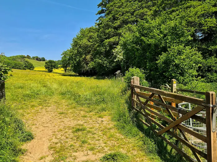
Image by Martyn Sanders
i
Image by Martyn Sanders The Herefordshire Trail is a 248 km circular walk through one of England’s quietest border counties, starting and finishing in Ledbury and linking the market towns of Ross-on-Wye, Kington, Leominster and Bromyard. It suits walkers who want a long, self-led countryside journey with inns, villages and river valleys rather than exposed mountain terrain.
The route threads through cider-apple and pear orchards, hop yards, ancient woodland, black-and-white villages and the broad valleys of the Wye, Lugg, Arrow, Monnow and Dore. High ground comes in steady, modest ridges rather than dramatic summits, with viewpoints such as Marcle Ridge, Garway Hill, Merbach Hill and Harley’s Mountain.
This is a practical long-distance walk, not a wilderness trail. The red cider-apple waymarks help, but field crossings, stiles, gates and quiet lanes still make a map or GPS essential, especially after rain or where crops and grass obscure paths.
Most walkers take 10–14 days, though the official 15 sections make it easy to break into day walks or weekends. Accommodation and food are best planned around the five market towns, because rural services between them can be thin and should be booked ahead.
This guide covers stages, daily planning, accommodation, food, transport, terrain and the common mistakes to avoid.
Stage-by-Stage Guide
The 15 stages below follow the trail’s own sectioning. Several stage ends are rural rather than natural overnight bases, so a continuous walk often needs accommodation slightly off-route, a taxi transfer, or combining/re-splitting days around the market towns.
Stage 1: Ledbury to Marcle Ridge — approx. 12 km
This is a short but useful first stage, leaving Ledbury on the red cider-apple waymarks and moving quickly into orchard country. The walking is typical lowland Herefordshire: field paths, lanes, gates and occasional muddy sections after rain, with no technical ground but enough field navigation to make a map or GPS worthwhile.
Much Marcle and the climb towards Marcle Ridge give the stage its character. The ridge is one of the early viewpoints of the route, with open prospects towards the Malverns and the Wye-side country ahead.
Ledbury is the place to buy food and fill bottles before setting out. Do not rely on facilities on Marcle Ridge itself; accommodation at the end is limited and should be arranged in advance, often by using nearby rural B&Bs, inns or a transfer.
Ledbury has a railway station, making this one of the easiest access points on the whole circuit. Marcle Ridge is a rural finish with road access by country lanes, but public transport should be checked before travelling.
Navigation is usually straightforward where the waymarks are visible, but field exits and hedge gaps can be missed. In late summer and autumn, paths through orchards and crops can be less obvious; keep the map handy rather than following tractor lines.
Stage 2: Marcle Ridge to Ross-on-Wye — approx. 19 km
This stage drops from the Marcle Ridge area into the Wye-side part of the county, with a mix of ridge walking, farmland, orchards and quiet lanes. It is longer than Stage 1 and feels more committing if staying on the rural ridge the night before, so carry enough water and food from the start.
The main destination is Ross-on-Wye, set above a horseshoe bend of the River Wye. The town’s Prospect gardens and St Mary’s church spire are key landmarks, and the approach also brings the route towards Wilton, Wilton Bridge and the ruins of Wilton Castle nearby.
Ross-on-Wye is a proper resupply and overnight stop, with the best range of accommodation and food since Ledbury. This is a sensible place to pause, restock and check the weather before the Wye-valley stages that follow.
Ross-on-Wye has no railway station, so access is by bus or road. Bus links include services between Ledbury and Ross-on-Wye, but timetables change and should be checked before travelling.
Expect field paths, lanes and possible mud rather than difficult walking. The final approach into a town can involve more junctions and urban-edge navigation, so do not relax too early simply because Ross is close.
Stage 3: Ross-on-Wye to Little Dewchurch — approx. 16 km
This is a varied Wye-side stage leaving Ross-on-Wye and crossing the red-sandstone Wilton Bridge near Wilton Castle. The route then works through riverside and agricultural country towards Sellack, Hoarwithy and Little Dewchurch.
Sellack and Hoarwithy are the main points of interest. The Sellack Boat suspension footbridge and the Italianate Church of St Catherine at Hoarwithy are notable landmarks, while the broader walking is through quiet villages, fields and lanes close to the Wye corridor.
Ross-on-Wye is the reliable place to buy supplies before starting. Food, water and accommodation options at Little Dewchurch are limited compared with Ross, so overnight plans should be fixed before committing to the stage.
Road access is generally by rural lanes and village roads. Public transport on this part of the county circuit is limited and should not be assumed without checking current bus times.
Navigation needs attention on field crossings and around village approaches, where rights of way can turn sharply between hedges, churchyards, lanes and pasture. After rain, riverside and low-lying fields may be muddy, and livestock should be expected in grazing land.
Stage 4: Little Dewchurch to Bagwyllydiart — approx. 14 km
This is a quieter rural stage moving deeper into south Herefordshire, away from the larger Wye-side settlement at Ross-on-Wye. It is not long, but it is the kind of section where services are thin and the practical challenge is logistics rather than terrain.
Kilpeck is the key highlight on this stage. The 12th-century Church of St Mary and St David is one of the most important landmarks on the entire trail, known for its Romanesque doorway and carved corbels.
Carry food and water from Little Dewchurch, or from wherever the previous night’s accommodation is based. Bagwyllydiart should be treated as a rural stage end rather than a guaranteed service point; accommodation will need planning ahead and may require staying off-route.
Public transport and onward access are limited in this rural area. If walking the trail in day stages, arrange pick-up points carefully and check current bus options before relying on them.
Underfoot, expect field paths, bridleways, green lanes and quiet lanes. Waymarks help, but field-to-field navigation remains important, especially where the path crosses open pasture or arable land without a clear worn line.
Stage 5: Bagwyllydiart to Abbey Dore — approx. 14 km
This stage continues across lowland farming country towards the Golden Valley. The walking is moderate rather than strenuous, but the cumulative distance of consecutive rural days starts to matter if carrying a full pack.
The stage builds towards Abbey Dore, associated with the Cistercian Dore Abbey church, still in use. This is one of the route’s strongest historical stops and marks entry into the pastoral country of the River Dore and the Golden Valley.
Food and water should be carried, as intermediate services cannot be assumed. Abbey Dore is a rural overnight location, so accommodation needs to be booked in advance and may involve nearby inns, B&Bs or a short transfer.
Road access is by country lanes. Rural buses in this part of Herefordshire are sparse; this should be checked before travelling, particularly for walkers using individual sections rather than a continuous itinerary.
The terrain is mainly fields, lanes and farm tracks. Mud is a realistic issue after wet weather, and boots with good grip are more useful here than lightweight road-style footwear.
Stage 6: Abbey Dore to Peterchurch — approx. 13 km
This is one of the shorter official stages, following the character of the Golden Valley and the River Dore. The route is low-level and pastoral, with broad valley scenery rather than high ground.
Abbey Dore is the main historical landmark at the start, while Peterchurch provides the next village focus. The stage is well placed for a steadier day after the more rural south-western sections, though services still need planning.
Carry a full day’s food and water unless accommodation or village facilities have been arranged. Peterchurch is a more practical stopping point than some of the smaller rural stage ends, but availability of food, accommodation and opening hours should still be checked before travelling.
Access is by road and limited rural bus services rather than rail. Anyone section-walking should plan both ends of the day before setting out, as missed connections can be awkward in this part of the county.
Navigation is generally easier in valley country than on some open ridges, but rights of way through fields still require attention. Expect stiles, gates, livestock and wet ground in places, especially after prolonged rain.
Stage 7: Peterchurch to Whitney-on-Wye (Whitney Bridge) — approx. 18 km
This stage leaves the Golden Valley area and heads towards the Wye at Whitney-on-Wye. It is a longer day than the previous section, with rolling countryside and a more open feel as the route approaches the river.
Dorstone and Arthur’s Stone are the principal highlights. Arthur’s Stone is a Neolithic chambered tomb set in the hills above the Golden Valley, with Merbach Hill nearby giving this part of the trail one of its stronger upland-feeling moments, despite the route remaining modest in altitude.
Peterchurch is the sensible place to start with food and water. Whitney-on-Wye and Whitney Bridge are rural, so do not assume a full range of services at the finish; accommodation at or near the end should be booked ahead.
Whitney-on-Wye has road access, but public transport is limited and should be checked before travelling. The wooden Whitney-on-Wye toll bridge is a notable access landmark and is used by traffic, so take normal care around the road and bridge approaches.
The walking mixes field paths, lanes and hillier countryside around Dorstone and Merbach Hill. Navigation can be fiddly where paths cross open fields or switch between tracks and lanes, so keep checking the route rather than relying only on visible waymarks.
Stage 8: Whitney-on-Wye (Whitney Bridge) to Kington — approx. 19 km
This is a substantial stage from the Wye towards Kington, beginning around the historic Whitney-on-Wye toll bridge. It crosses a sequence of rural settlements and rolling farmland before reaching one of the trail’s five market towns.
Brilley and Eardisley are the key named places on the way. Eardisley is part of Herefordshire’s black-and-white village character and is known for its Romanesque font, making it one of the better cultural stops on this section.
Carry food and water from the start unless definite services have been planned. Kington is the main resupply and accommodation base at the end, with a much stronger choice than the rural stages immediately before it.
Kington has no railway station, so access is by bus or road. For section walkers, current bus times should be checked carefully, and a taxi plan may be more reliable than assuming frequent public transport.
This is classic Herefordshire field-and-lane walking. The main navigation issue is staying on the correct rights of way through farmland, particularly where the walked line is faint or where several tracks meet near villages.
Stage 9: Kington to Lingen — approx. 19 km
Leaving Kington, the trail enters the quieter north-western part of the county, close to Offa’s Dyke country and the Welsh Marches. The stage is longer and more remote in feel than the town-to-town sections, though the terrain remains low-level by mountain standards.
The appeal here is wide Marches scenery, rolling hills and a sense of moving into a less visited part of Herefordshire. The high ground around Lingen and Leintwardine sets up the next stage towards the trail’s highest point.
Kington is the place to buy food, refill bottles and sort any kit before leaving town. Lingen is a rural finish with limited services, so accommodation and evening food need firm arrangements before setting out.
Public transport at Lingen is limited and should be checked before travelling. Road access is by country lanes, which can work for a pre-arranged pick-up but should not be treated as a walk-up transport option.
Navigation deserves attention on this stage. Field paths, green lanes and lanes may alternate frequently, and waymarks can be missed at farm boundaries, so keep a map or GPS visible rather than packed away.
Stage 10: Lingen to Leintwardine — approx. 14 km
This shorter stage crosses the far northern hills of the Herefordshire Trail, including the area around Harley’s Mountain, the highest point of the route at 376 m. It is still modest hill country rather than mountain terrain, but it can feel more exposed to weather than the sheltered valleys.
The reward is broad views across the Welsh Marches and a strong sense of space. The route then works towards Leintwardine, one of the key village stops in this northern arc of the circuit.
Food and water should be carried from Lingen unless the previous night’s accommodation provides a clear alternative. Leintwardine may offer more options than the smallest hamlets, but accommodation and meals should still be booked ahead rather than left to chance.
Road access is possible by rural lanes, while public transport is limited and should be checked before travelling. This stage can make sense as part of a two-stage plan from Kington, but only if overnight logistics are secure.
The main walking issues are mud, livestock fields and navigation over rolling farmland. In poor visibility, the high-point area is not technically difficult, but it is easy to lose time if a field exit or waymarked turn is missed.
Stage 11: Leintwardine to Richard’s Castle — approx. 25 km
This is the longest official stage and should be treated as a full day. Although the terrain is not mountainous, 25 km of field paths, lanes, stiles and rolling countryside can be tiring, especially in wet conditions or with a heavy pack.
Brampton Bryan is the main named place between Leintwardine and Richard’s Castle. The stage continues through the quiet northern part of the county before turning towards one of the historic border settlements on the route.
Start with enough food and water for the whole day. Intermediate services should not be relied on unless specifically planned, and Richard’s Castle is a small stage end where accommodation may be limited or slightly off-route.
Because of the distance, public transport planning matters more here than on shorter stages. Leintwardine and Richard’s Castle are rural access points, so current bus options and any taxi arrangements should be checked before travelling.
This stage is most likely to catch walkers out through time management rather than hazards. Start early in winter or poor weather, allow for slow going through muddy fields, and keep navigation disciplined so distance is not added by missed turns.
Stage 12: Richard’s Castle to Leominster — approx. 15 km
This is a more manageable day after the long Leintwardine section, heading towards Leominster and the services of a market town. The walking remains rural for much of the stage before the approach into town.
Leominster is the main highlight, with its priory church and practical role as one of the trail’s five market-town anchors. Reaching it is a useful reset point for laundry, resupply, accommodation and onward transport.
Carry enough food and water from Richard’s Castle, as the rural start should not be treated as a reliable resupply point. Leominster has the best end-of-stage facilities since Kington, including accommodation, shops and food options.
Leominster has a railway station on the Welsh Marches line, making this one of the easiest places to start, finish or break the walk. It is a strong choice for section walkers who want a public-transport-accessible stage end.
Navigation becomes more urban-fringe near Leominster, with more junctions and possible distractions, but the usual field-path care still applies earlier in the day. Muddy pasture and stiles remain part of the route character.
Stage 13: Leominster to Edwyn Ralph — approx. 19 km
This stage leaves the relative convenience of Leominster and returns to quieter countryside on the eastern side of the county circuit. It is a moderate-to-long day with rolling farmland, green lanes and field paths.
The interest is less about a single major landmark and more about the gradual transition from Leominster’s market-town setting back into rural Herefordshire. Expect agricultural landscapes, hedged lanes and open fields rather than dramatic high ground.
Leominster is the place to buy supplies and refill water before setting out. Edwyn Ralph is a rural finish, so accommodation and evening food need to be arranged in advance and may involve staying nearby rather than directly at the stage end.
Leominster’s railway station makes the start straightforward. Edwyn Ralph has rural road access, but public transport should be checked before travelling and should not be assumed to be frequent.
This stage can be muddy after rain and may include indistinct field crossings. Use the red-apple waymarks as reassurance, not as the only navigation method, and pay attention where the route leaves lanes for fields.
Stage 14: Edwyn Ralph to Fromes Hill — approx. 16 km
This stage continues across the eastern return arc of the trail and includes the Bromyard area. It is a varied countryside day with fields, lanes and the rise over Bromyard Downs before heading on towards Fromes Hill.
Bromyard is the main service and landmark point on this stage, and Bromyard Downs gives the day a stronger sense of height and openness. Fromes Hill marks the last rural stage end before the return to Ledbury.
Food and water should be planned around Bromyard, as it is the most practical resupply point on the stage. Fromes Hill is more limited as an overnight base, so accommodation should be booked ahead and may require using nearby options or a transfer.
Bromyard has no railway station and is reached by bus or road. Rural bus times around Edwyn Ralph, Bromyard and Fromes Hill should be checked before travelling, particularly for walkers finishing at Fromes Hill.
Navigation is mostly standard Herefordshire Trail terrain: fields, lanes, woodland edges and downs. Take care around road crossings and lane walking, and expect mud on field paths after wet weather.
Stage 15: Fromes Hill to Ledbury — approx. 15 km
The final stage brings the loop back to Ledbury through rolling countryside east of the county circuit. It is a moderate day and a practical finish, with the reward of ending in a town with rail access and full services.
The walking returns to the orchard-and-farmland character that opened the trail. Views towards the Ledbury area help orient the final approach, but the route still uses rural rights of way and should not be treated as a simple road walk back into town.
Carry food and water from Fromes Hill unless your accommodation provides supplies. Ledbury has shops, food, accommodation and transport, making it the easiest place on the circuit to finish cleanly.
Ledbury railway station gives good onward access at the end of the stage. Fromes Hill is a rural start, so transport to the trailhead should be arranged in advance unless staying locally.
The main navigation risk is losing concentration near the end of the loop. Keep following the red cider-apple waymarks and map through the final field paths, lanes and town-edge sections until the route returns to Ledbury.
Recommended Itinerary
Standard itinerary: 15 walking days
The most straightforward plan is to follow the trail’s own 15 sections clockwise from Ledbury. This keeps most days around 13–19 km, with one notably longer official section between Leintwardine and Richard’s Castle.
Several stage ends are small rural places rather than service centres. Accommodation should be booked before fixing dates, and rural bus times should be checked before relying on them for access, exits or rest-day positioning.
| Day | From | To | Approx. distance | Why this stage makes sense | Services/accommodation notes |
|---|---|---|---|---|---|
| 1 | Ledbury | Marcle Ridge | 12 km | A short opening day out of Ledbury, giving time to settle into the waymarking and the field-path navigation before the longer Wye-side stages. | Ledbury has the strongest start-point services and a railway station. Marcle Ridge is rural; arrange accommodation in advance and do not assume on-the-day availability. |
| 2 | Marcle Ridge | Ross-on-Wye | 19 km | A fuller day from orchard country and ridge views down towards the Wye and Ross-on-Wye. Ending in a market town gives a useful first resupply and overnight stop. | Ross-on-Wye has food and accommodation but no railway. Bus options should be checked before travelling. |
| 3 | Ross-on-Wye | Little Dewchurch | 16 km | A balanced stage leaving Ross-on-Wye, crossing by Wilton Bridge and continuing through the Wye-side villages around Sellack and Hoarwithy. | Start from a serviced town; Little Dewchurch is a smaller rural stop, so book ahead. |
| 4 | Little Dewchurch | Bagwyllydiart | 14 km | A shorter countryside day that allows time for Kilpeck Church without making the onward walk too long. | Rural services are limited. Accommodation or onward transport arrangements should be fixed before committing to this overnight. |
| 5 | Bagwyllydiart | Abbey Dore | 14 km | Another moderate day, taking the route towards Garway Hill and into the Golden Valley area without overloading the schedule. | Abbey Dore is rural. Book ahead and check evening meal options before arrival. |
| 6 | Abbey Dore | Peterchurch | 13 km | A shorter Golden Valley stage along the River Dore landscape, useful after several consecutive rural days. | Peterchurch is a logical overnight point on the route, but availability should still be checked in advance. |
| 7 | Peterchurch | Whitney-on-Wye (Whitney Bridge) | 18 km | This stage links the Golden Valley hills, Dorstone, Arthur’s Stone and Merbach Hill with the Wye at Whitney-on-Wye. | Whitney-on-Wye is a small riverside stop. Accommodation is not as plentiful as in the market towns, so plan early. |
| 8 | Whitney-on-Wye (Whitney Bridge) | Kington | 19 km | A good-length day from the Wye through Brilley and Eardisley to Kington, one of the trail’s key market-town breaks. | Kington has food, accommodation and resupply, but no railway. Check current bus times if joining, leaving or taking a rest day here. |
| 9 | Kington | Lingen | 19 km | This stage carries the route into the quieter north-western hills, moving away from Kington while keeping the day within a normal long-distance walking range. | Start with Kington services. Lingen is rural; book accommodation ahead or arrange a realistic off-route overnight plan. |
| 10 | Lingen | Leintwardine | 14 km | A shorter day through the far northern section near the trail’s highest ground around Harley’s Mountain, keeping the hillier Marches section manageable. | Leintwardine is a practical staging point before the longest official day. Check accommodation and food availability before booking. |
| 11 | Leintwardine | Richard’s Castle | 25 km | This is the longest official section, linking Leintwardine, Brampton Bryan and the approach to Richard’s Castle. It needs an earlier start and a realistic pace. | Treat this as a key planning day. If 25 km is too much, investigate whether accommodation or transport can split the section; this should be checked before travelling. |
| 12 | Richard’s Castle | Leominster | 15 km | A shorter recovery stage after the longest day, finishing in Leominster for proper town services. | Leominster has accommodation, food, resupply and a railway station on the Welsh Marches line. |
| 13 | Leominster | Edwyn Ralph | 19 km | A steady return-arc stage out of Leominster and back into quieter countryside. | Leave Leominster stocked. Edwyn Ralph is rural, so accommodation must be arranged in advance. |
| 14 | Edwyn Ralph | Fromes Hill | 16 km | A moderate day through the Bromyard section of the route, including Bromyard Downs before continuing towards Fromes Hill. | Bromyard is one of the five market towns and has useful services, but no railway. If staying at or near Fromes Hill, book ahead and check food options. |
| 15 | Fromes Hill | Ledbury | 15 km | A manageable final stage returning to Ledbury, avoiding a rushed finish and leaving time for onward rail travel. | Ledbury has accommodation, food and a railway station, making it the easiest place to finish the loop. |
Slower option: 16–18 days
A slower plan suits walkers who prefer shorter days, are walking in winter daylight, or want more time for places such as Ross-on-Wye, Kington, Leominster and Bromyard. The safest way to slow the route is to keep the 15 official walking sections and add rest nights in the market towns rather than relying on unplanned rural stops.
The Leintwardine to Richard’s Castle section is the main candidate for splitting, because it is 25 km. Any split depends on accommodation or transport availability around the intermediate villages, and this should be checked before travelling.
Faster option: 10–14 days
A faster itinerary is realistic for fit walkers who are comfortable with repeated 20 km-plus days, muddy field paths and limited services between towns. The usual approach is to merge some adjacent shorter official sections, but only after checking accommodation: several official stage ends are rural, and a theoretically neat mileage plan may not match available beds.
Good candidates for merging are the shorter central stages, such as Little Dewchurch to Bagwyllydiart plus Bagwyllydiart to Abbey Dore, or Abbey Dore to Peterchurch plus Peterchurch to Whitney-on-Wye, provided the resulting distance and overnight stop work for the party. Be cautious about compressing the north of the route, because the official Leintwardine to Richard’s Castle day is already 25 km.
For a 10–12 day plan, book around the five market towns wherever possible, then fill the rural gaps carefully. Ross-on-Wye, Kington and Bromyard have no railway, while Ledbury and Leominster do; bus connections in rural Herefordshire are limited and current timetables should be checked before relying on them.
Planning the Route
How many days to allow
Most walkers should plan the Herefordshire Trail as a 10–14 day walk, with shorter days if using the official 15-section structure and longer days if linking sections together. The official sections are deliberately moderate, generally around 16 km / 10 miles, which suits the route’s field paths, stiles, lanes and frequent navigation checks better than a rushed schedule.
A fast itinerary is possible for very fit walkers, but it is not the most practical way to approach this trail. The limiting factor is often not the walking itself, but where accommodation, food and transport are available at the end of each day.
| Plan style | Best for | Practical notes |
|---|---|---|
| 15 sections | Walkers wanting manageable days or day-walk stages | Follows the Ramblers’ section structure; some stage ends are rural, so accommodation or transport may need arranging carefully. |
| 10–14 days | Most continuous walkers | Combines shorter sections while still using market towns and larger villages for food, beds and onward transport. |
| About a week | Fit, lightweight walkers with long-day experience | Requires long days and very careful booking; rural accommodation gaps make this harder than the map may suggest. |
| Weekends / day stages | Section hikers | Practical, but dependent on rural bus times and occasional lifts, taxis or overnight stays. |
Let accommodation shape the itinerary
The five market towns — Ledbury, Ross-on-Wye, Kington, Leominster and Bromyard — are the natural planning anchors. They offer the best chances for accommodation, food, resupply and public transport, so an efficient itinerary should use them wherever possible.
Between these towns the trail passes smaller places such as Little Dewchurch, Bagwyllydiart, Abbey Dore, Peterchurch, Whitney-on-Wye, Lingen, Leintwardine, Richard’s Castle, Edwyn Ralph and Fromes Hill. These rural stage points can work well, but they should not be treated like towns with guaranteed beds, meals or shops.
Book accommodation before committing to daily distances. If a stage end has limited beds, it may be better to shorten the previous day, extend to the next practical stop, or arrange a taxi or bus connection to nearby accommodation. Any baggage transfer or taxi-assisted walking should be arranged directly and confirmed in advance.
Choosing direction and start point
The route is circular and can be walked clockwise or anticlockwise. Ledbury is the simplest start and finish for most walkers because it has a railway station and is the guidebook start near the Heritage Centre / Master’s House, with the red cider-apple waymarks leading out of town.
Direction is usually a logistical choice rather than a difficulty choice. Accommodation availability, train arrival times, bus links and where rest days are wanted will matter more than gradients, because the trail has no mountain section or obvious one-way advantage.
For a continuous walk, following one guidebook or GPX direction consistently avoids confusion at field crossings and village exits. The route is waymarked, but it still needs map or GPS support, especially where paths cross farmland or leave lanes through gates and stiles.
Section hiking the trail
The Herefordshire Trail works well as a section-hike because the official structure divides it into 15 manageable days. Many sections have some form of public-transport link, but rural services are limited and should not be assumed to run at convenient walking times.
Ledbury and Leominster are the strongest rail access points. Ledbury is on the Cotswold Line, while Leominster is on the Welsh Marches line. Ross-on-Wye, Kington and Bromyard do not have railway stations and rely on buses, with services such as the 459/232 between Ledbury and Ross-on-Wye; current timetables should be checked before travelling.
For weekend planning, the easiest approach is to build sections around Ledbury, Ross-on-Wye, Kington, Leominster and Bromyard, then fill the rural gaps with buses, taxis or overnight stops. Where a stage starts or ends at a small village rather than a town, have a fallback plan in case the last bus is missed or a service does not operate that day.
Shortening or extending days
The official sections are a useful baseline, but they are not compulsory. Shorter adjacent days can be merged by fit walkers, while longer or awkward days can be split if accommodation is available.
The section from Leintwardine to Richard’s Castle is one of the longer official days at about 25 km, so it deserves particular attention when building a relaxed itinerary. Conversely, several shorter days around Abbey Dore, Peterchurch, Lingen and Leominster may be combined if beds and daylight allow.
Avoid planning purely by distance. Field paths, mud, stiles, waymark hunting, livestock, and the need to stop for food or navigation can make a 16 km Herefordshire day slower than the same distance on a canal towpath or well-surfaced national trail.
Food, water and resupply
Use the market towns as the main resupply points. Ledbury, Ross-on-Wye, Kington, Leominster and Bromyard are the places to plan around for food shopping, evening meals and restocking snacks.
Do not rely on every village having an open shop, café or pub at the time you arrive. Carry lunch and enough water for the full day, especially on rural sections through the Golden Valley, the far north-west near Lingen and Leintwardine, and the return arc towards Bromyard and Fromes Hill.
Opening hours in small places can be limited and may vary by season or day of the week. This should be checked before travelling if a meal stop is essential to the day’s plan.
Navigation and maps
The trail is waymarked with the red Herefordshire cider-apple symbol, and the route was relaunched with extensive new waymarking in 2022. Even so, a map or GPS is still important: this is farming country, and the trickiest navigation is often not on hills but across fields, around farm boundaries and through small path junctions.
The Herefordshire Ramblers’ guidebook divides the walk into 15 sections and is the most practical paper companion for following the intended line. OS Explorer maps covering the route are OL13, OL14, 189, 190, 201, 202 and 203; Landranger coverage is 137, 138, 148, 149, 161 and 162.
A downloaded GPX track is useful, but it should not replace basic map-reading. Batteries, phone signal and field-side route changes can all cause problems, so carry a backup navigation method.
Weather, mud and daylight
Spring, summer and autumn are the most practical seasons. Spring blossom and autumn orchards are major rewards of the route, but both seasons can still bring wet fields and soft ground.
Winter walking is possible, but short daylight and muddy field paths make stage planning less forgiving. Build in shorter days, start early, and avoid depending on late rural transport unless the timetable has been checked carefully.
This is a low-level route rather than a mountain walk, but the cumulative ascent over rolling hills is still substantial. Ridges such as Marcle Ridge, Garway Hill Common, Merbach Hill, Wapley Hill and Harley’s Mountain add steady climbing, and wet clay or churned field edges can slow the pace.
Towns, Villages and Overnight Stops
The Herefordshire Trail is easiest to plan around its five market towns: Ledbury, Ross-on-Wye, Kington, Leominster and Bromyard. These are the natural places for accommodation, food and resupply, while many of the official section ends are small rural settlements or hill locations where services may be limited or absent.
Book rural accommodation ahead and do not assume there will be an evening meal, shop or onward transport at smaller stops. Where a section ends away from a larger town, some walkers may need to arrange a lift, taxi or accommodation slightly off the route; this should be checked before travelling.
| Place | Best use for hikers | Practical note |
|---|---|---|
| Ledbury | Start/finish base, overnight stop, rail access | Railway station; good place to begin with supplies arranged |
| Ross-on-Wye | Major overnight and resupply stop | No railway; bus links should be checked before relying on them |
| Kington | Major overnight and resupply stop | No railway; useful western-side base |
| Leominster | Major overnight, resupply and rail access | Railway station on the Welsh Marches line |
| Bromyard | Major overnight and resupply stop | No railway; useful before the final return towards Ledbury |
Ledbury
Ledbury is the start and finish of the circular trail, with the route beginning near the Heritage Centre / Master’s House area before the red cider-apple waymarks lead out of town. It is one of the best places on the whole loop for a pre-walk night, final night, food shopping and last-minute kit checks.
Accommodation is typically easier to arrange here than in the rural sections, with inns, guesthouses and B&B-style options in and around the town. Ledbury has a railway station on the Cotswold Line, with services on the Oxford–Worcester–Hereford corridor and GWR services to London Paddington, making it the most straightforward access point for many walkers.
Much Marcle
Much Marcle comes early on the route between Ledbury and Marcle Ridge, in the cider-orchard country associated with Westons Cider. It is useful as a landmark and possible refreshment point, but overnight planning should not rely on turning up without a booking.
For most continuous walkers, Much Marcle works better as a daytime stop than as a main trail base. Check any pub, café, shop or accommodation opening before travelling, especially outside the main walking season.
Marcle Ridge
Marcle Ridge is the first official section end if following the 15-section split, about 12 km from Ledbury. It is a scenic ridge-top stopping point rather than a full-service trail town, with views towards the Malverns and the Wye country.
Accommodation and food options on or close to the ridge are likely to be limited, so this stage needs advance planning. Many walkers will either arrange a nearby rural B&B, continue to a better-served settlement, or organise transport back to Ledbury or onward to Ross-on-Wye; this should be checked before travelling.
Ross-on-Wye
Ross-on-Wye is one of the five market towns and one of the strongest overnight stops on the trail. It sits after the Marcle Ridge section, above the River Wye, and gives a practical break after the first two walking days on the official schedule.
This is a sensible place for accommodation, food, pubs, cafés and resupply before the route continues through smaller Wye-side villages. Ross-on-Wye has no railway station, so access and section-walking plans depend on buses or taxis; rural timetables should be checked before travelling.
Wilton
Wilton is reached as the trail leaves Ross-on-Wye, with Wilton Bridge and the nearby ruins of Wilton Castle forming useful route landmarks. It is very close to Ross, so it is normally treated as part of the Ross-on-Wye overnight area rather than a separate base.
Do not rely on Wilton as a resupply stop. If staying nearby, book ahead and confirm meal arrangements, as Ross-on-Wye is the more practical service centre.
Sellack
Sellack is one of the Wye-side villages between Ross-on-Wye and Little Dewchurch, notable on the route for the Sellack Boat suspension footbridge. It is useful for navigation and interest, but not a dependable place for full trail services.
Accommodation, food and transport should be assumed limited unless arranged in advance. For most walkers, Ross-on-Wye and Little Dewchurch or nearby booked accommodation will shape this stage more than Sellack itself.
Hoarwithy
Hoarwithy lies on the Ross-on-Wye to Little Dewchurch part of the trail and is known for the Italianate Church of St Catherine. It is a worthwhile pause on the stage, but services should not be assumed.
If planning to break the day here, check accommodation, food and transport before travelling. Otherwise, treat Hoarwithy as a route village between larger overnight options.
Little Dewchurch
Little Dewchurch is the official end of the Ross-on-Wye to Little Dewchurch section, about 16 km from Ross-on-Wye. It can work as an overnight stop if accommodation has been booked, but it is not one of the main market-town service hubs.
Plan meals and onward logistics carefully here. Any pub, shop, bus or taxi arrangements should be checked before travelling, as this part of the trail is more rural than the Ledbury and Ross-on-Wye ends.
Kilpeck
Kilpeck is a key stop between Little Dewchurch and Bagwyllydiart because of the 12th-century Church of St Mary and St David, one of the most notable buildings on the route. It is a strong cultural waypoint, not necessarily a strong logistics base.
Food, accommodation and transport should be checked in advance if intending to stop here. Many walkers will pass through during the day and continue to a pre-booked rural overnight or the official section end.
Bagwyllydiart
Bagwyllydiart is the official end of the Little Dewchurch section and the start of the next stage towards Abbey Dore. It is a rural stopping point, so it needs more planning than the market towns.
Do not assume there will be accommodation, an evening meal or public transport available on demand. If using Bagwyllydiart as a stage end, arrange the overnight or transfer before setting out.
Garway Hill
Garway Hill sits on the route between Bagwyllydiart and Abbey Dore and is one of the higher viewpoints on the southern-western part of the trail. It is best thought of as a hill landmark rather than an overnight stop.
There are no town-style services to rely on here. Carry enough food and water for the day and plan the night around a booked stop in the surrounding rural area or at Abbey Dore.
Abbey Dore
Abbey Dore is the official end of the Bagwyllydiart to Abbey Dore section and lies in the Golden Valley area by the River Dore. The route’s highlight here is Dore Abbey, the church that remains in use from the former Cistercian abbey.
It can be a good rural overnight if accommodation has been arranged, but options are not comparable with the market towns. Check food, accommodation and transport before travelling, and do not arrive expecting a full range of services.
Golden Valley and the River Dore
The Golden Valley is a broad, pastoral section below the Welsh Black Mountains, followed around the Abbey Dore and Peterchurch part of the trail. It is one of the more distinctive landscape sections of the walk, but it remains rural and spread out.
Overnight planning here should be village-by-village rather than improvised at the end of the day. Carry daytime food, confirm evening meals with accommodation, and check any bus or taxi options before committing to a stage plan.
Peterchurch
Peterchurch is the official end of the Abbey Dore to Peterchurch section, about 13 km in the official split. It is a useful stopping point in the Golden Valley and a practical place to break the route before the longer stage towards Whitney-on-Wye.
Accommodation may be available in or around the village, but it should be booked ahead. Check food, pub, shop and transport arrangements before travelling, particularly if walking outside weekends or main holiday periods.
Dorstone
Dorstone lies on the Peterchurch to Whitney-on-Wye section, close to Arthur’s Stone and Merbach Hill. It is a good place to build in time for the chambered tomb and the hill views, but it should not be treated as a guaranteed service centre.
If planning a shorter day or a detour-based overnight around Dorstone, arrange accommodation and meals in advance. Otherwise, it is a daytime waypoint between Peterchurch and Whitney-on-Wye.
Whitney-on-Wye
Whitney-on-Wye, with Whitney Bridge, is the official end of the Peterchurch section and the start of the next stage to Kington. The privately owned wooden toll bridge, dating from 1779, is a clear route landmark.
This is a rural overnight stop rather than a major trail town. Book accommodation ahead if stopping here, and confirm food and onward transport before travelling; Kington is the next major market-town base on the official schedule.
Brilley
Brilley lies between Whitney-on-Wye and Kington on the western side of the loop. It is mainly a route village for walkers moving towards the Kington area.
Services should be checked before relying on them. Most walkers will use this part of the day to reach Kington, where accommodation and resupply options are stronger.
Eardisley
Eardisley is on the Whitney Bridge to Kington section and is one of the black-and-white villages associated with the route. Its church is known for a Romanesque font, making it a worthwhile stop on the way to Kington.
For logistics, it should still be treated cautiously unless accommodation or food has been booked. Kington is the better overnight and resupply target for this section.
Kington
Kington is one of the five market towns and a key overnight stop on the western side of the Herefordshire Trail. It comes after the Whitney-on-Wye to Kington section and before the more remote-feeling northern hills towards Lingen and Leintwardine.
This is a sensible place to restock food, arrange accommodation and reset before the next stages. Kington has no railway station, so walkers sectioning the trail need to rely on buses or other transport; current timetables should be checked before travelling.
Lingen
Lingen is the official end of the Kington to Lingen section, about 19 km from Kington. It sits in the quiet far north-western part of the county, near the high point area around Harley’s Mountain.
This is a rural stop where accommodation and evening food must be planned carefully. Do not assume walk-up availability, and check any bus, taxi or lift arrangements before setting out from Kington.
Leintwardine
Leintwardine is the official end of the Lingen to Leintwardine section and a useful overnight point before the long stage to Richard’s Castle. It sits in the northern arc of the loop, where the trail feels more dispersed between villages.
It can make a practical stop if booked ahead, especially because the following official section is around 25 km. Check food, accommodation and transport before travelling, and consider the next day’s distance when deciding where to stay.
Brampton Bryan
Brampton Bryan lies between Leintwardine and Richard’s Castle on the long official stage. It is a useful intermediate village for pacing the day and checking progress.
Do not rely on it as a full-service stop unless arrangements have been made in advance. On this section, carrying food and having a clear accommodation plan is more important than on the market-town stages.
Richard’s Castle
Richard’s Castle is the official end of the long Leintwardine to Richard’s Castle section. It is also the start of the following stage to Leominster, making it a practical staging point if accommodation or a transfer has been arranged.
This is not a market town, so treat services as limited. If no suitable overnight is available on the route, Leominster may be a more practical base, but transfers or alternative staging should be arranged before walking.
Leominster
Leominster is one of the five market towns and one of the best logistical stops on the trail. It follows the Richard’s Castle section and gives a strong resupply and accommodation point before the route turns towards Edwyn Ralph and Bromyard.
The town has a railway station on the Welsh Marches line between Newport, Hereford and Shrewsbury, making it particularly useful for section walkers. It is also a sensible place for a rest night or for joining/leaving the route without depending entirely on rural buses.
Edwyn Ralph
Edwyn Ralph is the official end of the Leominster to Edwyn Ralph section, around 19 km from Leominster. It is a small rural stage end rather than a major service point.
Accommodation, meals and onward transport need to be arranged before committing to a night here. Some walkers may prefer to use Bromyard as the next larger base, but that depends on distance, fitness and available accommodation.
Bromyard
Bromyard is one of the five market towns and a key service stop on the eastern side of the loop. It comes after the Edwyn Ralph and Bromyard Downs part of the route and before the final return towards Fromes Hill and Ledbury.
This is a sensible place for accommodation, food, pubs, cafés and resupply. Bromyard has no railway station, so section-walking plans depend on bus or taxi arrangements; current rural bus times should be checked before travelling.
Bromyard Downs
Bromyard Downs is a notable open, higher section near Bromyard rather than a main overnight settlement. It is useful as a route landmark and change of terrain before the trail continues towards Fromes Hill.
Plan services around Bromyard rather than the Downs. Carry what is needed for the day and avoid assuming there will be food or transport at the point where the path crosses the area.
Fromes Hill
Fromes Hill is the official end of the Edwyn Ralph to Fromes Hill section and the start of the final stage back to Ledbury. It is a useful staging point for the last day, but it is not one of the route’s main service towns.
If staying here, book accommodation and confirm food beforehand. The final leg to Ledbury is around 15 km on the official split, so walkers may also choose to arrange transport or adjust the stage depending on where accommodation is available.
Ledbury finish
Finishing back in Ledbury gives the trail a simpler end than many point-to-point long-distance walks. Accommodation, food and rail travel are all easier to organise here than in the smaller villages on the loop.
For walkers completing the route in sections, Ledbury is also a practical repeat access point, especially for the opening and closing stages. Check train times before travelling, and check rural bus times separately if linking Ledbury with non-rail towns such as Ross-on-Wye or Bromyard.
Getting to the Start
The Herefordshire Trail starts and finishes in Ledbury, making it one of the simpler long-distance walks to plan logistically: arrive in the same town where the route ends, and there is no end-to-start transfer to arrange. The Ramblers’ guide starts near the Heritage Centre / Master's House area at grid reference SO710377, with the red cider-apple waymarks leading out of town.
By train
Ledbury has its own railway station, which is the most practical access point for the trail. It sits on the Cotswold Line between Oxford, Worcester and Hereford, with West Midlands Railway services and GWR services including connections to London Paddington.
Hereford is the nearest large rail hub and is useful if accommodation or train timings work better there. Leominster also has a station, on the Welsh Marches line between Newport, Hereford and Shrewsbury, which can help with section-walking the northern part of the loop.
From Ledbury station, allow time to get across town to the official start area near the Heritage Centre / Master's House, especially with a full pack. Use a town map, GPS or local taxi if arriving late or in poor weather.
Train times and engineering works should be checked before travelling, particularly for weekend starts and bank holidays.
By bus
Ledbury is also linked by bus to nearby towns, including services such as the 459/232 between Ledbury and Ross-on-Wye. This can be useful for walkers joining or leaving the trail at Ross-on-Wye, or for short section logistics.
Rural bus coverage around Herefordshire is limited. Ross-on-Wye, Kington and Bromyard do not have railway stations, so any plan that starts at one of those towns rather than Ledbury depends on bus times, taxis or a pre-arranged lift.
Do not assume late-day, Sunday or public-holiday buses will run at useful times. This should be checked before travelling.
By car
Driving to Ledbury is straightforward for a circular walk because the route returns to the same town. The main issue is not route access but where to leave a vehicle for 10–14 days.
Long-stay parking arrangements should be made before arrival. Check public car park rules, maximum stays and charges, or ask booked accommodation in Ledbury whether secure or permitted guest parking is available for the full walk.
Avoid leaving a car in short-stay or residential parking on the assumption it will be acceptable for the whole trail. This should be checked before travelling.
From the nearest airport
There is no need to use an airport specifically for this route; the practical plan is to reach Ledbury by rail via the national network. For international arrivals, choose flights that allow a sensible rail connection to Ledbury via London Paddington, Oxford, Worcester or Hereford.
Allow generous transfer time between the airport, mainline station and Ledbury, particularly if arriving with a late-afternoon train connection. Current rail times and ticketing should be checked before booking flights.
Where to stay before starting
Ledbury is the best place to stay the night before starting. It puts you close to the official start area, allows time to buy food, check maps and sort any last-minute kit, and avoids beginning the first stage after a long journey.
Accommodation on the Herefordshire Trail is mainly B&Bs, inns, guesthouses and farmhouse stays, with services concentrated in the five market towns. Book Ledbury accommodation ahead, especially if starting at a weekend or during the busier spring, summer and autumn walking seasons.
If arriving late, confirm check-in times and whether food will still be available. Rural Herefordshire is not a place to rely on turning up and finding a room at the end of a travel day.
Getting Home from the Finish
The Herefordshire Trail finishes back in Ledbury, which makes end-of-walk logistics much easier than on a point-to-point route. If you began in Ledbury, your rail, car or accommodation arrangements can usually be reused at the finish rather than needing a cross-county transfer.
By train
Ledbury has a railway station, making train travel the simplest public-transport option after completing the trail. The station is on the Cotswold Line, with services on the Oxford–Worcester–Hereford corridor, including West Midlands Railway services and GWR services to London Paddington.
Hereford is the nearest large rail hub and is useful for onward connections. If travelling beyond the Cotswold Line corridor, plan the final leg around current train times rather than assuming a late-evening connection will be available.
If finishing late in the day, check the last train from Ledbury before setting out on the final stage from Fromes Hill. This should be checked before travelling, especially on Sundays and bank holidays.
By bus
Ledbury has bus links, including services towards Ross-on-Wye such as the 459/232, but rural bus services in Herefordshire are limited. Buses are more useful for staged walking or repositioning within the county than for a guaranteed late finish.
Do not rely on an evening bus without checking the current timetable. This should be checked before travelling.
By car/taxi
Because the route is circular, driving logistics are straightforward if a car is left in Ledbury at the start. You return to the same town at the end of the final stage, avoiding the need for a transfer from a remote trailhead.
If using a taxi at the finish, pre-book rather than assuming one will be available on demand, particularly after a long final day, in poor weather, or on a Sunday. This is also the sensible fallback if train or bus connections are tight.
From the nearest airport
Airport access is not a key part of the trail logistics, and no airport-specific transfer is needed at the finish. For flights, the practical approach is to leave Ledbury by train, usually via the Cotswold Line or via Hereford for wider onward connections, then continue to the chosen airport by the relevant rail or coach service.
The best airport and connection will depend on current timetables and flight times. This should be checked before travelling.
Where to stay at the finish
Ledbury is one of the main accommodation bases on the Herefordshire Trail, with B&Bs, inns and guesthouses in and around the town. Staying overnight at the finish is often the most relaxed option if the final stage from Fromes Hill ends late, if onward trains are limited, or if you want to avoid rushing the last day.
Book ahead in busy periods and do not assume same-day availability. Accommodation is more dependable in the market towns than in the thinner rural sections, but finish-night rooms should still be arranged before the walk.
Which Direction Should You Walk?
Standard direction: clockwise from Ledbury
The simplest and most natural direction is clockwise, starting in Ledbury and following the official section order towards Much Marcle, Marcle Ridge, Ross-on-Wye, the Wye-side villages, the Golden Valley, Kington, Leominster, Bromyard and back to Ledbury.
This is the direction that best matches the trail’s 15-section structure, the usual place-to-place descriptions and the HikeList stage order. For most walkers, that makes planning easier: accommodation bookings, transport checks and daily navigation can be matched directly to the published sequence.
Reverse direction: fully possible, but less convenient for planning
The Herefordshire Trail is a circular route, so it can be walked anticlockwise without changing the overall distance or ascent. A reverse itinerary would leave Ledbury towards Fromes Hill and Bromyard first, then continue round via Leominster, Kington, the Golden Valley, Ross-on-Wye and finally Marcle Ridge before returning to Ledbury.
The main drawback is practical rather than physical. Stage notes, guidebook section names and many walkers’ itineraries are normally arranged in the clockwise order, so reversing the route requires more careful checking of junctions, field exits and day-end logistics.
Transport and accommodation flow
For a continuous walk, direction makes little difference to the main access logistics because the route starts and finishes in Ledbury, which has a railway station. Leominster is the other rail-served town on the loop, while Ross-on-Wye, Kington and Bromyard rely on buses rather than trains.
Clockwise walking gives a clear progression through the five market towns, with Ross-on-Wye reached early, Kington and Leominster later, and Bromyard on the return arc. Reverse walking simply swaps that sequence; it does not remove the need to book carefully through the thinner rural stretches between towns.
For section walkers, clockwise is usually easier because it follows the official section order. Rural bus services are limited in either direction, especially around the smaller villages and road-end stages, so current timetables should be checked before travelling.
Climbs, weather and underfoot conditions
There is no strong physical advantage to either direction. The Herefordshire Trail is a low-level countryside circuit rather than a mountain route, and the main effort comes from the accumulated distance, repeated rolling climbs and roughly 5,200 m of total ascent.
Whichever way the route is walked, you will still cross the same ridges and hills, including Marcle Ridge, Garway Hill, Merbach Hill, Harley’s Mountain and Bromyard Downs. Reversing the route may make an individual climb feel steeper or gentler on a given day, but it does not materially change the overall difficulty.
Prevailing wind is not a major planning factor on this route. Mud, field crossings, stiles and wet grass are more important day-to-day considerations, and those affect both directions equally after rain.
Scenery progression and finish
Clockwise has the better overall rhythm for most walkers. It leaves Ledbury through orchard country, reaches Marcle Ridge and the Wye early, then builds through the Golden Valley and the western hills before crossing the quieter northern section around Kington, Lingen, Leintwardine and Harley’s Mountain.
The final arc through Leominster, Bromyard, Bromyard Downs and Fromes Hill gives a satisfying return towards Ledbury rather than ending abruptly after the most scenic western sections. The finish back in Ledbury works well psychologically: the same town that handled arrival logistics also provides the final food, accommodation and rail connection.
Reverse walking has its own appeal if you want a shorter final official section, because the last leg back from Marcle Ridge to Ledbury is about 12 km. It also saves the cider-orchard country around Much Marcle and Marcle Ridge for the end.
Recommendation
Walk the Herefordshire Trail clockwise from Ledbury unless there is a specific accommodation or transport reason to reverse it. Clockwise best matches the official section order, gives the cleanest planning sequence and provides the most balanced scenic progression around the county circuit.
Accommodation Along the Route
The Herefordshire Trail is best planned as an inn-to-inn and B&B walk, using the five market towns as the main accommodation anchors: Ledbury, Ross-on-Wye, Kington, Leominster and Bromyard. These are the places with the strongest chance of finding a choice of beds, food, resupply and onward transport.
Between those towns, the route crosses quiet farming country, small villages, ridges and river valleys where accommodation is much thinner. Several official section ends are not natural overnight bases, so a day-by-day plan should be built around available beds rather than simply following the 15 official sections exactly.
Booking ahead is strongly advised, especially for continuous walkers. Spring blossom, summer weekends and autumn cider-apple season can all put pressure on small rural inns and B&Bs, and there may be little fallback nearby if a village is full.
Best overnight bases
| Place | Accommodation level | Best for | Notes |
|---|---|---|---|
| Ledbury | Good | Start/finish night, restocking, rail access | The strongest place to begin and end the loop. Useful if arriving by train and for a final night before travelling home. |
| Much Marcle / Marcle Ridge area | Limited | Breaking the first leg if walking shorter days | Rural accommodation should be checked before committing to a stop here. Many walkers may prefer to continue towards Ross-on-Wye depending on pace and availability. |
| Ross-on-Wye | Good | Major overnight stop, food, resupply | One of the key accommodation towns on the circuit and a practical target after the Marcle Ridge section. No railway, so onward public transport depends on buses. |
| Little Dewchurch | Limited | Short-stage walkers between Ross-on-Wye and the south-western part of the route | Treat this as a pre-booked rural stop, not a place to arrive without a reservation. |
| Kilpeck / Bagwyllydiart area | Limited | Splitting the quieter country before Garway Hill and Abbey Dore | Accommodation is sparse in this part of the route. Check exact location carefully against the trail line. |
| Abbey Dore / Golden Valley | Limited | Rural overnight in the Golden Valley | A useful staging area, but not a large service centre. Book ahead and check evening meal options. |
| Peterchurch | Limited | Golden Valley stop, shorter daily distances | Practical for walkers following the official sections, but accommodation choice should be treated as limited. |
| Whitney-on-Wye / Whitney Bridge area | Limited | Splitting Peterchurch to Kington | Useful for avoiding a very long day into Kington, but beds should be arranged in advance. |
| Kington | Good | Major overnight stop, resupply, rest day option | One of the five market towns and a natural anchor on the western side of the loop. No railway; buses should be checked before relying on them. |
| Lingen | Limited | Breaking the northern hills section | Rural stop with limited options. Essential to check availability before building an itinerary around it. |
| Leintwardine | Limited | Overnight before the long section towards Richard's Castle | Useful for staging the far northern part of the trail, especially around Harley's Mountain and Brampton Bryan. Book ahead. |
| Richard's Castle | Limited | Splitting Leintwardine to Leominster | A small settlement rather than a service town. Consider taxi transfer if accommodation does not fit the walking day. |
| Leominster | Good | Major overnight stop, resupply, rail access | One of the strongest logistics points on the route, with a railway station on the Welsh Marches line. Good place to reset after the northern arc. |
| Edwyn Ralph | Limited | Splitting Leominster to Bromyard | Rural section end with limited accommodation. Confirm beds and food before travelling. |
| Bromyard | Good | Major overnight stop, food, resupply | One of the five market towns and a practical base before the final return towards Ledbury. No railway, so bus times need checking. |
| Fromes Hill | Limited | Final-stage break before Ledbury | Useful if following the official sections, but limited as an overnight base. Check availability before fixing the final two days. |
Planning the overnight pattern
For a 10–14 day walk, most itineraries will need at least a few rural nights between the main towns. The official 15-section structure keeps daily distances manageable, but some section ends are small places with limited accommodation, so combining or shortening stages may be necessary.
A practical approach is to secure the market-town nights first, then fill the rural gaps. Ledbury, Ross-on-Wye, Kington, Leominster and Bromyard give the route its most dependable overnight framework; the harder decisions usually fall around Little Dewchurch, Bagwyllydiart, Abbey Dore, Whitney-on-Wye, Lingen, Richard's Castle, Edwyn Ralph and Fromes Hill.
Do not assume every village has an inn, shop or evening meal available. When booking a rural B&B or farmhouse stay, ask about evening food, packed lunches, arrival time and whether muddy boots or wet kit can be dried.
Does the trail work inn-to-inn?
Yes, the Herefordshire Trail works well as an inn-to-inn route, but only with planning. It is a low-level countryside circuit rather than a remote expedition, yet the spaces between the market towns are quiet enough that accommodation can dictate the shape of the walk.
Walkers wanting shorter days should be prepared for occasional off-route accommodation or taxi transfers. This can also solve awkward gaps where the official section end does not match available beds.
There is no widely advertised dedicated baggage-transfer service for the whole Herefordshire Trail. If luggage transfer is important, availability should be confirmed before booking the itinerary; some walkers may need to arrange local taxi transfers instead. This should be checked before travelling.
Camping and wild camping
The route has some campsites in the wider accommodation mix, but it should not be planned as a reliable campsite-to-campsite trail unless each night has been identified and booked in advance. The strongest accommodation pattern is still B&Bs, country inns, guesthouses and farmhouse stays.
This is not a wild-camping route. The trail crosses working farmland, orchards, villages and private land, so overnight stops should be in booked accommodation or recognised campsites.
Camping and Wild Camping
The Herefordshire Trail is best treated as an inn, B&B and guesthouse route with occasional campsite use, not as a classic camping trail. It crosses lowland farming country, orchards, hop yards, river valleys and small villages, with long stretches on rights of way through private land. Accommodation and services are strongest in and around Ledbury, Ross-on-Wye, Kington, Leominster and Bromyard; the rural sections between them need more careful planning.
Campsites and planning a camping itinerary
There are some campsites in Herefordshire, but the trail does not have a neat chain of guaranteed camping stops at every official section end. Do not assume that places such as Marcle Ridge, Little Dewchurch, Bagwyllydiart, Abbey Dore, Peterchurch, Whitney-on-Wye, Lingen, Richard's Castle, Edwyn Ralph or Fromes Hill will have a campsite, shop or evening meal option within easy walking distance. This should be checked before travelling.
A camping itinerary is most practical when built around the larger towns and transport points rather than the exact 15 official stages. Ledbury, Ross-on-Wye, Kington, Leominster and Bromyard are the most logical places to look first for camping or mixed accommodation because they also give better access to food, buses or rail links. Leominster and Ledbury have railway stations; Ross-on-Wye, Kington and Bromyard rely on buses, so onward options should be checked before relying on them.
If camping the whole circuit, expect to adjust stage lengths, use occasional B&Bs or inns, and book ahead. A lightweight camping approach can work, but carrying full camping gear over 248 km and about 5,200 m of ascent makes the route noticeably harder than its lowland profile suggests.
| Part of the route | Camping practicality |
|---|---|
| Ledbury to Ross-on-Wye | More practical to plan because both towns have services, but rural overnight options between them still need checking. |
| Ross-on-Wye to the Golden Valley | Attractive countryside, villages and Wye-side walking, but do not rely on spontaneous camping stops. Book or confirm any campsite in advance. |
| Golden Valley to Kington | Scenic and rural, with long quiet sections around Abbey Dore, Peterchurch, Dorstone, Merbach Hill and Whitney-on-Wye. Plan food and water carefully. |
| Kington to Leominster | More remote in feel around Lingen, Leintwardine, Brampton Bryan and Richard's Castle; campsites and services should be checked stage by stage. |
| Leominster to Ledbury via Bromyard | Better town-based resupply at Leominster and Bromyard, but the intervening countryside around Edwyn Ralph, Bromyard Downs and Fromes Hill is still thinly served. |
Wild camping legality and reality
Wild camping is not a normal legal right in Herefordshire. Most of the route crosses private farmland, woodland edges, orchards, hop yards, commons, lanes and village approaches; a public footpath or bridleway gives a right of passage, not a right to pitch a tent. Camping without the landowner’s permission should not be planned as part of this route.
Common land, hilltops and river banks should not be treated as free camping areas. Places such as Garway Hill Common, Marcle Ridge, Merbach Hill and Harley’s Mountain may feel open, but that does not remove the need for permission. If a farmer, landowner, pub, campsite or accommodation provider offers a legal pitch, agree the location clearly and leave early and cleanly.
Water, food and resupply when camping
Natural water is present along the wider route, including the Wye, Lugg, Arrow, Monnow and River Dore catchments, but this is farming country and river or stream water should not be relied on untreated. Carry enough water between settlements and refill from known safe taps at campsites, accommodation, cafés, pubs or shops where permission is given.
The five market towns are the main resupply anchors. Smaller villages may have limited or no food options, especially in the evening, on Sundays or outside the main walking season. This should be checked before travelling, particularly if linking longer camping days between rural stage ends.
Fires, stoves and low-impact camping
Open fires are not appropriate on this route. The trail passes working farms, orchards, hedgerows, dry grass in summer, woodland tracks and livestock areas, where fire risk and landowner impact are serious concerns. Use a small stove only where camping is permitted and where the site rules allow it.
Follow strict low-impact practice:
- camp only on a booked site or with clear landowner permission;
- keep tents off crops, orchards, pasture with livestock, access tracks and field margins needed by farm vehicles;
- never block gates, stiles or rights of way;
- pack out all litter, food waste and sanitary items;
- use toilets at campsites, pubs or accommodation whenever possible;
- keep noise low near villages and farms;
- leave no sign of the pitch.
Seasonal considerations
Spring and autumn are attractive times for a camping version of the trail, but wet field paths can make progress slower and campsites may have reduced facilities outside their main season. Summer gives longer daylight, though water carries become more important on exposed field and ridge sections. Winter camping is possible only for well-prepared walkers, with short days, mud, cold nights and fewer open services making the logistics significantly less forgiving.
Food, Water and Resupply
The Herefordshire Trail is an inn-and-B&B countryside route rather than a remote expedition, but food planning still matters. The reliable resupply points are the five market towns on the loop: Ledbury, Ross-on-Wye, Kington, Leominster and Bromyard. These are the places to plan proper shopping, evening meals, cafés and next-day packed lunches.
Between the towns the route crosses small villages, farmland, orchards, hop yards and quiet lanes. Some places may have a pub, café or village shop, but opening hours can be short, seasonal or affected by Sunday and Monday closures. Do not assume food will be available in smaller settlements unless it has been checked before travelling.
Practical food strategy
For a continuous walk, buy breakfast and a packed lunch through accommodation wherever possible, then use the market towns for heavier resupply. On most stages, carry enough food to reach the end of the day without needing an open shop or pub en route.
A sensible daily carry is:
- lunch for the day;
- high-energy snacks for field-path and lane sections;
- an emergency meal or spare food on rural stages;
- extra food for the longer Leintwardine to Richard's Castle section, which is around 25 km.
If walking the route in 10–14 days rather than the 15 official sections, some days will combine shorter rural stages. In that case, treat the route between the market towns as lightly served and carry food accordingly.
Water
The easiest water is from accommodation, cafés, pubs and shops during opening hours. Start each day with full bottles, especially on the quieter sections between Little Dewchurch, Bagwyllydiart, Abbey Dore, Peterchurch, Whitney-on-Wye, Lingen, Richard's Castle, Edwyn Ralph and Fromes Hill.
The trail passes through the valleys of the Wye, Lugg, Arrow, Monnow and Dore, but these are lowland farming rivers and should not be treated as ready drinking water. If natural water is used, it should be filtered or treated. In practice, most walkers will find it simpler and safer to refill from accommodation and hospitality stops.
For typical 13–19 km stages, carry at least enough water for the full day if no confirmed refill is available. In warm weather, on exposed ridge or lane sections, or on the 25 km Leintwardine to Richard's Castle stage, carry more.
Section-by-section resupply guide
| Section | Food availability | Water availability | Notes |
|---|---|---|---|
| Ledbury to Marcle Ridge | Good in Ledbury; limited after leaving town. | Fill in Ledbury before starting. | Stock up before setting out. Do not rely on smaller places being open without checking. |
| Marcle Ridge to Ross-on-Wye | Limited until Ross-on-Wye; good resupply at Ross-on-Wye. | Carry enough for the day; refill at accommodation or businesses in Ross-on-Wye. | Ross-on-Wye is a key food and overnight stop. |
| Ross-on-Wye to Little Dewchurch | Good at Ross-on-Wye; limited in the Wye-side villages unless checked. | Fill in Ross-on-Wye; natural water from the Wye area should be treated if used. | Carry lunch and snacks despite passing settlements such as Wilton, Sellack and Hoarwithy. |
| Little Dewchurch to Bagwyllydiart | Limited rural availability. | Carry a full day’s water unless a refill has been arranged. | Plan this as a self-sufficient countryside stage. |
| Bagwyllydiart to Abbey Dore | Limited rural availability. | Carry a full day’s water unless confirmed otherwise. | The route passes through quiet country around Garway Hill and towards Abbey Dore. |
| Abbey Dore to Peterchurch | Limited; check any local options before relying on them. | Fill before leaving accommodation; the River Dore is not a ready drinking-water source. | Carry food for the whole stage through the Golden Valley. |
| Peterchurch to Whitney-on-Wye | Limited rural availability. | Carry enough for the day; treat any natural water. | Do not depend on food at the finish unless pre-arranged or checked. |
| Whitney-on-Wye to Kington | Limited until Kington; good resupply at Kington. | Start with full bottles; refill in Kington. | Kington is one of the main resupply towns on the loop. |
| Kington to Lingen | Good at Kington; limited after leaving town. | Fill in Kington and carry enough for the day. | A good stage to leave town with a packed lunch and spare snacks. |
| Lingen to Leintwardine | Limited; check local opening times. | Carry day water unless a refill is confirmed. | Rural services can be sparse; plan conservatively. |
| Leintwardine to Richard's Castle | Limited and this is the longest listed section at around 25 km. | Carry more than on a short stage unless definite refill points are known. | Start with a full food bag for the day and extra water in warm weather. |
| Richard's Castle to Leominster | Limited until Leominster; good resupply at Leominster. | Carry enough to reach Leominster. | Leominster is a major practical stop with rail access and food resupply. |
| Leominster to Edwyn Ralph | Good at Leominster; limited after leaving town. | Fill in Leominster before the rural section. | Buy supplies before leaving Leominster. |
| Edwyn Ralph to Fromes Hill | Bromyard is the key resupply point on this part of the loop; otherwise availability is limited. | Refill where services are open; carry enough between settlements. | Bromyard has no railway, but it is one of the five market towns and an important food stop. |
| Fromes Hill to Ledbury | Limited before Ledbury; good resupply and meals at Ledbury. | Carry enough to finish; refill in Ledbury. | The loop returns to the best-supported start/finish town. |
Opening hours and rural closures
Herefordshire’s smaller villages cannot be treated like town resupply points. Pubs may close between lunch and evening service, cafés may be seasonal, and village shops may have reduced hours. Sundays, bank holidays and winter weekdays need particular care.
Before each stage, check the next day’s shop, pub and accommodation meal arrangements directly. If there is any doubt, carry the day’s food from the previous market town.
Terrain, Conditions and Difficulty in Practice
What the walking is like underfoot
The Herefordshire Trail is a low-level countryside walk, not a mountain route. Most days are spent on field paths, bridleways, green lanes, woodland tracks and quiet country lanes through arable land, orchards, hop yards, river valleys and rolling ridges.
The surface changes frequently. A typical section may move from a hedge-lined lane to a grassy field crossing, then onto a woodland track or farm access route before returning to lanes near villages and market towns. There is no technical rocky ground and no scrambling, but the route is not a smooth surfaced trail.
Mud is the main underfoot issue. Field paths, gateways, woodland edges and green lanes can become slow and slippery after rain, especially outside summer. Waterproof footwear with decent grip is more useful here than lightweight road-style shoes once conditions are wet.
Climbs, descents and exposure
The trail’s difficulty comes from cumulative effort rather than altitude. The high point is Harley’s Mountain at 376 m, and other notable rises include Garway Hill Common, Marcle Ridge, Wapley Hill, Merbach Hill above the Golden Valley and Bromyard Downs. None are mountain climbs, but they add up over 248 km.
The total ascent is about 5,200 m, spread across the whole circuit. That means repeated short-to-moderate climbs out of valleys, over ridges and across rolling farmland rather than one or two major ascents. Fit walkers may find individual hills straightforward, but tired legs will notice them by the second week.
Exposure is limited compared with upland routes. Open ridges and hill commons can feel more weather-beaten in wind or poor visibility, but there is no sustained high, exposed or technical terrain.
Field crossings, stiles and gates
This is a working countryside route, so expect many field crossings, gates and stiles. These slow progress more than the map distance suggests, particularly on long days or in wet weather when paths through crops, grass or churned gateways are less obvious.
Navigation can also be slower across fields. The red cider-apple waymarks are a major help, but a map or GPS track is still important where the line crosses open farmland, changes direction at field edges or passes through a sequence of gates.
Where the route crosses enclosed farmland, use normal countryside precautions: leave gates as found, keep dogs under close control, and give livestock space if animals are present. This is not a wild or remote route, but it is very much a farmed landscape.
Lanes and road walking
Quiet country lanes form part of the walking mix. They are useful in poor weather because they are firmer underfoot, but they can be tiring over distance and need attention on bends, narrow verges and rural lanes with local traffic.
Road sections are not the defining character of the route, but they are frequent enough that footwear should cope with both tarmac and muddy field paths. Trekking poles may be helpful on slippery descents and churned field entrances, but are less useful on longer lane sections.
River valleys and lower ground
The trail repeatedly drops into broad valleys, including those of the Wye, Lugg, Arrow, Monnow and the River Dore in the Golden Valley. These sections are generally gentler in gradient than the ridges, but they can be muddier and slower after wet weather.
Low ground can also hold mist, damp grass and soft field edges, particularly in autumn and winter. Allow extra time if a day combines valley walking with several field crossings and stiles.
Seasonal conditions
Spring, summer and autumn are the most practical seasons. Spring brings blossom and longer daylight, but paths through grass and farmland can still be wet. Summer usually gives the easiest underfoot conditions, although overgrown field margins and hot, exposed lane walking can make progress slower than expected.
Autumn is one of the most attractive times in the orchards and cider-apple country, but rain can quickly make fields and green lanes muddy. Winter is possible, but short daylight, wet ground and repeated stiles make the trail feel more demanding than its low altitude suggests.
What makes the route harder in practice
The Herefordshire Trail is graded easy to moderate because there is no mountain terrain, no technical scrambling and no sustained exposure. In practice, the harder elements are distance, repetition and rural navigation.
The official sections are mostly around 16 km, but some are longer, including the Leintwardine to Richard’s Castle section at about 25 km. Combining sections to finish the loop faster increases the difficulty sharply, because the terrain is stop-start: stiles, gates, field corners, lanes, villages and short climbs interrupt the rhythm.
The route suits walkers who are comfortable with long days across farmland and can navigate confidently when waymarks are missed, hidden by vegetation or awkwardly placed at a field boundary. It is less suited to anyone expecting a broad, engineered trail or consistently easy underfoot conditions.
Weather and Best Time to Walk
The Herefordshire Trail is a low-level countryside circuit, so weather rarely creates mountaineering problems. The main practical issues are mud, wet grass, field-path navigation, short winter daylight and exposure on open ridges such as Marcle Ridge, Garway Hill Common, Merbach Hill and Harley’s Mountain.
Spring, summer and autumn are the most straightforward seasons for a continuous walk. The route is walkable year-round, but winter is a slower, more awkward undertaking because field paths and green lanes can be muddy, daylight is limited and rural transport is less forgiving if a stage takes longer than planned.
Best seasons
| Season | What to expect | Planning notes |
|---|---|---|
| Spring | One of the best times to walk, with orchard blossom and fresh growth through farmland, woodland and river valleys. | Expect wet ground after rain and carry waterproofs. Field crossings can be less obvious where vegetation is growing, so use a map or GPS as well as the red cider-apple waymarks. |
| Summer | Long daylight hours make the 15 official sections easier to manage, especially the longer days into Kington and Richard’s Castle. | Carry enough water between villages and do not rely on finding frequent shops or pubs in rural sections. Accommodation in the five market towns is the easiest to plan around, but rural stops still need booking ahead. |
| Autumn | Another excellent season, particularly through cider-apple and pear orchard country during harvest. Cooler walking conditions often suit a 10–14 day itinerary. | Paths can become muddy after sustained rain, and daylight shortens quickly later in the season. Build in realistic start times for the longer stages. |
| Winter | Possible, but not the easiest season for a full circuit. Short days, muddy field paths and colder wet weather make progress slower. | Treat it as a more serious logistics exercise: shorten stages where possible, carry a headtorch, check rural bus times before relying on them, and avoid assuming every lane or field crossing will be quick underfoot. |
Rain, mud and underfoot conditions
The trail uses field paths, bridleways, green lanes, woodland tracks and quiet country lanes. After rain, the slower sections are likely to be the field edges, gateways, green lanes and wooded ground rather than the road sections.
Waterproof boots or shoes with good grip are more useful here than heavy mountain footwear. In wet periods, gaiters can be worthwhile because long grass, muddy fields and repeated stiles can soak trousers quickly.
Navigation also becomes harder in poor weather. The route is waymarked with the red Herefordshire cider-apple symbol, but field crossings still need careful map or GPS work, especially in rain, mist or low light.
Wind, fog and storms
The high point is modest by upland standards — Harley’s Mountain at 376 m — but the route does cross several open hills and ridges. Wind and poor visibility can still make exposed viewpoints feel much less benign than the overall “lowland” description suggests.
In fog or heavy rain, take extra care on open farmland where the line across a field may not be obvious from the waymark at the gate. Do not count on waymarks alone for a continuous 248 km route.
Thunderstorms and strong winds are usually a matter of timing rather than route difficulty. If a poor forecast coincides with an exposed ridge section, it is usually easy to adjust the day because the trail links villages, lanes and market towns rather than committing walkers to remote mountain terrain.
Daylight and winter practicality
The official route is split into 15 sections, mostly around 16 km, but some days are longer. The Leintwardine to Richard’s Castle section is about 25 km, which is a demanding winter day if the ground is muddy or navigation is slow.
A winter completion is realistic for fit, well-organised walkers, but it is not the best season for a first attempt at the whole loop. Plan shorter days, start early, carry a headtorch and keep bailout options conservative, particularly where buses are limited.
Accommodation and seasonal logistics
Accommodation is concentrated in Ledbury, Ross-on-Wye, Kington, Leominster and Bromyard, with fewer options in the rural sections between them. This matters in every season, but especially when daylight or weather makes it harder to extend a day to the next settlement.
Book rural accommodation ahead rather than arriving speculatively. If splitting the trail into weekends or day walks, check current bus and train times before fixing plans, as Ross-on-Wye, Kington and Bromyard have no railway and rural bus services are limited.
Seasonal closures and checks
The Herefordshire Trail is not a seasonal route and there are no special seasonal walking permits for the circuit. However, field-path diversions, access issues and rural service changes can affect day-to-day planning.
Before travelling, check current route information, accommodation availability and public transport timetables, especially if walking outside the main spring-to-autumn season.
Safety Notes
The Herefordshire Trail is a low-level countryside walk, not a mountain route, but it still needs sensible daily planning. The main risks are ordinary long-distance walking risks: losing the line across fields, mud after rain, traffic on lanes, livestock, limited services between villages, and fatigue over repeated days.
In an emergency in the UK, call 999 or 112 and ask for the appropriate service. If mobile signal is weak, move to higher or more open ground if it is safe to do so, and know the name of the nearest road, village or grid reference before calling.
Navigation and remoteness
The route is waymarked with the red Herefordshire cider-apple symbol, but a map or GPS is still important. Field crossings, farm tracks and woodland edges can be less obvious than town and lane sections, especially when crops are high, paths are muddy or signs are hidden by vegetation.
This is not a wild or remote trail, but some rural stretches between the five market towns are thinly served. Do not rely on finding food, water, taxis or bus options at short notice between places such as Little Dewchurch, Bagwyllydiart, Abbey Dore, Peterchurch, Lingen, Richard's Castle, Edwyn Ralph and Fromes Hill.
Before setting off each day, check:
- the day’s route and escape points;
- the weather forecast and daylight hours;
- current bus or train times if using public transport;
- whether any field-path diversions are in place;
- accommodation check-in arrangements if finishing in a small village;
- phone charge, offline maps and a backup navigation option.
Roads, lanes and crossings
The trail uses quiet country lanes as well as footpaths, bridleways and green lanes. Walk on the right-hand side of the road where there is no pavement, face oncoming traffic, and take particular care on bends, narrow lanes, high-hedged sections and in poor visibility.
A small rear light or reflective item is useful in dull weather, late finishes or winter conditions. Avoid wearing headphones on lane sections, where approaching vehicles may be heard before they are seen.
Livestock and farmland
Much of the trail crosses working farmland. Keep dogs under close control, shut gates behind you, follow the signed line through fields, and give cattle, sheep and horses plenty of space.
If cattle are present, move calmly and do not get between cows and calves. If walking with a dog and cattle become threatening, let the dog go rather than trying to hold it close.
Orchards, hop yards and arable fields are part of the route’s character, but they are also working land. Keep to rights of way, avoid damaging crops, and expect machinery on farm tracks and lanes.
Weather, mud and exposure
The highest point is Harley's Mountain at 376 m, and other open viewpoints include Garway Hill Common, Marcle Ridge, Wapley Hill and Merbach Hill. These are modest hills, but open ground can still feel exposed in wind, rain, heat or winter cold.
Field paths and woodland tracks can become muddy after rain. Waterproof footwear, poles for slippery sections and enough time for slower going are sensible, particularly outside summer.
In hot weather, carry more water than usual and plan shade and resupply carefully, as villages and services are unevenly spaced. In winter, short days make the longer stages less forgiving, so start early and avoid committing to a late finish on unfamiliar field paths.
Rivers and water
The trail passes through the valleys of the Wye, Lugg, Arrow, Monnow and River Dore, and crosses or passes notable river features including Wilton Bridge, Sellack Boat suspension footbridge and Whitney-on-Wye toll bridge. There are no special tidal hazards on this inland route, but wet weather can make riverbanks, meadows and low-lying paths slippery or flooded.
Do not enter flooded sections or attempt to improvise crossings. If a riverside path is unsafe, use a mapped alternative or turn back to the nearest road or settlement. Drinking directly from rivers or streams is not advisable; carry enough water or refill at reliable services.
Solo walking
Solo walkers should leave a route plan with someone else, especially on the quieter rural stages. Include the intended start and finish, any planned transport connection, and a latest reasonable check-in time.
Keep a charged phone, offline maps and a power bank accessible rather than buried in a pack. On longer or more isolated days, such as the stretch from Leintwardine to Richard's Castle, fatigue can be a bigger risk than the terrain, so allow realistic timings and avoid pushing on in poor light.
Gear Recommendations
The Herefordshire Trail is not a mountain route, but it is a long countryside circuit with repeated field crossings, muddy lanes, stiles, gates and rolling climbs. Gear should be chosen for 248 km of mixed lowland walking rather than for technical terrain.
Footwear
Waterproof walking shoes or lightweight boots suit most walkers. The route uses field paths, bridleways, green lanes, woodland tracks and quiet lanes, so comfort over many miles is more important than heavy mountain support.
After rain, expect mud on agricultural paths and in woodland. Boots give better protection in prolonged wet conditions and on churned-up field edges; trail shoes are fine in drier months if they have good grip and dry quickly.
Gaiters are useful in spring, autumn and winter, especially where wet grass, mud and crop edges soak trousers and socks. Spare socks are worth carrying even on day stages.
Waterproofs and layers
Carry a proper waterproof jacket on every stage. Herefordshire is low-level, but the trail is exposed enough on ridges such as Marcle Ridge, Garway Hill Common, Merbach Hill and Harley’s Mountain for wind and rain to matter.
Waterproof trousers are strongly recommended outside settled summer weather. Many sections cross fields and grass paths where wet vegetation can soak clothing even when it is not raining.
A light fleece or insulated layer is usually enough for spring to autumn inn-to-inn walking, but add a warmer layer in winter or if walking long days with early starts and late finishes. Winter also needs gloves, hat and a reliable headtorch because daylight is short.
Navigation
Do not rely only on the red cider-apple waymarks. The route was re-waymarked with over 2,000 markers, but field-path navigation in lowland farmland still requires attention, especially where paths cross open fields, pass through farmyards or leave lanes at small unsigned gaps.
Carry at least one reliable navigation method:
- the Herefordshire Trail guidebook or route notes;
- OS mapping covering the route;
- a GPS app or handheld GPS with the route downloaded for offline use;
- a backup battery for phone navigation.
The OS Explorer sheets covering the trail are OL13, OL14, 189, 190, 201, 202 and 203. Landranger alternatives are 137, 138, 148, 149, 161 and 162.
Water and food carry
The five market towns — Ledbury, Ross-on-Wye, Kington, Leominster and Bromyard — are the main resupply points. Rural sections between them can be thinly served, so start each day with enough food and water to finish the section without depending on an unplanned shop, pub or café.
A carrying capacity of around 1.5–2 litres is sensible for most walkers, with more needed in hot summer weather. There are broad river valleys on the route, including the Wye, Lugg, Arrow, Monnow and Dore, but river water should not be treated as a normal drinking-water source.
Pack lunch and snacks for the day unless accommodation or local services have been arranged in advance. This is especially important on quieter stages through places such as Bagwyllydiart, Abbey Dore, Peterchurch, Lingen, Leintwardine, Richard’s Castle, Edwyn Ralph and Fromes Hill, where services may not line up neatly with walking times.
Trekking poles
Trekking poles are optional but useful. The trail has about 5,200 m of cumulative ascent, and poles help on repeated short climbs, muddy descents and long lane sections.
They are less convenient around frequent stiles and gates, so collapsible poles are best. If using poles mainly for stability rather than speed, keep them stowed on easier lane walking and bring them out for wet fields, woodland and ridge sections.
Power and electronics
A power bank is recommended for continuous walkers using a phone for mapping, accommodation details and bus or train checks. Rural public transport is limited in places, and timetables should be checked before relying on them for section walking.
Keep navigation files available offline. Mobile signal can vary in rural valleys and farmland, and a dead phone should not leave the day’s navigation unusable.
Sun, insects and field conditions
In summer, carry sun cream, sunglasses and a cap or brimmed hat. The route includes open farmland, orchards, hop yards and ridge walking where shade can be intermittent.
Insect repellent is sensible in warm, still conditions, particularly near rivers, woodland edges and damp meadows. Long trousers or gaiters also help with nettles, brambles, wet grass and rough field margins.
Gear by walking style
| Walking style | Practical gear focus |
|---|---|
| Inn-to-inn hikers | Keep the pack light: waterproofs, warm layer, navigation, first-aid basics, daily food and water, spare socks and phone power. Accommodation is mostly B&Bs, inns, guesthouses and farmhouse stays, so heavy camping kit is unnecessary unless specifically planned. |
| Campers | Use campsites rather than assuming wild camping. Carry a compact tent, sleeping system, stove if needed, and enough food for evenings away from towns. Campsites are not evenly spaced around the loop, so overnight plans must be made before committing to a camping itinerary. |
| Fast or section hikers | A small daypack is usually enough, but do not strip out waterproofs, navigation or food. Many sections are rural, and Ross-on-Wye, Kington and Bromyard have no railway, so missed buses or late finishes can turn a short stage into a logistical problem. |
Seasonal extras
Spring brings blossom and often wet ground, so waterproof footwear, gaiters and a mud-tolerant approach are useful. Summer requires more water capacity, sun protection and insect repellent.
Autumn is one of the best seasons for the cider-apple landscape, but paths can become muddy after rain and daylight begins to shorten. Winter is possible, but carry a headtorch, warmer layers and more robust waterproofing, and plan shorter days around limited daylight.
Budget and Costs
The Herefordshire Trail is best budgeted as a lowland inn-and-B&B walk rather than a cheap wild-camping route. Costs vary sharply depending on whether you are camping where sites exist, sharing rooms, using taxis to reach off-route accommodation, or walking the route in separate weekends.
Use the figures below as planning allowances, not fixed prices. Accommodation, pub food, rural taxi fares and bus timetables change, so confirm current prices before booking.
Typical daily budgets
| Style | Likely daily spend | What it usually means |
|---|---|---|
| Budget | £45–£80 per person | Camping where available, simple food, minimal pub meals, careful use of buses. This is not realistic for every stage because campsites and cheap accommodation are not evenly spaced. |
| Budget B&B / inn | £80–£125 per person | B&Bs, guesthouses or pub rooms, supermarket lunches, limited taxi use. Solo walkers should expect the higher end. |
| Mid-range | £120–£180 per person | Pre-booked inns and B&Bs, pub dinners, café stops in the market towns, occasional taxis to/from accommodation. |
| Comfortable | £180+ per person | Better rooms, more flexible stage planning, regular taxi transfers, restaurant meals and luggage help where it can be arranged. |
A 10–14 day continuous walk can therefore range from a relatively economical trip if camping and self-catering are possible, to a substantially more expensive inn-to-inn holiday if walking solo and using taxis. A 15-section itinerary often costs more overall because it adds extra travel days.
Accommodation costs
Accommodation is the largest cost on this trail. Ledbury, Ross-on-Wye, Kington, Leominster and Bromyard give the best choice, while smaller stage points such as Marcle Ridge, Little Dewchurch, Bagwyllydiart, Abbey Dore, Lingen, Edwyn Ralph and Fromes Hill need more careful planning.
As a rough allowance:
- Campsites: allow around £10–£25 per person where camping is available.
- B&Bs, guesthouses and country inns: allow roughly £70–£120 for a solo room, or £90–£160+ for a twin/double room.
- More comfortable rooms in the main towns can cost more, especially at weekends or busy holiday periods.
Book ahead rather than assuming a room will be available at the end of each stage. In thinly served rural areas, the practical choice may be to stay off-route and pay for a taxi transfer.
Food and drink
The five market towns are the main places to resupply and eat properly: Ledbury, Ross-on-Wye, Kington, Leominster and Bromyard. Between them, villages and pubs can be widely spaced, and opening days or food-serving times may not suit a walker’s schedule.
A sensible daily allowance is:
- £10–£20 for supermarket food, packed lunches and snacks.
- £25–£45 if adding a pub dinner or café stop.
- £50+ for a more comfortable food budget with regular meals out.
Carry lunch and snacks on rural stages rather than relying on finding food en route. This is especially important on the quieter stretches through the Golden Valley, around Lingen and Leintwardine, and on the return arc towards Bromyard and Ledbury.
Transport to and from the route
The circular layout keeps end-to-end transport simple: start and finish in Ledbury. Ledbury has a railway station on the Cotswold Line, while Leominster has a station on the Welsh Marches line and can be useful for section walkers.
Ross-on-Wye, Kington and Bromyard have no railway station and rely on buses or taxis. Rural bus services are limited, so check current timetables before relying on them for staged walking.
Do not budget only for the headline train fare. Add a contingency for:
- buses between towns and stage ends;
- taxis when accommodation is off-route;
- missed rural bus connections;
- returning to a parked car if walking individual sections.
Taxi costs can become significant because many stage ends are rural and drivers may need to cover dead mileage. Agree the fare before travelling.
Luggage transfer
There is no widely advertised dedicated baggage-transfer service for the Herefordshire Trail. Some walkers may be able to arrange ad hoc help through accommodation providers or local taxi firms, but availability and cost should be checked before travelling.
If luggage transfer is essential, plan the route around confirmed arrangements rather than booking accommodation first and trying to solve baggage later.
Maps, guidebook and navigation
Budget for navigation as well as accommodation. The route is waymarked with the red Herefordshire cider-apple symbol, but field crossings and rural rights of way still require a map or GPS.
The Herefordshire Ramblers guidebook and the relevant OS mapping should be treated as part of the trip cost. If buying paper maps for the full loop, the route spans several OS Explorer sheets, so check exactly what is needed before purchase.
Packages and guided options
The Herefordshire Trail is primarily suited to independent planning, using inns, B&Bs, guesthouses and occasional campsites. If booking through a walking-holiday company, compare the package price carefully against the cost of accommodation, meals, transport and any baggage arrangements booked separately.
Package availability, inclusions and luggage arrangements should be checked before travelling.
Luggage Transfer, Guided Tours and Support Services
Luggage transfer
The Herefordshire Trail is not a heavily commercialised National Trail, and walkers should not assume there will be a dedicated baggage-transfer courier covering every stage of the loop. Accommodation is spread unevenly outside Ledbury, Ross-on-Wye, Kington, Leominster and Bromyard, so bag logistics need to be arranged before the walk rather than improvised each morning.
The most practical options are:
- Walk with a full pack if staying in simple B&Bs, inns or campsites and keeping daily kit light.
- Ask accommodation providers in advance whether they can recommend a local taxi or luggage move to the next stop.
- Use pre-booked taxis for short transfers where accommodation is off-route or where two stages are being linked.
- Base yourself in market towns for section walking, using buses, trains and taxis to reach stage starts and finishes.
Any luggage transfer arrangement should be confirmed directly with the accommodation or taxi operator before booking the rest of the itinerary. This should be checked before travelling.
Self-guided walking holidays
There are fewer ready-made walking-holiday packages on the Herefordshire Trail than on better-known routes such as the Cotswold Way or Offa’s Dyke Path. That does not make the route difficult to organise independently, but it does mean walkers wanting accommodation booking, route notes and luggage movement handled for them should check availability early.
A self-guided package, where available, would typically suit walkers who want to complete the full 248 km / 154 mile circuit without carrying overnight luggage or spending time matching rural B&Bs to the 15 official sections. It is also useful for anyone compressing the route into 10–14 days, because the longer days can require careful accommodation placement.
Independent walkers can create a similar structure by booking nights around the five market towns and the smaller overnight stops between them. The key issue is not navigation difficulty, but the limited accommodation choice in rural sections such as Little Dewchurch, Bagwyllydiart, Abbey Dore, Peterchurch, Lingen, Richard’s Castle, Edwyn Ralph and Fromes Hill.
Guided walks
The Herefordshire Trail is generally walked self-guided. The waymarking with the red cider-apple symbol helps, but field paths, stiles and farmland crossings still require confident map or GPS use.
A fully guided end-to-end trip should not be assumed to be available on fixed dates. For groups, walking clubs or less confident navigators, a privately arranged local guide may be possible, especially for selected day stages or heritage-focused sections around places such as Ledbury, Ross-on-Wye, Kilpeck, the Golden Valley, Kington or Leominster. This should be checked before travelling.
Most reasonably experienced walkers will not need a guide for terrain reasons. The route is low-level and non-technical; the main challenges are distance, mud after rain, locating field exits and keeping to the correct line through farmland.
Taxi transfers and off-route accommodation
Taxis are the most useful support service on this trail. They can solve three common problems: reaching accommodation away from the path, shortening a long day, or returning to a rail or bus point after walking a single section.
This is particularly relevant where the official stages end in small villages or rural areas rather than larger service centres. If staying off-route, agree both the evening pick-up and next-morning return in advance, and give the operator clear place names and timings.
Do not rely on finding taxis at short notice in the smaller villages. Rural availability can be limited, and mobile reception may not always be reliable in valleys or wooded areas.
When support is worth paying for
Support services are most useful if:
- walking the full circuit in one continuous trip;
- aiming for longer 10–14 day schedules rather than the official 15 shorter sections;
- carrying camping equipment or travelling with heavier luggage;
- using off-route accommodation because on-route rooms are full;
- section-walking from Ledbury, Leominster, Ross-on-Wye, Kington or Bromyard without a car.
They are less necessary if walking the trail as separate day walks, using public transport where available, or keeping daily distances close to the official section lengths.
What to arrange before setting off
Book accommodation first, then arrange baggage or taxi support around those fixed overnight stops. On this route, the accommodation plan controls the logistics.
Before travelling, confirm:
- whether each overnight stop is directly on the trail or needs a transfer;
- whether luggage can be moved, stored or accepted before arrival;
- taxi availability for rural pick-ups and early starts;
- current bus and train times, especially for Ross-on-Wye, Kington and Bromyard, which do not have railway stations;
- any route diversions affecting access to booked accommodation.
Prices, availability and operating hours vary by provider and season, so current details should be checked when booking.
Shorter Hikes and Best Sections
The Herefordshire Trail works well as a section-walk because the official route is already split into 15 stages of roughly 16 km / 10 miles. The easiest short trips are the ones that start or finish in the five market towns, especially Ledbury and Leominster, which have railway stations.
Rural bus services are limited and many stage ends are small villages or countryside locations. Always check current timetables before building a day walk around a bus connection, and be ready to use a taxi or arrange a lift for the more rural endpoints.
| Best for | Section | Approx. distance | Why choose it | Transport and logistics |
|---|---|---|---|---|
| Best day walk | Ross-on-Wye to Little Dewchurch | 16 km | A strong one-day sample of the southern trail, with Ross-on-Wye, Wilton Bridge, Wilton Castle, Sellack, Hoarwithy and Wye-side countryside. It has more built interest than many rural stages and a good mix of river valley, villages and field paths. | Ross-on-Wye has no railway and is reached by bus. Little Dewchurch is a rural finish, so check return buses or arrange a taxi before setting off. |
| Best beginner taster | Ledbury to Marcle Ridge | 12 km | One of the shortest official sections, starting in a well-served market town and quickly moving into orchard country and ridge views. It is a sensible first taste of the waymarking, field paths and rolling terrain without committing to a long day. | Ledbury has a railway station. Marcle Ridge is not a transport hub, so arrange a pick-up, taxi, onward accommodation or a planned continuation to Ross-on-Wye. |
| Best weekend section | Ledbury to Ross-on-Wye via Marcle Ridge | 31 km | This is the classic opening weekend: Ledbury, Much Marcle, Marcle Ridge viewpoints, cider-orchard country and the descent towards Ross-on-Wye above the River Wye. It gives a rounded sense of the trail without needing several rural transfers. | Start from Ledbury railway station. Ross-on-Wye has bus links, including services such as the 459/232 between Ledbury and Ross-on-Wye, but current times should be checked before booking. Accommodation around Marcle Ridge / Much Marcle must be arranged ahead. |
| Best 3–5 day section | Abbey Dore to Kington via Peterchurch and Whitney-on-Wye | 50 km | A concentrated west-Herfordshire section through the Golden Valley, the River Dore, Dore Abbey, Dorstone, Arthur's Stone, Merbach Hill, Whitney-on-Wye toll bridge and Eardisley before finishing in Kington. It is one of the best multi-day slices for landscape variety and historic stops. | Abbey Dore is rural and Kington has no railway, so this section needs more transport planning than the Ledbury end of the trail. Use buses where they fit the timetable, but check current services and consider taxis for the start or finish. |
| Best single scenic stage | Peterchurch to Whitney-on-Wye | 18 km | This stage gives a particularly good hit of the Golden Valley and the hills around Dorstone, with Arthur's Stone and Merbach Hill close to the route before the trail reaches Whitney-on-Wye. It is a strong choice if scenery matters more than transport convenience. | Both ends are rural. Check bus options before travelling or book a taxi transfer; do not assume a same-day return will be straightforward. |
| Best for public transport | Ledbury to Ross-on-Wye | 31 km | Of the shorter point-to-point options, this has the clearest public-transport logic: a rail-served start at Ledbury and a bus-served finish at Ross-on-Wye. It also works well as either a two-day weekend or a longer single push for fit walkers. | Ledbury has rail services; Ross-on-Wye does not. Check the current 459/232 or other Ledbury–Ross-on-Wye bus times before relying on them. |
| Best for villages and overnight structure | Kington to Leominster via Lingen, Leintwardine, Brampton Bryan and Richard's Castle | 73 km | A good northern arc for walkers who want market-town starts and finishes, quiet Marches villages and the highest part of the trail around Harley's Mountain. It is more committing than the southern weekend sections, especially because one official stage is 25 km. | Kington is bus-served but has no railway; Leominster has a railway station on the Welsh Marches line. Book rural overnight stops early and check transport before committing to each stage. |
Camping and short sections
The Herefordshire Trail is not a wild-camping route. Camping only works where established campsites or landowner-permitted pitches fit the day lengths, and the rural sections between towns are too thinly served to improvise safely.
For a first camping-based attempt, the most logical candidate is Ledbury to Ross-on-Wye, about 31 km over two official sections, because both ends are service towns and the distance is manageable over a weekend. Only use this plan if a legal overnight pitch can be booked around the intermediate area; this should be checked before travelling.
Highlights and Points of Interest
The Herefordshire Trail is strongest as a slow county circuit: orchards, black-and-white villages, river crossings, ridge viewpoints and historic churches rather than a single headline summit. The places below are the best candidates for longer lunch stops, overnight bases or half-day detours in pace.
Ledbury
Ledbury is the natural place to allow time at either end of the circuit. The timber-framed centre, cobbled Church Lane, black-and-white Market House on stilts and St Michael and All Angels church make it one of the most attractive town stops on the route.
It is also a practical highlight: the loop starts and finishes here, and Ledbury has rail access, food and accommodation. If travelling by public transport, it is the easiest place to build in a relaxed first or final night.
Much Marcle and Marcle Ridge
The early walking out of Ledbury reaches classic Herefordshire cider country around Much Marcle and Marcle Ridge. This is one of the first places where the trail feels properly rural, with orchards and broad views towards the Malverns and the Wye.
Marcle Ridge is worth clear-weather timing if possible. It is not high mountain ground, but it gives the kind of open, rolling-country panorama that defines much of the trail.
Ross-on-Wye, Wilton Bridge and Wilton Castle
Ross-on-Wye is one of the major town breaks on the circuit and a good place to slow down, resupply or overnight. The town sits above a horseshoe bend of the River Wye, with the Prospect gardens and St Mary’s church spire giving a strong sense of place.
The route also crosses the red-sandstone Wilton Bridge and passes the ruins of Wilton Castle nearby. This is one of the more satisfying combinations of river scenery, history and town facilities on the whole trail.
Sellack, Hoarwithy and the Wye-side villages
South of Ross-on-Wye, the trail links quieter Wye-side villages including Sellack and Hoarwithy. The Sellack Boat suspension footbridge is a memorable small landmark, especially as a contrast to the wider river crossings elsewhere on the route.
Hoarwithy is worth extra time for the Church of St Catherine, an unusually striking Italianate church in a rural Herefordshire setting. This part of the walk is less about major services and more about small architectural and riverside details.
Kilpeck Church
Kilpeck is one of the most important historic stops on the route. The 12th-century Church of St Mary and St David is known as one of England’s finest Romanesque churches, with a richly carved doorway and corbel table.
It rewards unhurried visiting, so avoid treating it as just another village church on the way through. Opening arrangements can vary, so this should be checked before travelling if it is a key reason for planning a particular day.
Abbey Dore, the Golden Valley and the River Dore
The Golden Valley is one of the most distinctive landscape sections of the trail: broad, pastoral country below the Welsh Black Mountains, following the character of the River Dore and its valley. It gives a softer, more open feel than the wooded ridges and orchard country earlier in the route.
Abbey Dore is the main historic focus here. The ruins of the Cistercian Dore Abbey remain associated with a church still in use, making it a worthwhile pause on the approach into the valley.
Dorstone, Arthur’s Stone and Merbach Hill
Near Dorstone, Arthur’s Stone is one of the trail’s standout prehistoric sites. The Neolithic chambered tomb has a huge capstone and a strong Arthurian legend attached to it, set in the hills above the Golden Valley.
Merbach Hill, at 318 m, is close by and is one of the notable high viewpoints on the circuit. This is a good section for walkers who want ancient history and open hill-country views without leaving the lowland character of the route.
Whitney-on-Wye toll bridge
Whitney-on-Wye brings one of the route’s most unusual crossings: the privately owned wooden toll bridge dating from 1779. It remains in use and is one of the few surviving bridges of its kind in Britain.
The bridge is crossed at the start of the Kington section, so it is a useful landmark for splitting the walk as well as a point of interest. Allow a few minutes here rather than rushing straight onto the next stage.
Eardisley and the black-and-white villages
Eardisley is a key village stop on the way towards Kington and is noted for its Romanesque font. It also sits within the wider pattern of black-and-white villages that give western and northern Herefordshire much of its visual character.
Weobley and Pembridge are also associated with the return arc of the trail and are notable for timber-framed medieval architecture. Take care not to confuse this with the separate Black & White Village Trail; for the Herefordshire Trail, treat these villages as part of the broader architectural character rather than as a separate signed objective.
Kington and Offa’s Dyke country
Kington is one of the five historic market towns on the circuit and a sensible place to spend extra time, especially before or after the more northerly rural sections. It provides a useful resupply and accommodation break where the route touches the edge of Offa’s Dyke country.
The walking around Kington feels different from the gentler Wye and Dore valley sections, with a stronger Marches character. It is a good base for anyone splitting the trail into weekends because it marks a clear change in landscape and services.
Harley’s Mountain and the far north-west hills
Harley’s Mountain is the highest point of the Herefordshire Trail at 376 m / 1,234 ft. It lies in the quiet far north-west of the county near Lingen and Leintwardine, with wide views across the Welsh Marches.
Although modest in height, it is one of the route’s best high points because it comes after many miles of rolling lowland walking. In poor visibility it may feel less dramatic, but in clear conditions it is worth taking time on the ascent and descent for the views.
Leintwardine, Brampton Bryan and Richard’s Castle
The northern arc through Leintwardine, Brampton Bryan and Richard’s Castle is a quieter, more rural part of the circuit. It is less dominated by large towns and more by villages, lanes and the borderland feel of the Marches.
Richard’s Castle also works as a practical stage break before the trail turns towards Leominster. Accommodation and services in the smaller places should be planned carefully rather than assumed.
Leominster
Leominster is another major town stop and has a station on the Welsh Marches line, making it especially useful for section walkers. The town’s priory church is the main cultural landmark.
For continuous walkers, Leominster is one of the best places on the loop for a proper resupply, laundry stop or shorter day. It also marks the transition from the northern countryside back towards the eastern side of the county.
Bromyard and Bromyard Downs
Bromyard is the final market-town highlight before the return towards Ledbury. It is a useful resupply and accommodation point, but unlike Ledbury and Leominster it has no railway station, so bus times need checking if using it as a section start or finish.
Bromyard Downs gives the route one of its late elevated sections. It is a worthwhile place to slow the pace before the closing miles through Fromes Hill and back to Ledbury.
Best places to linger
| If you want… | Best stops on the trail |
|---|---|
| Historic market towns with services | Ledbury, Ross-on-Wye, Kington, Leominster, Bromyard |
| Strong viewpoints | Marcle Ridge, Garway Hill Common, Merbach Hill, Harley’s Mountain, Bromyard Downs |
| Churches and historic architecture | Ledbury, Hoarwithy, Kilpeck, Abbey Dore, Eardisley, Leominster |
| River and valley scenery | River Wye around Ross-on-Wye and Whitney-on-Wye; Golden Valley and the River Dore |
| Distinctive local character | Much Marcle cider-orchard country; black-and-white villages including Eardisley, Weobley and Pembridge |
| Ancient or unusual landmarks | Arthur’s Stone, Whitney-on-Wye toll bridge, Wilton Bridge and Wilton Castle |
Common Mistakes and Planning Tips
| Common mistake | Why it matters on the Herefordshire Trail | Better plan |
|---|---|---|
| Treating the route as a gentle village stroll | The trail is low-level, but it is still 248 km / 154 miles with roughly 5,200 m of cumulative ascent, many stiles, muddy field paths and repeated rolling climbs. | Train for consecutive walking days, not just single day walks. Keep the official 15-section structure in mind, even if combining sections into a 10–14 day itinerary. |
| Leaving accommodation too late | Beds are concentrated in Ledbury, Ross-on-Wye, Kington, Leominster and Bromyard. Rural overnight points between them can be thinly served. | Book ahead, especially around smaller stage ends such as Marcle Ridge, Bagwyllydiart, Abbey Dore, Lingen, Richard’s Castle, Edwyn Ralph and Fromes Hill. Confirm exact location, meal availability and whether a lift from the trail is possible before booking. |
| Assuming every village has food and water | The route links many villages, but not every village should be treated as a resupply point. Rural pubs, cafés and shops may have limited hours or may not sit directly on the line of the trail. | Carry lunch and sufficient water for the day, particularly on sections between the five market towns. Check opening days and times before relying on any pub, café or shop. This should be checked before travelling. |
| Relying only on the red apple waymarks | The route was relaunched with red Herefordshire cider-apple waymarks, but field crossings, gates, farm tracks and quiet lanes still require attention. Waymarks can be missed in hedgerows or at complex junctions. | Carry the official route information, a current GPX track and OS mapping. The route crosses several OS Explorer sheets: OL13, OL14, 189, 190, 201, 202 and 203. Use the waymarks as confirmation, not as the sole navigation method. |
| Planning over-long merged stages | Some official sections are short enough to combine, but the route’s rolling terrain and field-path navigation make mileage slower than it looks on paper. The Leintwardine to Richard’s Castle section is already about 25 km. | Combine stages selectively. If walking in 10–14 days, avoid creating back-to-back very long days unless fitness, daylight and accommodation are all secure. Build in easier days around longer sections. |
| Underestimating rural public transport | Ledbury and Leominster have railway stations, but Ross-on-Wye, Kington and Bromyard do not. Buses link many sections, but rural services can be sparse and are vulnerable to timetable changes. | Check current bus and train times before fixing an itinerary, especially for section walking. Do not assume a late-afternoon bus will exist from a small village. Current timetables should be checked before travelling. |
| Forgetting that a circular trail still needs logistics | Starting and finishing in Ledbury simplifies end-to-end travel, but mid-route access is uneven. A missed bus or unavailable taxi can disrupt a staged itinerary. | Use Ledbury and Leominster as the strongest rail access points. For Ross-on-Wye, Kington and Bromyard, plan bus links carefully and have a backup arrangement where possible. |
| Treating winter as the same walk with fewer people | The trail is walkable year-round, but winter means short daylight, muddy field paths and slower progress over stiles, gates and farm tracks. | In winter, shorten stages, start early and avoid relying on marginal daylight for navigation across fields. Waterproof footwear and gaiters are often more useful here than lightweight trail shoes after prolonged rain. |
| Not allowing for mud and agricultural ground | Much of the trail passes through lowland farming country, orchards, hop yards, bridleways, green lanes and river valleys. After rain, progress can be slow and boots can become heavy. | Pack for a countryside long-distance path rather than a paved village walk: grippy footwear, gaiters in wet periods, waterproofs and a way to clean mud from boots before entering accommodation. |
| Assuming baggage transfer is straightforward | This is an inn-and-B&B route, but there is no widely advertised dedicated baggage-transfer service for the whole trail. | If luggage movement is important, ask accommodation providers or local taxi firms in advance and confirm availability before booking. Do not build an itinerary that depends on baggage transfer until it is arranged. |
| Using old route notes without checking diversions | Field paths and rights of way can be affected by temporary diversions, maintenance, fallen trees or local access issues. | Use current Herefordshire Trail information and check for path diversions before setting off. This is especially important if using older printed notes or GPX files. |
| Confusing the Herefordshire Trail with nearby themed routes | The county has other signed walking routes, including black-and-white village routes, and some places overlap in character or geography. | Follow the red Herefordshire cider-apple waymark for this trail and keep the route map to hand in villages and on lanes where multiple paths may meet. |
| Ignoring Sunday and seasonal hours | Country pubs, village shops, cafés and buses may run reduced hours, especially on Sundays, bank holidays and outside the main walking season. | Check food stops, evening meals, accommodation arrival times and transport before committing to each day. Carry an emergency meal or snack buffer on rural sections. |
| Not taking the exposed ridges seriously in poor weather | The trail has no mountain terrain, but viewpoints such as Marcle Ridge, Garway Hill Common, Merbach Hill, Wapley Hill, Bromyard Downs and Harley’s Mountain can be more exposed than the valleys. | Check the forecast before ridge and hill sections. In strong wind, heavy rain or poor visibility, allow extra time and keep navigation tools accessible rather than buried in the pack. |
| Starting with an inflexible direction or schedule | The loop can be walked clockwise or anticlockwise, but accommodation and transport availability may make one direction easier for a particular set of dates. | Build the itinerary around beds and transport first, then choose direction. A circular route gives useful flexibility, especially for walkers using Ledbury as the start and finish. |
Final Advice
The Herefordshire Trail is best suited to walkers who enjoy long, quiet countryside journeys more than dramatic mountain walking. Its challenge is cumulative: 248 km of field paths, lanes, ridges, valleys, stiles and wayfinding decisions, rather than technical terrain or high altitude.
The single most important planning task is accommodation. The five market towns — Ledbury, Ross-on-Wye, Kington, Leominster and Bromyard — make natural resupply and overnight anchors, but the rural sections between them can be thinly served. Book ahead, and do not assume there will be an easy late change of plan in the smaller villages.
Navigation also deserves proper attention. The red cider-apple waymarks are a strong aid, especially since the route was relaunched with new waymarking, but field crossings, farm tracks and woodland edges still require an OS map, guidebook or reliable GPS route. After wet weather, expect mud and slower progress on lowland paths.
For most walkers, the official 15-section structure is the most sensible way to experience the trail, either as a steady two-week circuit or as separate day and weekend walks. Stronger walkers can combine stages, but doing so reduces flexibility around accommodation and transport, particularly on the quieter western and northern parts of the loop.
The most rewarding sections are often the ones that feel least hurried: the Wye-side villages around Sellack and Hoarwithy, Kilpeck, the Golden Valley and River Dore, Arthur's Stone and Merbach Hill, the approach to Kington, and the far-northern hills around Harley's Mountain. These give the trail its particular character: orchards, old churches, black-and-white villages, wide Marches views and a strong sense of rural Herefordshire.
As a thru-hike, the route works well for walkers who want an inn-and-B&B circuit with regular market-town resets. As a section hike, it is equally valid, especially because most official sections have some public-transport possibility; however, rural buses are limited, and current timetables should be checked before travelling.
The final recommendation is simple: treat the Herefordshire Trail as a genuine long-distance walk, not a casual string of short rambles. With accommodation booked, transport checked, and navigation prepared, it is one of England’s most satisfying lowland county circuits.
Reviews
How would you rate Herefordshire Trail?
Tap a star to start your review — you could be the first.