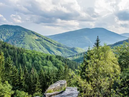
Grbaja Valley to Karanfili
How would you rate Grbaja Valley to Karanfili?
Tap a star to share your experience and help other hikers.
Grbaja Valley to Karanfili: Prokletije’s Jagged Summit Ascent
HikeList Score
Grbaja Valley to Karanfili scored 73/100 on HikeList's trail-quality metrics.
See score breakdownHide breakdown
- Ideal length 55
- Balanced challenge 74
- Scenery & wildness 98
- Varied terrain 64
- Accommodation 58
- Food & support 65
- Path quality 98
- Season flexibility 76
Computed from length, challenge, scenery & wildness, terrain variety, accommodation, food & support, path quality and season flexibility.
Grbaja Valley to Karanfili is a hard 14.5 km out-and-back summit hike in Prokletije National Park, Montenegro. It climbs about 1,400 m from the Grbaja (Grebaje) Valley to the Karanfili peaks, with the massif high point at Veliki Vrh / Kremeni Vrh (2,490 m). Allow one long day, typically 7–8 hours of walking. This is for fit, experienced mountain walkers comfortable with steep scree, exposed scrambling, cable-secured sections and fast-changing high-mountain weather.
Route Overview
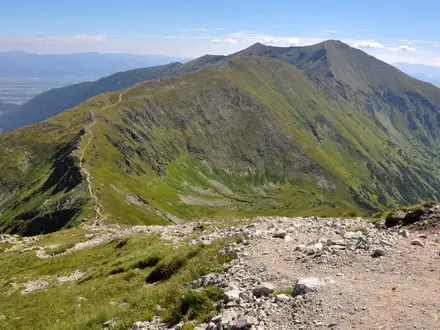
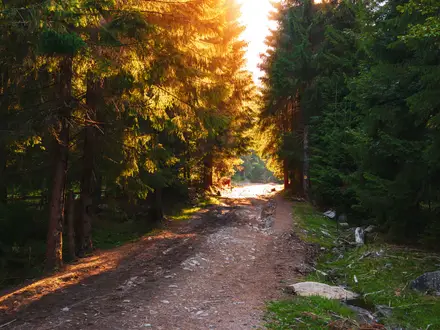
The route starts and finishes at the Grbaja (Grebaje) Valley mountain lodge, around 7 km from Gusinje and 19 km from Plav. From the valley floor, yellow waymarks climb steeply through forest, then onto rocky ground and scree towards Krosnjina Vrata pass (~2,156 m). The line continues to Severni Vrh (2,460 m) and on to Veliki Vrh / Kremeni Vrh (2,490 m), before returning by the same route. There is no loop or easy exit once high on the ridge. For other Montenegro hiking ideas, compare Ali Pasha's Springs Trail, Hrid Lake Trail and Bobotov Kuk Summit Trail.
Prokletije and the Karanfili Peaks
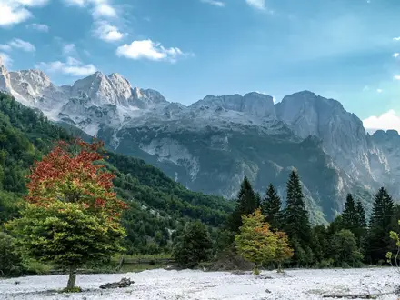
The Prokletije range, also known as the Accursed Mountains, straddles Montenegro, Albania and Kosovo and was long one of Europe’s least-explored mountain areas. The Montenegrin side became Prokletije National Park in 2009. Karanfili means “carnations” in Albanian, and the jagged limestone towers above Grbaja Valley have drawn climbers since the 20th century. The area remains a focus for rock climbing and serious mountain walking.
Notable highlights
- Karanfili massif: The “Carnations” form a wall of jagged limestone towers above the Grbaja Valley. They are the dominant landmark of this side of the Accursed Mountains.
- Krosnjina Vrata pass (~2,156 m): This gateway saddle marks a key transition from the lower forested climb to the higher, rockier mountain terrain.
- Veliki Vrh / Kremeni Vrh (2,490 m): The high point of the Karanfili massif gives wide views across Prokletije and into Albania.
- Maja Jezerce view: From the top, you can see Maja Jezerce (2,694 m), the highest peak of the Albanian Prokletije and the Dinaric Alps.
- Cable-secured scramble sections: Two exposed passages are fitted with steel cables, with additional hands-on terrain including a rock step and a notch.
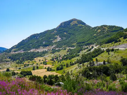
- Grbaja (Grebaje) Valley: The trailhead sits in a dead-end glacial amphitheatre of forest and meadow, one of Montenegro’s classic mountain settings.
Challenges to expect
Expect a relentless climb: sources describe no flat metre to the summit. The route includes steep forest, scree, exposed scrambling, two cable-secured sections, a rock step, a notch and a small permanent snow patch/glacier that can be passed on either side. Limestone becomes dangerous when wet. Snow patches and weather make the upper route serious outside July–September. A helmet and experienced local guide are advisable.
HikeList Score
Grbaja Valley to Karanfili scored 73/100 on HikeList's trail-quality metrics.
See score breakdownHide breakdown
- Ideal length 55
- Balanced challenge 74
- Scenery & wildness 98
- Varied terrain 64
- Accommodation 58
- Food & support 65
- Path quality 98
- Season flexibility 76
Computed from length, challenge, scenery & wildness, terrain variety, accommodation, food & support, path quality and season flexibility.
 Montenegro
Show more data Show less
- Mountainous
- Forest
- Dirt
- Rocky
- Huts
- Wild Camping Spots
- Pet Friendly
- Water Sources
- Campsites
- Shelters
Photos from hikers
Taken on the trail by people who've reviewed Grbaja Valley to Karanfili.
Start at the Grbaja Valley mountain lodge and follow yellow waymarks steeply through forest, then scree, to Krosnjina Vrata pass (~2,156 m). Continue over exposed, rocky ground to Severni Vrh (2,460 m) and Veliki Vrh / Kremeni Vrh (2,490 m), then descend the same way. Allow about 7–8 hours of walking.
Reviews
How would you rate Grbaja Valley to Karanfili?
Tap a star to start your review — you could be the first.