Formartine and Buchan Way
How would you rate Formartine and Buchan Way?
Tap a star to share your experience and help other hikers.
Formartine and Buchan Way: Railway Path Across Buchan
HikeList Score
Formartine and Buchan Way scored 70/100 on HikeList's trail-quality metrics.
See score breakdownHide breakdown
- Ideal length 66
- Balanced challenge 50
- Scenery & wildness 58
- Varied terrain 89
- Accommodation 91
- Food & support 68
- Path quality 84
- Season flexibility 89
Computed from length, challenge, scenery & wildness, terrain variety, accommodation, food & support, path quality and season flexibility.
The Formartine and Buchan Way is an easy, low-level walking, cycling and horse-riding route in Aberdeenshire, north-east Scotland. The headline Dyce to Fraserburgh line is about 64.5 km and takes around 2.5 days on foot; the full Y-shaped network, including the Peterhead spur from Maud, is about 85 km. It suits first-time long-distance walkers, cyclists and anyone wanting a traffic-free former railway route with gentle gradients, village services and coastal finishes.
Route Overview
The route starts at Dyce / Parkhill on the northern edge of Aberdeen, near the former Dyce railway station, and follows the old Formartine and Buchan Railway trackbed north through Newmachar, Udny Station, Ellon and Auchnagatt to Maud Junction. At Maud it splits: the north spur runs via Strichen to Fraserburgh, while the east spur runs via Mintlaw and Longside to Peterhead. This is a point-to-point route with a Y-shaped finish rather than a loop, so plan transport accordingly. For other Scottish long-distance options, compare the inland Annandale Way or coastal routes such as the Arran Coastal Way and Ayrshire Coastal Path.
From railway branch line to Scotland’s Great Trail
The Way follows the Great North of Scotland Railway’s Formartine and Buchan Railway, opened in sections between 1861 and 1865. Passenger services ended in 1965, but freight continued to Peterhead until 1970 and to Fraserburgh until 1979. The disused trackbed was later converted into a walkway and cycleway, opening in the early 1990s. Today it is listed among Scotland’s Great Trails and is waymarked with “F & BW” on a red railway logo.
Notable highlights
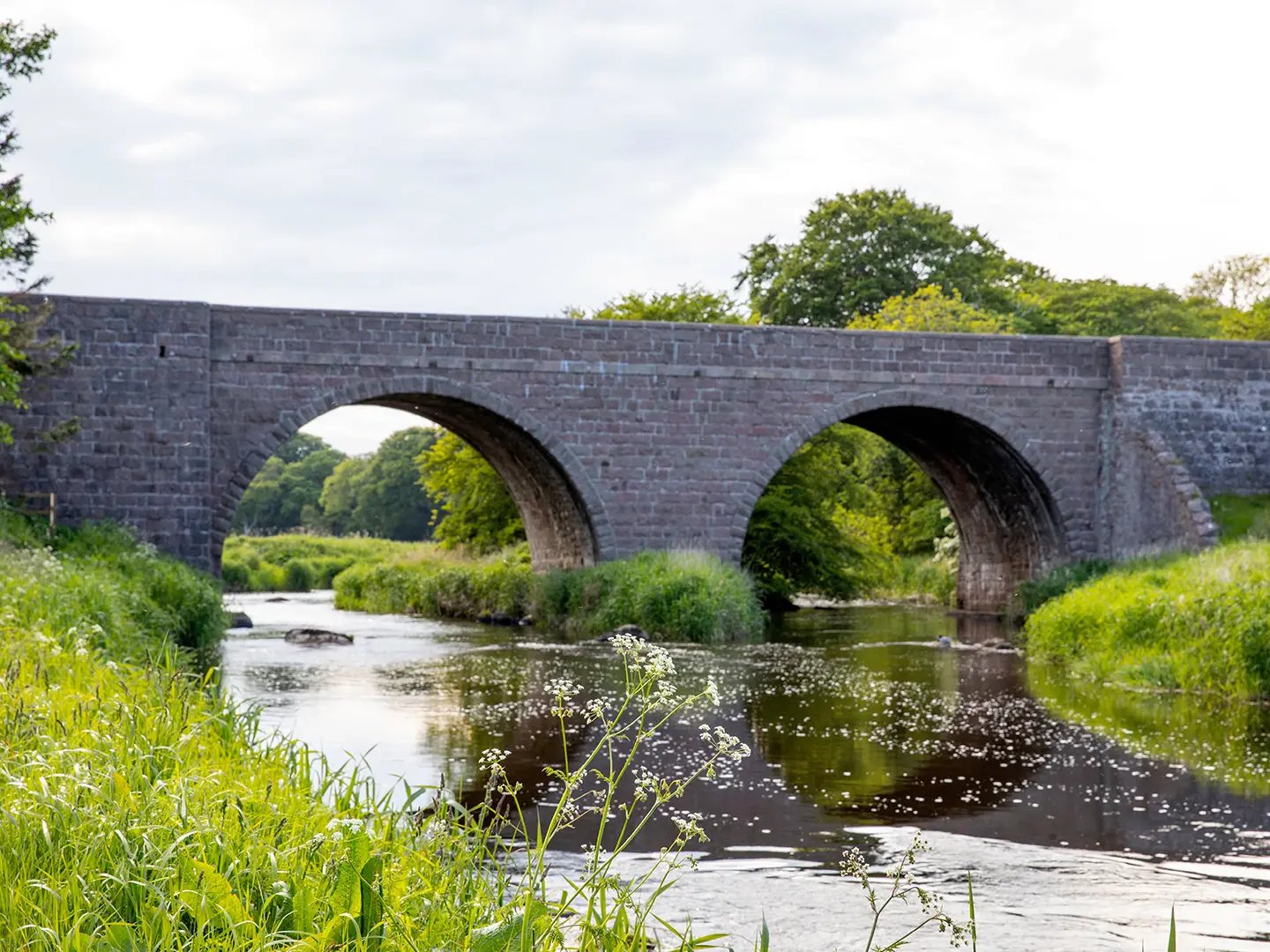
- Ellon Viaduct: This railway viaduct carries the path over the River Ythan at Ellon, giving an elevated view over the town and a clear reminder of the route’s railway origins.
- Maud Railway Museum, Maud Junction: Set in preserved station buildings, the museum explains the former line and the busy junction where the Fraserburgh and Peterhead branches divided.
- Aden Country Park: A short detour near Mintlaw leads to woodland, a popular cafe and the Aberdeenshire Farming Museum on a Georgian estate.
- Corten steel art trail and “Fit Wye”: Eleven weathered steel signs along the Way carry lines from Shane Strachan’s Doric poem, with rubbing plates so walkers can collect the verse.
- Deer Abbey, Old Deer: The ruined 13th-century Cistercian abbey lies close to the route near Maud, in an area linked to the medieval Book of Deer.
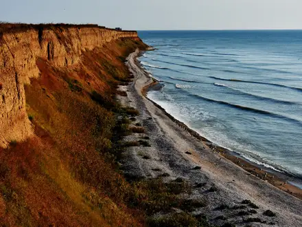
- Coastal finishes at Fraserburgh and Peterhead: Both spurs end at working Buchan fishing ports on the North Sea; Fraserburgh also has a long beach and the Museum of Scottish Lighthouses at Kinnaird Head.
Challenges to expect
The walking is generally easy: flat, low-level and mostly traffic-free on former railway grades. Expect a mix of mown grass, compacted gravel and short tarmac sections, with occasional rough, wet or muddy stretches, especially outside the drier May–September window. One Maud-to-Strichen section has a signed detour because of overgrowth and marsh. Services are in towns and villages, not at dedicated trail huts. For a rougher north-west coast feel, see the Assynt Coastal Path.
HikeList Score
Formartine and Buchan Way scored 70/100 on HikeList's trail-quality metrics.
See score breakdownHide breakdown
- Ideal length 66
- Balanced challenge 50
- Scenery & wildness 58
- Varied terrain 89
- Accommodation 91
- Food & support 68
- Path quality 84
- Season flexibility 89
Computed from length, challenge, scenery & wildness, terrain variety, accommodation, food & support, path quality and season flexibility.
Show more data Show less
- Lowland
- Rural
- Railway Path
- Grass
- Gravel
- Paved
- Muddy
- Hotels
- B&Bs
- Self Catering
- Family Friendly
- Dog Friendly On Leash
- Restrooms
- Picnic Areas
In these collections
Photos from hikers
Taken on the trail by people who've reviewed Formartine and Buchan Way.
From Dyce, the trail heads north, quickly leaving the Aberdeen city outskirts behind and entering open farmland. The route is predominantly flat, following the old railway line past the small settlement of Newmachar and continuing through rural landscapes until it reaches the larger town of Ellon. Waymarking is clear throughout this section, and the well-maintained path makes for easy walking. Ellon provides opportunities for rest and resupply.
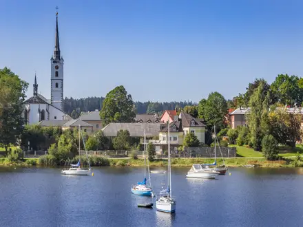
Leaving Ellon, the trail continues northwards through woodlands and agricultural countryside, passing by Udny Station and Auchnagatt. The route remains largely level, with some gentle undulations and scenic views, especially around the River Ythan. This stretch is quieter, with longer distances between villages. On arrival in Maud, hikers can find facilities before the route splits towards Fraserburgh or Peterhead.
From Maud, follow the main branch of the Way northeast towards Fraserburgh. This section is characterised by open moorland, farmland, and scattered woodland as it passes through Strichen and Philorth. The landscape gradually transforms as it approaches the North Sea coast. The final approach to Fraserburgh is mostly flat, and the trail ends close to the heart of this coastal town, offering amenities and transport connections.
Reviews
How would you rate Formartine and Buchan Way?
Tap a star to start your review — you could be the first.