Dachstein Glacier Circuit
How would you rate Dachstein Glacier Circuit?
Tap a star to share your experience and help other hikers.
Dachstein Glacier Circuit: Glacier Walks Above Ramsau
HikeList Score
Dachstein Glacier Circuit scored 71/100 on HikeList's trail-quality metrics.
See score breakdownHide breakdown
- Ideal length 55
- Balanced challenge 74
- Scenery & wildness 98
- Varied terrain 64
- Accommodation 49
- Food & support 65
- Path quality 98
- Season flexibility 63
Computed from length, challenge, scenery & wildness, terrain variety, accommodation, food & support, path quality and season flexibility.
The Dachstein Glacier Circuit is best treated as a glacier-walking area, not one official named trail. It starts from the Hunerkogel top station of the Dachstein Südwandbahn above Ramsau am Dachstein in Austria. Choose between the easy marked glacier trail to the Seethalerhütte, about 4 km return, or a hard 10–11 km high-alpine loop via the Simonyhütte and Hoher Gjaidstein. Both are 1-day outings; the longer circuit suits experienced alpine hikers only.
Route Overview
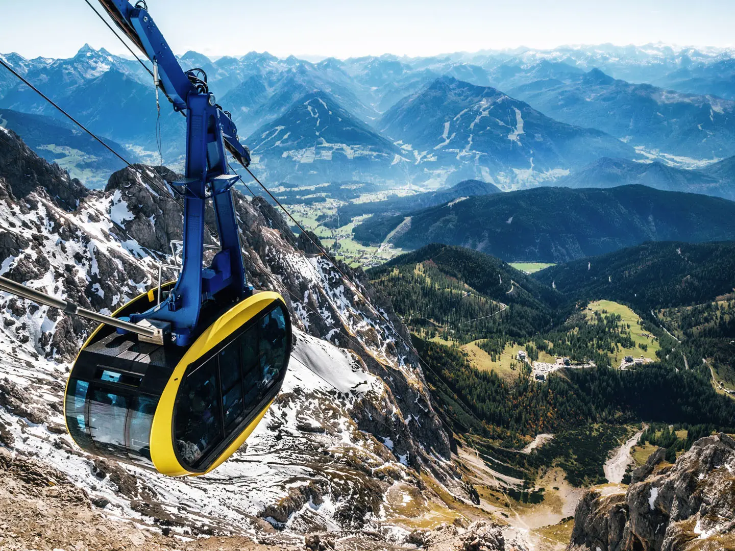
Access is by the paid Dachstein Südwandbahn cable car from the valley station above Ramsau am Dachstein to the Hunerkogel top station at about 2,700 m. From here the popular option is an out-and-back on the marked, groomed glacier trail across the Hallstätter Glacier to the Seethalerhütte. The harder loop descends towards the Simonyhütte, crosses glaciated high terrain, climbs Hoher Gjaidstein and returns to Hunerkogel. There is no single canonical waymarked “Dachstein Glacier Circuit”; do not confuse this day outing with the separate 121 km Dachstein Rundwanderweg around the whole massif.
Dachstein history and glacier access
The Hoher Dachstein was first climbed on 18 July 1834 by Peter Karl Thurwieser with Adam and Peter Gappmayr via the Gosau glacier. Friedrich Simony, a key Dachstein researcher, pioneered scientific study of the glaciers and chose the site of the Simonyhütte, opened in 1877. The Hallstatt–Dachstein/Salzkammergut cultural landscape, shaped by long salt-mining history around Hallstatt, became a UNESCO World Heritage Site in 1997. The Dachstein Südwandbahn, first opened in 1951, made the glacier plateau directly accessible.
Notable highlights
- Hallstätter Glacier: The marked trail crosses this high glacier plateau at the edge of the Dachstein massif. It is retreating rapidly, with more than 1 km of retreat since 1908, and walkers must stay on the marked line because of hidden crevasses.
- Seethalerhütte (2,740 m): The highest mountain hut in Upper Austria sits in the Dachsteinwarte saddle on the glacier edge. It is the standard rest stop on the easy glacier walk and the staging hut for Hoher Dachstein ascents.
- Simonyhütte (2,205 m): This Austrian Alpine Club hut below the Hallstätter Glacier opened in 1877. It is a historic base for Dachstein ascents and a key point on the longer glacier loop.
- Hoher Gjaidstein (2,794 m): This summit is the high point of the demanding loop. It gives wide views across the Hallstätter Glacier and the Dachstein massif.
- Dachstein Skywalk and suspension bridge: At the Hunerkogel top station, the viewing platform and bridge sit above the 250 m south face. They are beside the trailhead, before the glacier walking begins.
- Dachstein Ice Palace: This ice cave inside the glacier has tunnels and ice sculptures. It offers a close look at the glacier structure without leaving the top-station area.
Challenges to expect
The easy Seethalerhütte trail is marked and groomed, but it still crosses a live glacier: stay on the signed route. The full Simonyhütte–Gjaidstein loop is hard high-alpine terrain with glacier travel, steep rock and snow, exposure and serious navigation demands. Weather changes quickly at about 2,700 m, snow can return early, and cable car operating times affect your margin. For longer Austrian hut-to-hut routes, compare the Hohe Tauern Panorama Trail or Eagle Walk (Adlerweg).
HikeList Score
Dachstein Glacier Circuit scored 71/100 on HikeList's trail-quality metrics.
See score breakdownHide breakdown
- Ideal length 55
- Balanced challenge 74
- Scenery & wildness 98
- Varied terrain 64
- Accommodation 49
- Food & support 65
- Path quality 98
- Season flexibility 63
Computed from length, challenge, scenery & wildness, terrain variety, accommodation, food & support, path quality and season flexibility.
 Austria
Show more data Show less
- Mountainous
- Glacier
- Rocky
- Snow
- Huts
- Pet Friendly
- Restrooms
- Water Sources
- Shelters
Photos from hikers
Taken on the trail by people who've reviewed Dachstein Glacier Circuit.
Start at Hunerkogel top station and follow the marked, groomed glacier trail across the Hallstätter Glacier to the Seethalerhütte at 2,740 m, then return the same way. The official tourism figure is about 1.5 hours return with roughly 190 m ascent. It is rated easy, but remains glacier terrain.
From Hunerkogel, take the longer glacier circuit via the Simonyhütte and Hoher Gjaidstein before returning to the top station. This is the route that roughly matches the listing’s loop framing: about 6–7 hours with around 900–1,000 m ascent. It is hard/expert alpine terrain, not a casual glacier stroll.
Reviews
How would you rate Dachstein Glacier Circuit?
Tap a star to start your review — you could be the first.