Tochar Phádraig (Patrick’s Way)
How would you rate Tochar Phádraig (Patrick’s Way)?
Tap a star to share your experience and help other hikers.
Tochar Phádraig (Patrick’s Way): Pilgrim Route to Croagh Patrick
HikeList Score
Tochar Phádraig (Patrick’s Way) scored 80/100 on HikeList's trail-quality metrics.
See score breakdownHide breakdown
- Ideal length 59
- Balanced challenge 84
- Scenery & wildness 98
- Varied terrain 71
- Accommodation 74
- Food & support 81
- Path quality 98
- Season flexibility 89
Computed from length, challenge, scenery & wildness, terrain variety, accommodation, food & support, path quality and season flexibility.
Tóchar Phádraig is a 35 km point-to-point pilgrim path in County Mayo, west Ireland, from Ballintubber Abbey to the summit of Croagh Patrick above Murrisk. It takes 1–2 days and is graded hard because the long overland route ends with the steep, loose climb of Croagh Patrick. This is for fit walkers who want history, field paths, rural lanes, boggy ground and a demanding mountain finish, not a casual waymarked stroll.
Route Overview
The route starts at Ballintubber Abbey, near Castlebar and Claremorris, and heads west across private pilgrim land towards Croagh Patrick and Clew Bay. Key places on the way include Lankill, the Boheh Stone, Aghagower and Murrisk, before the final ascent to the 764 m summit of Croagh Patrick. It is a point-to-point walk, so plan transport carefully: independent walkers have no official backup or return transport and must arrange their own pickup from the Croagh Patrick/Murrisk end. For gentler Mayo days after the pilgrimage, compare the Great Western Greenway or Achill Island Trails.
A medieval pilgrim road with older origins
Tóchar Phádraig follows the line of an older chariot road linked with the royal seat of Connacht at Rathcroghan/Cruachan and Croagh Patrick. By tradition, St Patrick walked this way before his 40-day fast on the mountain in the 5th century, and the route later became a major medieval pilgrimage road. Ballintubber Abbey, founded in 1216, has served pilgrims for over 800 years and helped revive the path in modern times with Pilgrim Paths of Ireland.
Notable highlights
- Ballintubber Abbey (start): An Augustinian abbey founded in 1216 and still central to the route. Register here before setting out and stamp the Pilgrim Passport at the start.
- Boheh Stone / St Patrick’s Chair: A Neolithic/Bronze Age cup-and-ring carved rock. It is known for the “rolling sun” alignment, when the setting sun appears to roll down Croagh Patrick when viewed from here.
- Aghagower: An early monastic settlement around the halfway point, with a ruined round tower, holy well, St Patrick’s Bed and St Patrick’s “Bath”.
- The stiles: Expect roughly 100+ stone stiles over field walls. They are a memorable feature of the route and add real fatigue over a long day.
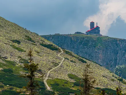
- Croagh Patrick summit (764 m): The high point and finish, with views over Clew Bay. It is also the focus of the Reek Sunday pilgrimage, held on the last Sunday in July.
Challenges to expect
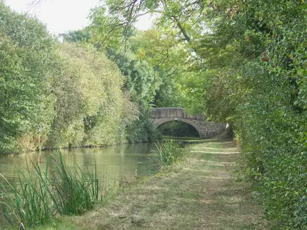
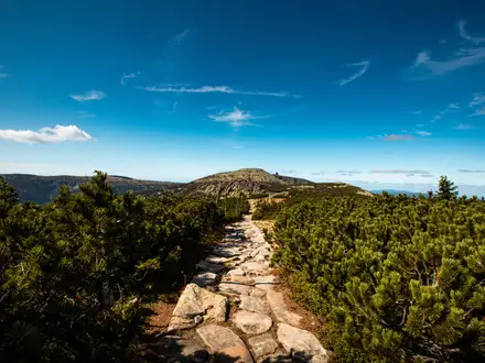
The main difficulty is the combination of distance, repeated stiles and the final steep, loose ascent of Croagh Patrick. Underfoot you can meet forest tracks, pasture, rural lanes, boggy ground, gravel and rock. The route has distinctive yellow Tóchar pilgrim markers, but navigation still needs attention across open ground. Registration is compulsory because much of the walk crosses private land.
HikeList Score
Tochar Phádraig (Patrick’s Way) scored 80/100 on HikeList's trail-quality metrics.
See score breakdownHide breakdown
- Ideal length 59
- Balanced challenge 84
- Scenery & wildness 98
- Varied terrain 71
- Accommodation 74
- Food & support 81
- Path quality 98
- Season flexibility 89
Computed from length, challenge, scenery & wildness, terrain variety, accommodation, food & support, path quality and season flexibility.
 Ireland
Show more data Show less
- Mountainous
- Forest
- Dirt
- Rocky
- Gravel
- Hotels
- Hostels
- Pet Friendly
- Restrooms
- Water Sources
- Campsites
In these collections
Photos from hikers
Taken on the trail by people who've reviewed Tochar Phádraig (Patrick’s Way).
Reviews
How would you rate Tochar Phádraig (Patrick’s Way)?
Tap a star to start your review — you could be the first.