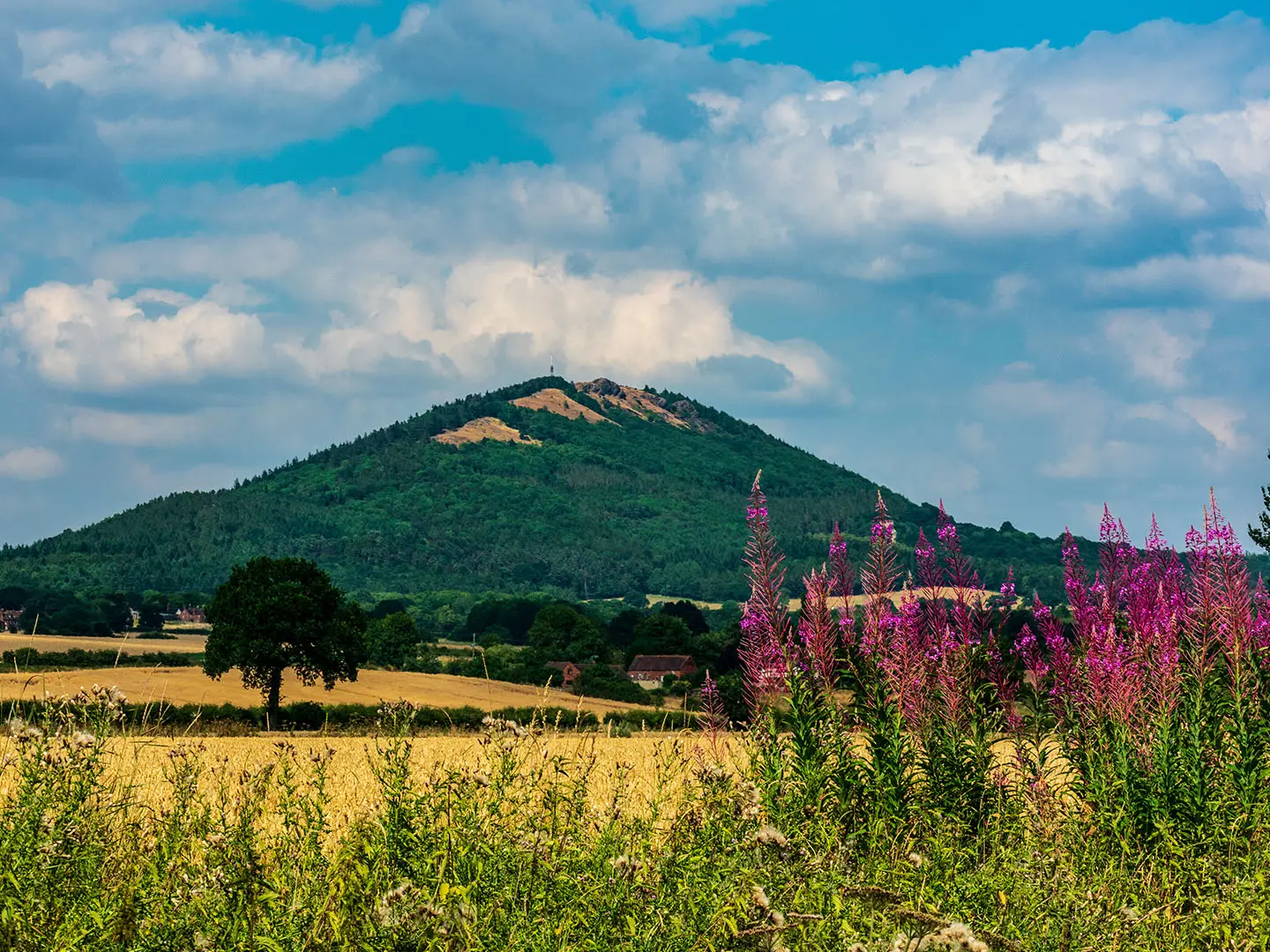
The Wrekin Walk
How would you rate The Wrekin Walk?
Tap a star to share your experience and help other hikers.
The Wrekin Walk: Shropshire’s Short Summit Loop
HikeList Score
The Wrekin Walk scored 73/100 on HikeList's trail-quality metrics.
See score breakdownHide breakdown
- Ideal length 55
- Balanced challenge 100
- Scenery & wildness 98
- Varied terrain 64
- Accommodation 45
- Food & support 52
- Path quality 98
- Season flexibility 63
Computed from length, challenge, scenery & wildness, terrain variety, accommodation, food & support, path quality and season flexibility.
The Wrekin Walk is a short, steep 7.2 km loop up The Wrekin, a 407 m hill rising from the Shropshire plain in east England. It is a moderate half-day walk, usually done from Forest Glen car park near Telford and Wellington, with around 320 m of ascent. The route suits hikers who want a quick summit, woodland paths, Iron Age ramparts and big views without committing to a long-distance trail. For gentler English route ideas, compare the Ashby Canal Trail or Amber Valley Route.
Route Overview
Start and finish at Forest Glen car park, between the Ercall and The Wrekin, reached from M54 Junction 7 on the road towards Little Wenlock. The classic loop climbs on a wide, well-used track through mixed woodland, then passes Hell Gate and Heaven Gate, the ramparted entrances to the Iron Age hillfort. The summit area has the trig point, toposcope, transmitting mast and red beacon at 407 m. From there, the route continues past the Needle’s Eye and Raven’s Bowl / Cuckoo’s Cup, descends the far side along the whaleback ridge, then returns around the wooded lower slopes to the car park. The Shropshire Way also crosses the summit.
Iron Age stronghold of the Cornovii
The Wrekin’s summit ridge carries a large Iron Age hillfort, the stronghold of the Cornovii tribe of Shropshire and Cheshire. Roundhouses appeared on the hill around 1000 BC, with major ramparts added later, and the fort was taken and burnt by the Romans around AD 47 before the Cornovii were resettled at Wroxeter, or Viroconium. The hillfort is now a Scheduled Ancient Monument. The hill is also tied to local giant folklore, including the legends behind the Needle’s Eye and Raven’s Bowl.
Notable highlights
- The Wrekin summit (407 m): The high point of the walk, with a trig-point toposcope, Iron Age hillfort earthworks, a transmitting mast and a red beacon. In clear weather the view takes in landmarks across Shropshire, Wales and the English Midlands.
- Hell Gate and Heaven Gate: These are the outer and inner ramparted entrances to the hillfort. Heaven Gate is where the woodland climb opens onto broader summit views.
- The Needle’s Eye: A narrow cleft in the summit rocks with steep drops nearby. Local tradition says a true Salopian has squeezed through it, but hikers should treat the area with care.
- Raven’s Bowl / Cuckoo’s Cup: A small natural basin in the summit rock, linked in local legend to the giant said to have made The Wrekin.
- Iron Age hillfort: The summit ridge is wrapped by a roughly 8-hectare hillfort, regarded as a Cornovii stronghold and now protected as a Scheduled Ancient Monument.
- The Ercall and the woods: The neighbouring Ercall can be added to the walk. Its old quarries expose very old Precambrian volcanic rocks, while the woods and open ground support birds such as ravens, buzzards and peregrine falcons.
Challenges to expect
The difficulty is the sustained steep climbing and descending, not technical scrambling. Expect wide dirt and stony tracks lower down, with rockier, uneven ground near the summit ridge and Needle’s Eye. Woodland sections can be muddy after rain, and the exposed top can be windy, cold, wet or misty. Navigation is straightforward on the main line, but side paths and poor visibility make a map useful.
HikeList Score
The Wrekin Walk scored 73/100 on HikeList's trail-quality metrics.
See score breakdownHide breakdown
- Ideal length 55
- Balanced challenge 100
- Scenery & wildness 98
- Varied terrain 64
- Accommodation 45
- Food & support 52
- Path quality 98
- Season flexibility 63
Computed from length, challenge, scenery & wildness, terrain variety, accommodation, food & support, path quality and season flexibility.
 United Kingdom
 England
Show more data Show less
- Mountainous
- Forest
- Dirt
- Rocky
- Accommodation Not Required
- Family Friendly
- Pet Friendly
- Restrooms
- Picnic Areas
Photos from hikers
Taken on the trail by people who've reviewed The Wrekin Walk.
Reviews
How would you rate The Wrekin Walk?
Tap a star to start your review — you could be the first.