Ruta dos Faros (The Lighthouse Way)
How would you rate Ruta dos Faros (The Lighthouse Way)?
Tap a star to share your experience and help other hikers.
Ruta dos Faros: A Complete Hiking Guide
HikeList Score
Ruta dos Faros (The Lighthouse Way) scored 89/100 on HikeList's trail-quality metrics.
See score breakdownHide breakdown
- Ideal length 98
- Balanced challenge 84
- Scenery & wildness 71
- Varied terrain 100
- Accommodation 100
- Food & support 81
- Path quality 98
- Season flexibility 89
Computed from length, challenge, scenery & wildness, terrain variety, accommodation, food & support, path quality and season flexibility.
O Camiño dos Faros, also called Ruta dos Faros or The Lighthouse Way, is a 200 km point-to-point coastal hike across the Costa da Morte in Galicia, north-west Spain. It runs from Malpica de Bergantiños to Cabo Fisterra in 8 demanding stages. Expect a hard village-to-village route: long daily distances, clifftop paths, granite boulders, beaches, dunes, woodland and low-key green waymarking. It suits experienced hikers who want wild Atlantic coastline rather than a classic pilgrimage trail like the Camino del Norte.
Route Overview
The route starts in Malpica de Bergantiños and follows the coast west and south to Cabo Fisterra / Cape Finisterre, staying as close to the Atlantic as possible. The eight published stages pass Niñóns, Punta Nariga, Ponteceso, Laxe, Arou, Praia de Trece, Cabo Vilán, Camariñas, Muxía, Nemiña, Lires and Fisterra. It is a point-to-point walk, not a loop, so plan start and finish logistics separately; no verified transport details are included in the brief. Compared with the Camino Primitivo, the challenge here is less altitude and more rough, exposed coast, repeated short climbs and navigation.
History of O Camiño dos Faros
The route was created from December 2012 by a group of Galician hikers, famously described as “6 people and 2 dogs”, who linked Malpica to Fisterra using seafront paths opened by fishermen and percebeiros, or goose-barnacle gatherers. Their aim was to stay as close to the ocean as possible. The volunteer Asociación Camiño dos Faros developed and waymarked the trail. Its name honours the lighthouses built along the Costa da Morte in the 19th and 20th centuries to make this dangerous coast safer.
Notable highlights
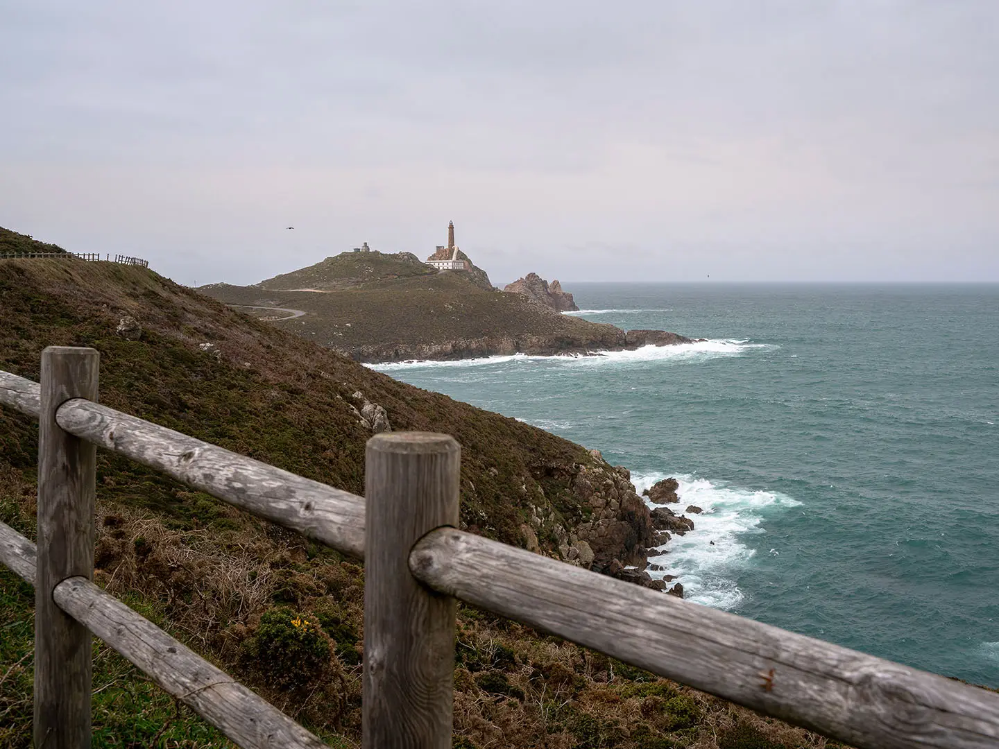
- Cabo Vilán lighthouse: A lighthouse on a 100 m rocky promontory near Camariñas. It was the first electrified lighthouse in Spain in 1896 and is one of the route’s defining coastal landmarks.
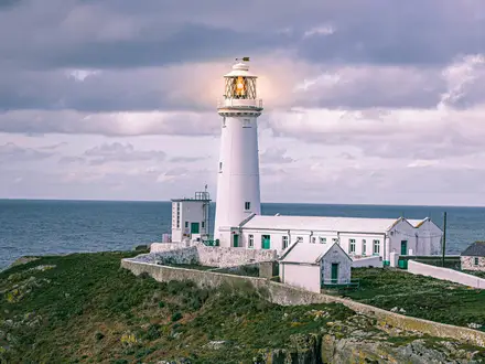
- Punta Nariga lighthouse: A modern lighthouse on a wild headland near Malpica, designed by Galician architect César Portela. Its ship-prow form makes it one of the most distinctive beacons on the walk.
- English Cemetery (Cemiterio dos Ingleses): A clifftop graveyard near Camelle for sailors lost in 19th-century shipwrecks, including the 1890 wreck of HMS Serpent. It underlines why this coast is called the Costa da Morte.
- A Ferida sculpture, Muxía: A jagged granite sculpture beside the Virxe da Barca sanctuary. It commemorates the 2002 Prestige oil spill and the volunteers who helped clean the coast.
- Praia de Trece and dunes of Monte Branco: A remote stretch of beaches backed by a major coastal dune system. This is one of the wildest-feeling sections of the route.
- Cape Finisterre (Cabo Fisterra): The finish at a granite cape with a lighthouse, long associated with the “end of the earth” and also shared with the Camino de Santiago.
Challenges to expect
The difficulty is cumulative: 200 km in 8 stages, with days averaging about 25 km and one stage of 32.6 km. The trail repeatedly climbs and drops over headlands despite a highest point of only 312 m. Expect rocky clifftops, boulders requiring occasional scrambling, sand, mud, fern and gorse. Green waymarks can blend into vegetation, so navigation needs attention. Winter is mild but very wet and muddy.
HikeList Score
Ruta dos Faros (The Lighthouse Way) scored 89/100 on HikeList's trail-quality metrics.
See score breakdownHide breakdown
- Ideal length 98
- Balanced challenge 84
- Scenery & wildness 71
- Varied terrain 100
- Accommodation 100
- Food & support 81
- Path quality 98
- Season flexibility 89
Computed from length, challenge, scenery & wildness, terrain variety, accommodation, food & support, path quality and season flexibility.
 Spain
SpainShow more data Show less
- Coastal
- Cliffs
- Beaches
- Dunes
- Forest
- Estuaries
- Natural Footpath
- Rocky
- Sandy
- Track
- Minor Road
- Hotels
- Guesthouses
- Apartments
- Small Inns
- Pet Friendly
- Restrooms
- Water Sources
- Campsites
Download Our Full Guide to Ruta dos Faros (The Lighthouse Way) FREE!
Get our comprehensive guide to this hike for free. Save it for later reading or print out at home.
Photos from hikers
Taken on the trail by people who've reviewed Ruta dos Faros (The Lighthouse Way).
Ruta dos Faros (The Lighthouse Way): The Complete Guide
 i
Image by D.G.Eirin
i
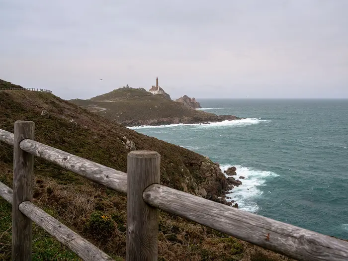
Image by D.G.Eirin Ruta dos Faros is a 200 km coastal crossing of Galicia’s Costa da Morte, linking the harbour lighthouse at Malpica de Bergantiños with Cabo Fisterra. It is a point-to-point walk for hikers who want raw Atlantic cliffs, working fishing towns and exposed headlands rather than a polished pilgrimage corridor.
The route follows lighthouses, beaches, dunes, rías and granite promontories along one of Spain’s wildest-feeling coasts. Highlights include Punta Nariga, Praia de Trece and Monte Branco, Cabo Vilán, Muxía and the final sweep out to the Faro de Fisterra.
This is not hard because of altitude: the high point is only around 312 m near Castelo/Loureiro. It is hard because the days are long, the ground is rough, the coast is exposed, and the path repeatedly climbs and drops over headlands.
Waymarking is low-key and volunteer-maintained, so green arrows can fade into vegetation and a GPX track is essential. Accommodation and transport also need planning, especially around smaller stage ends such as Niñóns, Arou, Nemiña and Lires.
This guide covers stages, daily planning, accommodation, food, transport, terrain and the common mistakes to avoid.
Stage-by-Stage Guide
The Ruta dos Faros is divided into eight official stages, but those stages are not equal in difficulty. A shorter day can still feel slow on sand, wet granite, gorse-lined paths and repeated headland climbs, while the longest day requires an early start and careful food and water planning.
Green waymarks are deliberately low-key and can be hard to see in vegetation, mist or fading light. Carry the official GPX/Komoot track and a paper or offline map for every stage.
Stage 1: Malpica de Bergantiños to Niñóns — 21.3 km
The route starts at the Faro de Malpica on the harbour/port of Malpica de Bergantiños and immediately sets the tone for the walk: open Atlantic coast, beaches, headlands and rough natural paths rather than a manicured trail. It passes Praia de Area Maior, Cabo de Santo Adrián, Beo, Seiruga and Barizo before reaching Punta Nariga and continuing to Niñóns.
Underfoot, expect a mix of coastal path, sand, rock, track and short sections of lane. After rain, muddy ground and slippery granite can slow progress, and wind exposure is a real factor on the headlands.
The key landmark is Faro de Punta Nariga, one of the signature lighthouses of the route. Its ship’s-prow design and exposed position make it a natural pause point, but it is also a place to treat with respect in strong wind or poor visibility.
Malpica is the reliable place to start with food and water. The smaller places passed en route should not be relied on for supplies without checking opening times, so carry enough for a full coastal day.
Niñóns is a small stage-end village with limited accommodation compared with the larger towns on the route. Book ahead and do not assume late availability, especially in July and August.
Malpica has road access and is normally reached by bus via Carballo or by taxi/private transfer. Niñóns has road access but limited public-transport practicality for walkers; taxis or accommodation transfers may be needed. This should be checked before travelling.
Navigation is generally coastal, but do not rely only on painted green marks. Vegetation, rock and side paths around beaches and headlands can make the line easy to miss, particularly late in the day.
Stage 2: Niñóns to Ponteceso — 27.1 km
This is a longer and more committing day than Stage 1, starting from a small village with limited services and finishing in the larger settlement of Ponteceso. The walking continues along the Costa da Morte’s exposed coast before the route begins to draw towards the ría landscape around Ponteceso.
The terrain remains varied: natural footpath, rough coastal ground, sand, rock, rural tracks and minor road sections. The repeated short climbs and descents are more significant than the absolute altitude suggests, and the day can feel hard if the ground is wet.
There are fewer major named landmarks on this stage than on the lighthouse-heavy days, so the practical challenge is maintaining pace and concentration over rough ground. Views are often open and Atlantic-facing, with the coast remaining wild and unsheltered for long periods.
Food and water planning matters here. Niñóns has limited facilities, and any intermediate village services should be treated as uncertain unless checked in advance. Carry lunch, snacks and enough water to reach Ponteceso.
Ponteceso is a better resupply and overnight stop than Niñóns, with the broader range of accommodation typical of the route’s coastal towns. It is a sensible place to reset supplies before the high-point stage to Laxe.
Road access improves at Ponteceso. Public transport along this part of the coast is indirect and timetable-dependent, so any plan to join, leave or skip the stage by bus or taxi should be arranged in advance.
Navigation can be less obvious where the route leaves open coast for tracks, lanes and settlement edges. Keep the GPX active rather than waiting until a waymark is missed.
Stage 3: Ponteceso to Laxe — 25.3 km
Stage 3 is one of the more varied days, linking Ponteceso with Laxe via the Corme-Laxe ría area, Corme, Cabana de Bergantiños and the inland rounding of the estuary. It also reaches the high point of the whole route, around Castelo / Loureiro at roughly 312 m above sea level.
The altitude is modest, but this stage is a reminder that the Ruta dos Faros is not flat coastal strolling. The route climbs and drops over headlands and inland ground, with a mix of paths, tracks, lanes and possible muddy sections after rain.
The views change from open sea to ría, settlement and higher ground. This contrast is useful psychologically: it breaks up the day, but it also makes navigation more complicated than on sections where the sea is always on one side.
Ponteceso is the best place to leave with full food and water. Corme, Cabana de Bergantiños and Laxe are the named settlements on or near the stage, but opening times and availability should be checked before relying on them during the walking day.
Laxe is one of the main coastal towns on the route and has a better accommodation base than the smaller village stage ends. It is a good place to book a proper recovery night before the shorter stage to Arou.
Road access exists at Ponteceso, Corme, Cabana de Bergantiños and Laxe, giving this stage more bailout possibilities than the wilder headland sections. Public transport remains local and indirect; check current timetables before planning around it.
Pay particular attention to waymarking where the route rounds the ría and passes through or near settlements. Green marks can be easier to lose among roads, tracks and local paths than on open cliff sections.
Stage 4: Laxe to Arou — 18 km
This is the shortest official stage, but it should not be dismissed as an easy rest day. The route runs from Laxe through the Traba and Camelle area to Arou, mixing coast, beaches, tracks, rock and village approaches.
The shorter distance gives more margin for slow going on sand, wet paths or awkward granite. It can also be a useful recovery stage after the longer Ponteceso–Laxe day, especially if the weather has been poor.
Traba and Camelle are the main named places before Arou. The stage gives a strong sense of the smaller coastal communities between the larger overnight towns, with the Atlantic remaining close and exposed for much of the day.
Start from Laxe with enough food and water for the stage. Camelle may be a useful practical stop, but services should not be assumed without checking current opening times.
Arou is a smaller stage end with fewer beds than Laxe, Camariñas or Muxía. Accommodation should be booked before starting the route, particularly if keeping to the official eight-day schedule.
Road access is available at Laxe, Traba, Camelle and Arou, making this a more manageable stage for transfers than the remoter stretches. Public transport details can change and should be checked before travelling.
Navigation is usually straightforward in concept — keep moving along the coast between the named settlements — but the actual line can weave between beach, rock, path and lane. Follow the GPX where local tracks or beach access paths create choices.
Stage 5: Arou to Camariñas — 23.8 km
Stage 5 is one of the defining days of the Ruta dos Faros. From Arou it crosses some of the wildest-feeling coast on the route, passing Praia de Trece, the dunes of Monte Branco, Punta do Boi, the Cemiterio dos Ingleses and Cabo Vilán before finishing in Camariñas.
The terrain is exposed and varied, with sand, rough coastal path, granite, tracks and headland walking. Progress can be slow in wind, heat or wet conditions, and there are long stretches where the landscape feels remote.
Praia de Trece and Monte Branco are major highlights, with beaches and a large dune system rising above the sea. Stay on the established route through dune and protected coastal areas; this is not a place to cut corners or create new lines.
The Cemiterio dos Ingleses near Punta do Boi is one of the most powerful historical points on the route, linked to the wreck of HMS Serpent in 1890. The setting also underlines the seriousness of this coast in bad weather.
Cabo Vilán and its lighthouse are another key landmark before Camariñas. The promontory is spectacular, but it is also exposed to wind, spray and sudden weather changes.
Arou has limited services, so leave with a full day’s food and water unless accommodation has made specific arrangements. Do not rely on finding supplies before Camariñas without checking in advance.
Camariñas is a main coastal town and a much stronger overnight base than Arou. It is also a sensible place to prepare for the longest official stage the following day.
Road access is better near Camariñas and Cabo Vilán than in the more remote central parts of the stage, but this should not be treated as an easy escape route in poor weather. Taxis or transfers should be arranged in advance if needed.
Navigation requires attention around beaches, dunes and open coastal ground where waymarks may be sparse or blend into the surroundings. Mist, rain or evening light can make the green markings much harder to pick out.
Stage 6: Camariñas to Muxía — 32.6 km
This is the longest official stage of the Ruta dos Faros and needs the most disciplined planning. It leaves Camariñas, rounds the Camariñas ría via Ponte do Porto and continues to Muxía, combining estuary walking, rural lanes, minor roads, tracks and coastal sections.
The main difficulty is not technical terrain but sustained distance. Even if the underfoot conditions feel easier in places than on the boulderier headlands, 32.6 km is a long day with cumulative fatigue, especially after five previous stages.
The route’s character changes here as it works around the ría rather than simply following open cliffs. Expect more lane and settlement-edge navigation, with less of the constant sea-cliff drama but plenty of scope to lose time if the line is missed.
Camariñas is the place to start fully supplied. Ponte do Porto is the main named place around the ría, but food and water availability should be checked before relying on it. Carry enough to complete the stage comfortably.
Muxía is one of the best overnight stops on the route, with accommodation options including hotels, guesthouses, apartments and albergue-style lodging. Book ahead in busy periods, as it is also a recognised coastal pilgrimage destination.
At Muxía, the Santuario da Virxe da Barca and A Pedra da Ferida sculpture are key landmarks. If arriving late after the long stage, allow enough daylight and energy if planning to visit them the same day.
Road access exists at Camariñas, Ponte do Porto and Muxía, giving theoretical options for shortening the day. Public transport is still not simple enough to improvise around; check timetables and arrange taxis or transfers before depending on them.
Navigation needs particular care through lanes, ría-side sections and settlement approaches. Long stages are when small mistakes become costly, so keep the GPX running and check turns early rather than after walking off-line.
Stage 7: Muxía to Nemiña — 25.3 km
Stage 7 leaves Muxía and returns to a wilder Atlantic feel, passing through the Touriñán area before reaching Nemiña. After the long Camariñas–Muxía stage, this can still feel demanding because the route is back on exposed coastal ground.
Expect the usual Ruta dos Faros mixture of natural path, rock, sand, tracks, mud after rain and short steep climbs and descents. Wind exposure is again a major consideration, particularly on open headlands.
Muxía’s coastal sanctuary and the A Pedra da Ferida sculpture are important route landmarks if not visited the previous evening. Once beyond the town, the day becomes more remote and practical services thin out.
Leave Muxía with enough food and water for the full stage. Do not assume reliable resupply before Nemiña unless checked in advance.
Nemiña is a small stage end with limited accommodation. Booking ahead is essential, and walkers splitting the route into more than eight days should plan carefully around bed availability in this area.
Road access exists at Muxía and Nemiña, with smaller local roads serving the coast between them. Public transport options are limited and should be checked before travelling; taxis or pre-arranged transfers may be the realistic option.
Navigation can be testing where green marks are partly hidden by vegetation or where informal coastal paths branch off. In poor visibility, avoid drifting towards cliff edges or exposed rock in search of the next mark.
Stage 8: Nemiña to Cabo Fisterra (Cape Finisterre) — 26.9 km
The final official stage runs from Nemiña via Lires to Cabo Fisterra, finishing at the lighthouse on the granite cape. It is a substantial final day, not a ceremonial stroll, and should be treated with the same respect as the earlier stages.
The terrain remains mixed: coastal paths, rural lanes, tracks, sand, rock and exposed headland walking. After rain, mud and slippery stone can still slow progress, and fatigue from the full route often becomes the main difficulty.
Lires is the main named place before the final approach to Cabo Fisterra. It can be useful for breaking the day or planning a slower itinerary, but accommodation and services in Lires are more limited than in Fisterra and should be booked or checked ahead.
Carry enough food and water from Nemiña to avoid depending on uncertain opening times. Fisterra has the better range of services at the end of the route.
The finish at Cabo Fisterra and the Faro de Fisterra is shared in spirit with the Camino de Santiago tradition, but the Ruta dos Faros reaches it after a much rougher coastal journey. The cape is exposed, and wind or rain can make the final headland feel severe even in mild temperatures.
Accommodation is normally planned in Fisterra rather than at the lighthouse itself. If finishing late, make sure the practical link between the cape and the night’s accommodation is clear before setting out.
Fisterra has onward bus connections to Santiago de Compostela bus/train station, with further connections to A Coruña and the airports. There is no railway at the finish, and current bus timetables should be checked before travelling.
Navigation usually becomes psychologically easier as the finish approaches, but complacency is still a risk. Keep following the route to the lighthouse rather than simply aiming for roads or visible buildings, and allow enough daylight for the final exposed section.
Recommended Itinerary
The cleanest way to walk the Ruta dos Faros is to follow the 8 official stages. That keeps navigation simple and uses the recognised stage-end settlements, but it is not an easy 8-day schedule: several days are over 25 km, the Camariñas–Muxía stage is 32.6 km, and the rough coastal ground makes the distances feel longer than a Camino-style itinerary.
Book accommodation before committing to dates, especially in Niñóns, Arou, Nemiña and Lires, where beds are limited. Do not assume frequent shops, cafés or transport along the wilder sections.
Standard 8-day itinerary
| Day | From | To | Approx. distance | Why this stage makes sense | Services/accommodation notes |
|---|---|---|---|---|---|
| 1 | Malpica de Bergantiños | Niñóns | 21.3 km | A tough but manageable opening day from the Faro de Malpica, taking in early headlands and the Punta Nariga area before reaching the first small stage end. | Malpica has the best start-of-walk logistics. Niñóns has fewer beds, so this night should be booked early. |
| 2 | Niñóns | Ponteceso | 27.1 km | One of the longer early stages, useful for moving from the smaller first-night stop to a more substantial town. Pace it conservatively after the first day. | Ponteceso is a more practical overnight base than Niñóns, with better chances of accommodation and resupply. |
| 3 | Ponteceso | Laxe | 25.3 km | This stage reaches the route’s high point around Castelo / Loureiro, roughly 312 m above sea level. The altitude is modest, but the repeated climbing and descending make it a proper walking day. | Laxe is one of the main coastal overnight stops on the route and is a good place to reset before the shorter fourth stage. |
| 4 | Laxe | Arou | 18 km | The shortest official stage. It works well as a partial recovery day before the wilder Arou–Camariñas section. | Arou is a smaller stage end with limited beds; book ahead rather than treating it as flexible. |
| 5 | Arou | Camariñas | 23.8 km | A major coastal day through some of the route’s wildest scenery, including Praia de Trece, Monte Branco, Punta do Boi, the Cemiterio dos Ingleses and Cabo Vilán before reaching Camariñas. | Camariñas is one of the stronger overnight bases on the route. Carry what is needed for the exposed sections before town. |
| 6 | Camariñas | Muxía | 32.6 km | The longest official stage. It rounds the Camariñas ría via Ponte do Porto before continuing to Muxía, so start early and avoid underestimating the road, track and estuary kilometres. | Muxía has accommodation and is the obvious overnight stop after the longest day. Anyone unsure about 32.6 km on rough ground should split this stage. |
| 7 | Muxía | Nemiña | 25.3 km | A demanding post-Muxía stage heading towards Touriñán and the western Atlantic coast. It comes after the longest day, so fatigue management matters. | Muxía is a good place to stock up before leaving. Nemiña has fewer beds, so pre-booking is important. |
| 8 | Nemiña | Cabo Fisterra (Cape Finisterre) | 26.9 km | A long final stage via Lires towards the granite cape and Faro de Fisterra. It is a satisfying finish, but still a full walking day rather than a ceremonial stroll. | Lires can be used as a split point on slower itineraries, but beds are limited. For the final night, most plans use Fisterra after walking to the lighthouse at Cabo Fisterra. |
Slower 9–12 day variant
This is the better choice for most independent walkers who want a margin for weather, mud, photography and tired legs. The most useful splits are the longest official stage, Camariñas–Muxía, and the final Nemiña–Cabo Fisterra stage via Lires.
| Day | From | To | Approx. distance | Why this stage makes sense | Services/accommodation notes |
|---|---|---|---|---|---|
| 1 | Malpica de Bergantiños | Niñóns | 21.3 km | Keeps the official first stage intact and avoids overcomplicating the start. | Book Niñóns early. |
| 2 | Niñóns | Ponteceso | 27.1 km | Still a long day, but it gets you to a more practical town. | Ponteceso is a useful services stop. |
| 3 | Ponteceso | Laxe | 25.3 km | Keeps the high-point stage as a single, coherent day. | Laxe is a good overnight base before the shorter day to Arou. |
| 4 | Laxe | Arou | 18 km | A natural lighter day in the middle of the walk. | Arou has limited beds; do not leave this night unplanned. |
| 5 | Arou | Camariñas | 23.8 km | Preserves the wild Praia de Trece, Monte Branco, Cemiterio dos Ingleses and Cabo Vilán section as one day. | Camariñas is a practical place to pause before the longest official stage. |
| 6 | Camariñas | Ponte do Porto or arranged intermediate stop | Check official mapping before booking | Splits the 32.6 km Camariñas–Muxía stage and reduces the pressure on the ría section. | This only works if accommodation or a transfer is arranged. This should be checked before travelling. |
| 7 | Ponte do Porto or arranged intermediate start | Muxía | Check official mapping before booking | Finishes the Camariñas–Muxía stage without needing a single 32.6 km day. | Muxía is a sensible overnight stop, with the Santuario da Virxe da Barca and A Pedra da Ferida close to the route. |
| 8 | Muxía | Nemiña | 25.3 km | A full coastal day, but more manageable after avoiding the previous 32.6 km push. | Nemiña has limited accommodation; book ahead. |
| 9 | Nemiña | Lires | Check official mapping before booking | Breaks the final 26.9 km stage and makes the finish at Cabo Fisterra less rushed. | Lires has fewer beds, so this split needs early booking. |
| 10 | Lires | Cabo Fisterra, then Fisterra | Check official mapping before booking | Gives a shorter final approach to the lighthouse and leaves time for the cape without racing the last day. | Use Fisterra for end-of-walk accommodation and onward transport planning. |
A rest day in Muxía, Camariñas or Fisterra can turn this into an 11–12 day trip without changing the walking logic. This is particularly useful in spring or autumn, when Atlantic weather can make exposed clifftop sections slower.
Faster 7-day variant
A 7-day crossing is only sensible for very fit hikers travelling light and already comfortable with consecutive long days on rough coastal terrain. The least complicated way to shorten the route is to combine the official Laxe–Arou and Arou–Camariñas stages, but that creates an approximately 41.8 km day.
| Day | From | To | Approx. distance | Why this stage makes sense | Services/accommodation notes |
|---|---|---|---|---|---|
| 1 | Malpica de Bergantiños | Niñóns | 21.3 km | Standard opening stage. | Book Niñóns ahead. |
| 2 | Niñóns | Ponteceso | 27.1 km | Keeps the early route intact. | Ponteceso is the next practical town stop. |
| 3 | Ponteceso | Laxe | 25.3 km | Keeps the high-point stage intact before the big combined day. | Laxe is the last overnight before a very long push to Camariñas. |
| 4 | Laxe | Camariñas | 41.8 km | Combines the official Laxe–Arou and Arou–Camariñas stages. This is a serious endurance day over coastal terrain, not a normal hiking stage. | Start early, carry enough food and water, and only attempt this if Camariñas accommodation is secure. |
| 5 | Camariñas | Muxía | 32.6 km | The longest official stage follows immediately after the combined day, making this the crux of the faster itinerary. | This back-to-back effort is the main reason the 7-day plan suits only strong walkers. |
| 6 | Muxía | Nemiña | 25.3 km | Returns to a standard official stage. | Nemiña accommodation should be booked. |
| 7 | Nemiña | Cabo Fisterra (Cape Finisterre) | 26.9 km | Final official stage to the lighthouse. | Plan the final night in Fisterra and check onward bus times before relying on them. |
Planning the Route
How many days to allow
The official Ruta dos Faros is laid out as 8 stages, but that schedule is demanding for most independent walkers. It works best for fit hikers who are comfortable with repeated 20–30 km days on rough coastal ground, including sand, rock, mud, gorse-lined paths and short steep climbs.
Many walkers should allow 9–12 days instead. This gives room to split the longest days, wait out poor Atlantic weather, and avoid turning the route into a forced march. The trail’s difficulty is not altitude; it is the cumulative effect of long days, uneven surfaces, exposure and navigation that sometimes needs concentration.
The 8-stage plan is still useful as the backbone for booking, because the stages generally finish at the main settlements or smaller overnight points along the coast. The main practical issue is that not every stage end has the same depth of accommodation or services.
The official stages and planning pressure
| Official stage | Distance | Planning notes |
|---|---|---|
| Malpica de Bergantiños to Niñóns | 21.3 km | A sensible opening distance, but accommodation at Niñóns is limited, so book early. |
| Niñóns to Ponteceso | 27.1 km | A longer day with limited flexibility unless accommodation or transfer arrangements are made in advance. |
| Ponteceso to Laxe | 25.3 km | Includes the highest part of the route near Castelo / Loureiro, at roughly 312 m, but the cumulative climbing matters more than the absolute height. |
| Laxe to Arou | 18 km | The shortest official stage and a useful natural easing point. Arou has fewer beds than the larger towns. |
| Arou to Camariñas | 23.8 km | A wild coastal stage through the Praia de Trece / Monte Branco and Cabo Vilán area; weather and underfoot conditions can affect pace. |
| Camariñas to Muxía | 32.6 km | The longest official day. Most walkers considering a slower itinerary should look at splitting this stage, but overnight and transport options must be checked before booking. |
| Muxía to Nemiña | 25.3 km | A substantial day after Muxía, with limited beds at Nemiña compared with the larger towns. |
| Nemiña to Cabo Fisterra | 26.9 km | Allow enough time for the final approach to Cabo Fisterra and onward logistics from Fisterra. |
Fast itinerary or slower itinerary?
An 8-day itinerary is best treated as the athletic version of the route, not the default. It is realistic only if daily distances of around 25 km on rough, exposed coast are already familiar, and if accommodation is secured at the smaller stage ends.
A slower itinerary is usually the better planning choice. Splitting the Camariñas–Muxía stage is the clearest priority because it is 32.6 km, but the Niñóns–Ponteceso, Muxía–Nemiña and Nemiña–Cabo Fisterra stages can also feel long when weather, mud or navigation slow the pace.
Do not assume that every possible split point has accommodation, food or public transport. Where a shorter day is needed, arrange beds and any taxi or transfer support before committing to the itinerary. This should be checked before travelling.
Accommodation dictates the schedule
Accommodation is the key constraint on the Ruta dos Faros. The larger coastal towns — Malpica de Bergantiños, Ponteceso, Laxe, Camariñas, Muxía and Fisterra — have the broadest mix of hotels, pensións, apartments, small inns and some albergues.
Smaller places such as Niñóns, Arou, Nemiña and Lires have fewer beds. These are not stage ends to leave until the last minute, especially in July and August or when walking with a fixed schedule.
Wild camping should not be used as a fallback. The route crosses protected Rede Natura 2000 areas and wild camping is prohibited; use official campsites only where they fit the route and are open. This should be checked before travelling.
Food and water planning
Food and water planning should be done stage by stage. The route passes beaches, headlands, dunes, clifftops and small villages, but services are not evenly spaced and should not be assumed between overnight stops.
Start each day with enough water and food to finish the stage if cafés or shops are closed or absent. This is especially important on the wilder coastal sections and when staying in smaller villages with fewer services.
Buy supplies in the larger towns whenever possible. If accommodation is remote or self-catering, check evening meal and breakfast options before arrival rather than after a long stage.
Navigation planning
The route is waymarked with low-key green arrows and marks maintained by the volunteer Asociación Camiño dos Faros. These marks are useful, but they can be faint, weathered or hidden by vegetation, and the route is not a fully signposted GR-style national trail.
Carry the official GPX track and an offline map, and keep a charged phone or GPS device available through the day. A paper map or backup navigation method is sensible because coastal weather, battery drain and confusing path junctions can all slow progress.
Official-route variants exist, so check the current route information before travelling. The official O Camiño dos Faros site and reliable GPS collections are the most useful planning tools for keeping the walking line current.
Weather and pace
Weather is a major route-planning factor on this coast. Strong wind, rain, mud and slippery granite can make a normal stage much slower, particularly on exposed clifftops and rocky headlands.
Late spring and early autumn are usually the most practical seasons for a balance of daylight, milder conditions and fewer crowds than high summer. July and August are busier, while winter is mild but very wet, muddy and storm-prone on this exposed Atlantic coast.
Build slack into the itinerary if the route is being walked end to end. A spare day can be more useful here than trying to hold an 8-day schedule through poor weather.
Shortening, extending and section hiking
The route can be shortened by walking selected stages, but it is not a simple railway-based section hike. There is no railway at either end, and public transport along the Costa da Morte is indirect.
For section hiking, plan access and exit points around the larger towns first, then check current bus and taxi options for smaller villages. A taxi or private transfer can make a short itinerary far easier, especially where a stage ends somewhere with limited onward transport.
Extending the trip is straightforward in the sense that most walkers simply add rest days or split stages. It is better to extend by adding nights in established towns than by relying on uncertain stops between them.
Getting to the start and away from the finish
Transport should be planned before accommodation is fixed. Malpica de Bergantiños has no railway, and access is usually by bus via Carballo from A Coruña or Santiago de Compostela, sometimes involving two or three connections. A taxi from Carballo to Malpica is a common shortcut.
From the finish, buses run from Fisterra to Santiago de Compostela bus/train station, with onward connections to A Coruña and the airports. Timetables change, so check current services with operators such as Monbus or Arriva before relying on a connection.
The walking route finishes at Cabo Fisterra, not at a railhead. Allow time after reaching the lighthouse for the practical move to Fisterra for accommodation or the onward bus.
Towns, Villages and Overnight Stops
Accommodation on the Ruta dos Faros is workable, but it is not evenly spread. The reliable planning bases are the larger coastal towns — Malpica de Bergantiños, Ponteceso, Laxe, Camariñas, Muxía and Fisterra — while smaller stage ends such as Niñóns, Arou and Nemiña have fewer beds and need earlier booking.
Wild camping is prohibited on the route, including in protected Rede Natura 2000 areas. Use booked accommodation or official campsites only, and do not assume that a beach, headland or lighthouse area is available for camping.
| Official stage stop | Overnight usefulness | Planning note |
|---|---|---|
| Malpica de Bergantiños | Start town | Best place to arrive the night before Stage 1. |
| Niñóns | Small stage end | Limited beds; book ahead or arrange transport. |
| Ponteceso | Main service stop | Good base after Stage 2 and before the inland ría section. |
| Laxe | Main coastal town | Good accommodation and resupply stop. |
| Arou | Small stage end | Limited beds; important to reserve early. |
| Camariñas | Main service stop | Strong overnight base before the longest official stage. |
| Muxía | Main service stop | Good place to rest or split the route. |
| Nemiña | Small stage end | Limited beds; book ahead or consider nearby alternatives only if transport is arranged. |
| Fisterra | Finish town | Main overnight base after finishing at Cabo Fisterra. |
Malpica de Bergantiños
Malpica de Bergantiños is the practical start base for the route, with the walk beginning at the small Faro de Malpica by the harbour/port. It is the sensible place to stay the night before setting out, especially if arriving by public transport from A Coruña or Santiago de Compostela via Carballo.
As one of the larger towns on the route, Malpica has the best choice at this end for hotels, pensións, apartments and food before the first stage. Stock up here rather than relying on small places later in the day.
There is no railway at Malpica. Bus access is indirect and commonly involves Carballo; a taxi from Carballo to Malpica is a common shortcut. Current bus times should be checked before travelling.
Praia de Area Maior, Cabo de Santo Adrián, Beo, Seiruga and Barizo
These places sit on the first stage between Malpica de Bergantiños and Niñóns. They are useful orientation points and possible short breaks, but they should not be treated as guaranteed service stops unless current opening times have been checked.
This first coastal day is already exposed and rough underfoot, so leaving Malpica with water and food is the safer plan. Any seasonal bars, cafés or accommodation in the smaller settlements should be regarded as a bonus rather than the basis of the day’s logistics.
Punta Nariga
Punta Nariga is a major landmark on Stage 1 rather than an overnight stop. The route passes the modern Faro de Punta Nariga on a wild headland, and it is one of the defining lighthouse points of the walk.
Do not plan on services here. Treat it as an exposed coastal section where wind, rain and poor visibility can make progress slower than the map distance suggests.
Niñóns
Niñóns is the official end of Stage 1 and the start of Stage 2. It is a small place with limited accommodation, so beds should be booked well ahead, particularly in July and August or if walking to the official eight-stage schedule.
Because Niñóns is not one of the larger service towns, do not arrive assuming there will be a wide choice of food, shops or last-minute rooms. If accommodation is unavailable, the alternative is to arrange transport to and from another base; this should be planned before starting the stage.
Ponteceso
Ponteceso is the official end of Stage 2 and one of the more useful service stops on the route. It sits by the Corme-Laxe ría section, where the trail turns inland to round the estuary before continuing towards Laxe.
For most hikers, Ponteceso is a good overnight choice because it gives access to a better range of accommodation and food than the smaller stage ends. It is also a logical place to reorganise food, dry kit and check conditions before the longer Stage 3.
Local transport options away from the trail may be possible, but should not be assumed without checking current timetables or arranging a taxi in advance.
Corme and Cabana de Bergantiños
Corme lies across the ría from the main walking line around this part of the route, while Cabana de Bergantiños is in the wider Ponteceso–Laxe section. They are relevant mainly as nearby settlements around the estuary rather than standard official stage ends.
They can be useful if splitting stages or looking for alternatives to the official overnight pattern, but the exact practicality depends on accommodation location, road access and transfers. This should be checked before travelling.
Laxe
Laxe is the official end of Stage 3 and a strong overnight base. It is one of the larger coastal towns on the route, with a better spread of accommodation and food options than the smaller villages.
This is a particularly useful place to resupply, do laundry if accommodation allows it, and prepare for the more remote-feeling coastline towards Arou and Camariñas. Walkers taking more than eight days often find Laxe a sensible place to slow the schedule or add rest time.
Traba
Traba is passed on Stage 4 between Laxe and Arou. It is useful as a route point and possible break location, but it should not be relied on for guaranteed food or shops without checking ahead.
Stage 4 is the shortest official stage, but the underfoot conditions can still be slow. Carry enough food and water from Laxe to reach Arou comfortably.
Camelle
Camelle lies on the coastal line between Laxe, Arou and the wilder section towards Praia de Trece and Cabo Vilán. It can be useful for walkers adapting the official stages, especially where accommodation in Arou is tight.
Do not assume that services will match those in Laxe or Camariñas. If using Camelle as an overnight or resupply stop, book accommodation and check food options before committing to the stage plan.
Arou
Arou is the official end of Stage 4 and the start of Stage 5. It is one of the smaller stage-end villages, so accommodation is limited and should be reserved early.
Its main planning value is location: stopping here puts you in position for the wild Arou–Camariñas stage, which includes Praia de Trece, Monte Branco, Punta do Boi, the Cemiterio dos Ingleses and Cabo Vilán. Start that day with enough food and water, as the route crosses long exposed coastal sections where services should not be relied upon.
Praia de Trece, Monte Branco and Punta do Boi
Praia de Trece, Monte Branco and Punta do Boi are major landscape and historical points on Stage 5, not overnight bases. The area is remote in feel, with beaches, dunes and exposed Atlantic headlands rather than dependable services.
The Cemiterio dos Ingleses near Punta do Boi is an important stop for understanding the Coast of Death and the wreck of HMS Serpent, but it is not a resupply point. Plan this stage as a self-sufficient coastal day between Arou and Camariñas.
Cabo Vilán
Cabo Vilán is another defining lighthouse landmark before Camariñas. It is a dramatic place to reach, but not a practical overnight stop for most independent hikers.
Weather matters here. The headland is exposed, and strong wind or rain can make the final approach to Camariñas feel much slower than expected. Keep enough food, water and daylight in reserve.
Camariñas
Camariñas is the official end of Stage 5 and one of the key accommodation towns on the route. It is the best place to prepare for Stage 6, the longest official stage at 32.6 km from Camariñas to Muxía.
Use Camariñas for a proper resupply and an early start the next morning. Accommodation demand can rise in the busier summer period, so booking ahead is still advisable even though it is a larger stop than Arou or Nemiña.
There is no rail access. Any onward or emergency transport should be checked locally or arranged by taxi rather than assumed.
Ponte do Porto
Ponte do Porto sits on the long Camariñas–Muxía stage as the route works around the Camariñas ría. It is an important planning point because Stage 6 is the hardest day to fit into a strict eight-day schedule for many walkers.
For hikers wanting to split the 32.6 km stage, Ponte do Porto may be relevant, but the practical details depend on available beds and transport. This should be checked before travelling.
Muxía
Muxía is the official end of Stage 6 and one of the best overnight towns on the Ruta dos Faros. It has a stronger range of accommodation and food options than the smaller stage ends, and it is a logical place to rest after the longest day.
The town is also a major route highlight because of the Santuario da Virxe da Barca and A Pedra da Ferida, the split granite memorial to the Prestige oil-spill disaster and the volunteers who cleaned the coast. These are close to the sea and worth allowing time for rather than rushing straight through.
Muxía is a good place to reassess the final two stages. If bad weather is forecast, the exposed coast towards Touriñán, Nemiña, Lires and Cabo Fisterra deserves a conservative plan.
Touriñán
Touriñán lies on Stage 7 between Muxía and Nemiña and is best treated as an exposed coastal route point rather than a full-service stop. It is useful for navigation and stage timing, but not a place to depend on for food or accommodation without prior arrangements.
Leave Muxía prepared for a full day on the coast. The Ruta dos Faros is often hardest not because of altitude, but because these repeated headland sections come after several accumulated days of rough walking.
Nemiña
Nemiña is the official end of Stage 7 and the start of the final stage to Cabo Fisterra. It is a small overnight stop with limited beds, so advance booking is important.
This is one of the places where the official eight-stage itinerary can become awkward if accommodation is full. If staying elsewhere, arrange transfers before starting from Muxía or before committing to the final-stage plan.
Food and shop options should also be checked in advance. Carry enough supplies from Muxía, and start the final day with enough food and water to reach Fisterra comfortably.
Lires
Lires lies on the final stage between Nemiña and Cabo Fisterra. It can be useful for walkers splitting the final approach or adjusting the schedule, but it is not the official end of the route.
Accommodation and food availability should be checked before relying on it. For many hikers, Lires is best treated as a possible intermediate stop or contingency point rather than a guaranteed resupply.
Cabo Fisterra (Cape Finisterre)
Cabo Fisterra is the official finish at the granite cape and the Faro de Fisterra. It is a finish point and landmark, not the main overnight base.
After reaching the lighthouse, most practical logistics are handled in Fisterra town. Allow for the extra time needed at the end of the walking day, especially if staying in town or catching onward transport.
Fisterra
Fisterra is the main accommodation and transport base at the end of the route. It has the widest practical choice near the finish, including hotels, guesthouses, apartments and pilgrim-style accommodation associated with the wider Cape Finisterre walking tradition.
This is also the simplest place to organise onward travel. There is no railway at the finish, but there is a direct bus from Fisterra to Santiago de Compostela bus/train station, with onward connections to A Coruña and the airports. Timetables change, so check current services before booking flights or tight onward connections.
Getting to the Start
The Ruta dos Faros starts in Malpica de Bergantiños, at the small lighthouse on the harbour/port: the Faro de Malpica. There is no railway at the start, and public transport to Malpica is indirect, so build in time for connections rather than trying to arrive and walk a full first stage on the same day.
By train
There is no train station in Malpica de Bergantiños. The practical rail gateways are A Coruña and Santiago de Compostela, where onward travel to the coast is by bus, taxi or private transfer.
If arriving in Galicia by long-distance train, plan the rail journey only as far as A Coruña or Santiago de Compostela, then check current bus connections towards Carballo and Malpica de Bergantiños. This should be checked before travelling.
By bus
Malpica is normally reached by bus via Carballo, with connections from A Coruña or Santiago de Compostela. Journeys commonly involve two or three connecting buses, so timings can be awkward if arriving late in the day.
A common shortcut is to take public transport as far as Carballo and then use a taxi for the final leg to Malpica. This is often the simplest way to avoid a missed connection, especially before the first walking day.
Current timetables should be checked before booking accommodation or flights. Operators and schedules can change, and the start of this route is not served like the main Camino towns.
By car
Driving to Malpica is straightforward in principle, but it creates a point-to-point logistics problem: the walk finishes at Cabo Fisterra / Cabo Finisterre, not back in Malpica. If leaving a car at the start, you will need to return from Fisterra to collect it, usually by using the bus network via Santiago de Compostela and then onward transport, or by arranging a taxi/private transfer.
Do not assume long-stay parking is available beside the harbour or at the Faro de Malpica. Local parking rules, safety and any time restrictions should be checked before travelling.
For groups, a private transfer to Malpica can be more efficient than threading together bus connections, particularly if arriving with luggage or starting outside the main daytime transport window.
From the nearest airport
The most practical airport approaches are via A Coruña or Santiago de Compostela. From either city, continue towards Malpica by bus, usually involving a connection through Carballo, or use a taxi/private transfer for all or part of the journey.
Santiago de Compostela is also useful at the end of the hike, as there is a direct bus from Fisterra to Santiago de Compostela bus/train station, with onward connections to A Coruña or the airports. This makes an open-jaw plan possible: fly or take the train into A Coruña or Santiago, start from Malpica, then leave from Santiago after finishing at Fisterra.
Flight arrivals late in the day can be problematic because of the indirect onward transport to Malpica. If the connection is tight, stay in A Coruña, Santiago de Compostela, Carballo or Malpica and start walking the next morning. This should be checked before travelling.
Where to stay before starting
The most convenient place to stay before the first stage is Malpica de Bergantiños itself. It has the advantage of putting you within easy reach of the harbour start at the Faro de Malpica, so the first walking day to Niñóns can begin early.
Malpica has a mix of small hotels, pensións/guesthouses and apartments. Book ahead in the main walking season, and do not rely on turning up late after multiple transport connections.
Staying in Carballo can work if bus times or taxi availability make same-day travel to Malpica easier the next morning, but it adds an extra transfer before walking. Staying in A Coruña or Santiago de Compostela is better suited to late arrivals, not to an efficient first trail day.
Getting Home from the Finish
By train
There is no railway at Cabo Fisterra or in Fisterra. The practical rail connection is to take the bus from Fisterra to Santiago de Compostela bus/train station, then continue by train from there.
Do not plan on stepping off the trail and catching a local train: the finish is a road-served coastal cape, not a railhead. Current rail times from Santiago de Compostela, and the bus connection from Fisterra, should be checked before travelling.
By bus
Fisterra has the most straightforward public-transport exit from the route. There is a direct bus from Fisterra to Santiago de Compostela bus/train station, where onward connections can be made to A Coruña, other Spanish cities and airport transport.
The trail itself finishes at Cabo Fisterra, by the lighthouse, while onward buses normally need to be picked up in Fisterra town. Allow enough time at the end of the final stage to get from the cape back into town, especially if aiming for a same-day bus.
Bus timetables on this coast can change by season and day of week. Check current services before relying on them, using operators such as Monbus/Arriva or a current journey planner, and build in a margin if you have a train, flight or hotel booking in Santiago de Compostela.
If finishing late in the day, the safest plan is usually to stay overnight in Fisterra and travel the following morning. This avoids rushing the final section to Cabo Fisterra and gives more room for delays caused by weather, slow going on rough ground or a missed bus.
By car/taxi
A taxi or private transfer is the simplest option if the bus times do not fit, if a group is sharing the cost, or if onward travel needs to line up with a fixed train or flight. Fisterra is a recognised Camino and coastal-trail finish, so local taxi and transfer options are generally part of the end-of-walk logistics, but availability and prices should be confirmed before booking.
For walkers who left a car elsewhere, remember that this is a point-to-point route with no railway at either end. Returning from Fisterra to Malpica de Bergantiños by public transport is indirect and likely to involve connections, so a pre-booked transfer may be more practical than trying to reverse the route by bus on the day of finishing. This should be checked before travelling.
From the nearest airport
The most practical airport connection is via Santiago de Compostela, because the direct bus from Fisterra runs to Santiago de Compostela bus/train station. From there, continue to the relevant airport connection or onward transport.
A Coruña is also a realistic onward city connection from Santiago de Compostela. Exact airport links, journey times and late-day options are timetable-dependent, so check current schedules before booking flights.
Avoid booking a tight same-day flight after the final stage unless transport has been checked carefully and there is a generous buffer. The last walking day is long, the finish is at the cape rather than beside a transport hub, and the route’s rough Atlantic terrain can make arrival times less predictable than the map suggests.
Where to stay at the finish
Fisterra is the obvious place to stay after finishing at Cabo Fisterra. Accommodation options include the same broad mix found elsewhere on the route: hotels, pensións/guesthouses, apartments, small inns and some albergues.
Staying overnight at the finish is usually the most relaxed and reliable option. It allows time to reach the lighthouse without rushing, return to town, eat, dry gear if needed, and take the bus to Santiago de Compostela the next day.
In July and August, and around weekends or busy Camino periods, book ahead rather than assuming beds will be available on arrival. Wild camping is not a fallback on this route; use official campsites only where available.
Which Direction Should You Walk?
The Ruta dos Faros is normally walked from Malpica de Bergantiños to Cabo Fisterra (Cape Finisterre). That is the official stage order, the direction used for the classic 8-stage itinerary, and the way the route’s strongest narrative works: from the small Faro de Malpica on the harbour to the lighthouse at Cabo Fisterra, the symbolic “end of the earth”.
Walking in reverse is possible, but it is less convenient for most independent hikers. It makes route-following and logistics slightly less natural, without offering a clear terrain advantage.
| Direction | Best for | Main drawbacks |
|---|---|---|
| Malpica de Bergantiños → Cabo Fisterra | Official stage order, strongest finish, easier onward travel from Fisterra, most natural use of route descriptions | Getting to Malpica at the start is indirect |
| Cabo Fisterra → Malpica de Bergantiños | Hikers who specifically need to start from Fisterra or link from another route | Less iconic finish, more awkward end transport, reverse navigation needs more care |
Transport and logistics
The standard direction has the better overall travel flow. Reaching Malpica de Bergantiños is indirect, usually involving bus connections via Carballo from A Coruña or Santiago de Compostela, with a taxi from Carballo to Malpica a common shortcut. Starting with the awkward transfer is usually preferable to ending with it.
At the finish, Fisterra has a direct bus to Santiago de Compostela bus/train station, where onward connections to A Coruña and the airports are simpler. Current bus timetables should be checked before travelling, especially if arriving late in the day or outside the main walking season.
In reverse, the easy transport comes first and the more complicated transfer comes at the end. That can be frustrating after 200 km of rough coastal walking, especially if a missed connection leaves a taxi as the practical option.
Scenery and sense of progression
The standard direction gives the route its clearest build-up. The walk starts on the northern Costa da Morte around Malpica de Bergantiños, passes major lighthouse and shipwreck landmarks such as Punta Nariga, Cabo Vilán and the Cemiterio dos Ingleses, then continues through Muxía, Touriñán, Nemiña and Lires towards the final headland at Cabo Fisterra.
That finish matters. Cabo Fisterra is one of the route’s defining places and gives the walk a natural psychological endpoint. Reversing the route front-loads that moment and ends at Malpica, which is a perfectly valid trailhead but a less powerful finale.
Terrain and climbing
There is no meaningful easier direction for climbing. The Ruta dos Faros is hard because of cumulative effort: repeated short climbs and descents over headlands, rough clifftop paths, granite, sand, mud and exposed coastal tracks. The total ascent is around 4,000 m as a conservative figure, with some GPS measurements higher, and that work remains much the same whichever way it is walked.
The highest point, around Castelo / Loureiro on the Ponteceso–Laxe stage, is only about 312 m, so there is no major pass where one side is clearly better to ascend or descend. The longest official stage, Camariñas–Muxía, is 32.6 km in either direction and remains a big day whether walked northbound or southbound.
Weather and wind
The route is exposed to Atlantic weather, but direction should not be chosen on the assumption of a guaranteed helpful wind. Conditions can change quickly on this coast, and the practical priority is to check the forecast daily and be prepared for wind, rain, slippery rock and poor visibility.
In strong weather, navigation and footing matter more than direction. The low-key green waymarking can blend into vegetation, so carry the official GPX or another reliable track whichever way you walk.
Waymarking and accommodation flow
The official stages and most route information are set out from Malpica de Bergantiños to Cabo Fisterra, so that direction is simpler for day planning. Reverse walkers can still follow the route, but should expect to rely more heavily on GPS and maps, especially where green arrows or marks are easier to interpret in the standard direction.
Accommodation constraints are similar both ways. Larger coastal towns such as Malpica, Ponteceso, Laxe, Camariñas, Muxía and Fisterra offer more options, while smaller stage ends such as Niñóns, Arou, Nemiña and Lires have fewer beds. Book ahead in either direction, particularly in July and August.
Recommendation
For most hikers, the best direction is Malpica de Bergantiños to Cabo Fisterra. It follows the official route order, makes navigation and stage planning more straightforward, saves the easier onward transport for the end, and gives the walk its strongest finish at the lighthouse of Cabo Fisterra.
Walk it in reverse only if there is a specific travel or scheduling reason to do so. There is no clear terrain advantage to reversing the route, and the standard direction is the more practical and satisfying choice.
Accommodation Along the Route
Ruta dos Faros works well as an inn-to-inn hike, but only if accommodation is planned rather than left to chance. The reliable overnight bases are the larger coastal towns: Malpica de Bergantiños, Ponteceso, Laxe, Camariñas, Muxía and Fisterra. These are the places with the best mix of hotels, pensións, guesthouses, apartments, small inns and some albergues.
The awkward points are the smaller official stage ends: Niñóns, Arou and Nemiña. They have fewer beds, so they can become the limiting factor in an 8-day itinerary. Lires is also a useful small overnight stop near the final approach to Cabo Fisterra, but it should not be treated like a major resort town.
Booking strategy
Book ahead for the whole route if walking in July or August, during Spanish holiday periods, or over weekends. The Costa da Morte is not as accommodation-dense as the Camino de Santiago corridors, and the smaller villages do not have enough spare capacity for many last-minute hikers.
For an 8-stage itinerary, secure Niñóns, Arou and Nemiña first, then fit the larger towns around them. If those places are full, the practical options are to adjust stage lengths, use a taxi transfer to or from a nearby overnight base, or add extra days and redesign the itinerary. Taxi availability and transfer costs should be checked before travelling.
Wild camping is prohibited, including through the protected Rede Natura 2000 areas crossed by the route. Use official campsites only where they exist and are open; do not assume camping is a fallback for a full village.
Where to stay
| Place | Accommodation level | Best for | Notes |
|---|---|---|---|
| Malpica de Bergantiños | Good | Start night before Stage 1 | Sensible place to arrive the day before walking, especially because public transport to the start is indirect. |
| Niñóns | Limited | Official end of Stage 1 | One of the key bottlenecks. Book early or plan a taxi transfer if beds are unavailable. |
| Ponteceso | Good | End of Stage 2 / start of Stage 3 | A stronger overnight base after the long Niñóns–Ponteceso stage. |
| Laxe | Good | End of Stage 3 / start of Stage 4 | One of the easier places to plan around, with a better choice than the small stage-end villages. |
| Arou | Limited | End of Stage 4 | Shorter walking day from Laxe, but accommodation choice is limited. Reserve ahead. |
| Camariñas | Good | End of Stage 5 / start of Stage 6 | Important base before the longest official stage, Camariñas–Muxía at 32.6 km. |
| Muxía | Good | End of Stage 6 / start of Stage 7 | Stronger accommodation base and a logical rest stop if extending the route to 9–12 days. |
| Nemiña | Limited | End of Stage 7 | Another bottleneck. If unavailable, consider nearby alternatives only after checking transport or taxi options. |
| Lires | Limited | Splitting the final approach / pre-Fisterra stop | Useful for walkers not wanting a long final day, but beds are fewer than in Fisterra. Book ahead. |
| Cabo Fisterra | None | Finish point only | The trail ends at the cape and lighthouse; accommodation is in Fisterra rather than at the lighthouse itself. |
| Fisterra | Good | Final night after finishing | Best place to stay after reaching Cabo Fisterra, with onward bus connections to Santiago de Compostela. |
Splitting stages and rest days
Many walkers take 9–12 days rather than the official 8. This is often more comfortable because the route is demanding underfoot, with long days over rock, sand, mud, lanes and exposed clifftop paths.
The Camariñas–Muxía stage is the obvious candidate for splitting because it is 32.6 km. Other long days, including Niñóns–Ponteceso, Muxía–Nemiña and Nemiña–Cabo Fisterra, may also suit a slower itinerary. However, not every village on the map has a practical overnight option, so any split should be built around actual bookable accommodation rather than distance alone.
Rest days are easiest in the larger towns, especially Laxe, Camariñas, Muxía and Fisterra. These places give more flexibility if weather, fatigue or accommodation availability forces a change of plan.
Luggage transfer and taxi use
Do not assume a Camino-style luggage-transfer network is available at every stop. If walking with baggage support, arrange it through accommodation, a local operator or a private transfer service and confirm coverage for the exact overnight places before booking flights or buses. This should be checked before travelling.
Taxis can be useful for solving accommodation gaps, especially around Niñóns, Arou and Nemiña, or for shortening a day in poor weather. They are a practical backup, but they should be planned in advance where possible; small villages may not have instant availability when a long stage ends late in the day.
Camping and Wild Camping
Wild camping is not a suitable planning strategy for the Ruta dos Faros. The route crosses protected Rede Natura 2000 coastal areas, and wild camping is prohibited; plan to use official campsites only, or book indoor accommodation in the coastal towns and villages.
This is especially important on the wilder Atlantic sections, where tempting-looking beaches, dunes and headlands are often environmentally sensitive, exposed to wind, or on private land. Do not pitch on Praia de Trece, Monte Branco, clifftops, dunes, lighthouse headlands or quiet coves unless it is an official, permitted camping area.
Official campsites and practical planning
Camping is possible only where an official campsite or authorised camping area is available, but the Ruta dos Faros should not be treated like a trail with guaranteed stage-end campsites. Availability, opening dates and booking rules can change, and this should be checked before travelling.
The most practical approach is to search around the larger coastal settlements on or near the route, such as Malpica de Bergantiños, Ponteceso, Laxe, Camariñas, Muxía and Fisterra. Smaller stage ends and villages such as Niñóns, Arou, Nemiña and Lires have fewer services and fewer beds, so do not arrive assuming there will be a legal camping option.
If camping, build the itinerary around confirmed campsites rather than the official eight stages. Some days may need to be shortened, lengthened, or linked by taxi or local transport to avoid illegal overnighting.
Does the route suit a camping itinerary?
The Ruta dos Faros is generally better suited to guesthouses, pensións, apartments and small hotels than to a full camping traverse. The official stages are long, the path is rough underfoot, and carrying a tent, sleeping kit and extra food increases the difficulty on repeated climbs, sandy beaches, muddy paths and granite sections.
A camping itinerary can work for experienced hikers who are willing to plan carefully and accept limited flexibility. It is not a good route for casual “camp where you finish” backpacking.
Water, food and carrying capacity
Do not rely on natural water sources along the coast. The route passes towns and villages, but some stages have limited services between settlements, and the exposed clifftop and beach sections can feel remote.
Carry enough water from each settlement for the full next leg, especially on longer or less serviced stages such as Camariñas–Muxía, Muxía–Nemiña and Nemiña–Cabo Fisterra. In hot weather, sandy and exposed sections will increase water needs.
Food resupply should also be planned around the larger towns. Smaller villages may not provide the range or opening hours needed for a camping-style itinerary, particularly outside the busiest summer period.
Protected areas, private land and fire rules
Because the route crosses protected coastal habitats, camping behaviour needs to be conservative. Stay on the route, avoid trampling dunes and vegetation, and never clear a pitch in gorse, fern or coastal scrub.
Open fires should be treated as forbidden outside designated places. Stove use and local fire restrictions should be checked locally, particularly in dry, windy or high-risk periods.
Leave No Trace principles are essential here: pack out all rubbish, avoid soap or washing in natural water, keep well away from livestock and private property, and leave no visible mark of an overnight stop. Where a legal campsite is not available, continue to booked accommodation rather than improvising a pitch.
Food, Water and Resupply
Food and water planning on the Ruta dos Faros is straightforward in the larger coastal towns but needs care on the wilder stages. The safest approach is to treat each walking day as self-sufficient unless accommodation or a café has been checked in advance.
Main resupply is easiest in Malpica de Bergantiños, Ponteceso, Laxe, Camariñas, Muxía and Fisterra. Smaller stage ends and villages such as Niñóns, Arou, Nemiña and Lires have fewer services, so do not arrive assuming there will be an open shop, bar or evening meal.
General food strategy
Buy lunch and snacks the evening before, especially before the longer and more remote stages. Arou–Camariñas, Camariñas–Muxía and Muxía–Nemiña all include long exposed stretches where you should not depend on finding food mid-stage.
Bars, cafés and restaurants may keep rural or seasonal hours, and Sunday or public-holiday closures can affect small villages. This should be checked before travelling, and again locally the day before each stage.
If staying in a small village, ask the accommodation in advance whether dinner and breakfast are available, or whether there is somewhere open nearby. Carrying one backup meal or substantial emergency snacks is sensible on this route.
Water strategy
Start each stage with enough water for the full day unless a definite refill point has been identified. Most walkers should carry at least 2 litres, and more in hot, windy or summer conditions, particularly on the 32.6 km Camariñas–Muxía stage.
The route follows exposed Atlantic clifftops, beaches, dunes, granite headlands and ría margins. Natural water should not be relied on: coastal streams can be seasonal, brackish or contaminated, and estuary water is not drinkable. If natural freshwater is used in an emergency, it should be filtered or treated.
The most reliable refills are at accommodation, cafés, bars and other staffed services in towns and villages. Public fountains or taps should not be assumed to be potable unless clearly signed or checked locally.
| Section | Food availability | Water availability | Notes |
|---|---|---|---|
| Malpica de Bergantiños to Niñóns | Stock up in Malpica de Bergantiños. Niñóns is a small stage end, so food options may be limited. | Fill before leaving Malpica de Bergantiños. Do not rely on refills along exposed headlands. | Carry lunch and enough snacks for the full 21.3 km stage. Punta Nariga and the coastal sections are exposed, so carry extra water in warm or windy weather. |
| Niñóns to Ponteceso | Limited at the start; Ponteceso is a better resupply point at the end. | Start full from Niñóns if possible. Refill reliably at the end in Ponteceso. | At 27.1 km, this is a long day. Carry a full packed lunch and do not depend on intermediate services being open. |
| Ponteceso to Laxe | Better options at both Ponteceso and Laxe. Intermediate villages such as Corme and Cabana de Bergantiños should not be relied on without checking. | Fill in Ponteceso and top up only where clearly available and potable. | Buy supplies in Ponteceso before setting out. This stage includes the route’s highest area near Castelo / Loureiro, so water demand can be higher despite the modest altitude. |
| Laxe to Arou | Laxe is the key place to stock up. Traba, Camelle and Arou are smaller stops where opening hours may be limited. | Fill in Laxe. Check locally before relying on any mid-stage refill. | This is the shortest official stage at 18 km, but still crosses rough coastal ground. Carry lunch unless an open stop has been confirmed. |
| Arou to Camariñas | Limited at Arou; Camariñas is the next stronger resupply point. | Start with a full water carry from Arou. Do not rely on water around Praia de Trece, Monte Branco, Punta do Boi or Cabo Vilán. | One of the wilder food-and-water stages. Carry all food for the day and enough water for exposed dune and headland walking. |
| Camariñas to Muxía | Good place to stock up at Camariñas; Muxía has services at the end. Ponte do Porto is passed around the ría, but current opening hours should be checked before depending on it. | Fill fully in Camariñas. Any refill opportunities on the ría section should be treated as a bonus, not the plan. | The longest official stage at 32.6 km. Carry a substantial lunch, high-energy snacks and more water than on shorter days. |
| Muxía to Nemiña | Stock up in Muxía. Touriñán and Nemiña are smaller places with limited services. | Fill in Muxía and carry enough for the full stage unless a refill has been checked. | A 25.3 km coastal stage with exposed ground. Arrange dinner/breakfast at Nemiña in advance if staying there. |
| Nemiña to Cabo Fisterra / Fisterra | Nemiña and Lires are small; Fisterra is the main resupply point after the finish. | Start full from Nemiña. Do not assume reliable water before Fisterra unless checked locally. | Carry food and water for the whole 26.9 km stage to Cabo Fisterra. Treat anything available en route as a bonus, especially outside peak season. |
Terrain, Conditions and Difficulty in Practice
Ruta dos Faros is hard because of time on feet, rough coastal ground and exposure, not because of altitude. The high point is only around 312 m near Castelo / Loureiro on Stage 3, but the route repeatedly climbs and drops over headlands, beaches, rías and minor inland detours. Treat the stated total ascent of about 4,000 m as conservative; GPS readings can vary towards 4,700–5,000 m depending on device and route variant.
The walking is technically straightforward for an experienced hiker. There is no climbing, but there are places where granite boulders require hands-on balance and care, especially when wet. A fully loaded pack, strong wind or tired legs can make these short rocky sections feel much slower than the map distance suggests.
Underfoot: what the walking actually feels like
Expect a constant mix rather than one consistent trail surface. The route uses clifftop paths, rocky granite, sandy beaches, dunes, woodland paths, tracks, rural lanes, minor roads and inland sections around the Corme-Laxe and Camariñas rías.
The natural sections are often uneven and slow. Granite can be polished or slick after rain, beach sand drains energy, and muddy or vegetated paths can hide holes, stones and slippery roots. Fern and gorse are part of the route’s character, but they can also narrow the line, brush against legs and make the low green waymarks harder to spot.
Road and lane walking does occur, especially where the route links villages or rounds rías inland. These sections are usually easier underfoot and can help regain time, but they do not remove the cumulative difficulty of the coastal stages.
| Terrain type | Practical effect |
|---|---|
| Clifftop footpaths | Exposed to wind and weather; concentration needed near rough edges and on narrow ground. |
| Granite boulders and slabs | Occasional easy scrambling and careful foot placement; much slower when wet. |
| Beaches and dunes | Physically tiring, especially over longer sandy stretches such as around Praia de Trece and Monte Branco. |
| Mud, fern and gorse | Slower progress after rain; waymarks and the trodden line can be harder to see. |
| Woodland and tracks | Generally easier going, but can still be muddy in wet spells. |
| Rural lanes and minor roads | Faster walking, useful for pacing, but still part of long days rather than a rest. |
Climbs, descents and cumulative fatigue
The climbs are rarely high, but they come again and again. Headlands, coves and river or ría crossings force repeated short ascents and descents, which is why the route feels tougher than its modest maximum altitude implies.
The official stages average around 25 km, with Stage 6 from Camariñas to Muxía reaching 32.6 km. On rough coastal terrain, that is a significant day even for fit walkers. Many hikers will find the route more enjoyable and safer by splitting some of the longer stages, especially where accommodation allows.
The shortest official stage, Laxe to Arou at 18 km, should not be treated as a guaranteed easy day in poor weather. Distance matters less here than surface, wind, mud and how much slow rocky or sandy ground falls within the stage.
Exposure and weather
This is an Atlantic coastal route on the Costa da Morte, so exposure is one of the main difficulty factors. Strong wind, rain and sea mist can make otherwise simple sections feel serious, particularly on clifftops and open headlands around places such as Punta Nariga, Cabo Vilán, Touriñán and Cabo Fisterra.
After rain, expect mud, slippery rock and slower descents. In poor visibility, the low-key green waymarking can be easy to miss, especially where vegetation is high or the path braids across open ground. Carry the official GPX or a reliable mapped track rather than relying on paint marks alone.
Season-by-season conditions
Late spring and early autumn usually give the best balance of daylight, milder temperatures and more manageable conditions. April to June is also a strong period for wildflowers, though rain and mud are still possible.
July and August are the busiest months and can be more straightforward logistically, but heat and exposure can make long open sections tiring. Shade is not consistent on the coastal headlands, so water and sun protection matter even though this is an Atlantic route rather than a hot inland trail.
Winter is mild compared with mountain routes, but it is the least forgiving season for this walk. The coast is wet, muddy and storm-prone, and exposed clifftop walking can become unpleasant or unsafe in severe weather. Winter itineraries need more spare time and a willingness to delay or shorten a stage if conditions deteriorate.
Navigation difficulty
Ruta dos Faros is waymarked, but it is not a heavily engineered national-trail style route. The green arrows and marks are maintained by the volunteer Asociación Camiño dos Faros and can be subtle, weathered or partly hidden by vegetation.
Navigation is usually manageable in clear weather with preparation, but it should not be treated like a fully signed Camino de Santiago. Carry a GPX track, check the next stage before setting out, and be alert where the route leaves a beach, crosses rocky ground or threads through low vegetation.
How hard is it compared with a Camino?
This route is generally more demanding underfoot and more exposed than the nearby Caminos de Santiago. It has fewer easy surfaced kilometres, more rough coastal walking, more wind exposure and less frequent service infrastructure on some stages.
Fit Camino walkers can complete it, but they should not assume the same daily pace. A 25 km day on Ruta dos Faros can take noticeably longer than 25 km on smoother pilgrim paths, especially with a full pack, rain or strong wind.
Practical difficulty verdict
The route is best suited to experienced, reasonably fit hikers who are comfortable with long days, rough ground, variable weather and self-navigation. The hardest combination is not any single climb or technical obstacle, but a long stage with wet granite, soft sand, wind, faint waymarks and limited services before the next overnight stop.
Good footwear, trekking poles, a waterproof layer, a reliable GPX track and realistic stage planning make a major difference. If the official eight-stage schedule feels too compressed, taking 9–12 days is a sensible way to reduce fatigue and keep the rougher coastal sections enjoyable.
Weather and Best Time to Walk
The best windows for the Ruta dos Faros are late spring, especially April to June, and early autumn. These periods give the best balance of milder conditions, better walking light and a lower chance of the sustained wet, stormy weather that makes this exposed Atlantic route much harder underfoot.
This is not a high mountain route — the high point is only around 312 m near Castelo / Loureiro — but the weather still matters. The trail spends long stretches on open clifftops, headlands, beaches, dunes, granite slabs and muddy coastal paths, where wind, rain and poor visibility can quickly turn a long stage into a slow, tiring day.
Season-by-season planning
| Season | What to expect | Practical advice |
|---|---|---|
| Spring: April to June | One of the best periods for the route, with milder conditions and good walking light. Paths can still be wet after rain. | A strong choice for the full 8-stage route. Carry waterproofs and expect mud, especially in shaded woodland, gorsey paths and trampled coastal sections. |
| Summer: July to August | The busiest period on the coast. Conditions are generally more settled than winter, but the route remains exposed to Atlantic wind and sun. | Book accommodation well ahead, especially in smaller stage-end villages such as Niñóns, Arou, Nemiña and Lires. Start early on the longer stages to avoid rushing late in the day. |
| Autumn: early autumn best | Another recommended window, with milder conditions before the wetter, stormier part of the year takes hold. | A good time for experienced walkers who want fewer people than in summer. Weather can change quickly, so keep plans flexible and carry reliable navigation. |
| Winter | Mild compared with many mountain areas, but very wet, muddy and stormy on this exposed coast. Daylight is shorter. | Not the best season for most walkers. The route is possible only for well-prepared hikers comfortable with long, wet days, slippery ground, exposed clifftops and limited daylight. |
Rain, mud and slippery ground
Rain is one of the main practical challenges on the Ruta dos Faros. The route uses natural coastal paths, granite boulders, sand, woodland, estuary-side tracks and minor roads; after rain, many sections become muddy, slick or slow.
Granite slabs and boulders can be especially slippery when wet. The route involves occasional easy scrambling over rock, so footwear with dependable grip is more important here than on a smoother Camino-style route.
Mud also affects pace. A 25 km day on this trail can take much longer than the same distance on firm tracks, particularly where the path is narrow, vegetated or repeatedly climbs and drops between headlands.
Wind, storms and exposed headlands
The Costa da Morte is an open Atlantic coastline, and exposure is a defining feature of the walk. Headlands such as Punta Nariga, Cabo Vilán, Touriñán and Cabo Fisterra are spectacular in good weather but can feel very committing in strong wind or rain.
In poor conditions, avoid underestimating short steep descents, rocky traverses and clifftop sections. If wind or storms are forecast, build in time to delay, shorten or rearrange a stage rather than pushing on late in the day.
Visibility and navigation
The Ruta dos Faros is waymarked with low-key green arrows and marks maintained by the volunteer Asociación Camiño dos Faros. In rain, poor light or overgrown vegetation, these can be easy to miss.
Carry the official GPX or a reliable digital track, plus a map or offline backup. This matters most in bad weather, when clifftop paths, minor variants and beach or dune sections can be less obvious.
Daylight and long stages
The official route is divided into 8 stages, and several days are long. The Camariñas to Muxía stage is 32.6 km, and most other stages are around 21–27 km, with repeated ascent and descent despite the low overall altitude.
Short winter daylight makes these long stages more serious. In the darker months, many walkers should split stages or allow extra days rather than trying to complete the official 8-day schedule.
Accommodation by season
Accommodation needs more planning than on busier pilgrimage routes. Larger coastal towns such as Malpica de Bergantiños, Ponteceso, Laxe, Camariñas, Muxía and Fisterra have more options, while smaller places such as Niñóns, Arou, Nemiña and Lires have fewer beds.
July and August are the busiest months, so advance booking is strongly recommended. Outside the main season, do not assume every small property or hostel-style option will be available; this should be checked before travelling.
Is winter realistic?
Winter is realistic only for experienced, well-equipped walkers who are prepared for wet ground, strong Atlantic weather, shorter days and fewer accommodation options. It is not the best time for a first attempt at the full Ruta dos Faros.
For most independent hikers, late spring or early autumn is the safest and most enjoyable choice: enough daylight for the long stages, better conditions underfoot, and less pressure on accommodation than in peak summer.
Safety Notes
Emergency help and communication
For emergency help in Spain, call 112. Do not rely on UK emergency numbers when walking in Galicia.
Mobile signal should not be treated as guaranteed on the wilder headlands, beaches and inland ría sections. Carry the route GPX offline, keep a charged phone in reserve, and consider a power bank for the longer stages.
Before leaving each morning, make sure someone knows the day’s intended stage and destination, especially on the longer and quieter sections such as Camariñas–Muxía and Nemiña–Cabo Fisterra.
Exposure, cliffs and the Atlantic
The main safety issue on the Ruta dos Faros is exposure rather than altitude. Much of the route follows open Atlantic coastline, clifftops, granite headlands and beaches where wind, rain and sea spray can make easy ground feel much more serious.
Keep well back from cliff edges, particularly in strong wind or poor visibility. Do not step onto wave-washed rocks or slabs, including around coastal sanctuaries and lighthouse headlands, and avoid taking shortcuts across exposed rock when the official line stays inland.
The Costa da Morte has a serious maritime history for a reason. Treat breaking waves, wet granite and stormy weather with caution, even when the path itself is technically straightforward.
Navigation and waymarking
The route is waymarked with low-key green arrows and marks maintained by the volunteer Asociación Camiño dos Faros. These can blend into vegetation, fade, or be missed where the path crosses rock, sand, tracks or minor roads.
Do not rely on paint alone. Carry the official route information, an offline GPX track and a map app or paper backup, and check the next day’s line before setting out. There are route variants, so confirm the version being followed before booking accommodation or arranging transfers.
Weather, heat and cold
Late spring and early autumn usually give the best balance of daylight and conditions, but Atlantic weather can still change quickly. Waterproof layers, warm clothing and wind protection are sensible even outside winter.
Winter is mild but often very wet, muddy and stormy on this exposed coast. In July and August, heat and sun exposure can be an issue on beaches, dunes, lanes and open headlands where shade is limited.
Carry enough water for the full day, especially on stages with fewer services such as those ending in Niñóns, Arou, Nemiña and Lires. Refill opportunities and opening hours should be checked before setting off each day.
Terrain underfoot
Expect rough and tiring ground: clifftop path, sand, mud, granite boulders, fern, gorse, tracks and tarmac. The route needs no climbing skill, but occasional easy scrambling over granite and repeated short climbs and descents make fatigue a real factor.
After rain, mud, rock and vegetation can be slippery. Wear footwear with reliable grip, and use trekking poles if they help on steep descents, loose sand or long road sections.
Road walking and rural sections
Some sections use rural lanes and minor roads, particularly where the route turns inland around the Corme-Laxe and Camariñas rías. Walk facing traffic where there is no pavement, stay visible in poor light, and take extra care on bends and narrow roads.
Livestock is not a defining hazard on this coastal route, but any animals encountered on rural sections should be given space. Do not feed animals, and pass calmly without blocking their route.
Water safety
The main water hazard is the Atlantic, not river crossings. Beaches, dunes and rocky coves are part of the route’s appeal, but rough surf, slippery rocks and sudden wave action can be dangerous.
Do not assume a beach is safe for swimming because it is on the walking route. If entering the water at all, use only clearly safe local bathing areas and avoid swimming alone, in poor weather or after a long, tiring stage.
Solo hiking and long stages
Experienced solo hikers can complete the Ruta dos Faros, but the combination of long days, rough ground and limited services means planning needs to be tighter than on a busier Camino route. Stage 6 from Camariñas to Muxía is especially long at 32.6 km.
If fitness, weather or daylight are uncertain, split the longer stages and book accommodation ahead. Smaller stage-end villages have fewer beds, so avoid assuming there will be a last-minute option.
Check before setting off each day
- The day’s weather forecast, especially wind, rain and storm risk.
- The GPX track and any official route updates or seasonal diversions. This should be checked before travelling.
- Water and food availability before the next stage end.
- Accommodation check-in arrangements, particularly in smaller villages.
- Daylight hours and expected walking time over rough terrain, not just distance.
- Phone battery, offline maps and emergency contact plan.
- Escape options by road, taxi or bus if injury, weather or fatigue makes continuing unsafe. Current transport options should be checked before relying on them.
Gear Recommendations
Gear for the Ruta dos Faros should be chosen for rough coastal walking rather than altitude. The route stays low, but it is exposed, often wet underfoot, and repeatedly crosses granite, sand, mud, fern and gorse on long daily stages.
Footwear
Wear footwear with reliable grip on wet rock and muddy paths. Lightweight trail shoes can work for experienced walkers in dry conditions, but many hikers will be better served by sturdy walking shoes or light boots with a protective sole for granite boulders, rough tracks and repeated descents.
Waterproof footwear is useful in spring, autumn and after rain, but breathability matters in warmer months. Whatever the choice, make sure it is already broken in before starting: the official stages average around 25 km, with the Camariñas–Muxía stage reaching 32.6 km.
Gaiters are worth considering outside dry summer conditions. Low gaiters help keep sand, mud and vegetation debris out of shoes, while tougher trousers or leggings are useful where the path brushes through fern and gorse.
Waterproofs and warm layers
Carry a proper waterproof jacket on every stage. This is an Atlantic coast route, and headlands such as Punta Nariga, Cabo Vilán, Touriñán and Cabo Fisterra can feel much colder and windier than the towns.
Waterproof overtrousers are strongly recommended in spring, autumn and any unsettled forecast. A pack cover is not enough on its own; use a dry bag or liner for spare clothes, electronics and documents.
A warm mid-layer is useful even in summer. Long exposed sections, wind after rain, and waiting at viewpoints or for transport can chill quickly, especially once clothing is damp.
Navigation and electronics
Do not rely only on the green waymarks. The Ruta dos Faros is volunteer-waymarked by the Asociación Camiño dos Faros, and the marks can be low-key or hidden by vegetation.
Carry the official GPX or a reliable offline route track, plus offline mapping on a phone or GPS device. A paper map or printed stage notes are sensible backup, particularly for walkers splitting stages or using accommodation away from the trail.
A power bank is recommended. Long stages, GPS use, photos, accommodation calls and transport checks can drain a phone before the end of the day, especially on the 32.6 km Camariñas–Muxía stage.
Water and food carry
Carry enough water capacity for a full stage, not just the distance to the next village. Services are concentrated in towns such as Malpica de Bergantiños, Ponteceso, Laxe, Camariñas, Muxía and Fisterra, while smaller stage ends and coastal sections can be much thinner on shops and cafés.
Exact refill points and opening hours should be checked before travelling. In summer or on windy exposed days, start remote sections with more water than usual; there is little shelter on many headlands and beaches.
Carry lunch and emergency snacks each day. Do not assume there will be an open bar or shop between stage towns, especially around smaller places such as Niñóns, Arou, Nemiña and Lires.
Trekking poles
Trekking poles are useful on this route. The height gain is modest, but the cumulative ascent and descent is large, with roughly 4,000 m of climbing over the full route and frequent short steep rises over headlands.
Poles help on muddy descents, sandy tracks and rough coastal paths. They are less convenient on sections of granite boulders where hands may occasionally be needed for balance, so collapsible poles are preferable.
Sun, wind and vegetation protection
Sun protection is important even when the air feels cool. Pack sunglasses, a brimmed cap or hat, and high-factor sunscreen for exposed cliff and beach sections.
A buff or light windproof layer is useful on open headlands. Long trousers or close-fitting leggings help protect against gorse, bracken and scratchy vegetation where the path narrows.
Insect protection is a secondary concern rather than a defining issue of the route, but repellent can be useful in warmer, still conditions around woodland, dunes and estuary sections.
Camping gear
Wild camping is prohibited, and the route crosses protected Rede Natura 2000 areas. Campers should only use official campsites and should plan each night carefully before setting out.
Because official stage ends do not all have the same level of accommodation or camping provision, camping gear should not be treated as a way to avoid planning. This should be checked before travelling.
If camping, keep the setup light and weather-resistant: a robust tent, warm sleeping system and fully waterproof packing are more important than comfort extras. The exposed Atlantic setting makes wind and rain a bigger concern than cold altitude conditions.
Inn-to-inn hikers
Inn-to-inn walkers can keep pack weight moderate, which is a major advantage on the longer and rougher stages. Prioritise waterproofs, navigation, water, food, spare socks, a warm layer and blister care over unnecessary spare clothing.
Accommodation should be booked ahead in smaller places such as Niñóns, Arou, Nemiña and Lires. Carry enough personal essentials to cope if a shop or pharmacy is closed when arriving late after a long stage.
Fast or section hikers
Fast hikers and section walkers should still carry full bad-weather and navigation kit. The route is technically straightforward, but speed drops quickly on wet granite, sand, mud and overgrown sections.
For single-day sections, make transport and exit planning part of the gear plan: phone battery, offline maps and warm layers matter if waiting for a bus, taxi or lift after finishing away from a larger town. Current transport options should be checked before travelling.
Seasonal extras
In late spring and early autumn, pack for mixed conditions: sun, wind, rain and cool evenings can all occur on the same stage. These are good seasons for the route, but waterproofing and warm layers still matter.
In July and August, add stronger sun protection and more water capacity, and start long days early where possible. The trail is busier, but exposed coastal sections still require self-sufficiency.
In winter, the route becomes a much wetter and stormier undertaking. Extra waterproofing, warmer layers, gloves, a hat and conservative stage planning are essential if attempting sections during this period.
Budget and Costs
Spain uses the euro, so plan all costs in EUR (€). Exact prices on the Ruta dos Faros vary by season, room availability and how far ahead you book, especially in July-August and in smaller stage-end villages such as Niñóns, Arou, Nemiña and Lires. Treat the figures below as planning allowances and confirm current prices before booking.
Daily budget ranges
| Style | Typical approach | Planning allowance |
|---|---|---|
| Budget | Albergues/hostels where available, simple guesthouses, supermarket food, buses, no luggage transfer | €45-75 per person per day |
| Mid-range | Private rooms in pensións, hotels or apartments, café meals, some restaurant dinners, occasional taxi | €80-130 per person per day |
| Comfortable | Better private rooms, more restaurant meals, private transfers/taxis, luggage support if arranged | €130+ per person per day |
Solo walkers usually pay more per person because many rooms are priced by the room rather than by the bed. Two walkers sharing twin or double rooms can often keep the per-person cost lower.
Accommodation costs
Accommodation is the main cost on this route. The Ruta dos Faros is not a Camino-style corridor with frequent pilgrim albergues at every stop; most walkers use a mix of hotels, pensións, guesthouses, apartments, small inns and some albergues in towns such as Malpica de Bergantiños, Ponteceso, Laxe, Camariñas, Muxía and Fisterra.
As a rough planning guide:
| Accommodation type | Typical allowance |
|---|---|
| Albergue/hostel bed, where available | €15-30 per person |
| Simple private room or pensión | €50-90 per room |
| Mid-range hotel/apartment | €70-140+ per room |
The smaller places need more care. Niñóns, Arou, Nemiña and Lires have fewer beds, so leaving bookings late can force a taxi transfer to a nearby town or a more expensive room. Book these nights first, then build the rest of the itinerary around them.
Food and drink
Food costs depend on how often you eat in restaurants and how much you buy before the quieter coastal sections. Some stages have limited services once you leave the main town, so carrying lunch, snacks and enough water is part of the budget as well as the logistics.
Allow roughly:
| Food style | Planning allowance |
|---|---|
| Supermarket breakfasts/lunches, simple evening meal | €15-30 per day |
| Café breakfast, picnic lunch, restaurant dinner | €30-50 per day |
| More comfortable restaurant/café use | €50-80+ per day |
Do not assume there will be a shop or bar exactly when needed on the longer stages, particularly on the more exposed coastal days. Buying supplies in larger overnight stops such as Ponteceso, Laxe, Camariñas, Muxía and Fisterra is usually the safer budgeting strategy.
Transport to and from the route
There is no railway at either end of the Ruta dos Faros. Reaching Malpica de Bergantiños normally involves buses via Carballo from A Coruña or Santiago de Compostela, often with connections; a taxi from Carballo to Malpica is a common shortcut. From the finish at Fisterra, there is a direct bus to Santiago de Compostela bus/train station, with onward connections to A Coruña or the airports.
Public transport is the budget option, but timetables and fares change. Check current bus times and prices with operators such as Monbus or Arriva, or through a journey planner, before relying on them.
Private transfers and taxis are useful if connections are awkward, if accommodation is away from the trail, or if a stage has to be shortened. They can quickly become a significant extra cost, so agree the fare before travelling and keep a contingency fund rather than budgeting only for buses.
Taxis, stage splitting and contingency costs
The official route is 8 stages, but many walkers take 9-12 days by splitting longer days or adding rest time. This usually increases accommodation and food costs, but can reduce the chance of needing an emergency taxi after a long day over rough ground.
A sensible contingency is to set aside money for at least one unplanned taxi or extra night. This is particularly useful around the longer or more isolated stages, including Camariñas-Muxía and Nemiña-Cabo Fisterra, where tiredness, poor weather or accommodation availability can change the plan.
Camping and campsites
Wild camping is prohibited, and the route crosses protected Rede Natura 2000 areas. Use official campsites only.
Campsites may reduce costs, but they are not a simple like-for-like replacement for accommodation in every stage-end village. Locations, opening dates and prices should be checked before travelling, and a camping plan must still work with the day’s walking distance and food supply.
Luggage transfer and package costs
Do not assume Camino-style luggage transfer is available at every stage of the Ruta dos Faros. If travelling with luggage support, check availability for each overnight stop before booking accommodation, especially in the smaller villages.
Guided or self-guided packages, where offered, will cost more than arranging the hike independently but may simplify accommodation, transfers and navigation. Compare exactly what is included: nights, meals, luggage movement, transfers to Malpica, return from Fisterra, route notes and support arrangements.
Luggage Transfer, Guided Tours and Support Services
The Ruta dos Faros is not a Camino-style route with dense pilgrim infrastructure at every stage. Support is available, but it should be arranged deliberately rather than assumed on arrival, especially around the smaller stage ends such as Niñóns, Arou, Nemiña and Lires.
Most independent walkers either carry their own kit, use taxis for selected transfers, or book a walking-holiday package that handles accommodation and luggage. Whatever option is chosen, build in enough flexibility for long, rough days and exposed Atlantic weather.
Luggage transfer
Daily luggage transfer can make the route significantly easier, as the difficulty comes from cumulative distance, rough coastal paths, sand, mud, granite and repeated short climbs rather than altitude. Walking with a lighter daypack is especially useful on the longer stages, including Camariñas to Muxía and Nemiña to Cabo Fisterra.
Do not assume there will be a turn-up-and-go baggage courier in every village. Accommodation providers may be able to arrange local taxi-based luggage moves, and some self-guided packages include baggage transfer between booked stops, but this should be organised before travelling.
If arranging luggage transfer independently, check three points with each accommodation or taxi operator:
- whether they will move bags to the next overnight stop;
- the latest bag drop-off and expected delivery time;
- whether the transfer is still possible for smaller or split-stage stops outside the main towns.
Keep valuables, waterproofs, warm layers, food, water, phone, power bank, navigation and any medication in the daypack. The route is exposed and waymarking is low-key, so the daypack still needs to be a proper hillwalking pack, not just a town bag.
Self-guided walking packages
Self-guided packages suit walkers who want to hike independently but do not want to manage every accommodation booking, bag move and local transfer. These trips typically bundle overnight stays, luggage transfer, route notes or GPX files, and sometimes arrival or departure transfers.
They are most useful if:
- walking in July or August, when accommodation pressure is higher;
- splitting the official 8 stages into 9–12 days;
- staying in smaller places with fewer beds, such as Niñóns, Arou, Nemiña or Lires;
- wanting a lighter pack without arranging each luggage move separately;
- arriving by public transport and wanting help with the first or final transfer.
Check exactly which route version the package follows. The Camiño dos Faros is volunteer-waymarked and has variants, so the GPX or route notes should match the accommodation plan for that day.
Guided walks
Guided options are best for walkers who want route-finding support, local interpretation and a more managed experience on a wild coast where the green waymarks can be faint. A guide can also help with decisions in poor weather, when the clifftop sections, granite and mud can become more demanding.
A guided trip is less necessary for experienced hikers who are comfortable with GPX navigation, booking accommodation and carrying suitable gear. The trail is technically a walk rather than a climbing route, but it is still a hard long-distance route and should not be treated as a casual coastal stroll.
Dates, group sizes, inclusions and language vary by operator. Check current itineraries, what is included, whether luggage transfer is part of the price, and whether the trip follows the full Malpica de Bergantiños to Cabo Fisterra route or only selected stages.
Taxis and private transfers
Taxis are useful on this route for three main purposes: reaching Malpica de Bergantiños from a better-connected hub, shortening or splitting a difficult stage, and moving luggage where no formal courier service is arranged.
A taxi from Carballo to Malpica de Bergantiños is a common shortcut for the start, as public transport to Malpica usually involves connections. At the finish, Fisterra has a direct bus to Santiago de Compostela bus/train station, but private transfer may be simpler for groups or for early flights. Current timetables and taxi availability should be checked before travelling.
Taxis can also help if weather, injury or fatigue makes a full stage unrealistic. This is particularly relevant on the longest official day, Camariñas to Muxía, and on remote-feeling coastal sections where there may be long gaps between services.
What to book ahead
Accommodation should be booked ahead for the smaller stage ends and in busier summer periods. If relying on luggage transfer, book that at the same time rather than after arrival.
Before committing to a support plan, confirm:
- accommodation for every night, including any split-stage stops;
- whether luggage transfer is available between each pair of stops;
- taxi contacts for the start, finish and any planned shortcuts;
- current bus times to Malpica de Bergantiños and from Fisterra;
- whether the walking itinerary follows the official 8 stages or a longer 9–12 day schedule.
Support services reduce the logistical load, but they do not remove the need for self-sufficiency on the trail. Carry GPX navigation, weather protection and enough food and water for each day, particularly where the route leaves the towns for exposed headlands, beaches and ría sections.
Shorter Hikes and Best Sections
The Ruta dos Faros works well as a shorter coastal hike, but it is not an easy trail simply because you do less of it. Even the best one- and two-day options involve rough clifftop paths, sand, rock, mud after rain and exposed Atlantic weather, so carry the official GPX/Komoot track rather than relying only on the low-key green waymarks.
Public transport is the main constraint. There is no railway at either end of the trail, buses can be indirect, and smaller stage ends such as Niñóns, Arou and Nemiña have fewer services and beds. For short trips, taxis or private transfers are often the most practical way to connect a start or finish with a larger town.
Best Short Sections at a Glance
| Best for | Section | Approx. distance | Suggested time | Why choose it | Transport and accommodation notes |
|---|---|---|---|---|---|
| Best single day for scenery | Arou to Camariñas | 23.8 km | 1 long day | Praia de Trece, Monte Branco, Cemiterio dos Ingleses, Cabo Vilán and one of the wildest coastal stretches on the route | Arou has fewer beds, so book ahead. Camariñas is a larger coastal town. Local transport should be checked before travelling. |
| Shortest official stage / beginner-friendly option | Laxe to Arou | 18 km | 1 day | The shortest official stage, with a more manageable distance than most of the route | Still rough and exposed in places. Arou has limited accommodation, so do not leave booking late. Transport should be checked before travelling. |
| Best weekend section | Laxe to Camariñas via Arou | 41.8 km | 2 days | A compact two-stage trip with coastline, villages and the major Arou–Camariñas highlights on day two | Stay in Arou between stages. This is a small stage end, so reserve accommodation early and consider taxi back-up. |
| Best 3-day section | Ponteceso to Camariñas via Laxe and Arou | 67.1 km | 3 days | Covers the high ground near Castelo / Loureiro, Laxe, the Arou coast, Praia de Trece, Cemiterio dos Ingleses and Cabo Vilán | Ponteceso, Laxe and Camariñas are more useful service towns; Arou is the limiting overnight stop. Check onward buses and possible taxi links. |
| Best final section | Muxía to Cabo Fisterra via Nemiña | 52.2 km | 2 days, or longer if split | Links two of the route’s most symbolic places: Muxía, with the Santuario da Virxe da Barca and A Pedra da Ferida, and Cabo Fisterra at the finish | Fisterra has the simplest onward transport, with a direct bus to Santiago de Compostela bus/train station. Nemiña has fewer beds; book ahead. |
| Best for villages and accommodation | Ponteceso to Laxe, or Ponteceso to Camariñas over three stages | 25.3 km, or 67.1 km | 1–3 days | Uses larger stage towns where possible while still giving a strong sample of the route | Ponteceso, Laxe and Camariñas are better bases than smaller villages, but the Arou overnight on the 3-day version still needs planning. |
| Best for public transport at the finish | Nemiña to Cabo Fisterra, or Muxía to Cabo Fisterra via Nemiña | 26.9 km, or 52.2 km | 1–2 days | Finishes at Cabo Fisterra, with onward bus connections from Fisterra to Santiago de Compostela | Getting to Nemiña, or to Muxía for the two-day version, should be checked before travelling. A taxi or private transfer may be simpler than relying on same-day bus connections. |
Best Day Walk: Arou to Camariñas
For a single full-day taste of the Ruta dos Faros, Arou to Camariñas is the strongest choice. It is 23.8 km and includes several of the route’s defining places: Praia de Trece, the dunes of Monte Branco, the Cemiterio dos Ingleses near Punta do Boi and Cabo Vilán lighthouse.
This is not the easiest day, but it gives the clearest sense of the Costa da Morte: remote beaches, exposed headlands, lighthouse history and shipwreck landscape. Start early, especially outside midsummer, because there are long natural sections where services are limited.
Arou is a smaller village with fewer beds, while Camariñas is a more useful end point for accommodation. Transport to Arou and onward travel from Camariñas should be checked before travelling; a pre-booked taxi or transfer can make this day much easier to organise.
Best Weekend Section: Laxe to Camariñas
Laxe to Camariñas is the best two-day section for walkers who want a proper short version rather than a single sample stage. The route covers 41.8 km in total: 18 km from Laxe to Arou, then 23.8 km from Arou to Camariñas.
The first day is the shortest official stage, which helps keep the weekend manageable. The second day is more demanding but much richer in headline scenery, with Praia de Trece, Monte Branco, Cemiterio dos Ingleses and Cabo Vilán before reaching Camariñas.
The key logistical issue is Arou. It is a smaller stage end with fewer beds, so accommodation should be booked before committing to this section. If suitable accommodation is not available, a taxi transfer to and from a nearby base may be the most practical workaround.
Best 3–5 Day Section: Ponteceso to Camariñas
Ponteceso to Camariñas is the strongest short itinerary for hikers wanting several continuous days without walking the full 200 km. It follows three official stages: Ponteceso to Laxe, Laxe to Arou and Arou to Camariñas, for a total of about 67.1 km.
This section gives a balanced sample of the whole route. It includes the high point area near Castelo / Loureiro on Stage 3, the coastal town of Laxe, the shorter Laxe–Arou day, and then the wild Arou–Camariñas coastline with some of the route’s best-known landmarks.
Fit hikers can walk it in three days. Those wanting shorter days should look at splitting stages where accommodation or transfers allow, but this should be checked before travelling rather than assumed.
Easiest Section for Beginners: Laxe to Arou
There is no truly easy section of the Ruta dos Faros, but Laxe to Arou is the most sensible first choice because it is the shortest official stage at 18 km. It is still a real coastal walking day, not a casual promenade, and conditions can become slippery and tiring after rain.
This section suits walkers who want to test the terrain before committing to a longer itinerary. It also works well as the first day of the Laxe to Camariñas weekend section.
The main drawback is the finish. Arou has fewer beds than the larger coastal towns, so accommodation and any onward transport should be arranged in advance.
Best Section for Public Transport
For public transport, the finish matters more than the start. Fisterra has a direct bus to Santiago de Compostela bus/train station, so short itineraries ending at Cabo Fisterra are generally the easiest to leave from.
The simplest options are Nemiña to Cabo Fisterra, at 26.9 km, or Muxía to Cabo Fisterra via Nemiña, at 52.2 km over two official stages. The two-day version also includes Muxía, the Santuario da Virxe da Barca and A Pedra da Ferida before continuing towards the final cape.
Access to Nemiña or Muxía should be checked before travelling. If bus timings do not work, use Fisterra as the transport anchor and arrange a taxi or private transfer to the start of the walking section.
Best Section for Villages and Accommodation
Ponteceso to Laxe is the simplest one-stage choice if accommodation matters, because both are established stage towns on the route. It is 25.3 km, so the day is not short, but it avoids finishing in one of the smaller overnight stops.
For a longer version, Ponteceso to Camariñas over three stages gives a good balance of scenery and services. Ponteceso, Laxe and Camariñas are more practical towns for beds and food, while Arou is the place that needs the most careful booking.
Niñóns, Arou, Nemiña and Lires have fewer accommodation options than the main coastal towns. Any itinerary using these smaller stops should be booked before travel, especially in busier summer months.
Camping and Short Sections
Wild camping is prohibited on the Ruta dos Faros, including protected Rede Natura 2000 areas crossed by the route. Do not plan a shorter hike around informal camping on beaches, dunes or headlands.
Use official campsites only. Locations, opening periods and availability should be checked before travelling, and in practice most short-section walkers will find booked accommodation or a taxi-supported itinerary easier than carrying camping gear.
Highlights and Points of Interest
Ruta dos Faros is at its best where the coast feels rawest: exposed granite headlands, remote beaches, lighthouses, shipwreck history and small fishing towns set around the rías. The most rewarding places to slow down are not always the biggest settlements; several of the strongest highlights sit on long, rough stages where time and weather need managing carefully.
Key highlights in walking order
| Place / section | Stage | Why it matters | Planning note |
|---|---|---|---|
| Faro de Malpica | 1 | The small harbour lighthouse marks the beginning of the route in Malpica de Bergantiños. | A practical place to make sure navigation is ready before leaving town, as the route soon becomes more coastal and exposed. |
| Cabo de Santo Adrián and the early Malpica coast | 1 | The first stage quickly introduces the pattern of beaches, headlands and short climbs that define the whole walk. | Do not treat the first day as a gentle warm-up; the terrain is already rough in places. |
| Faro de Punta Nariga | 1 | One of the route’s most distinctive lighthouses, set on a wild headland near Malpica. Designed by Galician architect César Portela, its form evokes a ship’s prow. | Worth allowing time for photos and a proper stop, especially if the weather is clear. |
| Corme-Laxe ría approach | 2–3 | The route turns inland around the Corme-Laxe ría, giving a different character from the open cliff sections. | These estuary sections are part of the route’s rhythm: expect less direct progress than a simple coastal line on the map suggests. |
| Castelo / Loureiro high point | 3 | The route reaches its highest point at roughly 312 m around Castelo / Loureiro. | The altitude is modest, but the repeated climbs and descents matter more than the height itself. |
| Laxe, Traba, Camelle and Arou | 4 | This shorter official stage links coastal settlements and gives a relative breather between longer days. | A good day to spend extra time on the coast rather than rushing on, especially before the highlight-heavy Arou–Camariñas stage. |
| Praia de Trece and Monte Branco | 5 | One of the wildest-feeling sections of the whole route: remote beaches backed by a large coastal dune system rising high above the sea. | Keep to established paths through dune and protected coastal areas; wind and soft sand can slow progress. |
| Cemiterio dos Ingleses, near Punta do Boi | 5 | A lonely clifftop cemetery for British sailors lost when HMS Serpent wrecked here in November 1890, with most of her crew lost. It is one of the clearest reminders of why this coast is known as the Costa da Morte. | A sombre place rather than a casual viewpoint; allow time, but remember Stage 5 still continues to Cabo Vilán and Camariñas. |
| Cabo Vilán and its lighthouse | 5 | A defining landmark of the route, set on a dramatic rocky promontory near Camariñas. The lighthouse was the first electrified lighthouse in Spain, in 1896, and stands in a modern landscape that also includes wind turbines. | In poor weather this headland can feel very exposed; in clear weather it is one of the best places to pause. |
| Camariñas ría and Ponte do Porto | 6 | The long Camariñas–Muxía stage rounds the ría via Ponte do Porto rather than taking a direct line along the open coast. | This is the longest official stage, so extra sightseeing time needs to be planned realistically. |
| Muxía: Santuario da Virxe da Barca | 6 | A major coastal sanctuary set among wave-washed granite slabs, including the legendary rocking stones. It gives Muxía a strong pilgrimage character at the sea’s edge. | Avoid arriving too late and rushing through Muxía; this is one of the best places on the route to spend unhurried time. |
| Muxía: A Pedra da Ferida | 6 | The tall split-granite sculpture beside the sanctuary commemorates the 2002 Prestige oil-spill disaster and the volunteers who helped clean the coast. | Pairs naturally with the sanctuary visit and adds important recent history to the route’s older shipwreck story. |
| Touriñán, Nemiña and Lires | 7–8 | The final stages remain remote in feel, linking headlands, small settlements and the last approach towards Cabo Fisterra. | Beds are more limited in smaller stage-end villages such as Nemiña and Lires, so extra time here needs accommodation planning. |
| Cabo Fisterra and Faro de Fisterra | 8 | The granite cape and lighthouse form the route’s symbolic finish: the long-associated end of the earth and a destination also shared with the Camino de Santiago. | If conditions allow, many walkers time the finish to enjoy the Atlantic sunset, but avoid building a plan that depends on perfect weather. |
Best places to spend extra time
Camariñas / Cabo Vilán is the strongest choice for lighthouse and shipwreck context. The combination of Cabo Vilán, the exposed rocky coast and the nearby Cemiterio dos Ingleses makes this part of the walk especially memorable.
Muxía deserves more than a hurried overnight stop. The Santuario da Virxe da Barca, the granite slabs at the sea’s edge and A Pedra da Ferida give the town both pilgrimage and contemporary coastal-history significance.
Cabo Fisterra is the natural place to linger at the end. The lighthouse, granite cape and Atlantic outlook give the route a clear finishing point, and it is worth leaving enough time to reach it without racing the final kilometres.
Natural features to watch for
The route repeatedly shifts between open Atlantic cliffs, granite boulder sections, sandy beaches, dunes, woodland and ría walking. Praia de Trece and Monte Branco are the standout dune-and-beach landscape, while the Corme-Laxe and Camariñas rías add quieter inland-feeling sections to an otherwise exposed coastal trail.
Several parts of the route cross protected Rede Natura 2000 coastal areas. Keep to the marked line through dunes, vegetation and sensitive coastal ground, and do not rely on shortcuts across fragile terrain.
Common Mistakes and Planning Tips
Mistake: treating the route like an easier Camino-style coastal walk
Fix: plan for a hard hiking route, not a pilgrimage stroll. The Ruta dos Faros is low in altitude — the high point is only around 312 m near Castelo / Loureiro on Stage 3 — but it accumulates roughly 4,000 m of ascent, with some GPS measurements giving a higher figure depending on variants and device.
The difficulty comes from repeated short climbs and descents, rough clifftop paths, granite, sand, mud, vegetation and long days. A fit Camino walker may still find this route noticeably harder underfoot than expected.
Mistake: assuming the official 8-stage schedule suits everyone
Fix: use the official stages as a framework, not a rule. The route is divided into 8 stages over 200 km, but many walkers take 9–12 days by splitting longer sections or adding rest time.
Pay particular attention to Stage 6, Camariñas to Muxía, at 32.6 km. That is a long day even before allowing for rough ground, weather, navigation stops and limited services.
Mistake: leaving accommodation too late in the smaller stage-end villages
Fix: book ahead, especially outside the larger towns. Malpica de Bergantiños, Ponteceso, Laxe, Camariñas, Muxía and Fisterra have the widest mix of hotels, pensións, apartments, small inns and some albergues.
Smaller places such as Niñóns, Arou, Nemiña and Lires have fewer beds, so an unbooked arrival can create a real problem. This is especially important if following the official 8-stage itinerary, because several stage ends are small coastal settlements rather than large service towns.
Wild camping is not a fallback. The route crosses protected Rede Natura 2000 areas, and wild camping is prohibited; use official campsites only.
Mistake: relying only on the green waymarks
Fix: carry current digital navigation as well as paying attention on the ground. The route is waymarked with low-key green arrows and marks maintained by the volunteer Asociación Camiño dos Faros, but these can blend into vegetation or be easy to miss in poor weather.
Use the official route information and carry GPX tracks, such as the official/Komoot stage tracks, plus a map backup. There are official-route variants, so check that any downloaded file matches the intended itinerary before setting off.
Mistake: using an old GPX file without checking for changes
Fix: download route files close to departure and check for seasonal diversions before travelling. This is a volunteer-maintained coastal route rather than a fully formalised national trail with large signage at every junction.
Weather damage, vegetation growth and local access changes can affect short sections. Current GPX files and the official O Camiño dos Faros information should be checked before travelling.
Mistake: underestimating food and water logistics between towns
Fix: start each day with enough food and water for the full stage unless a reliable stop has been checked in advance. The route passes through coastal towns and villages, but not every settlement should be assumed to have an open shop, café or bar when needed.
This matters most on the rougher, more remote-feeling coastal sections and on long days such as Camariñas to Muxía and Nemiña to Cabo Fisterra. Opening hours, rest days and seasonal closures should be checked before travelling.
Mistake: planning transport as an afterthought
Fix: arrange access and exit before booking the walking dates. There is no railway at either end of the route.
Malpica de Bergantiños is normally reached by bus via Carballo from A Coruña or Santiago de Compostela, often with two or three connecting buses. A taxi from Carballo to Malpica is a common shortcut. From Fisterra, there is a direct bus to Santiago de Compostela bus/train station for onward connections.
Bus operators and timetables can change, so current times should be checked before relying on them. This is particularly important if arriving late in the day or trying to connect with flights.
Mistake: choosing dates only for sunshine
Fix: choose the season for walking conditions, not just holiday convenience. Late spring, especially April to June, and early autumn are widely recommended for milder, drier conditions, better light and wildflowers.
July and August are the busiest months. Winter is mild compared with many mountain regions, but this exposed Atlantic coast can be very wet, muddy and stormy, making the rough clifftop and granite sections more demanding.
Mistake: ignoring the wind and weather on exposed headlands
Fix: check the forecast daily and carry proper waterproof and windproof layers. Much of the route follows open Atlantic clifftops, headlands and lighthouse approaches, including places such as Punta Nariga, Cabo Vilán, Touriñán and Cabo Fisterra.
Bad weather is not just uncomfortable here; it can slow progress, make granite and mud slippery, and reduce visibility when waymarks are already subtle. Build enough time into each day to avoid rushing rough coastal ground late in poor conditions.
Mistake: wearing footwear suited to town walking or smooth Camino paths
Fix: use footwear with reliable grip on wet rock, mud, sand and rough natural path. The route includes granite boulders, clifftop tracks, beaches, dunes, woodland, minor roads and muddy sections after rain.
Light trail shoes may suit some experienced walkers in dry conditions, but smooth-soled shoes are a poor choice. Expect constant changes underfoot rather than long stretches of even gravel or pavement.
Mistake: carrying too much because the route feels remote
Fix: pack for rough walking, but keep the load realistic. The Ruta dos Faros is wild in character, yet it links coastal settlements and does not require camping gear if accommodation is booked.
A heavy pack makes the repeated climbs, descents, sand and boulder sections harder. The essentials are weather protection, navigation, food and water for the day, a first-aid kit and enough warm clothing for exposed Atlantic conditions.
Mistake: forgetting that the finish is at Cabo Fisterra, not necessarily the night’s bed
Fix: allow time and energy for the final approach to the cape and onward movement to Fisterra. The trail finishes at Cabo Fisterra and its lighthouse, while accommodation and bus connections are in and around Fisterra.
Do not plan a tight same-day onward connection from the cape unless timings have been checked carefully. The final stage from Nemiña is already 26.9 km, so transport margins matter.
Mistake: booking every day too tightly with no contingency
Fix: build in flexibility where possible. The official stages are long enough that one spell of bad weather, a missed bus, a blister or a navigation delay can disrupt the schedule.
An extra night in a larger town such as Laxe, Camariñas, Muxía or Fisterra can make the itinerary more robust. Walkers on a fixed 8-day plan should be especially disciplined about early starts, checked accommodation and realistic daily pacing.
Final Advice
Ruta dos Faros is best suited to experienced, self-reliant walkers who are comfortable with long coastal days, rough ground and changeable Atlantic weather. The challenge is not altitude or technical climbing, but the cumulative effect of 200 km of clifftop paths, boulders, sand, mud, short steep climbs and exposed headlands.
The main planning task is accommodation. Malpica de Bergantiños, Ponteceso, Laxe, Camariñas, Muxía and Fisterra have the best choice, but smaller stage ends such as Niñóns, Arou, Nemiña and Lires have fewer beds, so booking ahead is strongly recommended. Wild camping is prohibited on the route, including in protected Rede Natura 2000 areas.
Navigation also deserves proper preparation. The green waymarks are useful but low-key and volunteer-maintained, and they can be easy to miss in vegetation or poor light. Carry the official GPX or Komoot tracks, keep a map available, and check for any seasonal diversions before setting out.
For most walkers, this route is better taken over 9–12 days than forced into the 8 official stages. Splitting the longer days, especially the 32.6 km Camariñas–Muxía stage, makes the walk more enjoyable and reduces the risk of rushing through the best coastal sections.
A full thru-hike gives the strongest sense of progression along the Costa da Morte, from the harbour lighthouse at Malpica to Cabo Fisterra. Section-hiking also works well if time is limited, particularly around the major coastal towns, but public transport is indirect and should not be treated as a turn-up-and-go safety net. Bus times to Malpica and from Fisterra should be checked before travelling.
The most rewarding parts are the wild Atlantic sections where the route feels far from the Caminos de Santiago: Punta Nariga, Praia de Trece and Monte Branco, Cemiterio dos Ingleses, Cabo Vilán, the coast into Muxía, and the final approach to Cabo Fisterra. These are also the places where wind, wet rock and exposure can matter most, so poor-weather judgement is part of walking the route well.
Treat Ruta dos Faros as a rugged coastal trek rather than a serviced pilgrimage trail. Book the scarce beds early, carry reliable navigation, leave spare time for weather and transport complications, and it becomes one of Spain’s finest long-distance coastal walks.
The opening stage leaves Malpica de Bergantiños and starts the westward traverse of the Costa da Morte coast towards Niñóns.
A long coastal stage from Niñóns to Ponteceso, passing the Punta Nariga area and continuing through the rugged Atlantic terrain.
This stage links Ponteceso with Laxe and includes one of the inland sections used to circumnavigate the Corme-Laxe estuary.
The shortest published stage, running from Laxe to Arou along the coastal line of the route.
A key scenic stage from Arou to Camariñas, passing Praia de Trece and the Cabo Vilán area.
The longest stage of the route, linking Camariñas and Muxía and including the inland section around the Camariñas estuary.
From Muxía, the route continues south-west along the Costa da Morte towards Nemiña.
The final stage runs from Nemiña via the Lires and Fisterra area to the finish at Cabo Fisterra / Cape Finisterre.
Reviews
How would you rate Ruta dos Faros (The Lighthouse Way)?
Tap a star to start your review — you could be the first.