Old Rail Trail
How would you rate Old Rail Trail?
Tap a star to share your experience and help other hikers.
Old Rail Trail: Athlone to Mullingar Greenway Guide
HikeList Score
Old Rail Trail scored 64/100 on HikeList's trail-quality metrics.
See score breakdownHide breakdown
- Ideal length 55
- Balanced challenge 50
- Scenery & wildness 66
- Varied terrain 80
- Accommodation 91
- Food & support 68
- Path quality 37
- Season flexibility 63
Computed from length, challenge, scenery & wildness, terrain variety, accommodation, food & support, path quality and season flexibility.
The Old Rail Trail is a 43 km, traffic-free paved greenway across County Westmeath in Ireland, linking Athlone and Mullingar. It is an easy, flat point-to-point route on a former railway line, usually done by bike in a few hours but a long full day on foot. The sealed surface suits families, strollers, wheelchairs and relaxed walkers who want simple navigation rather than wild terrain. For another Irish greenway-style trip, compare the Great Western Greenway.
Route Overview
The trail runs between Athlone and Mullingar, with the Athlone end now linked into town by the River Shannon pedestrian and cycle bridge opened in August 2023. Eastbound, the route order is Athlone / Garrycastle, Mount Temple, Maghermore, Moate, Rosemount, Streamstown, Castletown Station, Dysart, Ballinea and Mullingar. It is a linear route, so arrange your return between the two towns unless you plan to double back. The way is fully off-road, segregated from traffic and waymarked with white signs and blue text. It also forms part of the planned Dublin to Galway Greenway. For a very different Irish walking itinerary, see the Dingle Way or Beara Way.
Railway history of the Old Rail Trail
The Old Rail Trail follows the former Midland Great Western Railway line. The railway opened in 1851 and was the first line to reach Athlone from Dublin; the MGWR was then Ireland’s third-largest railway company. The line through this corridor closed to traffic in 1987. Greenway development followed from the 2010s: the Moate–Garrycastle section opened in October 2015, it was extended to the Ballymahon road by December 2016, and the Shannon crossing into Athlone opened in August 2023.
Notable highlights
- Moate Railway Station & Dún na Sí Amenity & Heritage Park: The restored station is the main mid-route stop. The adjacent park has a café, playground, wetland reserve and folk-heritage exhibits, making Moate the best planned break point.
- Castletown Station: This original 1851 station house was conserved by Westmeath County Council and is one of two protected stations on the corridor. Castletown Geoghegan village lies about 3 km off the trail.
- Streamstown stone railway bridges: Around Streamstown, 19th-century arched stone bridges show the masonry work of the original MGWR engineering. They are among the clearest reminders that this is an old railway alignment.
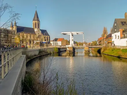
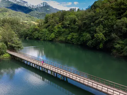
- River Shannon greenway bridge at Athlone: Opened in August 2023, this pedestrian and cycle bridge carries the route across the Shannon into Athlone town. It makes the castle and waterfront a natural start or finish.
- Athlone Castle & waterfront: At the western end, the 13th-century castle visitor centre and Luan Gallery sit beside the Shannon. They add an easy town-based cultural stop before or after the trail.
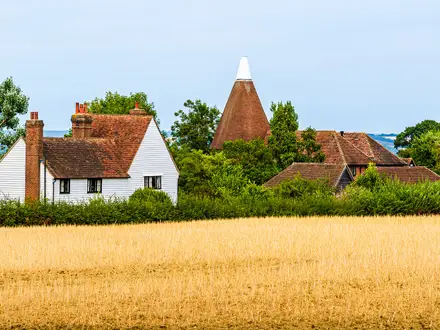
- Farmland and wildlife corridor: The route passes through fertile Westmeath farmland, hedgerows, bog and woodland. The flat, quiet corridor is well suited to relaxed cycling, family walking and birdlife.
Challenges to expect
The terrain is easy, but 43 km is still a long walking day on a hard paved surface, so foot fatigue is the main challenge. Navigation is straightforward thanks to waymarking and the former railway alignment. Weather is the other factor: rain can occur in any month, so carry waterproofs and layers. Services are available in the main towns and at Moate, but take food and water between stops.
HikeList Score
Old Rail Trail scored 64/100 on HikeList's trail-quality metrics.
See score breakdownHide breakdown
- Ideal length 55
- Balanced challenge 50
- Scenery & wildness 66
- Varied terrain 80
- Accommodation 91
- Food & support 68
- Path quality 37
- Season flexibility 63
Computed from length, challenge, scenery & wildness, terrain variety, accommodation, food & support, path quality and season flexibility.
 Ireland
Show more data Show less
- Farmland
- Hedgerows
- Bog
- Woodland
- Urban Rural
- Paved
- Hotels
- B&Bs
- Hostels
- Wheelchair Accessible
- Stroller Accessible
- Family Friendly
- Pet Friendly
- Restrooms
- Picnic Areas
Photos from hikers
Taken on the trail by people who've reviewed Old Rail Trail.
Start in Athlone, using the River Shannon bridge link into town, then follow the sealed former railway corridor via Garrycastle, Mount Temple, Maghermore, Moate, Rosemount, Streamstown, Castletown Station, Dysart and Ballinea to Mullingar. On foot this is a long but easy day; many walkers may prefer to split it around Moate.
Reviews
How would you rate Old Rail Trail?
Tap a star to start your review — you could be the first.