Negoiu Peak Summit Trail
How would you rate Negoiu Peak Summit Trail?
Tap a star to share your experience and help other hikers.
Negoiu Peak Summit Trail: Făgăraș Scramble Guide
HikeList Score
Negoiu Peak Summit Trail scored 75/100 on HikeList's trail-quality metrics.
See score breakdownHide breakdown
- Ideal length 59
- Balanced challenge 74
- Scenery & wildness 98
- Varied terrain 83
- Accommodation 58
- Food & support 65
- Path quality 98
- Season flexibility 76
Computed from length, challenge, scenery & wildness, terrain variety, accommodation, food & support, path quality and season flexibility.
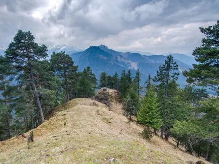
Negoiu Peak is a hard 15 km out-and-back summit hike in the Făgăraș Mountains of Romania, reaching 2,535 m on the country’s second-highest peak. Expect about 1,300 m of ascent, a 10–12 hour walking day for fit hikers, and exposed chain-assisted scrambling near the top. It suits experienced mountain walkers with sure feet, good route-finding and a head for heights. For a longer high-ridge objective, compare the Carpathian Ridge Trail.
Route Overview
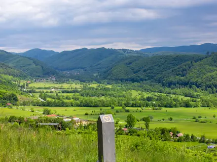
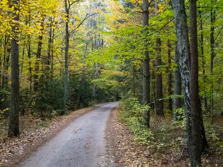
The popular Bâlea Lake variant starts beside the Transfăgărășan at Bâlea Lake and follows the marked ridge west over Șaua Doamnei, past Laitel Peak and Saua Paltinului, then drops towards Lake Călțun before the final climb to Negoiu. It returns the same way, unless linked into a wider Făgăraș traverse. The northern variant starts from Porumbacu de Sus, climbs through forest to Cabana Negoiu, then heads up the Sărății valley and Piatra Prânzului to the ridge. Bâlea Lake is reached by car when the Transfăgărășan is open, or by cable car when the road is closed. Nearby shorter walking includes Bâlea Lake to Bâlea Waterfall.
Negoiu’s place in Romanian mountaineering
Negoiu was long considered Romania’s highest summit until early-20th-century surveys confirmed nearby Moldoveanu as slightly higher. Its position on the Făgăraș main ridge made it an early focus for Romanian mountaineers, and Cabana Negoiu became one of the country’s best-known mountain huts. Today the mountain remains a serious objective rather than a simple high-point walk, especially because of the exposed summit approaches.
Notable highlights
- Negoiu summit (2,535 m): Romania’s second-highest peak, after Moldoveanu, with a wide view along the Făgăraș ridge. On exceptionally clear days, the Danube plain can be visible far to the south.
- Strunga Doamnei and Strunga Dracului: These rock notches guard the summit ridge. Strunga Dracului was closed in 2018 after rockfall damaged its chains, so the yellow-marked, chain-assisted Strunga Doamnei is now the standard way up.
- Lake Călțun: A glacial tarn at around 2,135 m below the summit. It is the usual camping point for hikers splitting the climb over two days.
- Bâlea Lake and the Transfăgărășan: The Bâlea approach starts at a high glacial lake beside Romania’s famous mountain road, making it the most direct ridge variant when access is open.
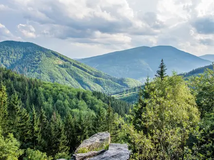
- Făgăraș main ridge: Negoiu sits on the spine of the Southern Carpathians. If you want more Romanian alpine terrain without this summit scramble, consider the Bucura Lake Circuit.
Challenges to expect
This is a hard alpine route, not a casual lake walk. The upper section has exposed rock, scree, boulder fields, fixed cables and chains, with real consequences in poor weather. Snow tongues can persist into August, and summer nights near the high lakes can stay close to freezing. Carry layers, navigation and enough food; there is no resupply on the ridge.
HikeList Score
Negoiu Peak Summit Trail scored 75/100 on HikeList's trail-quality metrics.
See score breakdownHide breakdown
- Ideal length 59
- Balanced challenge 74
- Scenery & wildness 98
- Varied terrain 83
- Accommodation 58
- Food & support 65
- Path quality 98
- Season flexibility 76
Computed from length, challenge, scenery & wildness, terrain variety, accommodation, food & support, path quality and season flexibility.
 Romania
Show more data Show less
- Mountainous
- Forest
- Alpine
- Dirt
- Rocky
- Scree
- Huts
- Wild Camping Spots
- Pet Friendly
- Water Sources
- Campsites
- Shelters
Photos from hikers
Taken on the trail by people who've reviewed Negoiu Peak Summit Trail.
Reviews
How would you rate Negoiu Peak Summit Trail?
Tap a star to start your review — you could be the first.