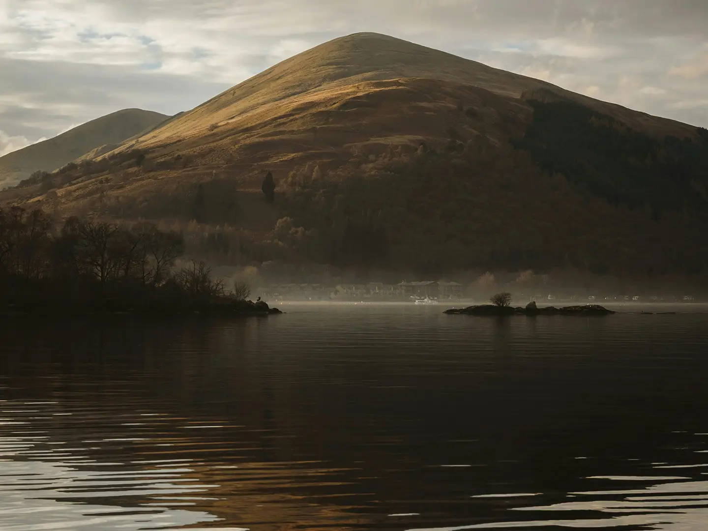
Loch Lomond & Cowal Way
How would you rate Loch Lomond & Cowal Way?
Tap a star to share your experience and help other hikers.
Loch Lomond & Cowal Way: Scotland in 57 Miles
HikeList Score
Loch Lomond & Cowal Way scored 92/100 on HikeList's trail-quality metrics.
See score breakdownHide breakdown
- Ideal length 85
- Balanced challenge 100
- Scenery & wildness 82
- Varied terrain 100
- Accommodation 100
- Food & support 94
- Path quality 84
- Season flexibility 89
Computed from length, challenge, scenery & wildness, terrain variety, accommodation, food & support, path quality and season flexibility.
The Loch Lomond & Cowal Way is a 92 km / 57 mile point-to-point walk across the Cowal peninsula in Argyll and Bute, running from Portavadie on Loch Fyne to Inveruglas on Loch Lomond. Usually walked in 5 days, this Scottish long-distance trail is moderate overall, with forest tracks, lochside paths, moorland and quiet roads. It suits hikers who want a compact Highland-style route with good waymarking, varied terrain and one rough, navigationally serious final stage.
Route Overview
The route crosses Cowal diagonally from south-west to north-east, starting at Portavadie marina on Loch Fyne and finishing at Inveruglas on the western shore of Loch Lomond. Key places on the way include Tighnabruaich and Kames, Glendaruel, Strachur, Lochgoilhead, Arrochar and Inveruglas. It is a point-to-point trail, fully waymarked with its own logo, and links towards the West Highland Way via Loch Lomond as well as the Kintyre Way. Glasgow and its airport are under an hour away. For other west-coast options, compare the Arran Coastal Way or the Ayrshire Coastal Path.
History of the Loch Lomond & Cowal Way
The trail was first established in 2000 as the Cowal Way. It was renamed the Loch Lomond & Cowal Way in December 2018 to reflect how much of the route lies within Loch Lomond & The Trossachs National Park and to give the walk clearer recognition. It has been listed as one of Scotland’s Great Trails by NatureScot/SNH since 2016 and is managed by the Colintraive and Glendaruel Development Trust.
Notable highlights
- Portavadie and Loch Fyne: The walk starts at Portavadie’s marina on Loch Fyne, giving immediate sea-loch and Firth of Clyde views before the route turns inland.
- Tighnabruaich and the Kyles of Bute: Near Tighnabruaich, the trail looks over the Kyles of Bute, the narrow straits between the Cowal peninsula and the Isle of Bute.
- Glendaruel and remote glens: The middle stages cross quiet glens, forestry and moorland around Glendaruel, showing why the route is promoted as “Scotland in 57 miles”.
- Lochgoilhead and Loch Goil: Lochgoilhead sits at the head of Loch Goil within Argyll Forest Park, making it a natural overnight stop before the hardest section.
- High bealach to Loch Lomond: The final stage crosses a rough, boggy pass near Glen Coilessan at about 500 m, the route’s highest and wildest section.
- Arrochar and the Arrochar Alps: Arrochar, at the head of Loch Long, is the gateway to the Arrochar Alps, including The Cobbler, near the route’s end.
Challenges to expect
Expect an undulating route on mixed surfaces: forest gravel, hill paths, moorland, lochside paths and some tarmac lanes. The main difficulty is the final Lochgoilhead-to-Inveruglas stage, which crosses a rough, boggy and faintly pathed bealach marked partly by wooden posts. In poor weather, map-and-compass skills are advised. Some accommodation and services are seasonal, especially outside April to October.
HikeList Score
Loch Lomond & Cowal Way scored 92/100 on HikeList's trail-quality metrics.
See score breakdownHide breakdown
- Ideal length 85
- Balanced challenge 100
- Scenery & wildness 82
- Varied terrain 100
- Accommodation 100
- Food & support 94
- Path quality 84
- Season flexibility 89
Computed from length, challenge, scenery & wildness, terrain variety, accommodation, food & support, path quality and season flexibility.
 United Kingdom
 Scotland
Show more data Show less
- Coastal
- Forest
- Hillside
- Moorland
- Lochside
- Gravel
- Rough Hill Paths
- Moorland
- Paved
- Hotels
- B&Bs
- Hostels
- Campsites
- Wild Camping Spots
- Family Friendly
- Dog Friendly On Leash
- Non Potable Water Sources
- Established Campsites
- Shelters
- Picnic Areas
- Public Transport Access Points
Download Our Full Guide to Loch Lomond & Cowal Way FREE!
Get our comprehensive guide to this hike for free. Save it for later reading or print out at home.
In these collections
Photos from hikers
Taken on the trail by people who've reviewed Loch Lomond & Cowal Way.
Loch Lomond & Cowal Way: The Complete Guide
 i
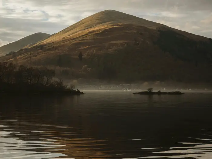
Image by Laura Meinhardt
i
Image by Laura Meinhardt The Loch Lomond & Cowal Way is a compact Highland-style crossing of the Cowal peninsula, running 92 km from Portavadie on Loch Fyne to Inveruglas on the western shore of Loch Lomond. It suits fit walkers who want sea lochs, quiet glens, forest tracks and open hill country without committing to a very long trail.
The route starts with Firth of Clyde and Loch Fyne views before passing Tighnabruaich, Kames and the Kyles of Bute. From there it turns inland through Glendaruel and Strachur, with forestry, moorland and valley walking giving the trail its “Scotland in 57 miles” character.
The final third feels wilder, moving through Lochgoilhead, the Arrochar Alps and the high bealach — a Scottish Gaelic word for a mountain pass — near Glen Coilessan. In clear weather this section can give views towards Ben Lomond, Ben Bheula, The Brack and the Luss Hills before the route drops towards Arrochar and Loch Lomond.
Most of the walk is moderate, waymarked and on forest tracks, quiet roads and lochside paths. The final Lochgoilhead-to-Inveruglas stage is the crux: rough, boggy, faintly pathed and exposed enough to make navigation skills important in poor weather.
This guide covers stages, daily planning, accommodation, food and water, transport, terrain, navigation, gear and common mistakes.
Stage-by-Stage Guide
Stage 1: Portavadie to Tighnabruaich — 10 km / 6 miles
This is the easiest day of the Loch Lomond & Cowal Way and a gentle introduction to the route. From Portavadie marina on Loch Fyne, the trail climbs gradually to around 85 m in the first couple of kilometres, then continues on a mix of forest tracks, paths and quiet road.
Underfoot conditions are generally straightforward and navigation is simple, with clear waymarking and no serious route-finding issues. It is an undulating coastal-and-woodland stage rather than a hill day, so most walkers can take it steadily without needing an early start.
The stage has several points of interest despite its short distance. The route passes the ruins of Asgog Castle, remains associated with an old gunpowder mill, and a Second World War tank landing slip, before the views open towards the Kyles of Bute as Tighnabruaich approaches.
Food is easiest to arrange at the start and finish. Portavadie marina has several dining options, including The Lodge Kitchen & Bar, the Marina Restaurant and the Leisure Café. Hayshed Gallery & Cafe may also suit as a refreshment stop if opening hours fit the day, but there should be no assumption of reliable mid-stage shops, so carry snacks and water.
Tighnabruaich has the best overnight services for this stage, with the Royal An Lochan on the seafront plus other B&B and self-catering options. Nearby Kames, around 1 km south, has The Kames Hotel, Kames Village Store and other services; Carry Farm eco-camping lies south of Kames, before Tighnabruaich. Tighnabruaich itself has village facilities including a Spar, post office, cafés, restaurants and a pub.
There is no railway on this part of Cowal. Portavadie is linked to Tarbert on Kintyre by the CalMac ferry across Loch Fyne, and Argyll bus services connect the area with Dunoon and the wider Glasgow direction. Bus times should be checked carefully, especially outside the main April–October walking season.
Stage 2: Tighnabruaich to Glendaruel — 18 km / 11 miles
Stage 2 leaves the coast and works inland towards Glendaruel, with mostly gentle walking on quiet public and private roads. The main exception is a rougher shoreline and woodland section of around 1.5 km, which is steeper, narrower and more awkward than the rest of the day.
The shoreline passage includes rocky ground, boulders, wooden walkways and steps. It should not be attempted on a particularly high tide; if the tide is high, the safer option is to move up slightly earlier at the edge of the trees to avoid the lower shoreline line. Tide times should be checked before setting out, and the official app includes tide information.
Waymarking is generally good, but this is a day where junctions and small path choices deserve attention. Look carefully for the waymarkers through the rugged shoreline section, especially where the line threads between rocks and woodland.
Landmarks give the stage plenty of interest. The route passes Thomas Telford-designed bridges, Kilmodan Church with historic carved Iona-style grave slabs, the Lucknow Gates, Caladh Castle ruins, Eilean Dubh, Ormidale Lodge and Ormidale Pier. Dunans Castle Heritage Trail can be added as a side-trip, but it adds time and distance and should be planned deliberately rather than treated as incidental.
Food and water are very limited between Tighnabruaich and Glendaruel. Carry a full day’s food and enough water from the start, rather than relying on finding supplies en route.
Glendaruel Camping and Caravan Park is a key overnight option, with tent pitches, a Camping Lodge, bothies and a shop. Eco Nature Holidays offers self-catering in the area. Glendaruel Hotel has been listed as closed, so its current status should be checked before travelling.
Glendaruel is served by Argyll buses, but services are infrequent. This stage is practical for walkers using luggage transfer or pre-booked accommodation, but last-minute transport fixes can be difficult.
Stage 3: Glendaruel to Strachur — 26 km / 16 miles
This is the longest standard stage, and the challenge is distance rather than difficult ground. The walking is mainly on forestry and farm tracks, woodland trails and quiet lanes, with a steady climb to around 360 m before descending back towards Loch Fyne.
The route continues up the Glendaruel valley, joins tracks by the Garvie Burn, crosses open moorland, and passes through forestry around Strath nan Lub. It then descends into Glen Branter by the Allt Robuic gorge, where waterfalls and woodland make this one of the strongest landscape sections of the middle route.
There are several features and possible short detours. Kildalvan ruins are passed, the Eas Davain burn cascades are on the route, and the Home Farm Woodland Walk can be used as a short diversion early in the stage. Dunans Castle Heritage Trail is also an option if it was not visited on Stage 2, but it adds extra time to an already long day.
Navigation is usually straightforward on the forestry tracks, but there is one important point before the Allt Robuic gorge: the left turn onto the narrow path through the trees can be easy to miss, so slow down at junctions and watch for waymarkers. The final 4 km into Strachur are on quiet public road, which is easy walking but less sheltered from traffic than the forest sections.
There are no reliable food stops mid-stage. Carry food and water for the full 26 km, and start with enough for a longer day on foot.
Strachur has useful end-of-stage services. Accommodation includes Balliemeanoch Breaks B&B and Creggan’s Inn, where food may be available through MacPhunn’s Bar & Restaurant or the Loch Fyne Dining Room, subject to season and opening. Out of the Blue Bistro includes a post office/shop, and the Clachan Bar is another local option; additional accommodation lies around 1 km along the Loch Fyne shore from the village centre.
Strachur is on the Dunoon–Inveraray bus route. Timetables should be checked before travelling, particularly if using Strachur as a section-hike access point.
Stage 4: Strachur to Lochgoilhead — 14 km / 9 miles
Stage 4 is shorter than the previous day but more varied and more demanding underfoot. It begins on quiet road, then uses farm and forest tracks before crossing rougher open ground and descending towards Lochgoilhead.
The route leaves Strachur, passes the Succoth Farm junction, crosses the River Cur and continues past the Leavanin burn. It then climbs towards Curra Lochain, a remote hilltop loch, before descending by zig-zags after the burn crossing at the loch’s outflow.
This is a good day for open-hill atmosphere, especially around Curra Lochain and the Sruth Ban falls. The falls drop dramatically into the glen below, and the stage gives a strong sense of moving from Loch Fyne into the higher, rougher ground that leads towards Loch Goil.
The open-ground section can be indistinct and boggy. White marker posts and swing gates help with route-finding, but the stage is more navigationally demanding than the first two days in poor weather. Several stiles and stream crossings add to the slower progress.
The Leavanin burn and other small stream crossings require care when water levels are high. If in doubt at the Leavanin burn, go higher rather than forcing an awkward crossing lower down.
There are no dependable food or water stops on the stage itself, so carry what is needed from Strachur. After the hill section, the route descends through forestry around the Lettermay forest gate and continues by road and track to Lochgoilhead.
Lochgoilhead, at the head of Loch Goil within Argyll Forest Park, is the natural overnight stop before the hardest day. Accommodation options include Rowan House B&B, The Shore House, Lochwood House and holiday cottages. The Goil Inn provides pub and restaurant facilities, subject to opening times.
Lochgoilhead has Argyll bus links towards Dunoon and the Glasgow direction, but services are limited. Check timetables carefully before relying on public transport here.
Stage 5: Lochgoilhead to Inveruglas via Arrochar — 24 km / 15 miles
This is the crux of the Loch Lomond & Cowal Way and should be treated as a proper hill day. The full stage combines a steep climb to the high bealach — the Scottish Gaelic word for a mountain pass — rough and boggy open ground, a steep descent, forestry, road walking by Loch Long, and the final approach to Inveruglas on Loch Lomond.
Many walkers split this stage at Arrochar, making a 6-day itinerary. Lochgoilhead to Arrochar is around 14.5 km / 9 miles, leaving a short final Arrochar to Inveruglas section of around 8 km / 5 miles. This is a sensible option in poor weather, for slower parties, or where transport and accommodation work better.
From Lochgoilhead the route uses quiet road, then farm and forest tracks before climbing towards the high pass near Glen Coilessan. Beyond the forest gate, the path can almost disappear on the open hillside, and the crossing is marked mainly by white posts.
The pass reaches roughly 500 m and is the wildest point of the trail. In clear weather there are views towards the Luss Hills, Ben Lomond, Ben Bheula, The Brack and the Arrochar Alps. A cairn by a small lochan marks the high point.
Navigation is serious in poor visibility. The route is waymarked, but mist, rain or low cloud can make the posts hard to follow across boggy, exposed ground, and a map and compass may be needed. The official route description gives compass bearings between marker posts for this section, so carry proper mapping rather than relying only on waymarks or a phone screen.
The descent from the bealach towards Glen Coilessan and Ardgartan is steep and can be boggy. Take extra care after heavy rain, when the ground is slower and small burns may be more awkward.
After the hill section, the route reaches the Loch Long side and continues towards Arrochar. Ardgartan’s former visitor facilities are closed, so do not plan food, toilets or shelter around them.
Arrochar is the key service point on the final day and the best place to split the stage. Accommodation and food options include the Arrochar Hotel, Ardgartan Hotel, Loch Long Hotel, Village Inn, Ben Arthur’s Bothy and Lochside Guest House. The village also gives access to The Cobbler / Ben Arthur, but that ascent should be treated as an extra hill day rather than added casually to the long-distance route.
Arrochar & Tarbet railway station, on the West Highland Line, is the most useful public transport link near the end of the trail, with trains towards Glasgow and beyond. Buses also serve the Arrochar and Tarbet area. For many walkers, this station is the practical exit point either after Stage 5 or after returning from Inveruglas.
The final section from Arrochar to Inveruglas is around 8 km and follows a mix of road walking and lochside path by Loch Long and Loch Lomond. The A82/A83 junction and nearby roads are busy, so road crossings and verge walking need care.
The route finishes at Inveruglas on the western shore of Loch Lomond, by the visitor centre and the An Ceann Mòr viewpoint. Facilities include Café Lochan and toilets at the visitor centre, with Loch Lomond Holiday Park nearby for accommodation and camping. Boat trips operate from Inveruglas, and onward transport should be planned in advance; the most reliable rail connection remains Arrochar & Tarbet rather than the finish itself.
Recommended Itinerary
The 5-day schedule is the most practical plan for most walkers: it keeps the early stages manageable, uses the established trail villages for overnight stops, and leaves the final high crossing as a full, serious mountain day. Accommodation and food are not evenly spaced, so book beds before fixing travel, especially outside the main April–October season.
Standard itinerary — 5 walking days
| Day | From | To | Approx. distance | Why this stage makes sense | Services/accommodation notes |
|---|---|---|---|---|---|
| 1 | Portavadie | Tighnabruaich | ~10 km | A short opening stage, useful if arriving by the Tarbert–Portavadie ferry. The walking is a gentle start on forest tracks, quiet roads and undulating ground, with early views over Loch Fyne and the Kyles of Bute. | Stay in Tighnabruaich or nearby Kames. Options include Royal An Lochan, Kames Hotel and Carry Farm eco-camping south of Kames. Kames Village Store is the key place to restock. |
| 2 | Tighnabruaich | Glendaruel | ~18 km | A fuller but still sensible second day, moving from the Kyles inland towards the quieter Cowal glens. Expect quiet roads, shoreline and woodland sections, including upgraded walkways and steps. | Glendaruel is a small hamlet with limited services. Accommodation includes Glendaruel Camping & Caravan Park and Eco Nature Holidays, though some self-catering may have minimum-stay requirements. There is nowhere to buy refreshments along this section, so leave Tighnabruaich/Kames with food. |
| 3 | Glendaruel | Strachur | ~26 km | The longest day of the standard itinerary, but it is generally the right place to put the distance because much of the walking is on well-maintained forest tracks, open moorland, forestry and quiet road. The route passes through Glen Branter, with waterfalls and open views. | Strachur has better end-of-day services than Glendaruel. Accommodation and food options include Balliemeanoch Breaks B&B, Creggans Inn, Out of the Blue Bistro, Clachan Bar and Creggans Inn restaurant. Out of the Blue also has a post office and shop, making this an important resupply stop. |
| 4 | Strachur | Lochgoilhead | ~14 km | A shorter day before the crux stage. The walking includes open moorland, waymarked but sometimes indistinct and boggy ground, several stiles and small stream crossings, with Sruth Ban Falls as the main scenic feature. | Lochgoilhead is the natural overnight stop before the final high crossing. Accommodation includes Rowan House B&B, Shore House Inn, Lodge on Loch Goil, Drimsynie House Hotel, Goil Inn and self-catering options. Shops include a Costcutter and a post office grocery store. |
| 5 | Lochgoilhead | Inveruglas, via Arrochar | ~24 km | The hardest and most serious day. The route crosses the high bealach near Glen Coilessan, where the path can become faint and boggy and navigation matters in poor visibility, before descending towards Arrochar and continuing by Loch Long and Loch Lomond to Inveruglas. | Arrochar is the main mid-stage service point and also an escape point via Arrochar & Tarbet station. Accommodation and food options in Arrochar include Ardgartan Hotel, Arrochar Hotel, Loch Long Hotel, Village Inn and Ben Arthur’s Bothy. Inveruglas has the visitor centre, toilets and café, but services are limited, so onward travel or accommodation should be planned in advance. |
Slower itinerary — 6 walking days
This is the best option for walkers who want a gentler finish, prefer not to combine the high bealach with the Loch Lomond approach, or want time in Arrochar for an additional hill day such as The Cobbler. Days 1–4 stay the same as the standard itinerary.
| Day | From | To | Approx. distance | Why this stage makes sense | Services/accommodation notes |
|---|---|---|---|---|---|
| 1 | Portavadie | Tighnabruaich | ~10 km | Short, easy start after travelling to the trailhead. | Use Tighnabruaich or Kames for accommodation and supplies. |
| 2 | Tighnabruaich | Glendaruel | ~18 km | Moves inland without making the early itinerary too demanding. | Stock up before leaving Tighnabruaich/Kames; Glendaruel has limited services. |
| 3 | Glendaruel | Strachur | ~26 km | Still the longest day, but it fits the available village spacing. | Strachur is the key resupply and food stop before the last two days. |
| 4 | Strachur | Lochgoilhead | ~14 km | Shorter stage before the rougher high ground. | Lochgoilhead has accommodation, shops and useful pre-crux services. |
| 5 | Lochgoilhead | Arrochar | ~14.5 km | Splits the hardest terrain from the final lochside finish. This is the day over the bealach near Glen Coilessan, so it still needs good weather judgement and navigation skills. | Arrochar has the best range of late-route accommodation and food, plus Arrochar & Tarbet station nearby. It is the logical place to pause before finishing. |
| 6 | Arrochar | Inveruglas | ~7.75 km | A short final stage on forest roads and marked paths towards Loch Lomond and Inveruglas. | Inveruglas has the visitor centre, toilets and café, but limited wider services. Check onward transport and accommodation before travelling. |
Faster itinerary — 4 walking days
A 4-day schedule is possible for fit, efficient walkers, but it is less balanced than the 5-day plan. It creates a long first day, keeps the longest middle stage, and still leaves the rough Lochgoilhead-to-Inveruglas crossing as a full final day.
| Day | From | To | Approx. distance | Why this stage makes sense | Services/accommodation notes |
|---|---|---|---|---|---|
| 1 | Portavadie | Glendaruel | ~28 km | Combines the short Portavadie–Tighnabruaich stage with the Tighnabruaich–Glendaruel stage. This only suits walkers comfortable starting with a long day and carrying enough food through the service-light second section. | Resupply at Kames before continuing inland. Glendaruel has limited services, so accommodation must be arranged carefully. |
| 2 | Glendaruel | Strachur | ~26 km | Keeps the standard longest stage intact. Underfoot conditions are generally favourable compared with the final high crossing, but the distance is still substantial. | Strachur is the main opportunity to eat, resupply and reset before the eastern half of the route. |
| 3 | Strachur | Lochgoilhead | ~14 km | A shorter recovery day before the navigationally serious final stage. | Lochgoilhead is the best overnight base before the bealach crossing. Stock up here rather than relying on facilities later in the day. |
| 4 | Lochgoilhead | Inveruglas, via Arrochar | ~24 km | A demanding finish over the route’s highest and wildest ground, followed by the approach through Arrochar and on to Inveruglas. Do not treat this as an easy final day. | Arrochar is the practical bail-out or break point if weather, time or fatigue make continuing unwise. Plan transport from Inveruglas in advance. |
Planning the Route
How many days to allow
Most walkers should plan on 5 walking days, with accommodation booked for the night before starting and at each overnight stop. This fits the natural spacing of the villages and gives a sensible progression from the short coastal opener to the rougher, more serious final stage.
A 6-day itinerary is often the better choice if you want a less pressured finish. The usual split is to walk from Lochgoilhead to Arrochar, stay there, then continue to Inveruglas the next day. This also gives more flexibility if poor weather makes the high bealach — the Scottish Gaelic word for a mountain pass — unattractive or unsafe.
A 4-day itinerary is possible for strong walkers, but it makes the logistics tighter. The most obvious compression is to combine Portavadie to Tighnabruaich with Tighnabruaich to Glendaruel, making a long first day of about 28 km. This is a fast-walking plan rather than the default way to experience the route.
| Plan | Structure | Best for | Main caution |
|---|---|---|---|
| 5 days | Standard Portavadie to Inveruglas itinerary | Most fit walkers | Final day is long and has the roughest navigation |
| 6 days | Split the final stage at Arrochar | Walkers wanting shorter days or more weather flexibility | Requires an extra night in Arrochar |
| 4 days | Combine shorter stages | Experienced, efficient walkers | Accommodation, food and transport become less forgiving |
How the overnight stops shape the walk
The route is strongly dictated by where accommodation exists. The practical overnight sequence is Portavadie, Tighnabruaich or Kames, Glendaruel, Strachur, Lochgoilhead and then either Arrochar or the finish at Inveruglas.
The pressure points are Glendaruel and Strachur, where accommodation is limited. Glendaruel has options including Glendaruel Camping & Caravan Park and Eco Nature Holidays, but availability and minimum-stay rules can affect plans. Strachur also has only a small number of choices, including Creggans Inn and Out of the Blue Bistro.
Lochgoilhead is the key stop before the final crossing and should not be treated as optional unless you are deliberately walking a much longer day. Arrochar has a much wider choice of accommodation and transport links, which is why it is the natural place to split the final stage.
Inveruglas is primarily a finish point, with the visitor centre, car park and access to onward transport. Do not assume there will be convenient accommodation at the finish itself; many walkers either stop in Arrochar before the final stretch or leave Inveruglas after finishing.
Booking accommodation
Accommodation should be booked well in advance, especially for summer and for the smaller stops in Glendaruel, Strachur and Lochgoilhead. Turning up without reservations is a poor strategy on this route.
Many services operate seasonally, with the main walking season running from April to October. Outside that period, accommodation, food and luggage options can be much harder to arrange. Minimum stays may also apply at some properties, so build the itinerary around confirmed beds rather than around an ideal stage plan.
Self-guided holiday companies can be useful when accommodation is tight because they arrange rooms, baggage transfer and daily logistics as a package. Independent walkers should still book early and confirm current opening dates, meal availability and check-in arrangements before travelling.
Shortening, extending and section hiking
Section hiking is practical because the route passes through a chain of villages with bus or taxi options, though services are not frequent enough to improvise casually. Timetables should be checked before travelling.
Useful standalone sections include:
| Section | Why it works well |
|---|---|
| Portavadie to Tighnabruaich | A short coastal half-day with views over Loch Fyne and the Kyles of Bute |
| Strachur to Lochgoilhead | A hillier section with Sruth Bàn / Sruth Ban Falls and good access at Lochgoilhead |
| Lochgoilhead to Arrochar | The highest and most serious part of the route, best saved for a clear forecast |
West Coast Motors service 478 links Dunoon and Portavadie via places including Glendaruel and Tighnabruaich, making the first half more workable for day walks or short breaks. Arrochar is the best transport base for the eastern end, with Arrochar & Tarbet station on the West Highland Line and bus links nearby.
The route can be split into two multi-day trips, for example Portavadie to Strachur or Lochgoilhead, then Lochgoilhead or Arrochar to Inveruglas. Extending the walk is less straightforward because there is no obvious continuous bolt-on trail from the route itself. Some walkers add time in Arrochar for a side trip to The Cobbler, but that is a separate hill day and should be planned as such.
Transport planning
Transport needs to be arranged before setting off because the route is point-to-point and Portavadie is remote. Reaching Portavadie from Glasgow normally involves a combination of train, ferry and bus, taking roughly 2 to 2.5 hours depending on connections. This should be checked before travelling.
At the finish, Inveruglas is on the A82 by Loch Lomond. Scottish Citylink services 914, 915 and 916 serve the Glasgow Buchanan Street to Sloy Power Station corridor, giving a practical onward option from the Loch Lomond end. Current stops and times should be checked before travelling.
Ferries also form part of the wider access picture, with the Portavadie–Tarbert ferry across Loch Fyne and a Loch Lomond ferry option from Inveruglas. These can be useful for creative itineraries, but sailing times and seasonal operation should be checked before booking accommodation around them.
Luggage transfer
Luggage transfer is available and is worth arranging if you want to keep the hill days light. Balliemeanoch Baggage is the dedicated door-to-door service for the trail and covers the main overnight stops.
This should be booked ahead, not treated as an on-the-day add-on. If using accommodation with limited reception hours or self-catering units, make sure both the accommodation and luggage provider know the delivery arrangements.
Navigation and maps
The Loch Lomond & Cowal Way is waymarked with its own distinctive logo, including timber waymarkers and section signs. That is helpful for most of the route, but it does not remove the need for proper navigation.
The final Lochgoilhead to Inveruglas stage is the navigational crux. The crossing near Glen Coilessan reaches about 520 m and includes rough, boggy ground where the path can be faint; wooden posts mark part of the way, but poor visibility can make this section serious. A map and compass should be carried and used confidently.
The route is covered by OS Explorer 362, 363 and 364. The official Cowal Way App is also useful because it includes waymarker information and tide details, while the Rucksack Readers guidebook provides a paper planning and route backup. GPX files are available through the komoot staged collection, but a phone or GPS should not be the only navigation tool for the final high crossing.
Weather, season and timing
The route is best planned for spring, summer or autumn, with April to October the main practical season for services. In winter, the final high section is only suitable for very experienced walkers with appropriate hill skills, equipment and daylight planning.
Check the weather forecast carefully before leaving Lochgoilhead. Wind, rain, low cloud and poor visibility have a much greater effect on the bealach crossing than on the lower forest tracks and quiet road sections earlier in the walk.
There is also one tidal consideration: the Tighnabruaich to Glendaruel section should not be tackled during a particularly high tide. Tide times should be checked before travelling, and the official app includes tide information.
Food, water and daily supplies
Plan food around the overnight villages and pre-arranged meals. Smaller stops have limited and seasonal services, so do not rely on finding shops, cafés or pub meals without checking opening times in advance.
Carry a full day’s food and enough water each morning, especially for the Glendaruel to Strachur day and the Lochgoilhead to Inveruglas stage. The final crossing should be treated as a hill day: leave with snacks, spare layers and enough fluids rather than expecting convenient resupply en route.
Permits and camping
No permit is required to walk the Loch Lomond & Cowal Way. Wild camping is generally allowed in Scotland under the Scottish Land Reform Act 2003 when done responsibly.
The important exception is the Loch Lomond & The Trossachs National Park camping management zone on parts of the Loch Lomond shore, including areas relevant near Inveruglas. If planning to camp near the finish, check the current National Park camping permit rules before travelling.
Towns, Villages and Overnight Stops
Services on the Loch Lomond & Cowal Way are useful but unevenly spaced. Tighnabruaich/Kames, Strachur and Lochgoilhead are the key resupply points; Glendaruel is much thinner, and Inveruglas is a finish point rather than a full village.
Accommodation should be booked ahead in the main walking season, especially from April to October. Several places are small, seasonal or holiday-focused, so turning up without a bed arranged is a poor strategy on this route.
Portavadie
Portavadie is the start of the trail on the east shore of Loch Fyne, reached by ferry from Tarbert. It is not a conventional village: the practical centre is Portavadie Marina, a full-service resort rather than a settlement with separate shops and pubs.
For walkers, Portavadie works best as a pre-trail overnight stop. Accommodation includes The Lodge, Studio Apartments, Luxury Apartments and cottages, with dining at the Lodge Kitchen & Bar, Marina Restaurant and Leisure Café.
The resort also has pools, spa and gym facilities, which make it a comfortable start if the budget allows. Budget-conscious hikers may find it more than they need, but it is the simplest place to stay immediately at the start.
There is no separate village shop or independent pub away from the resort facilities. Any food needed for the first day should be bought before arrival or from available resort options, with opening times checked before travelling.
Tighnabruaich and Kames
Tighnabruaich is the usual first overnight stop, about 10 km from Portavadie. Kames sits alongside it on the shore of the Kyles of Bute, and for trail planning the two villages are effectively one combined stop.
This is the best-served place on the first half of the route. Accommodation options include Kames Hotel, Royal An Lochan Hotel, Tighnabruaich Hotel, Evanachan Cottage B&B, Tregortha B&B and Carry Farm Shop & Holiday Park; Kilfinan Hotel is a few miles away rather than directly in the village pair.
Food choices are unusually good for a small trail stop. Options include The Oystercatcher Pub Restaurant, The Little Kitchen, Suzy’s Tearoom, Botanica Restaurant & Rooms in Kames, The Tearoom and dining at Kames Hotel.
Kames Village Store is one of the most useful resupply points on the whole walk, with groceries, butcher meat, Scottish cheeses, local beers and wines. There is also a Spar supermarket, Tighnabruaich Post Office and banking on Main Street.
Use Tighnabruaich/Kames to stock up properly before heading for Glendaruel. The next stage has no refreshments en route, so leaving with lunch, snacks and enough water is important.
Bus links run to Dunoon, and ferry access can also be used as part of wider travel arrangements. Accommodation should be booked ahead in summer, when the coastal villages are busy beyond the walking market.
Glendaruel
Glendaruel is the usual second overnight stop, about 18 km from Tighnabruaich. It is a very small place, and the main hiker facility is Glendaruel Caravan & Camping Park.
The caravan park offers tent pitches, a Camping Lodge, hikers’ huts/bothies for hire and caravan holiday homes. Facilities include toilets, showers, laundry, Wi-Fi and a small shop selling basics, local produce, wines and gifts.
There is no pub or café in the village proper, so the caravan park is effectively the overnight hub. Eco Nature Holidays also offers self-catering accommodation, with a two-night minimum.
The stage into Glendaruel crosses quiet coastal and moorland terrain with no refreshments on the way. Carry food from Tighnabruaich or Kames, and do not rely on finding a meal in Glendaruel unless it has been arranged with accommodation.
Strachur
Strachur is the third standard overnight stop, reached after the long stage from Glendaruel of about 26 km. It sits by Loch Fyne on the main road between Dunoon and Loch Lomond, close to the edge of Loch Lomond & The Trossachs National Park.
Accommodation includes Balliemeanoch Breaks B&B, a trail-focused option that is also linked with Balliemeanoch Baggage luggage transfer, and Creggans Inn on the Loch Fyne shore. Strachur is a welcome stop after the longest day of the standard itinerary.
Food and drink options include Out of the Blue Bistro, the Clachan Bar, and Creggans Inn’s MacPhunn’s Bar & Restaurant and Loch Fyne Dining Room. Out of the Blue Bistro also has the village’s small post office/shop, making it the key resupply point.
Bus links connect Strachur with Dunoon, Inveraray and Lochgoilhead. That makes it one of the more useful places for adjusting plans, though local timetables should be checked before travelling.
Lochgoilhead
Lochgoilhead is the fourth standard overnight stop, about 14 km from Strachur. It sits at the head of Loch Goil in Argyll Forest Park and is the last proper village before the hardest section of the route.
Accommodation options include Rowan House B&B, The Shore House B&B, The Goil Inn, Drimsynie Holiday Park, Lochwood House and Ederline Estate self-catering cottages. Drimsynie is a large holiday park with lodges, hotel accommodation, hot tub lodges, a swimming pool and golf course.
The Goil Inn is the classic village pub stop, with food and views across Loch Goil. Drimsynie also has the Rob Roy Lounge for pub-style food and The Bistro for a more intimate meal.
Lochgoilhead has proper village resupply, including a Post Office/shop and a small Costcutter supermarket. Use these before the final crossing: the next stage over the high bealach, the Scottish Gaelic word for a mountain pass, is rough, boggy and exposed.
A good rest here is worth planning. Accommodation is limited for the number of walkers and holiday visitors in summer, so book ahead rather than assuming space will be available.
Arrochar
Arrochar is reached on the final stage after the high crossing from Lochgoilhead. It sits at the head of Loch Long beneath the Arrochar Alps, with The Cobbler rising above the village.
On the standard 5-day itinerary, Arrochar is a pass-through stop before continuing to Inveruglas. Many walkers use it as an extra overnight stop instead, splitting the final stage and making a 6-day itinerary.
Accommodation includes Arrochar Hotel, Loch Long Hotel, Ardgartan Hotel in the glen beyond, Ben Arthur’s Bothy self-catering apartment, plus several B&Bs and guesthouses. It is the best practical base near the finish if onward transport or a shorter final day matters.
Food options include the Village Inn, Ben Arthur’s Bothy and Arrochar Fish & Chips. Braeside Stores is a useful grocery/newsagent with long opening hours, and there is a 24-hour self-service petrol station; the Post Office at Three Villages Community Hall has limited Wednesday-only hours.
Arrochar & Tarbet station is about 1–2 km from the village on the West Highland Line, with ScotRail services to Glasgow Queen Street taking about an hour. This makes Arrochar the main public-transport hub near the end of the route and a sensible fallback point if weather, injury or timing makes the final leg awkward.
Some walkers add a rest day here to climb The Cobbler, but that is a separate hill day and should not be treated as part of the Loch Lomond & Cowal Way itinerary.
Inveruglas
Inveruglas is the official finish on the western shore of Loch Lomond beside the A82. It is very small and should be thought of as a visitor-centre finish point rather than a village.
Facilities include the Inveruglas Visitor Centre, café/coffee shop facilities, toilets, information centre, gift shop, day parking and bookable campervan bays. The An Ceann Mòr viewpoint above the visitor centre is the ceremonial end point with Loch Lomond views.
Accommodation at Inveruglas itself is limited, with Loch Lomond Holiday Park the main nearby option. Many walkers either stay the previous night in Arrochar and walk to Inveruglas for the finish, or finish at Inveruglas and travel back towards Arrochar & Tarbet for onward connections.
Transport options include bus services along the A82, with Arrochar & Tarbet station reachable by bus. In summer, a seasonal ferry crosses Loch Lomond from Inveruglas to Inversnaid, where the West Highland Way passes.
Do not rely on Inveruglas for a full evening meal, late shop or last-minute bed. Café and visitor-centre opening hours are seasonal and should be checked before travelling.
Getting to the Start
Portavadie is remote and has no railway. Most public-transport approaches involve a Glasgow rail or coach journey, a ferry to Dunoon, and then the West Coast Motors 478 bus across Cowal to Portavadie. Build in slack: the final bus connection is rural, evening options are limited, and Sunday travel can be awkward. This should be checked before travelling.
By train
The most practical railhead for the start is Gourock, reached by ScotRail from Glasgow Central in about 40–50 minutes, via Paisley Gilmour Street, Port Glasgow and Greenock. Services are frequent, roughly every 30 minutes, but the onward ferry and bus timings matter more than the train frequency.
From Gourock, cross to Dunoon by ferry:
| Leg | Operator / option | Typical journey |
|---|---|---|
| Glasgow Central to Gourock | ScotRail | 40–50 min |
| Gourock to Dunoon | CalMac passenger ferry | about 25 min |
| Gourock / McInroy’s Point to Hunters Quay | Western Ferries, vehicle and passenger ferry | about 20 min |
| Dunoon to Portavadie | West Coast Motors bus 478 | about 1 hr |
CalMac’s Gourock–Dunoon ferry is passenger-only and runs frequently through the day. Western Ferries carries vehicles and passengers to Hunters Quay, just north of Dunoon, with frequent departures. Choose the ferry that best fits the bus connection onwards to Portavadie.
From Dunoon, take West Coast Motors bus 478 to Portavadie ferry terminal. The bus runs via Tighnabruaich and Kames, and the journey takes about an hour. It runs several times a day, but rural timetables are thin compared with city transport; Sunday service is very limited or may not operate. This should be checked before travelling.
From Edinburgh, take a frequent train to Glasgow, then use the Glasgow–Gourock–Dunoon–Portavadie chain. With good connections, Edinburgh to Portavadie takes roughly 3.5–4 hours.
By bus
A useful alternative from Glasgow is McGill’s bus 907 from Glasgow city centre to Dunoon. The ticket includes the ferry crossing, so there is no separate ferry ticket to arrange on that leg.
In Dunoon, connect with West Coast Motors bus 478 to Portavadie. This is the critical link for walkers using public transport, because it is infrequent and covers the final rural approach to the trailhead. This should be checked before travelling.
Arriving late in the day by public transport is risky. If the final 478 connection is missed, Portavadie is not a place where alternative onward options can be assumed. A pre-booked taxi or transfer may be possible, but it should be arranged in advance.
By car
From Glasgow, the most direct driving approach is usually via Greenock/Gourock, then Western Ferries to Dunoon, followed by the road south and west across Cowal to Portavadie. The overall journey is about 2 hours including the ferry in normal conditions.
Another option is to drive via the A83 to Tarbert, Loch Fyne, then take the CalMac Tarbert–Portavadie ferry across Loch Fyne. The crossing takes about 25 minutes, with up to 12 crossings per day in the summer timetable. The service is non-bookable, with tickets bought on board, and normally operates on a March–October summer timetable. This should be checked before travelling.
Long-stay parking at the start is not straightforward. Parking at Portavadie Marina is limited, with only a small number of spaces around the ferry terminal area, and it is not a sensible place to leave a car for 5 or more days without checking with the marina first.
Many drivers will find it more practical to leave a car at the finish and arrange onward transport to the start. Inveruglas has a visitor centre car park on the Loch Lomond side of the route, which makes more sense for end-of-walk logistics than leaving a vehicle at remote Portavadie. Any long-stay arrangement should be checked before travelling.
From the nearest airport
Glasgow Airport is the nearest major airport for Portavadie. By road it is about 82 miles from Portavadie, taking roughly 1 hr 47 min in good conditions.
By public transport from Glasgow Airport, the practical route is to reach Paisley Gilmour Street station by taxi or local bus, take the train to Gourock, cross to Dunoon by ferry, then use bus 478 to Portavadie. Allow at least 3 hours, and more if the connections are not tight.
A pre-booked taxi from Glasgow Airport to Portavadie is possible but expensive because of the distance and ferry logistics. Balliemeanoch Baggage, the route’s dedicated luggage-transfer service, also offers taxi and transfer options and may be able to help with airport transfers.
Glasgow Prestwick Airport is less convenient, as it sits further south and usually requires travelling into Glasgow first. Edinburgh Airport also normally means reaching Glasgow before following the standard Gourock–Dunoon–Portavadie route.
Where to stay before starting
The easiest place to stay is Portavadie Marina, as the Loch Lomond & Cowal Way starts there. Staying at the trailhead removes the pressure of making the Dunoon–Portavadie bus connection on the morning of Day 1.
At Portavadie Marina, The Lodge offers 4-star en-suite rooms with breakfast and access to leisure facilities. Studio Apartments offer self-catering accommodation and can be dog-friendly, with one-night stays available. Dining options at the marina include the Lodge Kitchen & Bar, Marina Restaurant and Leisure Café.
Booking ahead is strongly advised, especially in summer and at weekends. Portavadie Marina can be contacted on 01700 811075.
Dunoon is the main fallback if Portavadie is full or too expensive. It has a wider choice of hotels, guesthouses and B&Bs, but walkers staying there need to reach Portavadie by bus 478, car or pre-arranged transfer before starting the trail.
Getting Home from the Finish
The Loch Lomond & Cowal Way finishes at Inveruglas on the western shore of Loch Lomond, beside the A82 and the Inveruglas visitor centre. Treat Inveruglas as a transport stop rather than a village: there are toilets and paid parking, but no shops, pub or accommodation, and food facilities should not be relied on.
The practical onward choices are the train from Arrochar & Tarbet, Citylink coaches from the A82, or a taxi from Inveruglas or Arrochar. Timetables vary by day and season, especially in winter, so check current times before committing to a late finish.
By train
The nearest railway station is Arrochar & Tarbet, on the West Highland Line, about 3 km south of Inveruglas on the A82. It has direct ScotRail services to Glasgow Queen Street High Level, with an average journey time of about 1 hr 23 min.
Typical service levels are roughly six to nine trains per day Monday to Saturday and fewer on Sundays, with an early-morning first departure and a late-evening last train, and fares from around £16. Exact times, frequencies and prices should be checked with ScotRail before travelling, especially if planning a late finish.
The station is unstaffed. Tickets can be bought in advance online or on the train where available.
To reach Arrochar & Tarbet station from the finish:
| Option | Practical details |
|---|---|
| Walk | About 3 km south along the A82, usually 40–45 minutes. There is pavement for part of the stretch, but it is still an A-road walk after a long final day. |
| Bus | Southbound Citylink services from the Inveruglas/Sloy stop run to Tarbet, beside the station; this is a very short ride. |
| Taxi | Arrochar Taxis: 01436 678888. Balliemeanoch Baggage can also arrange collection for walkers using its transfer services. |
By bus
Scottish Citylink coaches stop on the A82 at Inveruglas, at the stop opposite Loch Sloy Power Station. This stop may also be referred to as Sloy Power Station or Loch Sloy.
Southbound services run to Glasgow Buchanan Bus Station, taking roughly 1 hr 20 min from Inveruglas. Routes using this corridor include 914 to Glasgow from Fort William, 915/916 from Fort William, Kyle of Lochalsh, Portree or Uig, 976 between Glasgow and Oban, and Ember services E5 and E16.
In summer there are multiple departures through the day, with roughly hourly options on the main 914/915/916 corridor. Winter services are reduced, and some coaches may not stop at every location in November–March; check Citylink or Traveline Scotland before travelling.
The Inveruglas stop is a flag stop on the A82. The coach does not enter the visitor centre car park, so stand at the roadside stop and signal clearly to the driver.
Do not rely on route 926 for Inveruglas. It serves the A82 corridor and stops at Arrochar, but not at Inveruglas itself.
By car/taxi
If a car has been left at the finish, Inveruglas visitor centre has paid parking. The published charges are 50p for 30 minutes and £1 for 2 hours, but parking rules and prices should be checked before travelling.
A taxi from Inveruglas or Arrochar to Glasgow city centre normally takes about 45–55 minutes. A taxi to Glasgow Airport takes about 40 minutes from Arrochar, over a distance of roughly 33 miles.
Local taxi contact: Arrochar Taxis — 01436 678888. Balliemeanoch Baggage can also arrange airport transfers and baggage collection by prior arrangement.
From the nearest airport
Glasgow Airport is the practical airport for most walkers leaving the route. It is about 33 miles from Arrochar and around 40 minutes by taxi.
There is no direct public transport from Inveruglas to Glasgow Airport. The usual public-transport option is to take a Citylink coach to Glasgow Buchanan Bus Station, then use an airport shuttle such as routes 500/747. Alternatively, take the train from Arrochar & Tarbet to Glasgow Queen Street and continue across central Glasgow for onward airport connections; exact connections should be checked before travelling.
Edinburgh Airport is much less convenient, at roughly 75 miles from the finish. The usual route is via Glasgow, then onward by train or coach to Edinburgh and tram to the airport.
Where to stay at the finish
There is no accommodation at Inveruglas. If finishing late, or if the weather has slowed the final high crossing from Lochgoilhead, it is usually better to stay in Arrochar and travel onwards the next morning.
Arrochar is the last real service village before the finish, around 3 km back from Inveruglas and on the trail route. Options include the Arrochar Hotel, the Loch Long Hotel and Glenloin House Campsite. Wild camping is permitted in Scotland where done responsibly under the Scottish Outdoor Access Code.
A late finish is common on the final stage because the Lochgoilhead-to-Inveruglas leg includes rough, boggy and exposed ground over the bealach. If arriving after about 17:00, plan around the evening coach and train times rather than assuming onward travel will be easy; the last southbound Citylink bus and the last train from Arrochar & Tarbet to Glasgow are both usually in the evening, but exact times should be checked before travelling.
Which Direction Should You Walk?
The standard and most popular direction is Portavadie to Inveruglas — broadly south-west to north-east across Cowal towards Loch Lomond. The official trail notes that either direction is possible, but the route’s terrain, transport and sense of progression all favour starting at Portavadie and finishing at Inveruglas.
Portavadie to Inveruglas: the standard direction
Walking from Portavadie gives the route a sensible build-up. The first day to Tighnabruaich is a short coastal and woodland stage of about 10 km, followed by the longer middle sections through Glendaruel, Strachur and Lochgoilhead.
The hardest ground comes last: the Lochgoilhead-to-Inveruglas stage crosses the high bealach — the Scottish Gaelic word for a mountain pass — near Glen Coilessan, reaching roughly 500 m. This is the roughest, boggiest and most exposed section of the trail, with faint ground and navigation that can become serious in poor weather.
That progression matters. In the standard direction, the crux comes after several days on the trail, when most walkers have settled into the route and have a better feel for the weather, surfaces and daily rhythm. In reverse, the most demanding day arrives immediately.
Transport is easier at the Inveruglas end
Transport logistics also favour finishing at Inveruglas. Portavadie is a more involved place to reach, commonly using a combination of rail, ferry and bus: Glasgow Central to Gourock by ScotRail, the Gourock–Dunoon passenger ferry, then West Coast Motors bus service 478 from Dunoon to Portavadie. Another option is McGill’s service 907 from Glasgow to Dunoon, with onward bus connection.
Inveruglas is the easier end to leave from. Scottish Citylink coaches on the Glasgow–Oban/Fort William/Skye corridor stop at Inveruglas, and Arrochar & Tarbet station on the West Highland Line is near the finish area. For walkers heading back to Glasgow, this is a much simpler finish than trying to line up ferry and bus connections from Portavadie at the end of a long walk.
Scenery builds better towards Loch Lomond
The standard direction also gives the stronger scenic progression. Portavadie provides an immediate sea-loch start on Loch Fyne and the Firth of Clyde, then the route moves through Tighnabruaich, the Kyles of Bute, quiet glens, forestry and moorland.
The final day brings the Arrochar Alps into play, including views towards The Cobbler in clear weather, before the route drops through Arrochar and continues to Inveruglas on the western shore of Loch Lomond. Ending at Loch Lomond is a more satisfying finish than ending at Portavadie marina, especially after the wild crossing from Lochgoilhead.
Weather and wind
Scotland’s prevailing winds are generally from the south-west. Walking Portavadie to Inveruglas means those winds are more likely to be behind you or across you for much of the route, including the more exposed moorland sections.
This is not a guarantee of easy weather. The high bealach near Glen Coilessan still needs proper hill-walking judgement in low cloud, wind or heavy rain. But in typical conditions, the standard direction is less likely to involve pushing into the prevailing wind across the tougher northern half.
Accommodation flow
The accommodation pattern works best with the usual south-to-north staging: Portavadie, Tighnabruaich, Glendaruel, Strachur, Lochgoilhead and then Inveruglas, with some walkers adding a night at Arrochar to split the final stage. This puts Lochgoilhead in the right place as the natural overnight stop before the hardest day.
Reverse walkers can still use the same villages, but the planning feels less forgiving. The high crossing comes first, so accommodation and transport around Inveruglas, Arrochar and Lochgoilhead need to be lined up carefully from the start. Some services and accommodation are seasonal, so opening dates, meal availability and baggage transfer arrangements should be checked before booking.
Reverse direction: when it makes sense
Walking Inveruglas to Portavadie is perfectly viable. It may suit experienced hill-walkers who want to tackle the hardest, highest ground first, or anyone whose travel plans make Inveruglas the more convenient starting point.
The drawbacks are clear: the route’s most navigationally serious section comes on Day 1, the prevailing wind is more likely to be against you, and the finish at Portavadie is less straightforward for onward public transport than Inveruglas. The scenic build-up also feels weaker, with Loch Lomond and the Arrochar Alps appearing at the start rather than as the finale.
Recommendation
Walk the Loch Lomond & Cowal Way from Portavadie to Inveruglas. It is the conventional direction, gives the best terrain progression, usually works better with wind, places the hardest stage at the end, and finishes at the easiest transport hub with the strongest landscape pay-off.
Accommodation Along the Route
Accommodation is workable on the Loch Lomond & Cowal Way, but it needs more planning than the route’s modest distance suggests. The villages are small, there is no railway along the trail itself, and in a few places there may be only one realistic overnight option for a through-walker.
Book all nights before setting off, especially in July and August. Many businesses are seasonal, commonly operating April–October, and opening dates, meal availability and minimum-stay rules should be checked before travelling.
Accommodation by Place
| Place | Accommodation level (good/limited/none) | Best for | Notes |
|---|---|---|---|
| Portavadie | Good | Pre-walk night, comfortable start, late arrival before Day 1 | Portavadie Resort has lodge rooms, apartments and cottages, with leisure facilities. Day 1 to Tighnabruaich is short, so some walkers arrive by the Tarbert–Portavadie ferry and start the same day. |
| Tighnabruaich / Kames | Good | First overnight stop | Royal An Lochan in Tighnabruaich and Kames Hotel in Kames give two practical hotel options. Carry Farm eco-campsite near Kames may suit walkers camping by prior arrangement. |
| Glendaruel | Limited | Campers, bothy users, self-catering stays | This is the weak link for inn-to-inn walkers. Glendaruel Camping and Caravan Park offers tent pitches, a Camping Lodge and bothies; many self-catering options require minimum stays and may not suit a one-night through-walk. |
| Strachur | Good | Hotel or B&B night after the long middle stage | Creggans Inn is the main hotel option on Loch Fyne. Balliemeanoch Breaks B&B is particularly walker-friendly and is linked with Balliemeanoch Baggage, the route’s dedicated luggage-transfer service. |
| Lochgoilhead | Limited | Essential overnight before the hardest stage | The Shore House is the key walker-friendly guesthouse on the route, with evening meals available. Other options in the area are limited or may be self-catering with minimum-stay rules, so book this night early. |
| Arrochar | Good | Optional sixth night, section walking, transport connections | A useful place to split the final Lochgoilhead-to-Inveruglas stage. Options include Arrochar Hotel, Loch Long Hotel, Ardgartan Hotel, Ben Arthur’s Bothy and Inversnaid Bunkhouse. Arrochar & Tarbet railway station makes this the most practical access point near the finish. |
| Inveruglas | Limited | Finish-day stop only for most walkers | Loch Lomond Holiday Park is the main nearby accommodation option. The Inveruglas Visitor Centre and An Ceann Mòr viewpoint are useful at the finish, but most walkers continue towards Arrochar or Tarbet for accommodation and transport. |
Best Overnight Pattern
The standard five-day pattern normally uses Tighnabruaich or Kames, Glendaruel, Strachur and Lochgoilhead as the overnight stops, with Portavadie as an optional pre-walk night. This keeps the stages balanced and puts you in Lochgoilhead before the rough, exposed final crossing towards Arrochar and Inveruglas.
A six-day version adds Arrochar as an overnight stop before the final approach to Inveruglas. This is a sensible choice for walkers who want to avoid a long final day, prefer not to tackle the high bealach and the Loch Lomond finish in one push, or need a railway connection at Arrochar & Tarbet.
The Glendaruel Problem
Glendaruel is the main accommodation bottleneck. It works well for campers and walkers happy to use the camping park, Camping Lodge or bothies, but it is less straightforward for those expecting a hotel or traditional one-night B&B.
Some inn-to-inn walkers avoid an overnight in Glendaruel by taking a longer day between Tighnabruaich/Kames and Strachur. That is a more demanding option and should only be planned if the distance, daylight and weather are realistic for the group.
Organised self-guided packages can also help with this gap. Companies such as EasyWays and Contours arrange accommodation for the route, with EasyWays offering packages from about £845 per person for five nights with baggage transfer; current prices and inclusions should be checked before booking.
Lochgoilhead: Book This Night Early
Lochgoilhead is the last overnight stop before the route’s crux: the rough, boggy high crossing over the bealach, the Scottish Gaelic word for a mountain pass, towards Arrochar and Inveruglas. Arriving there without a bed arranged is poor planning, particularly in summer.
The Shore House is the most important through-walker option here because it sits on the route and offers evening meals. If using any accommodation outside Lochgoilhead, check exactly how you will reach it, return to the trail and get an early enough start for the final stage.
Camping and Bothy-style Options
Camping gives much more flexibility on this route, especially around Glendaruel. Glendaruel Camping and Caravan Park is the key formal camping stop, with tent pitches, a Camping Lodge and small bothies.
Carry Farm near Kames is another useful camping option, though arrivals on foot, bike or kayak are by prior arrangement. Wild-camping possibilities exist along parts of the route, but site choice, access guidance and any local restrictions should be checked before travelling.
Luggage Transfer and Off-route Stays
Balliemeanoch Baggage, based near Strachur, provides the route’s dedicated door-to-door luggage transfer. This makes the walk much easier for inn-to-inn hikers and for anyone carrying waterproofs, spare layers and food for the rougher sections while avoiding a full multi-day pack.
Luggage transfer does not remove the need to book accommodation in the right order. If a property is away from the trail, confirm collection, drop-off, meal availability and any transfer arrangements before booking; there is no rail line along the route to make last-minute changes simple.
Booking Priorities
Book Lochgoilhead first, then Glendaruel, then the rest of the route. Those two stops have the least flexibility for a standard itinerary.
Tighnabruaich/Kames, Strachur and Arrochar have better choice, but they are still small Highland and west-coast settlements rather than large towns. In July and August, and on busy weekends, assume rooms can fill well ahead of time.
Camping and Wild Camping
Camping is a realistic way to walk the Loch Lomond & Cowal Way, but it needs more planning than on a fully remote hill route. The best wild-camping ground is in the quieter forestry, glen and moorland sections between Tighnabruaich, Glendaruel, Strachur and Lochgoilhead; the start and finish have more houses, farms, roads and formal restrictions.
Most camping itineraries work best if they mix campsites with occasional wild camps. This is especially useful on the long Glendaruel-to-Strachur stage and on the final Lochgoilhead-to-Inveruglas stage, where the route crosses rough, exposed ground over the bealach — the Scottish Gaelic word for a mountain pass — near Glen Coilessan.
Campsites and formal camping options
Book ahead in summer, especially in July and August, and check seasonal opening before building an itinerary around a campsite. Some accommodation and services on the route are seasonal, with the main walking season generally April to October.
| Area | Camping option | Use for | Notes |
|---|---|---|---|
| Kames / Tighnabruaich area | Carry Farm | Early-route camping near the Kyles of Bute | Around 3 miles south of Kames. Eco-camping on the shore in a 60-acre coastal location, accessed by foot, bike or kayak only. By prior arrangement only. |
| Glendaruel | Glendaruel Caravan & Camping Park | Day 2 overnight stop | At Clachan of Glendaruel, PA22 3AE. The Cowal Way passes by the park. It has tent pitches, toilets, showers, laundry, an undercover shelter with hot and cold water, plus lodge/bothy-style options. |
| Lochgoilhead | Drimsynie Estate Holiday Village | Day 4 overnight stop | At the head of Loch Goil in the National Park. A formal holiday-park option rather than a wild camp; check current camping/touring availability before booking. |
| Arrochar area | Ardgartan Camping and Caravanning Club Site | Splitting the final stage into 6 days | On Loch Long, 3 miles west of Arrochar off the A83. Useful if walking Lochgoilhead to Arrochar one day and Arrochar to Inveruglas the next. Camping and Caravanning Club members get priority; non-members may be able to book. |
| Arrochar | Glenloin House Campsite | Arrochar overnight | A smaller campsite at the head of Loch Long, suitable for walkers using Arrochar as a stop before the finish. |
| Inveruglas | Loch Lomond Holiday Park | Finish-line camping | On the western shore of Loch Lomond and useful if staying overnight after finishing. This area is within the West Loch Lomond Camping Management Zone in permit season. |
Wild camping law and National Park restrictions
Wild camping is permitted in Scotland under the Scottish Outdoor Access Code, provided it is lightweight, responsible and low impact. That means small groups, short stays, no damage, no litter, no camping in enclosed fields or around crops and livestock, and keeping well away from houses, buildings and roads.
The Loch Lomond & Cowal Way becomes more legally sensitive in its later stages because it enters Loch Lomond & The Trossachs National Park. The Park operates Camping Management Byelaws in four busy lochshore zones: West Loch Lomond, East Loch Lomond, Trossachs West and Trossachs North. These byelaws apply from 1 March to 30 September.
Within those zones during the byelaw season, camping is allowed only in a designated campsite or with a paid camping permit. The permit price is listed as £4.30 per tent per night, booked online up to 4 weeks ahead through the National Park permit system; current prices and availability should be checked before travelling.
For this route, the key point is Inveruglas. The finish lies within the West Loch Lomond Camping Management Zone, so walkers planning to camp near Inveruglas or on the Loch Lomond shore between March and September must check the National Park zone map and either book a permit or use a formal site such as Loch Lomond Holiday Park. Non-compliance can lead to a fine of up to £500.
Loch Goil and Loch Long are not among the four named Camping Management Zones, so the Lochgoilhead-to-Arrochar section is generally covered by the normal Scottish Outdoor Access Code rather than the permit system. Boundaries can matter on the ground, so the National Park’s interactive camping map should still be checked before relying on a wild camp close to any lochshore.
Best and worst sections for wild camping
Portavadie to Tighnabruaich is not an ideal wild-camping section. It is a short stage and the route passes through a more settled coastal landscape with houses and farms, so most walkers are better using accommodation around Tighnabruaich or Kames.
Tighnabruaich to Glendaruel becomes more feasible once the route leaves the more inhabited coastal ground. Forestry tracks and quieter glen sections offer better prospects for a discreet pitch away from buildings and livestock. Water is usually available from streams, but it should be treated.
Glendaruel to Strachur is probably the strongest wild-camping stage on the route. It is long, relatively remote in its middle sections, and has forestry, open moorland and glen terrain where a lightweight tent can be pitched responsibly. The Glenbranter area near the River Cur has natural woodland and river access, but pitches should still be chosen carefully to avoid path edges, sensitive ground and water margins.
Strachur to Lochgoilhead is short enough that many walkers continue to Lochgoilhead accommodation. The Argyll Forest Park surroundings give some scope for camping, and water is available around Sruth Bàn, but there is less need to camp unless using a deliberately slower itinerary.
Lochgoilhead to Inveruglas via Arrochar is the wildest and most serious camping stage. Glen Coilessan and the open ground on the approach to and descent from the high bealach can offer remote pitches with burns for water, but this is exposed hill country rather than casual roadside camping. Only camp high or remote here if equipped for bad weather and confident navigating in poor visibility.
As the route descends towards Loch Lomond and Inveruglas, the West Loch Lomond Camping Management Zone becomes the main consideration in permit season. Do not assume that a lochside pitch near the finish is legal without checking the zone map and booking the necessary permit.
Water for campers
There are many streams, burns and rivers along the route, particularly through the glens and rougher middle sections. Water availability is one of the reasons the route can work well for lightweight camping.
All untreated water should be filtered, boiled or chemically treated. Avoid collecting water downstream of farms, enclosed grazing land or obvious livestock areas, as agricultural run-off can contaminate burns even where the water looks clear.
Carry enough water capacity for the exposed final crossing from Lochgoilhead towards Inveruglas. Burns are present in the glens, but water points should not be relied on blindly in dry weather or if camping high.
Fires, stoves and Leave No Trace
Use a lightweight camping stove rather than an open fire. Open fires in Scotland must be small, safe and fully extinguished, but this route has long forested sections, peat and vegetation that can be damaged quickly, and fire risk can be high during dry spring spells.
In Loch Lomond & The Trossachs National Park, firelighting byelaws apply within Camping Management Zones during the same seasonal period as the camping byelaws. If camping anywhere near Inveruglas or the Loch Lomond shore in season, check the current National Park rules before lighting any fire. In practice, a stove is the responsible choice.
Leave No Trace matters on this route because many potential camp spots are beside burns, forestry tracks or sensitive glen ground. Pack out all litter, food waste and toilet paper. Human waste should be buried in a shallow cat hole at least 30 m from water, paths and camp spots, or packed out where burial is unsuitable.
Wash and dispose of grey water well away from streams, burns and lochs. Do not camp in enclosed fields, beside farm animals, close to houses or on ground needed for access and forestry work.
Seasonal issues for camping
The best camping window is generally May to September, but that is also the main midge season. Midges are worst from June to August, especially in still, damp conditions at dawn and dusk. A head net is strongly recommended, and pitches on breezier, slightly elevated ground are usually more tolerable than sheltered woodland or lochside hollows.
Argyll is wet, and a waterproof tent, reliable pegs and a good groundsheet are essential. The final high crossing can feel much more exposed than its altitude suggests, so camp choices should allow for wind, poor visibility and saturated ground.
Campsites, holiday parks and local services can operate seasonally. Before committing to a camping itinerary, check opening dates, booking requirements and the Loch Lomond permit rules for the exact dates of the walk.
Food, Water and Resupply
Food planning on the Loch Lomond & Cowal Way is straightforward in the villages, but several walking days have no reliable refreshments between overnight stops. The main rule is simple: leave Tighnabruaich, Glendaruel, Strachur and Lochgoilhead with the food needed for that day already packed.
Village shops and cafés are rural and seasonal. April to October is the easiest period for services, but Sunday opening, winter hours and small-café closures can affect plans at any time. Phone ahead or check current opening hours before relying on a specific shop, café or pub.
Resupply by section
| Section | Food availability | Water availability | Notes |
|---|---|---|---|
| Portavadie to Tighnabruaich | Very good for a short first day. Portavadie Marina has eating options, Botanica at The Barn at Millhouse is a useful coffee/lunch stop, Kames has a village store and hotel food, and Tighnabruaich has shops and cafés. | Fill before leaving Portavadie; village taps and businesses are the practical options on this short stage. | This is the best-served section of the route. Kames Village Store is useful for groceries and packed-lunch supplies. |
| Tighnabruaich to Glendaruel | No shops, cafés or pubs to rely on between Tighnabruaich and Glendaruel. | Burns and streams are present, but water should be filtered or treated. | Carry a full lunch, snacks and 1.5–2 litres of water from Tighnabruaich. Glendaruel has very limited services; the hotel at Clachan of Glendaruel has been closed for several years. |
| Glendaruel to Strachur | No reliable food stop en route. Strachur is the next proper resupply point, with Out of the Blue Bistro & Shop, Strachur Petrol Station & Shop, Strachur Post Office & Shop, Creggan’s Inn and the Clachan Bar. | Numerous burns and streams cross the forest sections; filter or treat. | This is the longest standard stage at about 26 km. Carry a full day’s food and at least 2 litres of water from Glendaruel. Do not plan on buying food at Glenbranter. |
| Strachur to Lochgoilhead | No food stop to plan around between Strachur and Lochgoilhead. Lochgoilhead has a Costcutter Mini Market at Drimsynie Estate Office / caravan centre, a Post Office Grocery Store, the Boat Shed Cafe Loch Goil and accommodation with meals. | Shorter stage, so a normal bottle carry is usually manageable; top up before leaving Strachur. | Carry lunch from Strachur. Costcutter publishes longer summer hours from April to October and shorter winter hours from November to March; this should be checked before travelling. |
| Lochgoilhead to Inveruglas via Arrochar | No refreshments on the remote crossing from Lochgoilhead over the bealach. Arrochar, partway through the stage, has Braeside Stores, Newsagent & Post Office, MacTavish’s Petrol Station, Ben Arthur’s Bothy and the Village Inn. Inveruglas has Café Lochan seasonally, but no shop. | Carry water from Lochgoilhead. Burns may be available on the descent, but treatment is advisable, especially towards the Loch Lomond side. | This is the hardest food-and-water carry because the high crossing is exposed and rough. Leave Lochgoilhead with lunch, snacks and at least 2 litres of water. Arrochar is the practical resupply or lunch stop before the final leg to Inveruglas. |
Best places to buy food
Portavadie is a good place to eat before starting. Portavadie Marina has The Lodge Kitchen & Bar, the Marina Restaurant and the Leisure Café, so walkers arriving the evening before can start the trail fed and organised.
Kames and Tighnabruaich give the best early resupply. Kames Village Store is useful for groceries, bread, cakes, local produce and packed-lunch supplies, while Tighnabruaich has a Spar Supermarket, Post Office shop, The Little Kitchen and other shorefront cafés and shops.
Glendaruel is limited. Glendaruel Camping and Caravan Park has a small shop, but it is a slight detour from the main route. If staying in a B&B, arrange evening meals or packed lunches in advance rather than assuming food will be available on arrival.
Strachur is the key mid-route resupply village. Out of the Blue Bistro & Shop combines food, shop and post office services, and there are also village shop/petrol-station options plus pub and inn meals.
Lochgoilhead is the last important place to stock up before the final high stage. The Costcutter Mini Market at Drimsynie Estate Office / caravan centre sells general provisions and licensed drinks, and there is also a Post Office Grocery Store in the village.
Arrochar is not the finish, but it is a major practical stop on the last day. Braeside Stores, Newsagent & Post Office is useful for sandwiches and supplies, and pubs such as Ben Arthur’s Bothy and the Village Inn provide proper meals after the bealach crossing.
Inveruglas should not be treated as a resupply point. Café Lochan is useful for coffee and cake when open, but it is seasonal and there is no shop at the finish.
Water planning
Tap water is the easiest and safest option in villages, so fill bottles at accommodation before leaving each morning. Where staying in small B&Bs or campsites, ask about filling bottles and packed lunches the night before, especially before the Glendaruel to Strachur and Lochgoilhead to Inveruglas stages.
Natural water is common on the route, particularly in the forested glens, around the Glenbranter sections and on the descent from the final bealach. Carry a filter or purification tablets rather than drinking untreated water, as burns can be affected by livestock, forestry activity, wild camping pressure and run-off.
For most walkers, the critical carries are:
- Tighnabruaich to Glendaruel: full lunch, snacks and 1.5–2 litres of water.
- Glendaruel to Strachur: full lunch, snacks and at least 2 litres of water.
- Lochgoilhead to Inveruglas: full lunch, snacks and at least 2 litres of water, with the option to resupply at Arrochar after the high crossing.
Do not start the final stage under-watered on the assumption that the weather will be cool. The bealach near Glen Coilessan is exposed, boggy and slow-going, and poor weather can increase time on the hill substantially.
Terrain, Conditions and Difficulty in Practice
The Loch Lomond & Cowal Way is not technically difficult for most of its length, but its difficulty is uneven. The first three stages are largely track-and-road walking with moderate climbs; the fourth adds rougher open hillside and awkward burns; the final Lochgoilhead-to-Inveruglas stage is a proper hill day with bog, faint trods and serious navigation implications in poor visibility.
Underfoot, expect a mix of compacted forestry roads, quiet single-track tarmac, farm tracks, woodland paths, open moorland and rough lochside path. The waymarking is a major help, but it should not be treated as a substitute for carrying a map, compass and offline route line, especially from Strachur onwards.
Surface and underfoot feel
Much of the route uses good forestry and estate tracks, which makes progress faster than the Highland setting might suggest. These sections are generally straightforward in trail shoes or boots, though hard gravel and tarmac can be tiring over consecutive days.
Road walking is unavoidable on every stage. It includes minor roads near Portavadie, extensive road sections between Tighnabruaich and Glendaruel, a short section on the A886 verge on the Glendaruel-to-Strachur stage, the final road approach into Strachur, lochside tarmac near Arrochar and the metalled Loch Sloy dam service road near the finish.
Bog is the main underfoot problem, not scrambling. There are boggy patches from the first day, but the most important wet ground is on the open hillside sections after Strachur and on the high bealach between Lochgoilhead and Inveruglas, where the path can be very faint or absent in places.
Stage-by-stage difficulty in practice
| Stage | Practical terrain difficulty |
|---|---|
| Portavadie to Tighnabruaich | A gentle introductory stage on concrete road, forest road, tracks, paths and quiet road. There are some boggy patches and wet fields, with boardwalks helping in places, but the climbing is modest. |
| Tighnabruaich to Glendaruel | Mostly road and track walking, but with a short, rough shoreline and woodland section above the Kyles of Bute. This is the first place where the route becomes awkward underfoot. |
| Glendaruel to Strachur | The longest stage, but generally straightforward underfoot on quiet road, forestry tracks and farm tracks. Watch for the A886 verge section and for waymarkers that can be easy to miss at some turns. |
| Strachur to Lochgoilhead | More varied and more serious: quiet roads, farm and forest tracks, then rough open hillside where the line can become indistinct and boggy. Burn crossings and the descent towards Lochgoilhead make this stage feel harder than its distance suggests. |
| Lochgoilhead to Inveruglas | The crux of the route. A long day with a climb from sea level to about 500 m, rough forest ascent, a boggy and faintly pathed bealach crossing, then descent through Glen Coilessan before easier road, forest road and cycle-track walking via Arrochar and Glen Loin. |
Rocky, narrow and awkward ground
The main rocky and awkward section before the final stage is the Kyles of Bute shoreline between Tighnabruaich and Glendaruel. It is only a short section, but it includes narrow rocky paths through steep woodland above the shore, steps, wooden walkways, handrails, overhanging rocks and occasional boulder obstacles.
At low tide, large fallen boulders can be walked around. At high tide, walkers may have to squeeze through a narrow gap between boulders, sometimes with a rucksack off. This section should not be attempted during a particularly high tide.
Elsewhere, the route is not a scrambling trail. The difficulty comes more from bog, wet hillside, steep descents, rough vehicle tracks fading into faint trods, and the need to keep to the correct line in poor weather.
Climbs, descents and exposure
The route’s climbing is spread across the peninsula, but two areas matter most. The Strachur-to-Lochgoilhead stage climbs to the remote Curra Lochain area at about 350 m before a steep, difficult descent towards Lochgoilhead. The open hillside here is waymarked with tall white posts, but the ground can be rough and wet.
The final stage is the major hill crossing. From Lochgoilhead the route climbs from sea level towards the bealach, the Scottish Gaelic word for a mountain pass, between The Brack and Cnoc Coinnich. The high point is around 500 m and is the most exposed part of the route.
In good visibility, wooden or white posts help guide the line across the bealach. In mist, low cloud or heavy rain, this section becomes navigationally serious; the path is faint and boggy, and compass bearings may be needed. The official route information includes bearings for this section, including a bearing from a stile early in the crossing.
Burns, wet ground and spate conditions
Burn crossings are most relevant on the Strachur-to-Lochgoilhead stage. The River Cur is crossed by a wooden bridge, but the Leavanin burn and the Curra Lochain outflow require care, especially after rain or snowmelt.
If these burns are in spate, the line of least resistance may not be the safest crossing point. Choose a safe place to cross and do not assume the waymarked line is suitable in high water. If in doubt, go higher to find a safer crossing.
The bealach above Glen Coilessan is boggy year-round and becomes slower after prolonged rain. Waterproof boots or robust trail shoes with good grip are much more appropriate than lightweight road-style footwear.
Gates, stiles, livestock and access furniture
There are stiles, gates and small gates throughout the route, especially around farmland and the moorland sections on Stages 4 and 5. Expect to open and close gates carefully, particularly in plantation forestry and grazing areas.
Some farmland may contain livestock. Keep dogs under close control, leave gates as found, and take particular care around sheep and cattle.
The route is described as suitable for mountain bikers on many sections, but it is not a uniform multi-use track. Narrow footbridges, steps, stiles and gates restrict horse access in places and also create minor interruptions for walkers carrying large packs.
Seasonal conditions
Spring and early summer usually give good walking conditions, but burns can run high after snowmelt or heavy rain. The Leavanin burn and the Curra Lochain outflow are the key places to treat with caution when water levels are up.
Summer generally gives the easiest ground conditions, though still, damp forestry and dusk stops can mean midges. Keep repellent accessible rather than buried deep in the pack.
Autumn can make the forestry tracks muddier and the already-boggy bealach wetter. Shorter daylight also matters on the final stage, where slow ground and navigation delays can extend the day.
Winter is a different proposition and the high bealach is not recommended for casual long-distance walkers in winter conditions. Snow, ice, low cloud and saturated ground can make the steep descents and faint upland line hazardous, and services may be reduced; this should be checked before travelling.
What makes the route feel easier or harder
The route feels easier when walked with sensible daily distances, a light pack and dry, settled weather. The abundance of forestry tracks and quiet roads allows efficient progress, and the waymarking is useful through the lower glens and forest sections.
It feels harder after heavy rain, in poor visibility, or when the final stage is attempted tired after four previous walking days. The last day combines the longest distance of the standard itinerary with the highest ground, the roughest path and the most important navigation.
Fit walkers comfortable with mixed Scottish hill terrain should find the route moderate overall, with one hard day. Walkers used only to lowland tracks should treat the Strachur-to-Lochgoilhead and Lochgoilhead-to-Inveruglas stages as a clear step up in seriousness.
Weather and Best Time to Walk
The most practical walking season for the Loch Lomond & Cowal Way is late April to September, with April–June and September–October often the best balance of daylight, services and trail conditions. Summer is also popular, but it brings more midges and can still be wet.
Argyll and Bute is one of the wettest parts of the UK, and the route crosses damp west-coast glens, forestry and open moorland. Waterproofs are not optional, even in summer. The final stage from Lochgoilhead to Inveruglas is the key weather-dependent section: it crosses a rough, boggy bealach — a Scottish Gaelic word for a mountain pass — near Glen Coilessan at about 500 m, where mist, rain and wind can turn a waymarked walk into a serious navigation day.
Best months
May and June are usually the strongest choices for most walkers. May is generally the driest month in Argyll and Bute, with around 127 mm of rain, and June has the longest days, with about 17.5 hours of daylight around the solstice.
September can also be a good month, especially for walkers who want fewer summer insects and quieter overnight stops. However, daylight is shorter and autumn rain starts to make the boggier sections wetter. By September and October, expect around 10–11.5 hours of daylight, so early starts matter on longer days such as Glendaruel to Strachur and Lochgoilhead to Inveruglas.
October is possible but less forgiving. It sits within the wetter part of the year, services may be reducing, and the high final crossing needs a settled forecast. Accommodation and facilities along the route are seasonal, with the most reliable period generally April–October; outside that window, bookings and food options should be checked carefully before committing to an itinerary.
Seasonal conditions at a glance
| Season | What to expect | Planning advice |
|---|---|---|
| Spring — April to May | Good walking window, improving daylight, but moorland can remain very boggy after winter rain. | A strong choice if accommodation is open. Carry full waterproofs and expect wet ground on the rougher sections. |
| Early summer — June | Longest daylight, generally good underfoot conditions, mild temperatures. | One of the best months for the route. Still pack warm layers and waterproofs. |
| High summer — July to August | Mild to warm days, but changeable west-coast weather and peak midge season. | Use repellent and carry a midge head net. Avoid lingering in sheltered, damp glens at dawn and dusk. |
| Autumn — September to October | Cooler, wetter and increasingly muddy, with shorter days. | Still realistic for fit walkers, but start early and treat the final bealach as weather-dependent. |
| Winter — November to March | Short daylight, wetter ground, possible ice and snow on the high crossing, reduced services. | Not recommended for inexperienced walkers. Winter completion should only be considered by suitably experienced and equipped walkers. |
Rain, wind and visibility
Wet weather is the main planning issue on this route. This is one of the wettest corners of the UK: Lochgoilhead and the surrounding Argyll glens see high annual rainfall spread across a large number of rain days, with the wettest months typically running from autumn into winter (roughly October to January). Exact local rainfall figures should be checked before travelling, but the practical point is simple — even a good forecast can change quickly on the Cowal peninsula, so walkers should be ready for rain on any stage.
Low cloud and mist matter most on the Lochgoilhead to Inveruglas stage. The route is partly marked by wooden posts across the high moorland, but in poor visibility the line can be hard to follow for around 2 km. Map-and-compass skills are advised for this section in mist or heavy rain, even though the overall trail is waymarked.
Wind exposure is also most significant on the high bealach and on open moorland. In strong wind and rain, progress across boggy ground can be much slower than the distance suggests, so the final day should not be planned as a rushed transfer day.
Temperatures and clothing
The climate is mild for Scotland, but not dry. Around Lochgoilhead, winter conditions are relatively mild by Scottish standards, with average January temperatures around 7°C high and 2°C low. Summer days from June to August can reach around 19°C in good conditions, with lows around 9°C, but cold rain and wind can still make exposed ground feel much colder.
A sensible kit list includes waterproof jacket and trousers, warm mid-layer, hat and gloves outside high summer, and footwear that can cope with prolonged wet ground. The final bealach is boggy in wet conditions regardless of season, so waterproof boots and knee-high gaiters are strongly recommended.
Daylight and stage timing
Daylight is generous in late spring and early summer. June gives about 17.5 hours, which provides a useful safety margin for slower walkers, navigation pauses and wet ground.
By September and October, daylight drops to around 10–11.5 hours. That is still adequate for a standard itinerary, but long stages require disciplined starts, especially the 26 km Glendaruel to Strachur day and the 24 km Lochgoilhead to Inveruglas day.
In December, daylight is only about 7 hours, with mid-December times around 08:47 sunrise and 15:52 sunset at Glasgow latitude. That is too limiting for most multi-day itineraries, particularly when combined with wet ground, reduced services and the seriousness of the high crossing.
Midges and ticks
Midges are a real issue on this route. The Cowal peninsula has damp glens, woodland, boggy ground and sheltered lochside sections, which are ideal midge conditions. The season usually runs from late April or May through September, with the worst period in July and August.
Midges are worst at dawn and dusk, and on calm, overcast, humid days. Windy, coastal and higher sections are usually less affected, while sheltered glens and boggy ground — including parts of the final stage — can be unpleasant in summer. A DEET-based repellent and a midge head net are strongly recommended for July and August walkers.
Ticks are also relevant from March to October, especially in long grass, bracken and woodland. Carry a proper tick-removal tool and check skin carefully after each day’s walk. Lyme disease is a risk in tick country, so embedded ticks should be removed promptly and correctly.
Is the route realistic in winter?
The full Loch Lomond & Cowal Way is not a good winter choice for inexperienced walkers. The route’s official guidance advises that walking the whole path in winter is only suitable for very experienced walkers, especially the Lochgoilhead to Inveruglas section.
Snow or ice on the high bealach changes the character of the final stage completely. In winter snow conditions, knowledge of ice axe and crampon use is required. Accommodation, food and local services may also be closed or operating reduced hours, so every overnight stop and transport link should be checked before travelling.
Safety Notes
The Loch Lomond & Cowal Way is a moderate long-distance walk, but it is not a low-level towpath route throughout. Most of the trail uses forest tracks, quiet roads and lochside paths; the main safety issues are the exposed final crossing from Lochgoilhead towards Arrochar, patchy mobile signal, burn crossings after rain, road walking and normal Scottish countryside hazards such as ticks, midges and livestock.
Emergency contacts
In an emergency in the UK, call 999 or 112 for Police, Ambulance, Fire, Coastguard or Mountain Rescue.
For Mountain Rescue, call 999, ask for Police Scotland, then ask for Mountain Rescue. If mobile signal is weak, the 999 text service can help; register in advance by texting “register” to 999.
Useful local numbers listed for the route include:
| Service | Number |
|---|---|
| Non-emergency Police | 101 |
| Police, Dunoon | 101 |
| Arrochar doctor | 08444 772520 |
| Tighnabruaich doctor | 01700 811207 |
| Lochgoilhead doctor | 01301 703258 |
| Dunoon surgeries | 01369 703252 / 01369 703482 |
| Cowal Community Hospital, Dunoon | 01369 704341 |
| Coastguard, Tarbet | 01880 820540 |
Local medical arrangements and phone numbers can change, so non-emergency healthcare details should be checked before travelling. Fire stations are located at Arrochar, Dunoon, Lochgoilhead, Strachur and Tighnabruaich.
The final stage is the serious mountain section
The Lochgoilhead–Arrochar–Inveruglas stage is the route’s crux and deserves proper hill-walking preparation. The bealach, the Scottish Gaelic word for a mountain pass, near Glen Coilessan reaches roughly 500 m and crosses rough, wet, exposed ground between The Brack and Cnoc Coinnich.
Do not treat this as just another waymarked path day. On the high col the line can be almost non-existent on the ground, with only a small number of wooden marker posts to help guide the crossing. In mist, low cloud or heavy rain this becomes a navigationally serious section.
Carry a map and compass and know how to use them. A phone GPS or mapping app is useful, but it should not be the only navigation system, especially on the bealach where mobile signal can be unreliable.
The ground on this crossing is very boggy, with long grass concealing wet sections. Allow more time than the distance suggests, keep footwear secure, and avoid pushing on into deteriorating visibility if navigation is becoming uncertain.
Weather and exposure
Check the forecast before every stage, but be especially strict before leaving Lochgoilhead for the final crossing. High ground on this route is regularly affected by thick cloud, wind and rain, even when the lower glens feel sheltered.
Carry waterproofs, warm layers, food, water and an emergency shelter on the final stage. Cold, wet wind is the main exposure risk; in warm still weather, dehydration and midges can also make the day harder.
The route is best tackled between April and October. Winter conditions add significant extra risk on the high ground and should only be considered by walkers with suitable winter hill skills and equipment.
Mobile signal and remote sections
Mobile coverage is patchy in the remote glens and on the high bealach. Do not assume that a call, live map or messaging app will work when needed.
Before the more remote stages, download offline mapping, carry a charged power bank, and leave an expected finish time with someone reliable. This is particularly important for solo walkers on the Lochgoilhead-to-Inveruglas stage.
Burn crossings and water hazards
Several burns are crossed along the route, and they can rise quickly after heavy rain. Take extra care where water is in spate, and do not assume that a normally easy crossing will be safe after prolonged wet weather.
On the Strachur-to-Lochgoilhead stage, the Leavanin burn should be crossed carefully; if in doubt, go higher. The outflow burn at Curra Lochain also needs care, especially after heavy rain.
Lochside walking is part of the route, but the main water-safety issue for walkers is burn crossing rather than tides or sea conditions.
Road walking and traffic
The trail includes sections on quiet single-track roads, but “quiet” does not mean traffic-free. Stay alert, listen for vehicles, and be ready to step safely onto the verge where necessary.
The Tighnabruaich-to-Glendaruel stage includes around 6 miles of road walking on single-track roads with vehicle traffic. Near Strachur, the route crosses the A815 diagonally to reach the minor road opposite; take time here and do not rush the crossing.
Livestock, dogs and farmland
The route passes through farmland with sheep and cattle, including cattle roaming freely in some lower pastures. Give livestock space and avoid walking between cows and calves.
Dogs should be kept on a lead around livestock and under close control elsewhere. Close gates behind you unless they were clearly left open.
Midges and ticks
Midges are a routine nuisance from May to September, with June to August usually the worst period. They are most active in still, damp, overcast conditions, especially morning and evening. Midge repellent and a head net are strongly recommended.
Ticks are present in long grass, moorland and forested sections. Wear long trousers, consider gaiters on boggy ground, carry a tick-removal tool and check skin after each day’s walk.
Ticks can carry Lyme disease. Seek medical advice if a bull’s-eye rash or flu-like symptoms appear after a bite.
Solo hiking
Solo walkers regularly complete the Loch Lomond & Cowal Way, but the final stage requires more caution than the lower-level sections. The combination of boggy ground, poor visibility, sparse waymarking and weak signal makes the bealach the key risk point.
Leave a route plan and expected finish time with someone before setting out from Lochgoilhead. If the forecast is poor, consider delaying, splitting the final stage with a stop at Arrochar, or using a lower-risk alternative plan.
Daily safety checklist
Before setting off each morning, check:
- the day’s weather forecast, especially wind, rain and hill cloud;
- whether burns may be high after recent rain;
- that offline maps are downloaded and a map-and-compass backup is packed;
- phone battery and power bank level;
- food, water, waterproofs and warm layers;
- accommodation or transport timing at the end of the stage;
- whether any seasonal services are open, particularly outside the April–October main walking season.
Gear Recommendations
Pack for a wet Scottish hill route, not for a dry lowland trail. Most of the Loch Lomond & Cowal Way is straightforward underfoot, but the combination of forestry tracks, boggy moorland, rough lochside path and the exposed bealach — the Scottish Gaelic word for a mountain pass — on the final stage makes reliable waterproofing, footwear and navigation kit essential.
Footwear
Waterproof walking boots are the safest default for this route. Higher-sided boots help in boggy sections, wet grass and the rougher moorland ground, especially on the Lochgoilhead to Inveruglas stage where the route climbs and crosses the high pass near Glen Coilessan.
Trail shoes are only sensible for experienced walkers in settled conditions who are comfortable with wet feet and rough ground. The Loch Riddon section includes rough steps and narrow rocky path, and the final day has faint, wet hill ground where weak soles and poor grip quickly become a problem.
Bring boots that are already well broken in. Blisters are a common problem on multi-day walks here, particularly when wet socks and long forestry or tarmac stretches are combined.
Recommended foot kit:
| Item | Why it matters here |
|---|---|
| Waterproof walking boots | Best for bog, wet vegetation and the final high crossing |
| 2–3 pairs of walking socks | Rotate dry pairs; merino is a good choice for cushioning, drying and odour control |
| Gaiters | Strongly recommended for boggy ground, wet grass and tick protection |
| Blister kit | Essential; carry it in the daypack, not transferred luggage |
Waterproofs and Clothing Layers
A waterproof jacket and waterproof over-trousers should be treated as essential. The Cowal peninsula and Loch Lomond area are wet, and the final high crossing is exposed enough for wind-driven rain to become serious even in summer.
Use a simple layering system: moisture-wicking base layer, insulating mid-layer, and waterproof shell. Cotton is a poor choice for walking days because it stays wet and cold once soaked.
Hat and gloves belong in the pack year-round. The bealach is around 500 m and can feel cold in wind, mist or rain even when the villages are mild.
A rucksack rain cover is useful, but a waterproof pack liner or dry bags are more reliable. Keep spare layers, electronics, first aid kit and sleeping kit fully protected from rain.
Navigation and Safety Kit
The route is waymarked, but the final Lochgoilhead to Inveruglas stage is serious navigation terrain in poor visibility. The path nearly disappears on the open pass and white marker posts are only a basic guide; mist, cloud or heavy rain can make a map and compass necessary.
Carry a compass and know how to use it before setting off. The official guidebook gives magnetic bearings for the high crossing, but those bearings are only useful if the walker is comfortable taking and following them.
Relevant OS mapping:
| Map type | Coverage |
|---|---|
| OS Explorer 362 (Cowal West & Isle of Bute) | Portavadie, Tighnabruaich, Kames and Glendaruel |
| OS Explorer OL37 (Cowal East, Dunoon & Inveraray) | Glendaruel to Strachur and on towards Lochgoilhead |
| OS Explorer OL39 (Loch Lomond North) | Lochgoilhead, the high bealach, Arrochar and Inveruglas |
The exact sheets and any small edge overlaps should be checked before travelling, as Ordnance Survey sheet numbering and coverage are occasionally revised.
A phone or GPS with offline mapping is strongly recommended as a backup, using an app such as OS Maps or Komoot. Mobile signal can be patchy or absent in deeper glens and on the high pass, so download maps before starting and do not rely on live data.
Carry a power bank if using a phone for navigation. Keep the phone dry, use flight mode where signal is poor, and avoid draining the battery on photos or route recording before the final stage.
Safety items worth carrying on every day:
- Head torch with spare batteries or sufficient charge
- Whistle
- Small first aid kit, including blister treatment and basic pain relief
- Emergency bivvy bag or survival blanket
- Fully charged phone in a waterproof pouch
- Personal Locator Beacon for solo walkers, especially on the final stage
Water and Food Carry
A 1–2 litre water capacity is usually enough because burns are common, but do not assume every stream is safe to drink untreated. Water can be affected by forestry, livestock and boggy ground, so use a filter or treatment tablets if taking water from the hill.
Carry the full 2 litres on longer stretches of forestry track or when conditions are warm. Day 3 from Glendaruel to Strachur and the final day from Lochgoilhead to Inveruglas are the main days where food and water planning matter most.
Do not rely on picking up food between villages. Carry lunch and high-energy snacks for the longer days, plus something extra in case poor weather slows the final high crossing.
Trekking Poles
Trekking poles are not mandatory, but they are worth carrying on this route. They are particularly useful on the steep climb and descent over the final bealach, in boggy moorland where they help probe depth, and on rougher lochside sections such as around Loch Riddon.
Campers carrying heavier packs will benefit most. Inn-to-inn walkers with lighter daypacks may still find poles useful for stability on wet descents and long track sections.
Midges, Ticks and Sun Protection
Midges are a real issue on Cowal and around Loch Lomond from May to September, especially at dawn and dusk in still, damp or overcast weather. A head net and repellent such as Smidge, Mossieguard or DEET-based repellent are sensible summer kit.
Campers should consider a midge jacket and lightweight mitts. They add little weight and can make camp life far more manageable when midges are active.
Ticks are present in long grass and bracken. Wear gaiters or long trousers where practical, carry a tick removal tool, and check thoroughly each morning and evening.
Sun cream and sunglasses are still worth packing in summer. The final high crossing is exposed, and clear days can mean long hours without much shade.
Camping-Specific Gear
Campers should keep the load light. A 60–70 litre rucksack is typical for carrying a tent, sleeping bag, mat, stove, food, waterproofs and navigation kit, but weight control matters on the boggy final stage.
A realistic lightweight camping set-up includes:
- Lightweight tent suitable for wet Scottish conditions
- Sleeping bag rated for cool nights; temperatures can drop significantly on higher ground even in summer
- Sleeping mat
- Stove and fuel
- Water filter or treatment method
- Waterproof pack liner or dry bags
- Small trowel and Leave No Trace essentials
- Midge protection, including head net and repellent
Wild camping is legal in Scotland under responsible access rights, but the Loch Lomond & The Trossachs National Park camping management zone has seasonal byelaws from March to September. These require use of designated permit areas or paid permits in affected places. This should be checked before travelling.
Open fires are discouraged in National Park camping zones; use a stove instead.
Inn-to-Inn, Camping and Fast/Section-Hiking Set-Ups
| Walking style | Suggested pack | Priorities |
|---|---|---|
| Inn-to-inn with luggage transfer | 30–40 litre daypack | Waterproofs, warm layer, lunch, 1–2 litres water, navigation, first aid, poles, midge protection |
| Camping | 60–70 litre rucksack | Lightweight shelter, sleeping system, stove, filter, full waterproofing, navigation and midge protection |
| Fast or section hiking | Small, stable pack | Keep weight low, but do not omit waterproofs, map/compass, offline navigation, emergency layer or midge kit |
If using luggage transfer, keep all essential hill kit in the daypack. Waterproofs, warm clothing, medication, navigation tools, food, water and emergency items should never travel in the forwarded bag.
Some operators set baggage limits; EasyWays uses an 18 kg transferred-bag limit. Current limits and arrangements should be checked before booking.
Seasonal Extras
Spring and autumn walkers should carry extra insulation and full waterproofs. The final bealach can be wet, windy and cold even in May, and daylight is shorter outside summer.
Summer walkers should prioritise midge protection, sun protection and water planning, but still carry hat, gloves and waterproof trousers. Warm sunshine in the glens does not remove the need for hill kit on the final stage.
Winter is not recommended unless the walker has winter hill skills and appropriate equipment, including crampons and an ice axe when conditions require them. For most independent walkers, this is a spring-to-autumn route, with April to October the practical season.
Budget and Costs
The Loch Lomond & Cowal Way is a relatively short Scottish long-distance trail, so total spend is lower than on longer routes, but costs vary sharply depending on accommodation. Portavadie can be expensive, Glendaruel has limited choice, and services are seasonal, so booking early matters more than chasing last-minute savings.
All costs below are in pounds sterling (£) and should be treated as planning ranges. Check current prices before booking, especially for accommodation, ferries, trains, taxis and baggage transfer.
Typical total budgets
These estimates are for a standard 5-day walk, per person, excluding travel to Scotland and any major gear purchases.
| Style | Likely total | What this assumes |
|---|---|---|
| Budget camper | £220–345 | Own tent, campsite or low-cost camping where available, mostly self-catered food, no luggage transfer |
| Mid-range independent | £505–735 | B&Bs or guesthouses, pub/hotel evening meals, packed lunches, luggage transfer, public transport at either end |
| Comfortable / self-guided package | £995–1,095+ | Booked package or smarter accommodation, baggage transfer, meals out, transport to/from the route |
A solo walker should allow extra for single occupancy in B&Bs and hotels. A typical single supplement is around £15–30 per night, though this varies by property and season.
Accommodation costs
Accommodation is the biggest variable. Budget walkers can keep costs down with camping, but a B&B-based trip is more straightforward because several stages have limited services and long gaps between food stops.
| Accommodation type | Typical cost per person per night | Notes |
|---|---|---|
| Camping / basic budget options | £12–25 | Glendaruel Caravan & Camping Park has tent pitches around this range; Loch Lomond Holiday Park at Inveruglas has camping; Carry Farm eco-camping is near Tighnabruaich and is for foot, bike and kayak access only |
| B&Bs / guesthouses | £40–90 | Common mid-range choice in trail villages; Tighnabruaich, Lochgoilhead, Strachur and Arrochar all have options, though availability varies |
| Hotels / smarter stays | £100–150+ | Portavadie Marina is at the pricier resort end; Creggan’s Inn at Strachur is also a higher-comfort option |
Glendaruel is one of the key places to book ahead because accommodation and services are limited. July, August and weekends need particular care, and some places reduce opening or close outside the main April–October walking season.
Portavadie is not a typical budget trailhead. Walkers trying to reduce costs often avoid an extra night there if transport timings allow, starting the first short stage to Tighnabruaich on arrival day.
Food and drink costs
B&B rates usually include breakfast. The main planning issue is not price but availability: several stages have few or no reliable places to buy food during the day, so packed lunches and emergency snacks are essential.
| Item | Typical cost |
|---|---|
| Packed lunch | £8–15 |
| Pub or hotel evening meal | £15–25 for a main course |
| Higher-end dining | £30–50+ |
| Simple self-catering food | Around £20–30 per day if camping or keeping costs low |
Useful food stops include Kames Village Store, Botanica at The Barn near Millhouse, Out of the Blue Bistro in the Strachur area, and Café Lochan at Inveruglas. Do not rely on finding lunch on the Tighnabruaich–Glendaruel, Glendaruel–Strachur or Lochgoilhead–Inveruglas stages without checking opening times before travelling.
Transport to and from the route
There is no railway on the route itself, so most walkers use a mix of bus, ferry, taxi and train.
Getting to Portavadie from Glasgow usually involves bus and ferry, either via Dunoon/Gourock or via Tarbert and the CalMac ferry across Loch Fyne. The Tarbert–Portavadie crossing is short (about 25 minutes) and inexpensive for a foot passenger, but the exact current fare should be checked with CalMac before travelling, as published prices change between seasons.
Leaving the finish is generally easier. Arrochar & Tarbet station is on the West Highland Line, with trains to Glasgow Queen Street from around £16.50 and a journey time of about 1 hour 23 minutes. CityLink buses also stop at Inveruglas on the A82 Glasgow–Oban/Fort William route.
Allow roughly £30–50 per person for end-to-end public transport connected with the walk, depending on the route taken and how far in advance tickets are bought. A short taxi between Inveruglas and Arrochar is likely to be around £10–20, but this should be checked before travelling.
Luggage transfer
Balliemeanoch Baggage provides the dedicated door-to-door luggage transfer for the Loch Lomond & Cowal Way, operating Portavadie to Inveruglas daily from late March to October. Prices are by enquiry rather than published, so contact the operator directly before building a budget around baggage support.
As a rough planning allowance, comparable Scottish trail baggage services often work out at about £8–15 per bag per stage. For this route, a mid-range walker should allow about £60–90 for luggage transfer, then confirm the actual price before booking.
Packages and organised trips
Self-guided packages suit walkers who want accommodation, baggage transfer and trail documents arranged in one booking. EasyWays Walking Scotland lists a Loch Lomond & Cowal Way package from £845 per person, based on two sharing, for 5 days walking and 6 nights.
That package includes en-suite B&B accommodation, breakfasts, baggage transfer up to 18 kg per bag, an electronic tour pack, GPS mapping app, walking guidebook, travel information and emergency support. It excludes evening meals, packed lunches, drinks, travel insurance and travel to and from the route.
Other companies advertise the route with prices by enquiry. For a package trip, add roughly £120–200 for evening meals and £30–50 for transport to/from the trail, giving a realistic total of about £995–1,095+ per person.
Other costs
There is no trail fee or permit cost for walking the Loch Lomond & Cowal Way. An official guidebook or route guide is worth budgeting for; the Rucksack Readers guide is typically around £12–16, and a map or digital mapping subscription may add a little more.
Wild camping can reduce accommodation costs substantially, provided it is done responsibly. Because the route enters Loch Lomond & The Trossachs National Park and local rules can change, camping rules and any seasonal restrictions should be checked before travelling.
Luggage Transfer, Guided Tours and Support Services
The Loch Lomond & Cowal Way is short enough to organise independently, but support services are useful if you are staying in B&Bs, guesthouses or hotels rather than carrying camping kit. The main practical decision is whether to use door-to-door luggage transfer, especially before the rough final crossing from Lochgoilhead towards Inveruglas.
Services on this route are seasonal, with the main walking season running from spring to autumn. Availability, dates and prices should be checked before booking, particularly outside April–October.
Luggage transfer
Balliemeanoch Baggage is the route’s dedicated door-to-door luggage transfer service. It is based in Strachur and covers the full Loch Lomond & Cowal Way from Portavadie to Inveruglas, including all standard stages.
This is the simplest option for walkers using fixed accommodation each night. It is especially helpful on the Lochgoilhead-to-Inveruglas stage, where the route crosses rough, boggy and exposed ground over the high bealach — the Scottish Gaelic word for a mountain pass — before descending towards Loch Lomond.
| Provider | What it offers | Contact |
|---|---|---|
| Balliemeanoch Baggage | Door-to-door luggage transfer on all stages from Portavadie to Inveruglas; also offers Glasgow Airport transfers and can transport people and bikes | balliemeanochbaggage.co.uk; [email protected]; 01369 860190 or 07721 753959 |
Balliemeanoch Baggage operates daily from late March to the end of October; for the 2026 season, dates are listed as 28 March to the end of October. Prices are not fixed publicly online, so current rates should be requested when booking.
Book luggage transfer as soon as accommodation is fixed. In peak summer, treat baggage, beds and any key taxi transfers as one linked booking rather than separate last-minute tasks.
Taxi transfers and local support
Taxis are useful for airport pickups, rail connections, short-stage adjustments and contingency planning if weather or fatigue affects the final section. They should not be treated as guaranteed on-demand services in the smaller trail villages; book ahead where timing matters.
| Provider | Useful for | Contact |
|---|---|---|
| Lochgoilhead Taxis | Bag drops for Cowal Way walkers; airport pickups from Glasgow and Edinburgh; collections from Arrochar railway station; useful around the remote Lochgoilhead and final-stage area | 07876 235657 |
| Macab Taxi, Tighnabruaich | Early Cowal peninsula stages around Tighnabruaich | 01700 811379 |
| A1 Taxis, Dunoon | Cowal-side transfers | 07732 714482 |
| Clyde Independent Taxis, Dunoon | Cowal-side transfers | 01369 706444 |
| Tucker’s Taxis, Dunoon | Cowal-side transfers | 01369 701710 |
Lochgoilhead Taxis is the key local contact to consider before the final day. If using a taxi for a bag drop, pickup from Arrochar railway station, or a fallback plan near the route’s most remote section, arrange it before starting the walk.
Self-guided walking-holiday packages
Self-guided packages suit walkers who want the route logistics handled but still want to walk independently. These typically combine accommodation booking, luggage transfer, route information and support during the trip.
EasyWays Walking Holidays offers a Loch Lomond & Cowal Way package of 5 walking days and 6 overnights. The package includes en-suite hotel, guesthouse or B&B accommodation, breakfast at all stops, luggage transfer at all stages with a maximum bag weight of 18 kg, a walking guidebook, Guibo GPS mapping app, electronic tour pack, travel information to and from the trailheads, and emergency support. Prices are listed from £845 per person based on two sharing a double or twin room; single supplements are available on request. Evening meals, packed lunches, drinks, travel insurance and transport to or from the endpoints are not included.
Contours Walking Holidays also arranges Loch Lomond & Cowal Way trips on a bespoke self-guided basis, with accommodation and baggage transfer organised to suit the walker rather than as a single fixed itinerary. Contact details are available via contours.co.uk or +44 (0)1629 821900.
International walkers may also find Scotland-focused operators useful. Schotland op Maat and TravellingWELL.nl arrange personalised Scottish walking holidays for Dutch visitors, including self-guided options with luggage transfer.
Guided options
Fully guided Loch Lomond & Cowal Way trips are less common than self-guided packages. Guided walking can be arranged by contacting the route management through the official Loch Lomond & Cowal Way website, run by the Colintraive and Glendaruel Development Trust.
The Scotland’s Great Trails network can also help walkers looking for local guiding contacts. This is a sensible route to take if a group wants a guide for the whole trail, or if walkers are concerned about navigation on the high, exposed final crossing in poor weather.
Who needs these services?
Most B&B, guesthouse and hotel walkers will benefit from luggage transfer. The route has enough rough and boggy ground, particularly on the final day, that walking with only a daypack can make the experience more manageable.
Fit backpackers carrying camping kit can complete the trail without support. The route is only 5 days on the standard itinerary, so self-sufficient walkers with strong navigation skills and appropriate hill gear do not need a package company.
A self-guided package is best for walkers who want accommodation and baggage logistics handled in one booking. It is less necessary for walkers comfortable arranging each overnight stop, baggage transfer and transport connection separately.
What to book ahead
Book these in this order:
- Accommodation in Portavadie, Tighnabruaich, Glendaruel, Strachur, Lochgoilhead and at or near the finish arrangements for Inveruglas or Arrochar.
- Luggage transfer with Balliemeanoch Baggage, once overnight stops are fixed.
- Any taxi support around Lochgoilhead, Arrochar railway station or the final stage.
- Self-guided package services, if using EasyWays, Contours or an international operator.
- Guided support through the official trail management or Scotland’s Great Trails network, if required.
Outside the main walking season, support services may be limited or unavailable. Dates, prices, baggage limits and pickup arrangements should be checked directly with the provider before travelling.
Shorter Hikes and Best Sections
The Loch Lomond & Cowal Way works well as a section hike because the official route divides into short, logical legs. The western end is easiest for gentle coastal walking, the middle gives long forest-and-glen days, and the eastern end has the wildest hill ground before finishing at Loch Lomond.
Public transport is useful but uneven. Bus 478 links Portavadie, Tighnabruaich, Kames and Glendaruel from Monday to Saturday, while the middle of the route has much thinner bus coverage. The Arrochar and Inveruglas end is the easiest to reach from Glasgow by train and coach, but timetables should be checked before travelling, especially outside the main April–October walking season.
| Best for | Section | Approx. distance | Why choose it | Transport notes |
|---|---|---|---|---|
| Best easy day walk | Portavadie to Tighnabruaich | 10 km / 6 miles | Short, scenic, easy underfoot, with Loch Fyne and Kyles of Bute views | Bus 478 serves Portavadie, Kames and Tighnabruaich, Monday–Saturday |
| Best dramatic day walk | Strachur to Lochgoilhead | 14 km / 9 miles | Sruth Bàn Falls, Curra Lochain, open moorland and the descent to Loch Goil | Bus access is limited; Lochgoilhead has parking and infrequent bus links |
| Best weekend | Portavadie to Glendaruel via Tighnabruaich | 28 km / 17 miles over 2 days | A strong sample of the route: coast, Kyles views, woodland and glen | Bus 478 makes this the most practical weekend section without a car |
| Best 3-day section | Strachur to Inveruglas via Lochgoilhead and Arrochar | About 46 km / 29 miles | The most Highland-feeling part of the Way, including the bealach and Loch Lomond finish | Middle access is awkward; Arrochar and Inveruglas have much better onward transport |
| Best for beginners | Portavadie to Tighnabruaich, or Arrochar to Inveruglas | 10 km / 6 miles, or about 8 km / 5 miles | Waymarked, short, manageable terrain and good end-point logistics | Western option uses bus 478; eastern option uses Arrochar & Tarbet station and coaches at Inveruglas |
| Best for public transport | Arrochar to Inveruglas | About 8 km / 5 miles | Short, accessible final leg with Loch Long, Loch Lomond and Arrochar Alps views | Arrochar & Tarbet station is near the start; Citylink coaches serve Inveruglas at the Sloy Power Station stop |
Best day walk: Portavadie to Tighnabruaich
Start/end: Portavadie to Tighnabruaich
Distance: 10 km / 6 miles
Difficulty: Easy
This is the most straightforward single-day taste of the Loch Lomond & Cowal Way. The walking is mainly on forest tracks, paths and quiet road, with an undulating start and a gentle early climb to around 85 m.
It gives a large scenic return for a short distance: Loch Fyne, the Kyles of Bute, viewpoint benches above the water, and the descent into Tighnabruaich. There is also good historical interest along the way, including Asgog Castle ruins, remains of a gunpowder mill and a Second World War tank landing slip near Kames.
Tighnabruaich has useful end-of-walk facilities including a post office, hotel and public toilets. Bus 478 links Dunoon, Portavadie, Kames and Tighnabruaich from Monday to Saturday, so this can be walked one-way by bus or adapted as an out-and-back from Tighnabruaich.
Best weekend section: Portavadie to Glendaruel
Start/end: Portavadie to Glendaruel, overnight at Tighnabruaich
Distance: 28 km / 17 miles over 2 days
Typical split: Portavadie to Tighnabruaich, 10 km; Tighnabruaich to Glendaruel, 18 km
This is the cleanest short break on the western half of the Way. Day one is a short, scenic arrival day from Portavadie to Tighnabruaich; day two continues from the Kyles into woodland and the quieter Glendaruel valley.
The terrain is generally forgiving, using tracks, quiet roads and woodland paths. The second day is longer but not technically difficult, making the weekend suitable for fit walkers who want a low-commitment version of the route.
Bus 478 is the key transport link for this section, serving Portavadie, Tighnabruaich and the Glendaruel road corridor from Monday to Saturday. Services can change seasonally, so check current times before booking accommodation.
Best 3-day section: Strachur to Inveruglas
Start/end: Strachur to Inveruglas via Lochgoilhead and Arrochar
Distance: About 46 km / 29 miles
Typical split: Strachur to Lochgoilhead, Lochgoilhead to Arrochar, Arrochar to Inveruglas
This is the strongest shorter version for walkers who want the route’s biggest scenery without walking all 92 km. It includes the moorland and waterfall section into Lochgoilhead, the high bealach between Lochgoilhead and Arrochar, and the final Loch Lomond approach to Inveruglas.
The middle day, Lochgoilhead to Arrochar, is the crux. It crosses rough, boggy, faintly marked moorland and reaches the route’s high point near Glen Coilessan, with wooden posts marking part of the bealach. A bealach is a mountain pass, and this one needs hill-walking judgement in poor weather.
This 3-day section is best for competent walkers, not beginners. Access to Strachur and Lochgoilhead is more limited than at the eastern end; buses 484/486 serve the Strachur–Lochgoilhead corridor only infrequently, while Arrochar and Inveruglas have stronger onward links by rail and coach.
Best section for scenery: Strachur to Lochgoilhead
Start/end: Strachur to Lochgoilhead
Distance: 14 km / 9 miles
Difficulty: Moderate, with rougher ground and a steep descent
For a single scenic stage, Strachur to Lochgoilhead is the pick. It has a varied mix of quiet roads, farm and forest tracks, rough hillside ground, Curra Lochain and Sruth Bàn Falls, then a striking descent towards Loch Goil.
This is a proper Highland-feeling day rather than a simple lowland stroll. The climb reaches around 350 m and the descent is steep and more difficult than the distance suggests.
Lochgoilhead has a car park and bus links, including service 484 from Dunoon via Strachur and service 302 from Helensburgh. Services are infrequent, so this section is easier with a car or a pre-arranged taxi.
Best section for experienced hill walkers: Lochgoilhead to Arrochar
Start/end: Lochgoilhead to Arrochar
Distance: About 17 km / 10 miles
Difficulty: Strenuous
This is the wildest part of the Loch Lomond & Cowal Way and should be treated as a hill day. After initial forest, the route crosses rough, boggy, faintly marked moorland over the high bealach near Glen Coilessan, with steep descents and exposed ground.
In clear weather this section gives views to Ben Lomond, Ben Bheula, The Brack and the Luss Hills, before dropping towards Arrochar and Loch Long below the Arrochar Alps. In poor visibility, map-and-compass skills may be needed despite waymarking.
This is not the best section for beginners or casual day walkers. It is better tackled as part of a planned overnight itinerary, usually after staying in Lochgoilhead, with the option to stop at Arrochar before continuing to Inveruglas the next day.
Best section for beginners
First choice: Portavadie to Tighnabruaich, 10 km / 6 miles
Alternative: Arrochar to Inveruglas, about 8 km / 5 miles
Portavadie to Tighnabruaich is the best beginner stage because it is short, waymarked and not technically demanding, yet still feels representative of the western Cowal landscape. It also finishes in a village with useful facilities.
Arrochar to Inveruglas is another good short option. It uses good paths, tarred lane, forest road and a cycleway beside the A82 on the final approach, with views of Loch Long, The Cobbler, Loch Lomond and the An Ceann Mòr viewpoint at Inveruglas.
The Arrochar option is especially practical by public transport. Arrochar & Tarbet station is on the West Highland Line, with trains to Glasgow Queen Street, and Scottish Citylink coaches serve Inveruglas at the Sloy Power Station stop.
Best section for villages and accommodation
Best short itinerary: Portavadie to Glendaruel via Tighnabruaich
Distance: 28 km / 17 miles over 2 days
The western two legs are the most convenient choice for a short trip based around village stops. Tighnabruaich is the obvious overnight point, with accommodation and facilities, and the walking either side is manageable without needing to tackle the route’s roughest ground.
This section is also the most forgiving if services are limited, because Bus 478 links the main western settlements from Monday to Saturday. Accommodation and some local services can be seasonal, so booking ahead is sensible, especially outside summer.
For a tougher village-to-village section, Strachur to Lochgoilhead to Arrochar gives more mountain atmosphere but requires stronger hill skills and more careful transport planning.
Best section for camping
Practical short camping choice: Portavadie to Glendaruel via Tighnabruaich
Distance: 28 km / 17 miles over 2 days
For a short camping-based outing, the western end is the easiest part of the Way to manage. The distances are moderate, the terrain is less committing than the final bealach, and bus 478 gives workable access to both ends.
The route has a mix of campsites and wild-camping possibilities, but specific pitches and seasonal opening dates should be checked before travelling. Where wild camping is used, follow the Scottish Outdoor Access Code, keep groups small, avoid enclosed fields and leave no trace.
The high Lochgoilhead to Arrochar crossing is not the best place to plan a first wild camp. The ground is rough and boggy, the route is exposed, and bad weather can make the bealach a serious navigation problem.
Highlights and Points of Interest
Portavadie to Tighnabruaich: Loch Fyne, hidden lochs and the Kyles of Bute
The route starts strongly at Portavadie marina on the eastern shore of Loch Fyne, with open sea-loch views before the trail turns inland. Portavadie also has a marina resort and spa with an infinity pool overlooking Loch Fyne, useful if starting the walk with an overnight stay rather than arriving and walking straight on.
Soon after the start, the trail passes close to Asgog Loch, a quiet freshwater loch that gives the first day a more secluded feel than the marina start suggests. Nearby are the medieval ruins of Asgog Castle, a 15th-century keep in a striking lochside position.
Near Millhouse, the route passes the remains of a former gunpowder mill, which operated until 1921. Look out for the surviving powder-testing cannon, the memorial to workers killed in explosions at Cladh a Mhuillinn cottages, and the old green road once used to move gunpowder by horse and cart on a turf surface intended to reduce sparks.
Around Kames, a Second World War tank landing slip is a brief but worthwhile piece of coastal military history. From Kames and Tighnabruaich, the views open across the Kyles of Bute, the narrow sea channels between Cowal and the Isle of Bute; Eilean Dubh, with its lighthouse, can be picked out from the coastal stretch.
Tighnabruaich is one of the most attractive overnight stops on the route, with classic waterfront views over the Kyles. The Hayshed Gallery & Café is a useful cultural stop in the village, though opening times should be checked before travelling.
Tighnabruaich to Glendaruel: carved stones, castle ruins and a quiet glen
The second stage moves from the coast into the quieter interior of Cowal. The main historic stop is Kilmodan Church at the Clachan of Glendaruel, built in 1783 and named after St Modan.
Within the churchyard are the Kilmodan Sculptured Stones, a group of nine late-medieval West Highland carved grave slabs from the 14th and 15th centuries. They are protected in a burial aisle and include carvings of knights, a cleric and blacksmith’s tongs, making this one of the most rewarding small heritage stops on the trail.
The church also has a local story attached to its three separate entrances, traditionally linked to rival Campbell families from Glendaruel, Ormidale and Colintraive. It is worth allowing time here rather than treating Glendaruel only as a place to sleep.
Also in Glendaruel, the Lucknow Gates commemorate the 1857 Siege of Lucknow in India, adding an unexpected British Indian empire connection to this remote Argyll glen. Dunans Castle, a romantic ruin in a wooded setting, and nearby Dunans Bridge, a Telford bridge, add further interest; access and visitor arrangements should be checked before travelling.
Glendaruel to Strachur: the wild middle of the route
The Glendaruel-to-Strachur stage is the longest and most remote-feeling part of the standard five-day itinerary. Its appeal is less about villages and more about forestry tracks, open moorland, rivers and the sense of crossing the interior of the Cowal peninsula.
The Allt Robuic gorge is one of the less-visited natural highlights, with waterfalls on the Allt Robuic stream. The Garvie Burn section gives a good river corridor, while Glen Branter adds further woodland and waterfall scenery before the route works towards Strachur.
In Strachur, the Strachur Smiddy is a converted blacksmith’s museum and a listed building, preserving one of the few surviving traditional Scottish smithies. It is a good local-history stop if timings allow; opening arrangements should be checked before travelling.
Strachur to Lochgoilhead: Sruth Bàn, Curra Lochain and Loch Goil
The Strachur-to-Lochgoilhead stage packs in some of the route’s strongest upland scenery. Sruth Bàn means white stream or current in Gaelic, and Sruth Bàn Falls are widely treated as one of the signature natural features of the Loch Lomond & Cowal Way.
The falls are reached in open moorland country, with a viewpoint giving dramatic water and hill scenery. Nearby, Curra Lochain, a high moorland lochan between Beinn Lochain and Beinn Bheula, is one of the most atmospheric places on the trail.
This stage also gives the first major views of Loch Goil, a steep-sided sea loch within Argyll Forest Park. The arrival at Lochgoilhead, at the head of the loch and inside Loch Lomond & The Trossachs National Park, makes a natural overnight stop before the hardest day.
Lochgoilhead to Inveruglas: the high bealach, Arrochar Alps and Loch Lomond
The final stage contains the route’s wildest and most serious section: the high bealach, the Scottish Gaelic word for a mountain pass, near Glen Coilessan. At roughly 520 m, it is the high point of the trail, with around 500 m of climb from Lochgoilhead.
This crossing is partly marked by wooden posts, but the ground can be boggy and the line faint. In poor visibility it is a navigationally serious hill section; in clear weather it is also one of the most memorable parts of the route, with views towards Ben Lomond, Ben Bheula, The Brack and the Luss Hills.
The descent brings the route towards Arrochar, set at the head of Loch Long beneath the Arrochar Alps. The surrounding peaks include Ben Narnain, A’Chrois, Ben Ime and The Cobbler, giving this section a more mountainous feel than the earlier Cowal stages.
The Cobbler — Ben Arthur, 884 m — is not on the main route, but it is a tempting extra objective for fit walkers spending a night in Arrochar. Its rocky triple summit is one of the most recognisable profiles in the southern Highlands, but it should be treated as a separate hill day rather than a casual add-on to the final stage.
After Arrochar, the trail follows lochside ground by Loch Long before finishing at Inveruglas on the western shore of Loch Lomond. The finish has the Inveruglas visitor centre and the An Ceann Mòr viewpoint above Loch Lomond, with views across the water towards the Ben Lomond massif.
Wildlife to watch for
The route crosses coast, woodland, moorland and lochside habitats, so wildlife interest changes noticeably from day to day. Around the Kyles of Bute and the coastal sections, watch for common and grey seals, porpoises, otters, oystercatchers, red-breasted mergansers, eider ducks, herons, cormorants, shags, gannets and fulmars.
In the wooded and pastoral middle sections, possible sightings include red squirrels, roe deer, foxes, badgers, barn owls and pine martens. On the open moorland and northern hill sections, red deer, buzzards and golden eagles are the key species to look for.
The route is associated with Scotland’s Big Five — otter, red squirrel, golden eagle, common seal and red deer — but sightings are never guaranteed. Early starts, quiet walking and carrying binoculars give the best chance, especially on the coastal and high-moorland stages.
Common Mistakes and Planning Tips
The Loch Lomond & Cowal Way is not technically difficult for most of its length, but it is easy to make poor assumptions about services, transport and the final high crossing. The safest plan is to treat it as a rural Scottish through-hike, not as a village-to-village walk with guaranteed shops, cafés and easy exits.
Mistake: booking accommodation too late
The route passes through small Cowal villages where accommodation can be very limited, especially in summer. Glendaruel is the pinch point: there is camping and self-catering-style accommodation, but no hotel or pub, and some options may require a minimum stay.
Fix: book every night before committing to travel dates, particularly Glendaruel and Lochgoilhead. April to October is the main walking season, but it is also when many places are busiest; outside that window, seasonal closures become a bigger issue. If a 5-day itinerary does not fit the available beds, consider adding a night at Arrochar to split the final stage.
Mistake: assuming every overnight stop has a shop or pub
Food planning matters on this route. The Tighnabruaich-to-Glendaruel section has no place to buy food or drink, and Glendaruel itself has no restaurant or pub. Portavadie has marina facilities but should not be treated as a supermarket resupply point.
Known on-route resupply options include Kames Village Store, Spar in Tighnabruaich, Out of the Blue Bistro & Shop and Strachur Petrol Station & Shop in Strachur, Costcutters Mini Market in Lochgoilhead, and Braeside Stores in Arrochar. Opening days and hours should be checked before travelling, especially on Sundays and outside the main season.
Fix: leave Tighnabruaich with enough food for the walk to Glendaruel, the evening in Glendaruel, and breakfast or onward snacks if needed. Do not plan a through-walk that depends on finding an evening meal in Glendaruel unless it has been arranged with accommodation in advance.
Mistake: underestimating the final stage from Lochgoilhead to Inveruglas
The last day is the crux of the whole trail. It is around 24 km via Arrochar, with a rough, boggy climb of roughly 500 m to the bealach, the Scottish Gaelic word for a mountain pass. On the high ground near Glen Coilessan the path can become faint, and the white marker posts require careful attention in mist or low cloud.
Fix: treat Lochgoilhead to Inveruglas as a hill day, not just a waymarked trail day. Carry a map and compass, know how to use them, and check the mountain weather before setting off. The published compass guidance for the high crossing is 72° for 600 m, then 89° for 550 m, then 101° for 230 m; these bearings are useful only if the walker is competent with navigation.
If the forecast is poor, build in flexibility. Many walkers make the route more manageable by stopping at Arrochar, then finishing the Loch Lomond section to Inveruglas the following day.
Mistake: relying only on waymarks
The route is generally well waymarked, but waymarks are not a complete navigation plan. Lower forest tracks and lanes are usually straightforward; the exposed bealach on the final stage is different, especially in poor visibility.
There is also a practical mapping issue: older GPX files may include route information that is no longer current, including a former diversion that has since been removed.
Fix: carry at least one reliable offline navigation source. A printed map or the current Rucksack Readers guidebook maps, plus the official offline app or a current GPX track, is a sensible minimum. Download maps before leaving Wi-Fi or mobile coverage, and check that any GPX file is current before travelling.
Mistake: planning transport as an afterthought
Portavadie is awkward to reach without a car. Public transport can involve several connections, such as train from Glasgow Central to Gourock, passenger ferry to Dunoon, then West Coast Motors bus 478 to Portavadie; another option is bus 907 from Glasgow to Dunoon, then bus 478 onward. Timetables are infrequent and can vary with school holidays.
Fix: plan the start-day journey in detail before booking the first night. If relying on public transport, allow enough time for missed or delayed connections. Staying at Portavadie the night before the first walking day is often the safer option than trying to travel there and walk to Tighnabruaich on the same day.
Mistake: not planning the exit from Inveruglas
Inveruglas is not a trail town. It is a small roadside stop on the A82 by the visitor centre, An Ceann Mòr viewpoint and Café Lochan, so it is not a place to arrive late and improvise transport.
Scottish Citylink coaches 914, 915 and 916 stop at Loch Sloy Power Station, but services are not frequent. Ardlui station is around 2 miles north by the lochside road, and Arrochar & Tarbet station is a useful rail option if the final stage is split with an overnight in Arrochar.
Fix: decide the exit plan before setting off from Lochgoilhead or Arrochar. Check current coach and train times before travelling, and do not rely on being able to finish late in the day and find onward transport easily.
Mistake: ignoring Sunday and seasonal closures
Rural services along the trail do not operate like city services. Many businesses are seasonal, April to October is the most reliable period, and Sunday opening can be limited. Buses can also be infrequent, with timetable changes around school holidays.
Fix: check shops, cafés, buses and accommodation directly before the trip. Carry an emergency meal and enough snacks to cover a closed shop or missed connection, particularly on the middle stages and the final day.
Mistake: carrying too little water between villages
The Tighnabruaich-to-Glendaruel leg is a common place to misjudge water and food because there are no cafés or shops along the way. Open moorland and forestry sections can feel slower and more exposed than the distance suggests.
Fix: start that stage with full bottles. Streams and springs may be available, but any untreated water should be filtered or treated before drinking. A lightweight filter is a useful backup on the middle stages, especially in warm weather.
Mistake: being unprepared for midges
Midges are a real issue from June to August, particularly at dawn and dusk, in still humid weather, and around water. They are especially disruptive for campers, but even walkers using accommodation can be affected during evening stops and food breaks.
Fix: carry a head net or midge jacket in summer, and take repellent such as Smidge. Breezier campsites and pitches away from standing water are usually more comfortable. April to May and September to October are better months for walkers who want to reduce midge pressure, as well as often being quieter for accommodation.
Mistake: forcing the standard 5-day schedule when it does not fit
Five days is the standard itinerary, but it is not the only sensible way to walk the route. The final Lochgoilhead-to-Inveruglas stage is long and more serious than the earlier days, while accommodation availability can also dictate the best schedule.
Fix: let beds, transport and the weather shape the itinerary. A 6-day version with a night in Arrochar is often more practical than pushing through a long final day and risking a missed coach from Inveruglas. Strong walkers may consider longer stages, but only if food, accommodation and exit transport have been properly planned.
Final Advice
The Loch Lomond & Cowal Way is best for fit walkers who want a quieter Scottish long-distance route with real variety: sea-loch starts, Cowal glens, forestry, open moorland and a tougher Highland-style finish beneath the Arrochar Alps. It is not a technical mountain route, but it is also not just a waymarked lowland trail; the final Lochgoilhead-to-Inveruglas stage demands proper hill-walking judgement in poor weather.
The main planning job is accommodation. Book ahead, especially around Glendaruel, Strachur and Lochgoilhead, where options are limited and some services are seasonal. April to June and September to October are the most reliable planning windows for walkers wanting quieter conditions without winter-level commitment; winter walking should be left to experienced walkers, particularly on the high final crossing.
The most rewarding section is the bealach — the Scottish Gaelic word for a mountain pass — between Lochgoilhead and Inveruglas. In clear weather it gives the route its strongest mountain character, with views towards Ben Lomond, the Luss Hills, Ben Bheula and The Brack. In poor visibility, however, this is the section where the path can become faint or disappear across boggy, exposed ground, with white marker posts rather than an obvious trod.
For most walkers, this route works best as a continuous 5-day thru-hike. The line is compact, the village spacing suits a linear journey, and transport logistics are cleaner than trying to dip in and out of rural Cowal. Section hiking is possible, but Arrochar is the natural break point if splitting the route into two chunks.
Do not rely solely on waymarks or a phone. Carry a map and compass, know how to use them, and keep a backup navigation option available, especially for the Lochgoilhead-to-Inveruglas stage. Check current route updates before setting out, including any forest access issues such as storm damage around Glenbranter, and confirm seasonal services, transport and accommodation before travelling.
Useful Links
Hand-picked external resources for planning and researching the Loch Lomond & Cowal Way — official trail sites, maps and GPX downloads, baggage transfer and local information. Each link opens in a new tab.
Official & reference
-
 Loch Lomond & Cowal Way – Official Website lochlomondandcowalway.org
The trail's official site, run by the managing Colintraive and Glendaruel Development Trust. Has the five-stage route breakdown, an interactive map, accommodation by village, transport and luggage-transfer info and downloadable leaflets.
-
 Loch Lomond and Cowal Way – Wikipedia en.wikipedia.org
Encyclopaedic overview of the 92 km Portavadie-to-Inveruglas route, including its 2018 renaming, Scotland's Great Trails status and links to connecting trails such as the West Highland Way and Kintyre Way.
Maps & GPX
-
 Loch Lomond and Cowal Way – Walking Englishman (map & GPX) walkingenglishman.com
Route page with a downloadable GPX file, Google Earth KMZ, an embedded map and full statistics (distance, elevation gain, start grid reference) for planning the walk.
-
 Loch Lomond and Cowal Way – komoot collection komoot.com
A komoot collection splitting the full route into staged tours with interactive maps, elevation profiles and GPX export for each section from Portavadie to Inveruglas.
Planning & logistics
-
 Balliemeanoch Baggage – Luggage Transfer balliemeanochbaggage.co.uk
The trail's dedicated door-to-door luggage-transfer service, moving bags between overnight stops along the whole Portavadie-to-Inveruglas route daily from late March to October, with optional Glasgow Airport transfers.
Local area & national parks
-
 Loch Lomond & Cowal Way – Loch Lomond & The Trossachs National Park lochlomond-trossachs.org
Official national-park page for the route, useful because much of the trail lies within the park. Covers the terrain mix, getting there from Glasgow and the services and attractions along the way.
External links are provided for convenience and are not affiliated with HikeList. Always check official sources for the latest trail conditions before you set out.
Reviews
How would you rate Loch Lomond & Cowal Way?
Tap a star to start your review — you could be the first.