Trail of the Eagles' Nests
Trail of the Eagles' Nests: Castles Across the Polish Jura
HikeList Score
Trail of the Eagles' Nests scored 90/100 on HikeList's trail-quality metrics.
See score breakdownHide breakdown
- Ideal length 100
- Balanced challenge 100
- Scenery & wildness 68
- Varied terrain 94
- Accommodation 100
- Food & support 88
- Path quality 80
- Season flexibility 89
Computed from length, challenge, scenery & wildness, terrain variety, accommodation, food & support, path quality and season flexibility.
The Trail of the Eagles' Nests (Szlak Orlich Gniazd) is a 163 km point-to-point hike across the Kraków-Częstochowa Upland in Poland, linking Kraków and Częstochowa. Allow about 7 days. It is moderate: navigation is on red waymarks, the high point is only 516 m and there is no technical terrain, but long stages, asphalt lanes and limited water between villages make it tiring. It suits hikers wanting a first Polish long-distance trail with castles, limestone crags, forest and small-town resupply.
Route Overview
The route runs between Kraków and Częstochowa and can be walked in either direction. It is marked with red trail signs and is route No. 1 on Poland's official list of tourist trails. The line crosses the Kraków-Częstochowa Upland, passing limestone outcrops, farmland, forest and the castle chain that gives the walk its name. Key places include Ojców National Park near the southern end, Pieskowa Skała, Ogrodzieniec at Podzamcze, the Bobolice and Mirów ridge, and Olsztyn Castle near Częstochowa. For contrast, compare it with the mountain Karkonosze Ridge Trail, the Tatra day hike to Giewont, or the lowland Kampinos National Park Trail.
Why it is called the Trail of the Eagles' Nests
The castles along the Szlak Orlich Gniazd were largely raised in the 14th century, many under King Casimir III the Great, to defend Kraków and trade routes on the medieval frontier between Lesser Poland and Silesia, then Bohemian territory. Built on tall limestone crags, they became known as “eagles' nests”. The hiking route was first marked out by Kazimierz Sosnowski, and the wider corridor has been protected as the Eagles' Nests Landscape Park since the 1980s.
Notable highlights
- Ogrodzieniec Castle (Podzamcze): The largest castle ruins in the Kraków-Częstochowa Upland and the best-known “eagle's nest”. Its walls sit directly on natural limestone rock.
- Pieskowa Skała Castle: A Gothic stronghold rebuilt as a Renaissance residence between 1542 and 1580. It stands above the Prądnik valley and is one of the route's major cultural stops.
- Hercules' Club (Maczuga Herkulesa): A free-standing limestone monadnock near Pieskowa Skała. It is a worthwhile short detour for hikers interested in the Jura's rock formations.
- Bobolice and Mirów Castles: Twin hilltop castles linked by a ridge walk. Bobolice has been extensively rebuilt, and both sites charge admission.
- Olsztyn Castle: An extensive ruin near Częstochowa and the second largest on the trail after Ogrodzieniec. It is usually much quieter than the headline sites.
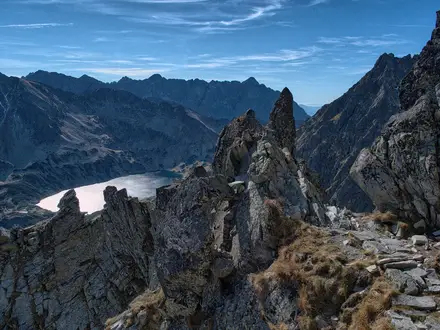
- Ojców National Park: Poland's smallest national park, near the southern end of the trail. Expect limestone gorges, caves and distinctive rock formations.
Challenges to expect
This is tiring more than technical. Expect long walking days, a large proportion of asphalt lanes, and limited natural water sources; plan resupply around villages, shops, restaurants and accommodation. Forest and dirt paths break up the road sections, but the surface mix can be hard on feet. Winter walking needs proper kit for snow. Castles and some Ojców National Park sites charge separate admission.
HikeList Score
Trail of the Eagles' Nests scored 90/100 on HikeList's trail-quality metrics.
See score breakdownHide breakdown
- Ideal length 100
- Balanced challenge 100
- Scenery & wildness 68
- Varied terrain 94
- Accommodation 100
- Food & support 88
- Path quality 80
- Season flexibility 89
Computed from length, challenge, scenery & wildness, terrain variety, accommodation, food & support, path quality and season flexibility.
Show more data Show less
- Limestone Uplands
- Forest
- Farmland
- Rocky Outcrops
- Paved
- Dirt
- Rocky
- Agritourism Farms
- Guesthouses
- Hostels
- Hotels
- Wild Camping Spots
- Family Friendly
- Pet Friendly
- Restrooms
- Water Sources
- Campsites
- Picnic Areas
Download Our Full Guide to Trail of the Eagles' Nests FREE!
Get our comprehensive guide to this hike for free. Save it for later reading or print out at home.

In these collections
Trail of the Eagles' Nests: The Complete Guide
 i
Image by Iwona
i
Image by Iwona The Szlak Orlich Gniazd is Poland’s classic castle-to-castle long-distance walk: a 163.9 km red-waymarked trail from Kraków to Częstochowa across the Kraków-Częstochowa Upland. It suits walkers who want a cultural route with real hiking days rather than a high-mountain trek.
The line threads limestone gorges, forest tracks, open field paths and small Jura villages, linking the ruined and rebuilt strongholds known as the Eagles’ Nests. Ojców, Pieskowa Skała, Rabsztyn, Ogrodzieniec, Bobolice, Mirów and Olsztyn give the walk its shape, with Jasna Góra waiting at the northern end.
This is not technically difficult ground: the high point is Góra Janowskiego at 516 m beside Ogrodzieniec Castle, and the gradients are mostly modest. The appeal is the rhythm of walking between crags, castles and villages, with enough history and scenery to justify taking the full week rather than rushing through.
What the trail asks for is stamina and planning. Daily stages are often long, around a quarter to a third of the route is on asphalt, and water can be limited between settlements, so footwear, resupply stops and accommodation need more thought than the modest height profile suggests.
This guide covers stages, day planning, accommodation, food and water, transport, terrain, seasonality and the common mistakes that make the Trail of the Eagles’ Nests harder than it needs to be.
Stage-by-Stage Guide
The stages below follow the common south-to-north itinerary from Kraków to Częstochowa. The trail is waymarked in red throughout, but daily planning should still allow for long paved sections, variable village services and time lost at castles, caves and viewpoints.
Stage 1: Kraków to Ojców — 23 km
This first day takes the Szlak Orlich Gniazd out of Kraków and into the southern edge of the Jura. The walking begins in an urban and suburban setting, leaving the city through the northern Krowodrza / Tonie area before passing through smaller settlements such as Giebułtów and Korzkiew.
The terrain is generally straightforward: pavements, lanes, field paths and easy tracks rather than mountain ground. Navigation needs most attention in the built-up sections, where red waymarks can be easier to miss at junctions than in open countryside.
Korzkiew is the first castle village on the route, before the trail continues towards Prądnik Korzkiewski and Ojców. The day finishes in Ojcowski Park Narodowy (Ojców National Park), where limestone scenery begins properly in the Dolina Prądnika.
Ojców itself gives access to Zamek w Ojcowie, the ruined royal castle above the valley. The show caves of the national park, including Jaskinia Łokietka and Jaskinia Ciemna, are seasonal attractions rather than guaranteed walk-in stops, so opening times and ticket prices should be checked before travelling.
Food and water are easiest to organise in Kraków before starting. There are villages on the way, but services should not be treated as continuous; carry enough water for the whole stage, especially in warm weather.
Ojców and the surrounding valley have walker-oriented accommodation including guesthouses and agritourism stays, with seasonal demand linked to the national park. Road access is possible at the villages along the route, and Kraków has full rail and city transport connections at the start.
Main warnings for this stage are practical rather than technical: paved walking underfoot, urban waymark-finding, and the temptation to spend too long sightseeing on a day that is already over 20 km.
Stage 2: Ojców to Olkusz / Rabsztyn area — 22 km
This is one of the classic Jura stages, continuing through the limestone landscape of the Prądnik valley before turning towards the upland villages and the Olkusz / Rabsztyn area. It is a moderate walking day, but sightseeing can easily make it feel longer.
The headline landmarks are Zamek Pieskowa Skała and Maczuga Herkulesa, the free-standing limestone pillar below the castle. Pieskowa Skała is one of the best-preserved cultural stops on the trail, but it should be treated as a separate visit with its own opening times and admission.
Beyond the national park section, the route becomes a mixture of lanes, field paths and forest roads. Expect the usual Jura pattern: easy gradients, white limestone underfoot in places, and sections of asphalt through and between villages such as Sułoszowa.
The approach to the Olkusz / Rabsztyn area brings the next major castle site, Zamek Rabsztyn, a hilltop ruin with wide upland views. Depending on where accommodation is booked, the overnight may be in Rabsztyn itself or nearby Olkusz.
Food and water should be planned village by village. Ojców and Pieskowa Skała are important early points, but there are still long enough gaps that a full bottle and packed food are sensible.
Olkusz is one of the more useful access points on the southern half of the trail, with regional bus and minibus links serving the wider area. Weekend services in rural parts of the Jura can be sparse, so onward or bail-out transport should be checked before travelling.
Navigation is generally simple on the red trail, but take care where the route leaves the obvious tourist areas around Ojców and Pieskowa Skała and resumes quieter lanes and field tracks.
Stage 3: Olkusz / Rabsztyn area to Smoleń — 24 km
This stage moves away from the busier southern castle sites and into a quieter stretch of the upland. It is a full walking day, with fewer major settlements and more need to carry food and water from the start.
If the previous night was spent in Olkusz, the practical start may involve returning to the red trail near Rabsztyn. Zamek Rabsztyn is the key early landmark if it was not visited the day before.
The route then continues north through the Jura’s typical mix of forest roads, field paths and asphalt lanes. Bydlin is the main intermediate castle stop before the trail reaches the Smoleń area.
Zamek Pilcza at Smoleń is one of the quieter ruined castles on the route, standing on a forested limestone rock near Pilica. It makes a more subdued but atmospheric contrast with the busier showpiece castles at Pieskowa Skała and Ogrodzieniec.
Food and water options are thinner than on the first two stages. Do not leave the Olkusz / Rabsztyn area without enough supplies for the day, and refill in villages whenever a reliable opportunity appears.
Accommodation is available in the broader Smoleń / Pilica area, but this is not a large-town finish. Booking ahead is sensible, particularly if aiming to stop exactly on or very close to the trail.
Public transport becomes more rural here. Buses and minibuses serve many intermediate villages and towns in the region, but exact services for Smoleń or nearby villages should be checked before travelling.
The main warning is endurance: this is not steep or exposed, but 24 km over mixed surfaces, including asphalt, can be tiring underfoot.
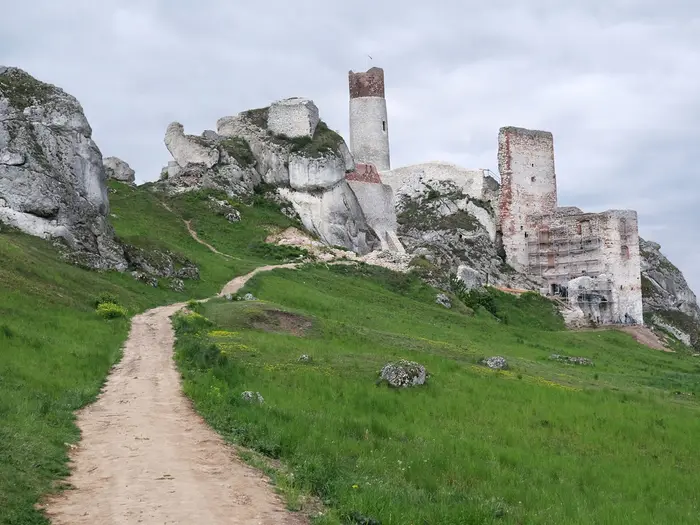
Stage 4: Smoleń to Podzamcze (Ogrodzieniec) — 20 km
Although slightly shorter than several other days, this is one of the most important stages of the whole trail. It links the quieter Smoleń / Pilica area with Podzamcze and Zamek Ogrodzieniec, the largest and best-known castle ruin on the Szlak Orlich Gniazd.
The walking remains moderate, with rolling limestone upland, forest tracks, field paths and village lanes. Gradients are mostly gentle, but there are short rocky or stony sections around the castle crags.
Pilica is the main settlement in the early part of the stage. The final approach to Podzamcze brings the trail to Góra Janowskiego, also called Góra Zamkowa, the 516 m high point of both the route and the whole Kraków-Częstochowa Upland.
Zamek Ogrodzieniec is built directly into the limestone of the hill and is one of the places where the route’s history and geology come together most clearly. Admission, opening times and access arrangements should be checked before travelling, especially outside the main season.
Food and water are more manageable than on the previous day if using Pilica and Podzamcze sensibly, but there is still no reason to rely on finding water between settlements. Carry a full day’s supply in hot weather.
Podzamcze and nearby Ogrodzieniec are popular overnight stops. Accommodation should be booked ahead in summer and around the May long weekend, when the castle village can be busy.
Road access is straightforward around Podzamcze and Ogrodzieniec, and regional links in the wider area often connect towards Zawiercie. Current bus or minibus times should be checked before planning a section break here.
The main planning issue is time management. A 20 km stage leaves room for Ogrodzieniec, but a long castle visit, meal stop and high-season queues can still push the finish late.
Stage 5: Podzamcze (Ogrodzieniec) to Bobolice — 22 km
This stage leaves the Ogrodzieniec high point and continues north across the central Jura. It is a varied day of tracks, lanes and open country, with another important castle sequence before the overnight stop at Bobolice.
The route passes the Morsko / Bąkowiec castle area on the way north. This is part of the same chain of limestone strongholds, though it is less dominant in trail planning than Ogrodzieniec or Bobolice.
The walking is not technically difficult, but expect the familiar mixture of forest road, field path and asphalt. On warmer days, open or paved stretches can feel harder than the height gain suggests.
Bobolice is the main finish landmark. Its castle has been almost fully rebuilt, which makes it very different in character from the more ruined sites such as Mirów or Smoleń.
Food and water should again be organised around villages and castle settlements. Carry lunch and enough water to avoid depending on seasonal kiosks or small local services.
Bobolice is a recognised overnight point on the trail and should be booked ahead in the busiest periods, especially in summer and around the May long weekend. Guesthouses, agritourism stays and small hotels are the typical accommodation style in this part of the route.
Road access exists at the castle villages, but rural public transport can be limited, particularly at weekends. If ending or starting a section at Bobolice, current bus or minibus options should be checked before travelling.
A key navigation point is to stay with the red walking trail rather than assuming that cycling-route signage follows the same line. The Rowerowy Szlak Orlich Gniazd is a separate route with a different distance.
Stage 6: Bobolice to Złoty Potok — 25 km
This is a longer stage and should be treated as a proper full day, particularly if visiting the castle sites at the start. The early section around Bobolice and Mirów is one of the most memorable parts of the northern half of the trail.
Zamek Bobolice and Zamek Mirów are the twin castle landmarks here. Bobolice is a modern reconstruction of a fortress, while Mirów remains a ruin; the two should not be confused when planning visits or tickets.
The short ridge walk between the two castles is a highlight, with limestone outcrops and broad views typical of the Jura. After Mirów, the route becomes quieter again, alternating between field paths, woodland tracks and local lanes.
The stage finishes at Złoty Potok, another useful trail settlement before the final push to Częstochowa. Depending on exact stopping point and sightseeing time, this can feel like one of the more demanding days despite the moderate terrain.
Food and water should be carried from Bobolice, with any intermediate resupply treated as a bonus unless already checked. Water between villages is limited on the Szlak Orlich Gniazd, and this stage is long enough for poor planning to matter.
Złoty Potok has accommodation options in the trail corridor, including small guesthouses and agritourism-style stays. Booking ahead is prudent in the main walking season.
Public transport access in this part of the Jura is more rural than at the route ends. Buses and minibuses serve many settlements in the wider area, including routes via towns such as Myszków, but exact services for a specific start or finish should be checked before travelling.
Navigation is usually uncomplicated on the red waymarks, but extra attention is useful after the popular Bobolice–Mirów section, where the trail leaves the obvious castle-to-castle focus and continues into quieter countryside.
Stage 7: Złoty Potok to Częstochowa — 27 km
The final day is the longest stage in the standard seven-day itinerary. It is not technically hard, but the distance, paved sections and urban finish make it a serious walking day.
From Złoty Potok the route continues north through the Jura landscape towards Ostrężnik and then Olsztyn. The terrain remains a mix of forest tracks, field paths and asphalt lanes, with increasingly frequent signs of the approach to Częstochowa.
Zamek w Olsztynie is the main castle highlight of the day. It is one of the largest ruins on the trail after Ogrodzieniec and is usually a quieter experience than the headline southern sites, but admission and opening arrangements should still be checked before travelling.
The final approach enters Częstochowa, where the trail ends at Stary Rynek below Jasna Góra. Jasna Góra, the Pauline monastery housing the Black Madonna, is the major cultural landmark at the northern end of the route.
Food and water are available at the start and finish, with Olsztyn the key intermediate settlement. Even so, this is a 27 km stage, so carry enough water and food to walk for several hours without relying on services.
Częstochowa has the widest accommodation choice since Kraków, including hotels and guesthouses. It is also the natural transport finish, with Częstochowa station on the national rail network and frequent direct trains back to Kraków Główny taking roughly 2–2.5 hours.
Navigation is straightforward in open country but needs attention on the urban approach and at road junctions. Follow the red waymarks to the trail’s actual endpoint at Stary Rynek rather than stopping at the first view of Jasna Góra.
The main warnings are fatigue and hard surfaces. After six days on the trail, the final paved kilometres into Częstochowa can be more wearing than the modest height gain suggests.
Recommended Itinerary
The standard HikeList schedule is a 7-day south-to-north walk from Kraków to Częstochowa. It keeps most days in the low-to-mid 20 km range, which is sensible for a trail with frequent asphalt lanes, limited water between villages and several castles that are worth allowing time for.
Distances are approximate. If adjusting stage ends around smaller villages, check official mapping before booking accommodation, as short-looking changes can alter the day more than expected on this rolling, road-and-track route.
Standard 7-day itinerary
| Day | From | To | Approx. distance | Why this stage makes sense | Services/accommodation notes |
|---|---|---|---|---|---|
| 1 | Kraków | Ojców | 23 km | A practical first day out of the city through the northern suburbs and into the limestone country of Ojcowski Park Narodowy. Finishing in Ojców gives time for the first major castle stop and places you well for the Prądnik valley sights the next morning. | Kraków has full city services before the start. Ojców is a key overnight stop, but accommodation should be booked ahead in busy periods, especially if planning cave or castle visits. |
| 2 | Ojców | Olkusz / Rabsztyn area | 22 km | This stage links the Ojców area with Pieskowa Skała, Maczuga Herkulesa and the approach towards Rabsztyn without making the day too long. It is one of the most sightseeing-heavy sections, so an early start helps. | Castle and cave opening times in the Ojców and Pieskowa Skała area should be checked before travelling. The Olkusz / Rabsztyn area is a sensible place to look for lodging and resupply, but check the exact distance from the red trail before booking. |
| 3 | Olkusz / Rabsztyn area | Smoleń | 24 km | A steady upland day through the central Jura, taking in Rabsztyn and continuing towards Bydlin and Smoleń. The distance is manageable but still long enough to feel tiring on hard surfaces. | Plan food and water around villages rather than relying on natural sources. Smoleń is a useful overnight because it places Zamek Pilcza close to the route and avoids overloading the following day. |
| 4 | Smoleń | Podzamcze (Ogrodzieniec) | 20 km | A slightly shorter stage that leaves time for Pilica and the major approach to Ogrodzieniec. Ending at Podzamcze is strongly recommended because Ogrodzieniec Castle and Góra Janowskiego are among the main reasons to walk the route. | Podzamcze / Ogrodzieniec is one of the popular castle areas, so book accommodation ahead in summer and around the May long weekend. Ogrodzieniec Castle charges admission and current opening times should be checked before travelling. |
| 5 | Podzamcze (Ogrodzieniec) | Bobolice | 22 km | This stage continues north through the high limestone landscape, passing the Morsko / Bąkowiec area before reaching Bobolice. It keeps the famous Bobolice–Mirów castle pair for the end of the day and following morning rather than rushing them. | Bobolice is another popular overnight area and should be booked ahead in peak periods. Bobolice Castle is a rebuilt fortress and charges admission; Mirów, reached on the next section, is a ruin and is separate. |
| 6 | Bobolice | Złoty Potok | 25 km | A longer day through the northern Jura, starting with the Bobolice–Mirów area and continuing via the limestone-and-forest country towards Złoty Potok. It is a good endurance day rather than a technical one. | Carry enough water from the start and top up when services appear, as gaps between villages can be awkward. Złoty Potok makes a logical stop before the final push to Częstochowa. |
| 7 | Złoty Potok | Częstochowa | 27 km | The longest standard day, but it finishes the route cleanly via Olsztyn and into Częstochowa. Allow time for Zamek w Olsztynie and for the final approach to Stary Rynek below Jasna Góra. | Start early, especially in warm weather or if planning to visit Olsztyn Castle. Częstochowa has full city services and rail connections for the return journey. |
Slower variant: 8–10 days
A slower schedule suits walkers who want to visit more castles, caves and paid sites rather than just pass them, or anyone who prefers shorter days on asphalt. It is also the better option in hot weather, when water planning and exposed road walking become more important.
The easiest way to slow the route is to keep the same overall line but add one or more extra nights at the busiest sightseeing points:
| Where to slow down | How to use the extra time | Planning note |
|---|---|---|
| Ojców / Pieskowa Skała area | Add time for Ojcowski Park Narodowy, the Prądnik valley, Ojców Castle, Pieskowa Skała, Maczuga Herkulesa and the seasonal caves. | Cave and castle opening times vary by season and should be checked before travelling. |
| Podzamcze / Ogrodzieniec | Avoid rushing Ogrodzieniec Castle and Góra Janowskiego, the high point of the whole Kraków-Częstochowa Upland. | Book ahead in summer and around the May long weekend. |
| Bobolice / Mirów | Give the twin-castle section proper time, with Bobolice rebuilt and Mirów remaining a ruin. | Both castles charge admission; current access and ticket details should be checked before travelling. |
| Olsztyn before Częstochowa | Split the long final 27 km stage and leave more time for Zamek w Olsztynie and Jasna Góra. | Accommodation and the exact split should be checked before booking. |
A slower itinerary is often more enjoyable if the aim is to enter paid sites rather than simply view the castles from outside. It also reduces the risk of arriving after closing time at seasonal attractions.
Faster variant: 5–6 days
A 5-day walk is possible for strong walkers, but it changes the character of the trail. Expect long days averaging over 30 km, substantial time on asphalt and less margin for castle visits, photography, food stops and hot-weather delays.
A faster schedule should be built around accommodation availability rather than fixed sightseeing ambitions. The practical approach is to merge parts of the standard stages and use larger or better-served overnight areas such as the Olkusz / Rabsztyn area, Smoleń / Pilica, Podzamcze / Ogrodzieniec, Bobolice / Mirów, Złoty Potok or Olsztyn, depending on where beds are available. Exact distances for any rebalanced fast itinerary should be checked on official mapping before booking.
For most hikers, 6 days is a more realistic fast option than 5. It still requires at least one longer combined section, but leaves more room for the main castle stops and reduces the chance of finishing each day tired, late and short of food or water.
Planning the Route
How many days to allow
A 7-day schedule is the most practical default for the Szlak Orlich Gniazd. It keeps most days in the low-to-mid 20 km range, with the longest finish into Częstochowa, and gives enough time to visit at least some of the major castles without turning every day into a forced march.
Strong walkers can compress the route into 5 days, but that suits hikers who are happy with long road-and-track mileage and limited sightseeing. This is not a technically difficult trail; the fatigue comes from repeated full days, hard asphalt through villages and stretches where water and services are not immediately available.
Allow longer if castles, Ojców National Park or cave visits are a priority. Ojców, Pieskowa Skała, Ogrodzieniec, Bobolice, Mirów and Olsztyn can easily absorb extra time, and several sites have seasonal opening hours and separate tickets.
Natural stage breaks
The route is best planned around settlements with accommodation rather than around equal distances. The usual 7-day structure works because it lands near practical overnight points: Ojców, the Olkusz / Rabsztyn area, Smoleń, Podzamcze, Bobolice, Złoty Potok and finally Częstochowa.
Accommodation is mixed rather than continuous: guesthouses, agritourism farms, hotels, hostels, campsites and open trail shelters all exist along the corridor, but not at every exact point where a hiker might want to stop. Book ahead in the popular castle villages, especially around Ogrodzieniec / Podzamcze and Bobolice in summer and during the May long weekend.
A practical planning table is:
| Plan | Best for | Planning notes |
|---|---|---|
| 5 days | Fit walkers prioritising the through-hike | Long days; less time for castles, caves and side trips |
| 7 days | Most independent hikers | Good balance of distance, services and sightseeing |
| 8+ days | Castle visits, Ojców caves, relaxed pace | Useful where ticketed sites or seasonal opening times matter |
Direction and transport
The trail is walkable in either direction. Kraków to Częstochowa is the conventional south-to-north line and has a satisfying finish at Stary Rynek below Jasna Góra, but the reverse direction is just as viable.
Both ends are straightforward for public transport. Kraków Główny and Częstochowa are on the national rail network, with frequent direct trains between them taking roughly 2–2.5 hours. Train times should be checked before travelling, particularly if the first or last day depends on a specific connection.
Intermediate access is workable but needs more care. Regional buses and minibuses serve many villages and castle areas, including routes via Olkusz, Zawiercie and Myszków, but rural services can be sparse at weekends. For section hiking, build the itinerary around confirmed transport rather than assuming every village has a useful onward connection.
Shortening, extending and section hiking
The trail is easy to divide into shorter trips because it passes through or near regular settlements, and both end cities are well connected. Practical section breaks include the Kraków–Ojców area, the Ojców–Olkusz / Rabsztyn section, the central castle stretch around Smoleń and Podzamcze, and the northern approach through Bobolice, Złoty Potok and Olsztyn towards Częstochowa.
Shortening a day usually means leaving the red trail for a village, bus stop or accommodation option. This should be planned in advance, as not every settlement has frequent public transport or late-day services.
Extending the route is mainly a matter of adding time at castles, caves and near-route side trips. The Błędów Desert and show caves in Ojców National Park are examples of worthwhile detours, but they should not be treated as part of the main red walking line.
Accommodation planning
Accommodation planning matters more here than navigation difficulty. The red trail is well marked, but overnight options are unevenly spaced and popular castle stops can fill quickly.
For a standard 7-day itinerary, secure nights in or near Ojców, the Olkusz / Rabsztyn area, Smoleń, Podzamcze, Bobolice and Złoty Potok before committing to travel. If using campsites, shelters or informal camping, check current local rules and conditions before relying on them.
Do not assume that every castle village has plentiful beds at short notice. Summer weekends, Polish holiday periods and the May long weekend need earlier booking.
Food and water
Food can be planned around towns and villages, but there are enough gaps between services that each day should start with food for the full stage. Small shops and local services may not keep long hours, especially in rural areas and at weekends.
Water planning is one of the main practical challenges. Natural water is limited and the route includes open field paths, forest roads and long asphalt lanes between villages. Carry enough water to cover the longest village-to-village sections of the day, and refill whenever a reliable opportunity appears.
Navigation and mapping
The walking trail is marked with red waymarks and is route No. 1 on Poland’s official list of tourist trails. Even so, carry an offline map or GPX track, especially for town exits, forest junctions and field sections where a missed mark can cost time.
Take care not to follow the cycling version of the Eagles’ Nests route by mistake. The Rowerowy Szlak Orlich Gniazd is a separate cycling trail with a different line and a longer distance.
Tickets, opening times and seasonal checks
The trail itself is planned as a public long-distance walking route, but many of the major attractions along it are ticketed separately. Ojców sites, Pieskowa Skała, Ogrodzieniec, Bobolice and Olsztyn all need their own opening-time and ticket checks.
This matters if the walking schedule is built around visits rather than simply passing the castles. Several castles, caves and park sites operate seasonally, so current opening times and prices should be checked before booking a fixed itinerary.
Weather and underfoot conditions
Late April to October is the easiest planning window. In this period, the main considerations are long exposed road and field sections, warm days, rain on limestone and the need to carry water.
Winter walking is possible, but it changes the character of the route. Snow and ice require proper kit, and shorter daylight makes the longer stages less forgiving. Seasonal closures at castles and caves are also more likely outside the main visitor season.
Towns, Villages and Overnight Stops
Accommodation on the Szlak Orlich Gniazd is uneven rather than difficult. The practical overnight anchors for a 7-day walk are Kraków, Ojców, the Olkusz/Rabsztyn area, Smoleń, Podzamcze, Bobolice, Złoty Potok and Częstochowa, with smaller villages useful for food, water and short breaks.
Expect a mix of pensjonaty, agrotourism farms, small hotels, hostels and campsites, plus open trail shelters in places. Book ahead in summer and around the May long weekend, especially in the castle villages around Podzamcze/Ogrodzieniec and Bobolice. Rural buses and minibuses can help with section walking, but services can be sparse at weekends; local timetables should be checked before travelling.
Kraków
Kraków is the southern end of the trail and the easiest place to organise the start. The red waymarked route runs out of the city through the northern Krowodrza / Tonie suburbs, and the Kraków–Wawel end is conventionally treated as the start of the Szlak Orlich Gniazd.
This is the best place to buy gas, food, maps and any missing kit before setting off. Accommodation is abundant at every budget level, so it makes sense to stay here the night before an early start rather than trying to reach Ojców late in the day.
Kraków Główny is on the national rail network and has frequent direct trains to Częstochowa, usually taking roughly 2–2.5 hours. This makes the end-to-end logistics simple: walk north and return by train, or travel to Częstochowa first and walk south.
Tonie
Tonie is the northern suburban exit from Kraków and is more of a route marker than an overnight stop. It is useful because it signals the transition from city walking towards the open upland and villages north of Kraków.
Do not plan Tonie as a main resupply or accommodation base unless specific arrangements have been made. For practical purposes, stock up in Kraków before leaving the city.
Giebułtów
Giebułtów lies on the first day between Kraków and the Ojców area. It is a useful settlement to have on the route when breaking up the long walk out of the city, particularly for water and a short rest.
Accommodation and food options should not be assumed without checking in advance. Most walkers will continue towards Korzkiew, Prądnik Korzkiewski and Ojców rather than overnighting here.
Korzkiew
Korzkiew is one of the first castle stops north of Kraków and a natural pause before entering the more scenic Prądnik valley area. It sits early enough on the route that it is usually part of the first walking day rather than a main stage end.
It can be useful for walkers starting late from Kraków or splitting the opening stage, but accommodation should be arranged in advance rather than relied upon on arrival. Local transport may be possible in this Kraków-side section, but current connections should be checked before travelling.
Prądnik Korzkiewski
Prądnik Korzkiewski sits between Korzkiew and Ojców, close to the approach into Ojcowski Park Narodowy. It is mainly relevant as a passing village on the first stage, not as one of the core overnight bases.
Use it as a practical waypoint for pacing, water and access to local services where available. For a planned stop, Ojców is usually the stronger option because it sits inside the national park area and close to the first major limestone and castle sights.
Ojców
Ojców is the most logical first overnight stop on the standard northbound itinerary. It sits in Ojcowski Park Narodowy, close to Ojców Castle, the Dolina Prądnika limestone scenery and the seasonal show caves such as Jaskinia Łokietka and Jaskinia Ciemna.
It is a good place to slow the schedule if castle and cave visits matter. Accommodation is available in and around the village, but it is a popular area and should be booked ahead in busy periods.
Food and drink options are more likely here than in the smaller villages before and after, though opening hours can vary seasonally. Castle and cave opening times and ticket prices should be checked before travelling, especially outside the main late-spring to autumn walking season.
Pieskowa Skała
Pieskowa Skała is a major cultural stop rather than the usual stage end. The castle is one of the best-preserved sites on the route, and Maczuga Herkulesa stands just below it, making this one of the places where most walkers will want time off the march.
It lies between Ojców and the Sułoszowa/Rabsztyn/Olkusz section, so it works well as a morning or midday stop after an overnight in Ojców. Do not assume that visiting the castle will be quick: separate admission and seasonal opening hours apply, and this should be checked before travelling.
Accommodation and full resupply should be planned elsewhere unless specifically booked nearby. Carry enough water and food for the onward stretch, as the trail’s thinner services become more noticeable after the Ojców area.
Sułoszowa
Sułoszowa is a useful village on the route north of Pieskowa Skała. It is not one of the headline overnight bases, but it can help break up the second stage towards the Rabsztyn/Olkusz area.
Expect village-level services rather than reliable hiker infrastructure. If depending on shops, food or buses here, check current availability and opening times before travelling.
Rabsztyn
Rabsztyn is a practical and scenic stopping area because of Zamek Rabsztyn, the hilltop ruins near Olkusz. It sits around the second overnight zone on the standard itinerary, paired with nearby Olkusz as the broader accommodation and resupply area.
This is a good place to overnight if accommodation is available, especially for walkers who want to visit the castle without rushing. It also works as a quieter alternative to staying in a larger town, but booking ahead is sensible because options may be limited.
The ruins charge admission separately, and current opening times should be checked before relying on a visit. For food and transport depth, nearby Olkusz is the more practical anchor.
Olkusz
Olkusz is not presented as the red trail’s main on-line village in every itinerary, but the Olkusz/Rabsztyn area is the key practical stop between Ojców and Smoleń. It is one of the better places in the middle-southern part of the route for accommodation, food shopping and transport.
For hikers who need a reset, this area is more useful than the smaller villages around it. It is a sensible place to replace snacks, organise a shorter day, or use regional transport if breaking the route into sections.
Regional buses and minibuses serving the wider trail corridor include services via Olkusz, though rural timetables can be thin at weekends. This should be checked before travelling.
Bydlin
Bydlin sits between the Olkusz/Rabsztyn area and Smoleń. It is part of the chain of castle locations on the route, but it is generally more useful as a passing point than as a planned overnight base.
Services should be treated as limited unless checked in advance. Carry enough water and food from the Olkusz/Rabsztyn area if walking through to Smoleń.
Smoleń
Smoleń is a strong overnight stop on the standard itinerary and a quieter contrast to the busier castle villages. The nearby Zamek Pilcza ruins sit on a forested rock near Pilica, making the area worth time rather than just a through-walk.
Accommodation is available in the wider trail accommodation mix, but it should be booked ahead because this is not a large town. Food options should also be checked in advance; do not arrive late assuming a wide choice of restaurants or shops.
Smoleń works well as a stage end before the walk to Podzamcze and Ogrodzieniec Castle. It is also a practical place to assess weather, footwear and water capacity before the central section of the trail.
Pilica
Pilica lies close to Smoleń and is relevant as part of the Smoleń/Pilica overnight and service area. It can be useful if accommodation in Smoleń itself is full or if a walker wants a slightly different staging point.
Treat it as a practical back-up rather than assuming it has all services needed for a long-distance hiker. Accommodation, food and onward transport should be checked before committing the day’s end to Pilica.
Podzamcze and Ogrodzieniec
Podzamcze is one of the most important overnight stops on the whole route. It sits beside Zamek Ogrodzieniec and Góra Janowskiego / Góra Zamkowa, the 516 m high point of the Kraków-Częstochowa Upland and of the trail.
This is a very logical stage end: the castle ruins are large, popular and worth allowing proper time for. Accommodation is available in and around Podzamcze/Ogrodzieniec, but this is one of the places where booking ahead is strongly advised in summer and around the May long weekend.
Food and tourist services are more developed here than in many smaller Jura villages, but opening hours and castle admission still vary. Current ticket prices and opening times should be checked before travelling.
Podzamcze is also one of the best places to pause for a rest day or half-day if the schedule allows. It gives time for Ogrodzieniec Castle without forcing a rushed start on the following stage towards Morsko and Bobolice.
Morsko
Morsko is associated with the Bąkowiec castle ruin and sits between Podzamcze and Bobolice. It is a useful waypoint on the castle chain, but it is not usually the main overnight target on the standard itinerary.
If planning to stop here, arrange accommodation in advance and check food availability. Most walkers will pass through or pause briefly before continuing towards Bobolice.
Bobolice
Bobolice is a key overnight stop and one of the busiest castle villages on the northern half of the route. Zamek Bobolice has been almost fully rebuilt, and it sits close to Mirów, whose ruined castle is linked by a short ridge walk.
This is one of the places where accommodation should be booked ahead in busy periods. It is a natural stage end after Podzamcze, and it avoids trying to combine too many castle visits with a long walking day.
Food and drink are more likely around the castle village than on the quieter sections either side, but do not rely on late opening. Bobolice Castle charges admission, and current opening times and ticket prices should be checked before travelling.
Mirów
Mirów is very close to Bobolice and is best treated together with it for planning. The castle here remains a ruin, unlike the rebuilt fortress at Bobolice, and the short ridge between the two is one of the most memorable small sections of the trail.
It is not usually necessary to overnight in both places. Staying in Bobolice or nearby and visiting Mirów as part of the onward walk is the most efficient plan for most hikers.
Services should be treated as limited compared with the larger towns. Carry enough water and food for the next stretch towards Złoty Potok, as the following day is one of the longer stages in the standard itinerary.
Złoty Potok
Złoty Potok is the main overnight anchor between Bobolice/Mirów and Częstochowa. It is a practical place to stop before the long final day through Ostrężnik and Olsztyn towards the city.
Accommodation should be arranged in advance, especially if walking in peak season or at weekends. It is also a sensible place to resupply, top up water and prepare for the longest stage in the typical 7-day schedule.
Regional transport in the wider northern Jura corridor can be useful for section walkers, including services via Myszków in the broader area, but current connections should be checked before travelling. Do not count on frequent rural services late in the day.
Ostrężnik
Ostrężnik sits north of Złoty Potok on the final approach towards Olsztyn and Częstochowa. It is a useful route point and castle location, but not normally a primary overnight stop.
Services should be assumed limited unless checked beforehand. For most walkers, Ostrężnik is a place to pass through during the final stage rather than a place to finish the day.
Olsztyn
Olsztyn is the last major castle stop before Częstochowa and can work either as a final overnight stop or a long break on the last day. Zamek w Olsztynie is one of the larger ruins on the route after Ogrodzieniec and is usually quieter than the headline sites.
Stopping overnight in Olsztyn can make sense for walkers who want a shorter final approach into Częstochowa or who plan to spend time at the castle. If continuing to Częstochowa the same day, allow enough time for both the castle visit and the remaining walk into the city.
Admission and opening times should be checked before travelling. Local food and accommodation options should also be checked in advance if using Olsztyn as a stage end.
Częstochowa
Częstochowa is the northern end of the trail, with the red route finishing at Stary Rynek below Jasna Góra. It is the best place to end the walk, clean up, replace any missed meals and connect back to the national transport network.
Accommodation is widely available compared with the villages on the trail, so it is a practical final overnight even for walkers arriving late. Staying here also leaves time to visit Jasna Góra without squeezing it into the final kilometres.
Częstochowa has frequent direct trains to Kraków Główny, typically taking roughly 2–2.5 hours. Train times should still be checked before travelling, especially when planning a same-day return after the final stage.
Getting to the Start
By train
Kraków is the easiest start point for the Szlak Orlich Gniazd. Arrive at Kraków Główny, the city’s main station and a major stop on Poland’s national rail network, then make your way to the chosen start point in the city.
The route is conventionally treated as starting from the Kraków–Wawel end, before heading north through the Krowodrza / Tonie suburbs. Depending on where you sleep the night before, it may be simplest to walk to the red waymarks from central Kraków or take local city transport or a taxi to a more convenient point on the northern exit.
If returning from the finish, Częstochowa and Kraków Główny are linked by frequent direct trains, typically taking around 2–2.5 hours. Timetables and seat rules should be checked before travelling, especially if finishing on a Sunday or public holiday.
By bus
Long-distance and regional buses can get you into Kraków, but for most walkers the train is the simpler and more predictable option. Once in the city, use local transport or a taxi to reach the red trail if your accommodation is not close to the central start.
Regional buses and minibuses are more useful for section-hiking or bailing out from the route later on, particularly around places such as Olkusz, Zawiercie and Myszków. Rural services can be sparse at weekends, so any bus-based plan should be checked against current timetables before relying on it.
By car
Driving to Kraków is straightforward in principle, but the route is point-to-point rather than a loop. The usual car logistics are either to leave the vehicle in Kraków and return by train from Częstochowa, or to park at the northern end and take the train to Kraków before starting.
For a week-long walk, do not assume casual street parking will be suitable. Arrange secure or long-stay parking through your accommodation or a dedicated city car park, and confirm access hours, prices and any maximum-stay rules before leaving the vehicle.
A taxi is a practical fallback for reaching the northern Kraków suburbs or for moving between a hotel and the trailhead. It is less suitable as a routine solution along the rural middle stages, where distances between trail villages and larger transport hubs can become expensive.
From the nearest airport
The practical air gateway is Kraków. From the airport, first get into the city, then reach your accommodation or the red trail by local transport or taxi.
Airport transfer times, ticketing and late-arrival options should be checked before travelling. If landing late, staying in Kraków and starting the walk the next morning is the sensible plan; the first stage to Ojców is already a full walking day.
Where to stay before starting
Stay in Kraków the night before starting unless you have a specific reason to begin from the northern suburbs. This gives the best choice of accommodation, food shops and transport, and makes it easier to deal with late trains or flights.
If starting early, choose accommodation with easy access either to the central start around the Kraków–Wawel end or to public transport towards Krowodrza / Tonie. Starting from the city keeps the walk continuous; starting farther north can save time on the suburban exit, but it should be treated as a personal logistics choice rather than the standard full-route start.
Getting Home from the Finish
By train
The practical way to leave the finish is by train from Częstochowa. The trail ends in the city at Stary Rynek (Old Market Square), below Jasna Góra, so plan a short city transfer to the railway station rather than assuming the finish is directly beside the platforms.
Częstochowa is on the national rail network and has frequent direct trains to Kraków Główny, typically taking roughly 2–2.5 hours. This makes the route easy to walk one-way: finish in Częstochowa, then return to Kraków by rail if that is where luggage, accommodation or onward transport has been arranged.
Train times are timetable-dependent and should be checked before travelling, especially if finishing late after the long final stage from Złoty Potok. If the last day runs slower than planned, staying in Częstochowa is simpler than relying on a late connection.
By bus
Buses and minibuses are more useful for intermediate exits than for the main end-to-end return. Regional services serve many trail towns and castle villages, with connections around places such as Olkusz, Zawiercie and Myszków, but rural services can be sparse at weekends.
From the finish in Częstochowa, train is normally the more reliable onward option for Kraków and other major rail-linked destinations. Use buses only after checking current timetables carefully, particularly outside weekday daytime hours.
By car/taxi
If being collected by car, Częstochowa is the easiest end of the route for a pick-up because the walk finishes inside the city rather than at a remote trailhead. Agree a clear meeting point around Stary Rynek, Jasna Góra or the railway station, depending on whether the priority is finishing at the official endpoint or getting away quickly.
A taxi is the simplest option for the short city transfer if finishing tired, in bad weather or after dark. Taxi availability, fares and app coverage can change, so this should be checked before travelling.
From the nearest airport
No airport transfer is needed to complete the trail itself. For flights, the practical approach is to leave Częstochowa first by rail, most commonly towards Kraków Główny if returning to the start city or using Kraków for onward travel.
Airport-specific routes and timings are not part of the trail logistics and should be checked before travelling. Allow a buffer if connecting from the final hiking day to a flight, as the last stage into Częstochowa is one of the longer days on the typical itinerary.
Where to stay at the finish
Częstochowa is the safest place to build in an overnight stop if transport plans are tight. It avoids rushing the final Złoty Potok to Częstochowa stage and gives time to visit Jasna Góra without having to catch an evening train immediately afterwards.
Staying at the finish is also sensible if walking in autumn, when daylight is shorter, or if using weekend public transport. Book accommodation in advance during busy pilgrimage periods and check current rail times before deciding whether to leave the same day.
Which Direction Should You Walk?
The Szlak Orlich Gniazd is walkable in either direction, and the red waymarking makes navigation broadly the same northbound or southbound. For most hikers, the better choice is the standard Kraków → Częstochowa direction.
Kraków to Częstochowa: the standard choice
South to north is the conventional way the route is usually treated: starting in Kraków, leaving through the northern Krowodrza / Tonie suburbs, then crossing the Kraków-Częstochowa Upland towards Częstochowa. It also matches the natural castle order, with Ojców and Pieskowa Skała early on, Ogrodzieniec and Góra Janowskiego in the middle of the walk, then Bobolice, Mirów, Olsztyn and finally Jasna Góra.
Transport is straightforward. Kraków Główny and Częstochowa are both major rail stations, with frequent direct trains taking roughly 2–2.5 hours, so the simplest plan is to arrive in Kraków, walk north, then return by train from Częstochowa. Current train times should be checked before travelling.
This direction also gives the stronger psychological finish. Częstochowa’s Stary Rynek and Jasna Góra make a clear end point, and arriving below Poland’s principal pilgrimage shrine feels more conclusive than simply walking back into a large city.
The main drawback is that the typical seven-day itinerary finishes with its longest day: Złoty Potok to Częstochowa is about 27 km. That is not technically difficult, but after six days of hard surfaces, forest roads and field paths, it can feel tiring. Build in an earlier start or split the final section if long road-bound mileage is a concern.
Częstochowa to Kraków: when the reverse makes sense
Walking southbound is perfectly viable and may suit hikers who have easier travel connections into Częstochowa or who want to finish in Kraków. The same red trail is followed, the same villages and castle sites are used, and the overall ascent is not meaningfully easier or harder.
The reverse direction puts the longest standard stage first, from Częstochowa to Złoty Potok, rather than last. That can be useful for strong walkers who prefer to tackle the biggest day while fresh, but it is a poor fit if arrival in Częstochowa is late or if the first day needs to be deliberately gentle.
Scenically, the reverse direction front-loads Olsztyn, Mirów, Bobolice and Ogrodzieniec, then ends with Ojców National Park and the approach into Kraków. That is still a strong progression, especially for walkers who want Ojców near the end, but the final approach through the northern suburbs is a less ceremonial finish than Jasna Góra.
Climbs, weather and accommodation
Direction makes little difference to the climbing. The route is a rolling limestone upland walk, not a mountain traverse, with about 2,567 m of total ascent spread across 163.9 km. The high point, Góra Janowskiego / Góra Zamkowa at Podzamcze, sits around the middle of the trail beside Ogrodzieniec Castle, so neither direction gives a clear climbing advantage.
There is no route-specific wind or weather advantage worth choosing a direction for. More important is managing heat, rain and tired feet on open field paths, forest roads and the substantial stretches of asphalt village lanes.
Accommodation flow is also similar in both directions, because the same overnight villages are used. The key planning point is to book ahead in the popular castle areas, especially Ogrodzieniec / Podzamcze and Bobolice in summer and around the May long weekend. Rural buses and minibuses can help with section walking, but services can be sparse at weekends, so intermediate transport should be checked before relying on it.
Recommendation
Walk Kraków → Częstochowa unless there is a specific transport or accommodation reason to reverse it. Northbound follows the conventional route order, builds naturally through the castle chain, keeps the logistics simple, and gives the walk its strongest finish at Jasna Góra in Częstochowa.
Accommodation Along the Route
Accommodation on the Szlak Orlich Gniazd is workable for an inn-to-inn walk, but it needs more planning than the route’s moderate terrain might suggest. The trail passes through villages, small towns and castle settlements rather than one continuous line of tourist centres, so the main task is matching overnight stops to the long daily stages.
Expect a mix of pensjonaty (guesthouses), gospodarstwa agroturystyczne (agritourism farms), hostels, hotels and campsites. There are also open trail shelters (wiaty) along the route, but these should be treated as rest stops or emergency/simple overnight options rather than a full accommodation plan.
Best overnight stops
The standard 7-day structure works because it uses the more practical stopping points: Ojców, the Olkusz / Rabsztyn area, Smoleń, Podzamcze / Ogrodzieniec, Bobolice, Złoty Potok and Częstochowa. Kraków and Częstochowa are major city bookends and have the easiest accommodation logistics.
The tighter points are the rural stages between the headline castles. Smoleń, Bobolice and Złoty Potok need more care than Kraków, Częstochowa or the Ogrodzieniec area, especially if walking in summer, over Polish holiday periods or around the May long weekend.
| Place | Accommodation level | Best for | Notes |
|---|---|---|---|
| Kraków | Good | Start night, late arrival, city-based logistics | The easiest place to organise the start of the walk, with the red trail accessible from the city side. |
| Ojców | Limited | First overnight on a 7-day Kraków-to-Częstochowa itinerary | A popular national-park village; book ahead in the main walking season. |
| Pieskowa Skała / Sułoszowa area | Limited | Alternative stop or slower castle-focused itinerary | Useful if shortening or reshaping the Ojców to Rabsztyn/Olkusz stage. Availability should be checked before travelling. |
| Olkusz / Rabsztyn area | Good | Practical second-night stop and resupply base | One of the more useful accommodation areas in the southern half of the route. Staying near Rabsztyn keeps the castle sequence neat; staying closer to Olkusz may help with services. |
| Bydlin | Limited | Breaking up the Olkusz–Smoleń section | A possible adjustment point rather than a default overnight for most 7-day plans. This should be checked before travelling. |
| Smoleń | Limited | Essential rural overnight on the standard itinerary | Important to book early because it sits at a natural stage end between Olkusz/Rabsztyn and Podzamcze. |
| Pilica | Limited | Alternative to Smoleń or a shorter day before Podzamcze | Can help walkers who want a less demanding split, but availability should be checked before travelling. |
| Podzamcze / Ogrodzieniec | Good | Castle stop, high point of the route, flexible rest or short-day point | One of the most popular overnight areas because of Zamek Ogrodzieniec and Góra Janowskiego. Book ahead in summer and at the May long weekend. |
| Morsko | Limited | Optional stop between Ogrodzieniec and Bobolice | Useful only if reshaping the stage; do not rely on turning up without a booking. |
| Bobolice | Limited | Standard overnight before the Mirów–Złoty Potok section | A popular castle village, so accommodation pressure can be high despite its small size. Book ahead in summer and at the May long weekend. |
| Mirów | Limited | Alternative to Bobolice or a castle-focused short stop | Close enough to Bobolice to be part of the same planning problem: secure a bed before fixing the day’s mileage. |
| Złoty Potok | Limited | Final rural overnight before Częstochowa | A practical last-night stop on the 7-day itinerary, but availability should be checked before travelling. |
| Olsztyn | Limited | Alternative final overnight before Częstochowa | Useful for walkers who want to split the long Złoty Potok–Częstochowa day differently. This should be checked before travelling. |
| Częstochowa | Good | Finish night, onward trains, visit to Jasna Góra | The easiest northern-end base and the most flexible place to absorb delays at the end of the route. |
Booking strategy
Book the rural nights first, then fit Kraków and Częstochowa around them. The key pinch points are Ojców, Smoleń, Bobolice and Złoty Potok, plus Podzamcze / Ogrodzieniec during busy periods.
Summer weekends and the May long weekend are the main pressure points. Castle villages attract visitors who are not walking the whole trail, so a place that looks like a small rural stop can fill because of Ogrodzieniec, Bobolice, Mirów or nearby national-park attractions.
If walking a faster 5-day version, accommodation becomes less of a problem only if daily distances remain realistic and end in larger settlements. If walking more slowly to visit every castle, check each added stop individually rather than assuming every village has suitable beds.
Camping, shelters and simple overnights
Campsites exist in and around some trail towns, and the route also has a string of open wiaty. These are useful for breaks, poor weather or a very lightweight approach, but they do not replace proper planning for food, water and legal overnight arrangements.
Wild-camping use exists on the route, but walkers should be cautious, discreet and aware that the trail passes through protected landscapes including Ojcowski Park Narodowy and the Park Krajobrazowy Orlich Gniazd. Local rules and permitted camping options should be checked before travelling.
Luggage transfer and taxi options
This is a viable inn-to-inn route if accommodation is booked in advance and daily stages are planned around available beds. Do not assume a dedicated end-to-end luggage-transfer system; private taxi transfers or local arrangements may be needed if walking with light day packs only.
Taxi or bus/minibus transfers can also solve awkward gaps, especially around smaller villages where the preferred overnight stop is full. Rural services can be sparse at weekends, so any transfer plan should be checked before travelling rather than left to the end of a long day.
Camping and Wild Camping
Camping is possible on the Szlak Orlich Gniazd, but it suits a flexible, low-impact approach rather than a fully self-contained wilderness trip. The route passes frequent villages and castle settlements, crosses private farmland and forest, and includes protected areas such as Ojcowski Park Narodowy (Ojców National Park) and Park Krajobrazowy Orlich Gniazd (Eagles’ Nests Landscape Park).
The easiest camping strategy is to use established campsites where available and combine them with guesthouses, agritourism farms or hostels when spacing does not work. Do not assume there will be a campsite at the end of every stage; current locations, opening periods and prices should be checked before travelling.
Campsites and organised camping
The brief accommodation pattern for this trail is mixed: campsites exist in and around some trail towns and tourist villages, alongside pensjonaty, gospodarstwa agroturystyczne, hostels and hotels. The most sensible places to look first are the main overnight hubs and castle villages on the standard itinerary, especially around Ojców, the Olkusz / Rabsztyn area, Smoleń, Podzamcze / Ogrodzieniec, Bobolice, Złoty Potok, Olsztyn and Częstochowa.
Summer, weekends and the May long weekend are the periods when accommodation pressure is highest, particularly around Ogrodzieniec / Podzamcze and Bobolice. If relying on campsites, contact them in advance rather than turning up late after a long stage.
Open trail shelters, known as wiaty, occur along the route and can be useful for breaks in bad weather. Treat them as rest shelters, not guaranteed overnight accommodation, unless local signage explicitly allows sleeping there.
Wild camping: legality and practical reality
Wild camping should be approached cautiously on this route. Much of the trail passes through managed land, villages, farmland, forest and protected landscapes, so there is no general assumption that a tent can be pitched wherever a flat patch appears.
Ojcowski Park Narodowy is the least suitable section for informal camping. National park rules and any site-specific restrictions must be followed, and camping should only be considered where clearly permitted. This should be checked before travelling.
Outside the national park, the route still crosses private and managed land. If no designated camping area is available, seek clear local permission from the landowner or accommodation provider, arrive late, leave early, and avoid camping near castles, viewpoints, car parks, cave entrances, fields under cultivation or village paths.
How well does the route suit a tent?
A tent can work, but it adds weight on a route where the main difficulty is endurance: long daily stages, hard asphalt lanes and limited water between villages. For many walkers, a lighter guesthouse-and-agritourism plan will be more comfortable and simpler.
Camping is most workable in the more rural middle and northern parts of the route, where villages and forested sections are more frequent between Smoleń, Podzamcze, Bobolice, Mirów, Złoty Potok and Olsztyn. The Kraków approach and the Ojców section are less convenient because of urban edge walking, protected-area sensitivity and tourist pressure.
Water and resupply for campers
Water is one of the main constraints. The trail has limited reliable natural water between villages, and much of the walking is open, paved or on dry limestone ground.
Plan to fill bottles in settlements, at accommodation, cafés, shops or official facilities rather than depending on streams or springs. Carry more than usual on hot days, especially on longer stages such as Bobolice to Złoty Potok and Złoty Potok to Częstochowa.
Fires, waste and low-impact practice
Do not light fires unless a place is clearly designated for them and current local rules allow it. A stove is the safer option, but it still needs careful use in dry grass, forest edges and popular tourist areas.
Follow strict Leave No Trace practice:
- pitch only where camping is permitted or permission has been granted;
- keep well away from homes, crops, castle ruins and visitor sites;
- pack out all rubbish, including food scraps;
- avoid damaging limestone outcrops, forest floor and vegetation;
- keep noise low, especially near villages and shelters;
- do not wash, cook or dispose of wastewater near natural water sources.
Seasonally, late spring to early autumn is the most practical camping window. In summer, heat and water planning matter more than cold; in winter, camping is possible only with proper cold-weather equipment and a clear plan for snow, ice and short daylight.
Food, Water and Resupply
The Szlak Orlich Gniazd is not a wilderness route, but it is not a continuous line of services either. Food and water planning should be based around towns, villages, overnight stops and the busier castle areas, with enough carried for long gaps on forest tracks, field paths and asphalt lanes.
Kraków and Częstochowa are straightforward places to buy supplies before or after the walk. On the trail itself, the best resupply points are the larger settlements and established overnight stops, especially the Olkusz / Rabsztyn area, Pilica, Podzamcze, Bobolice, Złoty Potok and Olsztyn. Smaller villages may have shops or seasonal food outlets, but opening hours should not be assumed.
Water is the more important constraint. The route crosses the limestone Kraków-Częstochowa Upland, and natural water is not something to rely on between villages. Start each stage with enough water to reach the next certain settlement or accommodation, and carry extra in hot weather because much of the walking is open, paved or on hard tracks.
Practical resupply strategy
Buy the next day’s walking food the evening before whenever possible. This is especially useful when staying in smaller villages, where morning opening hours may not suit an early start.
Accommodation can be an important part of the food plan. Pensjonaty, gospodarstwa agroturystyczne and small hotels may offer breakfast or dinner, but this should be arranged before arrival rather than assumed.
Castle villages and tourist sites can have cafés or seasonal food options, particularly around the better-known stops such as Ojców, Pieskowa Skała, Podzamcze / Ogrodzieniec, Bobolice, Mirów and Olsztyn. These are useful bonuses, but they should not replace carrying lunch and snacks for the day, as opening times and seasonal operation vary.
Sundays, public holidays and the May long weekend need extra care. Rural opening hours can be limited, while the most popular castle villages may be busy. Buy food ahead and confirm meal arrangements with accommodation before travelling.
Water planning
Use tap water from accommodation, restaurants, cafés or other staffed services as the main refill source. In villages, ask politely at accommodation or food stops rather than depending on public fountains or outdoor taps.
Do not plan around streams, springs or ponds unless a specific source has been checked locally. Natural water in the Jura should be treated or filtered if used, and in dry periods it may not be available where expected.
For a typical 20–27 km stage, most walkers should leave the overnight stop with enough water for several hours of walking and ideally enough to reach the next dependable village service. In warm weather, carry more than for a shaded mountain route: the combination of limestone terrain, exposed field paths and asphalt lanes can make the trail feel hotter and drier than the elevation suggests.
| Section | Food availability | Water availability | Notes |
|---|---|---|---|
| Kraków to Ojców | Easy at the Kraków end; more limited once leaving the city through Tonie, Giebułtów and Korzkiew. Ojców has tourist services, but opening can be seasonal. | Fill in Kraków before starting; refill at staffed services or accommodation in villages and Ojców. | Do not rely on natural water in the Prądnik valley without treating it. Carry lunch from Kraków if starting early. |
| Ojców to Olkusz / Rabsztyn area | Tourist services around Ojców and Pieskowa Skała may help, then village-level options through Sułoszowa and towards Rabsztyn. Olkusz area is the strongest resupply point on this stage. | Start full from Ojców; refill where eating or staying. | A useful stage for restocking properly before the quieter central part of the route. Check seasonal opening around caves and castle sites before relying on them. |
| Olkusz / Rabsztyn area to Smoleń | Best to leave with a full day’s food. Options become more rural through Bydlin and towards Smoleń. | Fill before leaving the Olkusz / Rabsztyn area; plan on accommodation or village services for later refills. | This is a stage where carrying lunch and snacks is sensible rather than hoping for a convenient shop at the right time. |
| Smoleń to Podzamcze / Ogrodzieniec | Pilica is the key intermediate service point. Podzamcze is one of the busier castle villages on the trail. | Fill in Smoleń before departure and again where possible in Pilica or Podzamcze. | Podzamcze / Ogrodzieniec is a good place to eat and resupply, but book accommodation and check food options in busy periods. |
| Podzamcze / Ogrodzieniec to Bobolice | Food is most likely around Podzamcze and the main castle villages; between them the route is more intermittent. | Leave Podzamcze with plenty of water; refill only where services are open. | Do not assume every castle stop has year-round food. Carry enough for the full day, especially outside summer. |
| Bobolice to Złoty Potok | Bobolice and Mirów may have tourist services, but this remains a long day with limited guaranteed resupply between settlements. Złoty Potok is the main end-of-stage service point. | Start full from Bobolice; refill at staffed services where available. | One of the stages where water discipline matters. Avoid leaving Bobolice short of water. |
| Złoty Potok to Częstochowa | Food is available at Złoty Potok and becomes easier again as the route approaches Olsztyn and then Częstochowa. | Fill at Złoty Potok; refill in Olsztyn or at services before the final approach. | The final kilometres lead into a major city, but the stage is still long. Carry enough food and water until Olsztyn rather than treating Częstochowa as immediately close. |
Navigation and Waymarking
The Szlak Orlich Gniazd is an official, waymarked long-distance walking trail, marked in red and listed as route No. 1 on Poland’s tourist-trail network. For most walkers it is a straightforward route to follow: the terrain is non-technical, gradients are modest, and the line links villages, castles, forest tracks and field paths rather than remote mountain ground.
That said, it should not be treated as a trail where waymarks alone remove the need to navigate. The route is 163.9 km long, passes through towns, suburbs, lanes, woodland junctions and castle approaches, and occasionally shares busy-looking local corridors where several paths, roads or tourist routes may overlap. A GPX track and offline mapping are strongly recommended.
Waymarks to follow
Follow the red walking waymarks for the Szlak Orlich Gniazd. This is the hiking trail from Kraków to Częstochowa, not the separate Rowerowy Szlak Orlich Gniazd cycling route, which follows a different line and is longer.
Pay particular attention where the trail:
- leaves Kraków through the northern suburbs around Krowodrza / Tonie;
- threads the popular paths and attractions of Ojcowski Park Narodowy;
- passes castle areas where sightseeing paths, access roads and car parks can pull you off the through-route;
- uses asphalt village lanes, where waymarks may be less obvious than on forest tracks;
- enters Częstochowa, where urban navigation replaces simple countryside walking.
At junctions, look ahead for the next red mark before committing. If a turn feels ambiguous, stop and check the map rather than continuing on a plausible lane or forest road.
GPX and digital maps
A GPX file is sensible for this trail, especially if walking long stages or booking accommodation off the exact line. The interactive map and GPX on mapa-turystyczna.pl are useful for following the walking route and keeping it distinct from nearby variants or the cycling trail.
Download maps for offline use before each stage. The route passes through settled country, but there are enough forest and field sections that relying on live mobile data alone is poor practice. An offline map also helps with practical decisions such as leaving the trail for shops, accommodation, buses or a castle visit.
A good mapping setup should show:
- the red Szlak Orlich Gniazd line;
- local paths and forest tracks;
- villages, lanes and road crossings;
- contour lines or terrain shading;
- your current GPS position;
- the GPX track of the walking route.
Paper maps
A paper map is still sensible, particularly for walkers who do not know the Polish trail-marking system or who plan detours to castles, caves or accommodation. Use a current hiking or topographic map covering the Kraków-Częstochowa Upland / Polish Jura and check that it distinguishes walking trails from cycling routes.
No single paper map should be relied on without checking the actual waymarks on the ground. Trail alignments, access around visitor sites and local road layouts can change over time.
Navigation difficulty by setting
| Section type | What to watch for |
|---|---|
| City start and finish | Urban streets, suburbs and junctions can be less intuitive than the rural trail. Use GPX through Kraków and Częstochowa. |
| Ojcowski Park Narodowy | Many visitors and local paths around Ojców, Pieskowa Skała and the Prądnik valley can make it easy to follow the wrong attraction path. |
| Castle areas | Access roads, car parks, ticketed sites and short sightseeing paths may not be the through-route. Rejoin the red walking trail after visits. |
| Forest and field tracks | Usually simple walking, but track junctions can look similar. Check for the next red mark before turning. |
| Asphalt village lanes | The route uses a significant amount of road and lane walking. Waymarks may be spaced farther apart, so navigation is mostly by junction awareness. |
Suitability for less experienced navigators
The Trail of the Eagles’ Nests suits hikers with limited navigation experience better than many mountain routes, because it is waymarked, non-technical and regularly passes settlements. It is still a long point-to-point trail, so basic navigation competence is needed: reading a map, following a GPX line, recognising when the trail has been missed, and relocating without panic.
Anyone new to Polish long-distance trails should practise following the red waymarks from the first day out of Kraków rather than relying only on the phone screen. The safest approach is to use all three together: waymarks on the ground, an offline GPX, and a map overview of the day’s villages and castle stops.
Terrain, Conditions and Difficulty in Practice
The Szlak Orlich Gniazd is best understood as a long upland walking route, not a mountain trek. Its difficulty comes from repeated full days on mixed surfaces, frequent hard road sections and limited water between villages, rather than from altitude, exposure or technical terrain.
The route totals about 2,567 m of ascent over 163.9 km, with a high point of 516 m at Góra Janowskiego beside Ogrodzieniec Castle in Podzamcze. Gradients are generally moderate, but the constant rolling profile can become tiring when combined with warm weather, sightseeing stops and a loaded pack.
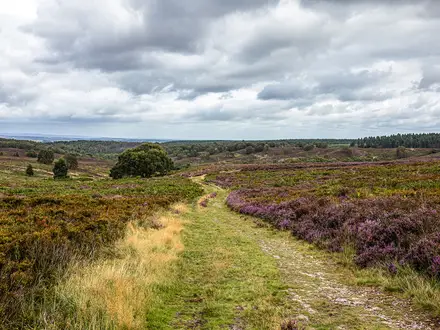
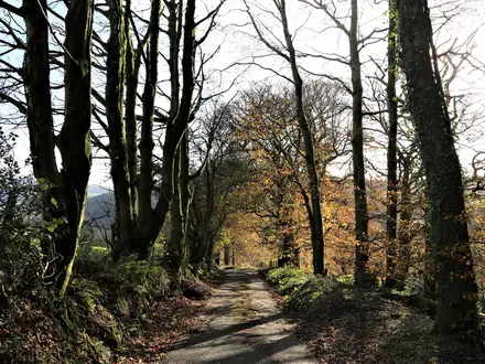
Path surfaces
The walking is a mixture of forest roads, field paths and asphalt village lanes. A useful working split is roughly 45% forest road, 30% field path and 25% asphalt, though the exact feel changes by stage.
| Surface | What to expect in practice |
|---|---|
| Forest roads and tracks | Usually straightforward walking through the Jura forests, often on firm tracks rather than narrow mountain paths. These are generally easy to follow but can be slower after rain. |
| Field paths | Open, rolling sections across the limestone upland. These can feel exposed to sun and wind, and are where water planning matters most. |
| Asphalt lanes | A significant part of the route. The road walking is not technically difficult, but it is hard on feet, knees and hips over several consecutive days. |
| Limestone rock near castles | Shorter rocky sections around castle crags, outcrops and viewpoints. These add interest rather than serious scrambling, but can be slippery when wet or icy. |
Footwear should be chosen for endurance rather than technical mountain use. Lightweight walking shoes or trail shoes suit many hikers in dry conditions, but they need enough cushioning for long asphalt stretches and enough grip for wet limestone, forest tracks and short rocky climbs.
Road walking and underfoot fatigue
The asphalt share is one of the main practical challenges of the trail. A quarter to a third of the route may be on paved lanes through villages and between trail sections, so the walking can feel harder than the elevation profile suggests.
This matters most on the longer days into Złoty Potok and Częstochowa, where tired feet can become a bigger issue than climbs. Good socks, blister management and footwear that has already been tested on hard surfaces are more important here than heavy mountain boots.
Road sections also affect pacing. Distances that look moderate on a map can still take a full day once castle visits, food stops, waymark checks and hard-surface fatigue are included.
Climbs, descents and rocky ground
There is no sustained mountain ascent on the Trail of the Eagles' Nests. The upland rises and falls repeatedly, with short climbs to castle sites, limestone outcrops and wooded ridges.
The most notable high point is Góra Janowskiego, also called Góra Zamkowa, at Podzamcze beside the Ogrodzieniec Castle ruins. At 516 m it is the highest point of the Kraków-Częstochowa Upland, but the effort is still a short upland climb rather than a major mountain stage.
Rocky ground is most likely around the castle crags and limestone features such as the areas near Ojców, Pieskowa Skała, Ogrodzieniec, Bobolice, Mirów and Olsztyn. These sections are not technical, but limestone can become polished and slippery in rain, frost or winter snow.
Mud, bog and wet conditions
This is not a boggy trail in the way that some upland or moorland routes are. The underlying Jura landscape is limestone, with forest roads, field paths and chalky-white rock forming much of the walking.
After heavy rain, the slower sections are most likely to be forest tracks, field paths and any shaded paths that hold moisture. The route does not require river fords or tidal planning, and wet-weather difficulty is mainly about slippery limestone, muddy tracks and keeping feet comfortable over multiple days.
Exposure and navigation difficulty
There are no serious exposed ridges or technical airy traverses on the standard waymarked walking trail. The castle crags can feel elevated in places, but the route is classed as moderate because of distance and surfaces, not because of exposure.
Navigation is helped by the red waymarks, and the trail is a recognised long-distance route. Even so, the mix of villages, forest tracks, fields and castle detours means a map or GPX remains useful, especially where the walking trail passes close to roads or tourist sites.
Do not confuse the red walking trail with the separate cycling Szlak Orlich Gniazd. The cycling route follows a different line and has a different overall distance.
Seasonal conditions
Late April to October is the most practical walking season. Spring, summer and autumn all work well, but the trail feels different in each.
| Season | Practical effect on difficulty |
|---|---|
| Spring | Good walking temperatures are possible, but forest tracks and field paths may be damp after rain. Castle and cave opening times can be seasonal, so sightseeing plans should be checked before travelling. |
| Summer | Long daylight helps with 20–27 km stages, but open field sections and asphalt lanes can be hot. Carrying enough water between villages becomes a key part of the difficulty. Popular castle villages such as Podzamcze and Bobolice should be booked ahead in busy periods. |
| Autumn | Often a strong season for walking, with cooler conditions and less heat stress. Shorter daylight makes early starts more important on the longer stages. |
| Winter | Possible, but it changes the character of the route. Snow and ice require proper winter kit, and wet or frozen limestone around castle rocks can be slippery. Seasonal closures may also affect castles, caves and services. |
What makes the route harder than it looks
The headline figures can make the trail sound easy: the high point is only 516 m, the route is well waymarked, and there is no technical ground. In practice, the following factors matter more:
- Long daily stages: the typical seven-day itinerary includes several days above 20 km, with the final stage to Częstochowa around 27 km.
- Hard surfaces: repeated asphalt walking increases foot and joint fatigue.
- Water gaps: natural water is scarce, so water needs to be planned around villages and services.
- Sightseeing time: castles, caves and viewpoints can turn a simple walking day into a long day out.
- Heat and exposure: open field paths and road sections can be tiring in summer, especially with limited shade and long distances between stops.
What makes it easier
The route is forgiving compared with high mountain trails. It is waymarked in red, passes through or near regular settlements, and both ends are major cities with rail access.
There is no need for scrambling equipment, alpine experience or specialist navigation in normal conditions. A reasonably fit hiker with comfortable footwear, sensible daily distances and a clear food-and-water plan should find the Szlak Orlich Gniazd demanding but manageable.
Weather and Best Time to Walk
The best walking window for the Trail of the Eagles' Nests is late April to October. This is when the route is most practical for a multi-day walk: accommodation is easier to use, castles and Ojców National Park cave sites are more likely to be open, and there is enough daylight for the typical 20–27 km stages.
For most hikers, May, June, September and early October are the most comfortable months. They avoid the worst of summer heat while still giving reasonable conditions for long days on forest tracks, field paths and asphalt lanes.
Spring
Late April and May are a strong choice if the priority is cooler walking and quieter villages. Expect variable conditions: forest tracks and field paths can be damp or muddy after rain, and the limestone sections around the castle crags can be slippery when wet.
The May long weekend is a busy Polish holiday period. Accommodation in popular castle villages, especially around Podzamcze / Ogrodzieniec and Bobolice, should be booked ahead.
Summer
Summer is the most straightforward season for facilities, sightseeing and longer daylight. It is also when the route can feel most tiring underfoot, because a significant share of the trail uses asphalt village lanes and some sections are open rather than shaded.
Water planning matters in hot weather. Natural water is limited between villages, so each day should be planned around known settlements, shops and accommodation rather than assuming streams or springs will be available.
Summer is also the busiest period around the headline castles and Ojców National Park. Book accommodation early in the main castle stops and check current opening times and ticket prices before building a day around caves or paid castle visits.
Autumn
September and early October are often the best balance for a full traverse: cooler walking, less pressure on accommodation than peak summer, and generally enough daylight for the standard 7-day itinerary.
Later in autumn, shorter days become the main constraint. The final stages into Złoty Potok, Olsztyn and Częstochowa are long enough that late starts can easily turn into walking after dark, especially if time is spent visiting castles en route.
Winter
Winter walking is possible, but it changes the character of the trail. The route is not high mountain terrain — the high point is only 516 m at Góra Janowskiego — but snow, ice and frozen limestone can make the short rocky climbs and castle approaches much less secure.
A winter attempt needs proper cold-weather kit, footwear suitable for snow and ice, and conservative daily distances. Short daylight also makes the standard 7-day schedule harder, particularly on the longer 25–27 km days.
Seasonal closures matter more in winter. Many castles, caves and park sites operate seasonally or with reduced hours, so current opening times should be checked before travelling.
Rain, storms and trail surfaces
Rain is mainly a comfort and footing issue rather than a navigation problem: the red waymarks are established, but wet field paths, chalky-white limestone and forest tracks can become slippery. The asphalt sections are useful in bad weather, though they are hard on feet over repeated long days.
In thunderstorms, avoid lingering on exposed castle rocks, limestone outcrops and high viewpoints such as the crags around Ogrodzieniec, Bobolice, Mirów and Olsztyn. Build enough slack into the day to wait out bad weather rather than rushing over wet rock or open ground.
Practical timing advice
- Best overall months: May, June, September and early October.
- Best for sightseeing: late spring to early autumn, when castles and Ojców cave sites are more likely to be open.
- Most demanding conditions: hot summer days on asphalt and open paths; winter snow and ice; late-autumn short daylight.
- Book ahead: summer and the May long weekend, especially in Podzamcze / Ogrodzieniec and Bobolice.
- Check before travelling: current castle and cave opening times, ticket prices, and any seasonal limits affecting paid sites.
Safety Notes
Emergency help and communications
In Poland, 112 is the general emergency number; 999 is used for ambulance emergencies. Save these before setting off, along with the phone numbers for that night’s accommodation and any onward transport being used.
The Szlak Orlich Gniazd is not a remote mountain route, but it does pass through long rural stretches, forests, field paths and quieter villages between Kraków and Częstochowa. Treat mobile coverage as useful but not guaranteed everywhere, especially in wooded sections, gorges and around limestone crags. Carry an offline map or GPX track as well as following the red waymarks.
Navigation and route finding
The trail is waymarked in red and is generally straightforward, but long days make small mistakes more costly. This is especially true where the route leaves villages, crosses field tracks or follows lanes before returning to forest.
Do not rely only on signs at junctions. Keep an offline map open through the day and check the line whenever the route changes surface, passes through a settlement, or approaches castle areas where local paths and visitor routes can be confusing.
Road walking and hard surfaces
A significant part of the route is on asphalt lanes, roughly a quarter to a third of the total distance. The main safety issue is not technical terrain but fatigue, sore feet and sharing narrow village roads with traffic.
Walk facing oncoming traffic where there is no pavement, use reflective detail or a headtorch in poor light, and avoid finishing road-heavy stages after dark. Long paved sections can also be hard on knees and feet, so footwear with enough cushioning matters as much as grip.
Weather exposure, heat and cold
The upland is low by mountain standards, with a high point of 516 m at Góra Janowskiego, but the route still has exposed field sections, open limestone areas and long stretches of paved walking. In summer, heat and sun can be more tiring than the climbs, particularly where there is little shade and limited water between villages.
Carry sun protection, enough water and a layer for sudden weather changes. In spring and autumn, expect colder starts and quicker changes in conditions; in winter, the route is possible but needs proper kit for snow and ice, especially on rocky approaches to castle crags and shaded forest paths.
Water and food
The main water risk on this route is running short between villages, not river crossings. Natural water is scarce and should not be relied on for drinking.
Start each day with enough water to cover the longest village-to-village section on the planned stage, and top up whenever reliable services are available. Shops, cafés and accommodation opening hours can vary, especially at weekends and outside summer, so do not plan a long day around a single assumed stop without checking it in advance.
Limestone crags, castles and ruins
Several highlights sit on limestone outcrops or castle crags, including Ojców, Pieskowa Skała, Rabsztyn, Smoleń, Ogrodzieniec, Bobolice, Mirów and Olsztyn. The walking route itself is not technical, but short rocky climbs, steps, broken surfaces and viewpoints need care, particularly when wet, icy or crowded.
Stay on permitted paths and visitor areas around ruins and caves. Do not climb walls, unstable masonry or closed sections, and allow extra time at paid or seasonal sites so that sightseeing does not force a rushed finish late in the day.
Solo hiking
This is a reasonable solo route for a fit walker because it is waymarked and passes regular settlements, but long stages still require normal self-sufficiency. Tell someone the planned stage and destination each day, and message them on arrival.
Solo walkers should be especially conservative with late starts, water, and detours to castles or caves. If accommodation or transport is fixed, build in enough daylight to finish without rushing the final road or forest sections.
What to check each morning
Before leaving, check the practical details that can affect safety on that specific stage:
- weather forecast, including heat, storms, wind and overnight frost risk
- available daylight for the planned distance
- water and food options before the next accommodation stop
- whether any castles, caves or park sites being visited are open that day
- the day’s road-walking sections and any likely finish in low light
- battery level, offline maps and GPX access
- accommodation address and contact details
- onward bus or train times if section-hiking or cutting a day short
Rural buses and minibuses can be sparse at weekends, so escape options should be checked before relying on them.
Gear Recommendations
The Szlak Orlich Gniazd is not a mountain route, but it is hard on feet. Long stages, frequent asphalt lanes and limited water between villages matter more here than technical kit.
Footwear
Choose footwear for mixed forest tracks, field paths, chalky limestone and a substantial amount of road walking. Lightweight hiking shoes or trail shoes work well for many walkers in dry conditions, provided they have enough cushioning for repeated 20–27 km days on hard surfaces.
Boots are useful in wet spring or autumn, or if carrying camping gear, but stiff mountain boots are usually excessive. Whatever the choice, prioritise a comfortable fit, a grippy sole on polished limestone and enough underfoot protection for road sections.
Pack spare socks and blister treatment. The combination of asphalt, warm weather and long daily distances makes foot care more important than ankle support.
Waterproofs and layers
A light waterproof jacket should be carried in all seasons. The trail crosses open upland, forest and villages rather than high mountains, but a wet day on exposed field paths can still become uncomfortable quickly.
A compact warm layer is enough for most late spring, summer and early autumn trips. Even though the high point is only 516 m at Góra Janowskiego beside Ogrodzieniec, early starts, cool evenings and windy castle crags can feel colder than the altitude suggests.
In winter, proper cold-weather kit is needed for snow and ice. That means warmer insulation, gloves, hat and traction suitable for icy paths if conditions require it. Winter opening times for castles, caves and services should also be checked before travelling.
Navigation
The route is waymarked in red and is generally suitable for independent walkers, but do not rely on paint marks alone. Carry an offline map or GPX track, especially for the exits from Kraków, village-to-village links and forest sections where a missed turn can add unwanted kilometres.
A phone with offline mapping is usually sufficient for most hikers, but carry enough battery capacity for a full day. A small power bank is strongly recommended if using the phone for navigation, photography, accommodation contact and transport checks.
Water and food carry
Plan water deliberately. Natural water is scarce and the route relies heavily on villages, shops and accommodation stops, with some longer gaps between reliable resupply.
Most walkers should start each day with enough water for the full stage until the next planned village stop. In hot weather or on the longer Bobolice–Złoty Potok and Złoty Potok–Częstochowa stages, carrying extra capacity is sensible.
Food carry can stay moderate for inn-to-inn hikers because the trail passes towns and villages, but do not assume that every small settlement has a shop open when needed. Carry at least lunch, snacks and an emergency meal or substantial reserve for each day.
Trekking poles
Trekking poles are optional rather than essential. The gradients are mostly easy, with only short rocky climbs to castle sites and limestone outcrops.
They become more useful for walkers with knee issues, anyone carrying a camping load, and for taking strain off the legs on long hard-surface sections. Rubber tips are worth using on asphalt lanes.
Sun, heat and insects
Late spring to early autumn walking needs sun protection. Much of the route passes through forest, but there are also open fields, paved lanes and exposed castle approaches where shade can be limited.
Carry sunglasses, sun cream and a cap or brimmed hat. Insect repellent is useful in forested areas and around evening accommodation stops, especially in warmer months.
Camping and shelter kit
The route has mixed accommodation, including guesthouses, agritourism farms, hostels, hotels and campsites, plus open trail shelters. Campers should still carry a proper sleep system rather than relying on shelters being empty or conveniently placed.
A lightweight tent or tarp, sleeping mat, sleeping bag suited to the season and a compact stove setup are the core camping items. Water capacity becomes more important when camping, because overnight stops may not coincide with easy water access.
Wild-camping use exists on the route, but local rules, land ownership and protected-area restrictions should be checked before relying on it. This is especially important around Ojcowski Park Narodowy and other managed natural areas.
Inn-to-inn hikers
Inn-to-inn walkers can keep packs relatively light. The practical core is comfortable footwear, waterproof shell, warm layer, water capacity, offline navigation, power bank, snacks and basic first aid.
A small daypack or lightweight overnight pack is enough if accommodation is booked and meals are planned around towns and villages. In summer and around the May long weekend, book popular castle villages such as Podzamcze and Bobolice ahead rather than carrying extra camping gear as a fallback.
Fast and section hikers
Fast walkers and section hikers should focus on low weight, foot comfort and reliable navigation. A minimal kit works because the trail is non-technical, but only if water, food and transport exits are planned in advance.
For long single-day sections, carry more water than the map distance might suggest. Road walking, open fields and warm weather can make a 22–27 km day feel much harder than the modest altitude implies.
A power bank is particularly useful for section hikers using regional buses or minibuses to leave the trail from intermediate villages. Rural services can be sparse at weekends, so transport times should be checked before travelling.
Budget and Costs
Poland uses the Polish złoty (zł). Current prices for accommodation, castle tickets, caves, trains and local buses should be checked before booking, especially in summer and around the May long weekend.
This is usually a moderate-cost long-distance walk rather than an expensive one, but the total can rise quickly if you stay in private rooms every night and pay for multiple castle, cave and museum admissions. The two main cities, Kraków and Częstochowa, also need separate budgeting if you add nights before or after the trail.
Main cost drivers
| Cost item | Budget approach | Mid-range approach | Comfortable approach |
|---|---|---|---|
| Accommodation | Campsites, open trail shelters where appropriate, occasional simple rooms | Guesthouses, agritourism farms and small hotels in trail villages | Hotels in Kraków/Częstochowa, better private rooms, taxis to off-trail accommodation if needed |
| Food | Supermarket and village-shop supplies, simple meals | Mix of self-catering, cafés and local restaurants | More restaurant meals, castle-area cafés, less reliance on carrying food |
| Admissions | Select only key paid sites | Visit several major castles and one or two seasonal Ojców National Park sites | Visit most paid castles, caves and museums on or near the route |
| Transport | Train between Kraków Główny and Częstochowa; occasional bus | Train plus regional buses/minibuses for access or shorter sections | Train plus taxis for rural gaps, off-trail accommodation or schedule problems |
| Luggage | Carry everything | Arrange occasional help through accommodation if available | Private taxi transfers between booked stays, where possible |
Accommodation costs
Accommodation on the Szlak Orlich Gniazd is mixed: guesthouses, pensjonaty, gospodarstwa agroturystyczne, hostels, hotels and campsites, plus a string of open trail shelters. Exact prices vary by season, village and room type, so confirm current rates before booking.
A budget walker can keep costs down by using campsites and shelters, then paying for rooms only where necessary. This requires more self-sufficiency and careful planning, because water and food are not always available between villages.
A mid-range walker should budget for a paid bed most nights in places such as Ojców, the Olkusz/Rabsztyn area, Smoleń, Podzamcze, Bobolice and Złoty Potok. Podzamcze/Ogrodzieniec and Bobolice are popular castle stops, so book ahead in summer and during the May long weekend.
A more comfortable itinerary may involve staying slightly off the red trail where the better accommodation is, then using local taxis or accommodation transfers to rejoin the route. This adds cost but can reduce long end-of-day road walking to reach a bed.
Food and drink
Food costs depend heavily on how often you eat in cafés or restaurants. The cheapest approach is to buy breakfast, lunch and snacks from shops in towns and villages, then eat a simple hot meal when available.
Do not assume frequent resupply on every section. The route passes villages, but natural water is scarce and services can be spaced out, so carrying food and water for the day is part of the normal budget and planning.
Castle villages and tourist sites may be more convenient but not always the cheapest places to eat. Kraków and Częstochowa offer the widest range of food options before and after the walk.
Castle, cave and park admissions
Admissions are a real budget item on this trail. Ojców, Pieskowa Skała, Ogrodzieniec, Bobolice and Olsztyn all charge separately, and the Ojców caves and some park sites open seasonally.
A low-cost walker can still enjoy the route by being selective and viewing some ruins or landscapes from outside. A castle-focused itinerary should allow extra money and extra time, because visiting most of the major sites can add a meaningful amount to the total trip cost.
Opening times and ticket prices change, and several sites are seasonal. This should be checked before travelling.
Transport costs
Both ends are easy to budget for compared with many rural trails. Kraków Główny and Częstochowa are on the national rail network, with frequent direct trains taking roughly 2–2.5 hours, so most walkers only need one intercity rail journey to return to the start or continue onward.
Intermediate access is possible by regional buses and minibuses, including routes via places such as Olkusz, Zawiercie and Myszków, but rural services can be sparse at weekends. Check current timetables before relying on public transport for section hiking, bail-outs or late arrivals.
Taxis are useful for off-trail accommodation, missed buses or splitting long stages. There is no single trail-wide taxi system to rely on, so agree the fare in advance or check local availability through accommodation.
Campsites, shelters and wild camping
Campsites and open trail shelters can reduce accommodation costs, but they require more flexibility and more kit. Shelters should not be treated as bookable accommodation, and they may not have water or facilities.
Some walkers use wild camping on this route, but anyone planning to do so needs to understand local restrictions, protected-area rules and practical water availability. This should be checked before travelling, particularly around Ojcowski Park Narodowy and other protected areas.
Luggage transfer and packages
Do not assume a dedicated luggage-transfer service exists along the whole Szlak Orlich Gniazd. If travelling light is essential, arrange private transfers through accommodation or local taxis stage by stage, and confirm each move before committing to the itinerary.
This is a straightforward self-guided trail, with red waymarks and good end-to-end rail logistics. Guided or self-guided package options may exist through specialist operators, but availability and prices change; check current package details before booking rather than budgeting around an assumed service.
Practical budgeting by style
Budget: carry camping/shelter kit, self-cater heavily, visit only selected paid sites, and use trains or buses rather than taxis. This is the cheapest approach, but it demands the most planning around water, food and legal overnight options.
Mid-range: book simple rooms most nights, buy lunches from shops, eat some hot meals, and choose the major castles rather than every paid attraction. This is the most practical balance for a typical 7-day walk.
Comfortable: book private rooms or hotels where available, add extra nights in Kraków or Częstochowa, take taxis where rural transport is awkward, and budget for most castle and cave admissions. This approach reduces friction but costs noticeably more, especially in the popular castle villages.
Luggage Transfer, Guided Tours and Support Services
The Szlak Orlich Gniazd is straightforward to walk independently, but it is not a heavily serviced luggage-transfer trail in the way some western European routes are. The red waymarks, regular villages and rail access at Kraków and Częstochowa make full guiding unnecessary for most fit walkers, while the long asphalt sections make pack weight worth thinking about.
Luggage transfer
Do not assume there is a standard end-to-end baggage-transfer network covering every overnight stop between Kraków and Częstochowa. If walking with a light daypack is important, arrange luggage moves directly through booked accommodation or local taxi operators, stage by stage. This should be checked before travelling.
The most practical approach is to book staffed accommodation in advance and ask each host whether they can move a bag to the next night’s lodging, arrange a taxi, or hold luggage until a driver collects it. This works better between established trail villages and towns such as Ojców, the Olkusz / Rabsztyn area, Smoleń, Podzamcze, Bobolice, Złoty Potok and Częstochowa than it does if relying on shelters, campsites or informal overnight stops.
Expect any transfer to be quoted individually in zł, based on distance and driver availability. Confirm the price, collection time, delivery address and bag limit when booking, and label luggage clearly with a phone number and next accommodation name.
Luggage transfer is most useful for walkers who want to cover the standard 7-day itinerary without carrying a full pack, especially because several stages are over 20 km and a significant share of the route is on asphalt lanes. It is less necessary for lightweight hikers staying in simple accommodation, as the route does not involve technical terrain or high mountain conditions.
Self-guided walking packages
A self-guided package can suit walkers who want accommodation booked, route notes prepared and local backup arranged without joining a group. When comparing packages, check that the itinerary follows the walking Szlak Orlich Gniazd, not the separate cycling route, which uses a different line and distance.
A good package should make clear:
| Check before booking | Why it matters on this route |
|---|---|
| Exact overnight places | Some villages have limited beds, especially near popular castles such as Podzamcze and Bobolice |
| Whether luggage transfer is included | It should not be assumed unless stated clearly |
| Whether castle and cave tickets are included | Ojców sites, Pieskowa Skała, Ogrodzieniec, Bobolice and Olsztyn charge separately and opening times vary seasonally |
| Route format | The walking trail is red-waymarked and differs from the cycling Szlak Orlich Gniazd |
| Emergency or taxi support | Rural buses and minibuses can be sparse at weekends |
Self-guided support is most worthwhile for travellers with limited Polish, for anyone walking in the busy summer period or May long weekend, and for walkers who want to include castle visits without spending time coordinating bookings each day. Independent walkers comfortable with basic Polish logistics can usually arrange the same journey themselves.
Guided options
A fully guided end-to-end hike is not essential for navigation: the route is waymarked in red and passes through frequent settlements. A guide is more useful for cultural interpretation at the castle sites, for group management, or for walkers who want Polish-language support with transport, tickets and accommodation.
Guided day support may be more practical than a guide for the whole trail. The sections around Ojców National Park, Pieskowa Skała, Ogrodzieniec, Bobolice, Mirów and Olsztyn are the most obvious places where historical context adds value.
If booking a guide, clarify whether the fee covers walking only, transport, entry tickets, meals and any detours such as show caves or the Błędów Desert. Seasonal openings and ticket prices should be checked before committing to a fixed itinerary.
Taxi transfers and public-transport backup
Taxis are useful for three situations: reaching accommodation slightly off the red trail, shortening a long day, or escaping to a transport hub if weather, injury or fatigue intervenes. They are especially useful around the intermediate service towns and transport corridors linked with Olkusz, Zawiercie and Myszków, as well as at Kraków and Częstochowa.
Regional buses and minibuses serve many intermediate villages and castle areas, but services can be limited outside commuter hours and sparse at weekends. Build slack into the plan rather than relying on a single late connection from a small village. This should be checked before travelling.
For a one-way thru-hike, the simplest major transfer remains the train between Kraków Główny and Częstochowa, with direct services taking roughly 2–2.5 hours. Confirm current train times before booking accommodation at either end.
Shorter Hikes and Best Sections
You do not need to walk the full Szlak Orlich Gniazd to get a strong sense of the route. The best shorter sections are the ones that link castle sites with a realistic village-to-village day, while keeping transport at least partly manageable.
For any one-way section, check current rural bus and minibus times before booking. Kraków and Częstochowa are straightforward railheads, but services around smaller villages and castle stops can be sparse at weekends.
| Best for | Start → end | Approx. distance | Why choose it | Transport notes |
|---|---|---|---|---|
| Best day walk | Ojców → Olkusz / Rabsztyn area | 22 km | The strongest single-day mix of limestone scenery and castles: Ojcowski Park Narodowy, the Prądnik valley, Pieskowa Skała, Maczuga Herkulesa and the Rabsztyn ruins all sit on or near this southern part of the route. | Both ends need local transport planning. Regional buses and minibuses serve many intermediate places, but times should be checked before travelling, especially outside weekdays. |
| Easiest public-transport start | Kraków → Ojców | 23 km | No outward transfer is needed if starting from Kraków, and the day finishes in the national park after leaving the northern Krowodrza / Tonie side of the city. It is a practical first taste of the red waymarks, though still a full walking day. | Start from Kraków, with onward national rail available at Kraków Główny. Return transport from Ojców should be checked before travelling. |
| Best weekend section | Ojców → Smoleń | 46 km over 2 days | A compact two-day slice with the Prądnik valley, Pieskowa Skała, Maczuga Herkulesa, Rabsztyn, Bydlin and the quieter Zamek Pilcza at Smoleń. It gives a proper long-distance feel without committing to the full week. | The natural overnight point is the Olkusz / Rabsztyn area. Rural transport at Ojców and Smoleń should be checked; Olkusz is one of the more useful intermediate transport areas on this part of the trail. |
| Best 3–5 day section | Smoleń → Częstochowa | 94 km over about 4 days | This is the castle-heavy northern half: Smoleń, Pilica, Ogrodzieniec at Podzamcze, Morsko, Bobolice, Mirów, Ostrężnik, Olsztyn and the finish below Jasna Góra in Częstochowa. It includes Góra Janowskiego, the 516 m high point of the whole upland. | Finish logistics are easy at Częstochowa, with national rail and direct trains back towards Kraków. Access to Smoleń is more rural and should be checked before travelling. |
| Best scenery-focused section | Ojców → Olkusz / Rabsztyn area | 22 km | This is the best short section for limestone Jura scenery rather than just distance-covering: gorges, rock pillars, the Prądnik valley, Pieskowa Skała and Maczuga Herkulesa. It also avoids spending most of the day on the longer, more road-bound linking stages. | Plan it as a point-to-point walk only after checking local transport. If transport is awkward, base yourself near Ojców or Kraków and adapt the day around the national park and Pieskowa Skała. |
| Best for beginners | Smoleń → Podzamcze | 20 km | One of the shorter standard stages, with a clear objective at the end: Ogrodzieniec Castle and Góra Janowskiego above Podzamcze. The walking is still moderate, not technical, but water and food should be planned around villages. | Both ends are smaller places, so transport is less simple than at Kraków or Częstochowa. Check buses/minibuses and book accommodation at Podzamcze or Ogrodzieniec ahead in busy periods. |
| Best for villages and accommodation | Podzamcze → Bobolice | 22 km | A practical castle-village section linking the Ogrodzieniec area with Morsko and Bobolice. It works well for walkers who want guesthouses or agritourism rather than carrying camping kit. | Podzamcze / Ogrodzieniec and Bobolice are popular in summer and around the May long weekend, so accommodation should be booked ahead. Local transport should be checked before relying on it. |
| Best camping-style section | Bobolice → Złoty Potok | 25 km | A rural stage where carrying camping kit can make sense if using established campsites or open trail shelters, but it should not be treated as a carefree wild-camping section. Water is limited between villages, and exact overnight options need advance planning. | Check current campsite, shelter and water options before setting out. Rural bus/minibus services around this part of the Jura can be limited at weekends. |
Choosing the right short section
For a first visit, Ojców to the Olkusz / Rabsztyn area is the most rewarding single day, provided transport works. It concentrates many of the route’s best-known southern sights into one manageable stage.
For the best castle density over several days, start at Smoleń and walk north to Częstochowa. This gives the biggest-name ruins and a simple rail finish, without needing to walk the Kraków exit.
For the least complicated logistics, use one of the city ends. Kraków to Ojców avoids an outward transfer; Złoty Potok to Częstochowa gives a straightforward rail finish, but at 27 km it is a long final-day walk rather than an easy day hike.
Highlights and Points of Interest
The strongest reasons to slow down on the Szlak Orlich Gniazd are the castle sites, the limestone scenery of the Polish Jura and the cultural finish at Jasna Góra. If time is limited, the most rewarding places to build in extra time are Ojców and Pieskowa Skała, Podzamcze for Ogrodzieniec, the Bobolice–Mirów ridge, and Olsztyn before the final walk into Częstochowa.
Castle and cave opening times, ticket prices and seasonal closures change, especially outside the main spring-to-autumn walking season. This should be checked before travelling, particularly for Ojców caves, Pieskowa Skała, Ogrodzieniec, Bobolice and Olsztyn.
Southern section: Ojców National Park and the Prądnik valley
Ojcowski Park Narodowy (Ojców National Park) is the key natural highlight near the southern end of the trail. It is Poland’s smallest national park, but for walkers it delivers a concentrated section of limestone gorges, rock pillars and wooded valley walking in the Dolina Prądnika.
The park is also the place to consider adding time for the show caves, especially Jaskinia Łokietka (Łokietek’s Cave) and Jaskinia Ciemna (the Dark Cave). They open seasonally and are best treated as planned stops rather than assumed walk-through attractions.
Zamek w Ojcowie (Ojców Castle) is the first major “eagle’s nest” after leaving Kraków. It is a ruined royal castle set on a crag above the Prądnik valley, and it gives the first clear sense of the trail’s castle-and-limestone character.
Pieskowa Skała and Maczuga Herkulesa
Zamek Pieskowa Skała is one of the most important cultural stops on the trail. Originally a Gothic stronghold, it was rebuilt between 1542 and 1580 as a Renaissance residence and is the best-preserved castle set-piece on the route.
Just below it stands Maczuga Herkulesa (Hercules’ Club), a free-standing limestone monadnock of about 25 m. It is one of the most recognisable rock formations in the Kraków-Częstochowa Upland and an easy place to justify a pause, even on a tight schedule.
Rabsztyn, Smoleń and the quieter middle castles
Zamek Rabsztyn, near Olkusz, is an extensive hilltop ruin with partly restored sections and broad views over the upland. It is a useful stop for walkers who want a strong castle viewpoint without the crowds of the better-known sites.
Zamek Pilcza at Smoleń is a ruined tower-castle on a forested rock near Pilica. It is one of the quieter castle stops on the trail and suits walkers who prefer less developed historic sites between the bigger visitor attractions.
The middle section also passes through the wider castle chain around places such as Bydlin, Pilica and Morsko/Bąkowiec. These are most relevant if the aim is to trace as many of the Eagle’s Nests as possible rather than simply complete the long-distance walk.
Ogrodzieniec, Podzamcze and the high point of the Jura
Zamek Ogrodzieniec at Podzamcze is the largest castle ruin on the Szlak Orlich Gniazd and the best-known of the Eagle’s Nests. Its walls rise directly from the natural limestone of Góra Janowskiego / Góra Zamkowa, which gives the site much of its impact.
This is also the high point of the whole route and of the entire Kraków-Częstochowa Upland, reaching 516 m at Góra Janowskiego. The summit rock is the Czubatka outcrop, and the Carpathians can be visible on clear days.
Podzamcze is one of the best places on the route to allow extra time, especially if the day’s schedule includes visiting the castle as well as walking the stage. Accommodation can be in demand in popular castle villages in summer and around the May long weekend.
Bobolice and Mirów
Zamek Bobolice and Zamek Mirów form one of the most memorable paired sights on the trail. The two hilltop castles are linked by a short ridge walk, making this an especially rewarding section for walkers who want castle scenery without a long detour.
Bobolice has been almost fully rebuilt and is one of the few complete-looking fortresses in the Polish Jura. Mirów is different: it remains an atmospheric ruin and should not be treated as another reconstruction.
Both Bobolice and Mirów charge admission. Current access arrangements and prices should be checked before building a tight itinerary around visiting both.
Złoty Potok, Ostrężnik and the northern approach
Złoty Potok is a practical staging point before the final northern section towards Olsztyn and Częstochowa. Walkers with spare time can use this part of the route to keep the pace steadier before the longest final stage of the typical itinerary.
Ostrężnik belongs to the northern castle sequence, but it is not one of the major headline stops in the route information. Treat it as part of the cumulative Eagle’s Nests experience rather than a place that necessarily needs a long stop.
Olsztyn Castle and the finish at Częstochowa
Zamek w Olsztynie is one of the largest castle ruins on the trail after Ogrodzieniec. It dates from the 13th–14th centuries and is usually much quieter than the most famous sites, making it a strong final castle highlight before the walk into Częstochowa.
The trail ends in Częstochowa at the Stary Rynek below Jasna Góra. The Pauline monastery houses the Black Madonna and is Poland’s foremost pilgrimage shrine, so it is worth allowing time after the final walking stage rather than treating Częstochowa only as a transport exit.
Near-route detours
The Pustynia Błędowska (Błędów Desert) and the Ojców show caves are near-route side trips rather than features to assume directly on the red waymarked line. Add them only if the itinerary has enough slack, and check current access and opening arrangements before relying on them.
Best viewpoints on the trail
| Viewpoint / area | Why it matters | Planning note |
|---|---|---|
| Zamek Rabsztyn | Hilltop ruins with wide views over the upland | Useful viewpoint near the Olkusz / Rabsztyn stage area |
| Góra Janowskiego / Góra Zamkowa | Highest point of the trail and the whole Kraków-Częstochowa Upland at 516 m | Beside Ogrodzieniec Castle; the Carpathians can be visible in clear weather |
| Ogrodzieniec Castle crags | The largest and most dramatic castle ruin on the route, built into limestone rock | Allow extra time in Podzamcze if visiting the castle as well as walking onward |
| Bobolice–Mirów ridge | Short castle-to-castle section linking a rebuilt fortress and a ruin | Both sites charge admission; check current arrangements |
| Olsztyn Castle | Large northern ruin near Częstochowa, typically quieter than the headline castles | A strong final historic stop before the city finish |
Common Mistakes and Planning Tips
| Common mistake | Practical fix |
|---|---|
| Treating the Szlak Orlich Gniazd as an easy stroll because the high point is only 516 m. | Plan for a moderate endurance walk, not a mountain scramble. The tiring part is the repeated 20–27 km days, the accumulated 2,567 m of ascent and the long asphalt village lanes. Shoes with good cushioning matter more here than technical mountain kit. |
| Trying to compress the route into five days without the pace to support it. | Strong walkers can finish in five days, but the standard seven-day plan is more realistic for most hikers, especially if visiting castles. If the aim is to go inside Ojców, Pieskowa Skała, Ogrodzieniec, Bobolice, Olsztyn or the Ojców caves, build in shorter days or an extra day. |
| Assuming every village has reliable food and water. | Carry more water than the map distance alone suggests. Natural water is limited between villages, and the route has open and paved sections where hot weather feels harder. Use towns and larger villages such as Ojców, the Olkusz/Rabsztyn area, Pilica, Podzamcze, Bobolice, Złoty Potok and Częstochowa as deliberate resupply points, not as afterthoughts. |
| Booking accommodation too late in the castle villages. | Reserve ahead in summer and around the May long weekend, especially around Ogrodzieniec/Podzamcze and Bobolice. The route has guesthouses, agritourism farms, hostels, hotels and campsites, but availability can tighten where the castles draw day visitors. |
| Relying on open trail shelters as a full accommodation plan. | Treat wiaty as useful rest stops or emergency shelter, not a guaranteed bed for the night. If camping or using informal overnight options, local rules and land access should be checked before travelling. |
| Forgetting that castle and cave visits take time, money and planning. | Budget in złoty for separate admissions, and check current opening times and ticket prices before setting off. Several sites, including the Ojców caves, operate seasonally, so a walking itinerary that works on the map may not match visitor opening hours. |
| Confusing the walking route with the cycling Szlak Orlich Gniazd. | Follow the red walking waymarks for route No. 1. The cycling route is a different line and is longer, so do not use cycling distances or GPX files when planning walking days. |
| Following waymarks only, with no backup navigation. | The trail is well waymarked in red, but an offline map or GPX is still sensible, particularly through suburbs, field paths, forest tracks and around castle detours. Use a current walking-route track and check it against the red marks on the ground. |
| Planning stages from headline castle to headline castle only. | Check where the trail actually passes and where accommodation sits. For example, the walking order south to north is Ogrodzieniec/Podzamcze, Morsko/Bąkowiec, Bobolice, then Mirów; Bobolice is a rebuilt castle, while Mirów remains a ruin. |
| Underestimating the asphalt. | Expect roughly a quarter to a third of the route on asphalt lanes. Lightweight boots, trail shoes or well-cushioned walking shoes are usually more comfortable than stiff mountain boots, and blister prevention is important from day one. |
| Leaving transport from Częstochowa until the last minute. | The simplest end-to-end plan is to walk one way and return by train between Częstochowa and Kraków Główny, with frequent direct services taking roughly 2–2.5 hours. Current train times should still be checked before travelling, especially if finishing late in the day. |
| Assuming rural buses will always rescue a short day or a late finish. | Regional buses and minibuses serve many intermediate places, including routes via Olkusz, Zawiercie and Myszków, but rural services can be sparse at weekends. If section-hiking or bailing out mid-route, check the specific bus or minibus times before committing to a stage. |
| Treating side trips as if they are on the direct red trail. | The Błędów Desert and some show-cave visits are near-route detours rather than automatic parts of the waymarked line. Add them only if the day’s distance, opening times and onward accommodation still work. |
| Ignoring weather because the route is not high mountain terrain. | The Jura’s open field paths, limestone tracks and paved lanes can be tiring in heat, rain or icy winter conditions. Late April to October is the usual walking season; winter is possible but needs proper kit for snow and ice. |
| Starting in Kraków without allowing for the urban exit. | The southern end can be started from Kraków, with the red trail running out through the northern Krowodrza/Tonie suburbs before the landscape becomes more rural. Allow time for this less scenic but logistically important first section rather than expecting to be immediately among castles and crags. |
Final Advice
Szlak Orlich Gniazd is best suited to hikers who want a cultural long-distance trail rather than a remote mountain trek. The walking is moderate, well waymarked in red and never technical, but the 163.9 km distance, repeated 20–27 km days, limited water between villages and long paved stretches make it a genuine endurance walk.
The main planning task is not navigation; it is logistics. Book accommodation ahead in the most popular castle villages, especially around Podzamcze/Ogrodzieniec and Bobolice in summer and over the May long weekend, and check food and water options before each day’s start. Carry enough water to cover the gaps between villages, particularly in warm weather.
The most rewarding section for many walkers is the central castle belt around Smoleń, Pilica, Podzamcze, Morsko, Bobolice and Mirów, where the limestone crags and ruined fortresses feel most continuous. Ojców National Park and Pieskowa Skała are also major highlights, but opening times for caves, castles and ticketed sites should be checked before travelling, as several operate seasonally or charge separate admission.
The full thru-hike works well because Kraków and Częstochowa are both major rail-connected cities, making a one-way walk straightforward. The route also lends itself to section hiking, especially for anyone short on time or wanting to spend longer visiting castles rather than covering a fixed daily distance.
Do not underestimate the asphalt. Footwear, blister care and pacing matter more here than mountain equipment, and a fast five-day schedule will feel hard underfoot even though the high point is only 516 m. For most hikers, a seven-day itinerary gives the best balance between steady progress, castle visits and manageable daily effort.
Begin the Trail of the Eagles' Nests on the outskirts of Kraków, heading northwest toward the lush woodlands of Ojców National Park. The route on Day 1 leads you through rolling countryside, scenic valleys, and the village of Prądnik Korzkiewski before reaching the heart of Ojców National Park. Finish your day amid dramatic limestone formations and your first castle ruins. The terrain includes stretches of dirt and gravel, with gentle ascents.
Departing Ojców, the trail climbs out of the national park’s valleys and enters open agricultural land interspersed with forests. You’ll pass by castle ruins such as Pieskowa Skała and unique geological features like Hercules' Club. Continue through several rural villages, experiencing pleasant paths and exceptional views before approaching the outskirts of the Olkusz region.
Moving north, this segment leads deeper into the highlands, with rolling hills and stretches of tranquil woodland. The day includes a visit to Pilica and culminates with the ruins of Smoleń Castle, nestled in a forest setting. Expect varied surfaces—dirt, gravel, and a few rocky climbs—before reaching the peaceful area around Smoleń.
Start the day in woodlands before venturing into open countryside, tracing ridgelines and small villages en route to one of the trail’s highlights, Ogrodzieniec Castle. This fortress offers extensive ruins to explore and sits on a dramatic rocky hilltop. Day 4 features several short climbs, scenic views, and plenty of opportunities for photos as you approach Ogrodzieniec.
Leaving Ogrodzieniec, traverse a segment featuring iconic Jurassic rock formations and dense patches of forest. Visit the less-crowded Morsko Castle remains, then ascend gently toward Bobolice Castle. The latter is fully restored and surrounded by scenic hills, making it an excellent midpoint stop. Look out for wild camping opportunities and pleasant forested tracks.
This section combines peaceful woodlands with exposed rocky ridges and leads you past Mirów Castle’s picturesque ruins. Continue north through quiet countryside dotted with small lakes, eventually entering the charming town of Złoty Potok. Expect a moderate day with gentle ascents and the chance to explore both castles and natural attractions along the way.
The final stretch heads north over undulating terrain and through mixed forests and farmland. Pass the ruins of Ostrężnik Castle before the trail gradually descends toward Częstochowa. The hike ends at the Jasna Góra Monastery, one of Poland’s most important pilgrimage sites. This day offers a mellow finale, with accessible paths and glimpses of the urban landscape as you approach the city.
Useful Links
Hand-picked external resources for planning and researching the Trail of the Eagles' Nests — official trail sites, maps and GPX downloads, baggage transfer and local information. Each link opens in a new tab.
Official & reference
-
 Szlak Orlich Gniazd — official trail portal orlegniazda.pl
The official trail portal run by the Związek Gmin Jurajskich (Association of Jurassic Communes), the body that manages the route. Lists the marked walking and cycling trails, every castle, accommodation, guides and a trip planner for the whole Kraków–Częstochowa corridor.
-
 Trail of the Eagles' Nests — Wikipedia en.wikipedia.org
English-language background on the 163 km trail: its 25 medieval castles, the 14th-century history under Casimir the Great, the Polish Jura setting and the Eagles' Nests Landscape Park designation. A good orientation before planning.
Maps & GPX
-
 Szlak Orlich Gniazd — interactive map & GPX mapa-turystyczna.pl
Interactive map of the full red Kraków–Częstochowa route with elevation profile and a one-click GPX download, plus the regional sections. Useful for loading the whole trail onto a phone or GPS before you set off.
Planning & logistics
-
 Szlak Orlich Gniazd — practical planning guide (Górskie Wyrypy) gorskiewyrypy.pl
Detailed Polish hiker's planning page: kilometre-by-kilometre waypoints, the locations of 15+ trail shelters (wiaty), towns with shops and food, current castle admission prices, terrain breakdown and wild-camping notes. The single most useful resource for organising stages and resupply.
Local area & national parks
-
 Eagle's Nest Trail guide (PolskieSzlaki, English) polskieszlaki.pl
A substantive English-language overview of the route, its castles (Ogrodzieniec, Pieskowa Skała, Bobolice, Rabsztyn) and side attractions such as the Błędów Desert and Ojców caves. Helpful for English speakers since the official portal and most practical guides are Polish-only.
-
 Ojców National Park — official site opn.gov.pl
Official English site for Ojców National Park near the southern end of the trail. Covers the limestone gorges, the Łokietek and Dark Caves, the marked trails (5 routes, 46.6 km) and current ticket prices and opening hours for park sites.
-
 Eagles' Nests Landscape Park (Silesian Landscape Parks) zpk.com.pl
Official page of the Silesian Landscape Parks authority for Park Krajobrazowy Orlich Gniazd, the protected area the northern half of the trail crosses. Describes the limestone geology, caves, beech forests and nature reserves along the route.
External links are provided for convenience and are not affiliated with HikeList. Always check official sources for the latest trail conditions before you set out.